February 19, 2026
An early season severe weather event unfolded across southeast Illinois on February 19th. Scattered supercell thunderstorms developed during the afternoon...primarily along and south of the I-70 corridor. A National Weather Service Lincoln survey team determined that a total of 6 tornadoes touched down...including 3 EF-U, 2 EF-0, and 1 EF-1. The most significant structural damage occurred south of New Hebron in southern Crawford County where an elderly woman was severely injured when her mobile home was wrapped around a tree. In addition, damaging thunderstorm wind gusts caused a 7-vehicle crash on I-57 south of Watson in Effingham County, resulting in at least one injury. Other cells produced hail up to the size of tennis balls (2.5" in diameter) in Dieterich in Effingham County.
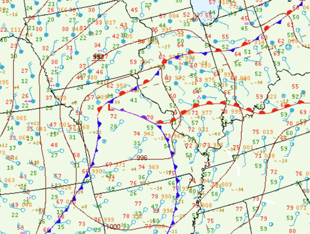
Surface analysis from the afternoon of February 19th showed a 993mb low centered over northern Missouri with a dryline extending southeastward into the Ozarks. Dewpoints ahead of the system had risen into the upper 50s to around 60 degrees along and south of the I-70 corridor, while readings behind the dryline quickly dropped into the 20s and lower 30s across central and western Missouri. Further east, a distinct wind-shift line was noted from the Saint Louis metro eastward to just south of Louisville, Kentucky. Winds to the south of the line were from the southwest, while they switched to the east-southeast north of the boundary across much of central Illinois.
SURFACE MAP 3PM CST FEBRUARY 19, 2026
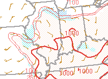
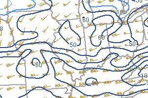
Mesoanalysis from the Storm Prediction Center (SPC) indicated Surface Based Convective Available Potential Energy (SBCAPE) values of 500-1000J/kg and 0-6km shear of 60-80kt along and south of the I-70 corridor. At this point, the moderately unstable and highly sheared environment was primed for strong to severe convection.
SBCAPE 3PM CST FEBRUARY 19, 2026 0-6KM SHEAR 3PM CST FEBRUARY 19, 2026
 |
 |
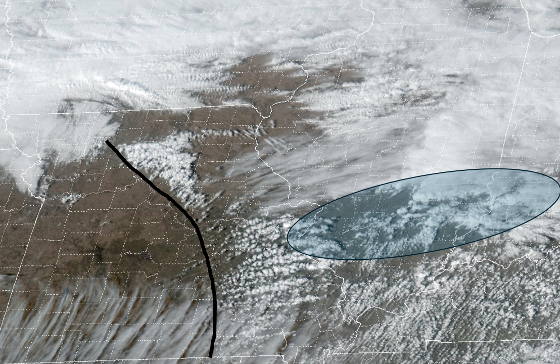
Mid-afternoon visible satellite imagery showed deep convection developing along the wind-shift line as shown in the blue oval in the image below. Meanwhile, towering cumulus were forming along the dryline (black line) across northern and eastern Missouri.
VISIBLE SATELLITE IMAGERY 3:31 PM CST FEBRUARY 19, 2026
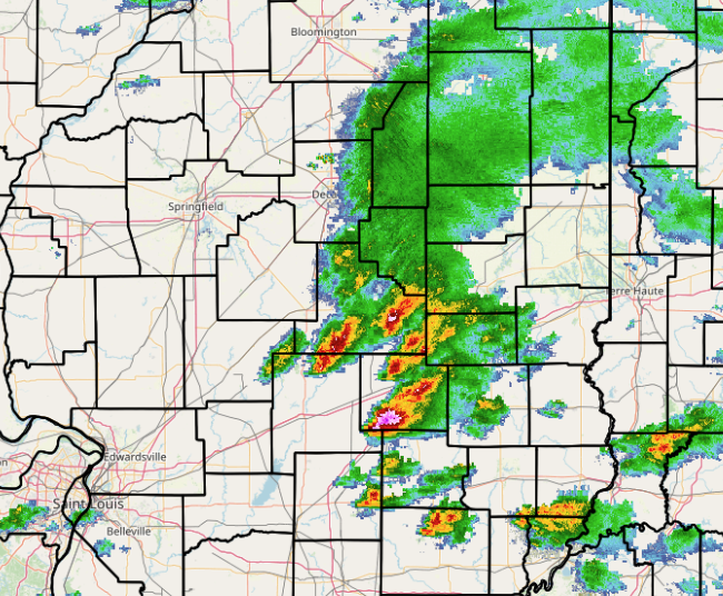
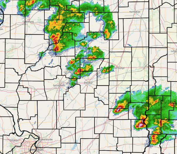
Regional radar imagery from 3:05pm CST showed the newly-developed thunderstorms from Shelby County southward to Wayne County...while only showers were noted further north into the more stable airmass closer to the I-72 corridor.
REGIONAL RADAR 3:05 PM CST FEBRUARY 19, 2026
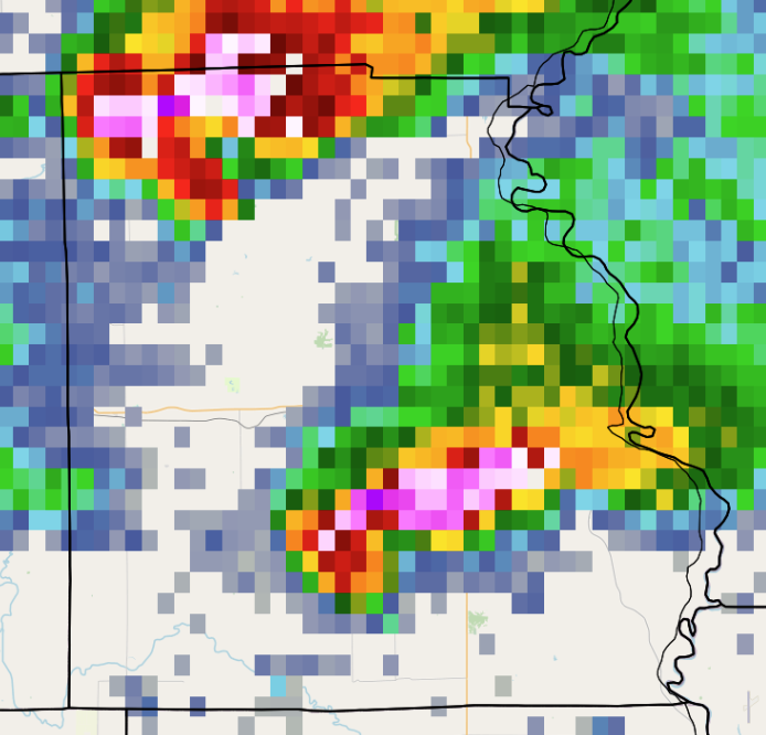
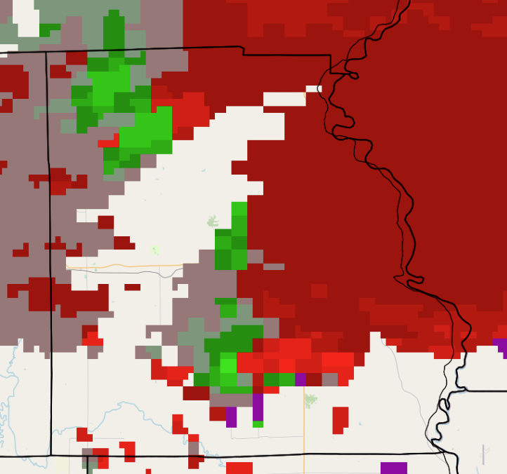
The thunderstorms were initially inhibited by a pocket of warm air aloft: however, as mid-level cooling associated with a short-wave trough arrived from the west...rapid intensification occurred after 3pm. Given the presence of the wind-shift line, which enhanced low-level wind shear, many of the cells along the I-70 corridor began rotating. Numerous reports of wall clouds and funnel clouds were received for the balance of the afternoon as NWS forecasters monitored radar imagery and issued warnings accordingly. One of the most impressive cells developed over southern Jasper County, then tracked eastward across southern Crawford County. A classic supercell signature was seen on radar, complete with hook echo and tight storm-relative motion (SRM) couplet. The image below shows two supercell thunderstorms over Crawford County at 4:25mph CST. Note the hook structure on radar reflectivity and the velocity couplet (red next to green) on both cells. The southernmost storm was producing an EF-1 tornado at the time of the imagery, while the northern storm dropped a brief EF-U tornado about 7 minutes later.
REFLECTIVITY 4:25 PM CST STORM RELATIVE MOTION 4:25 PM CST
 |
 |
As the initial convection along and south of I-70 pushed into Indiana, scattered thunderstorms formed along the advancing dryline during the evening. While these storms were not quite as strong due to the decreasing instability after sunset, one of the cells produced an EF-0 tornado north of Bible Grove in southern Effingham County. In addition, storms further north along the boundary generated prolific lightning and dropped hail as large as half dollars (1.25" in diameter) in northern Mason County near Goofy Ridge.
REGIONAL RADAR 7:45 PM CST FEBRUARY 19, 2026
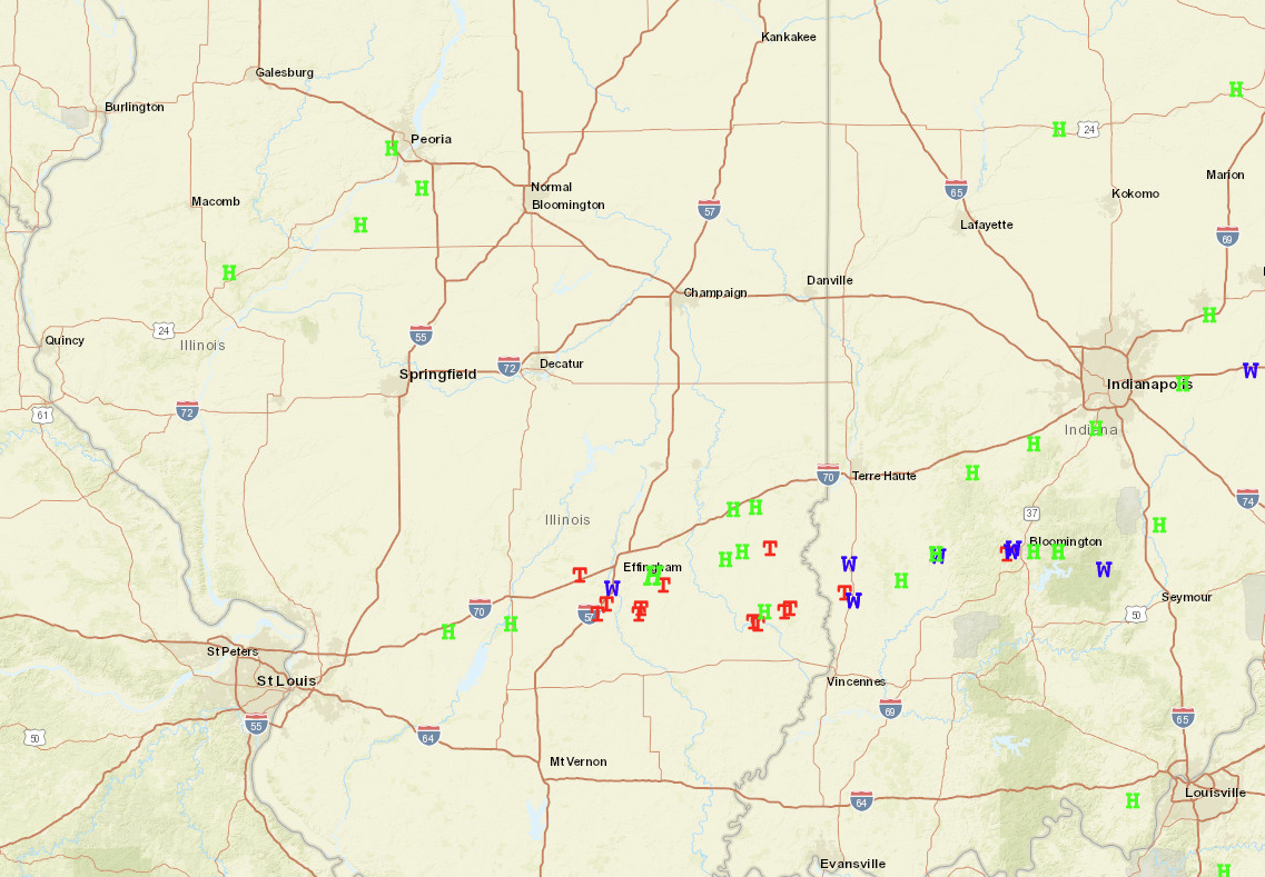
Here is a map of all severe weather reports received on February 19th. Note the majority of reports clustered along and south of I-70 where instability, shear, and forcing mechanisms sufficiently aligned to produce a significant cool season severe event. Only scattered hail occurred further north in the Illinois River during the evening.
SEVERE WEATHER REPORTS FEBRUARY 19, 2026