Overview
Low pressure tracked from western Kentucky to western Lake Erie, spreading a large area of snow across the area starting during the pre-dawn hours of Jan 25 and continuing until early evening on the 25th. Temperatures near or just above freezing allowed for a "wet" snow to fall, limiting blowing and drifting during the event.Snow
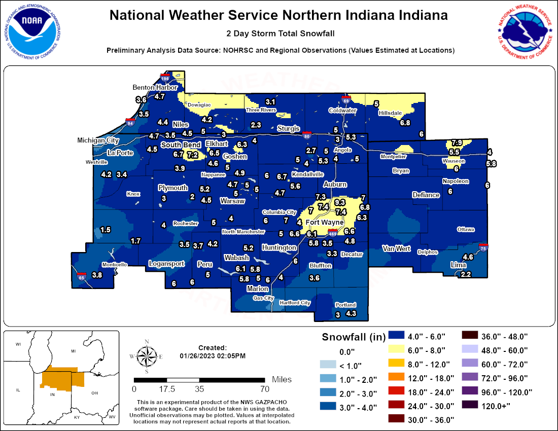
Many locations averaged between 4 and 6 inches of snow, with the heaviest snow falling from late morning through mid afternoon. Some meso banding occurred in a few locations that allowed for locally higher amounts, approaching 7 to 9 inches. The map represents reports received through our various data sources. A table of specific amounts can also be found under the Storm Reports tab of this story.
Photos & Video
Photos
 |
 |
 |
 |
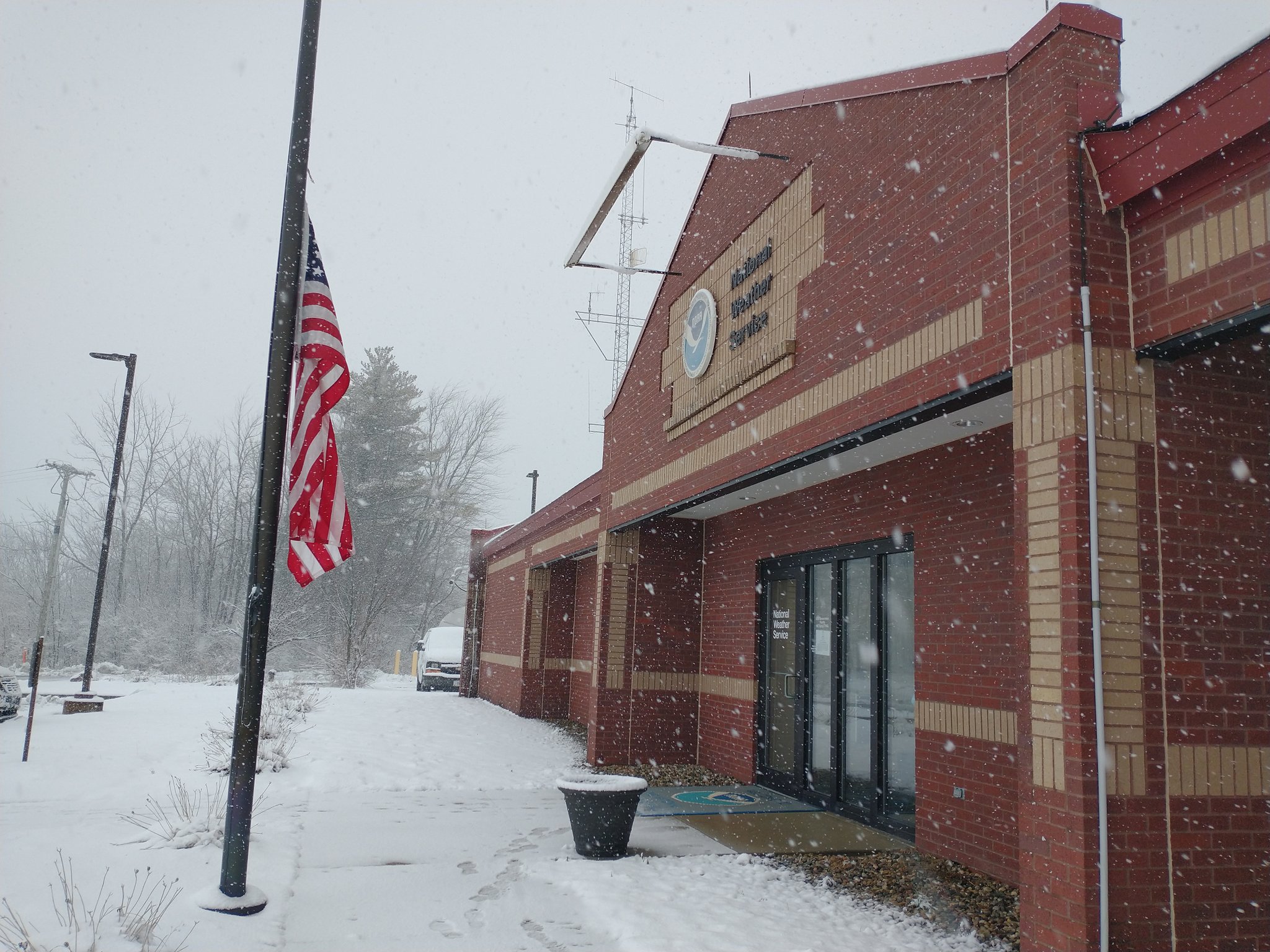
| Snow falling at NWS Northern Indiana. (Maddi Johnson - NWS IWX) |
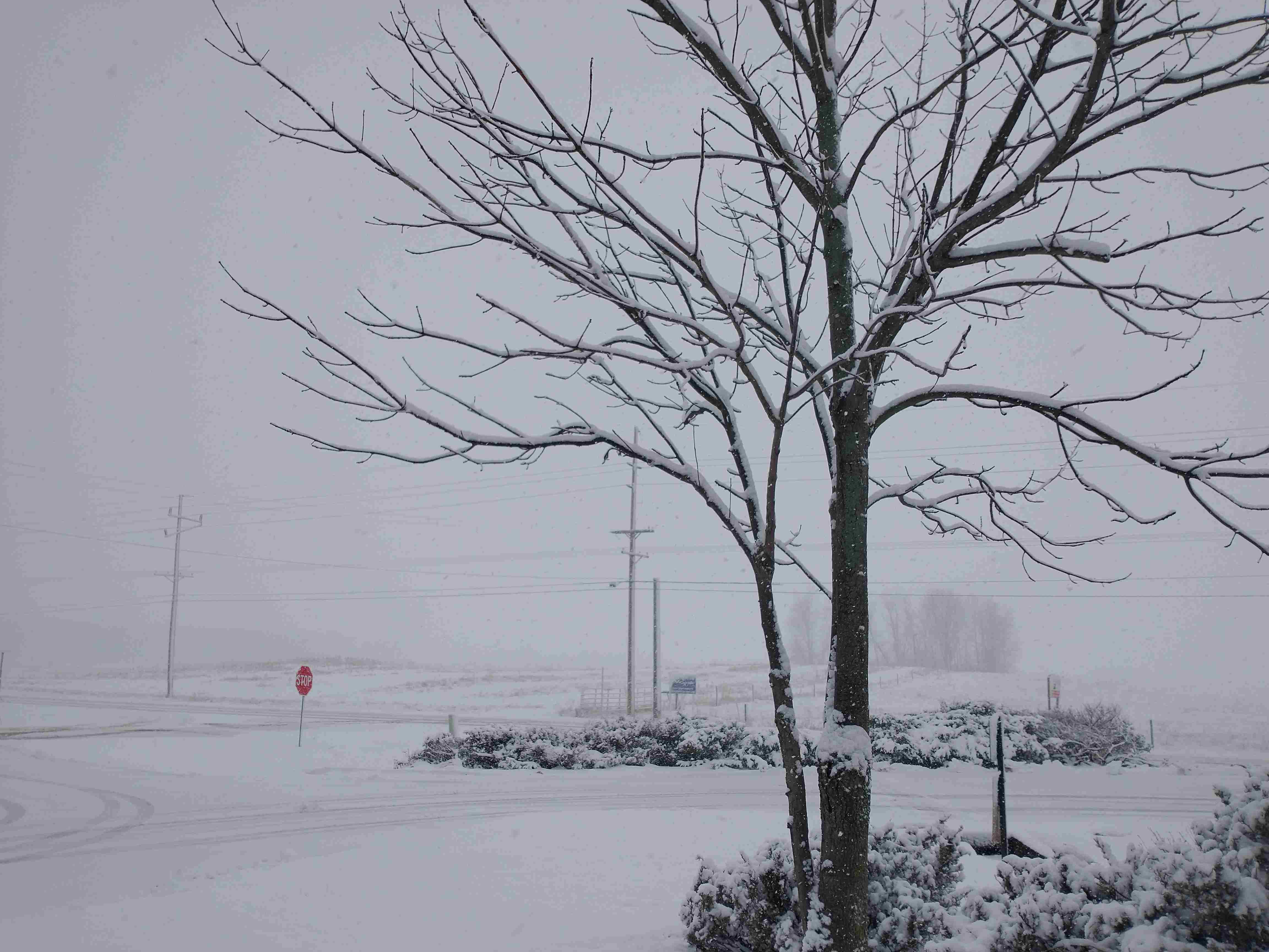
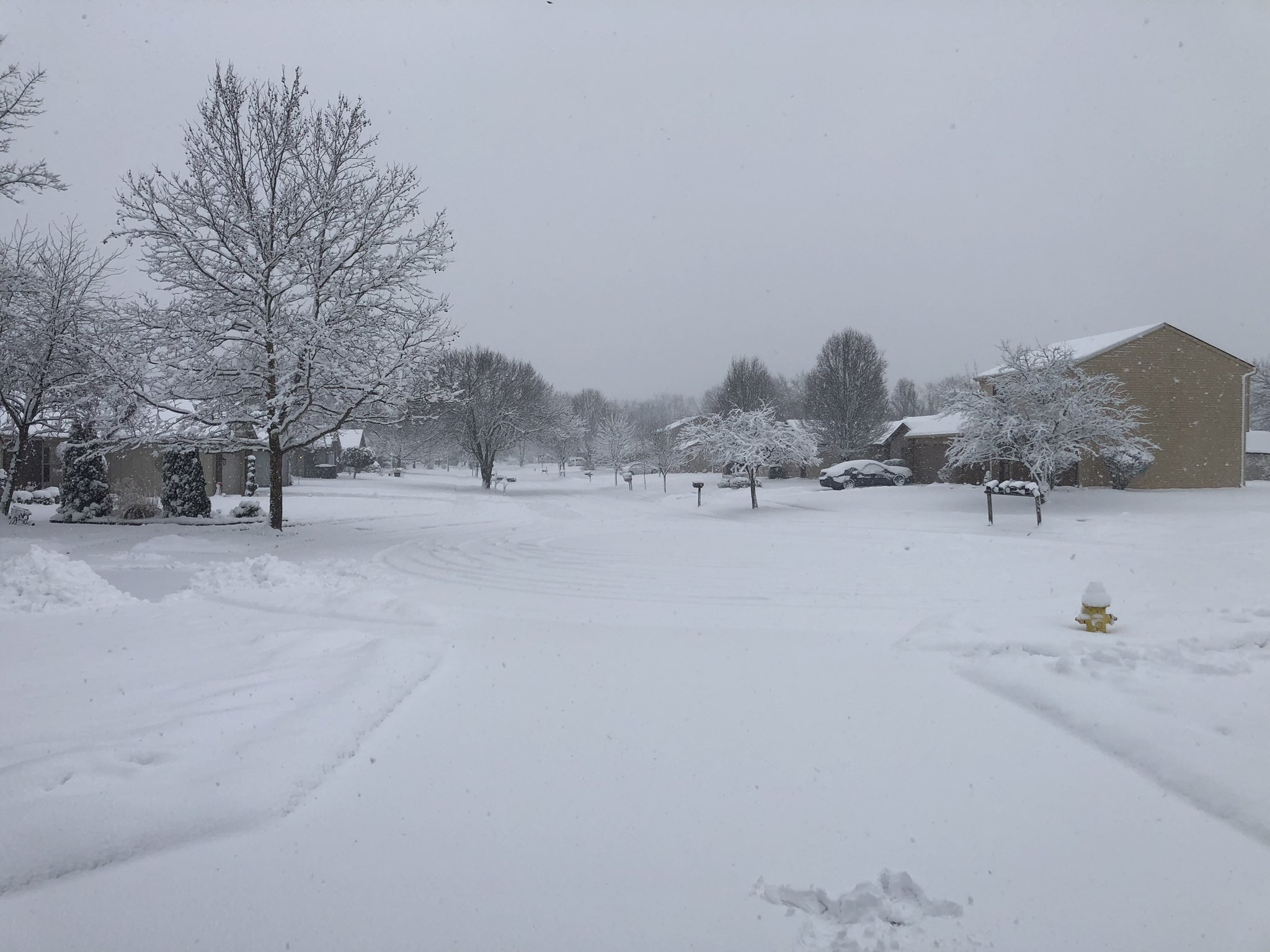
A view of snow-covered roads at NWS Northern Indiana (Maddi Johnson - NWS IWX) |
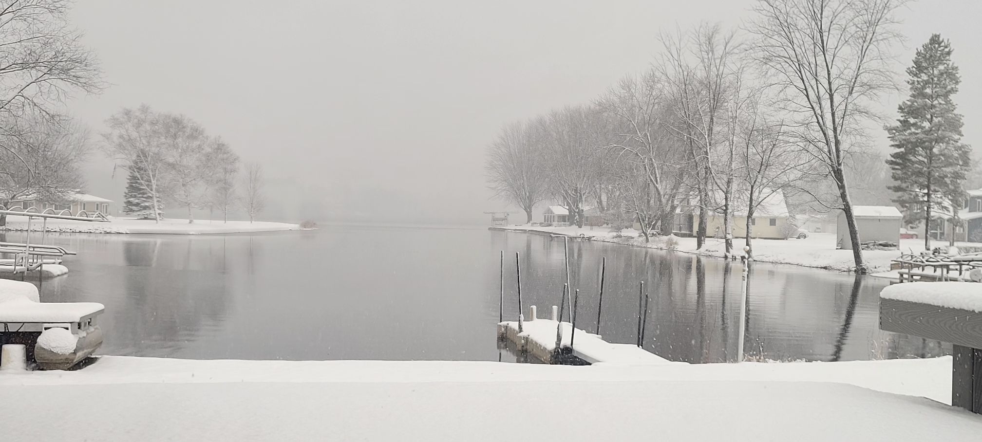
Dallas Lake in Lagrange County (Jennifer Bierdz Fondel) |
Snow in Fort Wayne, IN (Jay Farlow) |
 |
 |
 |
|
| Snowy landscape on the northwest side of South Bend. (Tom Coomes - ABC 57) |
Notre Dame in South Bend, IN (Lynnette Grant - WSBT) |
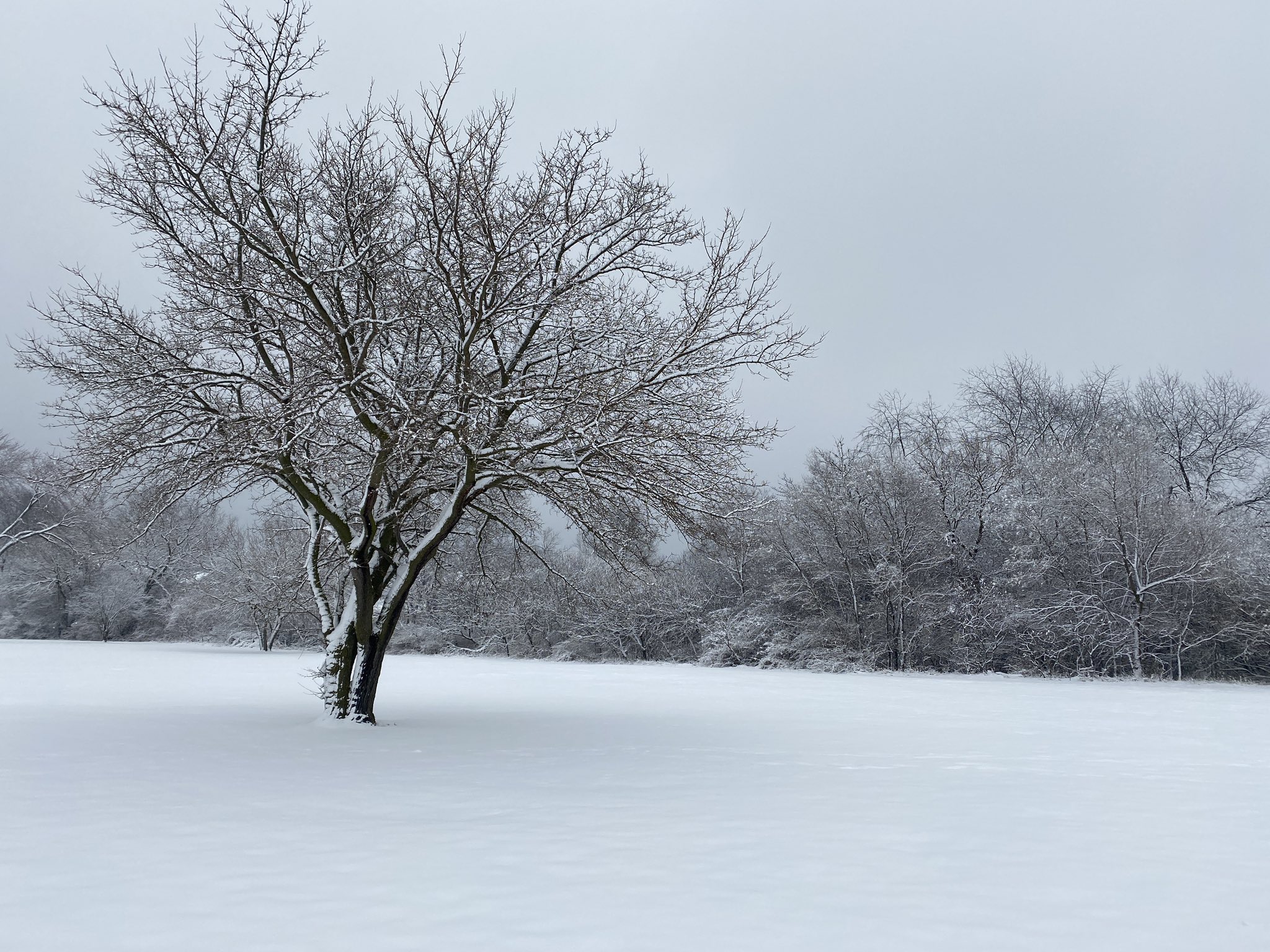
Snow-covered trees in Miami County, IN (Bonnie Davis) |
Videos
| Snow falling at a rate of 1" per hour in Monroe, IN (Matthew K. Hartman) |
Large snowflakes falling in Defiance OH (Steph Helmke) |
Heavy snow falling at WFO IWX (Maddi Johnson) |
Radar
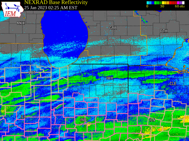 |
| Radar Loop of the Event (Courtesy IEMCow) |
Storm Reports
PUBLIC INFORMATION STATEMENT
NATIONAL WEATHER SERVICE NORTHERN INDIANA
149 PM EST THU JAN 26 2023

...2 DAY STORM TOTAL SNOWFALL REPORTS...

LOCATION                     AMOUNT    TIME/DATE       PROVIDER

...INDIANA...

...ALLEN COUNTY...
GRABILL 5.2 WSW              9.3 IN    0813 AM 01/26   COCORAHS
2 SW FORT WAYNE              8.5 IN    0230 PM 01/25   PUBLIC
4 NNW NEW HAVEN              7.4 IN    0252 PM 01/25   TRAINED SPOTTER
4 E WALLEN                   7.4 IN    0300 PM 01/25   TRAINED SPOTTER
HUNTERTOWN                   7.3 IN    1124 PM 01/25   PUBLIC
3 ENE ARCOLA                 7.0 IN    0105 PM 01/25   PUBLIC
GEORGETOWN                   7.0 IN    0309 PM 01/25   PUBLIC
FORT WAYNE 1.6 S             7.0 IN    0652 AM 01/26   COCORAHS
1 NE CUBA                    6.8 IN    0555 PM 01/25   TRAINED SPOTTER
FORT WAYNE 4.1 NE            6.8 IN    0700 AM 01/26   COCORAHS
WOODBURN 2.6 NNW             6.8 IN    0900 AM 01/26   COCORAHS
ABOITE                       6.6 IN    0825 PM 01/25   PUBLIC
FORT WAYNE 9.1 SE            6.6 IN    0700 AM 01/26   COCORAHS
FORT WAYNE 6.8 NE            6.4 IN    0700 AM 01/26   COCORAHS
WOODBURN 2.8 WSW             6.3 IN    0700 AM 01/26   COCORAHS
2 ENE NINE MILE              6.1 IN    0400 PM 01/25   ASOS
NEW HAVEN                    6.0 IN    0135 PM 01/25   PUBLIC
3 NW FORT WAYNE              6.0 IN    0445 PM 01/25   BROADCAST MEDIA
FORT WAYNE 2.6 NE            6.0 IN    0700 AM 01/26   COCORAHS
HARLAN                       5.9 IN    0122 PM 01/25   TRAINED SPOTTER
2 NW WOODBURN                5.9 IN    0400 PM 01/25   PUBLIC
FORT WAYNE 10.4 N            5.9 IN    0700 AM 01/26   COCORAHS
2 N FORT WAYNE               5.8 IN    0130 PM 01/25   PUBLIC
FORT WAYNE 5.7 NE            5.7 IN    0700 AM 01/26   COCORAHS
WOODBURN 2.6 NNW             5.5 IN    0900 AM 01/26   COCORAHS
FORT WAYNE 6.0 N             5.4 IN    0728 AM 01/26   COCORAHS
FORT WAYNE                   5.0 IN    0305 PM 01/25   EMERGENCY MNGR
HOAGLAND 1.5 SSW             4.8 IN    0745 AM 01/26   COCORAHS

...BLACKFORD COUNTY...
HARTFORD CITY 4 ESE          3.1 IN    0800 AM 01/26   COOP
1 ENE HARTFORD CITY          2.0 IN    1050 AM 01/25   PUBLIC

...CASS COUNTY...
GALVESTON                    6.0 IN    0140 PM 01/25   PUBLIC
LOGANSPORT                   6.0 IN    1148 PM 01/25   PUBLIC
YOUNG AMERICA                6.0 IN    0800 AM 01/26   COOP
TWELVE MILE                  3.5 IN    0831 PM 01/25   PUBLIC

...DE KALB COUNTY...
GARRETT                      7.4 IN    1128 PM 01/25   PUBLIC
ASHLEY                       5.3 IN    0900 AM 01/26   COOP
0.6 S GARRETT                5.0 IN    0700 AM 01/26   COOP
AUBURN                       4.9 IN    0527 PM 01/25   PUBLIC

...ELKHART COUNTY...
GOSHEN 3.0 WSW               7.4 IN    0700 AM 01/26   COCORAHS
ELKHART 4.8 SW               6.5 IN    0630 AM 01/26   COCORAHS
4 N GOSHEN                   6.3 IN    0700 AM 01/26   PUBLIC
GOSHEN 4.6 N                 6.3 IN    0700 AM 01/26   COCORAHS
GOSHEN 1.2 SW                5.7 IN    0700 AM 01/26   COCORAHS
NAPPANEE 4.8 NE              5.0 IN    0700 AM 01/26   COCORAHS
WAKARUSA 2.4 NNE             4.6 IN    0700 AM 01/26   COCORAHS
2 WNW GOSHEN                 4.5 IN    0932 PM 01/25   PUBLIC
ELKHART 4.8 SW               4.5 IN    0630 AM 01/26   COCORAHS
GOSHEN 0.3 NE                4.1 IN    0630 AM 01/26   COCORAHS
MIDDLEBURY                   4.0 IN    0115 PM 01/25   PUBLIC
ELKHART                      4.0 IN    0343 PM 01/25   PUBLIC
2 WNW GOSHEN                 3.0 IN    0730 AM 01/25   PUBLIC
2 SSE SIMONTON LAKE          3.0 IN    0330 PM 01/25   PUBLIC

...FULTON COUNTY...
AKRON                        5.0 IN    0330 PM 01/25   PUBLIC
KEWANNA                      4.0 IN    0707 PM 01/25   PUBLIC
ROCHESTER                    3.8 IN    0404 PM 01/25   PUBLIC
ROCHESTER 2.4 NW             3.3 IN    0600 AM 01/26   COCORAHS
ROCHESTER                    3.0 IN    0700 AM 01/26   COOP

...GRANT COUNTY...
GAS CITY                     7.0 IN    0855 AM 01/26   PUBLIC
2 WSW HANFIELD               6.0 IN    1013 PM 01/25   PUBLIC
2 NW MARION                  5.5 IN    1249 PM 01/25   PUBLIC
MARION 6.5 N                 5.0 IN    0745 AM 01/26   COCORAHS
MARION                       4.5 IN    1256 AM 01/26   PUBLIC
VAN BUREN                    4.0 IN    0406 PM 01/25   PUBLIC
MARION 5.6 NE                4.0 IN    0600 AM 01/26   COCORAHS
2.2 N MARION                 4.0 IN    0713 AM 01/26   COOP
MARION 1.8 NW                3.5 IN    0750 AM 01/26   COCORAHS
UPLAND 2.4 SSE               1.5 IN    0700 AM 01/26   COCORAHS

...HUNTINGTON COUNTY...
HUNTINGTON                   6.7 IN    0300 PM 01/25   TRAINED SPOTTER
PLUM CREEK                   6.0 IN    1209 PM 01/25   PUBLIC
3 S GOBLESVILLE              5.0 IN    0412 PM 01/25   TRAINED SPOTTER
HUNTINGTON 0.3 W             5.0 IN    0700 AM 01/26   COCORAHS

...JAY COUNTY...
PORTLAND 2.3 S               4.3 IN    0700 AM 01/26   COCORAHS
PORTLAND                     4.0 IN    1044 AM 01/25
(W9JKL) PORTLAND 0.6 SSW     3.5 IN    0700 AM 01/26   COCORAHS
(KC9LQY) PORTLAND 5.4 SW     3.0 IN    0700 AM 01/26   COCORAHS

...KOSCIUSKO COUNTY...
LEESBURG 6.7 ESE             5.8 IN    0700 AM 01/26   COCORAHS
NORTH WEBSTER 2.3 N          5.6 IN    0700 AM 01/26   COCORAHS
1 SSE JAMES LAKE             5.2 IN    0706 PM 01/25   COCORAHS
NORTH WEBSTER                5.0 IN    0320 PM 01/25   PUBLIC
WARSAW                       5.0 IN    0340 PM 01/25   PUBLIC
1 WNW TIPPECANOE LAKE        5.0 IN    0414 PM 01/25
2 N NORTH WEBSTER            5.0 IN    0543 PM 01/25   OFFICIAL NWS OBS
WARSAW 1.4 N                 5.0 IN    0645 AM 01/26   COCORAHS
MILFORD 0.9 N                4.9 IN    0700 AM 01/26   COCORAHS
LEESBURG 0.1 WNW             4.7 IN    0700 AM 01/26   COCORAHS
ETNA GREEN                   4.5 IN    0500 PM 01/25   PUBLIC
SILVER LAKE                  4.0 IN    0345 PM 01/25   PUBLIC
WARSAW 3.7 E                 4.0 IN    0730 AM 01/26   COCORAHS

...LA PORTE COUNTY...
MILL CREEK 1.9 NNE           4.5 IN    0615 AM 01/26   COCORAHS
WANATAH 4.4 ESE              4.2 IN    0900 AM 01/26   COCORAHS
MILL CREEK 1.9 NNE           3.5 IN    0615 AM 01/26   COCORAHS
HANNA 1.1 E                  3.4 IN    0800 AM 01/26   COCORAHS
WANATAH 4.4 ESE              3.3 IN    0930 AM 01/25   COCORAHS
LA PORTE 1.6 SW              2.8 IN    0800 AM 01/26   COCORAHS
2 WNW MICHIGAN CITY          2.0 IN    0145 PM 01/25   PUBLIC

...LAGRANGE COUNTY...
WOLCOTTVILLE                 5.0 IN    0300 PM 01/25   PUBLIC
LAGRANGE 9.6 ESE             2.7 IN    0700 AM 01/26   COCORAHS

...MARSHALL COUNTY...
BOURBON                      5.3 IN    0413 PM 01/25   PUBLIC
LA PAZ                       3.9 IN    0350 PM 01/25   PUBLIC
BURR OAK                     3.0 IN    0349 AM 01/25   PUBLIC
3 E ARGOS                    2.0 IN    1245 PM 01/25   PUBLIC
PLYMOUTH 2.5 WSW             1.3 IN    1200 PM 01/26   COCORAHS

...MIAMI COUNTY...
PERU                         5.5 IN    0445 PM 01/25   PUBLIC
2 SE BUNKER HILL             5.0 IN    1006 PM 01/25
DENVER 1.3 NE                4.2 IN    0700 AM 01/26   COCORAHS
DENVER 0.5 SSE               3.7 IN    0700 AM 01/26   COCORAHS
0.8 NW PERU                  2.9 IN    0700 AM 01/26   COOP

...NOBLE COUNTY...
ALBION                       6.7 IN    0818 PM 01/25   PUBLIC
CROMWELL                     6.0 IN    0351 PM 01/25   PUBLIC
ALBION 2.9 S                 5.6 IN    0900 AM 01/26   COCORAHS
KENDALLVILLE                 4.8 IN    0520 PM 01/25   PUBLIC
1 WNW ROME CITY              4.0 IN    0308 PM 01/25   PUBLIC
KENDALLVILLE 4.5 NW          4.0 IN    0700 AM 01/26   COCORAHS

...PULASKI COUNTY...
FRANCESVILLE                 1.5 IN    0800 AM 01/26   COOP

...ST. JOSEPH COUNTY...
SOUTH BEND 4.6 SE            7.2 IN    0800 AM 01/26   COCORAHS
SOUTH BEND 3.3 SE            6.7 IN    0700 AM 01/26   COCORAHS
1 WSW GULIVOIRE PARK         5.3 IN    0649 PM 01/25   PUBLIC
GRANGER 1.8 ENE              5.0 IN    0700 AM 01/26   COCORAHS
SOUTH BEND 4.0 SSW           5.0 IN    0800 AM 01/26   COCORAHS
NEW CARLISLE                 4.7 IN    0730 AM 01/26   COOP
SOUTH BEND                   4.3 IN    0130 PM 01/25   TRAINED SPOTTER
2 W ROSELAND                 3.5 IN    0400 PM 01/25   COCORAHS
1 E INDIAN VILLAGE           3.3 IN    0559 PM 01/25   BROADCAST MEDIA
1 NW SOUTH BEND              2.5 IN    1100 AM 01/25   BROADCAST MEDIA

...STEUBEN COUNTY...
ANGOLA 4.1 N                 5.3 IN    0545 AM 01/26   COCORAHS
2 N NEVADA MILLS             5.0 IN    0412 PM 01/25   PUBLIC
ANGOLA                       5.0 IN    0711 PM 01/25   PUBLIC
HAMILTON                     5.0 IN    1129 PM 01/25   PUBLIC
HUDSON 4.1 NNW               5.0 IN    0700 AM 01/26   COCORAHS
ANGOLA                       4.3 IN    0700 AM 01/26   COOP
HUDSON 4.6 N                 4.3 IN    0715 AM 01/26   COCORAHS
HUDSON                       4.0 IN    0218 PM 01/25   PUBLIC
ANGOLA 6.2 NW                3.0 IN    0700 AM 01/26   COCORAHS

...WABASH COUNTY...
LA FONTAINE 1.1 NW           6.1 IN    0600 AM 01/26   COCORAHS
LA FONTAINE 0.3 SE           5.8 IN    0700 AM 01/26   COCORAHS
LA FONTAINE                  5.8 IN    1230 PM 01/25   PUBLIC
LAGRO                        5.3 IN    0120 PM 01/25   PUBLIC

...WELLS COUNTY...
2 ENE BLUFFTON               5.8 IN    0343 PM 01/25   TRAINED SPOTTER
5 SW NINE MILE               5.8 IN    0103 AM 01/26   PUBLIC
1 NNW KEYSTONE               3.6 IN    0615 PM 01/25   PUBLIC
OSSIAN                       3.5 IN    1135 AM 01/25   PUBLIC
CRAIGVILLE 2.7 NW            3.3 IN    0800 AM 01/26   COCORAHS

...WHITE COUNTY...
5.6 N BADGER GROVE           3.8 IN    0700 AM 01/26   COOP
BURNETTSVILLE 9.9 NNW        1.7 IN    1108 AM 01/25   COCORAHS

...WHITLEY COUNTY...
1 ENE PEABODY                7.0 IN    0315 PM 01/25   TRAINED SPOTTER
SOUTH WHITLEY                6.0 IN    0907 PM 01/25   PUBLIC
TRI-LAKES 3.0 N              4.7 IN    0800 AM 01/26   COCORAHS
COLUMBIA CITY 0.5 WSW        4.6 IN    0745 AM 01/26   COCORAHS
1 WSW COLUMBIA CITY          4.4 IN    0345 PM 01/25   NWS EMPLOYEE
3 NNW ABOITE                 4.0 IN    1116 AM 01/25   PUBLIC

...MICHIGAN...

...BERRIEN COUNTY...
NILES 2.7 W                  6.6 IN    0800 AM 01/26   COCORAHS
ST. JOSEPH 2.8 SSE           4.7 IN    0700 AM 01/26   COCORAHS
1 NW FAIR PLAIN              4.5 IN    0837 PM 01/25   TRAINED SPOTTER
BERTRAND                     4.5 IN    0800 AM 01/26   COCORAHS
BUCHANAN 1.4 ESE             4.4 IN    0700 AM 01/26   COCORAHS
SHOREHAM 2.0 SE              3.8 IN    0800 AM 01/26   COCORAHS
STEVENSVILLE 1.7 SSE         3.6 IN    0730 AM 01/26   COCORAHS
1 E NEW TROY                 3.5 IN    0437 PM 01/25   PUBLIC

...CASS COUNTY...
NILES 3.5 E                  5.1 IN    0900 AM 01/26   COCORAHS
2 NNW EDWARDSBURG            4.2 IN    0700 AM 01/26   COCORAHS
DOWAGIAC                     4.0 IN    0400 PM 01/25   PUBLIC

...HILLSDALE COUNTY...
1 WSW OSSEO                  6.8 IN    0209 AM 01/26   PUBLIC
HILLSDALE                    6.7 IN    0422 PM 01/25   PUBLIC
HILLSDALE 2.5 ESE            6.5 IN    0800 AM 01/26   COCORAHS
WALDRON                      6.0 IN    0311 PM 01/25   PUBLIC
ALLEN                        5.0 IN    0628 PM 01/25   PUBLIC

...ST. JOSEPH COUNTY...
STURGIS                      6.5 IN    0634 PM 01/25   TRAINED SPOTTER
THREE RIVERS 2.4 NE          3.1 IN    0700 AM 01/26   COCORAHS
2 E MOTTVILLE                2.3 IN    1003 AM 01/25

...OHIO...

...ALLEN COUNTY...
LIMA 2.7 NE                  4.6 IN    0700 AM 01/26   COCORAHS
DELPHOS 2.3 ESE              3.7 IN    0600 AM 01/26   COCORAHS
LIMA 3.0 SSE                 2.2 IN    0600 AM 01/26   COCORAHS

...FULTON COUNTY...
1 SW OAKSHADE                7.9 IN    0654 PM 01/25   TRAINED SPOTTER
SWANTON 4.0 S                5.8 IN    0825 AM 01/26   COCORAHS
1 NE TEDROW                  5.5 IN    0502 PM 01/25
SWANTON                      4.0 IN    0400 PM 01/25   PUBLIC

...HENRY COUNTY...
1 ESE OKOLONA                6.0 IN    0345 PM 01/25   PUBLIC
MCCLURE 3.4 SSE              6.0 IN    0700 AM 01/26   COCORAHS
NAPOLEON 4.5 NNW             6.0 IN    0700 AM 01/26   COCORAHS
NAPOLEON 0.6 WSW             3.1 IN    0800 AM 01/26   COCORAHS

...PUTNAM COUNTY...
OTTAWA 1.0 N                 4.2 IN    0700 AM 01/26   COCORAHS

...VAN WERT COUNTY...
1 WNW VAN WERT               7.0 IN    0430 PM 01/25   EMERGENCY MNGR
VAN WERT                     5.6 IN    0112 PM 01/25   EMERGENCY MNGR
1 NNE VAN WERT               4.5 IN    0226 PM 01/25   PUBLIC

...WILLIAMS COUNTY...
BRYAN                        5.0 IN    0202 PM 01/25   PUBLIC
Environment
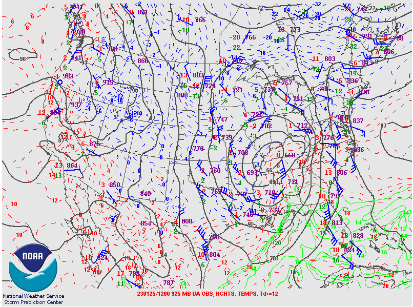
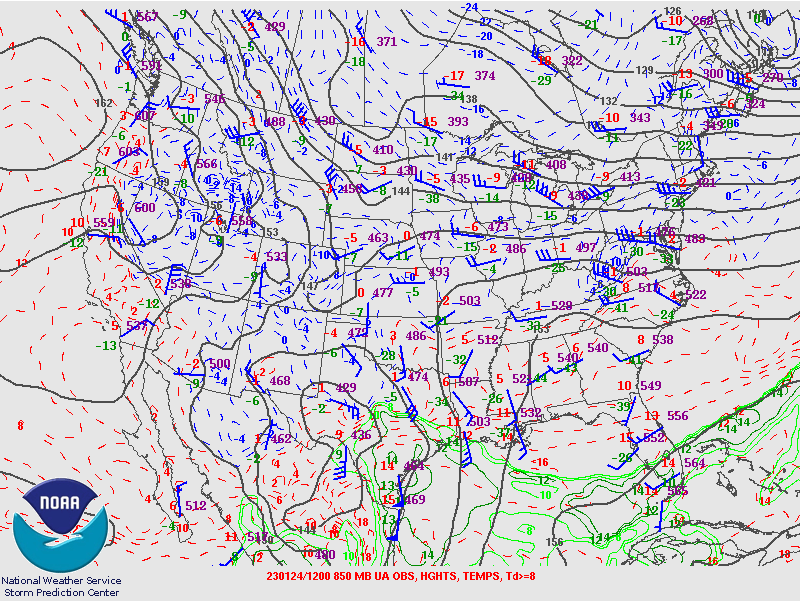
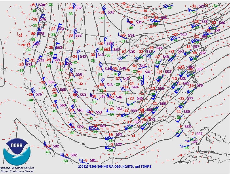
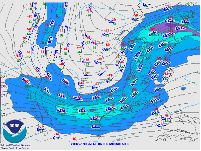
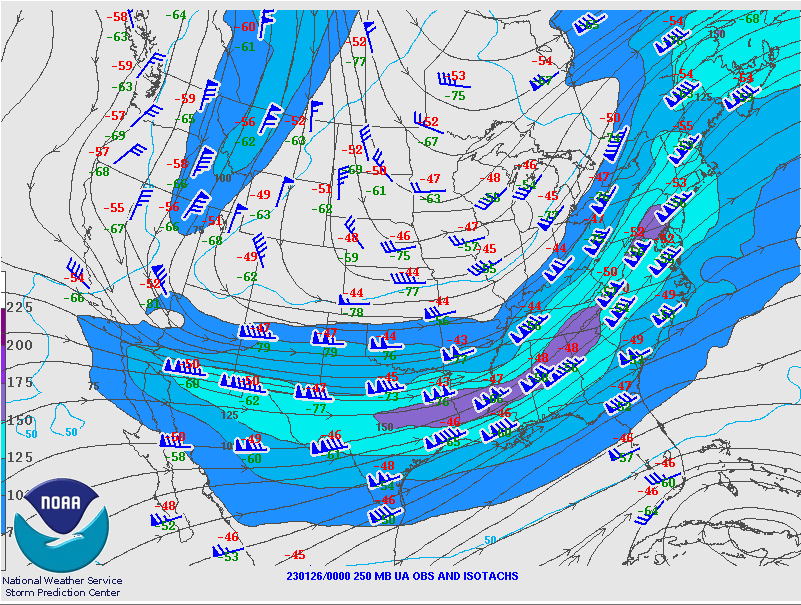
Early stages of the low pressure intensification, starting out in western Kentucky. The 250 mb plot shows the hints of a couple jet structure, aiding in the development of the surface low and increased lift across the area.
.PNG) |
 |
 |
 |
 |
|
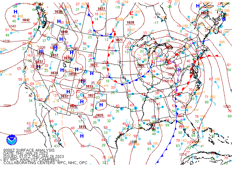
Figure 6: Surface Plot 7 AM EST January 25 |
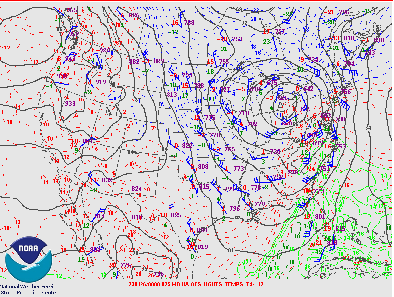
Figure 7: 925mb Plot 7 AM EST January 25 |
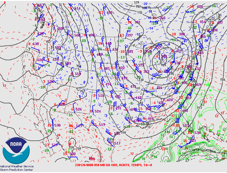
Figure 8: 850mb Plot 7 AM EST January 25 |
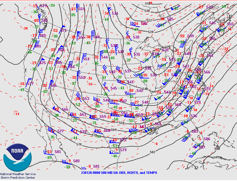
Figure 9: 500mb Plot 7 AM EST January 25 |
Figure 10: 250mb Plot 7 AM EST January 25 |
The low rapidly tracked northeast into western Lake Erie.
 |
 |
 |
 |
 |
|
Figure 11: Surface Plot 7 PM EST January 25 |
Figure 12: 925mb Plot 7 PM EST January 25 |
Figure 13: 850mb Plot 7 PM EST January 25 |
Figure 14: 500mb Plot 7 PM EST January 25 |
Figure 15: 250mb Plot 7 PM EST January 25 |
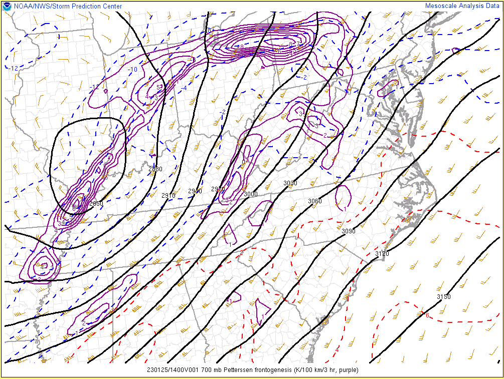
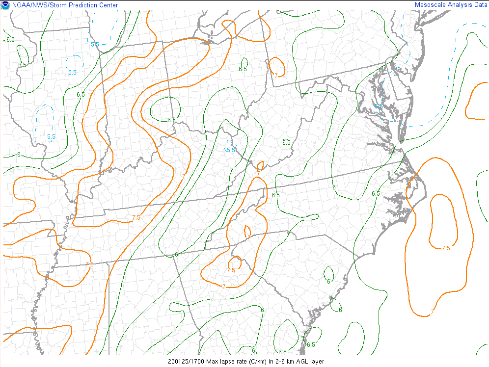
Figure 16 shows increasing frontogenesis around 9 am EST as some of the meso banding was increasing. Steep mid level lapse rates (Figure 17) aided in the intensification, with even a few reports of thundersnow coming in southeast of Fort Wayne, along the IN/OH border between 1130 am and 12 pm EST.
 |
 |
|
Figure 16: 700mb Frontogenesis 9 AM EST January 25 |
Figure 17: Mid Level Lapse Rates Noon EST January 25 |
 |
Media use of NWS Web News Stories is encouraged! Please acknowledge the NWS as the source of any news information accessed from this site. |
|

