Overview
|
Summary of the Tornadoes and Severe Weather Tuesday September 24th, 2024. Thunderstorms developed along a warm front, resulting in the development of 4 tornadoes. See the Public Information Statement (PNS) for the survey results. This webpage will be updated as more information is received. If you have video footage or pictures of damage from the event, please send them to our webmaster at nws.northernindiana@noaa.gov If you have reports only with no pictures, send them in using this form and make sure you include the time the storm damage or weather phenomena (the event) occurred, and the location (nearest intersection or address preferred). Thank you to those who sent us videos, photos, and reports during the event! We appreciate you! |
|
Tornadoes:
|
Tornado - Mishawaka, IN
|
||||||||||||||||
|
||||||||||||||||
|
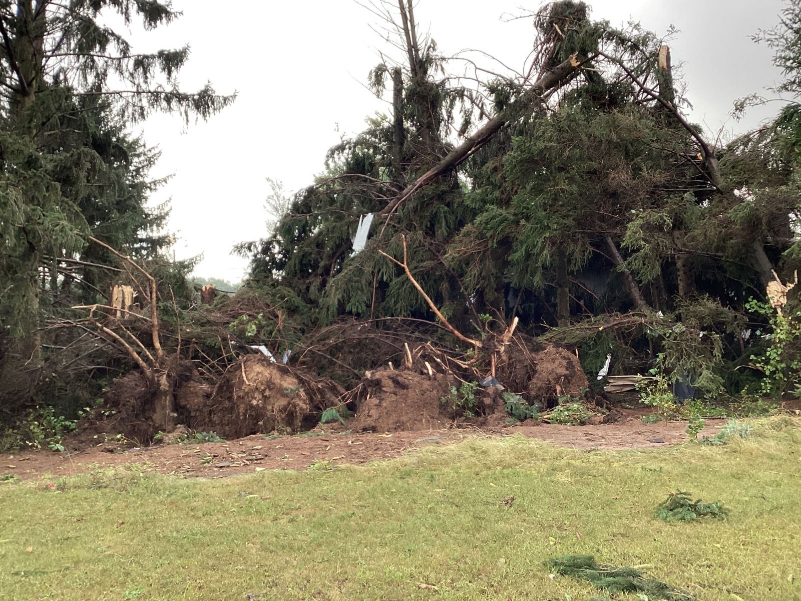
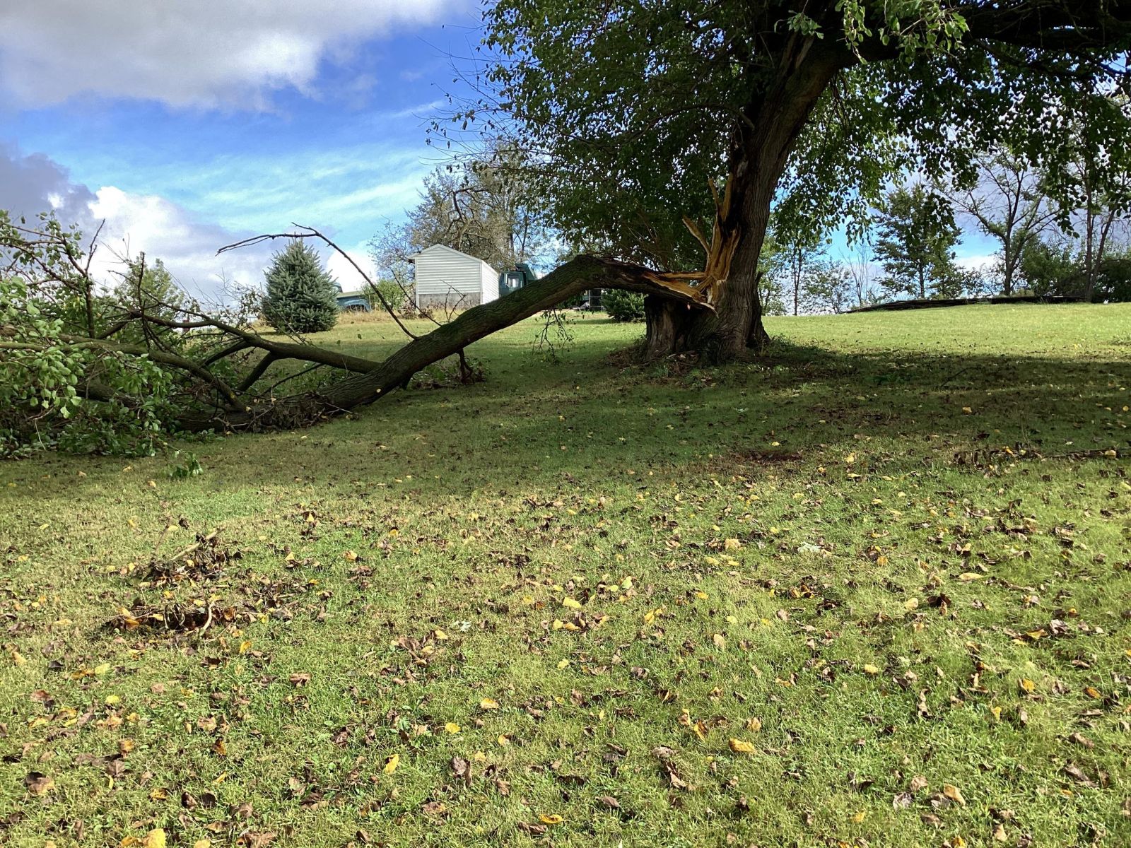
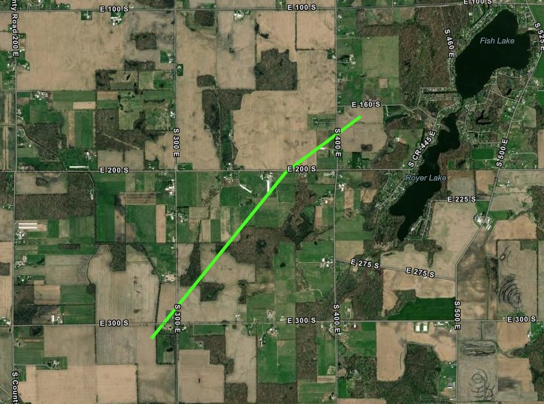
Tornado - Near Camden, MI
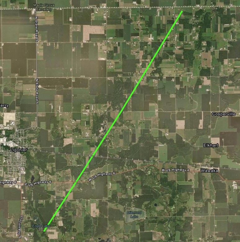
Track Map 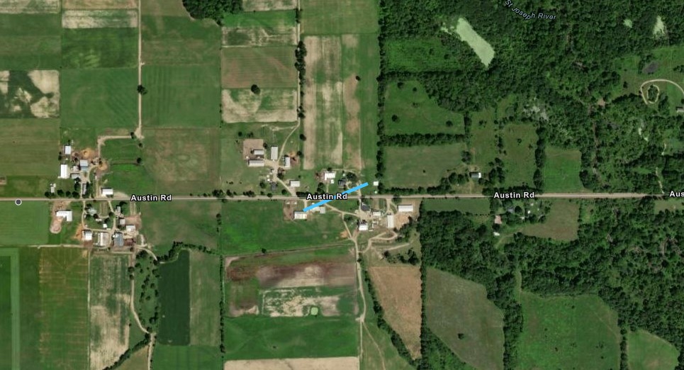 
|
||||||||||||||||||||||
|
Tornado - Near Oliver Lake, IN
|
||||||||||||||||
|
||||||||||||||||
|
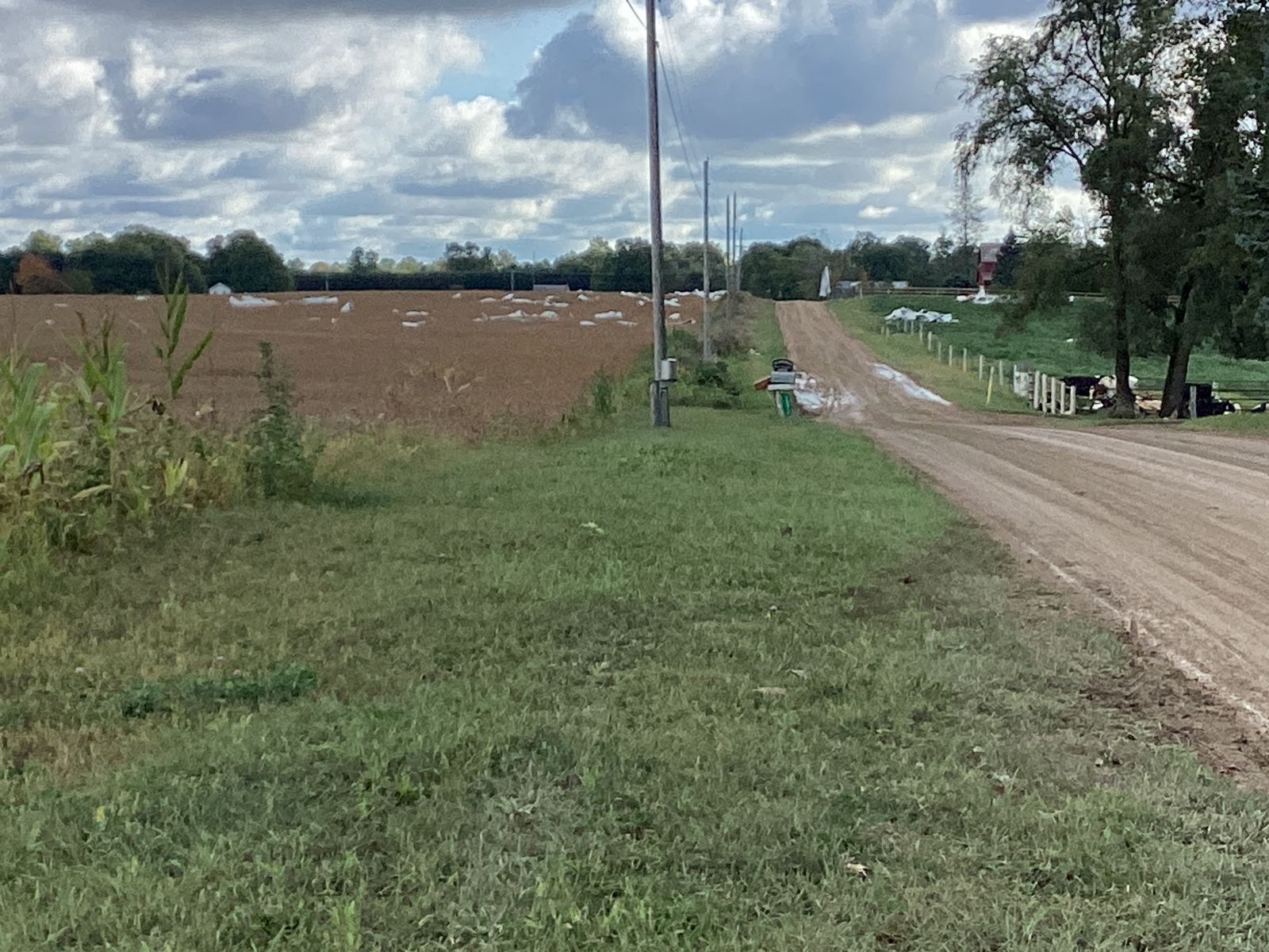
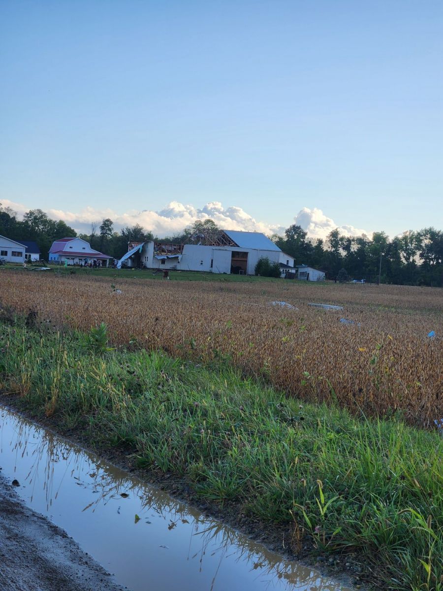
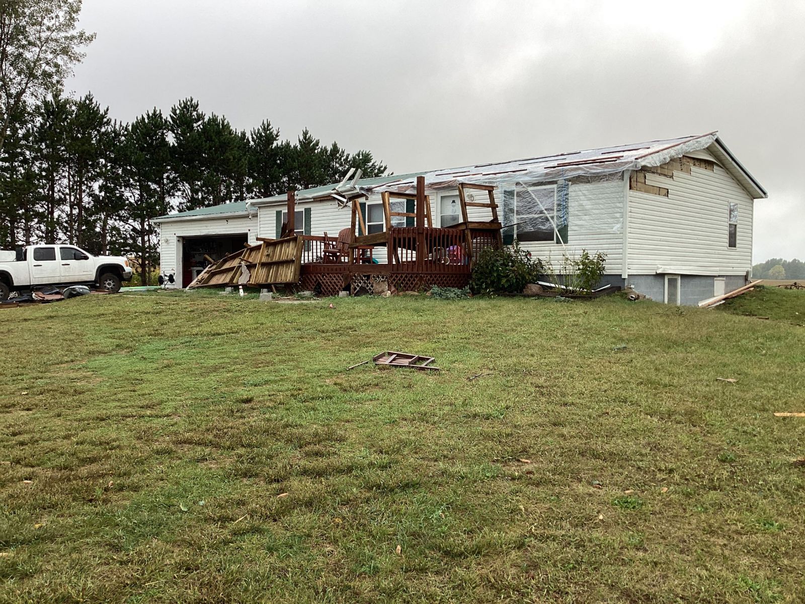
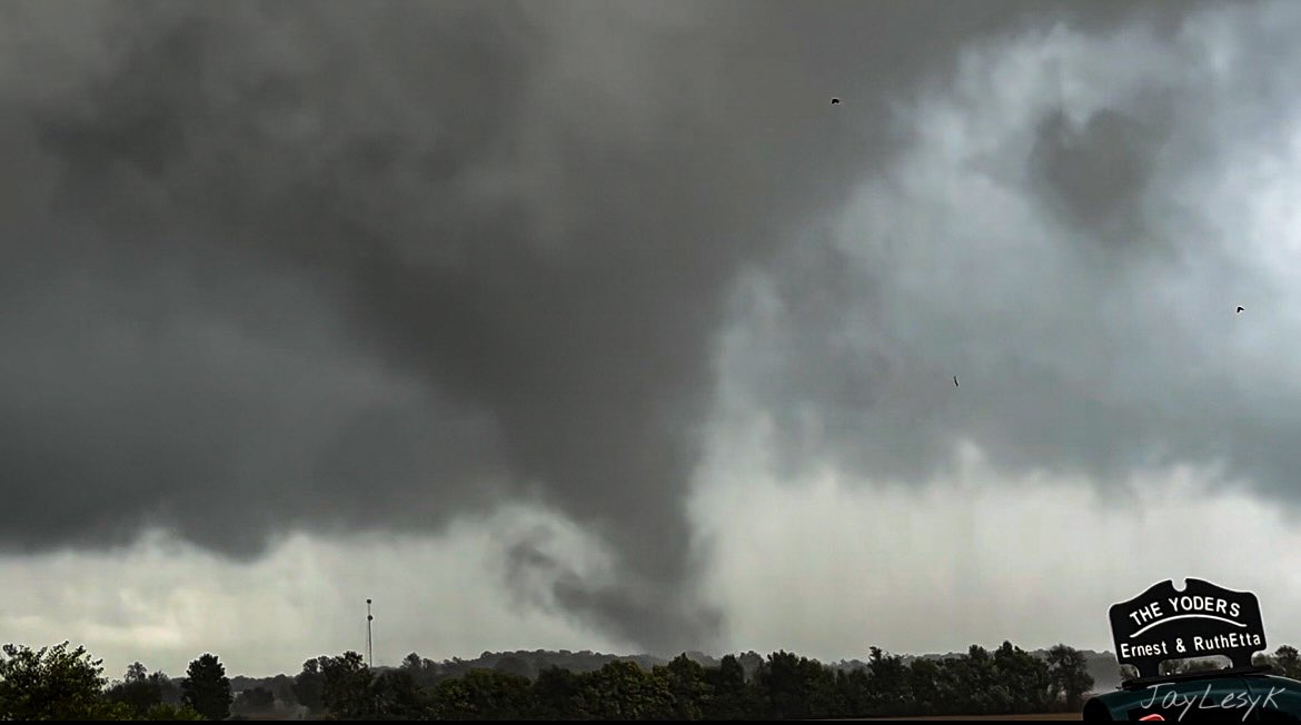
Tornado - 2 SSE of Ligonier, IN
|
||||||||||||||||
|
||||||||||||||||
The Enhanced Fujita (EF) Scale classifies tornadoes into the following categories:
| EF0 Weak 65-85 mph |
EF1 Moderate 86-110 mph |
EF2 Significant 111-135 mph |
EF3 Severe 136-165 mph |
EF4 Extreme 166-200 mph |
EF5 Catastrophic 200+ mph |
 |
|||||
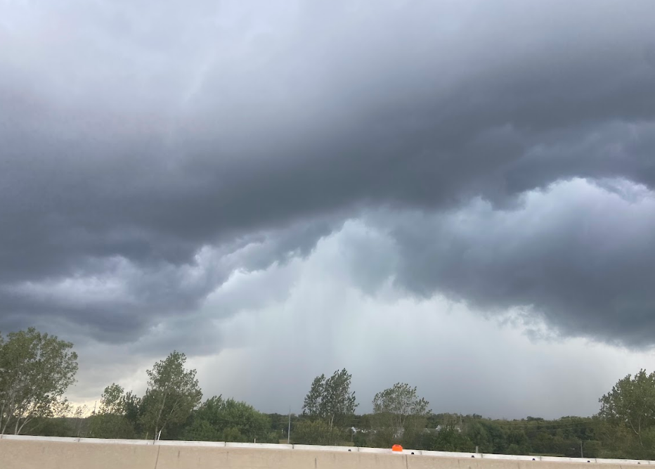
Photos & Video
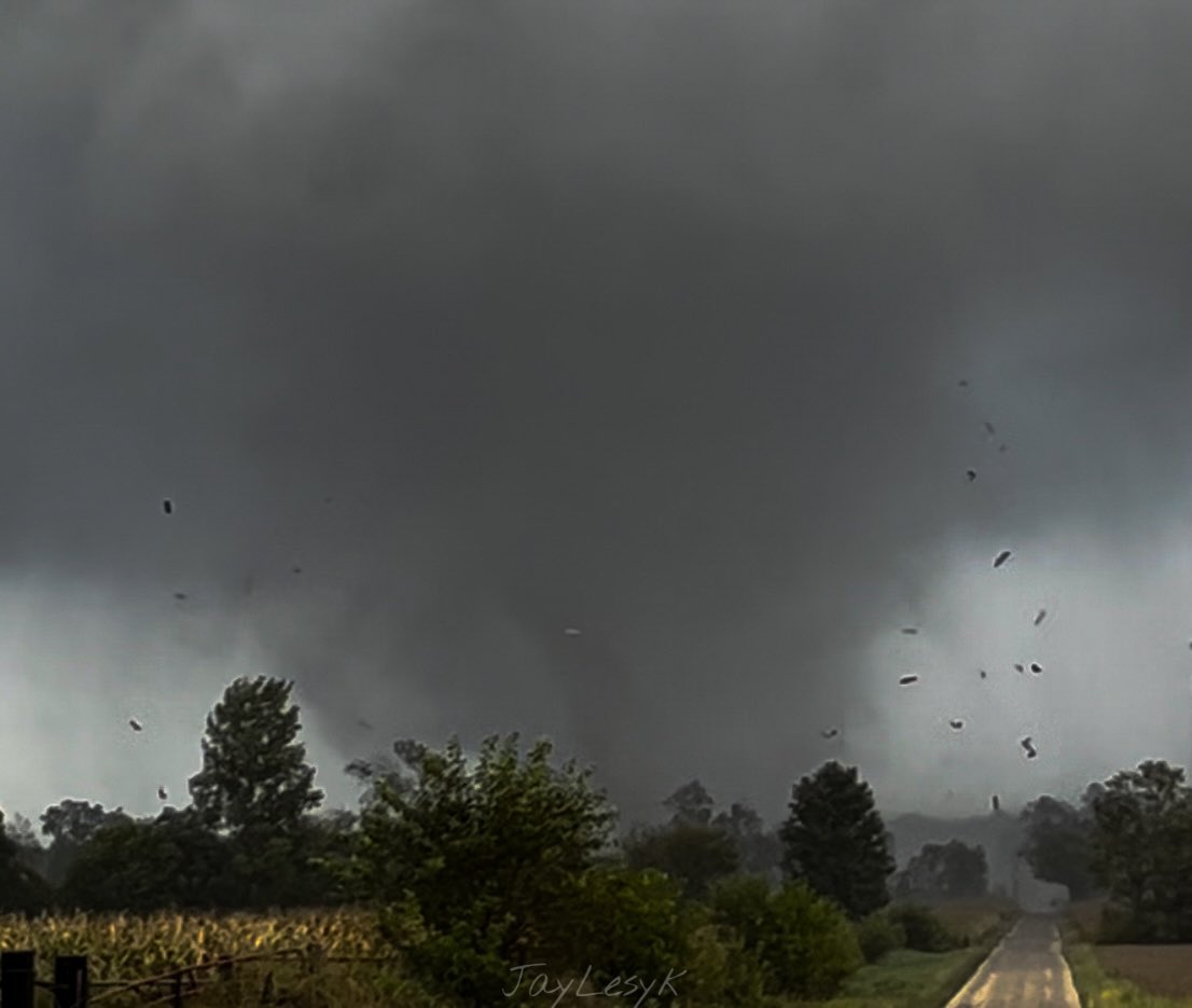
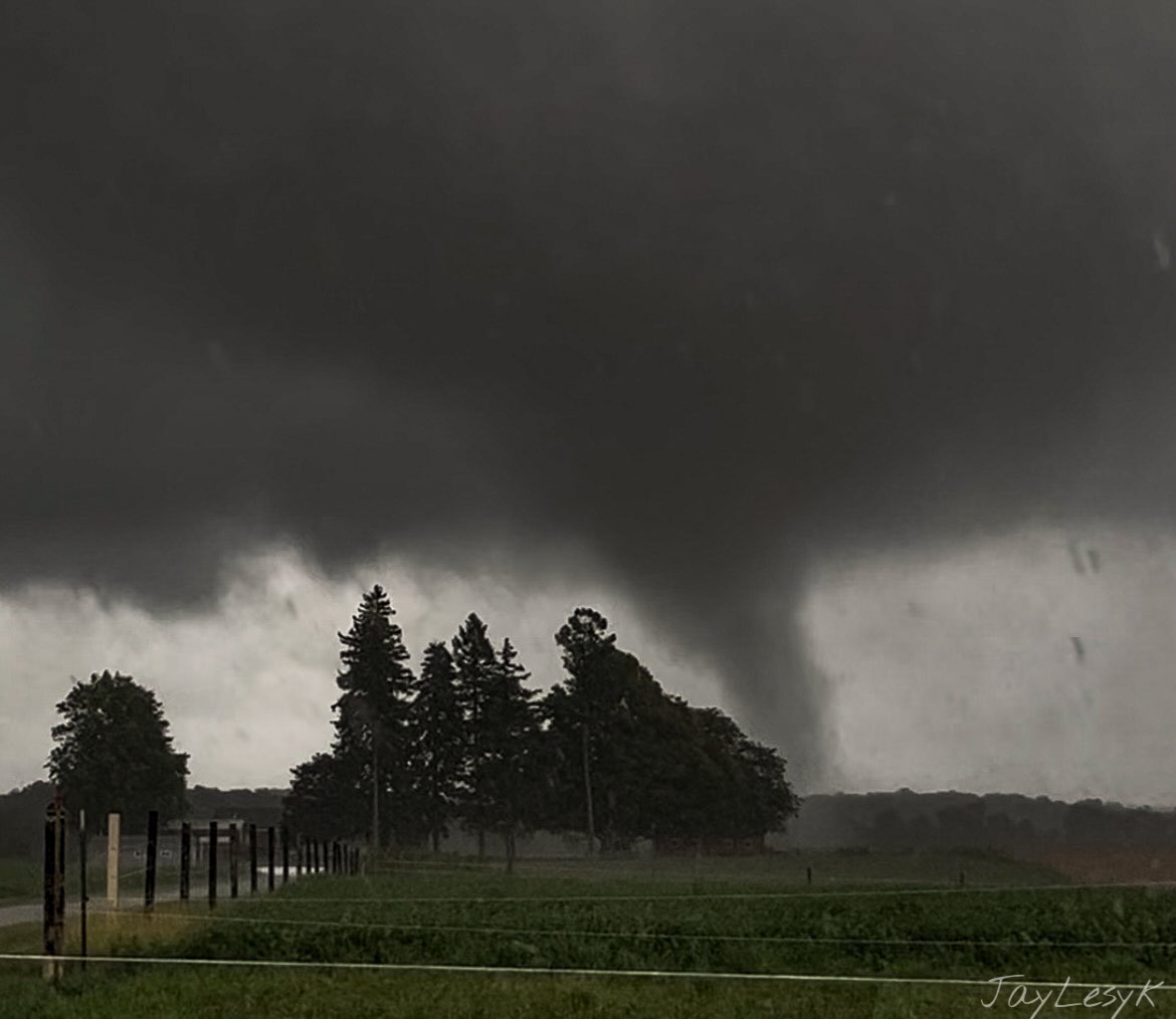
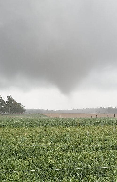
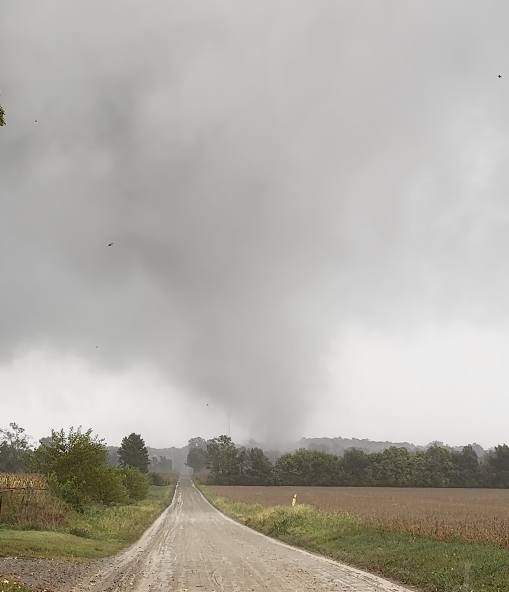
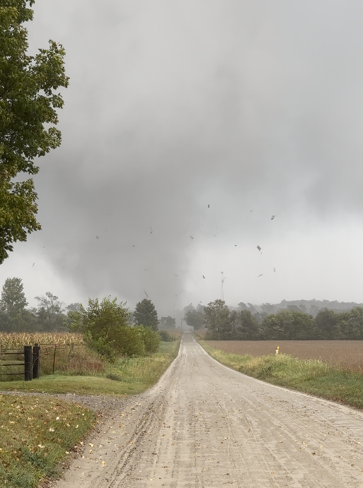
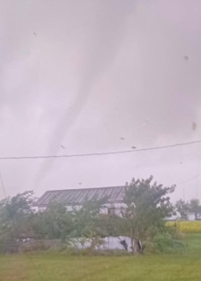
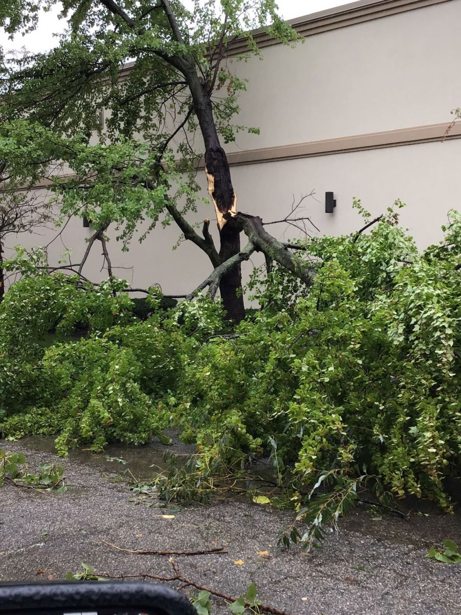
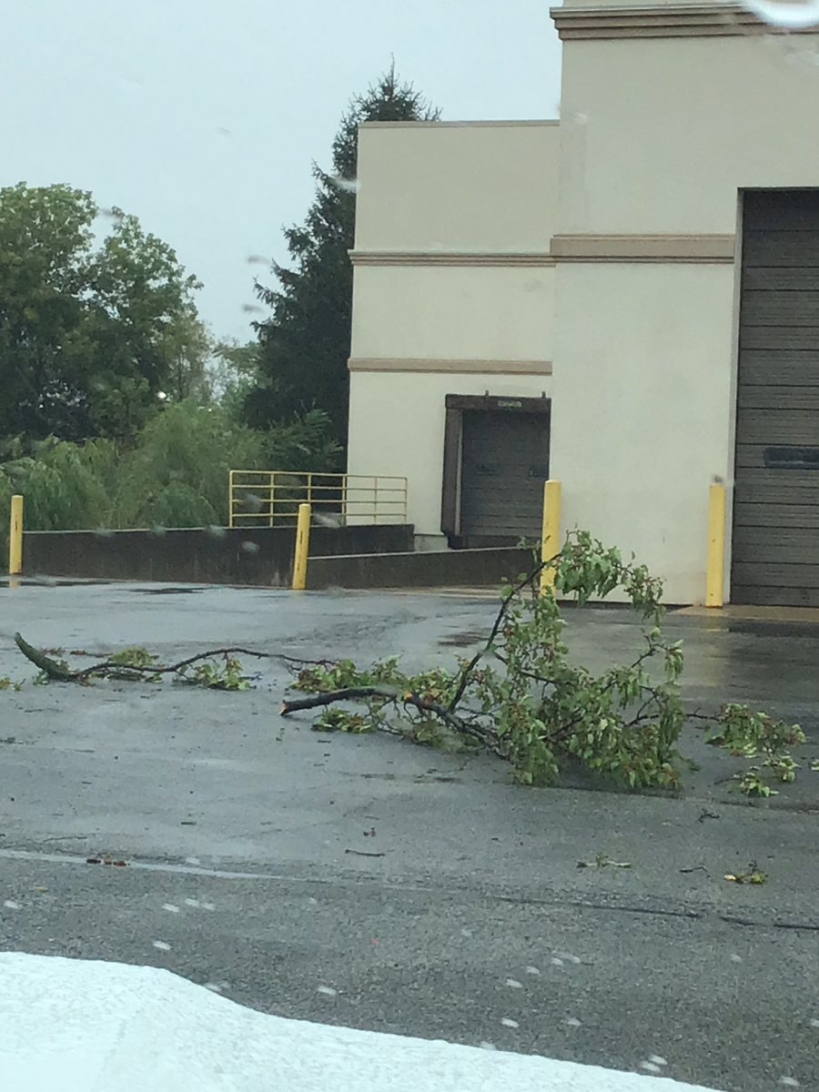
Ligonier, IN
 |
 |
 |
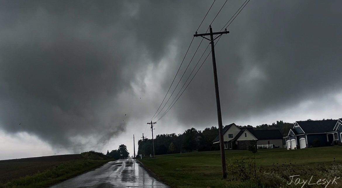 |
| Image courtesy Jay Lesyk @JayLesykWX | Image courtesy Jay Lesyk @JayLesykWX | Image courtesy Jay Lesyk @JayLesykWX | Image courtesy Jay Lesyk @JayLesykWX |
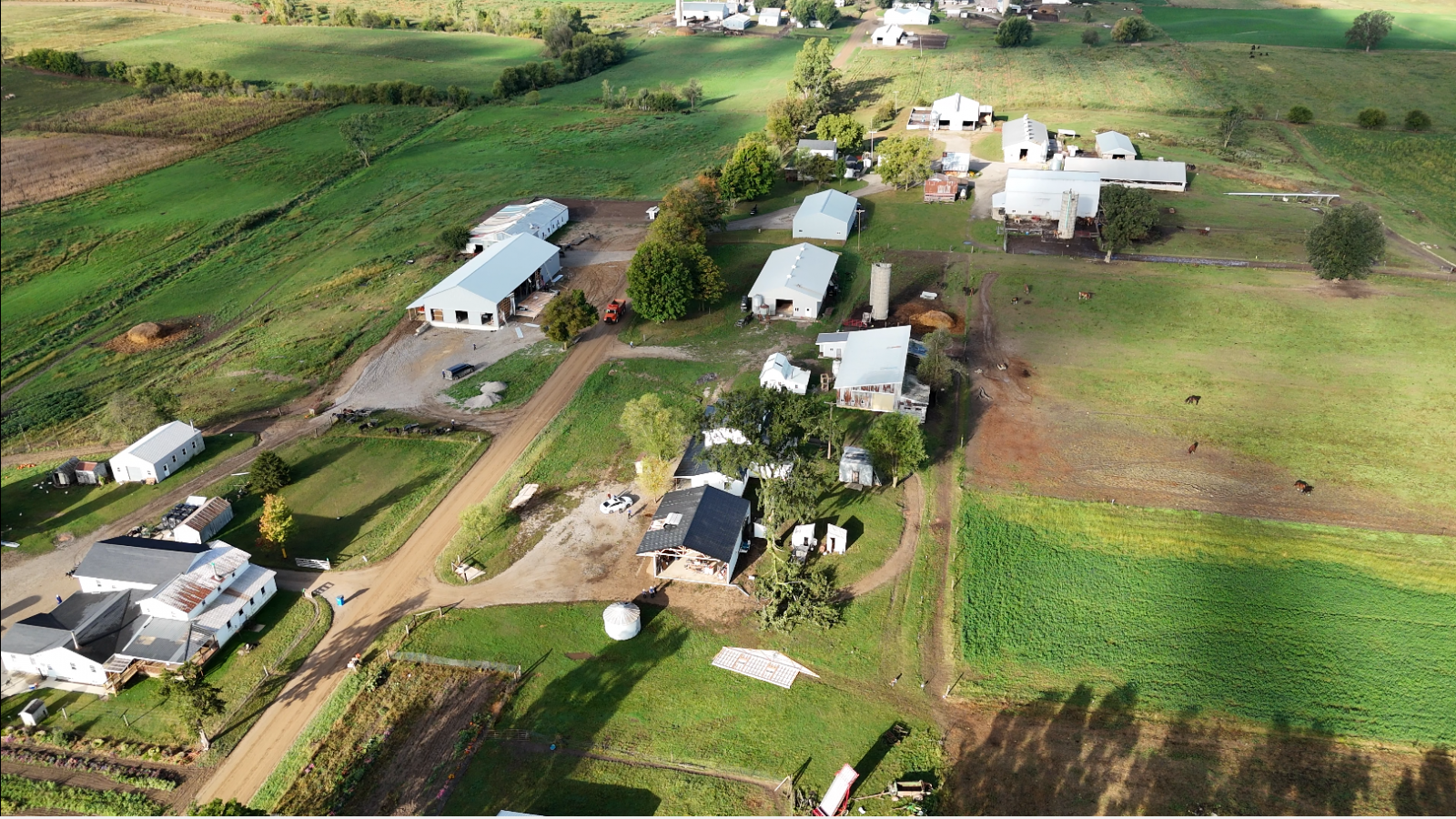
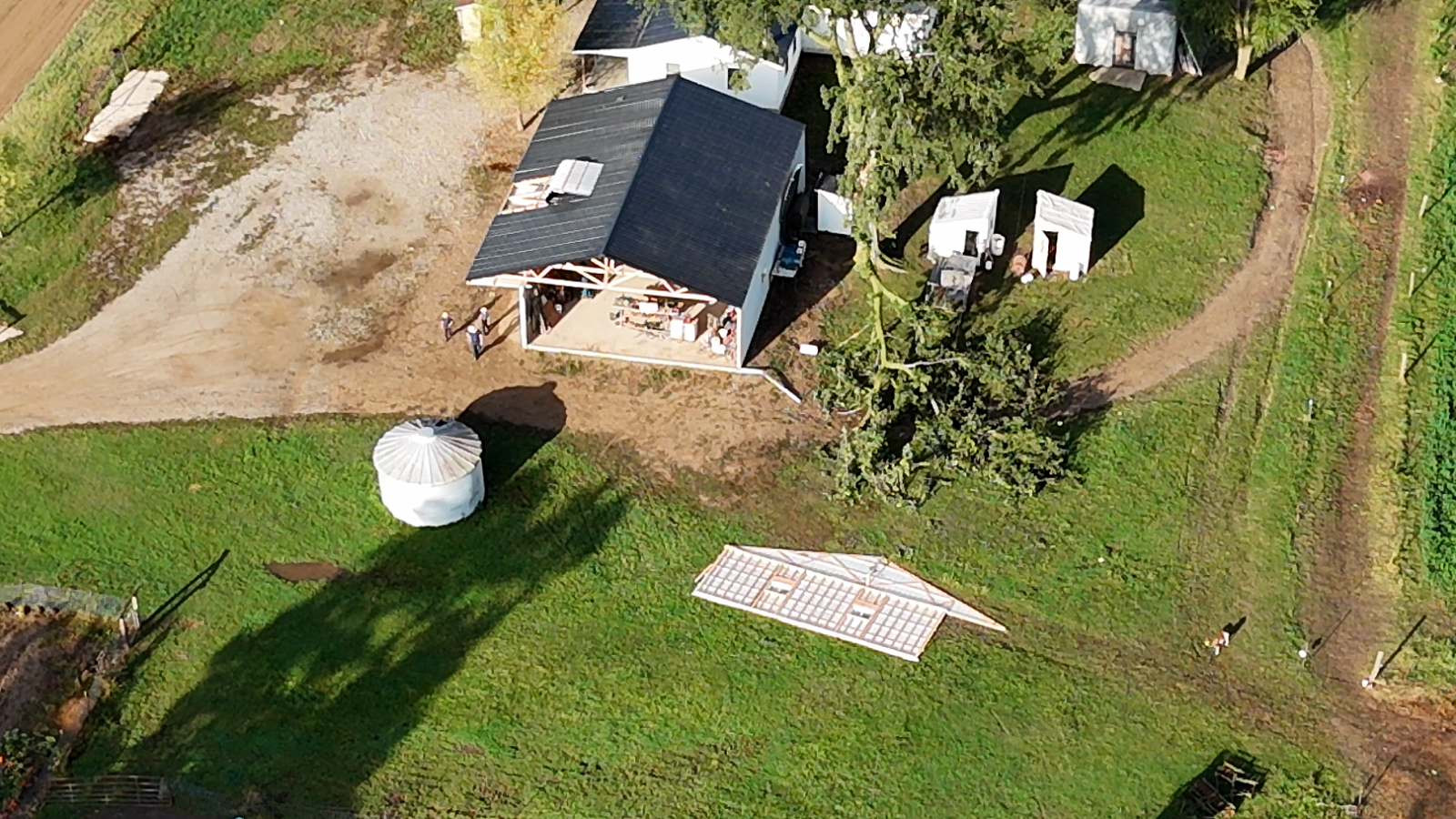
Lagrange, IN
 |
 |
 |
 |
| Image Courtesy Peyton Davis | Image Courtesy Peyton Davis | Image Courtesy Peyton Davis | Image Courtesy Peyton Davis |
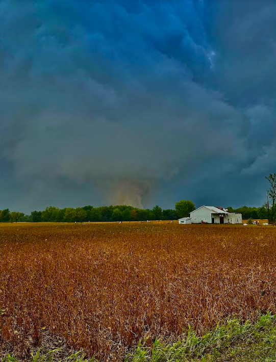
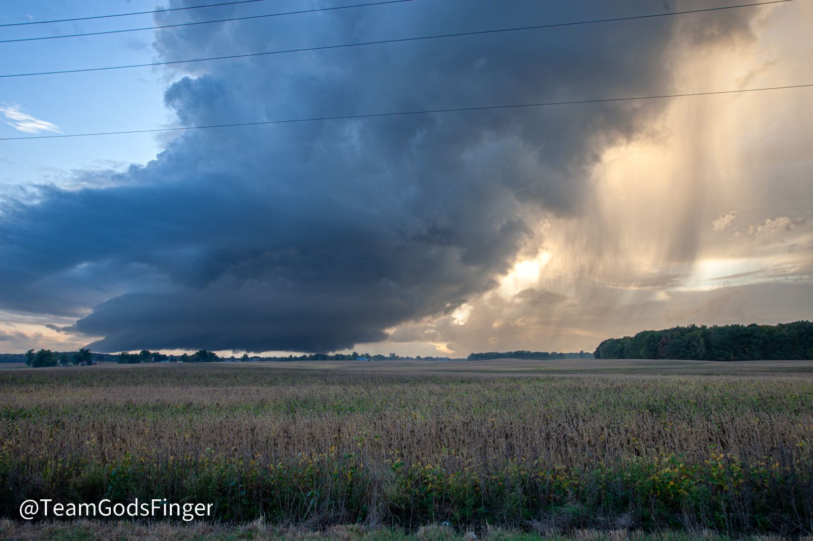
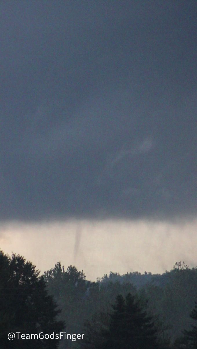
Camden, MI
 |
 |
 |
.png) |
| Image Courtesy Mikey Plemmons @TeamGodsFinger | Image Courtesy Mikey Plemmons @TeamGodsFinger | Image Courtesy Facebook/Lacey Drake | Image Courtesy Facebook/Lisa Wood |
Radar
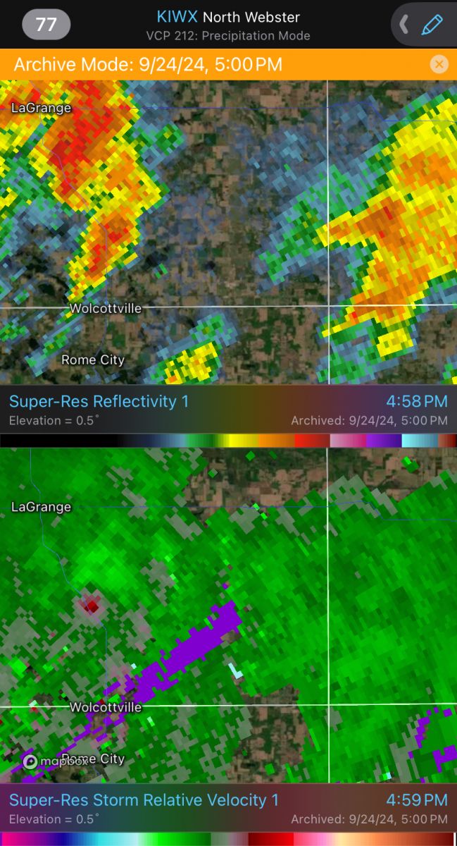
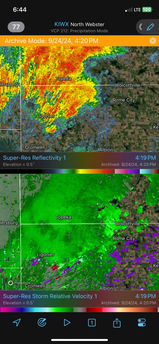
Radar Data
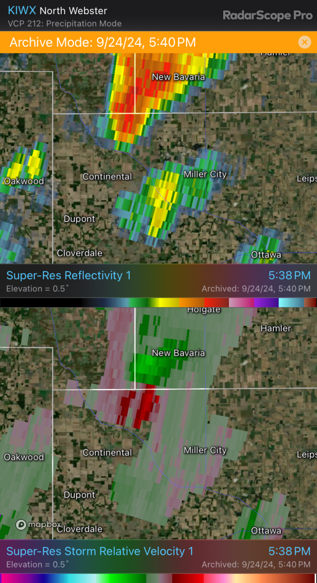
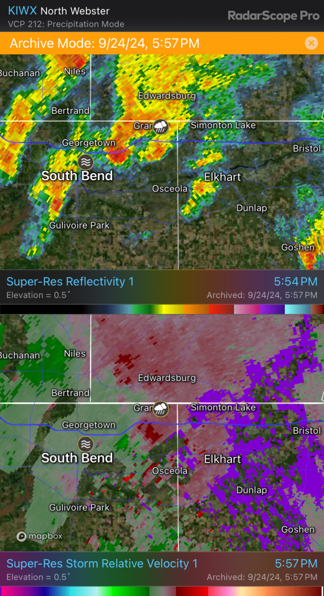
Here are a few of the radar images from the event, showing reflectivity and storm relative velocity data (KIWX from Radarscope). Clearing shown in the 2-5 pm ET time frame (shown below on Visible Satellite) helped generate more instability (fuel) for storm development. Additional radar data will be added in the coming days!
 |
 |
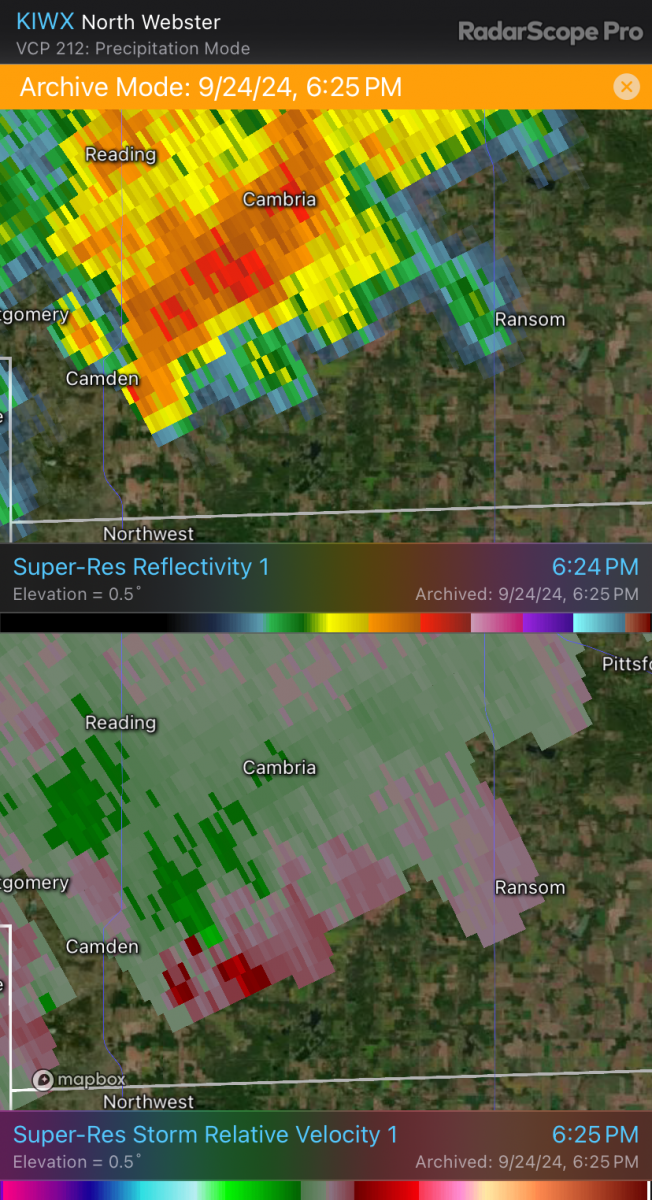 |
| KIWX Radar (Radarscope) Storm Relative Velocity and Reflectivity at 4:58 pm ET | KIWX Radar (Radarscope) Storm Relative Velocity and Reflectivity at 4:20 pm ET | KIWX Radar (Radarscope) Storm Relative Velocity and Reflectivity at 6:25 pm ET |
 |
 |
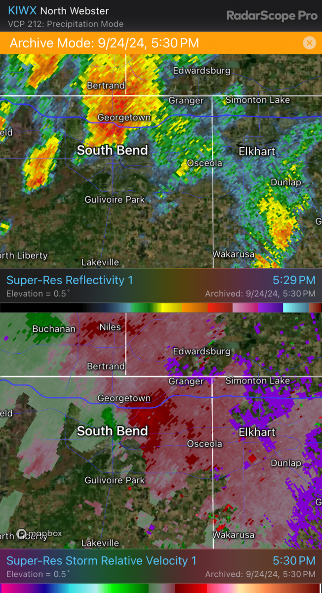 |
| KIWX Radar (Radarscope) Storm Relative Velocity and Reflectivity at 5:38 pm ET | KIWX Radar (Radarscope) Storm Relative Velocity and Reflectivity at 5:57 pm ET | KIWX Radar (Radarscope) Storm Relative Velocity and Reflectivity at 5:30 pm ET |
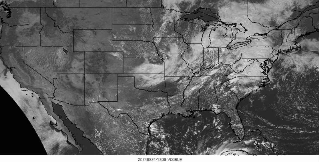
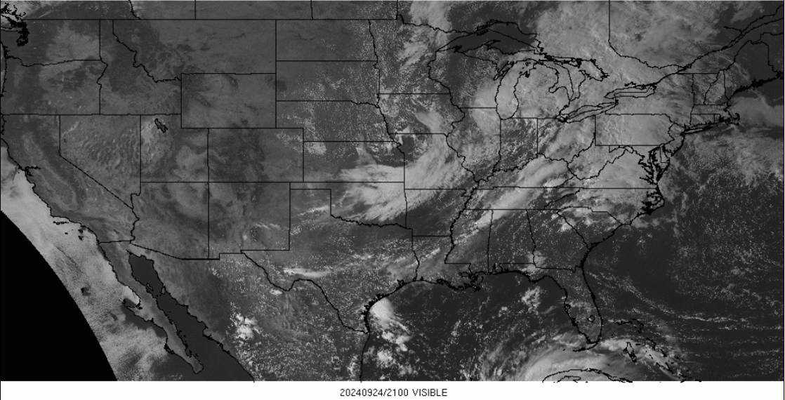
Satellite Data
Clearing shown in the 2-5 pm ET time frame (shown below on Visible Satellite) helped generate more instability (fuel) for storm development.
 |
 |
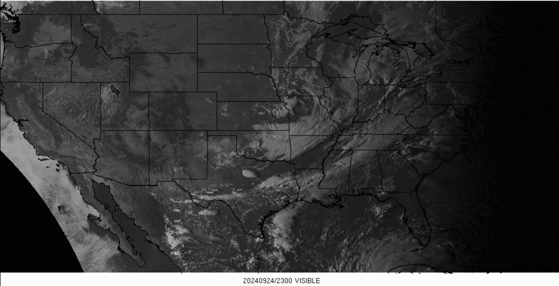 |
| Visible Satellite Imagery at 3pm ET 9/24/24 | Visible Satellite Imagery at 5pm ET 9/24/24 | Visible Satellite Imagery at 7pm ET 9/24/24 |
Storm Reports
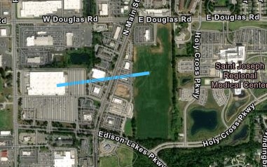
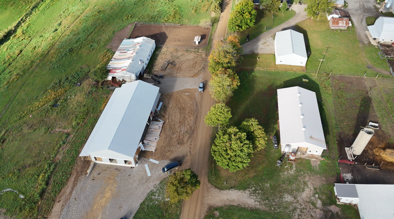
Preliminary Local Storm Report...Summary
National Weather Service Northern Indiana
936 PM EDT Wed Sep 25 2024

..TIME...   ...EVENT...      ...CITY LOCATION...     ...LAT.LON...
..DATE...   ....MAG....      ..COUNTY LOCATION..ST.. ...SOURCE....
            ..REMARKS..

0436 PM     Hail             2 NNW Haviland          41.05N 84.59W
09/24/2024  E1.50 Inch       Paulding           OH   Emergency Mngr

            Time estimated from radar.

0622 PM     Tornado          2 SE Camden             41.74N 84.74W
09/24/2024                   Hillsdale          MI   Emergency Mngr

            Minor damage occurred to 2 barns on Austin
            Road, between S Edon Rd and Gilmore Road.
            The circulation was only briefly on the
            ground with estimated wind speeds of around
            65 mph.

0532 PM     Tstm Wnd Dmg     Georgetown              41.73N 86.22W
09/24/2024                   St. Joseph         IN   Emergency Mngr

            Delayed report. Numerous large tree limbs
            downed in the Arlington Heights subdivision,
            along with some roof damage to a residence.
            Time estimated from radar.

0549 PM     Tornado          2 ESE Indian Village    41.71N 86.19W
09/24/2024                   St. Joseph         IN   NWS Storm Survey

            The combination of video relayed by local
            media and an NWS storm survey concluded that
            a weak EF0 tornado occurred. The tornado
            began in the vicinity of the east side of
            the Meier store parking lot. Medium sized
            tree branches were downed near the beginning
            of the tornado path. The tornado tracked
            east and affected the La-Z-Boy Furniture
            store and the Potbelly restaurant where some
            large tree branches were downed. The tornado
            crossed North Main Street with some
            additional medium sized tree limbs downed
            near Raising Canes restaurant. The tornado
            then dissipated over an adjacent field to
            the west of the St. Joseph Health System
            medical facility.

0413 PM     Tornado          2 SSE Ligonier          41.43N 85.57W
09/24/2024                   Noble              IN   NWS Storm Survey

            This tornado started just east of Engle
            Lake, knocking down some trees in a
            residential area. As it continued northward,
            some of the strongest damage was sustained
            to a house, which had some of its roofing
            ripped off and a wall pushed in. Other
            houses and farm buildings sustained roof
            damage and more trees were knocked down or
            snapped as it continued on crossing highway
            6. One large chicken building had its entire
            outer shell removed. It came to an end just
            before the Noble/Lagrange county line.

0501 PM     Tornado          2 NE Oliver Lake        41.60N 85.37W
09/24/2024                   Lagrange           IN   NWS Storm Survey

            *** 2 INJ ***
            The storm that caused tornadic damage to
            Noble county intensified again and moved
            northeast. After initially dropping down
            around the intersection of 300 S and 300 E
            it continued northeastward damaging barns
            and knocking down trees. It completely
            destroyed one barn building and ripped the
            roof off and knocked the walls down from a
            chicken housing structure. The tornado
            dissipated shortly thereafter in a field. A
            buggy was blown over in the 2900 block of
            County Road E 300 S, with 2 occupants
            suffering minor injuries.


&&

$$
Rain Reports
Public Information Statement
National Weather Service Northern Indiana
112 AM EDT Wed Sep 25 2024

...24 HOUR PRECIPITATION REPORTS FROM SEPTEMBER 24TH 2024...

Location                     Amount    Time/Date       Lat/Lon

...Indiana...

...Adams County...
0.8 N Linn Grove             0.67 in   1145 PM 09/24   40.66N/85.03W

...Allen County...
4 S Tuckers Corner           0.55 in   0100 AM 09/25   40.99N/84.94W
SPENCERVILLE                 0.45 in   1230 AM 09/25   41.25N/84.89W
Fort Wayne International Ap  0.10 in   1154 PM 09/24   40.98N/85.18W

...Cass County...
Galveston                    0.14 in   1245 AM 09/25   40.56N/86.19W

...De Kalb County...
Garrett                      0.54 in   1250 AM 09/25   41.33N/85.13W

...Elkhart County...
Goshen                       1.11 in   1253 AM 09/25   41.53N/85.78W
Goshen 3 SW                  0.75 in   0700 PM 09/24   41.56N/85.88W
Jamestown                    0.58 in   1258 AM 09/25   41.64N/86.04W
Elkhart Municipal ap         0.29 in   1255 AM 09/25   41.72N/86.00W

...Grant County...
Grant County Municipal Apt   0.28 in   1255 AM 09/25   40.48N/85.68W
MARION                       0.28 in   1258 AM 09/25   40.62N/85.71W

...Huntington County...
2.4 NW Warren                0.62 in   1245 AM 09/25   40.71N/85.45W
1.7 E Bowerstown             0.19 in   1200 AM 09/25   40.90N/85.41W
Huntington                   0.16 in   1248 AM 09/25   40.83N/85.53W

...Kosciusko County...
1 SSE Clunette               0.74 in   1230 AM 09/25   41.31N/85.92W
2.3 N North Webster          0.64 in   1200 AM 09/25   41.36N/85.70W
Warsaw Municipal AP          0.39 in   1255 AM 09/25   41.27N/85.83W

...La Porte County...
0.8 W La Porte               0.42 in   1258 AM 09/25   41.61N/86.73W

...Marshall County...
Bremen 3.9 WSW               1.83 in   0508 PM 09/24   41.43N/86.23W

...Miami County...
Peru                         0.66 in   1230 AM 09/25   40.75N/86.07W
Amboy                        0.32 in   0100 AM 09/25   40.59N/85.98W
Grissom AFB Peru             0.10 in   1255 AM 09/25   40.63N/86.15W

...Noble County...
Cosperville                  0.38 in   1230 AM 09/25   41.48N/85.48W

...Pulaski County...
1.3 SW Ora                   0.50 in   1245 AM 09/25   41.16N/86.56W

...St. Joseph County...
South Bend International Ap  1.79 in   1254 AM 09/25   41.70N/86.32W
South Bend                   1.62 in   1126 PM 09/24   41.70N/86.25W
0.9 W Roseland               1.40 in   1215 AM 09/25   41.72N/86.27W

...Starke County...
3.5 N Brems                  0.28 in   1200 AM 09/25   41.39N/86.71W

...Steuben County...
0.7 E Hamilton               0.58 in   1145 PM 09/24   41.53N/84.90W
Angola                       0.49 in   1255 AM 09/25   41.63N/85.08W

...Wabash County...
0.7 SE Wabash                0.47 in   1130 PM 09/24   40.79N/85.82W
3.0 SE Lagro                 0.21 in   1215 AM 09/25   40.81N/85.68W

...Wells County...
Bluffton                     2.10 in   1245 AM 09/25   40.74N/85.17W

...White County...
Burnettsville 9.9 NNW        0.16 in   0100 PM 09/24   40.90N/86.65W

...Michigan...

...Berrien County...
Niles                        1.43 in   1256 AM 09/25   41.83N/86.25W
3.7 S Watervliet             0.17 in   1100 PM 09/24   42.13N/86.25W
Benton Harbor                0.11 in   1253 AM 09/25   42.13N/86.42W

...Branch County...
QUINCY                       0.78 in   0100 AM 09/25   41.94N/84.90W
1 SSW Coldwater              0.20 in   0103 AM 09/25   41.92N/85.01W

...Hillsdale County...
Hillsdale                    0.24 in   1255 AM 09/25   41.92N/84.58W

...St. Joseph County...
2 E Mottville                0.38 in   0931 AM 09/24   41.80N/85.72W
2.0 SE Mendon                0.18 in   1100 PM 09/24   41.98N/85.43W

...Ohio...

...Allen County...
2 WNW Westminster            1.07 in   1153 PM 09/24   40.71N/84.02W
Lima 1 N                     0.62 in   1258 AM 09/25   40.78N/84.12W
Bluffton                     0.45 in   0100 AM 09/25   40.89N/83.89W

...Defiance County...
Defiance                     0.38 in   1253 AM 09/25   41.33N/84.43W

...Henry County...
DESHLER                      1.35 in   0100 AM 09/25   41.20N/83.89W
New Bavaria 2.3 WSW          0.27 in   1243 PM 09/24   41.19N/84.21W

...Van Wert County...
1 WNW Convoy                 1.38 in   0100 AM 09/25   40.93N/84.74W
2 N Wetsel                   0.72 in   0100 AM 09/25   40.98N/84.44W
Van Wert                     0.47 in   0100 AM 09/25   40.87N/84.59W
Van Wert                     0.38 in   0100 AM 09/25   40.85N/84.48W

...Williams County...
3 S Nettle Lake              0.69 in   1230 AM 09/25   41.63N/84.73W

Observations are collected from a variety of sources with varying
equipment and exposures. We thank all volunteer weather observers
for their dedication. Not all data listed are considered official.

$$

MCD
Environment
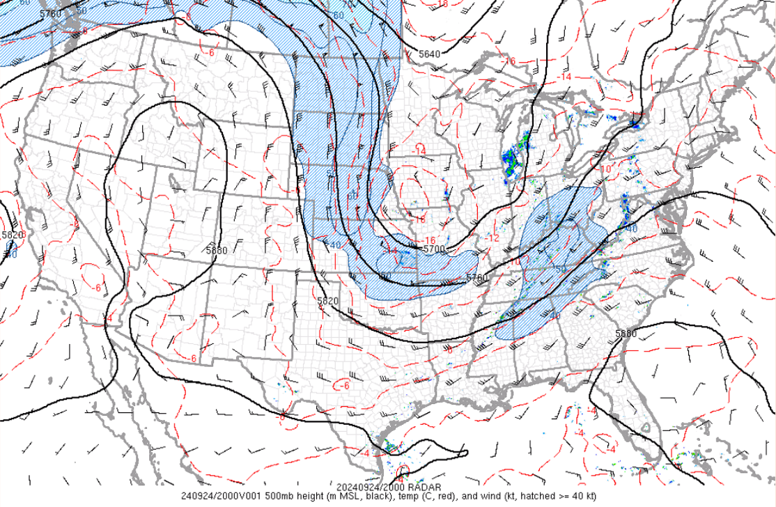
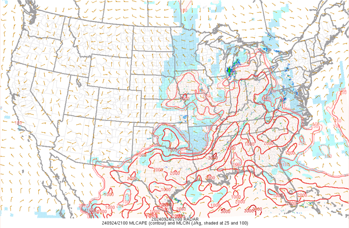
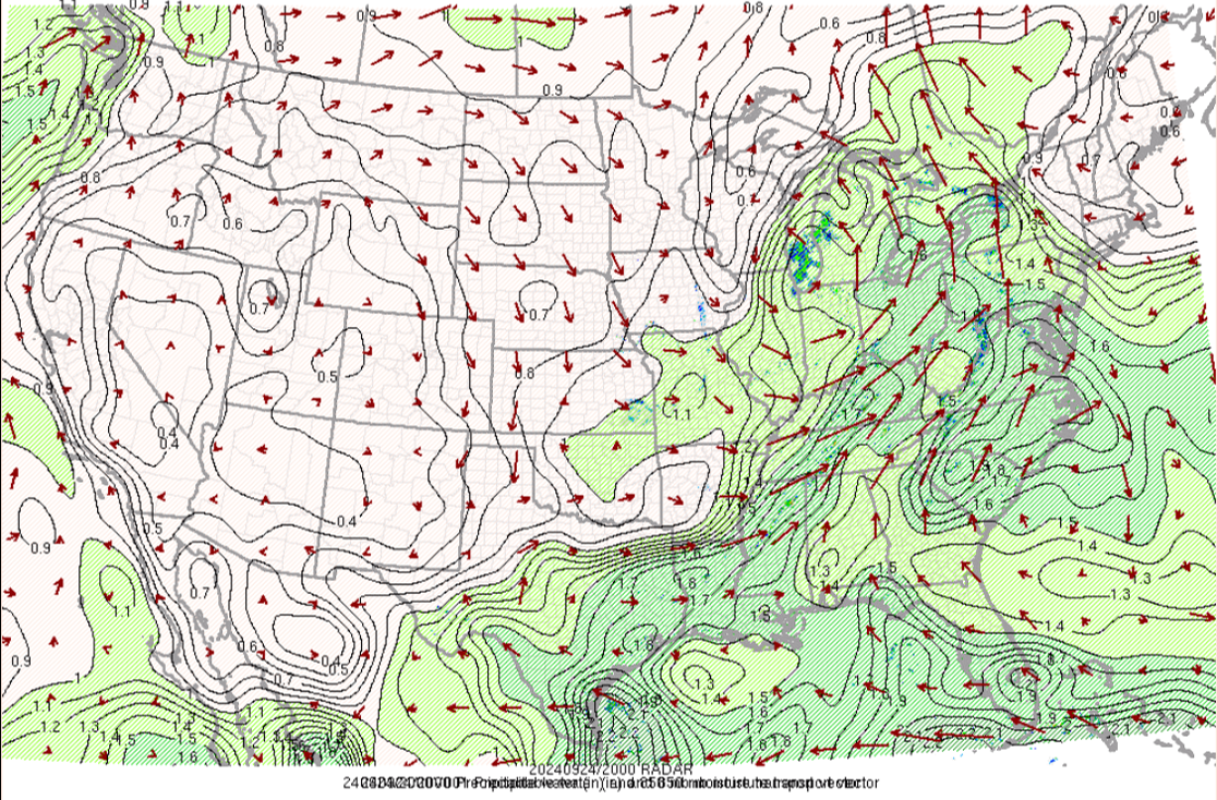
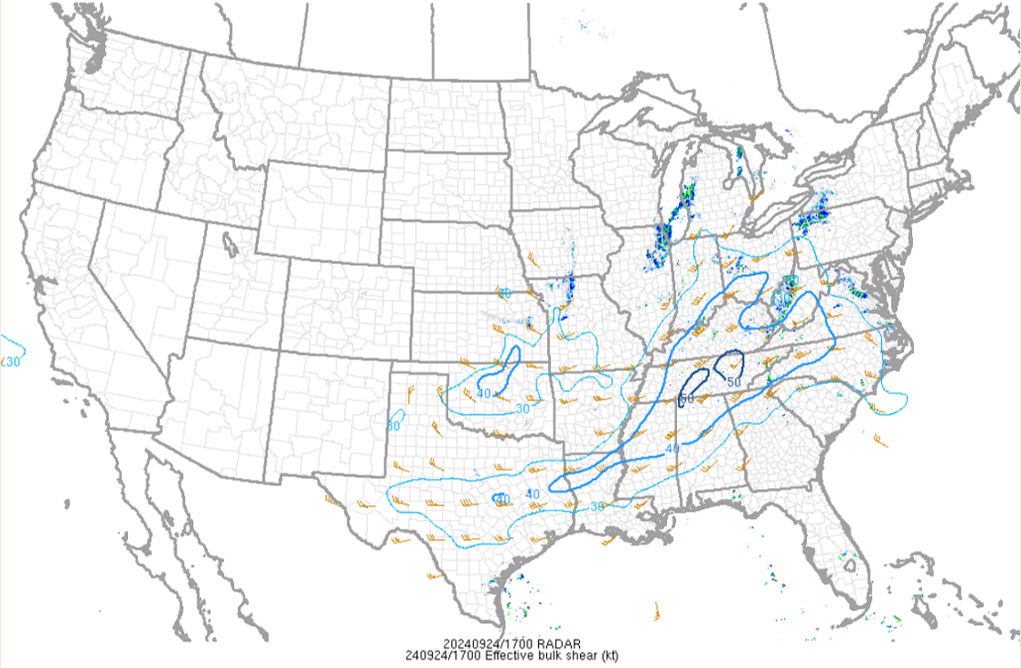
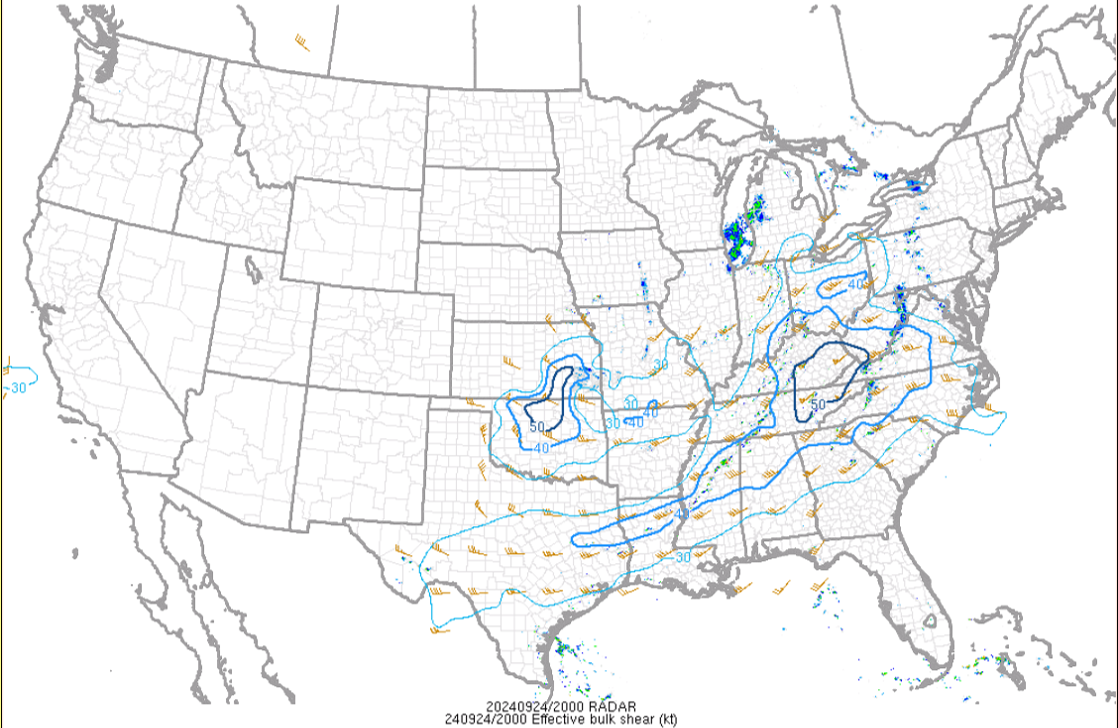
The following images are an analysis of the environment before and during the event. An upper level trough (Fig. 1) brought upper level support for a surface low moving through the forecast area. The warm front lifted northward through the night prior and early morning on 9/24/24, then the cold front swept through in the late afternoon and evening. Storms developed in the afternoon as skies began to clear (see radar/satellite section) and deeper moisture (PWATS, 850mb transport Fig.11) moved in with the front. Instability reached around 2000 J/kg surface based CAPE, with around 20-40 knots of bulk effective shear. In combination with low Lifted Condensation Levels (LCL's), it was a favorable environment for isolated strong to severe storms with tornadoes. The Storm Prediction Center (SPC) had our forecast area in a Marginal Risk for Severe Storms.
 |
 |
 |
| Figure 1: 500mb Trough at 4 pm ET 9/24/24. Data from the SPC mesoanalysis Archive. | Figure 2: Surface Analysis at 5 am EDT 9/24/24. Data from WPC Surface Analysis Archive | Figure 3: Surface Analysis at 8 am EDT 9/24/24. Data from WPC Surface Analysis Archive |
 |
 |
 |
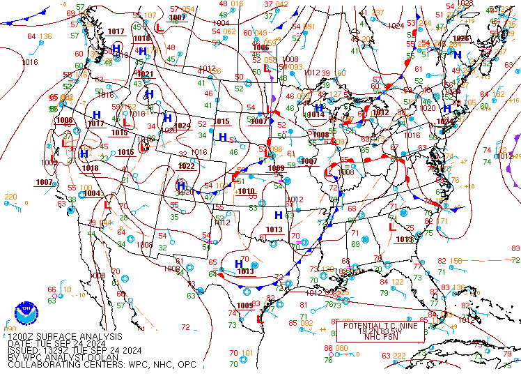
| Figure 4: Surface Analysis at 11 am EDT 9/24/24. Data from WPC Surface Analysis Archive | Figure 5: Surface Analysis at 2 pm EDT 9/24/24. Data from WPC Surface Analysis Archive | Figure 6: Surface Analysis at 5 pm EDT 9/24/24. Data from WPC Surface Analysis Archive |
 |
 |
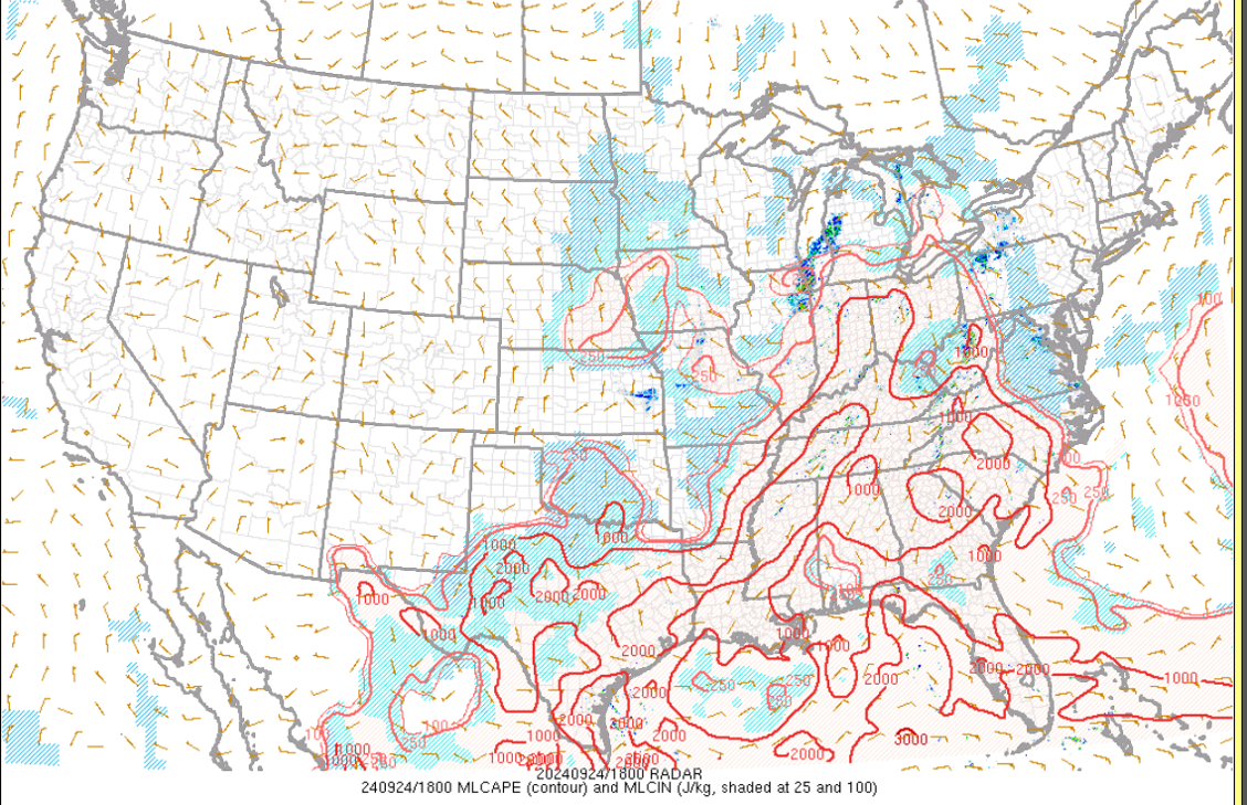 |
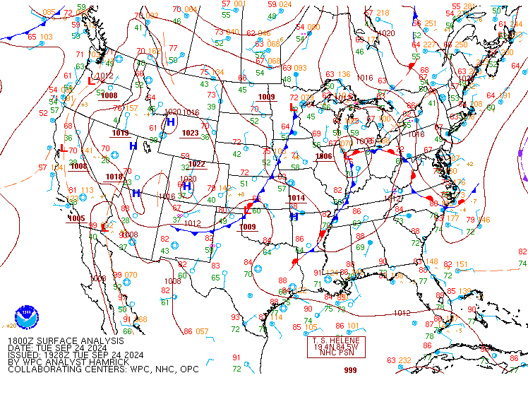
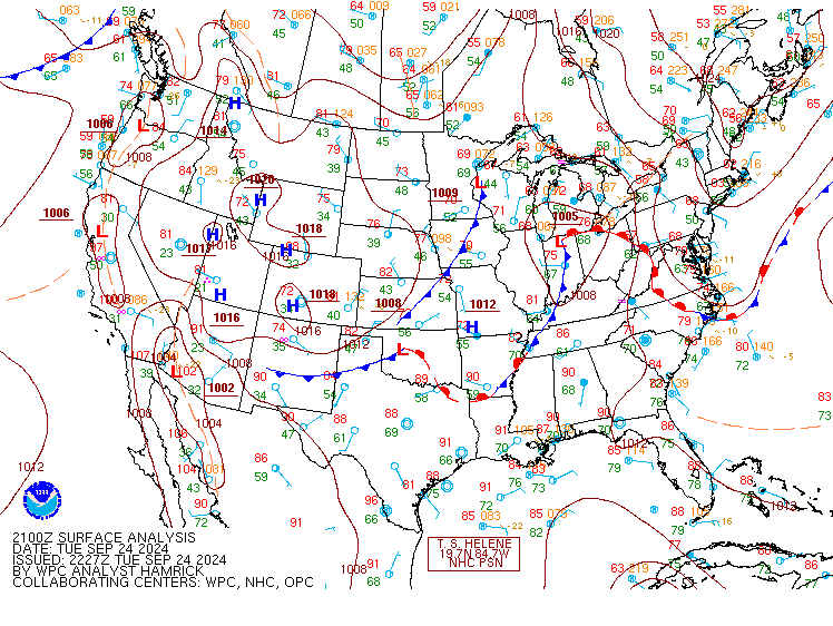
| Figure 7: Surface Analysis at 8 pm EDT 9/24/24. Data from WPC Surface Analysis Archive | Figure 8: Surface Analysis at 11 pm EDT 9/24/24. Data from WPC Surface Analysis Archive | Figure 9: MLCAPE/CIN 2 pm ET 9/24/24. Data from the SPC mesoanalysis Archive. |
 |
 |
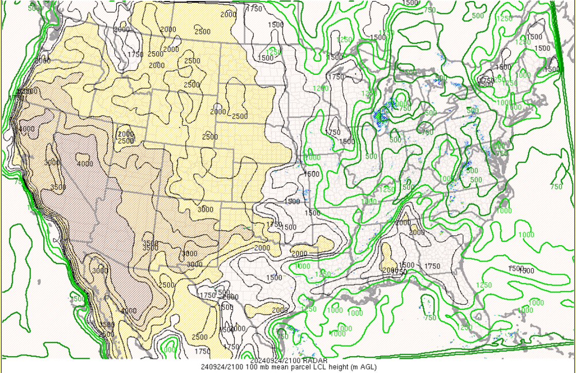 |
| Figure 10: MLCAPE/CIN 5 pm ET 9/24/24. Data from the SPC mesoanalysis Archive. | Figure 11: 850mb Moisture Transport, PWAT (in) at 3pm ET 9/24. From SPC mesoanalysis Archive. | Figure 12: 5 pm ET LCL Heights (m AGL) 9/24/24 Data from the SPC mesoanalysis Archive. |
 |
 |
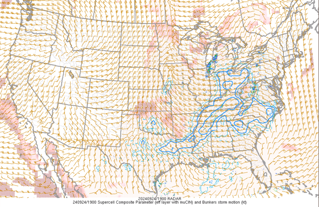 |
| Figure 13: 1 pm ET 9/24/24 Bulk Effective Shear Data from the SPC mesoanalysis Archive. | Figure 14: 4 pm ET 9/24/24 Bulk Effective Shear Data from the SPC mesoanalysis Archive. | Figure 15: 3 pm ET 9/24/24 -(SCP) Supercell Parameter and Bunkers Storm Motion (kt). SPC mesoanalysis Archive. |
 |
Media use of NWS Web News Stories is encouraged! Please acknowledge the NWS as the source of any news information accessed from this site. |
|


.jpg)