Overview
A significant, early season winter storm moved through the entire forecast area on November 29th into early November 30th. Moderate to heavy snow was occurring by the afternoon and evening of November 29th, with visibilities between a 1/2 and 1/4 of a mile reported through much of the day into the evening. Blowing and drifting snow were reported, with road conditions becoming treacherous. Widespread snow totals of 6-10” (isolated higher up to 12”) were reported by 11 pm ET the 29th, with areas further southeast reporting closer to 2-6". Between 12 AM and 2 AM EST November 30th, precipitation in some areas transitioned from all snow to a wintry mix of sleet/freezing drizzle/snow and even all rain in some locations as temperatures briefly rose to right at or slightly above freezing. Widespread system snow was done early morning on the 30th, then lake effect developed downwind of Lake Michigan and moved inland for areas mainly west of I 69 and along/north of US 30 into the evening hours.
The 5.6 inches of snow that fell at Fort Wayne on November 29th was the third highest daily snowfall total for the month of November on record. The highest daily totals were 6.2 inches and 6.0 inches in 1942 and 1950. The 9,0 inches of snow that fell at South Bend on November 29th was the eighth highest daily snowfall total for the month of the November. The highest daily snowfall total at South Bend for November was 18.0 inches in 1911.
Snow
24 Hour Snowfall Reports and Snow Totals for primarily the system snow that occurred Nov 29th into the morning of Nov 30th are listed below the map. Additional lake effect snow fell for favored regions downwind of Lake Michigan through the evening hours, moving further south and east before dissipating. Lake effect snow totals for the period of November 30th-early December 1st, 2025 are HERE .
Thank you to those who sent us reports with frequent updates so we could remain situationally aware and capture the event for our records, the public and the media. We appreciate you!

Public Information Statement National Weather Service Northern Indiana 1121 AM EST Sun Nov 30 2025 ...24 HR SNOWFALL REPORTS AND STORM TOTALS NOVEMBER 29TH-30TH, 2025... NOTE: THESE WERE THE REPORTS ISSUED THROUGH THE EVENT AT VARIOUS TIMES (SOME EARLIER THAN OTHERS)-INCLUDED FOR COMPLETENESS. THIS MAY MAKE IT APPEAR THAT THERE WERE MISMATCHED AMOUNTS. ALWAYS CHECK THE TIME/DATE OF REPORTS IF USING THE SNOW TOTALS FOR BROADCAST. Location Amount Time/Date Lat/Lon ...Indiana... ...Allen County... 2 SW Fort Wayne 10.0 in 0130 AM 11/30 41.05N/85.17W 3 SE Wallen 9.6 in 1120 PM 11/29 41.13N/85.12W 3 NNW Fort Wayne 9.4 in 1214 AM 11/30 41.11N/85.16W 2 S Fort Wayne 9.2 in 1130 PM 11/29 41.05N/85.14W Fort Wayne 8.5 in 1100 PM 11/29 41.07N/85.14W 1 WSW Georgetown 8.5 in 1145 PM 11/29 41.23N/84.88W 3 N Fort Wayne 8.3 in 1050 PM 11/29 41.12N/85.14W 2 ESE Wallen 8.3 in 0729 AM 11/30 41.15N/85.13W 5 N New Haven 8.0 in 1054 PM 11/29 41.14N/85.03W New Haven 8.0 in 1125 PM 11/29 41.07N/85.03W Fort Wayne 4.1 NE 7.6 in 0700 AM 11/30 41.12N/85.09W Fort Wayne 6.8 NE 7.3 in 0700 AM 11/30 41.13N/85.03W Huntertown 7.0 in 0830 PM 11/29 41.23N/85.17W Leo-Cedarville 7.0 in 1030 PM 11/29 41.21N/85.02W Fort Wayne 2.6 NE 6.5 in 0700 AM 11/30 41.10N/85.11W Fort Wayne 2.6 NW 6.4 in 0700 AM 11/30 41.10N/85.18W Fort Wayne 10.4 N 6.1 in 0700 AM 11/30 41.22N/85.14W Fort Wayne 9.3 W 6.1 in 0700 AM 11/30 41.05N/85.31W 3 ENE Wallen 6.0 in 0745 PM 11/29 41.17N/85.12W 1 N Rolling Hills 6.0 in 0832 PM 11/29 41.04N/85.27W Fort Wayne 9.1 SE 6.0 in 0700 AM 11/30 40.99N/85.00W Fort Wayne 1.6 S 6.0 in 0800 AM 11/30 41.05N/85.14W Fort Wayne 1.9 SSW 6.0 in 1028 AM 11/30 41.05N/85.15W 1 S Dunfee 5.8 in 0848 PM 11/29 41.08N/85.34W 1 NW New Haven 5.5 in 0500 PM 11/29 41.08N/85.04W 2 SE Wallen 5.2 in 1050 PM 11/29 41.14N/85.15W 1 SW Fort Wayne 5.0 in 0515 PM 11/29 41.06N/85.15W 1 SE Dunfee 5.0 in 0515 PM 11/29 41.08N/85.32W 2 SSW Huntertown 5.0 in 0615 PM 11/29 41.20N/85.19W Fort Wayne 6.0 N 5.0 in 0700 AM 11/30 41.16N/85.13W 4 SW Leo-Cedarville 4.5 in 0730 AM 11/30 41.18N/85.08W Woodburn 2.8 WSW 4.1 in 0700 AM 11/30 41.12N/84.91W 2 ENE Nine Mile 3.9 in 0700 PM 11/29 40.99N/85.19W Hoagland 1.5 SSW 3.9 in 0743 AM 11/30 40.93N/85.00W 4 S Leo-Cedarville 3.5 in 0440 PM 11/29 41.16N/85.02W ...Blackford County... Hartford City 4 ESE 3.6 in 0800 AM 11/30 40.44N/85.29W Montpelier 3.5 in 0345 PM 11/29 40.55N/85.28W ...Cass County... Clymers 10.7 in 0900 PM 11/29 40.71N/86.45W 2 ENE Twelve Mile 10.0 in 1050 PM 11/29 40.87N/86.20W New Waverly 9.5 in 1048 PM 11/29 40.76N/86.19W Twelve Mile 9.0 in 1100 PM 11/29 40.87N/86.22W Logansport 8.0 in 0845 PM 11/29 40.75N/86.36W Young America 8.0 in 0800 AM 11/30 40.57N/86.33W 5 SSW Deacon 5.5 in 0520 PM 11/29 40.57N/86.35W ...De Kalb County... Butler 8.0 in 0900 PM 11/29 41.43N/84.87W Garrett 7.0 in 0830 PM 11/29 41.35N/85.14W 1 SE Hamilton 6.5 in 0923 PM 11/29 41.52N/84.91W 1 SSE Hamilton 6.5 in 0923 PM 11/29 41.52N/84.91W Auburn 5.3 in 0800 PM 11/29 41.36N/85.05W Auburn 0.2 SE 5.3 in 0800 PM 11/29 41.36N/85.05W ...Elkhart County... 3 NE Bristol 11.0 in 1030 PM 11/29 41.76N/85.78W Simonton Lake 11.0 in 1206 AM 11/30 41.75N/85.97W Goshen 3.0 WSW 10.3 in 0700 AM 11/30 41.56N/85.88W Goshen 10.0 in 0819 AM 11/30 41.58N/85.84W 1 NE Elkhart 9.8 in 0830 PM 11/29 41.70N/85.96W 1 NNE Goshen 9.5 in 1052 PM 11/29 41.59N/85.83W Nappanee 8.9 in 1050 PM 11/29 41.45N/85.98W Goshen 1.8 SE 8.0 in 0700 AM 11/30 41.56N/85.81W 1 W Goshen 7.5 in 0900 PM 11/29 41.58N/85.86W Goshen 3 SW 7.1 in 0700 PM 11/29 41.56N/85.88W Goshen 1.2 SW 6.0 in 0700 AM 11/30 41.57N/85.85W Elkhart 4.8 SW 6.0 in 0700 AM 11/30 41.64N/86.04W 3 NW Goshen 5.5 in 0600 PM 11/29 41.61N/85.87W 1 WSW Goshen 5.5 in 0850 PM 11/29 41.57N/85.85W Wakarusa 2.4 NNE 3.2 in 0700 AM 11/30 41.57N/85.99W ...Fulton County... Rochester 10.0 in 1000 PM 11/29 41.06N/86.20W Rochester 2.4 NW 6.6 in 0700 AM 11/30 41.09N/86.23W ...Grant County... Marion 7.5 in 0900 PM 11/29 40.55N/85.67W (KC9QCJ) Shamrock Lakes 3.0 5.8 in 0700 AM 11/30 40.45N/85.45W 2.2 N Marion 4.7 in 0700 AM 11/30 40.58N/85.66W 1 N Marion 4.0 in 0357 PM 11/29 40.56N/85.67W Marion 5.6 NE 3.0 in 0700 AM 11/30 40.60N/85.59W ...Huntington County... Huntington 10.3 in 1158 PM 11/29 40.88N/85.51W 1 S Goblesville 9.8 in 1158 PM 11/29 40.98N/85.51W Andrews 9.5 in 0409 AM 11/30 40.86N/85.60W Bippus 9.0 in 1050 PM 11/29 40.94N/85.62W 1 NE Huntington 8.3 in 1228 AM 11/30 40.89N/85.50W Roanoke 8.0 in 0925 PM 11/29 40.97N/85.38W 2 ESE Goblesville 8.0 in 0939 PM 11/29 40.98N/85.47W 1 WSW Bowerstown 7.0 in 1015 PM 11/29 40.88N/85.46W Huntington 0.3 W 6.9 in 0700 AM 11/30 40.88N/85.51W Warren 6.0 in 0930 PM 11/29 40.69N/85.42W 1 N Huntington 5.0 in 0740 PM 11/29 40.90N/85.51W 1 ENE Huntington 3.0 in 0330 PM 11/29 40.88N/85.50W ...Jay County... Bryant 2.3 in 0200 PM 11/29 40.53N/84.96W ...Kosciusko County... Burket 10.0 in 1040 PM 11/29 41.16N/85.97W 2 S Oswego 10.0 in 1130 PM 11/29 41.29N/85.78W Leesburg 6.7 ESE 10.0 in 0700 AM 11/30 41.31N/85.72W Pierceton 10.0 in 0750 AM 11/30 41.20N/85.71W Warsaw 3.0 SE 9.0 in 0800 AM 11/30 41.21N/85.80W 1 SSE James Lake 8.5 in 0728 PM 11/29 41.31N/85.72W Winona Lake 8.5 in 1030 PM 11/29 41.22N/85.82W North Webster 8.0 in 0800 PM 11/29 41.33N/85.70W 2 NW Tippecanoe Lake 8.0 in 1034 PM 11/29 41.35N/85.78W 1 NNE Winona Lake 8.0 in 1127 PM 11/29 41.24N/85.81W North Webster 2.3 N 8.0 in 0700 AM 11/30 41.36N/85.70W 2.3 N North Webster 7.9 in 1200 AM 11/30 41.36N/85.70W Milford 0.9 N 7.3 in 0700 AM 11/30 41.42N/85.85W Warsaw 3.7 E 7.3 in 0730 AM 11/30 41.23N/85.78W 1 NW Tippecanoe Lake 7.0 in 0700 PM 11/29 41.34N/85.78W Syracuse 7.0 in 0815 PM 11/29 41.42N/85.75W Warsaw 6.0 in 0538 PM 11/29 41.24N/85.85W 2 N North Webster 5.9 in 0700 PM 11/29 41.35N/85.70W ...La Porte County... La Porte 1.6 SW 10.3 in 0800 AM 11/30 41.59N/86.73W 0.8 W La Porte 9.1 in 1258 AM 11/30 41.61N/86.73W La Porte 7.3 in 0940 PM 11/29 41.61N/86.71W Mill Creek 1.9 NNE 7.3 in 0800 AM 11/30 41.61N/86.52W 1 S Michigan City 7.0 in 0930 PM 11/29 41.70N/86.88W La Crosse 1.2 W 6.7 in 0800 AM 11/30 41.32N/86.91W 2 SW La Porte 6.5 in 0829 PM 11/29 41.59N/86.73W Rolling Prarie 6.0 in 1055 PM 11/29 41.67N/86.62W Trail Creek 3.0 SE 5.0 in 0800 AM 11/30 41.67N/86.81W Michigan City 4.3 in 0845 AM 11/30 41.71N/86.88W ...Lagrange County... Howe 6.5 in 0855 PM 11/29 41.72N/85.42W LaGrange 1.3 ENE 6.5 in 0704 AM 11/30 41.65N/85.40W 1 NNW Indianola 6.5 in 1048 AM 11/30 41.57N/85.25W Lagrange 9.6 ESE 6.3 in 0700 AM 11/30 41.59N/85.24W ...Marshall County... 3 SSE Plymouth 10.0 in 0854 PM 11/29 41.31N/86.29W Plymouth 9.0 in 0900 PM 11/29 41.35N/86.31W Bremen 8.5 in 0805 PM 11/29 41.45N/86.15W 1 NE Culver 8.2 in 1048 PM 11/29 41.23N/86.41W Argos 8.0 in 0859 PM 11/29 41.23N/86.25W Culver 6.0 in 0740 PM 11/29 41.22N/86.42W La Paz 6.0 in 1030 PM 11/29 41.46N/86.31W ...Miami County... Miami 8.5 in 1005 PM 11/29 40.61N/86.10W 1 WSW Peru 8.0 in 0900 PM 11/29 40.75N/86.09W Peoria 8.0 in 0942 PM 11/29 40.72N/85.96W Peru 8.0 in 1155 PM 11/29 40.75N/86.07W 1 WSW Peru 8.0 in 1230 AM 11/30 40.75N/86.08W 1 SSW Peoria 7.8 in 0920 PM 11/29 40.71N/85.97W Denver 1.3 NE 7.6 in 0815 AM 11/30 40.88N/86.06W 1 S Peru 7.5 in 1100 PM 11/29 40.74N/86.07W 1 E Wells 7.5 in 1100 PM 11/29 40.73N/86.08W Denver 5.0 in 0500 PM 11/29 40.86N/86.08W ...Noble County... Cromwell 6.5 in 0610 PM 11/29 41.40N/85.61W Big Lake 6.5 in 0815 PM 11/29 41.28N/85.50W Avilla 6.0 in 0615 PM 11/29 41.37N/85.24W Kendallville 4.5 NW 6.0 in 0700 AM 11/30 41.50N/85.31W Bear Lake 5.3 in 0730 PM 11/29 41.32N/85.52W 1 N Kendallville 5.0 in 0829 PM 11/29 41.46N/85.25W Avilla 3 SW 0.3 in 0300 PM 11/29 41.35N/85.30W ...Pulaski County... Monterey 2.2 WNW 7.3 in 0800 AM 11/30 41.17N/86.52W Winamac 3.2 SSE 7.0 in 0900 AM 11/30 41.01N/86.57W Winamac 9.9 NW 4.1 in 0800 AM 11/30 41.15N/86.75W ...St. Joseph County... Granger 10.0 in 0925 PM 11/29 41.74N/86.14W 3 NE Chain-O-Lakes 10.0 in 0934 PM 11/29 41.74N/86.34W Georgetown 10.0 in 1048 AM 11/30 41.73N/86.23W 4 NW Roseland 9.8 in 1030 PM 11/29 41.75N/86.30W South Bend 3.3 SE 9.5 in 0800 AM 11/30 41.64N/86.23W 1 NNE South Bend 9.0 in 1123 PM 11/29 41.69N/86.26W 1 WNW Osceola 8.3 in 1043 PM 11/29 41.67N/86.09W 1 E Mishawaka 8.0 in 0845 PM 11/29 41.67N/86.15W 2 NE Georgetown 7.7 in 0552 PM 11/29 41.75N/86.20W 1 NNE Georgetown 7.7 in 0600 PM 11/29 41.75N/86.22W 4 W Lakeville 7.7 in 1130 PM 11/29 41.53N/86.35W South Bend 4.6 SE 7.6 in 0800 AM 11/30 41.62N/86.22W Walkerton 7.5 in 0640 PM 11/29 41.46N/86.48W Osceola 7.0 in 0800 PM 11/29 41.67N/86.08W 2 N Gulivoire Park 7.0 in 0830 PM 11/29 41.64N/86.24W 3 WNW Roseland 7.0 in 1130 PM 11/29 41.74N/86.29W Granger 1.8 ENE 7.0 in 0700 AM 11/30 41.75N/86.11W 2 S Roseland 6.8 in 0843 PM 11/29 41.69N/86.25W New Carlisle 6.8 in 0730 AM 11/30 41.71N/86.50W Mishawaka 3.9 ENE 6.5 in 0800 AM 11/30 41.68N/86.10W Mishawaka 6.0 in 0740 PM 11/29 41.67N/86.17W 1 S Roseland 5.9 in 0700 PM 11/29 41.70N/86.25W 1 N Mishawaka 4.5 in 0546 PM 11/29 41.68N/86.17W South Bend 1.1 in 0100 PM 11/29 41.70N/86.25W ...Starke County... Koontz Lake 8.9 in 1134 PM 11/29 41.42N/86.48W 3 NE Knox 8.5 in 0935 PM 11/29 41.32N/86.58W 2 NNE Winona 8.0 in 0914 PM 11/29 41.26N/86.56W 1 S North Judson 7.5 in 0850 PM 11/29 41.20N/86.78W ...Steuben County... 1 S Metz 8.2 in 0815 AM 11/30 41.60N/84.84W Angola 8.0 in 1215 AM 11/30 41.64N/85.00W Lake James 8.0 in 0815 AM 11/30 41.70N/85.05W Metz 7.0 in 1245 PM 11/29 41.61N/84.84W 1 SE Hamilton Lake 6.5 in 0815 AM 11/30 41.54N/84.90W Hudson 4.1 NNW 5.5 in 0700 AM 11/30 41.59N/85.10W 1 ENE Big Turkey Lake 5.5 in 0815 AM 11/30 41.59N/85.18W 2 E Salem Center 5.5 in 0815 AM 11/30 41.58N/85.11W Hamilton 1.7 E 5.0 in 0700 AM 11/30 41.53N/84.89W 2 NNW Silver Lake 5.0 in 0815 AM 11/30 41.66N/85.08W 2 WNW Hamilton Lake 5.0 in 0815 AM 11/30 41.56N/84.95W Clear Lake 5.0 in 0815 AM 11/30 41.73N/84.84W 2 ENE Salem Center 4.7 in 0945 PM 11/29 41.59N/85.10W 1 SSE Salem Center 4.5 in 0805 PM 11/29 41.57N/85.14W 1 NW Lake James 3.0 in 0730 PM 11/29 41.71N/85.06W ...Wabash County... Wabash 0.3 NNW 8.0 in 0600 AM 11/30 40.80N/85.83W Wabash 7.8 in 1030 AM 11/30 40.80N/85.83W North Manchester 7.5 in 0900 PM 11/29 41.00N/85.77W Somerset 7.0 in 0900 PM 11/29 40.67N/85.83W Roann 6.5 in 0541 PM 11/29 40.91N/85.92W ...Wells County... 4 NNW Uniondale 7.9 in 0343 AM 11/30 40.89N/85.28W Ossian 7.0 in 0930 PM 11/29 40.88N/85.17W Markle 5.1 NE 5.5 in 0700 AM 11/30 40.89N/85.28W ...White County... Idaville 10.0 in 0840 PM 11/29 40.76N/86.65W Monticello 10.0 in 0930 PM 11/29 40.75N/86.76W Monticello 5.5 NNW 7.2 in 0800 AM 11/30 40.82N/86.79W 5.6 N Badger Grove 4.5 in 0530 AM 11/30 40.67N/86.95W ...Whitley County... Columbia City 10.0 in 0833 AM 11/30 41.16N/85.48W Columbia City 4.6 S 9.3 in 0600 AM 11/30 41.09N/85.47W 1 ENE Peabody 8.6 in 1030 PM 11/29 41.09N/85.47W 3 NW Aboite 8.2 in 0930 PM 11/29 41.03N/85.36W 1 W Columbia City 7.6 in 1137 PM 11/29 41.16N/85.50W Columbia City 0.5 WSW 7.6 in 0825 AM 11/30 41.16N/85.49W 1 W Washington Center 7.5 in 1045 PM 11/29 41.05N/85.53W Tri-Lakes 3.0 N 7.5 in 0800 AM 11/30 41.26N/85.49W Tri-Lakes 7.0 in 0835 PM 11/29 41.22N/85.48W 1 SW Etna 6.9 in 0918 PM 11/29 41.27N/85.58W 1 N Larwill 6.5 in 0900 PM 11/29 41.19N/85.62W 3 SE Laud 6.0 in 0630 PM 11/29 41.02N/85.41W 2 N Larwill 5.0 in 0515 PM 11/29 41.21N/85.63W Churubusco 5.0 in 0533 PM 11/29 41.23N/85.32W 3 SE Lorane 4.5 in 0505 PM 11/29 41.18N/85.53W ...Michigan... ...Berrien County... 3 ENE Paw Paw Lake 13.5 in 0907 AM 11/30 42.23N/86.23W Spinks Corners 12.0 in 1200 AM 11/30 42.09N/86.32W Bertrand 11.0 in 1130 PM 11/29 41.77N/86.26W 1 NE Bertrand 10.0 in 1130 PM 11/29 41.78N/86.25W 3 W Niles 9.5 in 1030 PM 11/29 41.83N/86.31W St. Joseph 1.5 SSE 9.5 in 0700 AM 11/30 42.08N/86.48W Stevensville 1.7 SSE 9.3 in 0900 AM 11/30 41.99N/86.51W St. Joseph 2.8 SSE 9.1 in 0800 AM 11/30 42.06N/86.47W Berrien Springs 9.0 in 1130 PM 11/29 41.95N/86.34W 1 E Paw Paw Lake 8.5 in 0147 AM 11/30 42.21N/86.25W Shoreham 2.0 SE 8.4 in 0800 AM 11/30 42.03N/86.49W Buchanan 8.0 in 1030 PM 11/29 41.83N/86.37W Fair Plain 8.0 in 1100 PM 11/29 42.09N/86.45W Baroda 1.3 W 7.8 in 0700 AM 11/30 41.95N/86.51W Niles 2.7 W 7.8 in 0800 AM 11/30 41.84N/86.30W Niles 7.0 in 0800 PM 11/29 41.83N/86.25W Coloma 7.0 in 0900 PM 11/29 42.19N/86.31W Buchanan 1.4 ESE 6.7 in 0700 AM 11/30 41.82N/86.34W Saint Joseph 6.5 in 0730 PM 11/29 42.10N/86.49W 2 SE Shoreham 6.5 in 0820 PM 11/29 42.03N/86.49W Stevensville 5.5 in 0846 PM 11/29 42.02N/86.52W ...Branch County... 1 NNE Coldwater 4.5 in 0905 PM 11/29 41.95N/85.00W ...Cass County... Marcellus 12.0 in 1130 PM 11/29 42.03N/85.81W Cassopolis 11.0 in 1000 PM 11/29 41.91N/86.01W 2 NNW Edwardsburg 3.2 in 0700 AM 11/30 41.84N/86.10W ...Hillsdale County... Osseo 2.7 NE 7.0 in 0850 AM 11/30 41.90N/84.49W 1 NW Hillsdale 6.2 in 0229 AM 11/30 41.94N/84.65W Hillsdale 2.5 ESE 5.5 in 0800 AM 11/30 41.91N/84.59W Hillsdale 3.2 SW 5.2 in 0830 AM 11/30 41.90N/84.68W ...St. Joseph County... Three Rivers 2.4 NE 7.8 in 0700 AM 11/30 41.97N/85.60W ...Ohio... ...Allen County... Delphos 2.3 ESE 4.5 in 0600 AM 11/30 40.83N/84.30W Lima 2.7 NE 3.2 in 0700 AM 11/30 40.77N/84.08W 1 WNW Lima 3.1 in 1145 PM 11/29 40.75N/84.13W Lima 3.0 in 0440 PM 11/29 40.74N/84.11W ...Defiance County... Hicksville 5.5 in 0800 PM 11/29 41.29N/84.77W ...Fulton County... Swanton 4.0 S 5.5 in 0700 AM 11/30 41.53N/83.91W Delta 0.4 ENE 4.5 in 0700 AM 11/30 41.58N/83.99W ...Henry County... 1 E Napoleon 5.5 in 0850 PM 11/29 41.40N/84.10W Napoleon 4.5 NNW 5.0 in 0700 AM 11/30 41.46N/84.15W Napoleon 1.2 SSE 4.5 in 0700 AM 11/30 41.38N/84.12W Napoleon 1 SW 4.5 in 0800 AM 11/30 41.38N/84.15W Napoleon 0.6 WSW 4.3 in 0800 AM 11/30 41.39N/84.14W ...Putnam County... Ottawa 1.0 N T in 0700 AM 11/30 41.04N/84.04W ...Van Wert County... Van Wert 4.7 in 1038 PM 11/29 40.87N/84.58W Convoy 4.5 in 0930 PM 11/29 40.92N/84.71W ...Williams County... Pioneer 6.0 in 0600 PM 11/29 41.68N/84.55W
Wind
Highest wind reports from the event are listed below.
Public Information Statement
National Weather Service Northern Indiana
1208 PM EST Sun Nov 30 2025

...HIGHEST WIND REPORTS OVER LAST 24 HRS...

Location                     Speed     Time/Date       Lat/Lon

...Indiana...

...Allen County...
Fort Wayne International Ap  53 MPH    0825 AM 11/30   40.98N/85.18W
1 SE Wallen                  47 MPH    0815 AM 11/30   41.15N/85.15W
FORT WAYNE                   40 MPH    0750 AM 11/30   41.10N/85.22W
SPENCERVILLE                 38 MPH    0830 AM 11/30   41.25N/84.89W
FORT WAYNE                   37 MPH    0653 AM 11/30   41.03N/85.17W

...Blackford County...
MONTPELIER                   38 MPH    0752 AM 11/30   40.56N/85.35W

...Cass County...
Logansport                   51 MPH    0435 AM 11/30   40.72N/86.37W
Walton                       46 MPH    0515 AM 11/30   40.66N/86.22W
Galveston                    37 MPH    1100 AM 11/30   40.56N/86.19W

...De Kalb County...
Auburn Dekalb C              41 MPH    1017 AM 11/30   41.30N/85.07W
Garrett                      37 MPH    0740 AM 11/30   41.33N/85.13W
Hamilton                     36 MPH    0705 AM 11/30   41.50N/84.94W

...Elkhart County...
Goshen                       46 MPH    0957 AM 11/30   41.53N/85.78W
Elkhart Municipa             36 MPH    0526 AM 11/30   41.72N/86.00W

...Fulton County...
Rochester                    43 MPH    0715 AM 11/30   41.07N/86.18W
Kewanna                      35 MPH    0455 AM 11/30   40.94N/86.43W

...Grant County...
Grant County Municipal Apt   44 MPH    0655 AM 11/30   40.48N/85.68W

...Jay County...
1 N Portland                 44 MPH    0835 AM 11/30   40.45N/84.98W

...Kosciusko County...
Warsaw Muni                  38 MPH    0735 AM 11/30   41.27N/85.83W

...La Porte County...
La Porte                     35 MPH    0515 AM 11/30   41.57N/86.73W

...Marshall County...
Plymouth Site KC65           37 MPH    0915 AM 11/30   41.37N/86.30W

...Miami County...
Grissom AFB Peru             46 MPH    0626 AM 11/30   40.63N/86.15W

...Noble County...
Kendallville                 41 MPH    0815 AM 11/30   41.47N/85.25W

...St. Joseph County...
South Bend International Ap  40 MPH    0824 AM 11/30   41.70N/86.32W

...Starke County...
Knox - Starke Co. Airport    44 MPH    0859 AM 11/30   41.33N/86.67W

...Wells County...
Montpelier                   35 MPH    0535 AM 11/30   40.58N/85.18W

...White County...
Monticello - White County Ar 40 MPH    0655 AM 11/30   40.72N/86.77W

...Whitley County...
Northeast Purdue Agricultura 43 MPH    0640 AM 11/30   41.11N/85.40W

...Michigan...

...Berrien County...
Benton Harbor                41 MPH    0714 AM 11/30   42.13N/86.42W
Saint Joseph                 41 MPH    0835 AM 11/30   42.13N/86.47W

...Branch County...
Coldwater                    37 MPH    1120 AM 11/30   41.92N/85.03W

...Hillsdale County...
Hillsdale                    35 MPH    1112 AM 11/30   41.92N/84.58W

...St. Joseph County...
Sturgis Kirsch               38 MPH    0727 AM 11/30   41.80N/85.43W

...Ohio...

...Allen County...
2 WNW Westminster            51 MPH    0811 AM 11/30   40.71N/84.02W
Lima 1 N                     42 MPH    0733 AM 11/30   40.78N/84.12W

...Defiance County...
Defiance                     43 MPH    0814 AM 11/30   41.33N/84.43W
Hicksville                   39 MPH    0925 AM 11/30   41.26N/84.73W

...Fulton County...
Wauseon                      43 MPH    0735 AM 11/30   41.62N/84.13W

...Putnam County...
Ottawa                       49 MPH    0808 AM 11/30   41.03N/83.98W

...Van Wert County...
Van Wert                     48 MPH    1055 AM 11/30   40.85N/84.48W
Convoy                       42 MPH    0645 AM 11/30   40.95N/84.73W
Venedocia                    37 MPH    0635 AM 11/30   40.81N/84.42W
Van Wert County              35 MPH    0815 AM 11/30   40.87N/84.62W

Observations are collected from a variety of sources with varying
equipment and exposures. We thank all volunteer weather observers
for their dedication. Not all data listed are considered official.
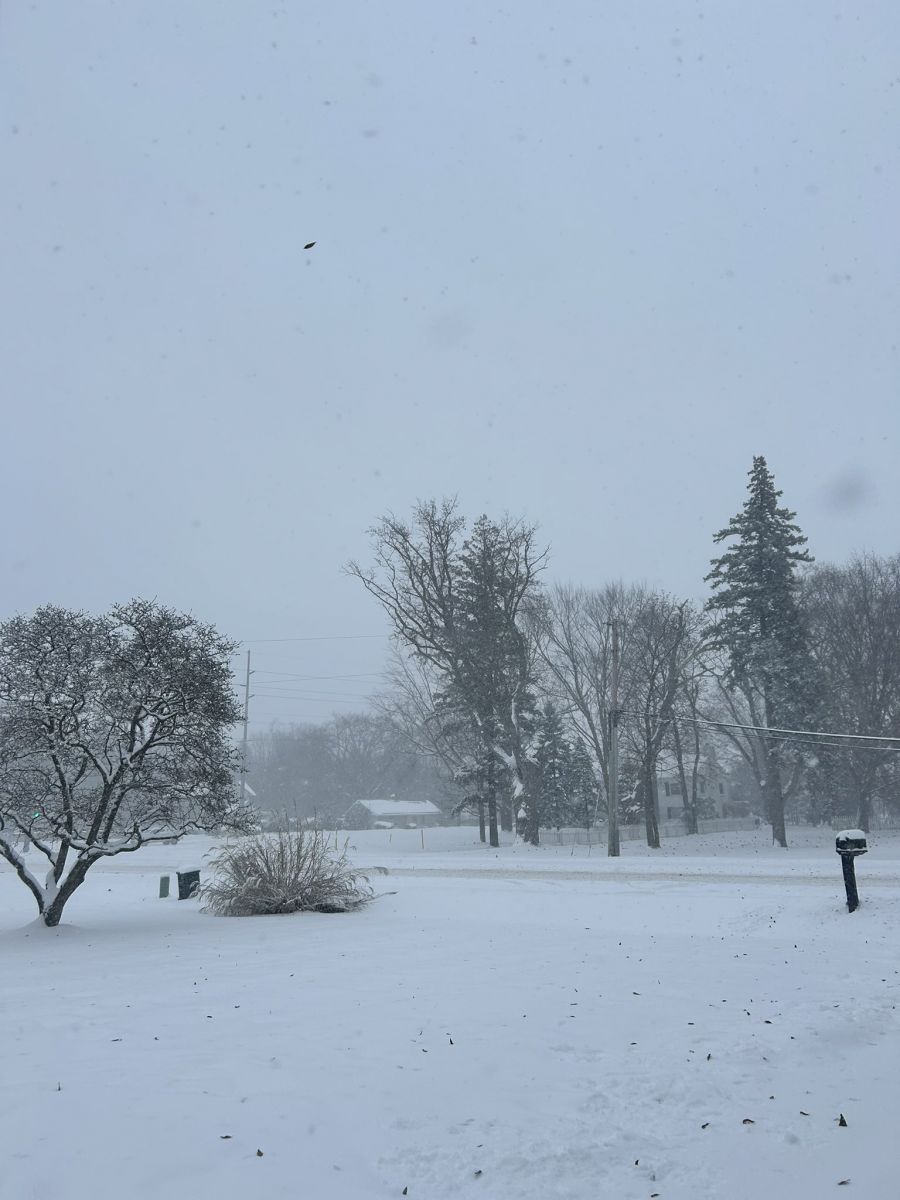
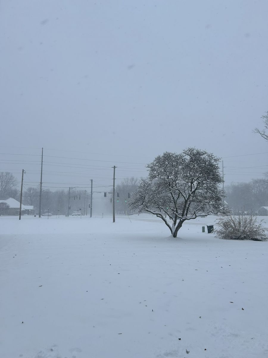
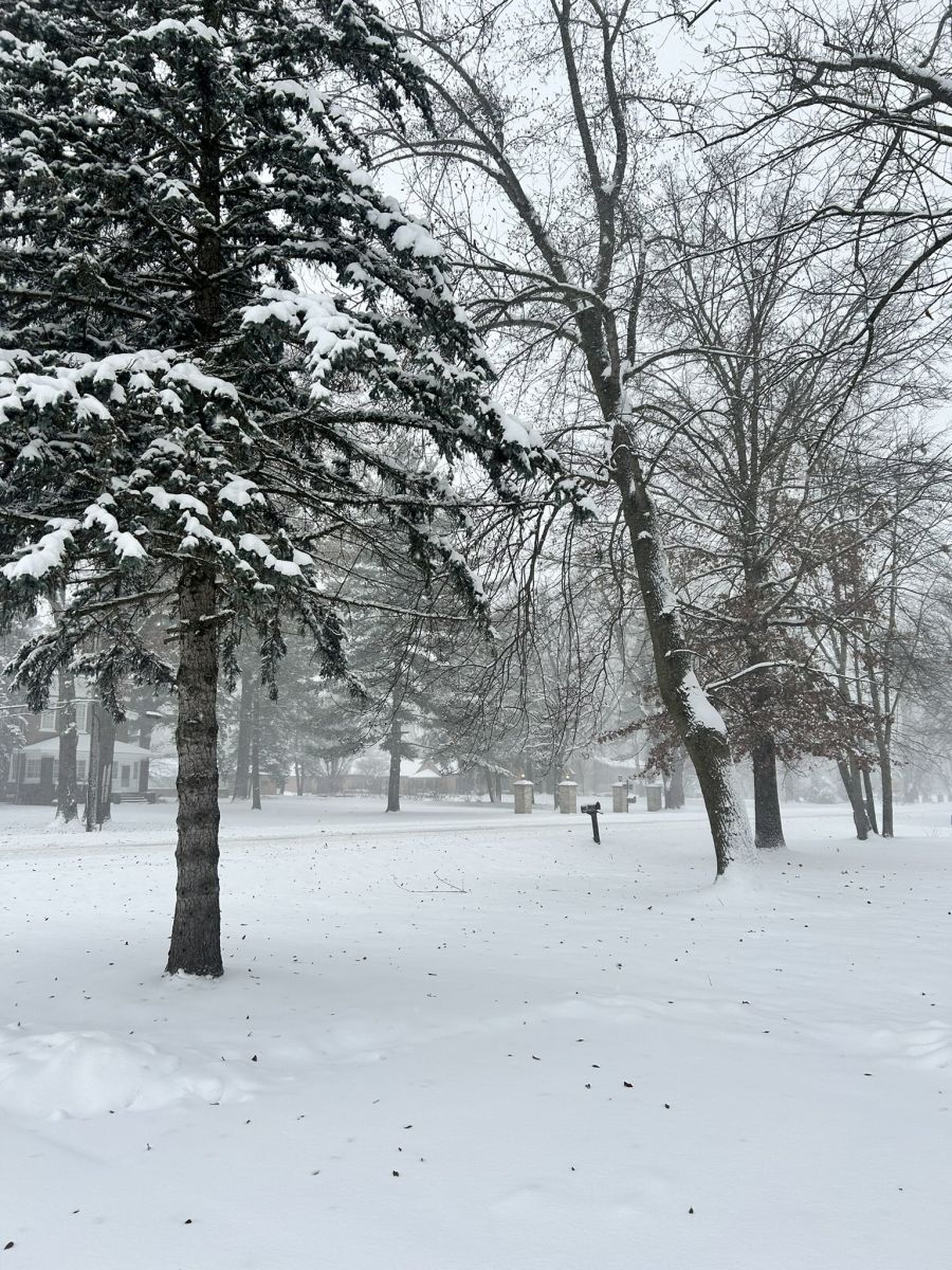
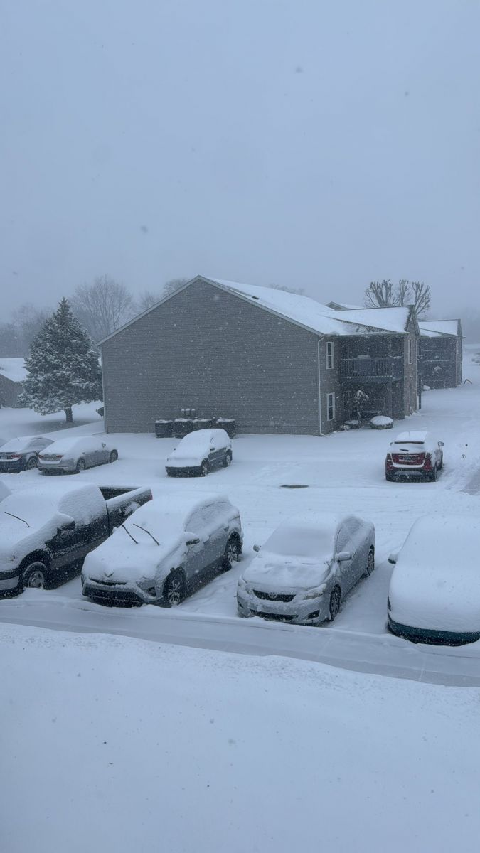
Photos & Video
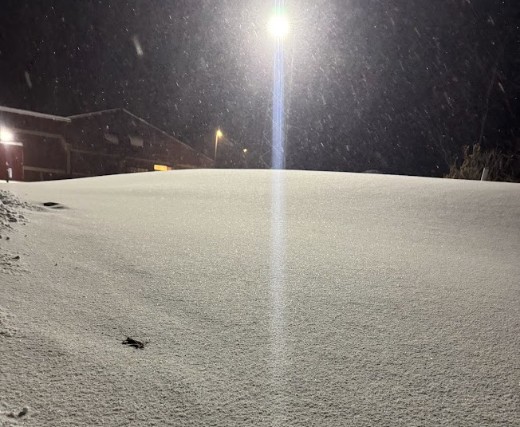
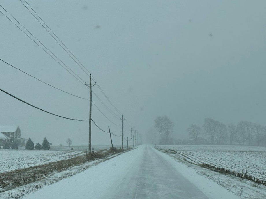
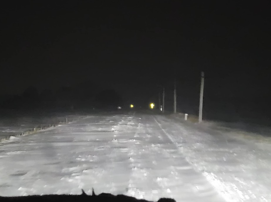
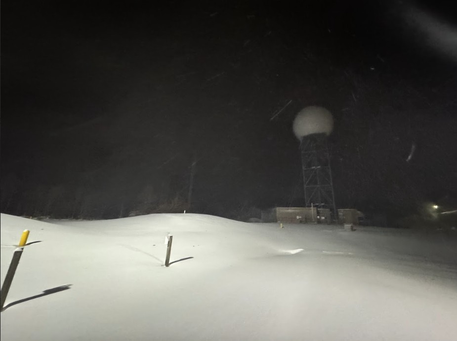
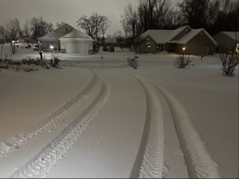
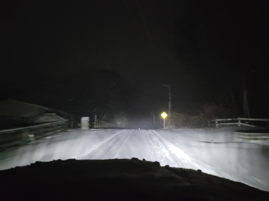
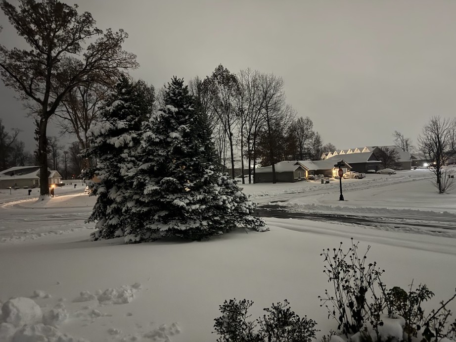
Here are photos taken at IWX (2N North Webster), Leesburg, Monticello, and Goshen, IN on November 29th into November 30th, 2025. The IWX images show the snow at IWX just after the event began (top left), and the rest at IWX were taken late evening around midnight the 29th into the 30th after much of the snow fell. Photos on 700N show the road conditions shortly after midnight (taken by the passenger in the car). Roads were completely snow covered from falling, blowing, and drifting snow. At times, it was like driving on a ski hill of moguls! Other photos were submitted from north Warsaw (12-1 am ET 11/30/25), Goshen and Monticello, IN (3:30-4:30 pm ET 11/29/25) as snow was accumulating. Thank you to those who submitted photos to us for use on our website!
 |
 |
 |
 |
| IWX at 2 PM EST 11/29/25 (Megan Dodson-NWS IWX) |
IWX at 11:45 PM ET 11/29/25 (Megan Dodson-NWS IWX) |
700N-Leesburg, IN 2 PM ET 11/29/25 (Megan Dodson) |
700N-Leesburg, IN 12 AM 11/30/25 (Megan Dodson) |
 |
 |
 |
 |
| IWX Radar at 11:45 PM ET 11/29/25 (Megan Dodson-NWS IWX) |
Warsaw, IN at 1 AM ET 11/30/25 (Megan Dodson) |
700N-Leesburg, IN 12 AM 11/30/25 (Megan Dodson) |
Warsaw, IN at 1 AM ET 11/30/25 (Megan Dodson) |
 |
 |
 |
 |
| Goshen, IN 4:30 PM ET 11/29/25 (Josh Briggs) |
Goshen, IN4:30 PM ET 11/29/25 (Josh Briggs) |
Goshen, IN 4:30 PM ET 11/29/25 (Josh Briggs) |
Monticello, IN 3:50 PM ET 11/29/25 (Dustin Shadbolt) |
Radar
Here is a radar loop of the event from 9:20 pm November 28th to 9:20 pm EST November 30th, 2025. Widespread system snow overspread the area overnight November 28th into the 29th. System snow transitioned to more of a lake effect snow set up for the 30th, with the bulk of new accumulations occurring by 9:20 pm ET. Minor accumulations occurred shortly after that (beyond the loop). Rain and light drizzle/freezing drizzle mixed in at times during the evening of the 29th into the 30th, particularly areas further south and east.
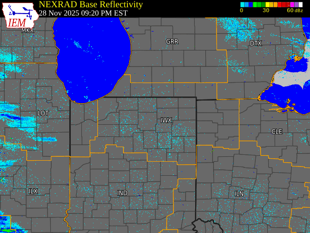
Radar Loop Created Using Iowa Environmental Mesonet (IEM) Page.
The IEM link goes to the interactive loop, where you can adjust the times and dates if desired.
Environment
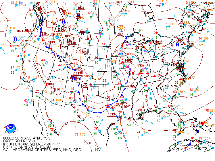
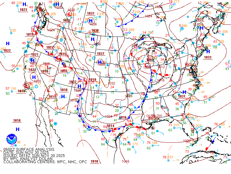
A low pressure system moved northeastward through the Great Lakes region November 29th-30th, 2025, bringing widespread snow and a wintry mix to the area.
 |
 |
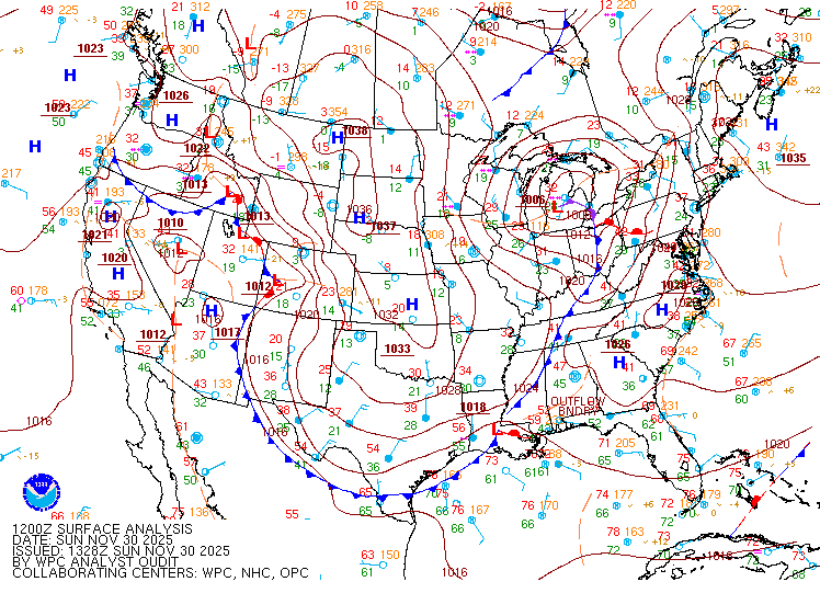 |
| Figure 1: 7 pm ET November 29th, 2025 (WPC) | Figure 2: 1 am ET November 30th, 2025 (WPC) | Figure 3: 7 am ET November 30th, 2025 (WPC) |
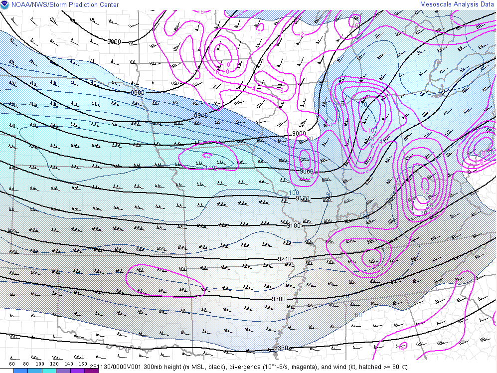
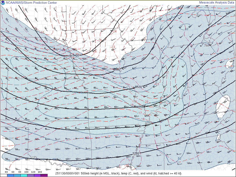
Upper Level Charts at 300mb, 500mb, and 850mb at 7 pm EST Nov 29th, 2025 are below. There was a strong upper level jet at 300mb that led to strong lift across the area. At 500mb there was an upper level trough (lift). At 850mb, you can see the warm air advection that led to the widespread snow (isentropic ascent/lift).
 |
 |
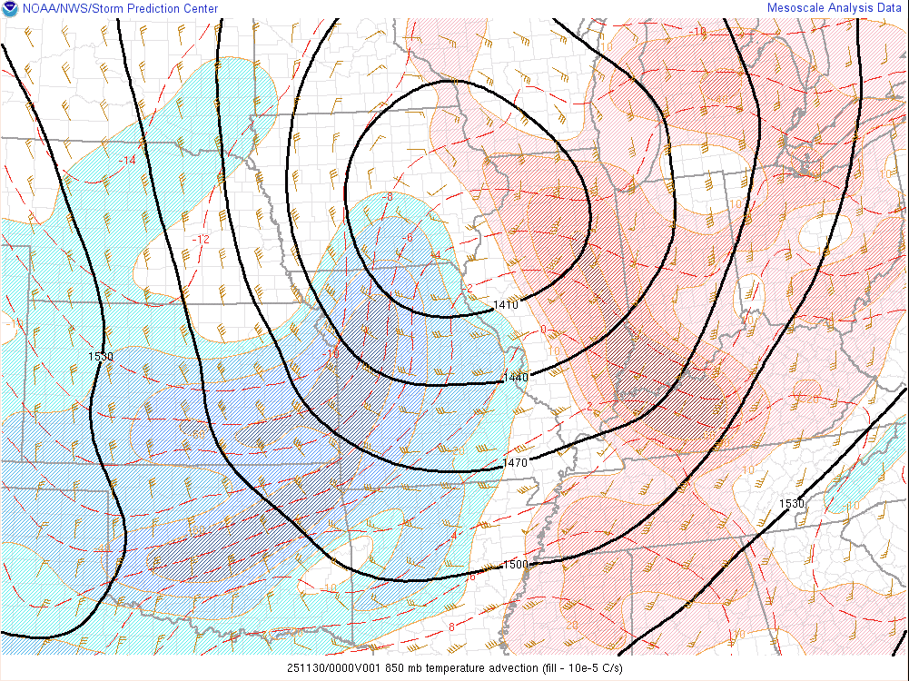 |
| Figure 4: 300mb Analysis (SPC) | Figure 5: 500mb Analysis (SPC) | Figure 6: 850mb Analysis (SPC) |
 |
Media use of NWS Web News Stories is encouraged! Please acknowledge the NWS as the source of any news information accessed from this site. |
|

