 |
 |
 |
 |

|
|
|
|

|
|


|

|
|

|
|

|
Synopsis
A strong cold front advanced across the Great Lakes during the late afternoon and evening hours of March 31, 2006. The area had seen a period of showers and isolated thunderstorms during the morning associated with a pre-frontal trough. This activity was followed by clearing skies, which allowed temperatures to soar into the upper 60s to lower 70s with dewpoints in the low to mid 50s.
Mesoscale/Stormscale conditions
Surface based capes (SBCAPES) were on the order of 500 J/KG to 900 J/KG...considered weak instability. However...0-3 km helicity values were around 300 m2/s2. Winds were generally unidirectional, but speed shear was noted in lowest 2 km (25kt sfc to 55 kt around 2 km) and surface winds over northeast Indiana and northwest Ohio began backing slightly by late afternoon. Wet Bulb zero was favorable for hail...around 7.5 kft. 0 Degrees C was near 10 kft with -20 C around 20 kft. A Tornado Watch was issued at 235 PM EST for the entire IWX Forecast area.
Radar trends and observations
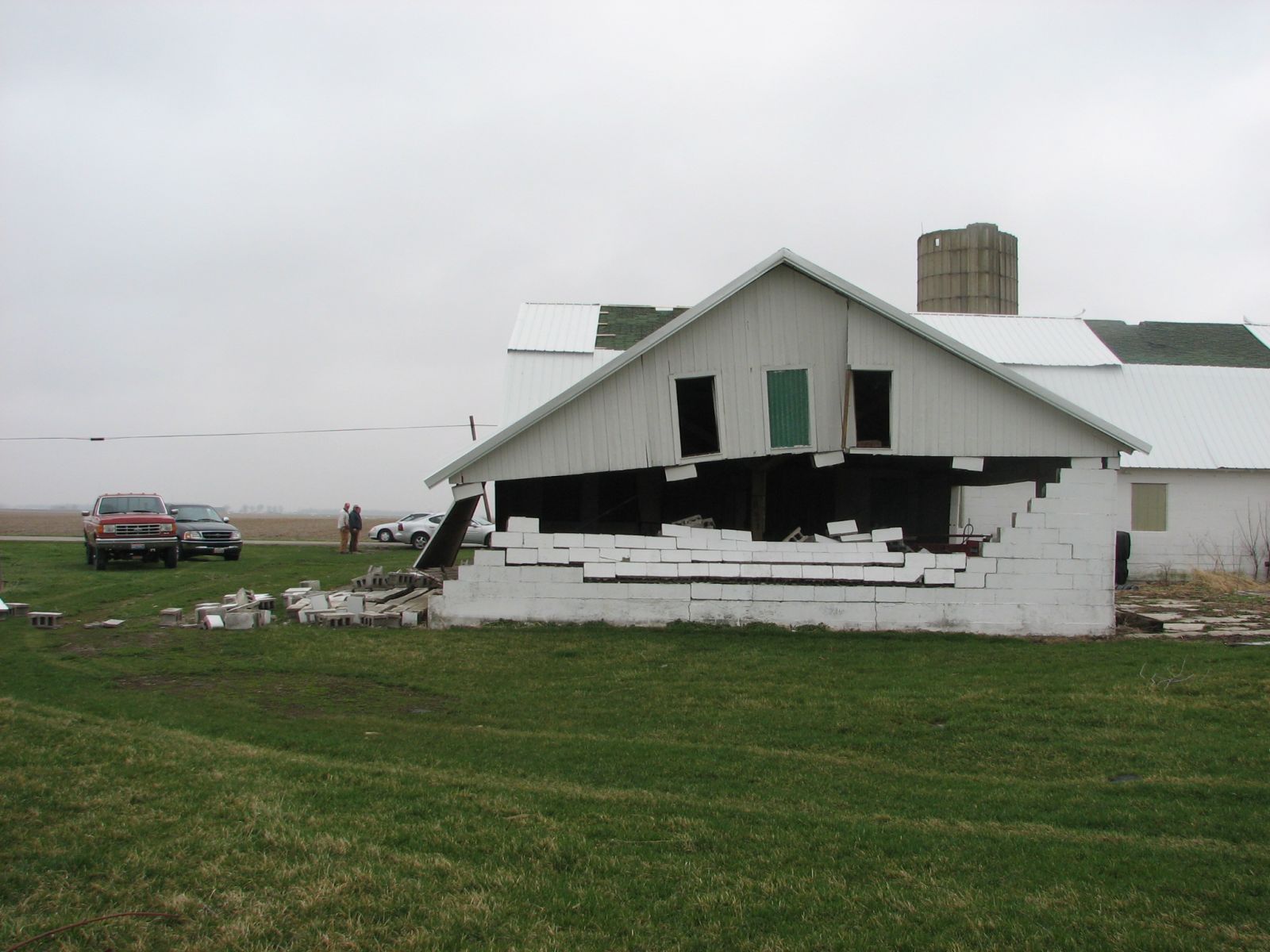
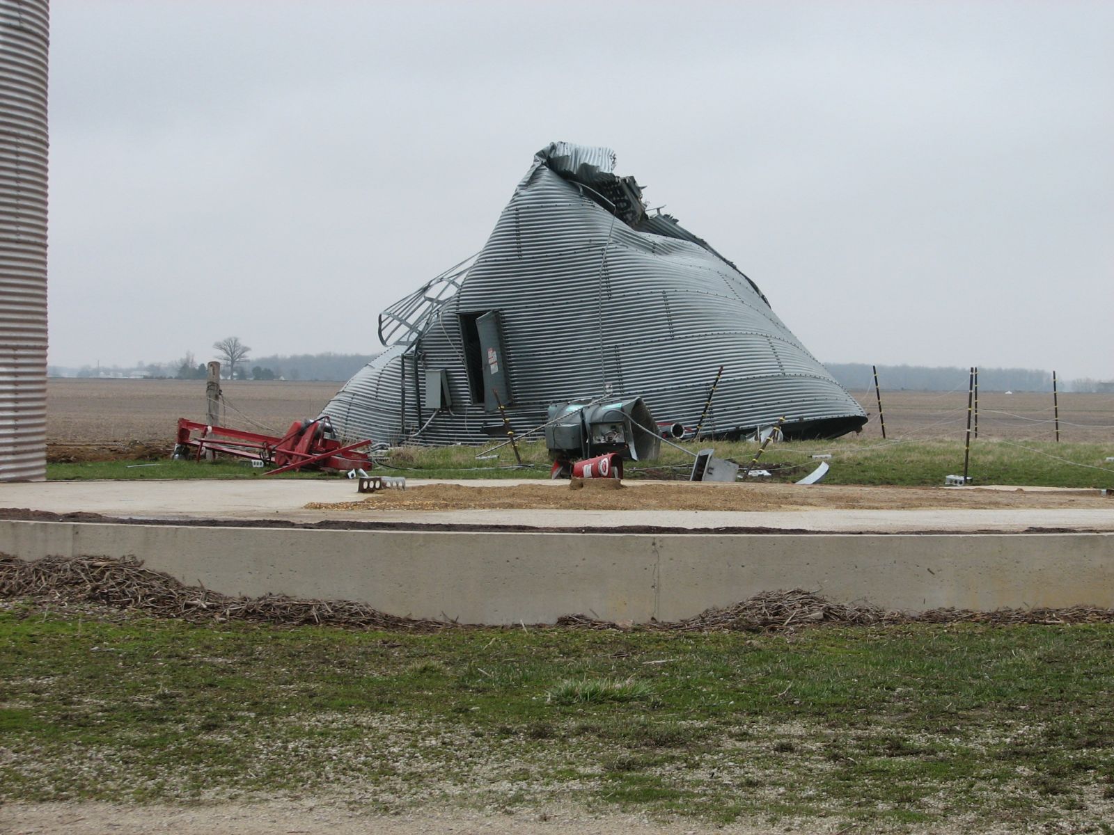
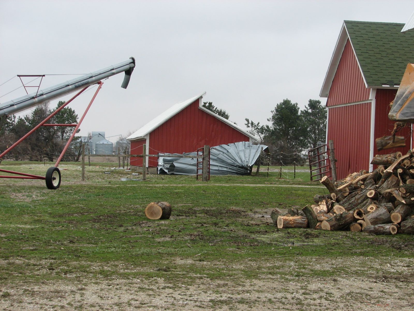
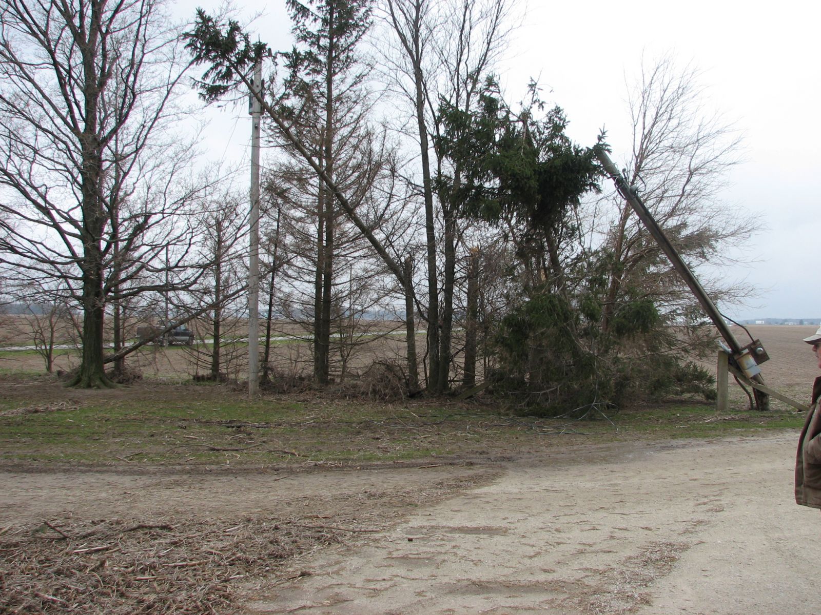
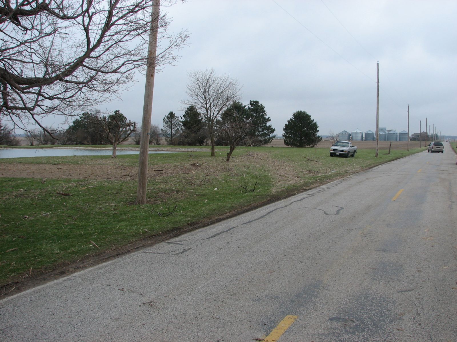
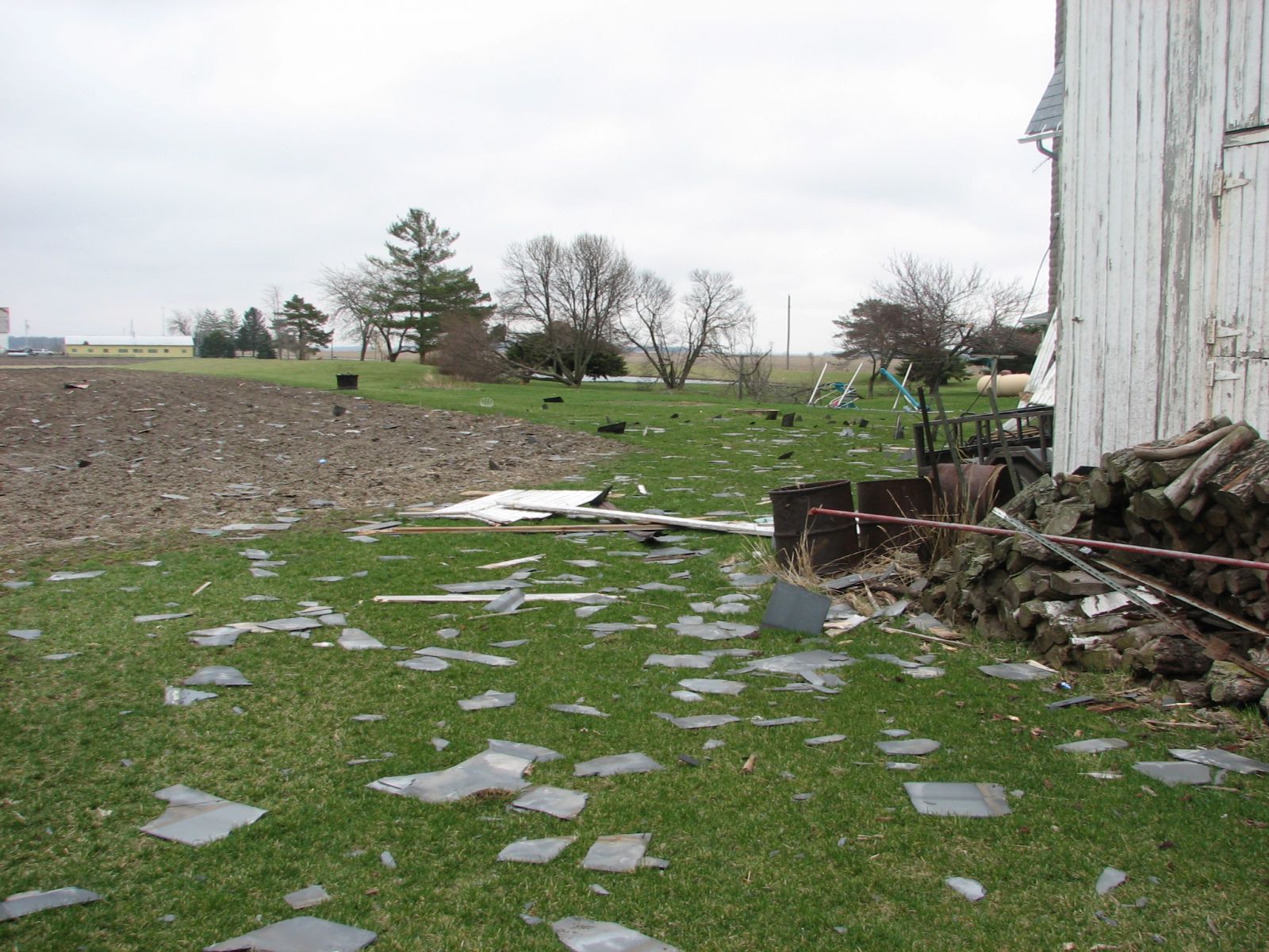
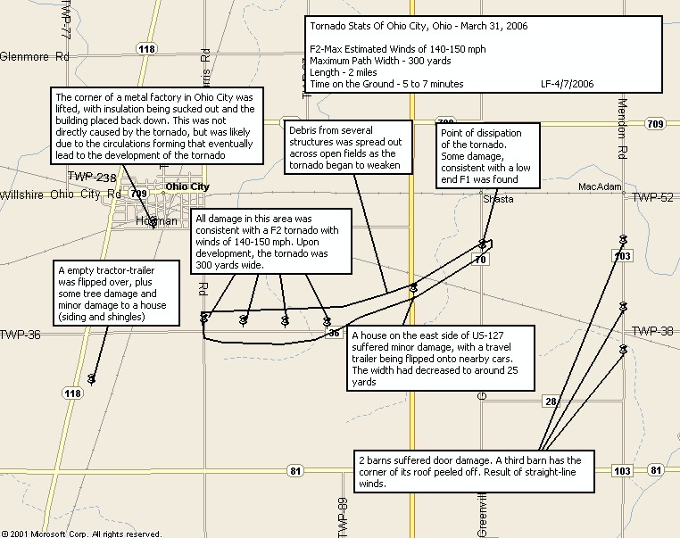
A broken line of showers and thunderstorms developed across far NW Indiana and SW Michigan and intensified as it reached roughly a Terre Haute to Logansport to Coldwater line. The line filled in after this point as it began to interact with increasing surface based convergence. Radar observations indicating at least a few low-topped supercells,which exhibited some mid level rotation. A merger of a low topped supercell and the squall line occurred in Adams county with Gate to Gate shear of 113 kts near Ohio City, OH. This resulted in the activity moving from Adams county into Van Wert county to intensify.
LF/TH...4/11/06

