Northern Indiana
Weather Forecast Office
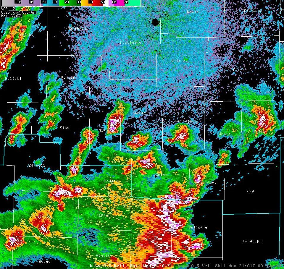
A cluster of thunderstorms moved out of portions of central Indiana and began to race northeast at speeds of 50 to 60 mph on Monday, June 9th. A bowing segment began to develop and produce widespread wind damage east of Highway 27 from Berne in Adams County to Portland and then southeast to Salamonia in Jay County. The strong winds and damage continued across much of Van Wert, Putnam, and Allen counties in Ohio. Another area of thunderstorms caused damage in eastern Whitley County and northwestern Allen County Indiana, including portions of the northwest side of Fort Wayne, and then spread into much of Fulton and Williams Counties in Ohio. Wind speeds of 65 to 80 mph were found in these areas, bringing down numerous trees, tree limbs, power lines and poles. One NWS survey team was sent into the Middle Point and Delphos area of Van Wert County to investigate a possible tornado touchdown. Damage found in the area was consistent with 60 to 65 mph straight line winds and there were no signs of any tornado related damage.
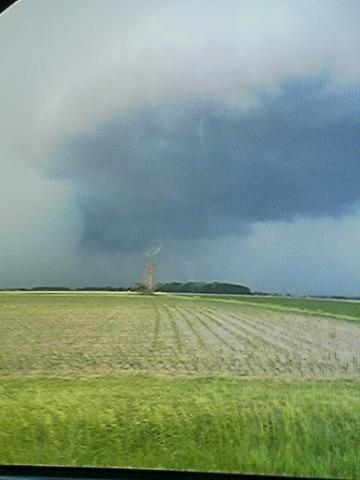
Two initial spotter reports of a 99 mph wind gust 2 miles east of Glenmore in Van Wert County and 117 mph in Lyons in Fulton County Ohio, were found to be in kilometers per hour, with the respective speeds in mph being 62 and 73. Note the photo of the rain foot that was observed near Middlepoint - Fig. 7
 |
 |
| Fig. 1 - 2101Z 0.5° Reflectivity |
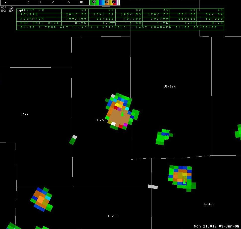
Fig. 2 - 2101Z Digital VIL |
 |
 |
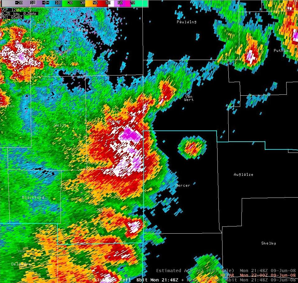
| Fig. 3 - 2148Z 0.5° Reflecitivty |
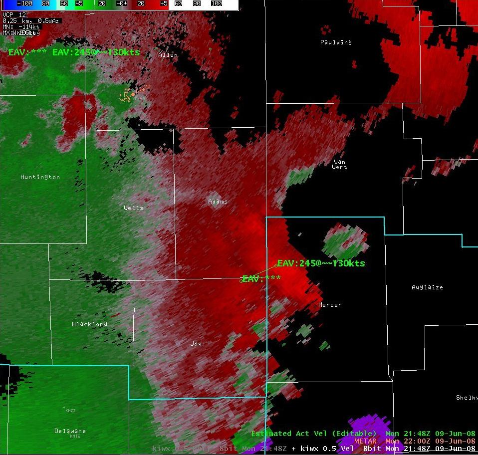
Fig. 4 - 2148Z 0.5° Velocity |
 |
 |
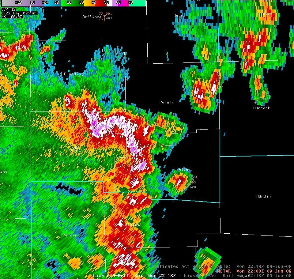
| Fig. 5 - 2218Z 0.5° Reflectivity |
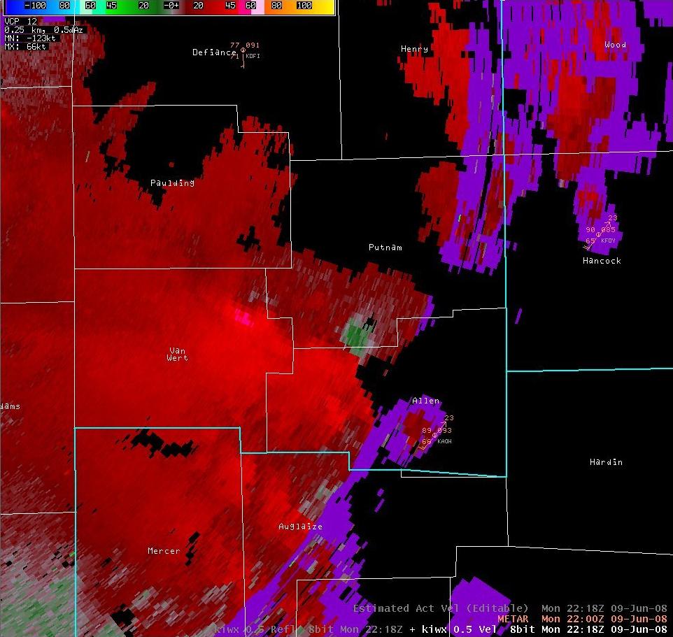
Fig. 6 - 2218Z 0.5° Velocity |
 |
|
| Fig. 7 - Photo of rain foot near Middlepoint | |
Hazards
Heat Related
Winter Related
Watch/Warning
Outlook
Storm Reports
Storm Prediction Center
Submit a Report
Event Ready
Climate
FWA Daily
SBN Daily
FWA Monthly
SBN Monthly
CoCoRaHS
Spring Frost Climatology
Fall Frost Climatology
Severe Climatology
Local Information
Skywarn
COOP
Our Office
WSR-88D
Headline Criteria
NOAA Weather Radio
Weather History
Probabilistic Snowfall
Public Information Statement
Social Media Feeds
Weather Events Page
US Dept of Commerce
National Oceanic and Atmospheric Administration
National Weather Service
Northern Indiana
7506 E 850 N
Syracuse, IN 46567
574-834-1104
Comments? Questions? Please Contact Us.

