The National Weather Service in Northern Indiana and Van Wert County Emergency Management confirmed that a weak EF1 tornado touched down in eastern Van Wert County during the early morning hours of Friday May 14, 2010. A detailed survey was performed by emergency management officals of the damage and the following conclusions resulted.
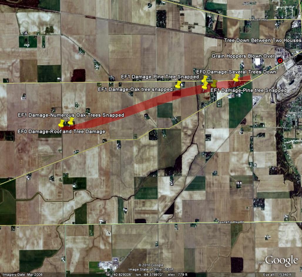
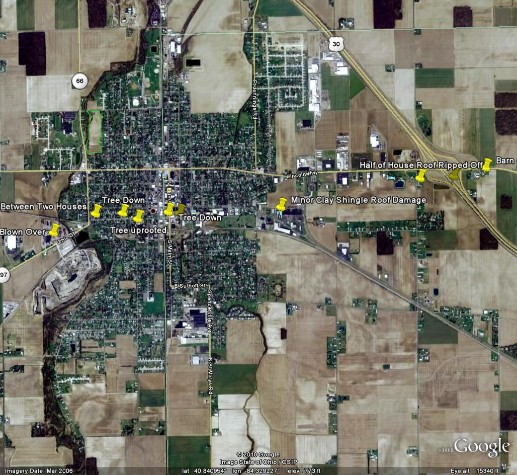
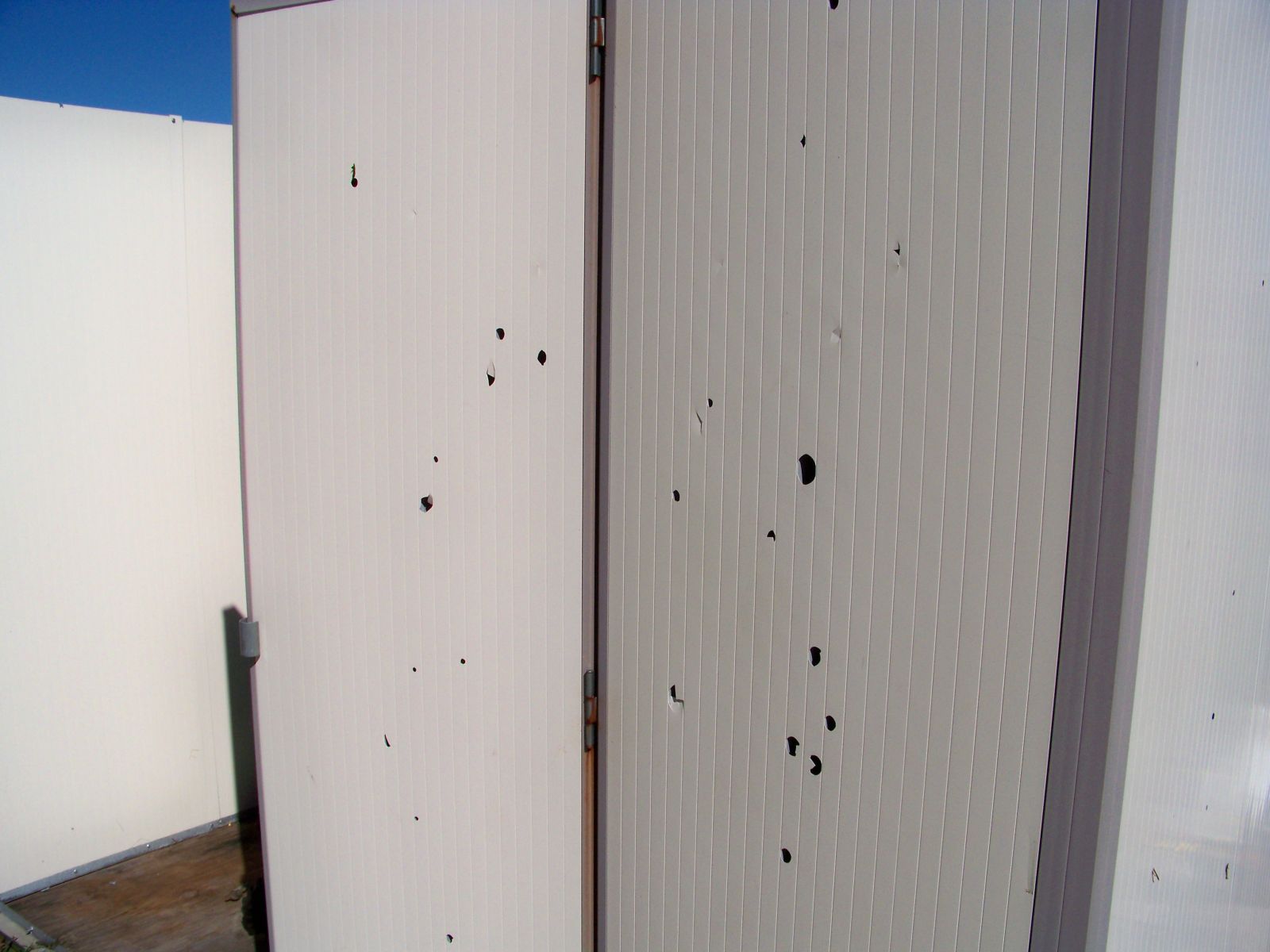
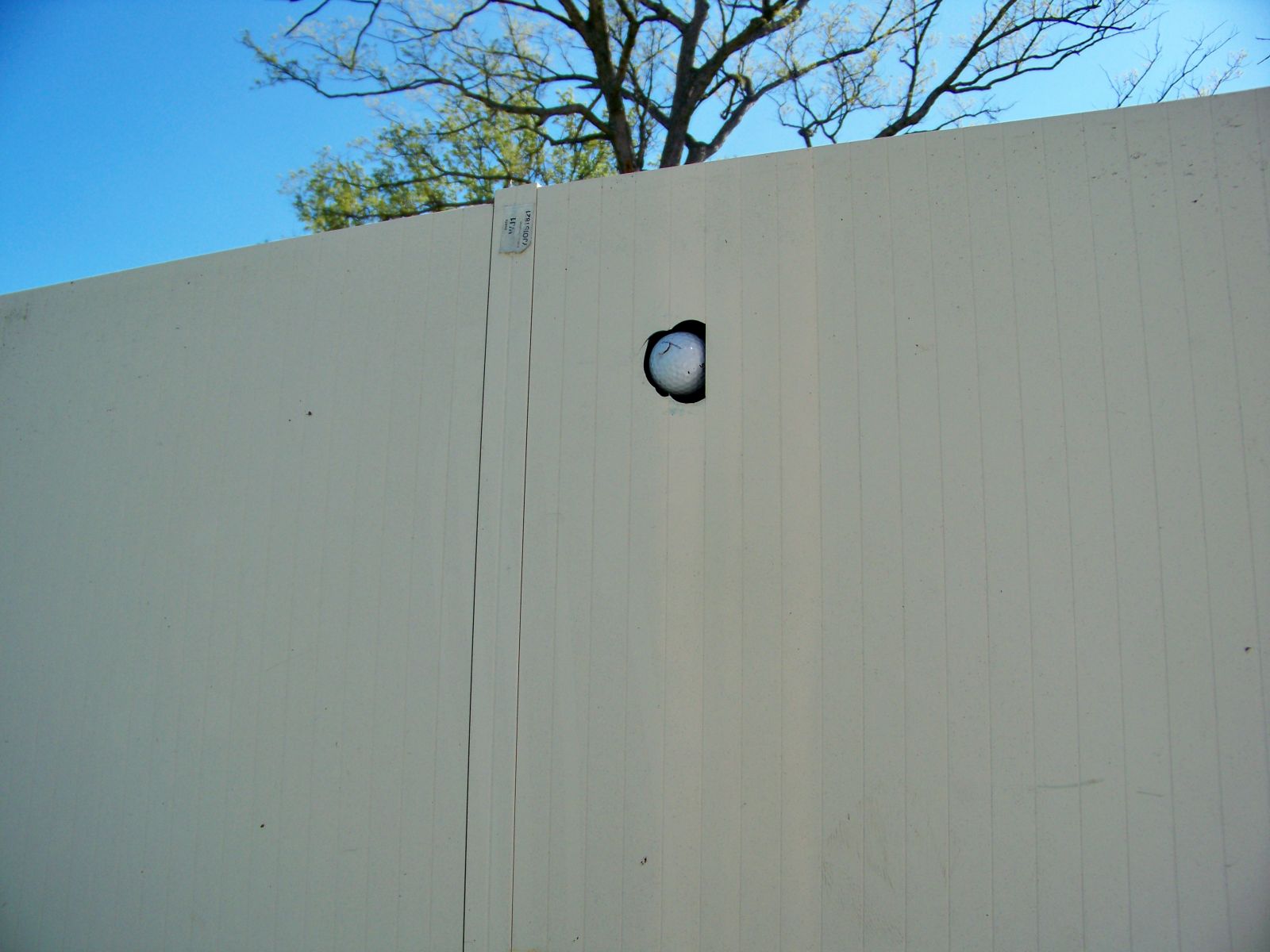
The tornado touched down approximately 3 miles southwest of Delphos and 0.5 miles south of State Road 697 on Bocky Rd at 1:47 AM EDT. The tornado heavily damaged several large oak trees, with trunks snapped near the ground in some cases. The damage in this area was the most intense of the damage and was consistent with an EF1 tornado, wind speeds in the 90 to 95 mph range. Despite the time of day and lack of visual confirmation, a circulation was evident in the debris pattern, most noted with a storage shed, which had golf balls embedded in an eastern flank wall. The 8X8 aluminum shed had also lost its roof. The tornado continued on an ENE trajectory toward Delphos, with damage observed along Brickner and Mox Roads. The damage pattern suggest that the circulation weakened and likely ended somewhere just before Delphos, near the intersection State Road 697 and Jennings-Delphos Road. However, very strong winds, likely from the rear flank downdraft (RFD) continued into Delphos. The tornado entered the southwest side of Delphos with damage noted at a grain elevator and along 1st Street where several structures and large trees received some degree of damage. As the strong winds exited Delphos, one last area of damage was seen in and around the US 30/Lincoln Highway interchange. A house, located southwest of the interchange, lost half of its roof. As the winds crossed the US 30 bypass a semi was flipped onto its side. Damage was also found on the southeast side of the interchage where trees were blown down and a Morton barn was destroyed. In all, 23 structures sustained damage to some degree.
Specifics:
Damage was observed along a 5 mile path. The tornado formed on Bocky Road, south of State Road 697 and continued ENE toward Delphos, lifting near the intersection of State Road 697 and Jennings-Delphos Road. The tornado travel around 2 miles, with a maximum width of 150 yards and maximum wind speed of 90 to 95 mph. Straight line wind damage, averaging in the 75 to 85 mph range, continued through Delphos to the US 30/Lincoln Highway interchange where all signs of damage ended. The map below displays the path of damage. An updated map will be posted in the near future showing further details on exact damage locations.
Swath of Damage From Tornado
Damage Locations from Straight-Line Winds
 |
 |
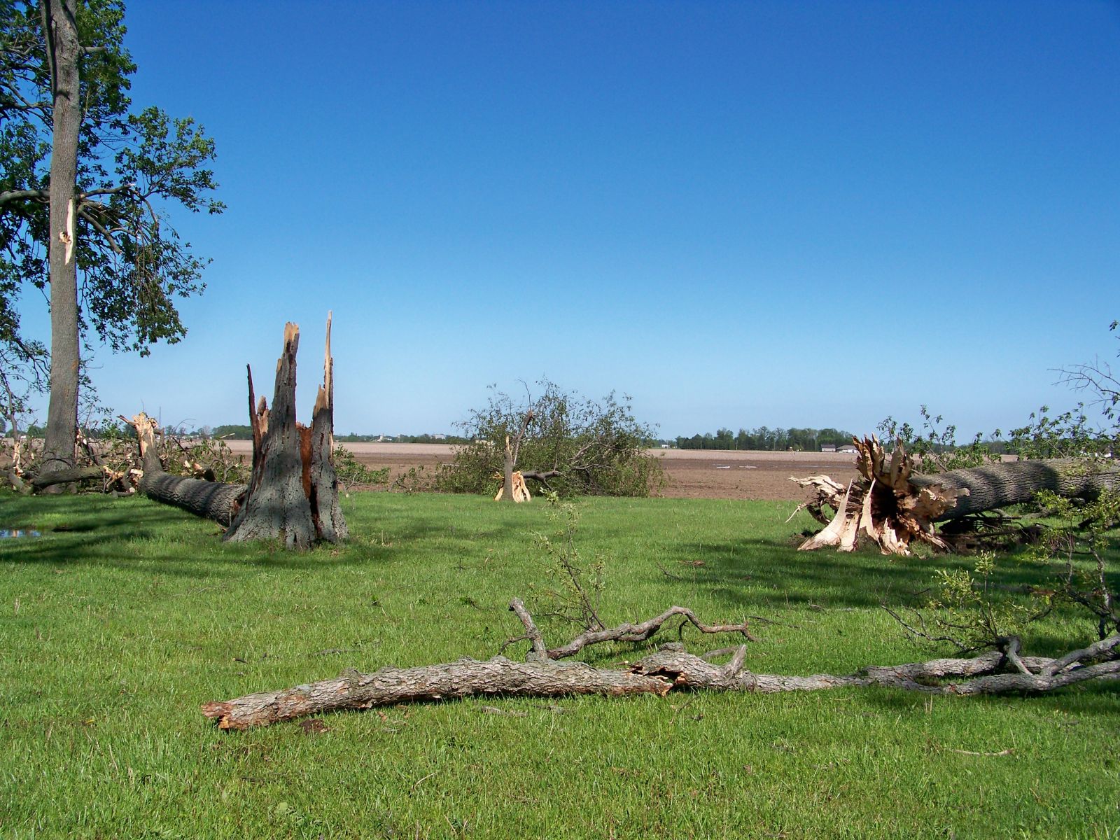 |
| Large tree with trunk snapped near base. | Another Large tree with the trunk snapped at the base. | Several large hardwood trees snapped. |
 |
 |
 |
| Flying derbis create numerous small holes in this storage shed. | A golf ball lodged in the northeast wall of storage shed. | Large tree toppled just outside of Delphos. |
Chamberlain/Fisher 5/20/10

