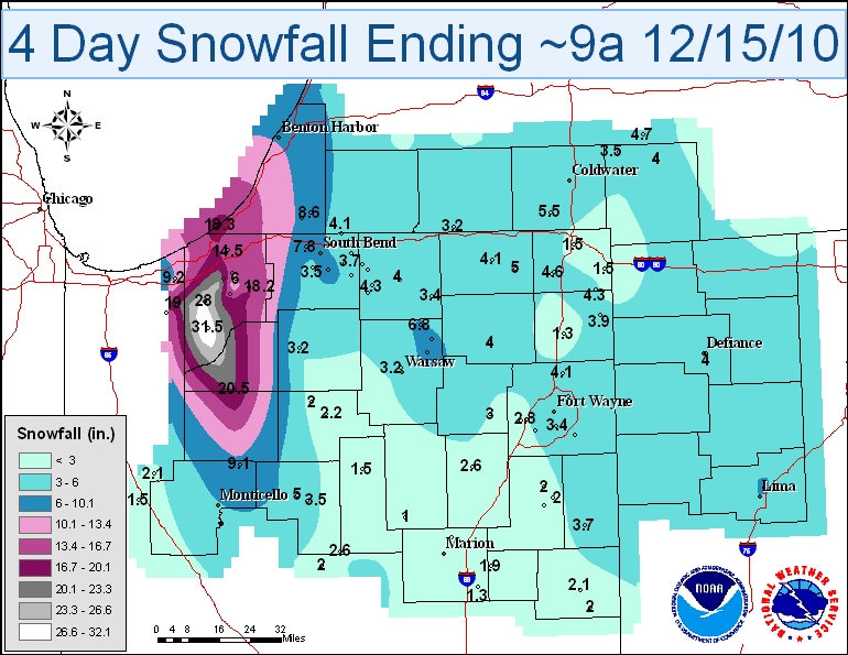
Below is a table highlighting the highest snowfall amounts for this event.
| LOCATION | SNOW AMT | LOCATION | SNOW AMT | |
| Wanatah 4.4 ESE | 31.5 | South Bend 4.6 SE | 8.2 | |
| Westville 4.7 ESE | 28.0 | Leesburg 6.7 ESE | 7.2 | |
| La Porte 1.6 SW | 24.7 | Porter 0.6 S | 7.1 | |
| North Judson 5.7 ESE | 20.5 | Valparaiso 5.7 WSW | 7.1 | |
| Valparaiso 3.9 ENE | 19.0 | Syracuse 0.9 SW | 6.8 | |
| Kingsbury 5.0 ENE | 18.2 | Crown Point 7.8 E | 6.7 | |
| Valparaiso 0.4 SSW | 17.1 | Hebron 3.7 NE | 6.2 | |
| Valparaiso 1.4 ENE | 15.9 | Valparaiso 1.8 NW | 6.2 | |
| Kingsbury 0.3 WNW | 15.1 | La Porte 2.3 ESE | 6.0 | |
| La Porte 6.2 N | 14.5 | Fort Wayne 7.0 NE | 5.8 | |
| Valparaiso 0.9 NNW | 13.6 | Woodburn 2.8 WSW | 5.6 | |
| La Porte 1.2 E | 13.2 | Munster 0.8 SSE | 5.5 | |
| Lakes Of The Four Seasons 1.5 NNE | 10.0 | Crown Point 1.1 N | 5.5 | |
| Valparaiso 1.4 WNW | 9.9 | Bedford 8.6 NNW | 5.5 | |
| Chesterton 4.2 E | 9.2 | Valparaiso 0.6 SE | 5.5 | |
| Burnettsville 9.9 NNW | 9.1 | Mishawaka 2.5 SE | 5.2 | |
| Valparaiso 4.6 NNE | 8.9 | Fort Wayne 9.1 SE | 5.1 | |
| Valparaiso 2.0 ESE | 8.6 | Carmel 0.9 ESE | 5.1 | |
| Chesterton 1.4 ENE | 8.3 | Logansport 2.2 NNW | 5.0 | |
| Portage 0.9 ESE | 8.2 | LaGrange 7.2 ESE | 5.0 |
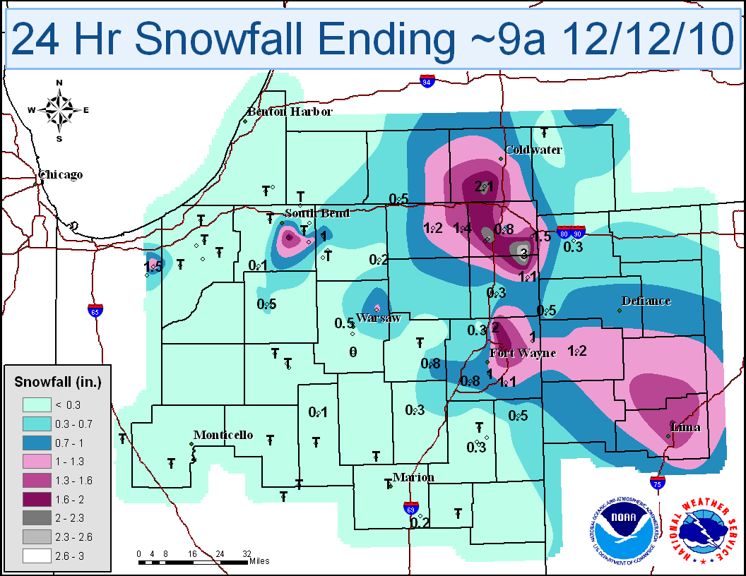
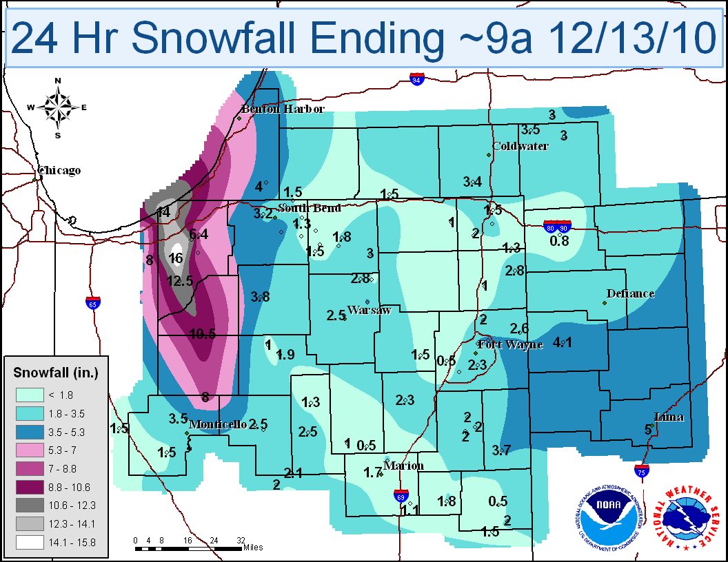
| 24 Hour Totals Dec. 12: Mainly system snow amounts | 24 Hour Totals Dec. 13: Lake Effect Snow amounts | |
|---|---|---|
 |
 |
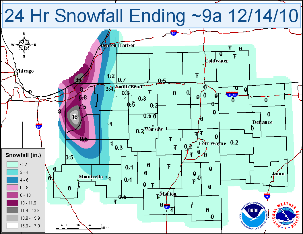
| 24 Hour Totals Dec. 14: Lake Effect Snow amounts | 24 Hour Totals Dec. 15: Lake Effect Snow amounts | |
|---|---|---|
 |
 |
| 3 Day Snowfall Totals as of Tuesday, December 14, 2010 |
|---|
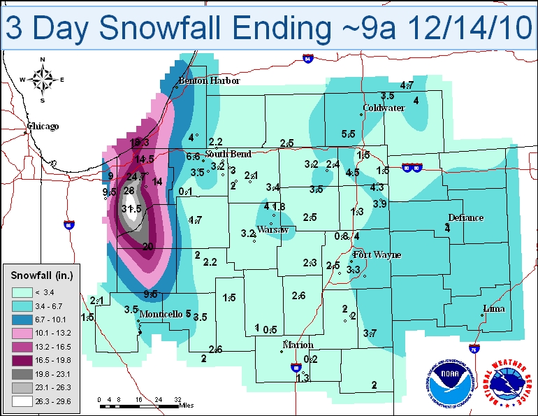 |
Click on any image to see a larger map.
Below is a picture of downtown La Porte at the height of the storm on December 12th. Notice the limited visibility and blowing snow!
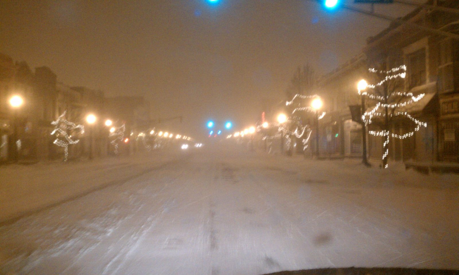 |
| Photo courtesy Joe Vorrier |
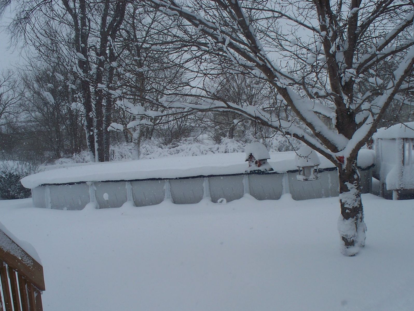
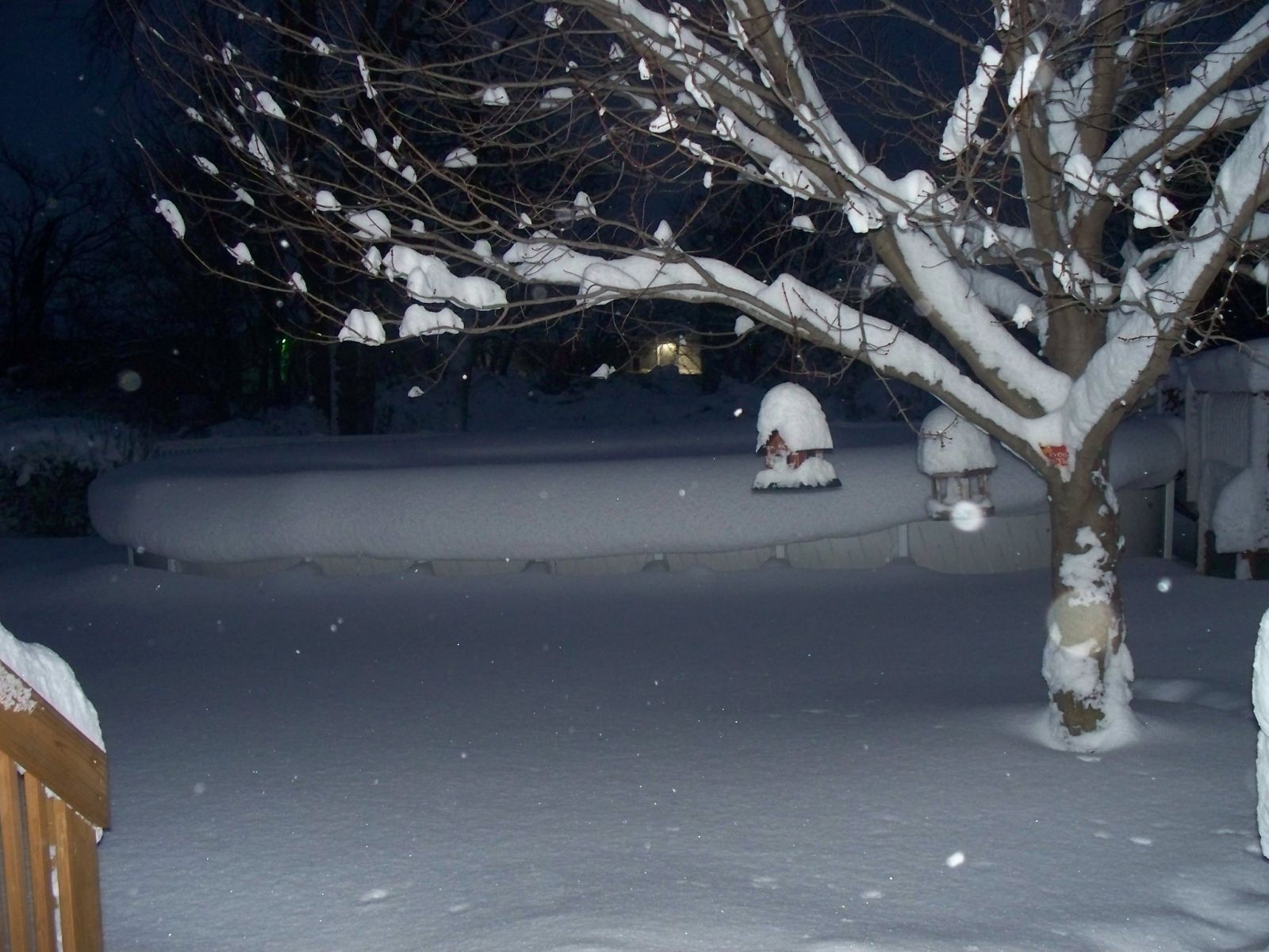
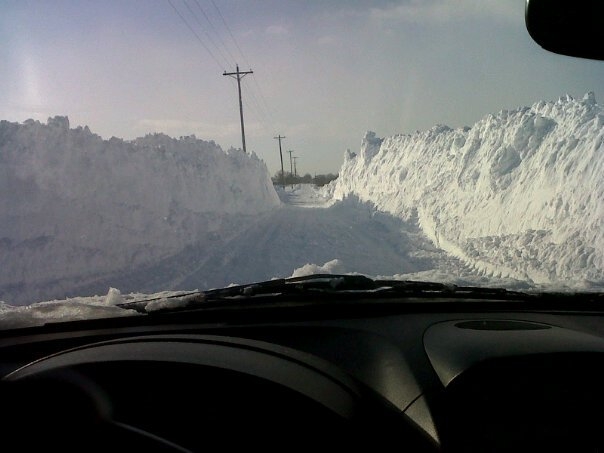
Below are a few photos showing the amount of snow La Porte County where over 30 inches fell in the 3 day period. (Photos courtesy Lori Barrett)
 |
 |
|
| Wanatah - December 13th | Wanatah - December 14th |
 |
| Union Mills - December 14th |
WEISSER/OBERGFELL

