Overview
|
Rainfall from March 31 to April 4, 2026 totaled an impressive 3 to 6 inches across the area. This soggy stretch began with severe thunderstorms on the 31st that produced one tornado and caused instances of hail and damaging wind. In the days that followed, isolated severe thunderstorms occurred as well, including an EF-1 tornado in Defiance, OH on April 4. High temperatures during this time were generally above normal, but crashed well below normal starting on the 5th in the wake of a cold front. Drought conditions were ongoing prior to this rain event, especially over northwest Ohio. In contrast to fall and winter conditions characterized by low stream flows, poor soil moisture content, and mounting precipitation deficits, many rivers now reached Minor or Moderate flood stage and flooded fields are commonplace. See our stand-alone summary of the March 31 severe storms here. |
 7-Day rainfall total through 8am April 5. Red areas indicate 5 to 6 inches of rain. Yellow areas indicate 2 to 3 inches of rain. Normal rainfall for the entire month of April is about 3.5 to 3.75 inches. |
Flooding
Unseasonably dry conditions late in 2025 and through the winter (Fort Wayne recorded its 8th driest winter on record) resulted in very low stream flows. On March 31, When 2 to 3 inches of rain fell over the Maumee and a portion of the St. Joseph River basins, rivers began to rise quickly. In the coming to days, rivers continued to rise from additional bouts of heavy rain and associated runoff.
Visit water.noaa.gov to see the location of these hygrographs below and see real-time observations.
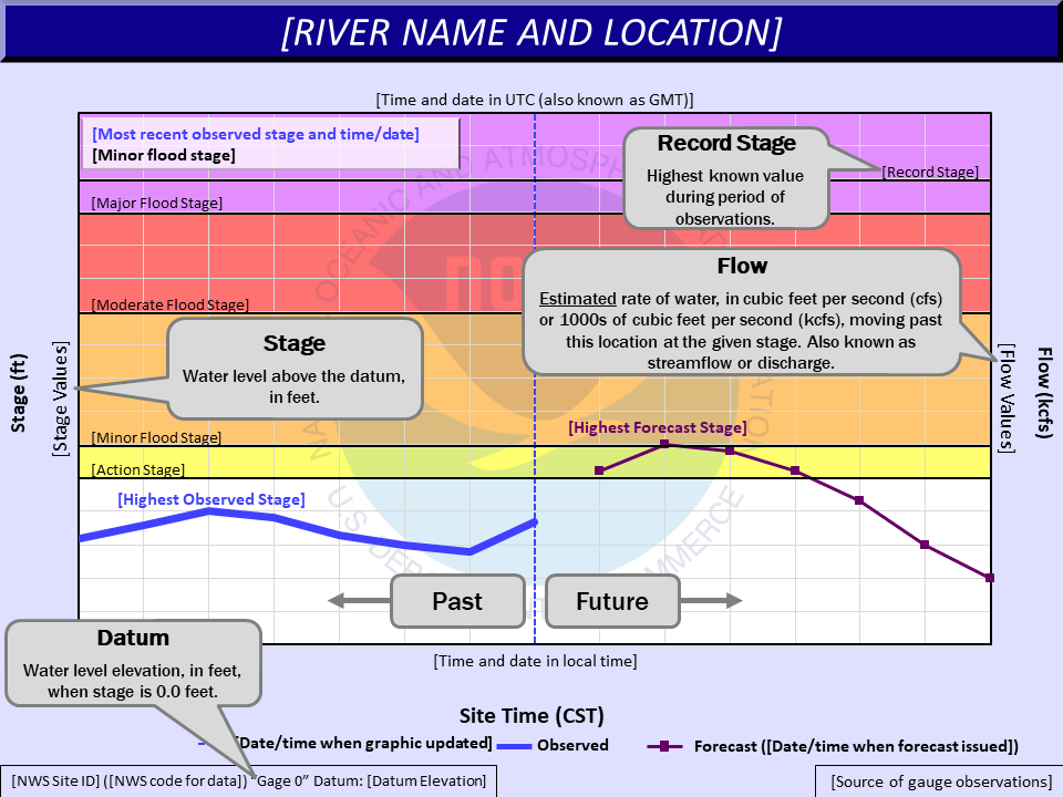
Hydrographs
 |
 |
 |
 |
| How to intrepreat a hydrograph. Additional information is here. | The St. Joseph River near Newville rose from 8' to 12' in about 6 hours. Additional rain pushed the river to Moderate Flood stage. The forecast crest just over 15' is comparable to May 21, 2020 and the crest of 15.46'. | The Tippecanoe River near Ora rose steadily from about 8' on the 31st all the way to Moderate Flood stage by April 4. The forecast crest near 13.5' is comparable to the 13.3' crest on May 3, 2019. | The Maumee River at Coliseum Blvd in Fort Wayne rose from 7' to 17' between the 31st and April 1st, respectively. The river remained elevated in the days that followed. The crest shy of 19' is comparable to 19.3' on January 13, 2020. |
Photos
 |
 |
 |
 |
| Volunteer precipitaiton observers from CoCoRaHS provided invalueable rain and flooding reports. maps.cocorahs.org | Flooding of Gill Park along the Yellow River in Plymouth, IN on April 4. (Marshall County Emergency Management Agency) | The Kankakee River approaching the bridge deck of W 600 N in southern La Porte County on April 4. The river continued to rise, reaching Minor Flood stage; 10.0'. (La Porte Co EMA) | Flooding in Defiance County, OH, slowed storm damage survey efforts on April 1 (NWS IWX Storm Survey) |
 |
 |
 |
 |
| A view of the Maumee River in Antwerp, OH. The river rose 9ft in 24 hours from March 31st to April 1st! (Dawn Hoobler) | Flooding of Shoaff Park in Fort Wayne, IN (Nathan Gidley) | Tree damage from the April 4th Defiance tornado and high water levels near the confluence of the Auglaize and Maumee rivers (NWS IWX Storm Survey) | Tree damage from the March 30th EF-1 tornado southeast of Hicksville, OH. Lots of standing water in yards and over rural roads (NWS IWX Storm Survey) |
Rain Reports
Public Information Statement
National Weather Service Northern Indiana
406 PM EDT Sun Apr 5 2026

....5-DAY PRECIPITATION REPORTS THROUGH THE MORNING OF APRIL 5...

Many observations are courtesy of CoCoRaHS. See an interactive map
of this data at maps.cocorahs.org.

Location                     Amount    Time/Date       Provider

...Indiana...

...Adams County...
0.8 N Linn Grove             1.90 in   0245 PM 04/05   HADS

...Allen County...
Fort Wayne 2.6 NW            5.01 in   0700 AM 04/05   COCORAHS
Fort Wayne 8.0 N             4.84 in   0700 AM 04/05   COCORAHS
Hoagland 1.5 SSW             4.79 in   0840 AM 04/05   COCORAHS
Ellisville 0.3 W             4.41 in   0730 AM 04/05   COCORAHS
Fort Wayne 9.3 W             4.37 in   0700 AM 04/05   COCORAHS
Fort Wayne 9.1 SE            4.35 in   0700 AM 04/05   COCORAHS
Fort Wayne 4.1 NE            4.19 in   0700 AM 04/05   COCORAHS
Fort Wayne 2.6 NE            4.06 in   0700 AM 04/05   COCORAHS
Woodburn 2.8 WSW             3.93 in   0700 AM 04/05   COCORAHS
Fort Wayne 1.9 SSW           3.80 in   0800 AM 04/05   COCORAHS
Fort Wayne 1.9 S             3.00 in   0545 AM 04/05   COCORAHS
Fort Wayne International Ap  2.74 in   0254 PM 04/05   ASOS

...Blackford County...
Hartford City 4 ESE          2.20 in   0800 AM 04/05   COOP

...Cass County...
Young America                2.07 in   0800 AM 04/05   COOP

...De Kalb County...
Corunna 1.1 S                5.00 in   0700 AM 04/05   COCORAHS
Hamilton 3.0 ESE             4.34 in   0700 AM 04/05   COCORAHS
Auburn 1.1 NNE               4.13 in   0700 AM 04/05   COCORAHS
1.7 SE Butler                3.68 in   0715 AM 04/05   COOP

...Elkhart County...
Syracuse 2.0 NW              3.78 in   0721 AM 04/05   COCORAHS
Syracuse 4.4 NNW             3.44 in   0700 AM 04/05   COCORAHS
Goshen 3.0 WSW               3.26 in   0700 AM 04/05   COCORAHS
Goshen 1.8 SE                3.19 in   0700 AM 04/05   COCORAHS
Wakarusa 2.4 NNE             3.10 in   0700 AM 04/05   COCORAHS
Goshen 1.4 SSE               3.09 in   0700 AM 04/05   COCORAHS
Goshen 1.2 SW                3.06 in   0700 AM 04/05   COCORAHS
Nappanee 4.8 NE              3.02 in   0700 AM 04/05   COCORAHS
Goshen 4.6 N                 2.94 in   0700 AM 04/05   COCORAHS
Goshen 3.5 NNW               2.93 in   0700 AM 04/05   COCORAHS
Goshen                       2.63 in   0253 PM 04/05   ASOS
Elkhart 4.8 SW               2.46 in   0700 AM 04/05   COCORAHS
1 SE Dunlap                  1.26 in   0600 AM 04/05   COCORAHS
Goshen 3 SW                  1.10 in   0700 PM 04/04   COOP

...Fulton County...
Rochester 2.4 NW             3.43 in   0700 AM 04/05   COCORAHS

...Grant County...
Upland 2.4 SSE               2.43 in   0700 AM 04/05   COCORAHS
2.2 N Marion                 2.16 in   0705 AM 04/05   COOP
Marion 5.6 NE                2.08 in   0700 AM 04/05   COCORAHS

...Huntington County...
Huntington 8.6 N             3.60 in   0900 AM 04/05   COCORAHS
1 W Roanoke                  3.52 in   0700 AM 04/05   COCORAHS
Huntington 5.7 ENE           2.80 in   0700 AM 04/05   COCORAHS
Huntington 0.3 W             2.60 in   0700 AM 04/05   COCORAHS
2.4 NW Warren                1.87 in   0245 PM 04/05   HADS

...Jay County...
Portland 2.3 S               1.28 in   0700 AM 04/05   COCORAHS

...Kosciusko County...
Leesburg 6.7 ESE             5.52 in   0700 AM 04/05   COCORAHS
Warsaw 3.0 SE                4.88 in   0646 AM 04/05   COCORAHS
Leesburg 0.1 WNW             4.77 in   0600 AM 04/05   COCORAHS
Warsaw 3.0 SE                4.59 in   0800 AM 04/05   COCORAHS
North Webster 2.3 N          4.53 in   0800 AM 04/05   COCORAHS
Warsaw 1.2 NNE               4.46 in   0700 AM 04/05   COCORAHS
Warsaw 1.4 N                 3.96 in   0631 AM 04/05   COCORAHS
Cromwell 2.9 W               3.91 in   0700 AM 04/05   COCORAHS
Milford 0.9 N                3.69 in   0700 AM 04/05   COCORAHS

...La Porte County...
La Crosse 1.2 W              3.17 in   0800 AM 04/05   COCORAHS
La Porte 0.9 SSE             3.04 in   0800 AM 04/05   COCORAHS
La Porte 1.6 SW              2.87 in   0800 AM 04/05   COCORAHS
Trail Creek 3.0 SE           2.71 in   0800 AM 04/05   COCORAHS
La Porte 6.8 SW              2.55 in   0800 AM 04/05   COCORAHS
Mill Creek 1.9 NNE           2.40 in   0755 AM 04/05   COCORAHS

...Lagrange County...
Lagrange 9.6 ESE             3.19 in   0700 AM 04/05   COCORAHS
Orland 6.6 SSW               2.66 in   0700 AM 04/05   COCORAHS
LaGrange 9.9 E               2.61 in   0700 AM 04/05   COCORAHS
LaGrange 1.3 ENE             2.41 in   0830 AM 04/05   COCORAHS

...Marshall County...
Plymouth 2.5 WSW             5.06 in   0500 AM 04/05   COCORAHS
Tippecanoe 0.8 S             4.05 in   0700 AM 04/05   COCORAHS
Plymouth 7.3 NNE             3.22 in   0700 AM 04/05   COCORAHS

...Miami County...
Denver 0.5 SSE               3.25 in   0715 AM 04/05   COCORAHS
Denver 1.3 NE                2.79 in   0700 AM 04/05   COCORAHS

...Noble County...
Albion 3.7 S                 5.47 in   0930 AM 04/05   COCORAHS
Albion 2.9 S                 5.43 in   0900 AM 04/05   COCORAHS
Ligonier 5.3 ENE             3.61 in   0900 AM 04/05   COCORAHS
Kendallville 4.5 NW          3.13 in   0700 AM 04/05   COCORAHS
Albion 0.5 N                 2.93 in   0600 AM 04/05   COCORAHS
Kendallville 0.5 NW          2.29 in   0745 AM 04/05   COCORAHS

...Pulaski County...
Monterey 2.2 WNW             4.48 in   0800 AM 04/05   COCORAHS
Monterey 1.3 WNW             4.37 in   0800 AM 04/05   COCORAHS
Winamac 3.2 SSE              3.67 in   0900 AM 04/05   COCORAHS
1.3 SW Ora                   3.30 in   0245 PM 04/05   COOP
Winamac 9.9 NW               3.08 in   0800 AM 04/05   COCORAHS
Francesville                 2.81 in   0700 AM 04/05   COOP

...St. Joseph County...
New Carlisle                 2.86 in   0830 AM 04/05   COOP
South Bend 4.6 SSE           2.48 in   0822 AM 04/05   COCORAHS
Walkerton 5.7 ENE            2.43 in   0600 AM 04/05   COCORAHS
Mishawaka 3.9 ENE            2.36 in   0720 AM 04/05   COCORAHS
Granger 1.8 ENE              2.24 in   0700 AM 04/05   COCORAHS
South Bend 4.6 SE            2.16 in   0700 AM 04/05   COCORAHS

...Starke County...
Culver 3.1 WNW               5.45 in   0700 AM 04/05   COCORAHS

...Steuben County...
Hamilton 1.7 E               5.60 in   0700 AM 04/05   COCORAHS
Angola 8.7 ESE               4.43 in   0700 AM 04/05   COCORAHS
0.7 E Hamilton               4.37 in   0245 PM 04/05   HADS
Angola 8.8 ESE               4.32 in   0800 AM 04/05   COCORAHS
Hudson 4.1 NNW               3.22 in   0700 AM 04/05   COCORAHS
Hudson 4.6 N                 3.14 in   0715 AM 04/05   COCORAHS
Angola 1.2 S                 3.04 in   0600 AM 04/05   COCORAHS
Angola                       3.04 in   0630 AM 04/05   COOP
Hudson 6.4 WNW               2.79 in   0800 AM 04/05   COCORAHS
Angola 6.2 NW                2.53 in   0700 AM 04/05   COCORAHS

...Wabash County...
Wabash 1.5 SW                4.72 in   0700 AM 04/05   COCORAHS
Wabash 0.3 NNW               4.71 in   0600 AM 04/05   COCORAHS

...Wells County...
Bluffton 0.9 SE              3.18 in   0700 AM 04/05   COCORAHS
Ossian 2.4 W                 3.03 in   0800 AM 04/05   COCORAHS
Markle 5.1 NE                2.97 in   0700 AM 04/05   COCORAHS
Craigville 2.7 NW            2.48 in   0800 AM 04/05   COCORAHS
Roanoke 4.0 SSE              2.35 in   0600 AM 04/05   COCORAHS

...White County...
5.6 N Badger Grove           2.92 in   0630 AM 04/05   COOP

...Whitley County...
Columbia City 0.2 NE         5.15 in   0712 AM 04/05   COCORAHS
Columbia City 7.4 N          5.05 in   0710 AM 04/05   COCORAHS
Tri-Lakes 3.0 N              4.99 in   0700 AM 04/05   COCORAHS
Columbia City 6.8 NNE        4.80 in   0800 AM 04/05   COCORAHS
Columbia City 4.6 S          4.55 in   0600 AM 04/05   COCORAHS
Columbia City 5.4 N          4.55 in   0804 AM 04/05   COCORAHS
South Whitley 2.6 SE         3.55 in   0800 AM 04/05   COCORAHS

...Michigan...

...Berrien County...
Stevensville 1.7 SSE         3.35 in   0700 AM 04/05   COCORAHS
Buchanan 1.4 ESE             3.15 in   0900 AM 04/05   COCORAHS
Niles 2.7 W                  3.10 in   0800 AM 04/05   COCORAHS
Baroda 1.3 W                 2.99 in   0700 AM 04/05   COCORAHS
St. Joseph 2.8 SSE           2.84 in   0700 AM 04/05   COCORAHS
3.7 S Watervliet             2.67 in   0300 PM 04/05   UCOOP
Benton Harbor                2.51 in   0253 PM 04/05   ASOS
Niles 7.4 SW                 2.39 in   0800 AM 04/05   COCORAHS
Shoreham 2.0 SE              2.38 in   0800 AM 04/05   COCORAHS
Baroda 0.7 WSW               1.24 in   0430 PM 04/04   COCORAHS

...Branch County...
1 SSW Coldwater              1.09 in   0142 AM 04/05   AWS

...Cass County...
2 NNW Edwardsburg            2.79 in   0700 AM 04/05   COCORAHS
Niles 3.5 E                  2.40 in   0800 AM 04/05   COCORAHS

...Hillsdale County...
Hillsdale 3.2 SW             2.55 in   0800 AM 04/05   COCORAHS
Hillsdale 2.5 ESE            2.05 in   0800 AM 04/05   COCORAHS
Jonesville 0.2 WSW           1.50 in   0737 AM 04/05   COCORAHS
Jonesville 5.9 ENE           1.42 in   0300 PM 04/05   COCORAHS

...St. Joseph County...
2.0 SE Mendon                2.11 in   0300 PM 04/05   UCOOP

...Ohio...

...Allen County...
Lima 2.7 NE                  3.40 in   0700 AM 04/05   COCORAHS
Lima 7.3 SE                  3.23 in   0700 AM 04/05   COCORAHS
Ada 3.0 W                    3.21 in   0930 AM 04/05   COCORAHS
Delphos 2.3 ESE              3.14 in   0600 AM 04/05   COCORAHS

...Fulton County...
Archbold 4.7 NW              4.79 in   0700 AM 04/05   COCORAHS
Wauseon 1.8 S                4.38 in   0700 AM 04/05   COCORAHS
Archbold 2.4 NW              4.11 in   0700 AM 04/05   COCORAHS
Swanton 4.0 S                4.01 in   0730 AM 04/05   COCORAHS
Fayette 4.3 ESE              3.70 in   0700 AM 04/05   COCORAHS
Delta 0.4 ENE                3.34 in   0700 AM 04/05   COCORAHS

...Henry County...
Napoleon 1.2 SSE             5.16 in   0700 AM 04/05   COCORAHS
Napoleon 1 SW                5.02 in   0700 AM 04/05   COOP
Napoleon 0.6 WSW             4.75 in   0800 AM 04/05   COCORAHS
Napoleon 4.5 NNW             4.48 in   0700 AM 04/05   COCORAHS

...Paulding County...
Payne 5.2 S                  4.49 in   1000 AM 04/05   COCORAHS

...Putnam County...
Leipsic 5.4 W                5.10 in   0700 AM 04/05   COCORAHS
Ottawa 1.2 ENE               4.01 in   0904 AM 04/05   COCORAHS

...Williams County...
Pioneer 2.3 S                4.18 in   0700 AM 04/05   COCORAHS
Bryan 2.1 NNW                3.79 in   0700 AM 04/05   COCORAHS
1.2 E Bryan                  3.75 in   0800 AM 04/05   COOP
Alvordton 0.5 E              3.12 in   0700 AM 04/05   COCORAHS

Observations are collected from a variety of sources with varying
equipment and exposures. We thank all volunteer weather observers
for their dedication. Not all data listed are considered official.
Tornadoes
Select a tornado from the table to zoom into the track and view more information. The default table view is limited to 8 tracks, but can be scrolled by a mouse wheel or dynamically expanded. Additionally, the table can fill the entire window by clicking the small circular expanding arrow icon at the very top right of the table and returned to its original size by clicking the button again. The side information panel that opens over the map can be closed using the "X" on the upper right corner of the pop-up. Zoom into the map and click damage points to see detailed information and pictures from the surveys.
|
NOTE: times shown below are local to your device's time zone. |

The Enhanced Fujita (EF) Scale classifies tornadoes into the following categories:
| EF0 Weak 65-85 mph |
EF1 Moderate 86-110 mph |
EF2 Significant 111-135 mph |
EF3 Severe 136-165 mph |
EF4 Extreme 166-200 mph |
EF5 Catastrophic 200+ mph |
 |
|||||
| Tornadoes that fail to impact any ratable damage indicators on the EF-Scale are rated EF-Unknown (EF-U) | |||||
Photos & Video
Photos of the Defiance Tornado and Damage
 |
 |
 |
 |
| KFC Sign Damaged in Defiance, OH With an Oddly Coincidental Message (Jerry Latta; Defiance OH) |
Tree uprooted at Riverside Cemetery in Defiance, OH (Jerry Latta; Defiance, OH) |
Plastic Siding Impaled 4" into the Ground in Defiance, OH (Patty Gonzalez; Defiance, OH) |
Photo of the storm when the rain obscured tornado touched down (left) (Jaden Pappenheim; Defiance, OH) |
Photos of Defiance Tornado Damage and Flooding
 |
 |
 |
 |
| Debris on the Road in Defiance, OH (Samantha Caryer; Defiance, OH) |
Damage to St. Mary's Church in Defiance, OH (Defiance Police Dept Arial Footage) |
Construction Trailer Tipped over onto a car. Trampoline wrapped on edge (Patty Gonzalez; Defiance, OH) | Flooding on the Maumee River in Defiance, OH (Defiance Police Dept Arial Footage) |
Radar
Heavy Rain/Flooding
 |
.gif) |
 |
 |
| Radar at 9:40 pm on March 31st. The beginning of the soaking rain that moved through overnight. | Loop of the rain following severe weather on March 31st. Notice how heavy rain continued over the same area. (Via IEM) | Radar at 8:16am ET on April 1. Rain continues. | Heavy rain is now focused over southwest Michigan and far northwest Indiana on the morning of April 4, 2026 |
Defiance, OH Tornado
 |
 |
 |
 |
| Radar image from the early afternoon of April 4th. There was a line of thunderstorms that eventually produced the EF-1 tornado in Defiance, OH. To the west, the thin line is a cold front moving through. | Base reflectivity at the time of the Defiance tornado with the severe thunderstorm warning overlayed. | Storm-relative velocity at the time of the Defiance tornado. | Normalized rotation at the time of the Defiance tornado |
Drought
Drought conditions across our area worsened from late summer through the fall. During this time, stream flows were low, soils were dry, and precipitation deficits were mounting. Away from the lake effect snow belt, drought worsened during the winter. As the calendar turned to March, drought improved elsewhere in the Midwest but conditions remained poor in northwest Ohio until this soaking rain event.
The U.S. Drought Monitor is a weekly map, published on Thursday, depicting where drought is and how bad conditions are. A variety of stakeholders across disciplines meet virtual or coordinate by email to discuss drought conditions across their respective states. These drafts are then submitted to the national drought author for consideration.
Want to help document drought conditions? Consider becoming a volunteer precipitation observer through CoCoRaHS. Or, you can submit drought impacts via the Condition Monitoring Observer Reports (CMOR) program.
 |
 |
 |
 |
| Severe to Extreme Drought (level 2 and 3, respectively) began in late September 2025. In fact, Fort Wayne went on to have its driest year on record (through 1897) recording onl y 24.31", which is 15.17" below normal. | Drought conditions continued through the fall and actually worsened in the first part of the winter. In the image above, nearly 25% of our forecast area was within Extreme Drought (level 3 of 4) | Drought improved in mid-March but lingered in northwest Ohio. The image above incorporated data through 8am EDT March 31, just before heavy rain soaked the area. | US Drought Monitor released April 9 shows significant drought reduction following all of the heavy rain. |
 |
Media use of NWS Web News Stories is encouraged! Please acknowledge the NWS as the source of any news information accessed from this site. |
|

