Overview
A complex of thunderstorms tracked across southern Lower Michigan and northern Indiana Saturday morning. Additional thunderstorms formed along the outflow boundary from the morning storms and produced isolated severe weather in the afternoon and early evening. Localized very heavy rainfall also produced flash flooding across south central Lower Michigan and portions of far northeast Indiana. In addition, damage in the Angola, Indiana area was surveyed by a NWS Survey Team at the request of Emergency Management officials. It was determined that 2 brief tornadoes occurred in the area around Angola. Further details can be found below.Tornadoes
|
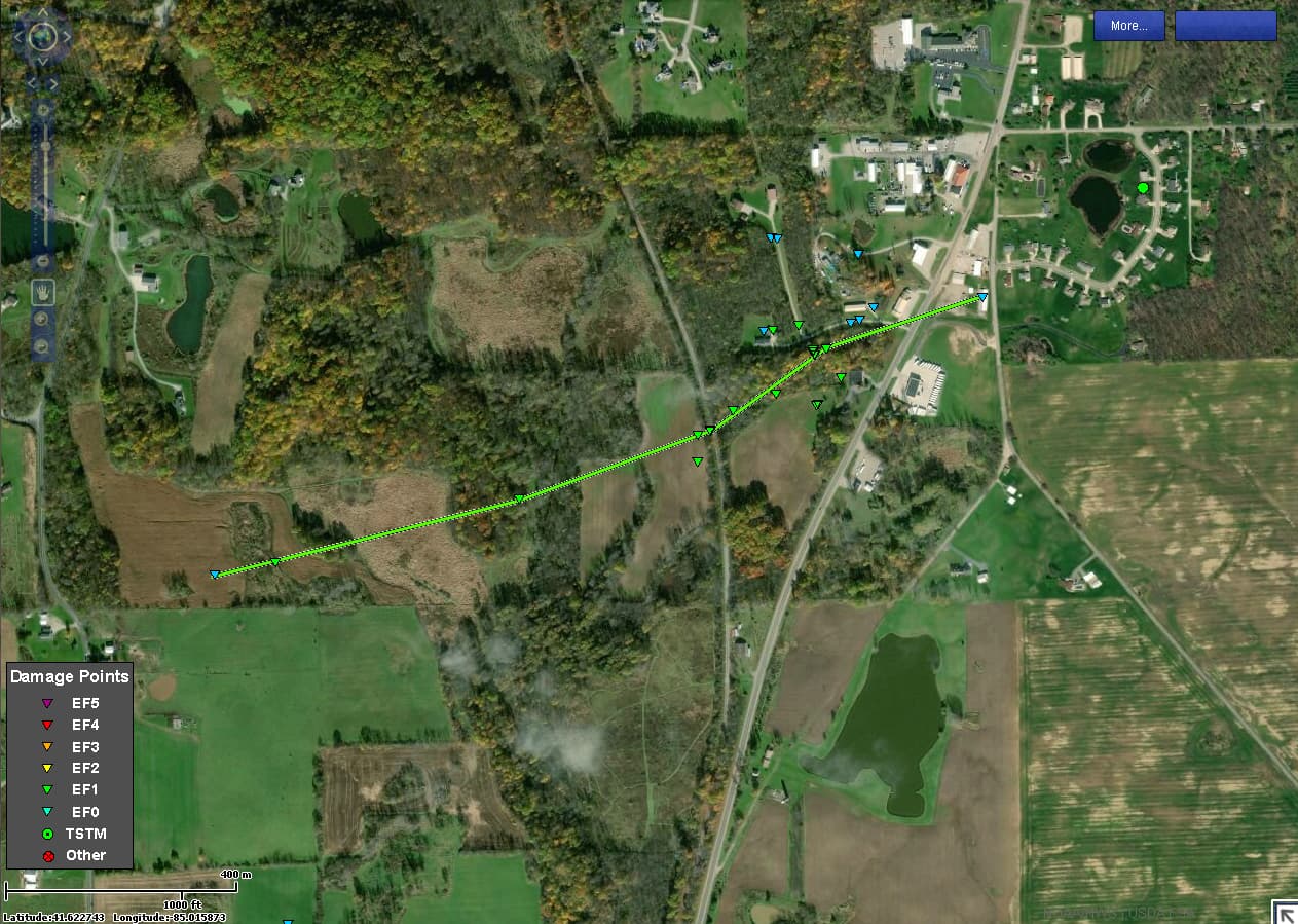
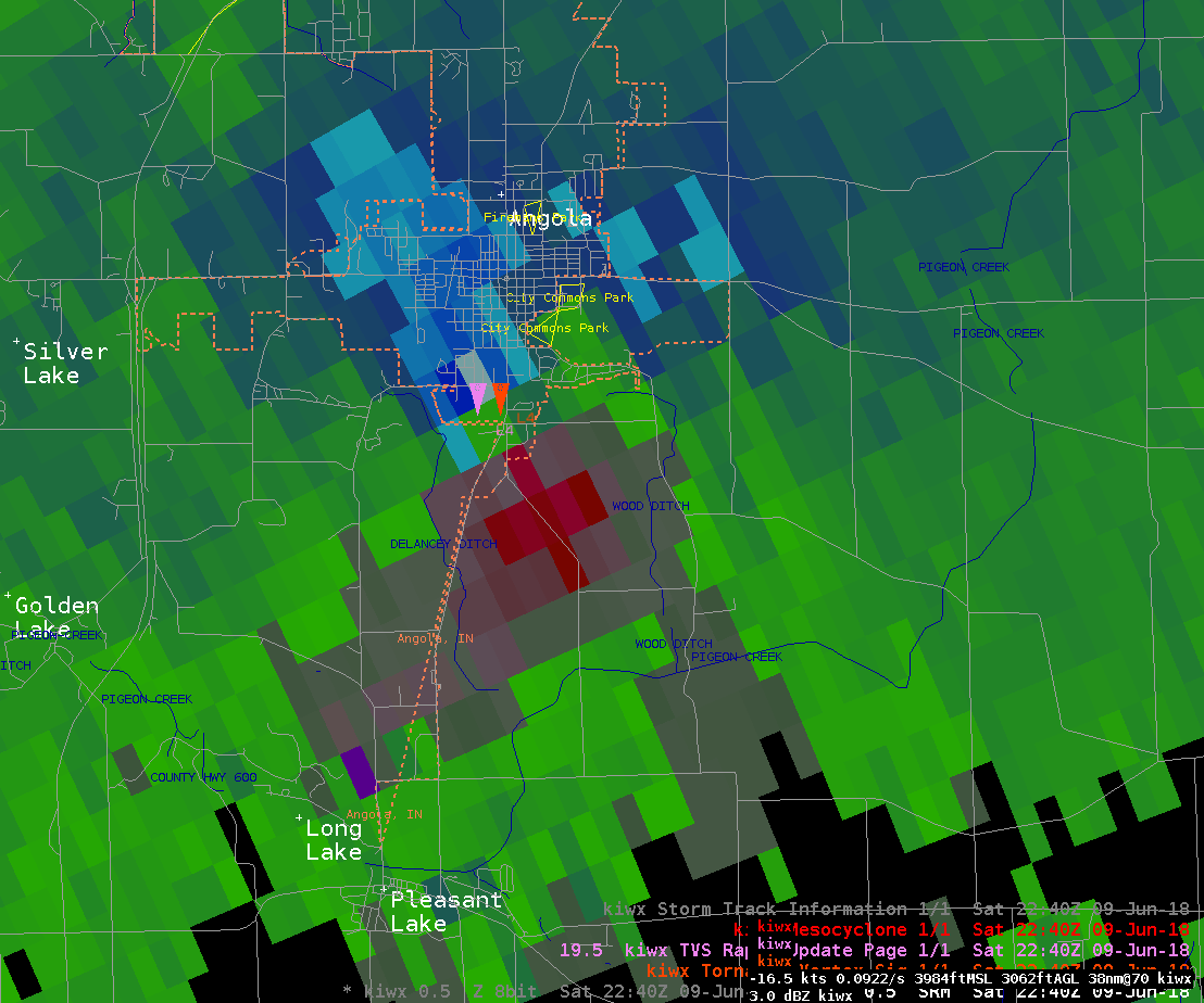
Tornado 1 - Angola, IN
Track Map
|
||||||||||||||||
|
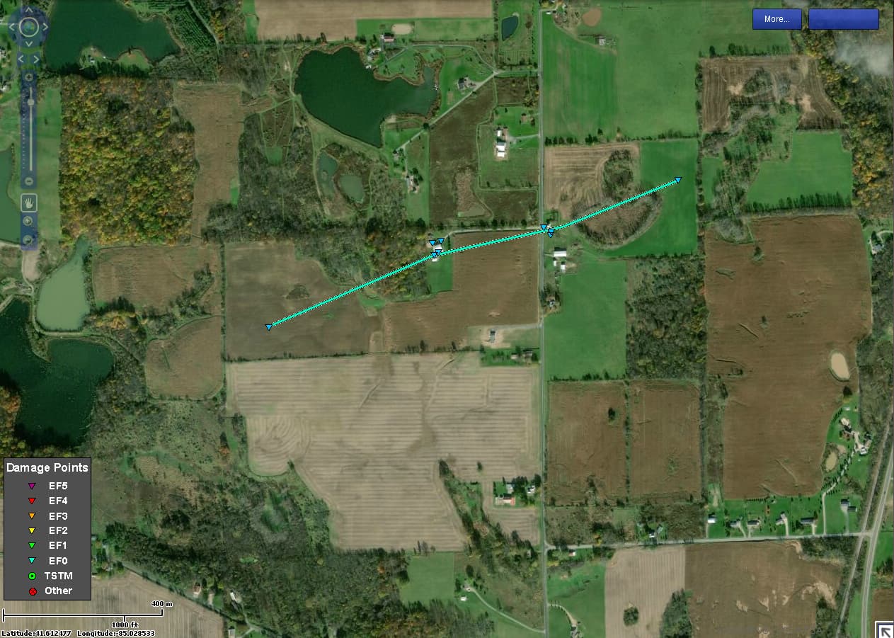
Tornado 2 - Angola, IN
Track Map
|
||||||||||||||||
The Enhanced Fujita (EF) Scale classifies tornadoes into the following categories:
| EF0 Weak 65-85 mph |
EF1 Moderate 86-110 mph |
EF2 Significant 111-135 mph |
EF3 Severe 136-165 mph |
EF4 Extreme 166-200 mph |
EF5 Catastrophic 200+ mph |
 |
|||||
Flooding
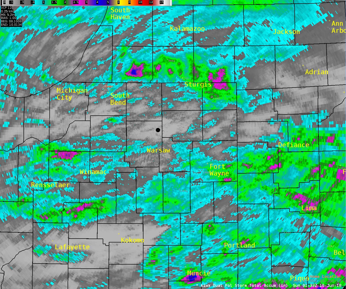
Abundant moisture was in place with this system, with Precipitable Water values over 1.75 inches. An upper level disturbance was also strengthened across the region from the overnight storms across northern Illinois. The combination of the abundant low level moisture and the slow moving upper level disturbance resulted in high rainfall rates and flash flooding. The heaviest rain on Saturday occurred across south central Lower Michigan where radar estimated that around 5 inches of rain fell across the south central portions of Cass County Michigan. As a result, flash flooding occurred near Edwardsburg, Michigan. The heavy rainfall on Saturday continued an active pattern of the previous 2 days. Pockets of heavy rain over the last few days can be seen on the radar estimated rainfall amounts below.
 |
 |
 |
 |
| Radar estimated storm total rain from June 8th-June 9th | Hydrograph from Three Rivers, MI indicating some response to the heavy rainfall | Photo captured from video taken by Sara LaMonds (Davis Lake Edwardsburg, MI) | Radar loop from about 145pm to 800pm showing evolution of heavy rain across south central Lower Michigan. |
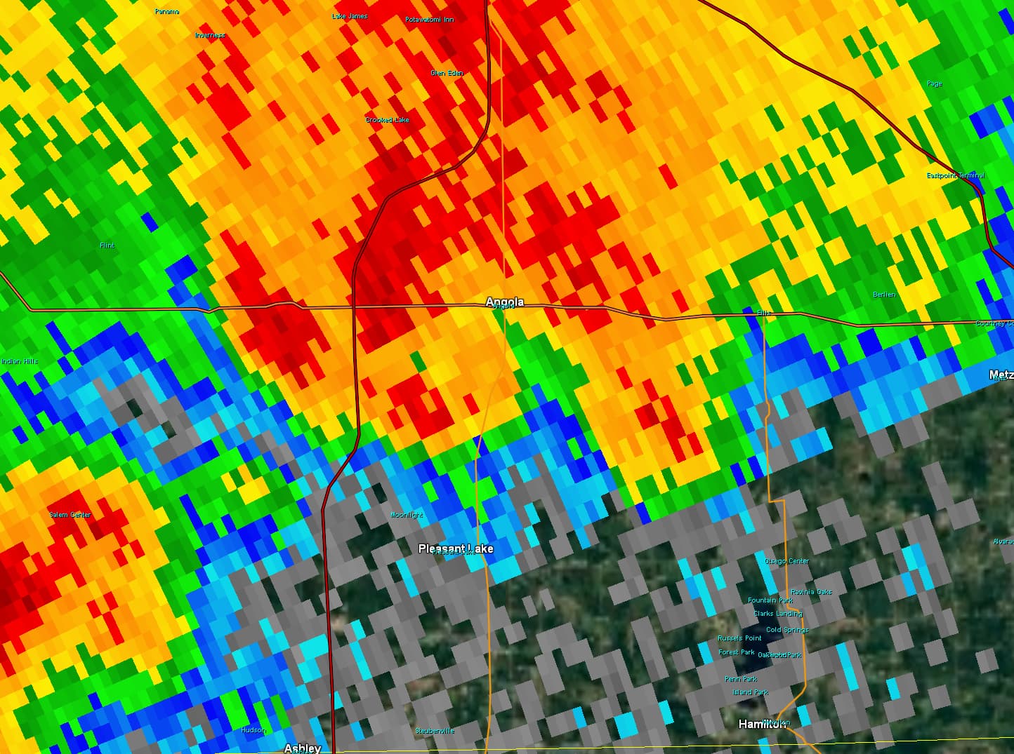
Radar:
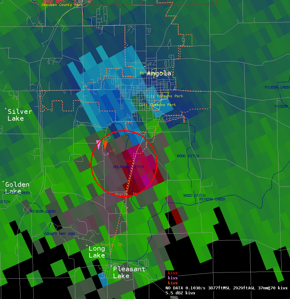
Tornadic Storm Angola, IN
 |
 |
 |
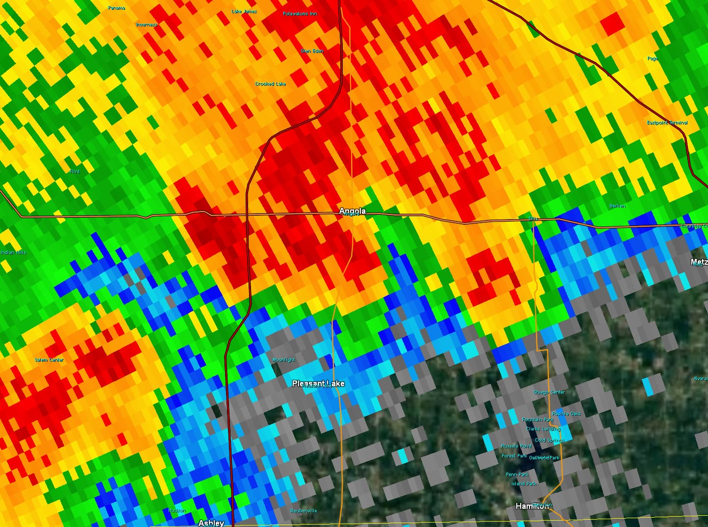 |
| Rotational couplet shown on Radar southeast of Angola city limits at 6:36 PM EDT. | Rotational couplet moves northeast into the Angola city limits at 6:40 PM EDT. | 0.5 degree base reflectivity corresponding to rotational couplet image at 6:36 PM EDT | 0.5 degree base reflectivity corresponding to rotational couplet image at 6:40 PM EDT |
Storm Reports
PRELIMINARY LOCAL STORM REPORT...SUMMARY
NATIONAL WEATHER SERVICE NORTHERN INDIANA
951 PM EDT SAT JUN 9 2018

..TIME...   ...EVENT...      ...CITY LOCATION...     ...LAT.LON...
..DATE...   ....MAG....      ..COUNTY LOCATION..ST.. ...SOURCE....
            ..REMARKS..

0240 PM     TSTM WND GST     2 E FIAT                40.55N 85.11W
06/09/2018  E65 MPH          JAY                IN   TRAINED SPOTTER

            10" DIAMETER TREE BLOWN DOWN AND NUMEROUS
            LIMBS TO 6" IN DIAMETER BLOWN DOWN.

0248 PM     HAIL             2 E FIAT                40.55N 85.11W
06/09/2018  E1.00 INCH       JAY                IN   PUBLIC


0330 PM     FLASH FLOOD      1 N EAGLE LAKE          41.82N 86.03W
06/09/2018                   CASS               MI   PUBLIC

            FLASH FLOOD VIDEO PROVIDED VIA SOCIAL MEDIA.
            TIME APPROXIMATE.

0500 PM     FLOOD            1 WSW DOWAGIAC          41.98N 86.13W
06/09/2018                   CASS               MI   TRAINED SPOTTER

            INDUSTRIAL PARK AREA SOUTHWEST OF DOWAGIAC
            IS FLOODED. ROADS IMPASSABLE.

0638 PM     TSTM WND DMG     2 S ANGOLA              41.62N 85.00W
06/09/2018                   STEUBEN            IN   EMERGENCY MNGR

            ROOF REMOVED FROM SCHOOL BUS GARAGE AND TREE
            DAMAGE OBSERVED IN THE AREA. TIME ESTIMATED
            FROM RADAR.

0755 PM     HEAVY RAIN       STURGIS                 41.81N 85.44W
06/09/2018  M1.57 INCH       ST. JOSEPH         MI   AWOS

            AWOS STATION IRS, STURGIS.

0833 PM     HEAVY RAIN       1 SE CROOKED LAKE       41.66N 85.02W
06/09/2018  M2.17 INCH       STEUBEN            IN   MESONET

            MESONET STATION C0621, 1 SE CROOKED LAKE.

0900 PM     HEAVY RAIN       2 WSW GOLDEN LAKE       41.59N 85.10W
06/09/2018  E1.31 INCH       STEUBEN            IN   COCORAHS

            RAIN OCCURRED AFTER NOON.


&&

$$
Public Information Statement...Corrected
National Weather Service Northern Indiana
944 PM EDT Sun Jun 10 2018/844 PM CDT Sun Jun 10 2018/

...NWS DAMAGE SURVEY FOR 6/09/2018 TORNADO EVENT...

.TORNADO # 1...

Rating:                 EF-1
Estimated peak wind:    105 mph
Path length /Statute/:  0.90 mile
Path width /Maximum/:   375 yards
Fatalities:             0
Injuries:               0

Start date:             6/09/2018
Start time:             6:34 PM ET
Start location:         Angola, IN
Start Lat/Lon:          41.6138/-85.0163

End date:               6/09/2018
End time:               6:40 PM ET
End location:           Angola, IN
End_lat/lon:            41.6181/-85.0002

SURVEY_SUMMARY: A weak EF-1 tornado caused widespread extensive tree
damage knocking down trees along railroad tracks. Minor roof damage
to a few structures was noted here as well.

.TORNADO #2...

Rating:                 EF-0
Estimated peak wind:    80 mph
Path length /Statute/:  0.70 mile
Path width /Maximum/:   200 yards
Fatalities:             0
Injuries:               0

Start date:             6/09/2018
Start time:             6:30 PM ET
Start location:         Angola, IN
Start Lat/Lon:          41.6050/-85.0271

End date:               6/09/2018
End time:               6:31 PM ET
End location:           Angola, IN
End_lat/lon:            41.6084/-85.0147

SURVEY_SUMMARY: A weak, but multi-funnel EF-0, according to
witnesses, touched down in an empty field and then intensified
somewhat as it rapidly tracked east northeast removing a portion of
a roof. It also caused damage to 2 barn structures as it crossed
150W and snapped/uprooted numerous trees before it lifted.

 EF Scale: The Enhanced Fujita Scale Classifies
Tornadoes into the following categories.

EF0...Weak......65 to 85 mph
EF1...Weak......86 to 110 mph
EF2...Strong....111 to 135 mph
EF3...Strong....136 to 165 mph
EF4...Violent...166 To 200 mph
EF5...Violent...>200 mph

NOTE:
The information in this statement is PRELIMINARY and subject to
change pending final review of the events and publication in
NWS Storm Data.

$$
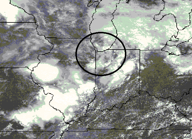
Environment
 |
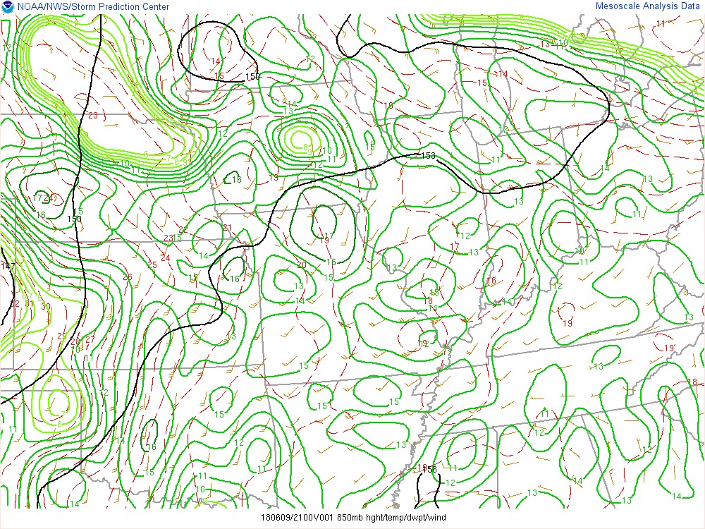 |
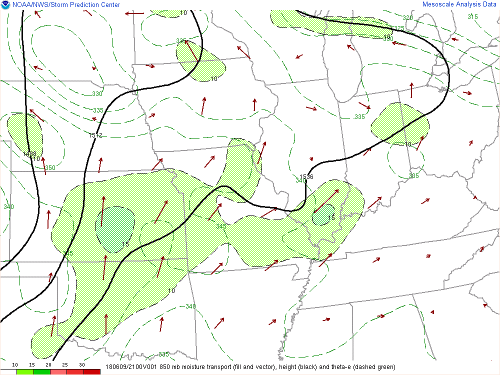 |
| Visible Satellite Imagery from around 2pm. Note the curl in the clouds coming out of northeast Illinois. This was an mesoscale convective vortex (MCV) from earlier storms across northern Illinois that aided in renewed thunderstorm development. | 850 mb RAP analysis from 5pm. Note the small scale cyclonic circulation across northern Indiana associated with the MCV moving out of northern Illinois. | 850 mb RAP analysis from 5pm of 850 mb moisture transport. Notice weak axis of low level moisture transport into northeast Indiana at this time. |
 |
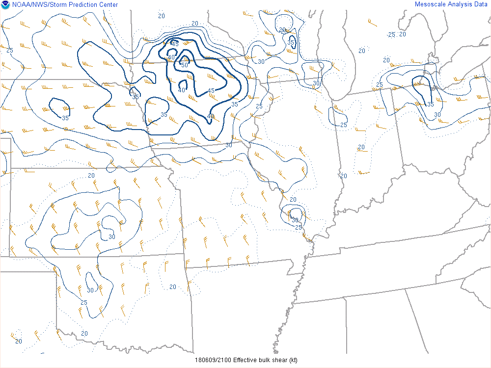 |
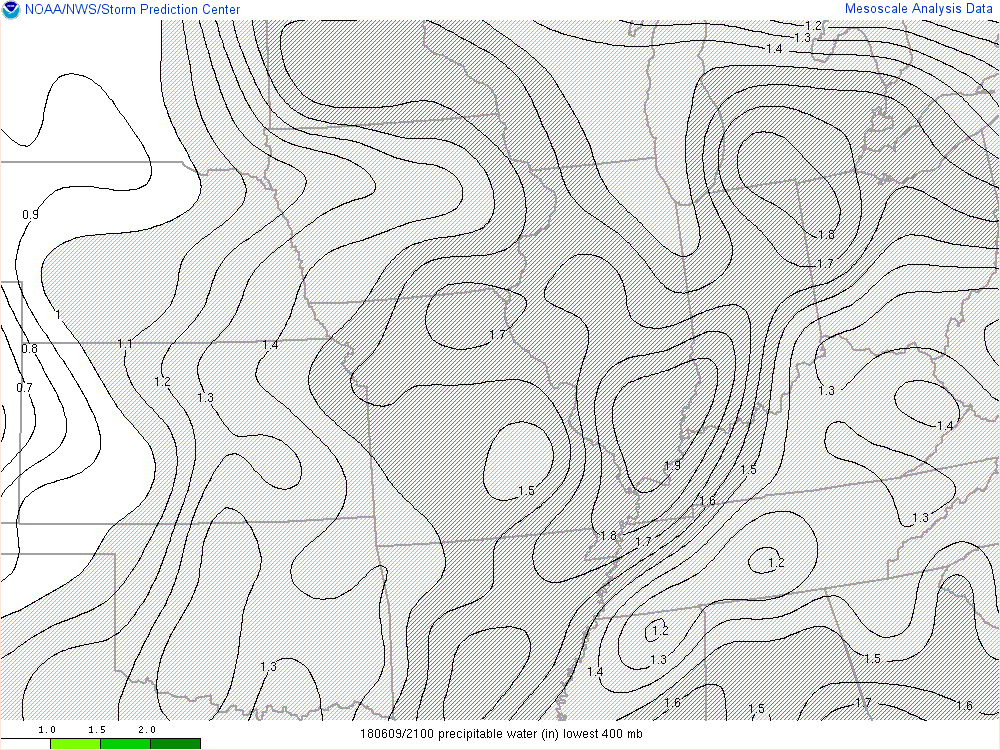
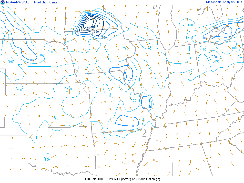 |
| RAP analysis from 5pm of precipitable water (PWAT). Note a bullseye of very high PWAT's across far northern Indiana/southern Lower Michigan of 1.8+ inches. | RAP analysis of effective shear from 5pm. Note the pocket of slightly higher effective shear across northeast Indiana (25-30 knots). | RAP analysis of 0-3 km storm relative helicity (SRH). Note the pocket of slightly enhanced 0-3 km SRH values across northeast Indiana. |
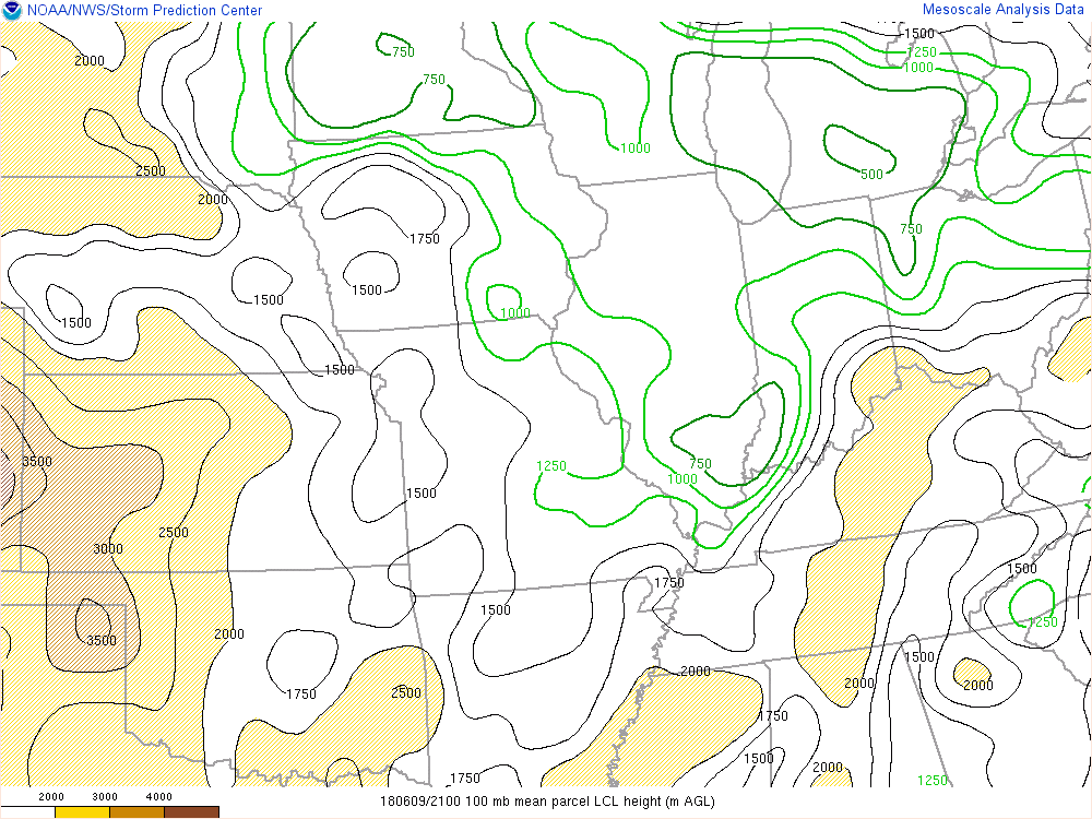 |
| RAP analysis of Lifting Condensation Level (LCL) heights from 5pm. Note the relative minimum in LCL heights across southern Lower Michigan/extreme NE Indiana. Lower LCL heights provide a favorable environment for tornadoes. |
 |
Media use of NWS Web News Stories is encouraged! Please acknowledge the NWS as the source of any news information accessed from this site. |
|