Overview
|
A look back on the 50th anniversary of the April 3, 1974 Super Outbreak For more on this historical event, see:- NWS Wilmington, OH - NWS Indianapolis, IN - NWS Lincoln, IL - IN Dept of Homeland Security |
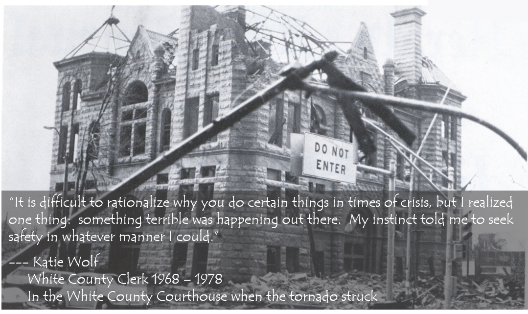 Monticello Court House Monticello Herald |
|
Tornadoes
Tornado Tracks 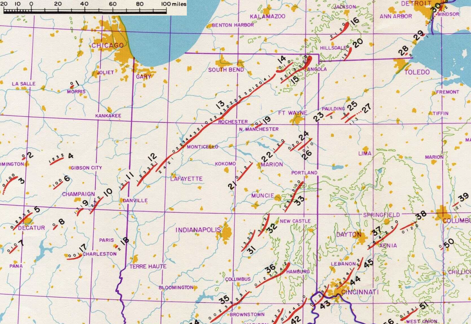 |
||||||||||||||||||||||||||||||||||||||||||||||||||||
The Fujita (F) Scale classifies tornadoes into the following categories:
| F0 Weak < 73 mph |
F1 Moderate 73 - 112 mph |
F2 Significant 113 - 157 mph |
F3 Severe 158 - 206 mph |
F4 Extreme 207 - 260 mph |
F5 Catastrophic 261 - 318 mph |
 |
|||||
Photos
Monticello, IN
 |
 |
 |
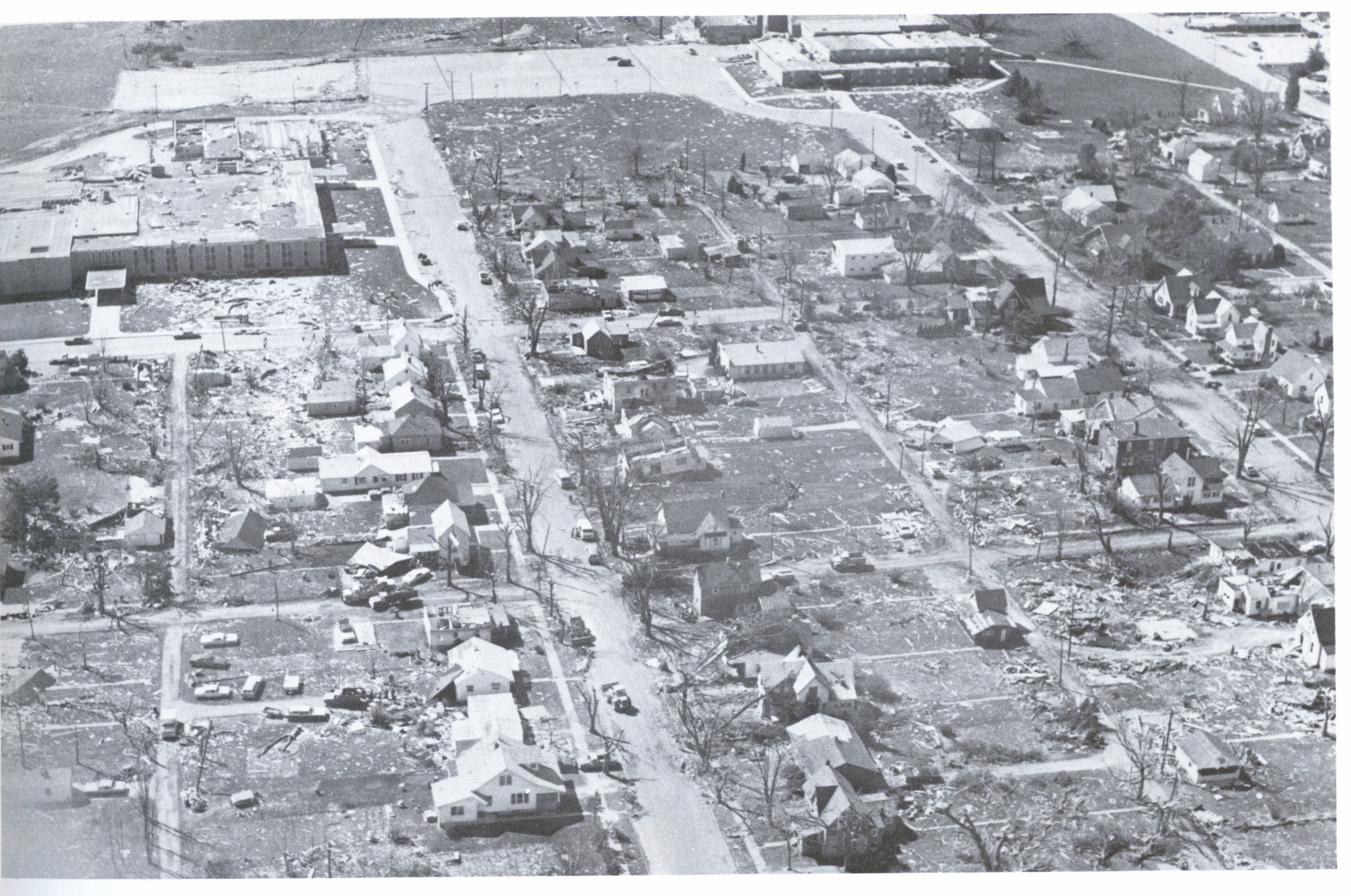
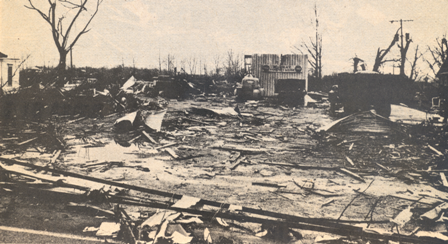
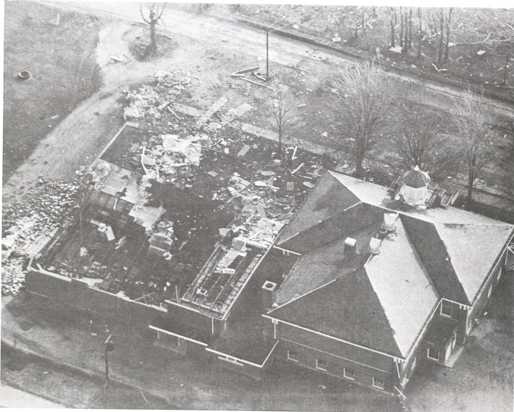
| Damaged School and Residential Area (Monticello Herald) |
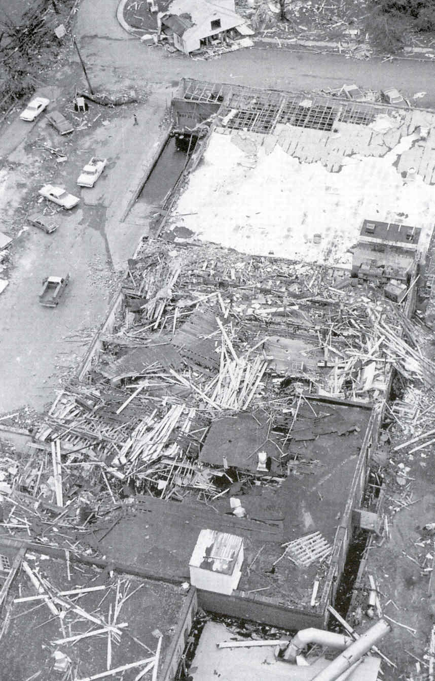
Bryan's Department Store (Monticello Herald) |
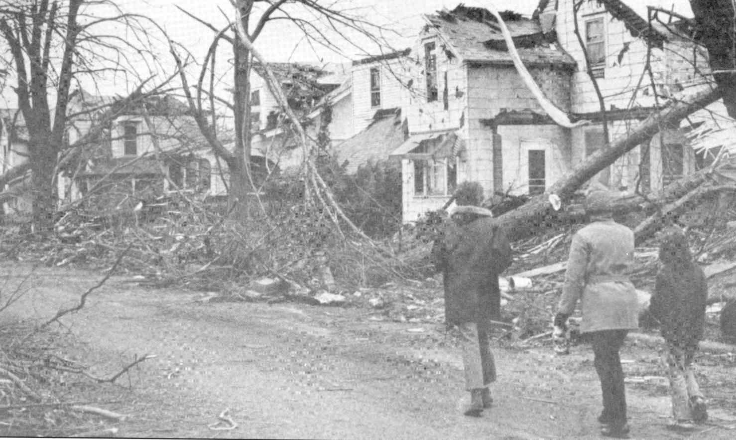
Harrison Street (Monticello Herald) |
 |
 |
 |
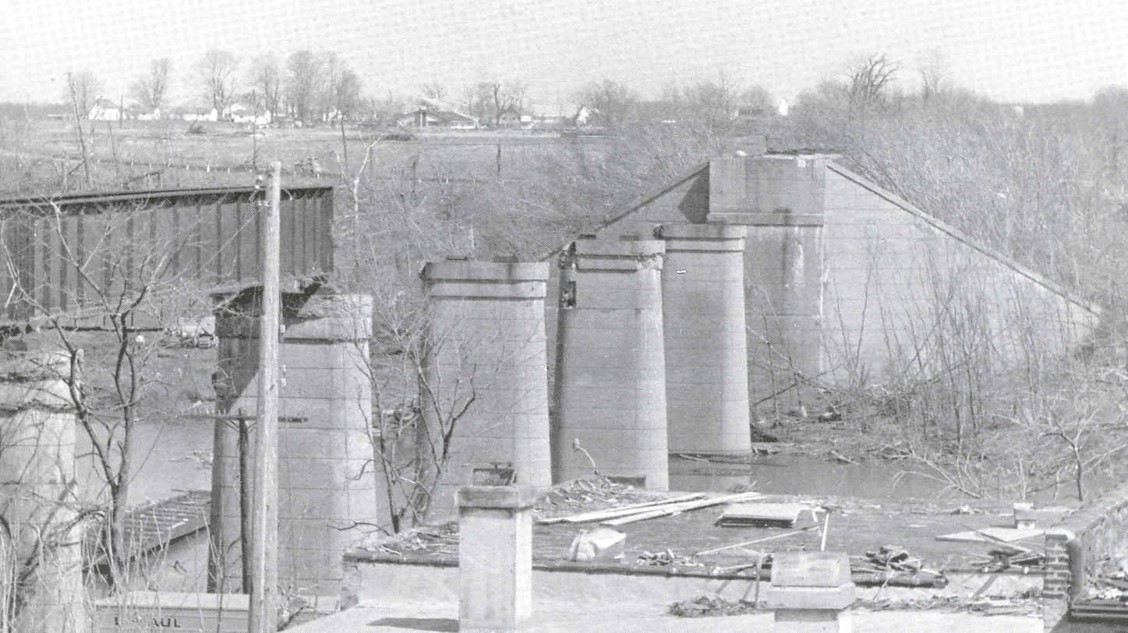
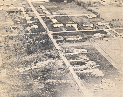
| Penn-Central Railroad Trestle (Monticello Herald) |
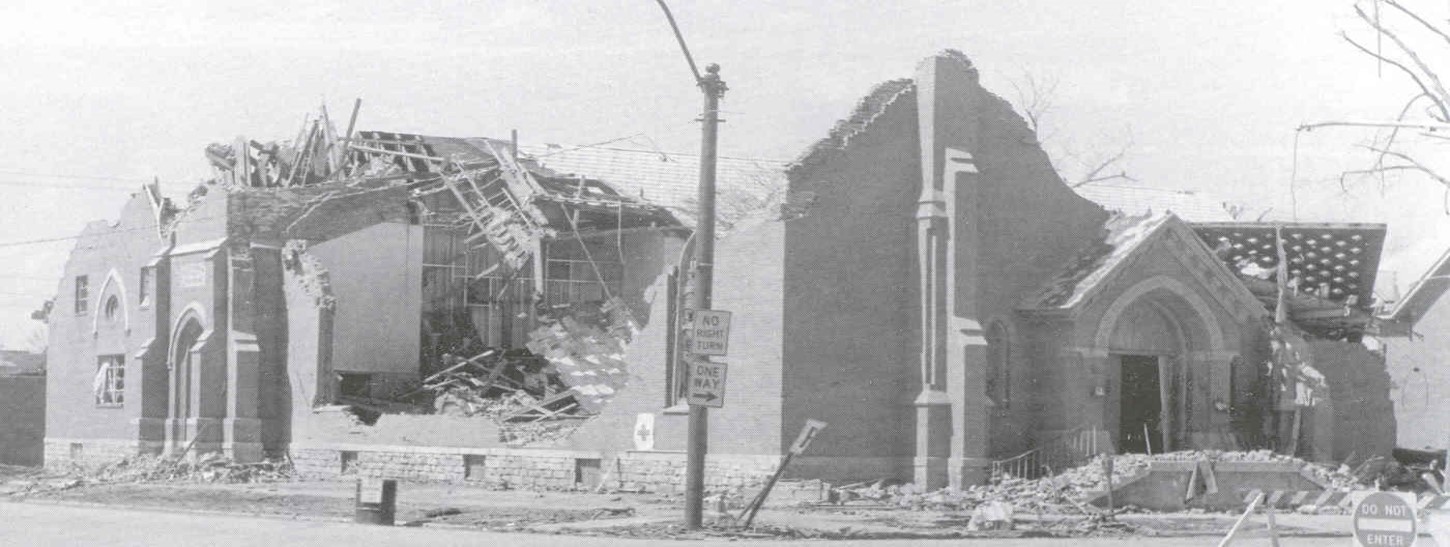
Presbyterian Church (Monticello Herald) |
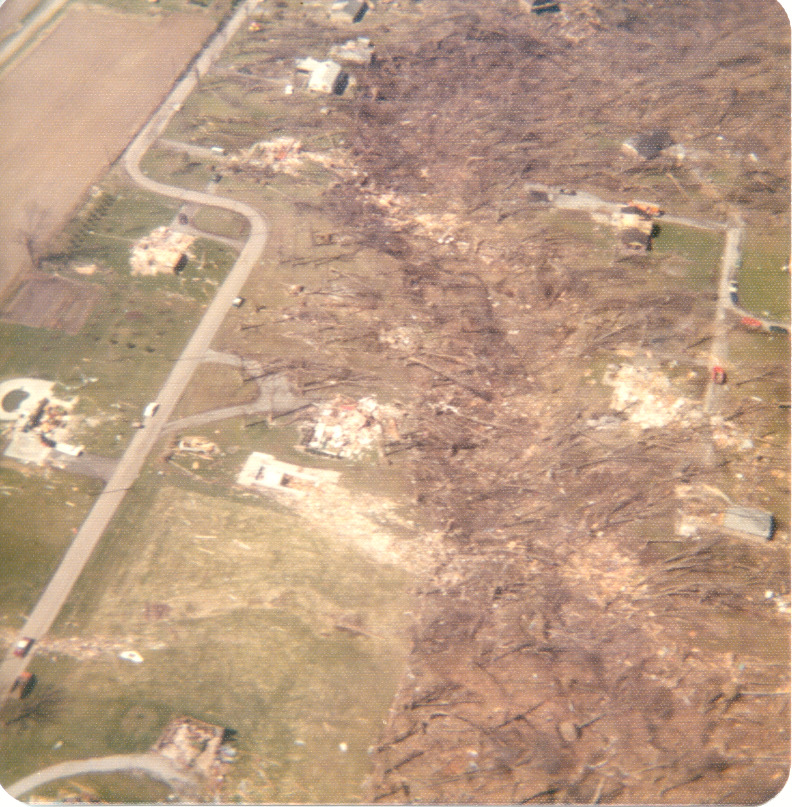
Hickory Ridge subdivision (Steve Weisser) |
Rochester/Talma, IN
 |
 |
 |
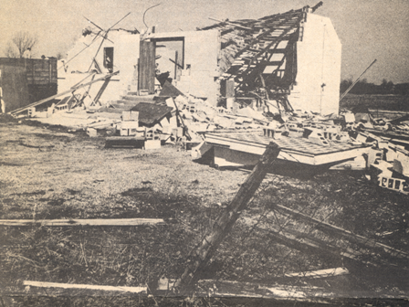
| What's left of a 6th street home (Rochester Sentinel) |
Devastation along County Road 50 (Rochester Sentinel) |
Murray Radiator and Garage on US 31 (Rochester Sentinel) |
 |
 |
 |
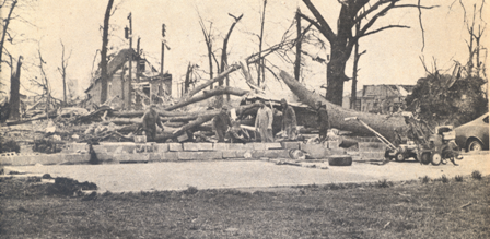
| Destroyed homes on 6th street (Tom Zoss) |
Talma School (Tom Zoss) |
Dean Milk Plant (Tom Zoss) |
Lakes Region (North central and northeast Indiana)
 |
 |
 |
 |
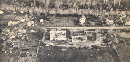
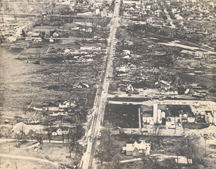
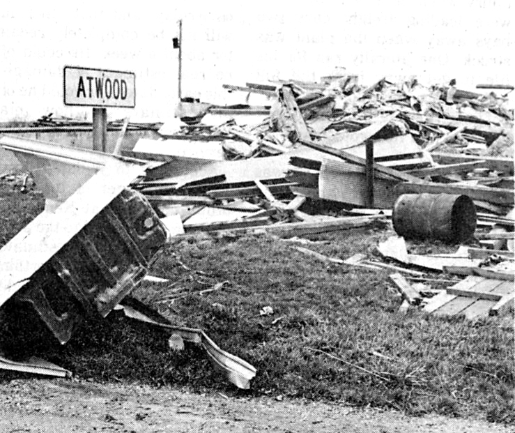
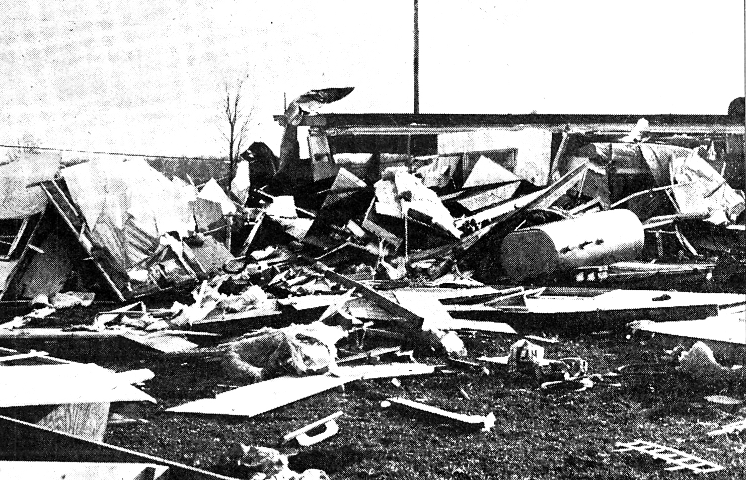
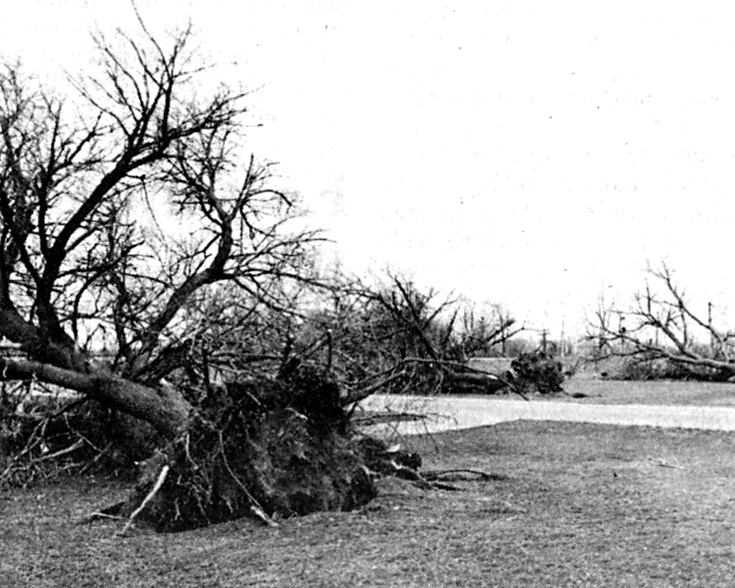
| Atwood Damage (Mail Journal) |
Dewart Lake (Mail Journal) |
Wawasee Golf Course (Mail Journal) |
Perry School (Lagrange News Sun) |
Miscellaneous Photos
 |
 |
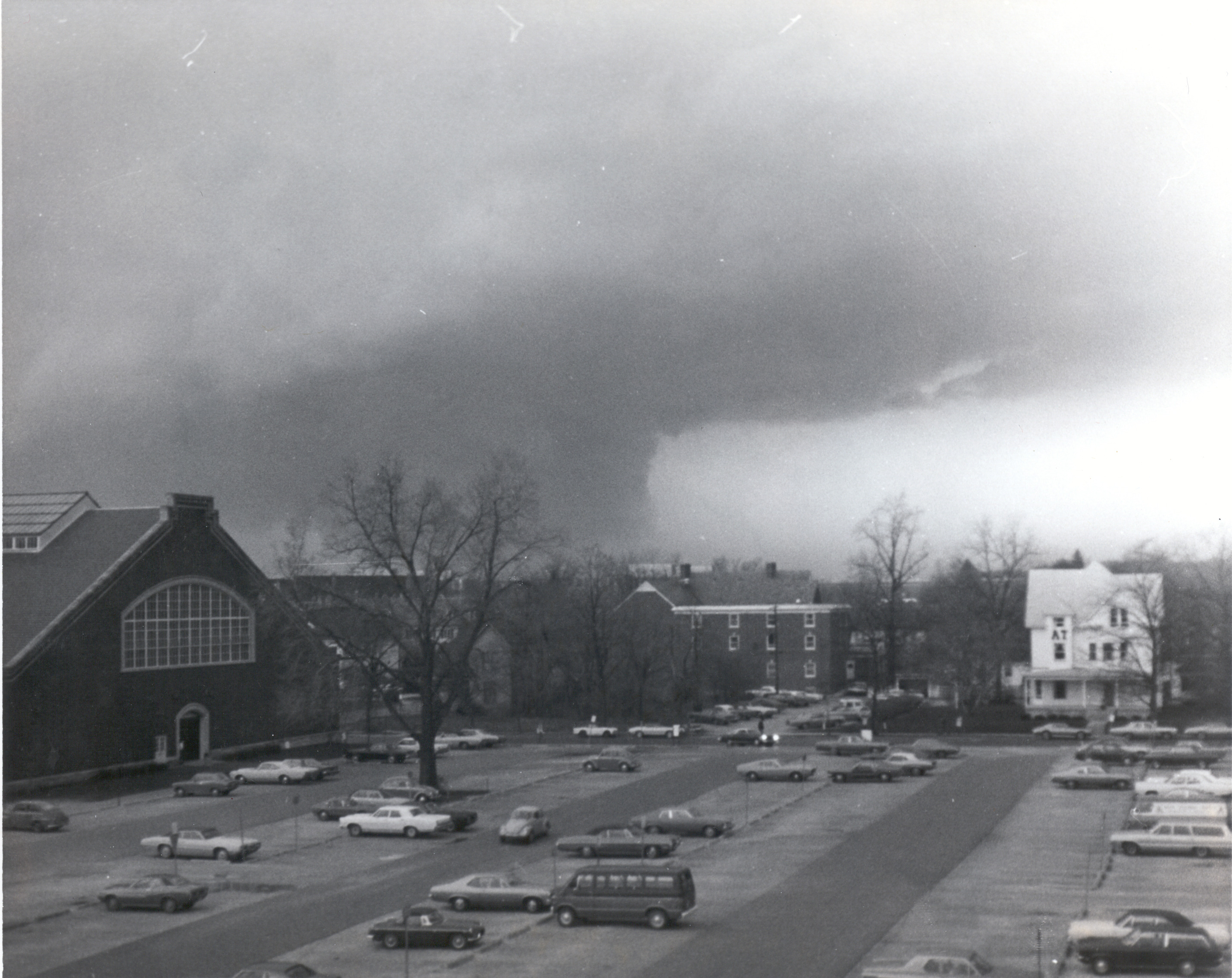
| Wall cloud descending on the Purdue University Campus (Dr. Agee) |
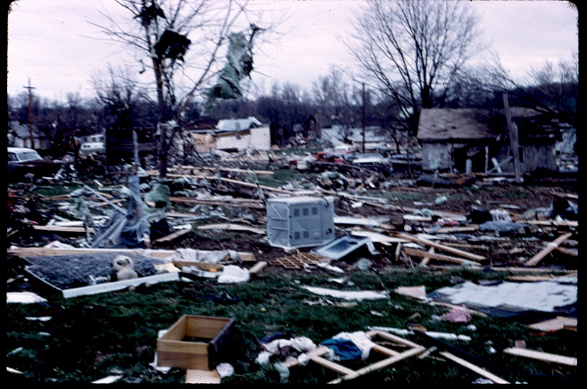
Devastation in Rainwater, IN (Dr. Agee) |
Radar
| Marseilles Illinois (MMO) WSR-74C Radar Loop | Champaign Illinois (CMI) CHILL Radar Loop |
Environment
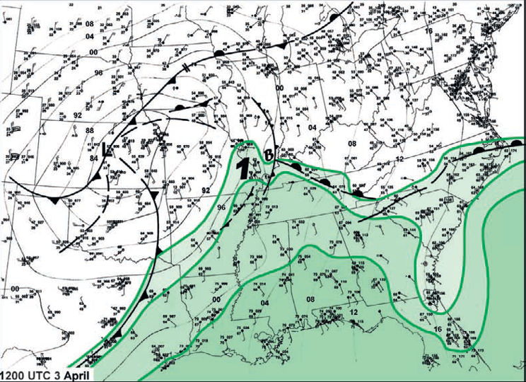
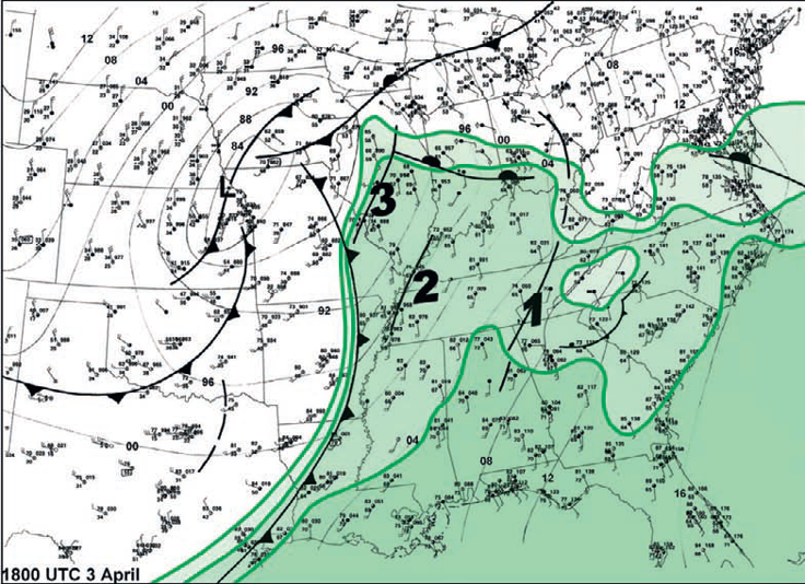
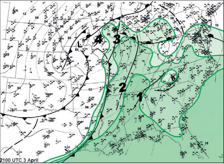
Surface Evolution
 |
 |
 |
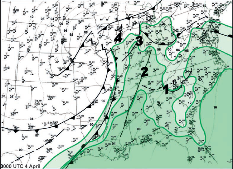 |
| Figure 1: April 3, 1974 8am SFC Map | Figure 2: April 3, 1974 2pm SFC Map | Figure 3: April 3, 1974 5pm SFC Map | Figure 4: April 4, 1974 8pm SFC Map |
Upper Air Evolution
 |
 |
 |
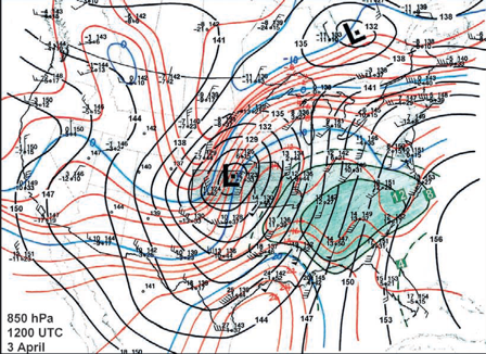 |
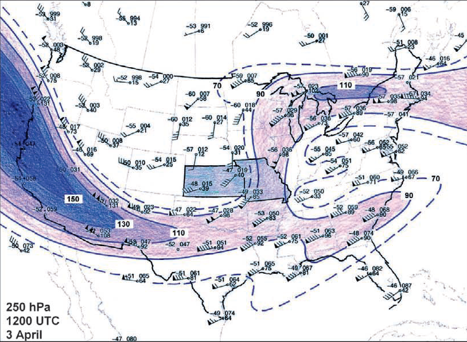
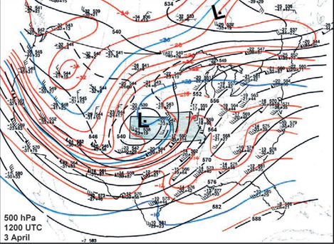
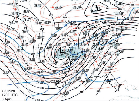
| Figure 5: April 3, 1974 8am 250mb analysis | Figure 6: April 3, 1974 8am 500mb analysis | Figure 7: April 3, 1974 8am 700mb analysis | Figure 8: April 3, 1974 8am 850mb analysis |
 |
 |
 |
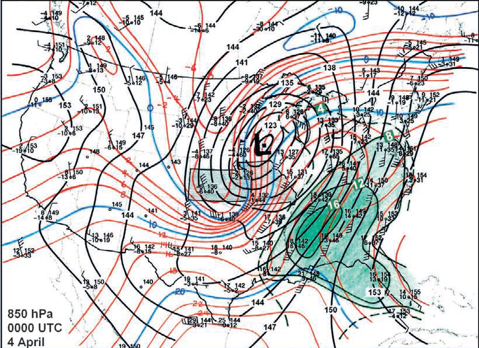 |
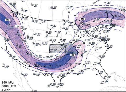
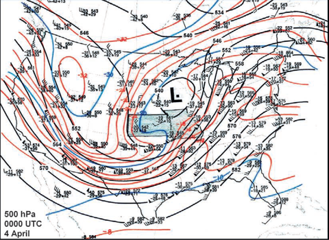
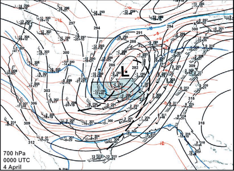
| Figure 9: April 4, 1974 8pm 250mb analysis | Figure 10: April 4, 1974 8pm 500mb analysis | Figure 11: April 4, 1974 8pm 700mb analysis | Figure 12: April 4, 1974 8pm 850mb analysis |
Upper Air Soundings
 |
 |
 |
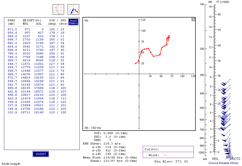 |
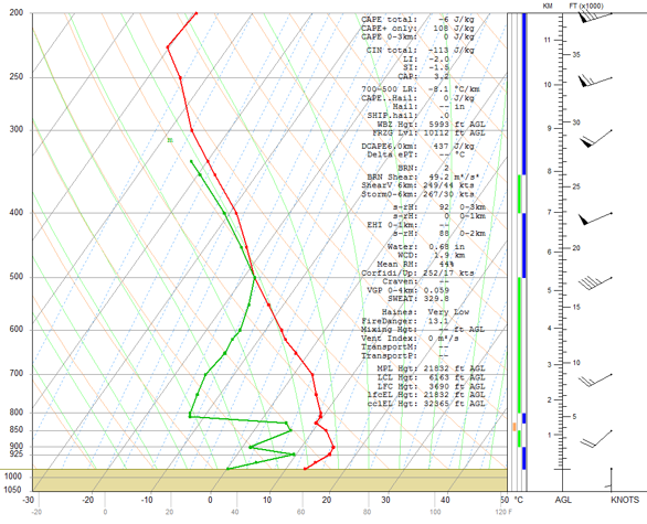
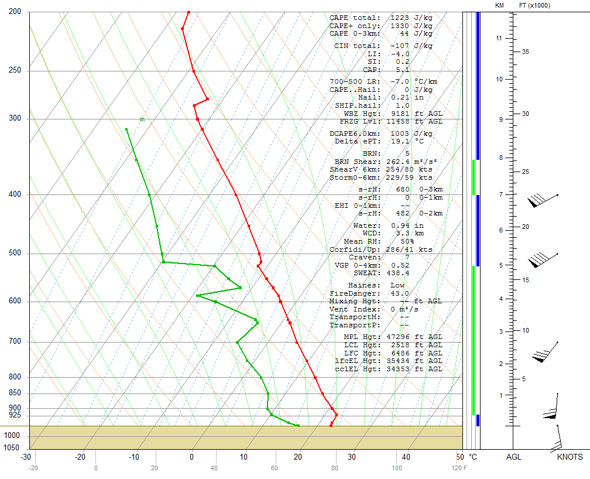
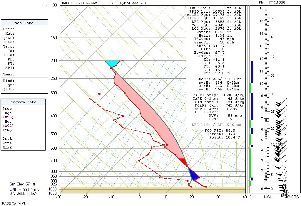
| Figure 13: April 3, 1974 8am Dayton, OH Sounding | Figure 14: April 4, 1974 8pm Dayton, OH Sounding | Figure 15: April 3, 1974 2pm Lafayette, Indiana Sounding | Figure 16: April 3, 1974 2pm Lafayette, Indiana Hodograph |
 |
Media use of NWS Web News Stories is encouraged! Please acknowledge the NWS as the source of any news information accessed from this site. |
|

