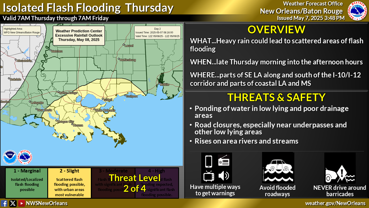
Another round of heavy rainfall is expected to impact portions of the area today. Recent heavy rainfall in the area, especially for areas east of I-55 in southeast Louisiana and coastal Mississippi has already led to flooding issues. Any additional rainfall in these areas, even light rain, could lead to additional flooding concerns. Given these concerns, a flood watch is in effect from 7 am to 7 pm tomorrow for the entire region. Please stay weather aware today and remember to turn around don't drown if you encounter a water covered road while driving.


 Local Radar
 Weather Map
 Tropical Weather Outlook
 Graphical HWO
 Climate Data for Today