June 2nd and 3rd, 2018 Bow Echoes
Two separate bow echoes wreaked havoc across portions of the Mid-South late Saturday night into the early morning hours on Sunday June 3rd, 2018. The term "bow echo" comes from the distinctive shape and signature of a cluster of thunderstorms on radar. The bow shape is caused by upper level winds that mix down to the surface and spread out horizontally. Bow echoes often leave widespread damage in their wake, as was the case with these two particular storms that night.
1st Bow Echo:
A very unstable airmass was in place across the entire Mid-South that evening. A measure of the amount of energy in the atmosphere, referred to as "CAPE", weighed in on the upper half of the scale. For this, the Storm Prediction Center issued an Enhanced Risk (3/5) for the areas along and west of the Mississippi River due to the threat of severe thunderstorms. At 3PM Saturday afternoon, a Severe Thunderstorm Watch was issued and was to last until 10PM. Some uncertainty did remain as to what time the storms would arrive and where they would hit.
Shower and thunderstorm activity remained relatively quiet across the Mid-South until around 830 PM that evening. Thereafter, thunderstorms began to fire up across southeastern Missouri, with a southward track aimed towards the Mid-South. Air temperatures across much of the Mid-South were still in the mid to upper 80's around 9 PM CDT, indicating that the atmosphere was still prime for strong to severe thunderstorms.
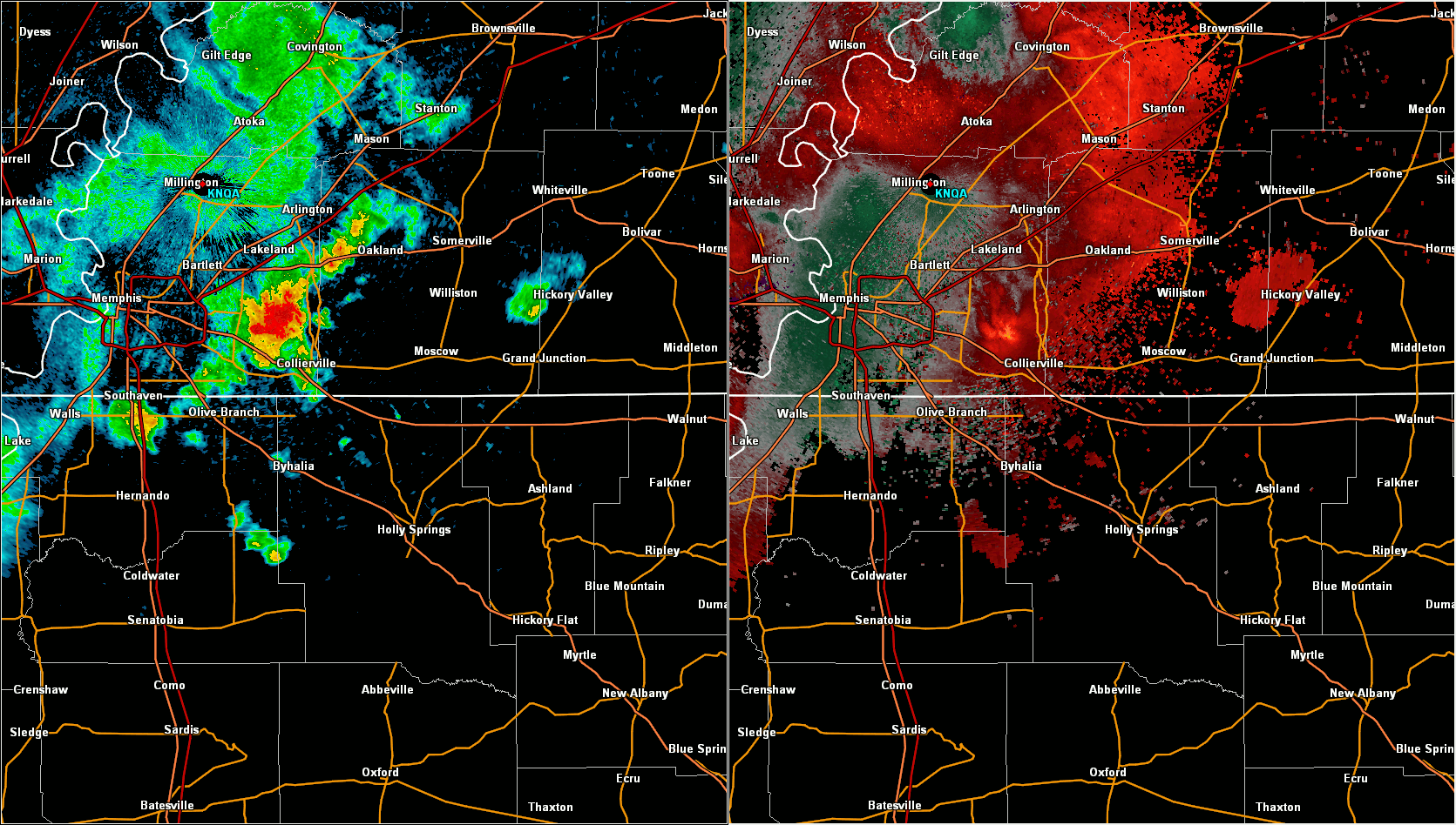
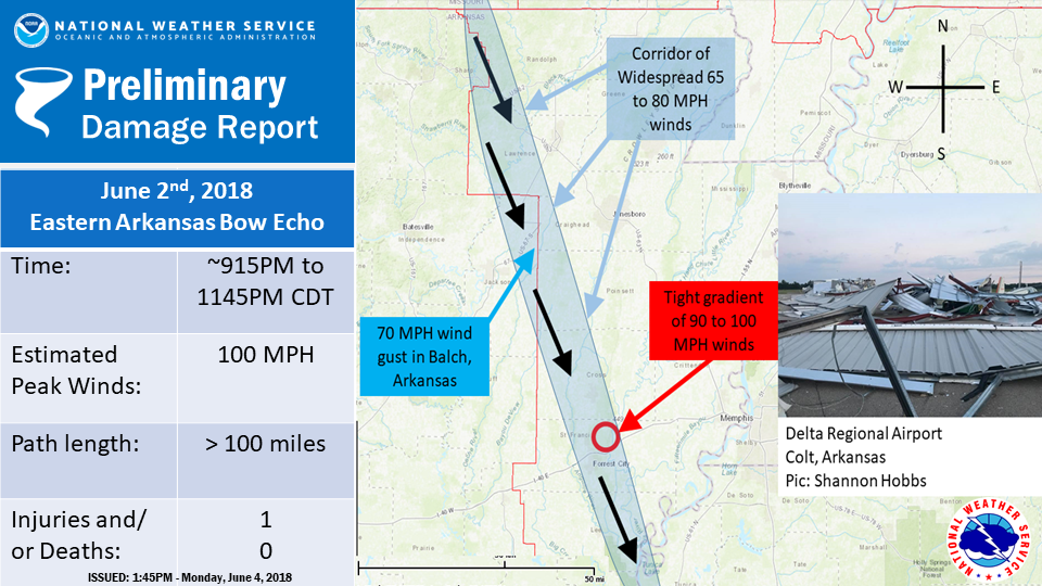
The main cluster of storms arrived in Eastern Arkansas just after 9PM. The bow echo was well organized as it began to move south southeast into Randolph County, Arkansas around 915 PM. A Severe Thunderstorm warning was issued ahead the Bow's arrival. From there, the Bow Echo continued SSE all the way through Eastern Arkansas. Widespread 60 to 80 mph winds caused tree damage, took down powerlines, blew away grain bins, and even destroyed an entire regional airport near Forrest City, Arkansas. The damage path extended from Imboden all the way down to Marianna, Arkanas. Preliminary damage estimates are near the 10 Million Dollar mark. Pictured below is the radar imagery and the approximate damage path for the bow echo.
Radar Imagery of the first Bow Echo in Eastern Arkansas.
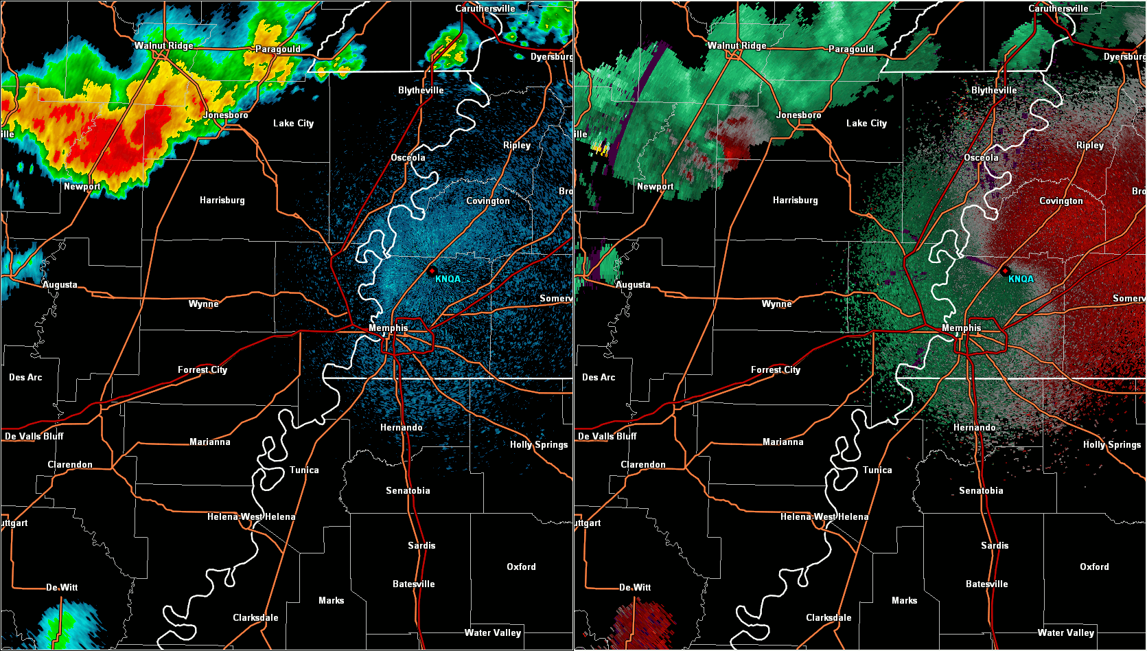
Note the "Bow-like" appearance in the Reflectivity. This image shows Doppler velocity. The yellow areas
signify 70+ mph winds
Preliminary Damage Survey (completed the afternoon of June 3rd)
2nd Bow Echo:
A second and separate bow echo formed just after midnight. This particular storm actually fired up in southeastern Shelby County and then accelerated southeastward into Marshall County, MS. The city of Holly Springs was hit particularly hard with extensive tree and powerline damage. Damage was noted as far north as Mt. Pleasant and all the way down into Potts Camp, MS.