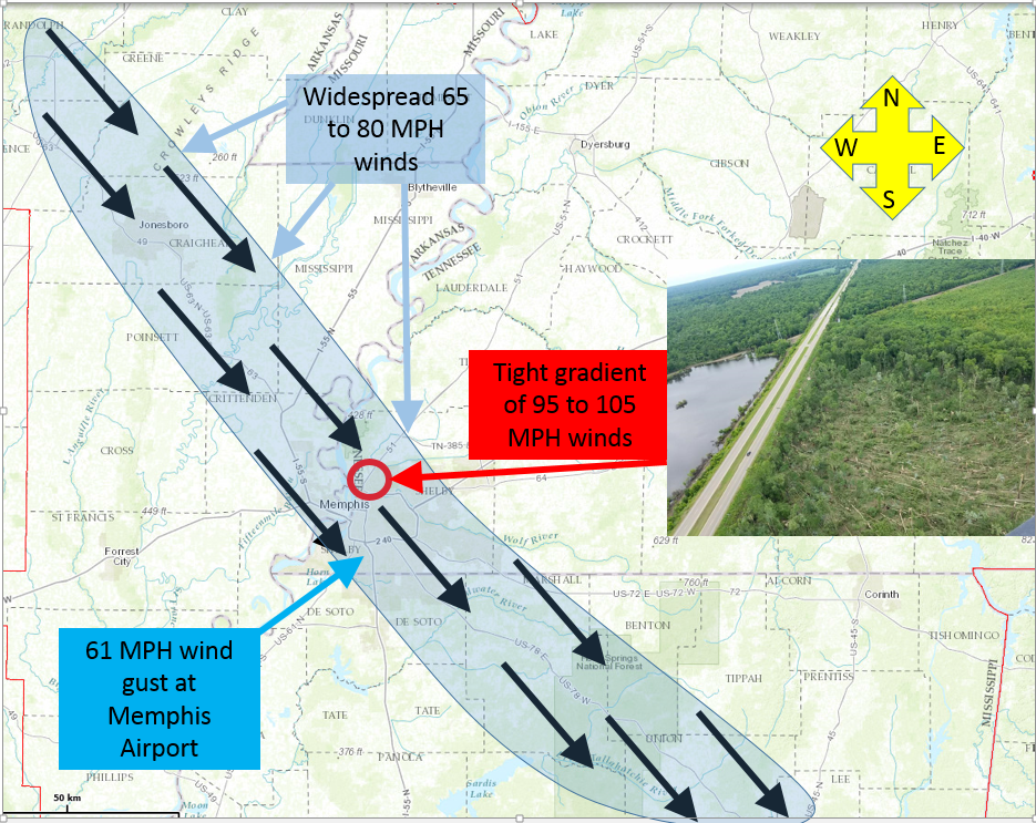
Overview:
A widespread damaging wind event (aka Derecho) began late evening May 27th and continued into early morning hours on May 28th across the Mid-South region. Considerable damage occurred to trees and power infrastructure, which spanned over 240 miles and covered portions of four states. Estimated maximum winds of 105 MPH occurred near the Arkansas/Tennessee State line, where roughly 100 to 200 trees were flattened. The city of Memphis experienced its 3rd largest power outage ever, with nearly 175,000 customers left without power after the storms rolled through.
Synopsis:
A very humid and unstable airmass was in place over the region during the day on Saturday, but the atmosphere remained capped for much of the day, keeping the atmospheric energy bottled up. However, around approximately 9PM CDT, a line of thunderstorms entered Randolph County, Arkansas from the northwest. The line of storms quickly pushed southeast around 60 to 70 mph. As it passed Corning Airport at 9:15 PM CDT, a 68 MPH gust was recorded at the Automated Weather Observing System (AWOS). From there, the bow echo (shape of the radar signature) continued southeastward at 60 to 70 MPH. Widespread damage began in Walnut Ridge, and continued into Jonesboro, Arkansas, where a roof was blown off a large metal shop. The line of storms continued to pack a punch as it moved into the Memphis metro. At the Memphis Airport, a 61 MPH wind gust was recorded at 11:12 PM CDT, with another gust of 67 MPH at approximately 11:15 PM CDT. North Memphis and Midtown Memphis were hit particularly hard, with downed large trees and powerlines on almost every major thoroughfare.
Damage continued roughly along the I-22 corridor out of Memphis, through Olive Branch, Holly Springs, New Albany, and into Fulton, MS, knocking down several trees and powerpoles in its wake.
Fortunately, no deaths occurred, and just two injuries were reported. The storm exited Monroe County, MS around 2:00 AM CDT, at which point damage ceased across the Mid-South.
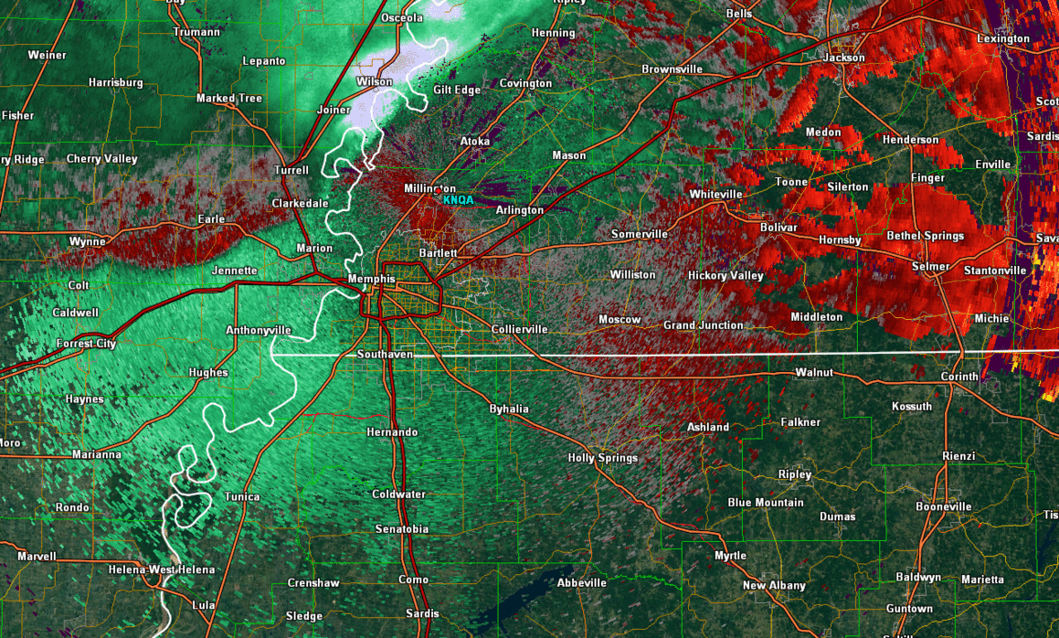
Radar Reflectivity Loop
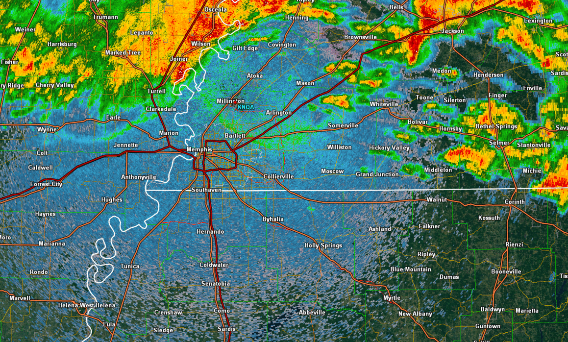
Radar Velocity Loop (strongest winds in yellow)