Memphis, TN
Weather Forecast Office
Houston and New Wren, MS EF-3 Tornado
Tornado Track Map:
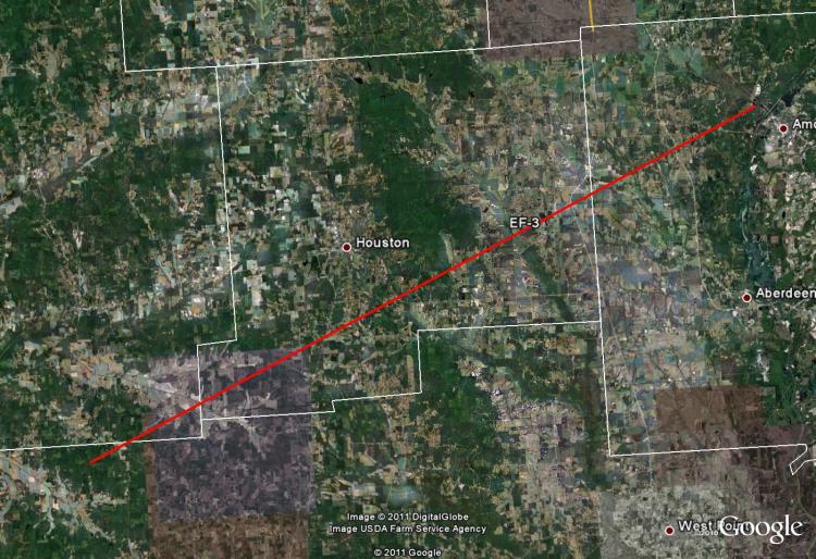
Survey Results:
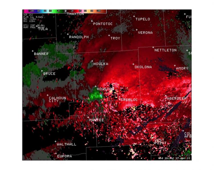
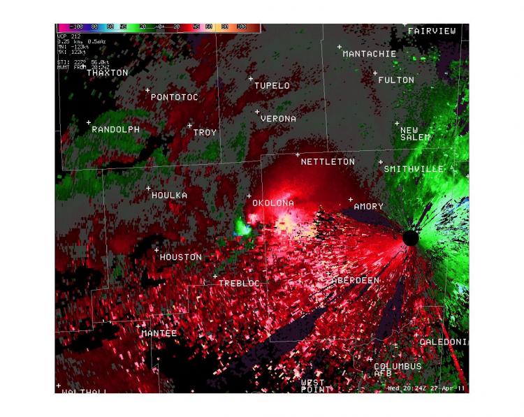
...PRELIMINARY EF-3 TORNADO IN CALHOUN...CHICKASAW AND MONROE COUNTIES IN MISSISSIPPI...
* COUNTIES: CALHOUN...CHICKASAW AND MONROE
* LOCATION: EXTREME SOUTHEASTERN CALHOUN COUNTY TO COUNTY RD 69 IN
  CHICKASAW CO TO HIGHWAY 6 NEAR BIGBEE IN MONROE COUNTY.
* TIME: 304 PM ON WEDNESDAY APRIL 27 2011
* BEGINNING POINT: 33.704, -89.311
* ENDING POINT: 34.0078, -88.5186
* RATING: EF-3
* ESTIMATED PEAK WIND: 150 MPH
* PATH LENGTH: 49.9 MILES
* MAXIMUM WIDTH: 3/4 MILE
* FATALITIES: 7
* INJURIES: 7
* SUMMARY OF DAMAGES: 15 TO 20 HOMES DAMAGED OR DESTROYED...
  HUNDREDS OF TREES SNAPPED AND/OR DEBARKED...POWER LINES DOWN.
  FATALITIES AND INJURIES OCCURRED NEAR HOUSTON AND NEW WREN.
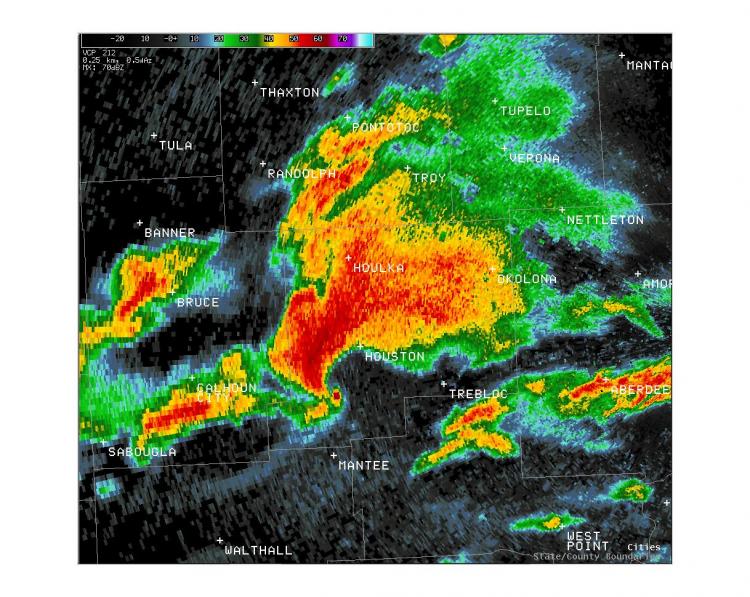
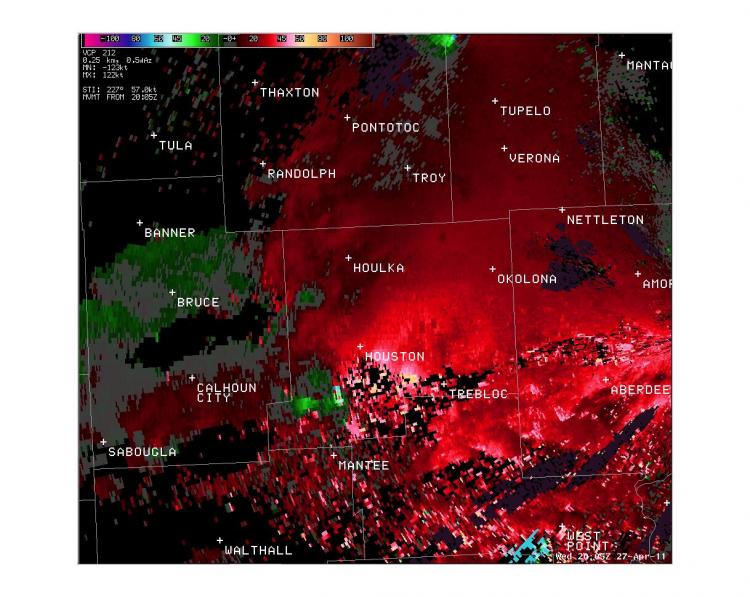
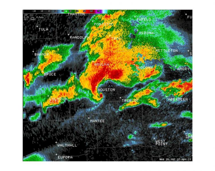
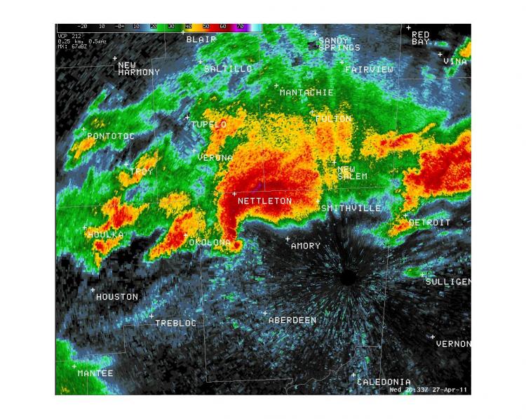
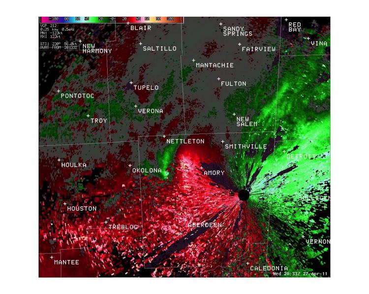
Radar Images:
 |
 |
 |
 |
 |
 |
 |
 |
CURRENT HAZARDS
Briefing Page
Outlooks
Submit a Storm Report
Submit a Storm Photo
View Storm Report
Spot Forecast Request
Hazard Outlook
FORECASTS
Local
Graphical
Probabilistic
Precipitation
Aviation
Fire
Severe Weather
Winter Weather
Tropical Weather
Air Quality
US Dept of Commerce
National Oceanic and Atmospheric Administration
National Weather Service
Memphis, TN
7777 Walnut Grove Road, OM1
Memphis, TN 38120
(901) 544-0399
Comments? Questions? Please Contact Us.

