Memphis, TN
Weather Forecast Office
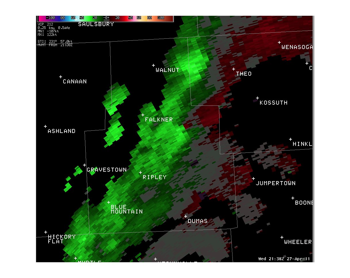
Tippah County, MS EF-1 Tornado
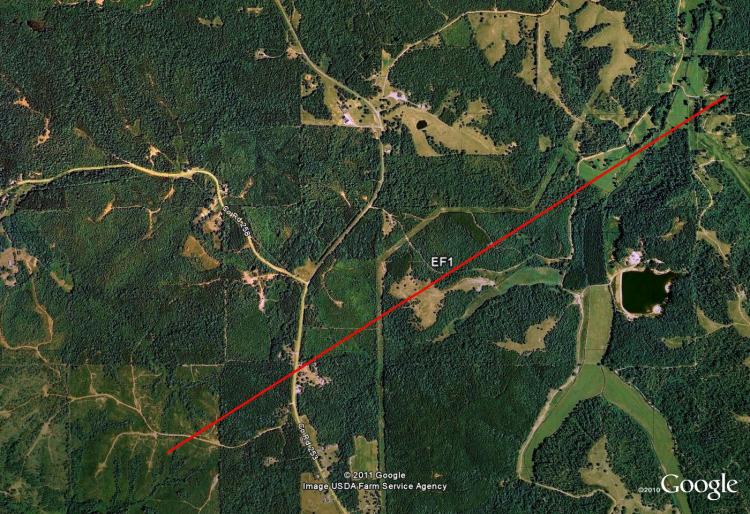
Tornado Track Map:
Survey Results:
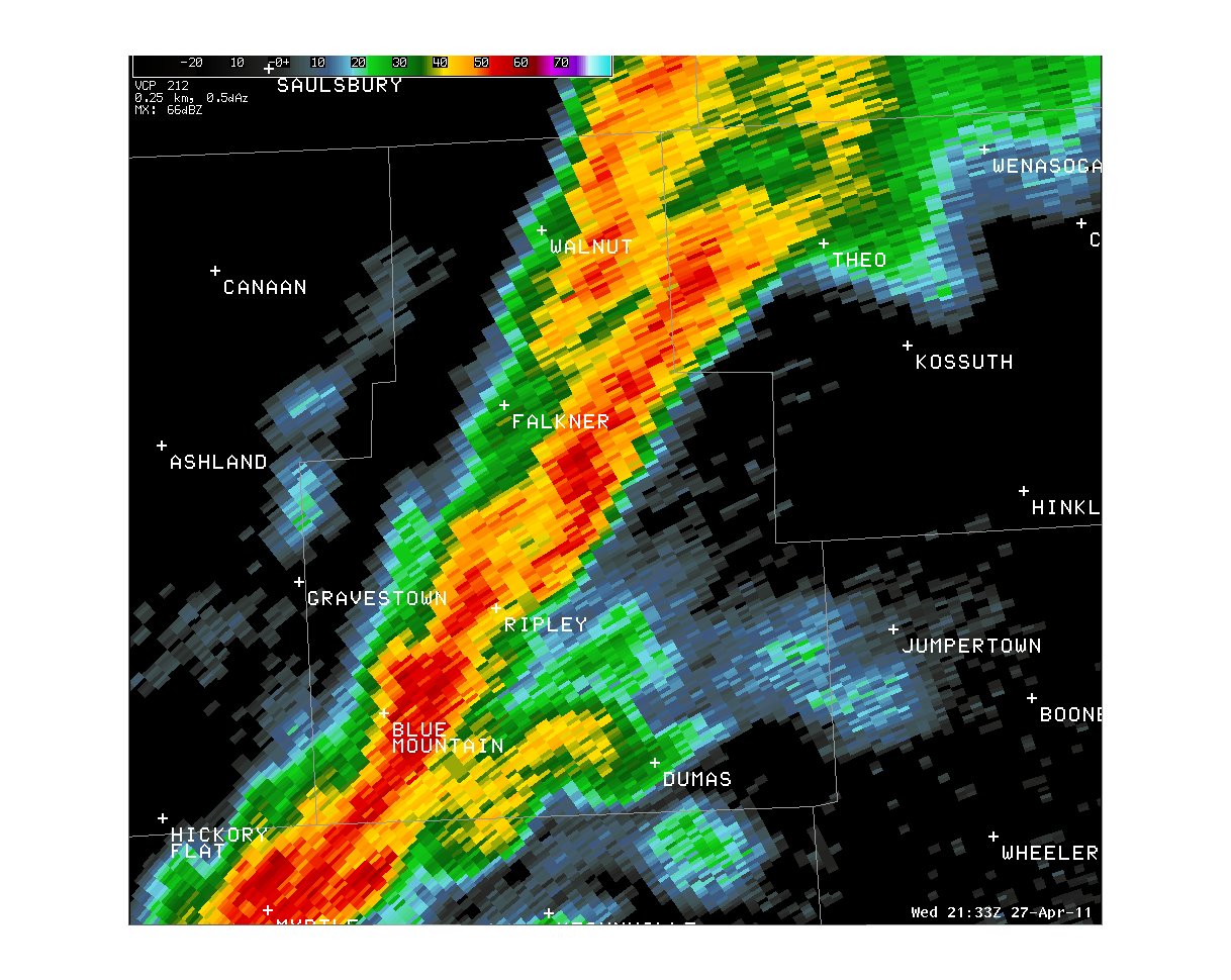
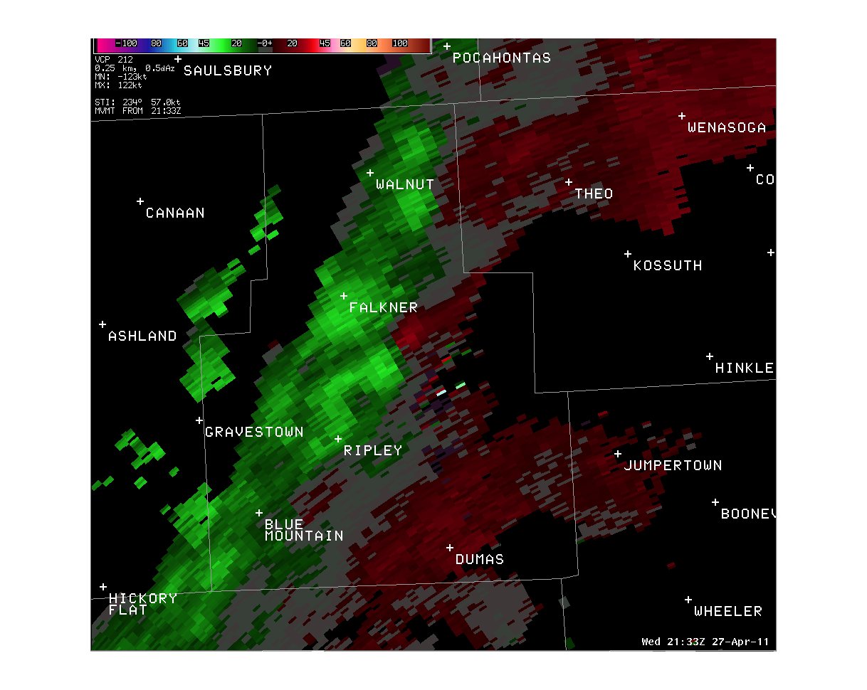
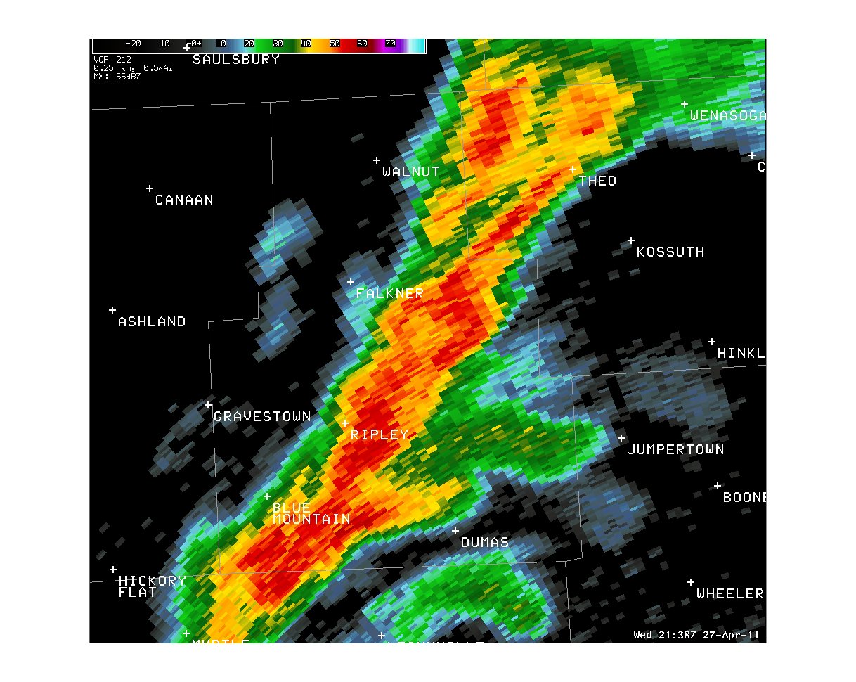
...PRELIMINARY EF-1 TORNADO IN TIPPAH COUNTY MISSISSIPPI...
* COUNTY: TIPPAH
* TIME OF EVENT: TIPPAH COUNTY, MISSISSIPPI AT 445 PM ON APRIL 27 2011
* BEGIN POINT: 34.810939 -88.791569
* END POINT: 34.82758 -88.759988
* RATING: EF-1
* ESTIMATED PEAK WIND: 90 MPH
* PATH LENGTH: 2.13 MILES
* PATH WIDTH: 100 YARDS
* FATALITIES: 0
* INJURIES: 0
* SUMMARY OF DAMAGES: TORNADO APPEARED TO HAVE TOUCHED DOWN ABOUT A
QUARTER OF A MILE WEST OF COUNTY ROAD 253 IN EAST CENTRAL TIPPAH
COUNTY AND TRACKED NORTHEAST FOR A LITTLE OVER 2 MILES AND LIFTED
BETWEEN COUNTY ROAD 254 AND THE TIPPAH/ALCORN COUNTY LINE. ONLY
ONE HOME AND TWO MOBILE HOMES RECEIVED MINOR DAMAGE AS THE AREA
IS HEAVILY FORESTED. DAMAGED A PORTION OF A MOBILE HOME ROOF AND
AWNING WAS RIPPED OFF. SEVERAL HARDWOOD TREES WERE EITHER SNAPPED
OR UPROOTED. A FEW TELEPHONE POLES WERE ALSO SNAPPED OFF. ESTIMATED
WINDS WITH TORNADO ABOUT 85 TO 90 MPH.
Radar Images:
 |
 |
 |
 |
CURRENT HAZARDS
Briefing Page
Outlooks
Submit a Storm Report
Submit a Storm Photo
View Storm Report
Spot Forecast Request
Hazard Outlook
FORECASTS
Local
Graphical
Probabilistic
Precipitation
Aviation
Fire
Severe Weather
Winter Weather
Tropical Weather
Air Quality
US Dept of Commerce
National Oceanic and Atmospheric Administration
National Weather Service
Memphis, TN
7777 Walnut Grove Road, OM1
Memphis, TN 38120
(901) 544-0399
Comments? Questions? Please Contact Us.

