Overview
|
During the afternoon/evening hours of July 4th, 2026, a mid-level wave progressed south-southeastward across Minnesota and Wisconsin. Earlier in the day, morning precipitation activity had cleared, allowing temperatures to warm into the mid-80s and dew points into the mid-60s. By the early afternoon, thunderstorms which had initiated over northwestern MN progressed into central Minnesota. These storms took advantage of the warm, moist airmass in place and sufficient MUCAPE values exceeding 2100 J/kg. Quarter to half-dollar size hail was reported by several trained spotters across Streans and Todd Counties as well as gusty winds west of Long Prairie that downed a few trees and powerlines. Additionally, locally heavy rainfall created localized flooding across St. Cloud, disabling a few vehicles. Storms continued to pulse in strength as they followed outflow boundaries that began to race out ahead of the main line of storms. |
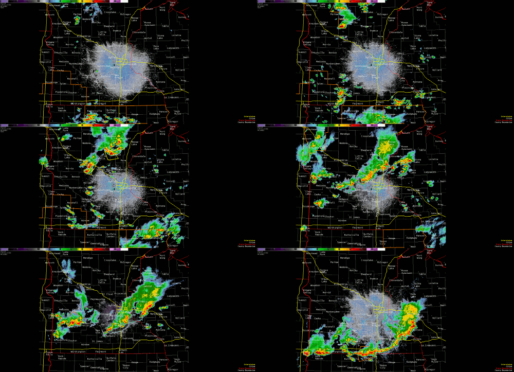 Radar Reflectivity showing showers and thunderstorms moving south across Minnesota and Wisconsin during the afternoon and evening hours of July 4, 2026. |
Hail
The largest hailstones were observed early in this event in Todd, Streans, and Mille Lacs Counties. Hailstones in this region measured between quarter (1.00") size up to near half-dollar (1.50") size in diameter. Otherwise, pea size hail was most common as storms moved into south-central MN.
 |
 |
|
Hail stone approaching half dollar size 1 mile SE of New Munich, MN. Photo courtesy of Marc Johnson. |
Quarter sized hail measurement near the intersection of 25th Ave and 4th Street in St Cloud, MN. Photo courtesy of Bob Scanlon. |
Funnel Clouds
The storm environment mainly supported the threat for heavy rain and hail. A few storms did manage to produce weak rotation aloft and ultimately producing a few funnel clouds. Tornado development was not likely in this event due higher cloud bases, and weak wind shear.
 |
 |
.jpeg) |
| Photo of a funnel cloud in Wright County. Storm spotter captured this photo near the intersection of County Road 8 and County Road 35. Photo courtesy of Bob Scanlon. | Photo of funnel cloud 2 S of Buffalo, MN. Photo courtesy of Bill Doms. | Funnel cloud SE of Clear Lake. Photo courtesy of Derek Tamm. |
Rain Reports and Urban Flooding
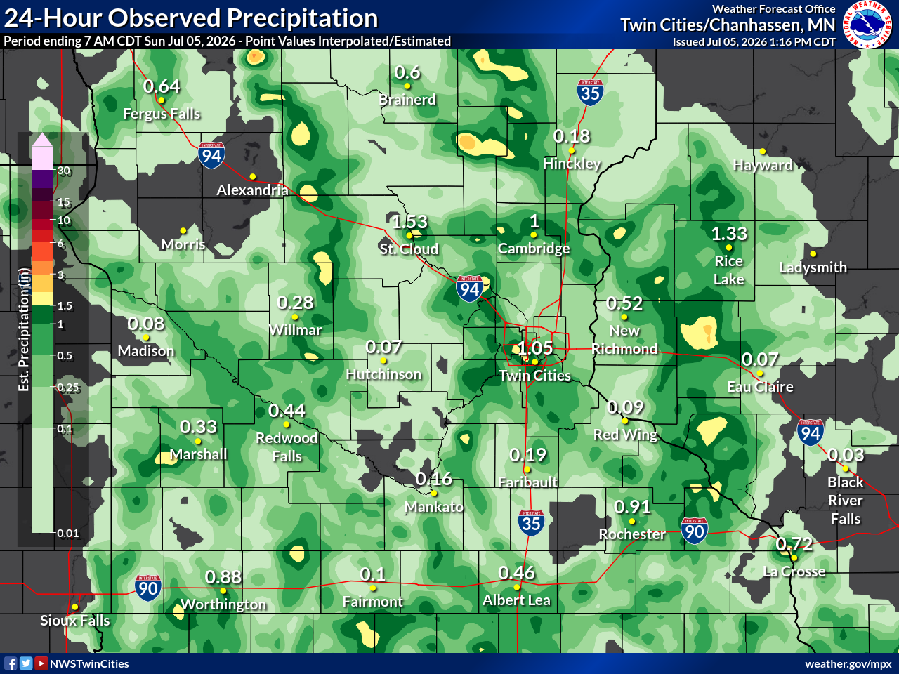
Most thunderstorms produced between a tenth and quarter inch of heavy rain. However, a few storms managed to produce localized higher amounts measuring 1 to 3 inches of rain. The highest rainfall totals were in St. Cloud, MN where a CoCoRaHS observer reported 3.26" of rain.
 |
 |
 |
.jpg) |
| Observed interpolated rainfall analysis from July 4, 2026. | Flooded underpass with two flooded vehicles at Highway 23 and 9th Ave in St. Cloud, MN. Photo courtesy of Doug Kiesling. | Rainfall Measurement in Sauk Centre. Photo courtesy of Kristina Marie. | Rainfall Measurement in Elk River. Photo courtesy of Scott Stordahl. |
Storm Reports
Here is a snapshot of all the storm reports from the event.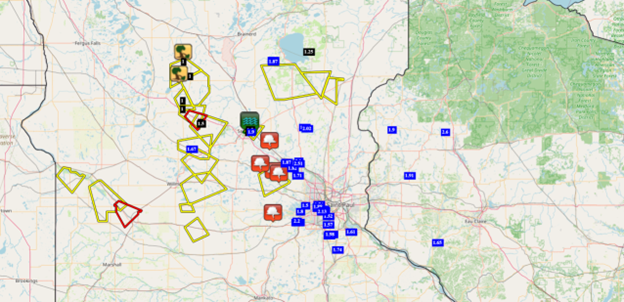 |
| Local storm and rainfall reports across central and southern Minnesota and western Wisconsin from July 4,2026. |
 |
Media use of NWS Web News Stories is encouraged! Please acknowledge the NWS as the source of any news information accessed from this site. |
|



 Follow us on X
 Follow us on Facebook
 Follow us on YouTube
 MPX RSS Feed