Overview
|
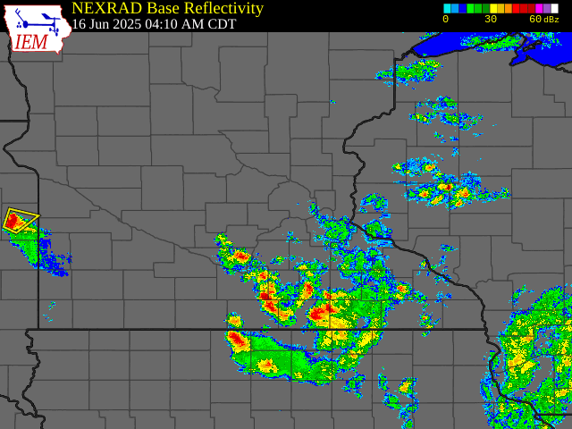
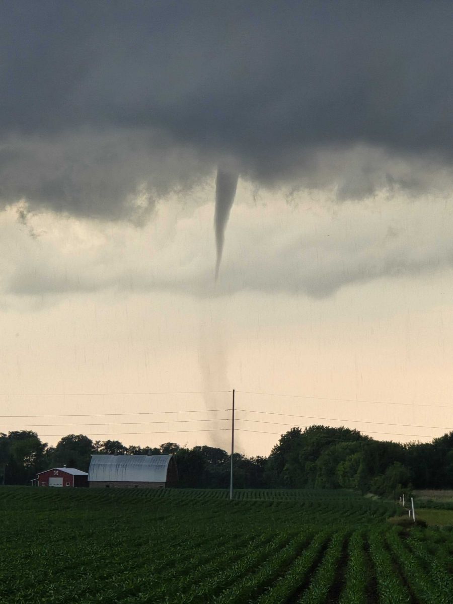
A very moist and unstable atmosphere led to multiple rounds of thunderstorms on Monday, June 16th, 2025 across Minnesota. The first round of scattered storms developed over western and southeastern Minnesota during the early morning hours on Monday. Warm-air advection primarily facilitated the lift for these storms. While the storms in western Minnesota were not noteworthy, the ones in southeastern Minnesota did lead to some localized flooding. This was due to the "training" of storms as new storms developed behind the old ones and passed over the same area. Radar estimated rainfall maps showed a small 4-6" swath of rain fell from Minnesota Lake to Alden. The flooding caused a couple of road closures and water into residents' basements in Alden. Just before noon, another cluster of storms formed in central Minnesota. This cluster passed through St. Cloud and produced severe wind gusts that caused several reports of trees damaged/falling. The storm then continued southeast along Interstate 94 into the Twin Cities metro, producing one more wind damage report near Plymouth before dissipating after crossing into Wisconsin. While the aforementioned storm was weakening, a few supercells formed in west-central Minnesota near Fergus Falls and traveled east. These storms were associated with the main upper-level shortwave and had the most environmental synoptic support. As a result, a few tornadoes (including one longer track) occurred with this activity mainly in NWS Grand Forks and Duluth's forecast areas. However, a tornado did occur in Todd county near the town of Bertha at around 3:41 PM. The only damage reported from this tornado was barn that had its roof blown off. The storms eventually formed into a line and continued east until they reached Wisconsin and slowly dissipated. The final round of storms occurred at around 5:00 PM in south-central Minnesota. Two dominant right-moving supercells prevailed from initial scattered convection and traveled southeast over the next couple of hours. The northern supercell traveled from just east of Hutchinson to Waconia and then eventually through Lakeville before dissipating. A few funnels were reported by spotters but no tornadoes occurred. However, 3.25" hail fell in Waconia. The southern supercell formed near New Ulm and traveled through Mankato and St. Clair before dissipating. Two tornadoes were observed near Courtland and Nicollet but no damage was reported. 2" hail fell in Mankato and a funnel was spotted near St. Clair. |
|
Tornadoes
Select a tornado from the table to zoom into the track and view more information. The default table view is limited to 8 tracks, but can be scrolled by a mouse wheel or dynamically expanded. Additionally, the table can fill the entire window by clicking the small circular expanding arrow icon at the very top right of the table and returned to its original size by clicking the button again. The side information panel that opens over the map can be closed using the "X" on the upper right corner of the pop-up. Zoom into the map and click damage points to see detailed information and pictures from the surveys.
|
NOTE: times shown below are local to your device's time zone. |

The Enhanced Fujita (EF) Scale classifies tornadoes into the following categories:
| EF0 Weak 65-85 mph |
EF1 Moderate 86-110 mph |
EF2 Significant 111-135 mph |
EF3 Severe 136-165 mph |
EF4 Extreme 166-200 mph |
EF5 Catastrophic 200+ mph |
 |
|||||
| Tornadoes that fail to impact any ratable structures on the EF-Scale are rated EF-Unknown (EF-U) | |||||
Wind & Hail
There was damaging wind gusts and very large hail observed with these storms as well.
Wind
The most concentrated thunderstorm wind damage occurred in St. Cloud, MN where numerous trees were damaged/blown over. Some trees fell onto buildings causing structural damage, including to building at a MnDOT facility.
Hail
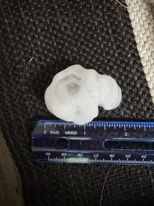
Very large hail fell in Waconia and Mankato, Minnesota. The largest hailstone was 3.25" and was reported by a National Weather Service employee.
 |
 |
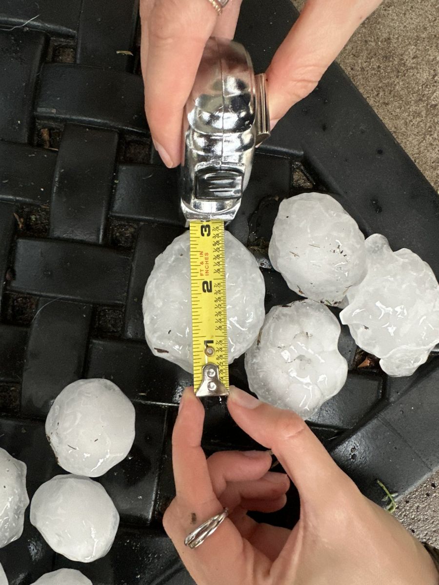 |
| A 3.25" hail report from a NWS employee in Waconia, MN. | A 2" hail report from Mankato, MN courtesy of Lance Schwartz. | A 3 inch hail report via Adam Young from Eau Claire, WI. |
Additional Photos
 |
 |
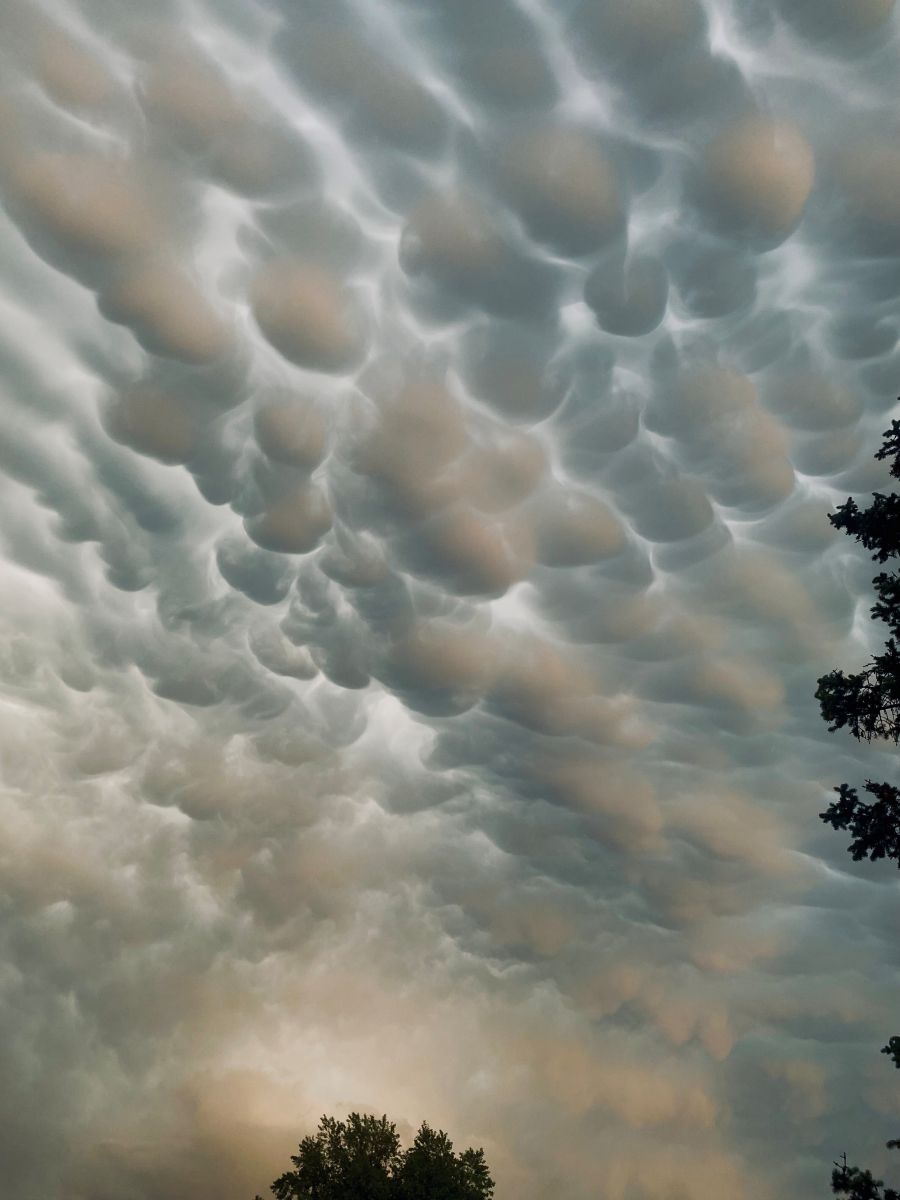 |
| Tornado near Nicollet, MN. Image courtesy of Nicollet county law enforcement. | Another photo of the same tornado near Nicollet, MN. | Mammatus clouds over Apple Valley, MN. Image courtesy of Ramsey county EM. |
 |
Media use of NWS Web News Stories is encouraged! Please acknowledge the NWS as the source of any news information accessed from this site. |
|