Overview
|
Supercell thunderstorms produced severe weather on the evening of September 24, 2019. A strong tornado developed in Elk Mound, WI and strengthened to an EF3 as it went through Wheaton, WI. A very favorable environment capable of producing supercells and tornadoes was in place and a Tornado Watch was issued at 445 PM. Gradual development of thunderstorms occurred during the early evening with widespread storms stretching from northwestern Iowa, southern Minnesota, into western and northern Wisconsin. A few became severe, but the number of storms probably limited most from becoming as strong as they could have alone. The supercell that produced the strong EF3 tornado was an exception. It rapidly intensified and went on to produce the first September EF3 tornado in Wisconsin since Ladysmith on 9/2/2002 and the last EF3 tornado this late in the season occurred on 9/28/1971. |
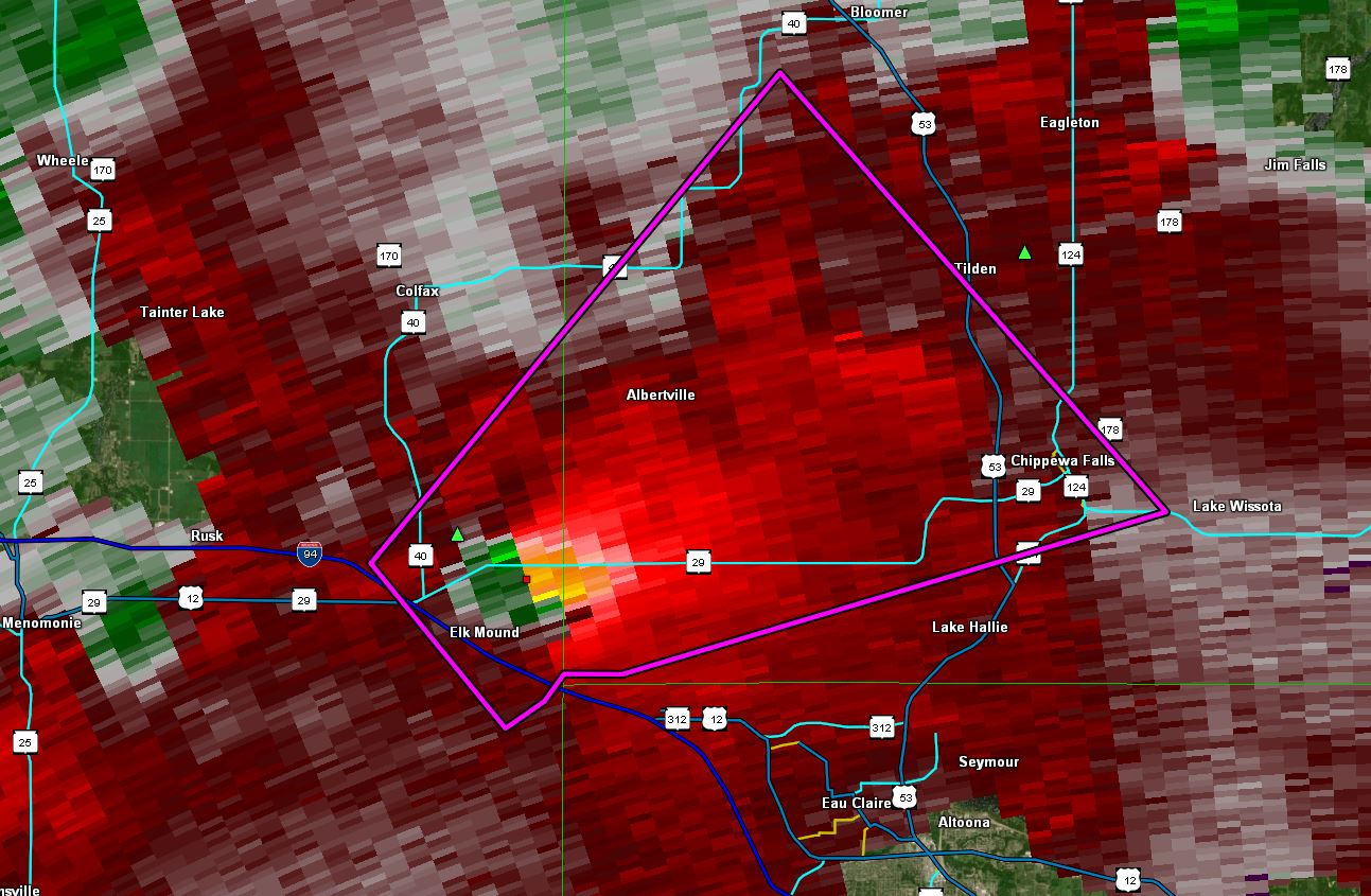 Velocity image as the tornado was developing. Reds indicate wind moving away from the radar (WFO La Crosse) and green indicated toward. |
Tornado:
|
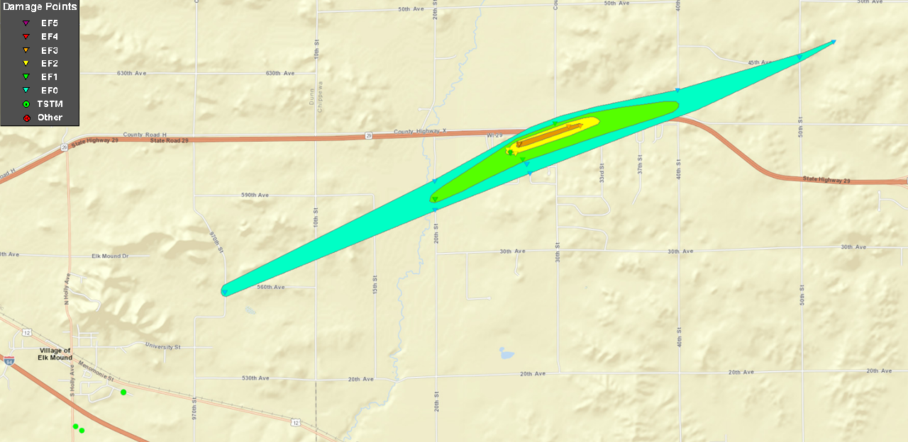
Tornado - Elk Mound/Wheaton, WI
Track Map
 |
||||||||||||||||
The Enhanced Fujita (EF) Scale classifies tornadoes into the following categories:
| EF0 Weak 65-85 mph |
EF1 Moderate 86-110 mph |
EF2 Significant 111-135 mph |
EF3 Severe 136-165 mph |
EF4 Extreme 166-200 mph |
EF5 Catastrophic 200+ mph |
 |
|||||
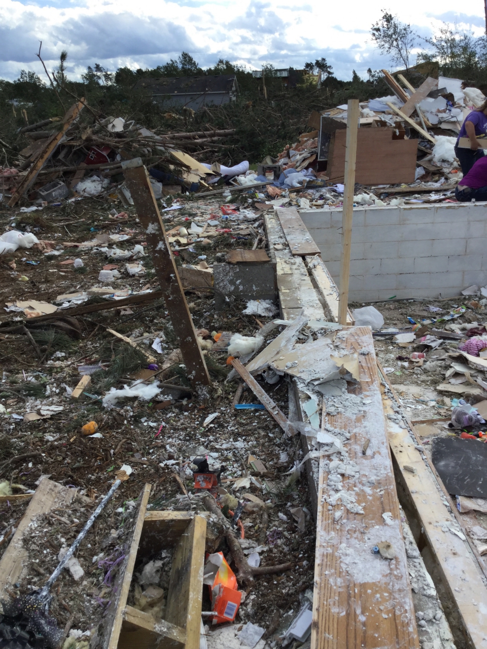
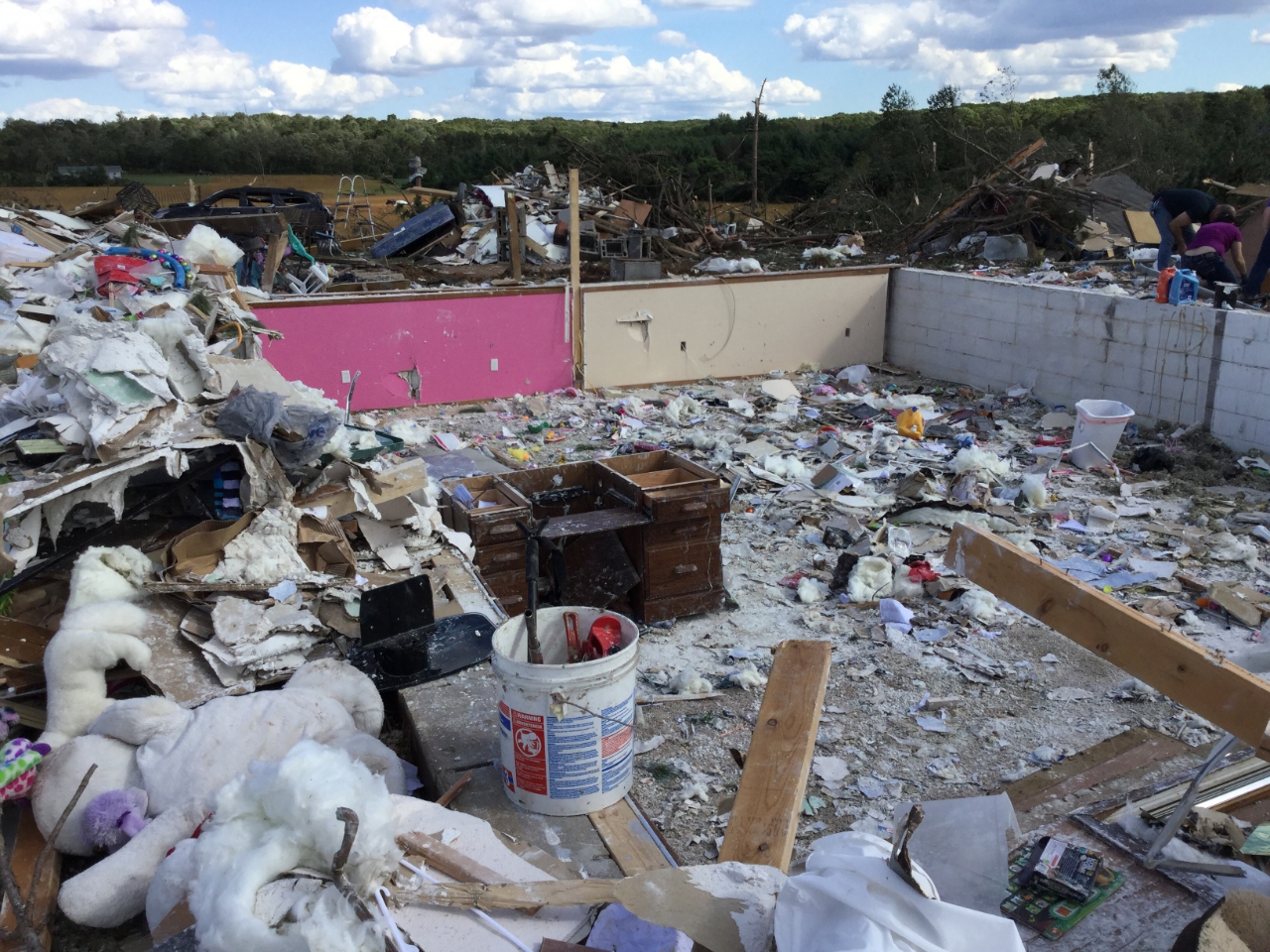
Photos & Video
 |
 |
 |
 |
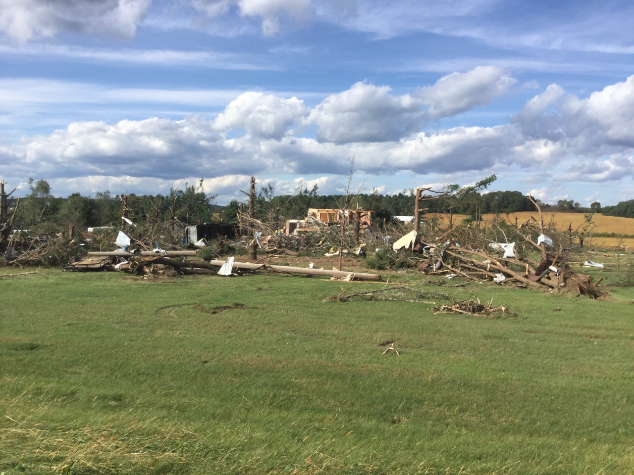
| House destroyed. Photo by: NWS damage survey |
Photo by: NWS damage survey |
Photo by: NWS damage survey |
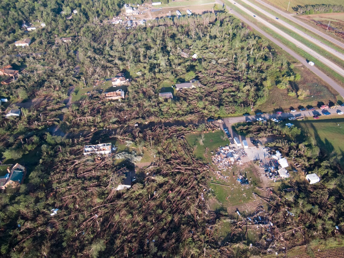
Photo by: Branden Bodendorfer |
Radar
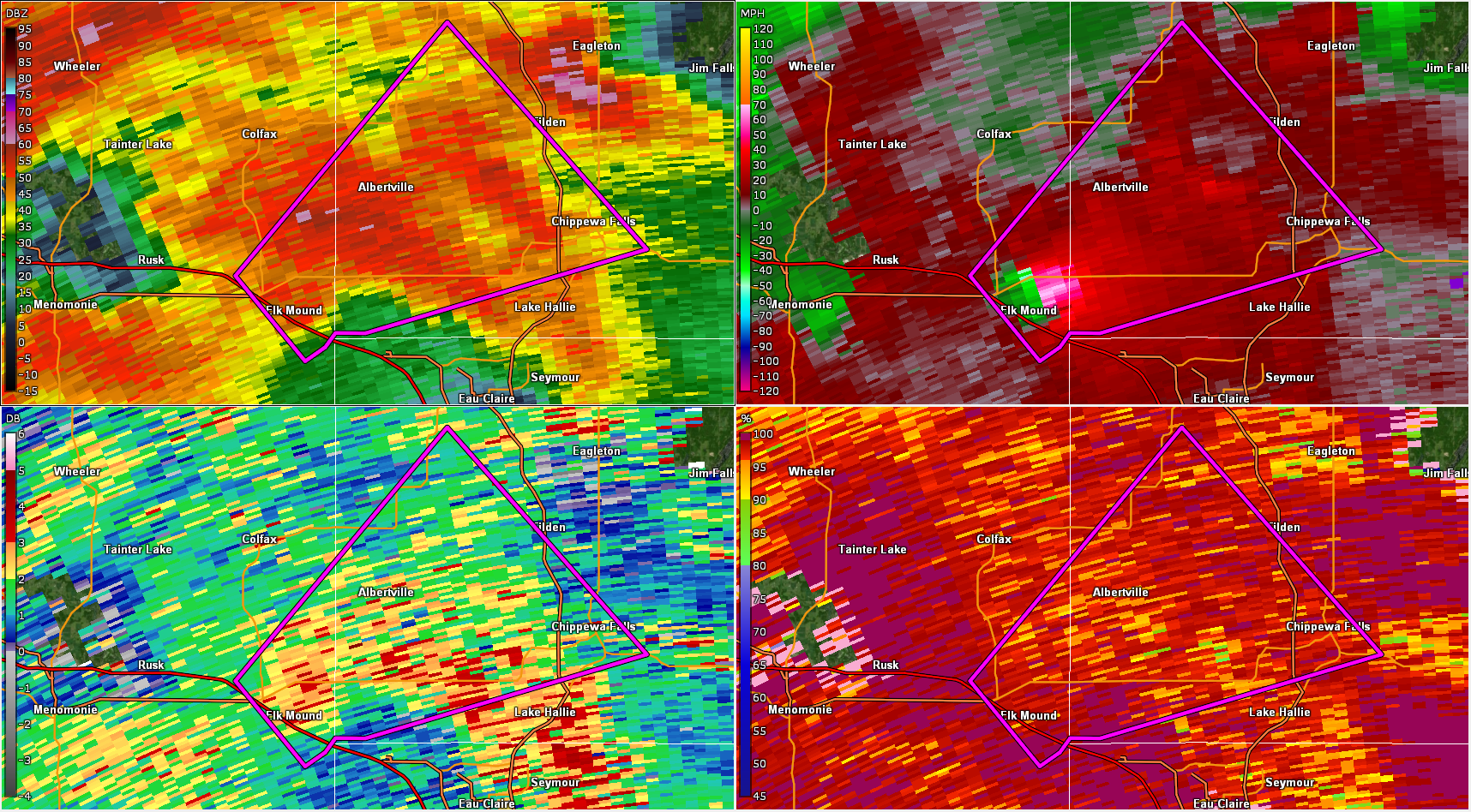
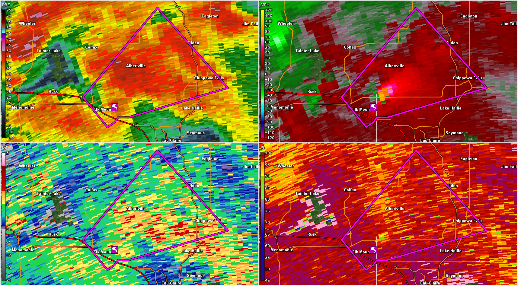
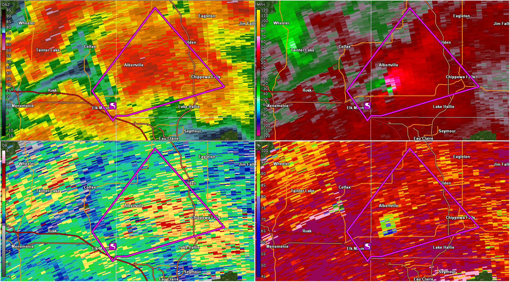
4-Panel showing reflectivity (upper left), velocity (upper right), differential reflectivity (lower left), and correlation coefficient (lower right).
 |
 |
 |
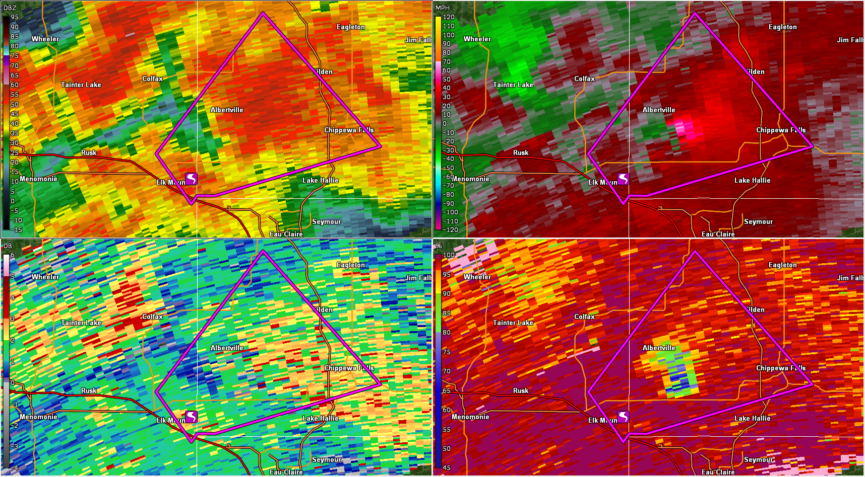 |
| 7:46 PM - 2 minutes before spin up | 7:51 PM - Debris is starting to be picked up by radar by the little green dot in the CC image (lower right) just northeast of the tornado report icon. | 7:55 PM - Much more debris is now being picked up as the tornado matures to EF3 strength. | 7:58 PM - The tornado is ending, but the debris is still high up in the atmosphere. |
 |
Media use of NWS Web News Stories is encouraged! Please acknowledge the NWS as the source of any news information accessed from this site. |
|