Overview
Numerous severe thunderstorms impacted much of central and southern Minnesota during the evening of Sunday, July 9, 2017. There were many reports of very large hail, in excess of 2" in diameter, with one report of a 4" hail stone. In addition, reports from spotters and law enforcement indicated that at least one tornado may have touched down in southern Nicollet and/or northwest Blue Earth Counties. A damage survey team from the National Weather Service reviewed the area of damage and confirmed that two tornadoes occurred: an EF-0 near Courtland in Nicollet County and an EF-1 near Lake Crystal in Blue Earth County.
Tornadoes:
|
Tornado #1 - Near Courtland
Tornado #1 Track Map 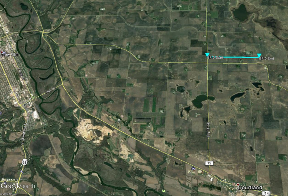
|
||||||||||||||||
|
Tornado #2 - North of Lake Crystal
Tornado #2 Track Map 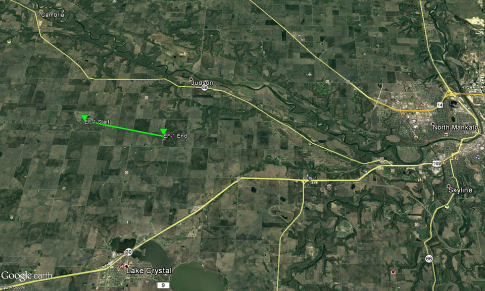
|
||||||||||||||||
The Enhanced Fujita (EF) Scale classifies tornadoes into the following categories:
| EF0 Weak 65-85 mph |
EF1 Moderate 86-110 mph |
EF2 Significant 111-135 mph |
EF3 Severe 136-165 mph |
EF4 Extreme 166-200 mph |
EF5 Catastrophic 200+ mph |
 |
|||||
Photos
 |
 |
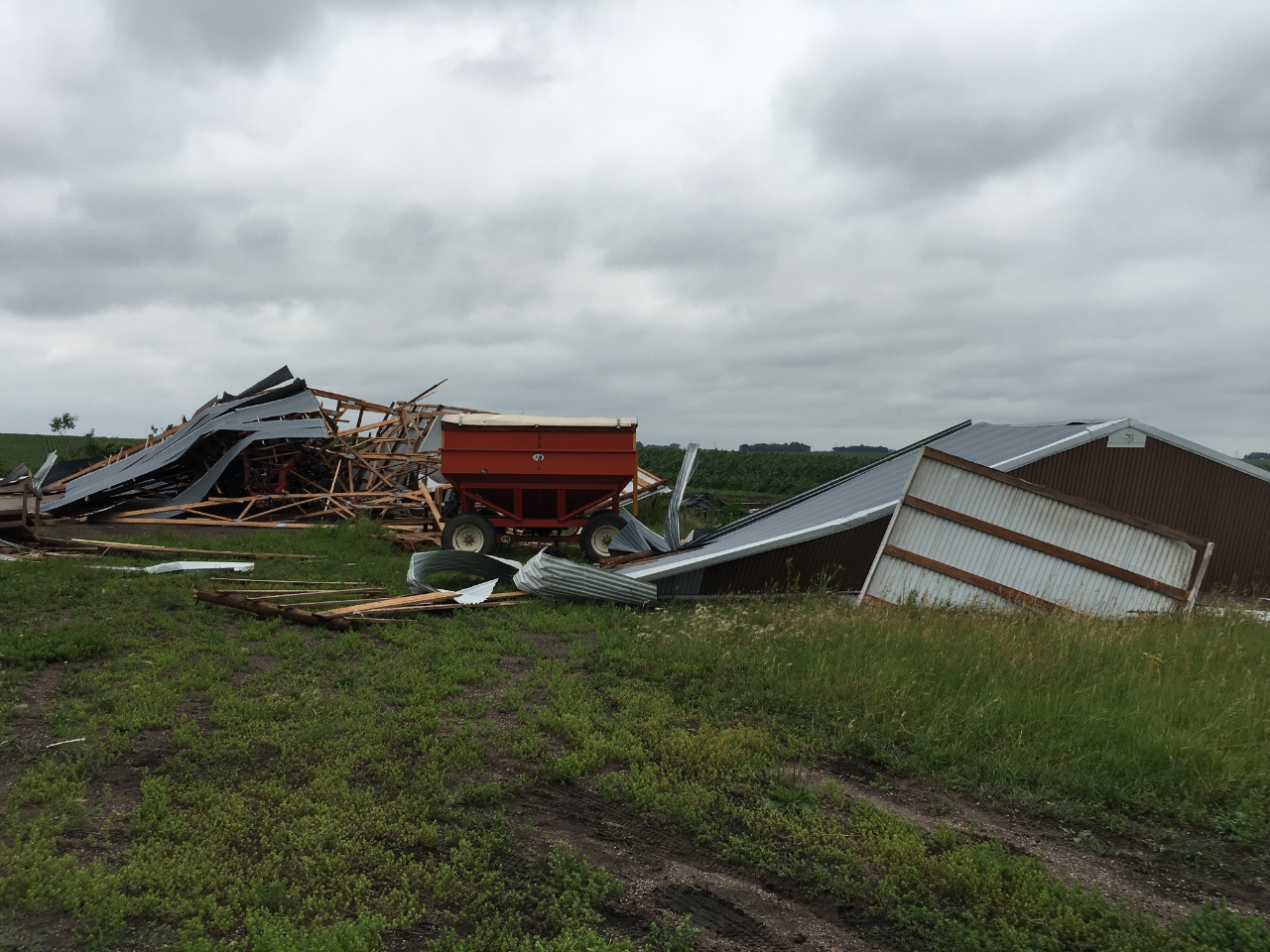 |
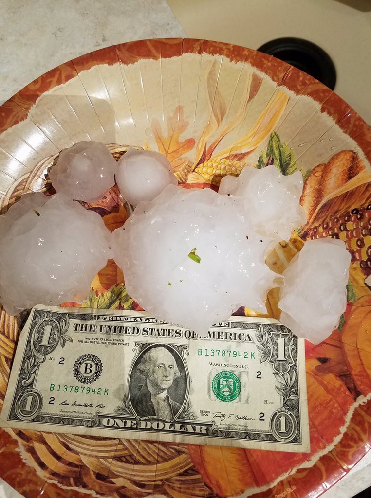 |
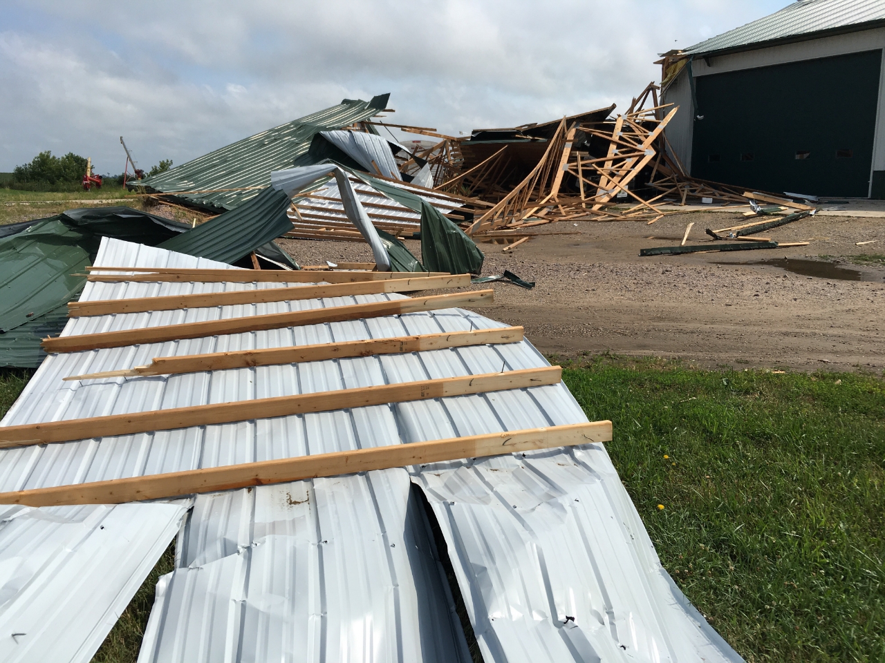
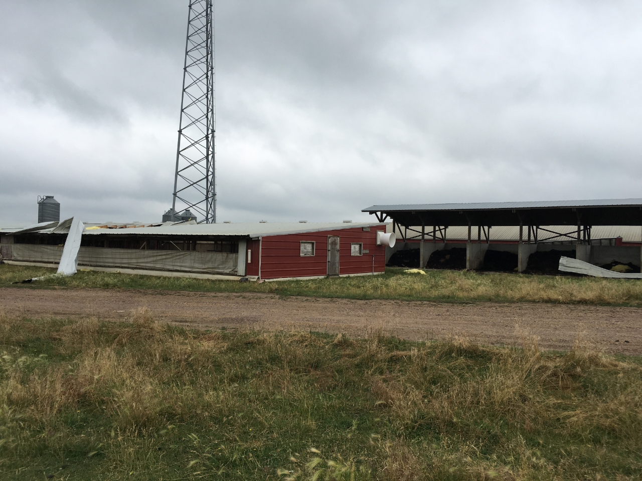
| Straight line (rear flank downdraft) wind damage south of Lafayette and northwest of Swan Lake in Nicollet County | Tornado damage north of Courtland and west of Swan Lake in Nicollet County | Tornado damage north of Lake Crystal in Blue Earth County | Hail near Winthrop via Social Media (@shaneahlbrecht) |
Radar:
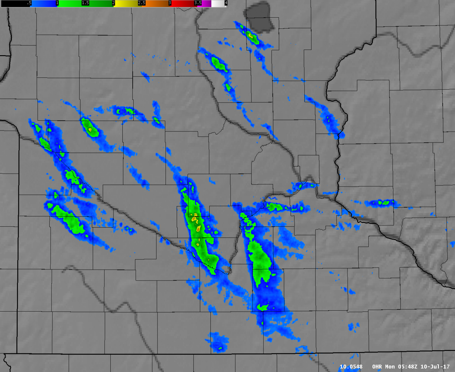 |
|
| Radar estimated Max Estimated Size of Hail (MESH) from all storms during the evening | Radar reflectivity (left) and storm relative velocity (right) loop of tornadic storm in southern Nicollet & northwest Blue Earth Counties from 1005 PM through 1045 PM. |
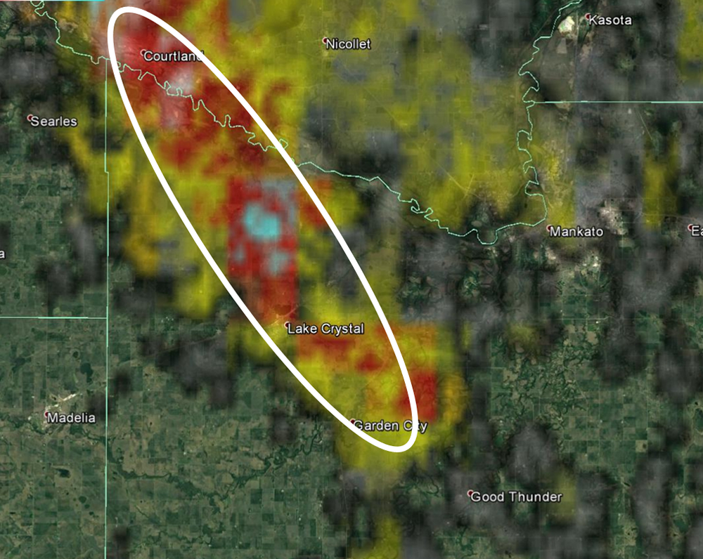 |
|
| Rotational tracks of the EF-0 and EF-1 tornadoes. | |
Storm Reports
Click link to see storm reports for July 9, 2017: http://www.spc.noaa.gov/exper/archive/event.php?date=20170709
Environment
A warm front extending from an area of low pressure over South Dakota helped to initiate thunderstorm development during the early evening of Sunday, July 9, 2017. Very warm, moist, and unstable air south of the front allowed the storms to quickly intensify, and abundant deep layer wind shear fostered the development of supercell thunderstorms, which were capable of producing large hail and damaging wind gusts. In addition, locally enhanced low-level wind shear allowed for the development of brief weak tornadoes.
 |
 |
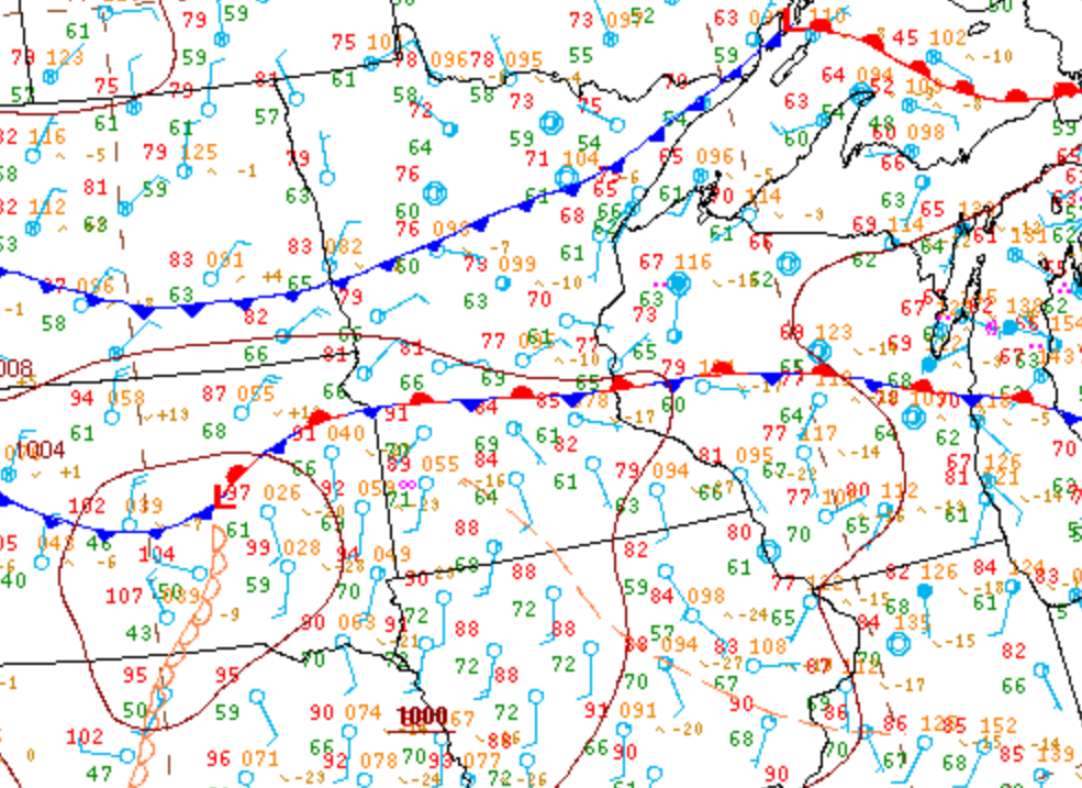 |
| Effective bulk shear loop from 5 PM to 11 PM | Mixed layer CAPE from 5 PM to 11 PM | Surface analysis at 7 PM |
 |
 |
 |
| 0-1 km AGL Bulk Shear from 5 PM to 11 PM | Significant hail parameter from 5 PM to 11 PM | Chanhassen (MPX) sounding at 7 PM |
 |
Media use of NWS Web News Stories is encouraged! Please acknowledge the NWS as the source of any news information accessed from this site. |
|

