Overview
A pronounced cold front sagged south of Canada, colliding with a warm and humid air mass across central Minnesota on August 3, 2024. Surface temperatures reached the upper 80s/lower 90s with dew points in the low to mid 70s. This created an unstable environment, featuring instability exceeding 4000-5000 J/kg of MLCAPE and steep mid-level lapse rates between 8.0-9.0°C/km.
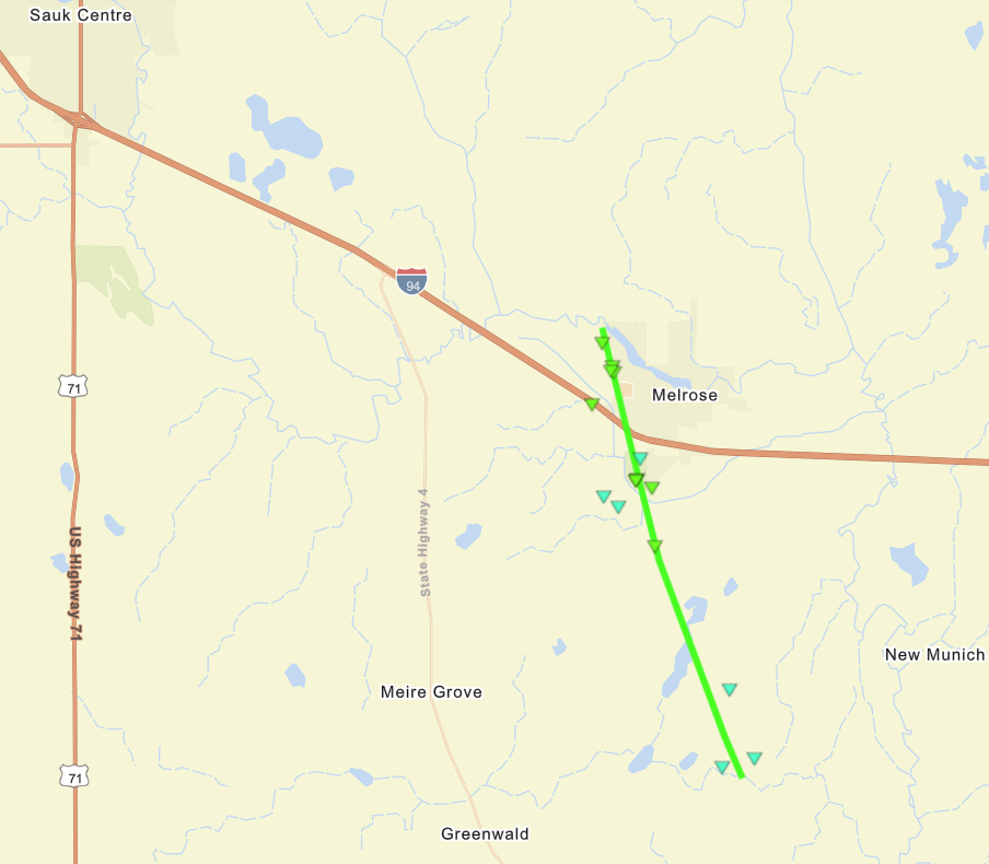
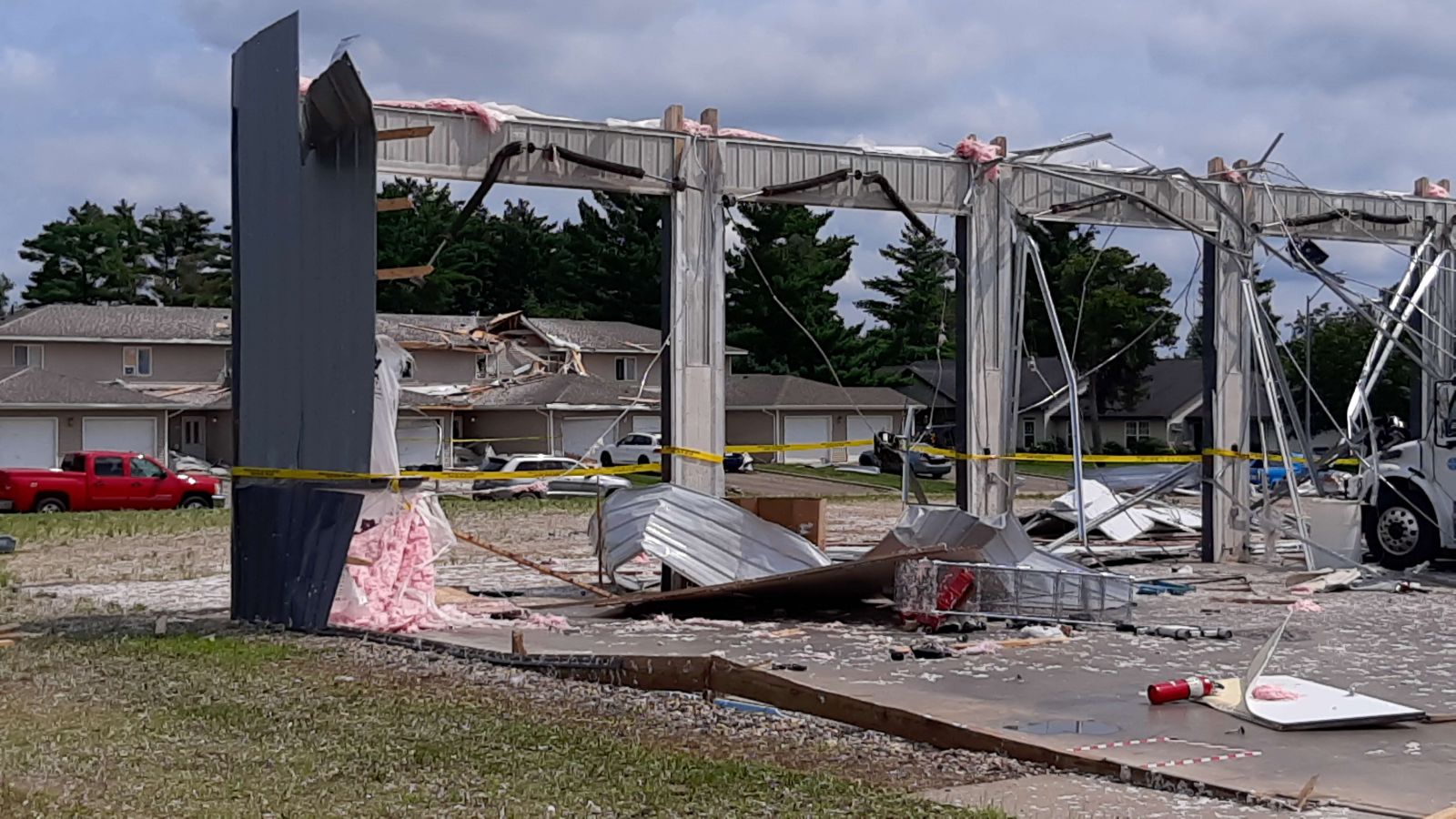
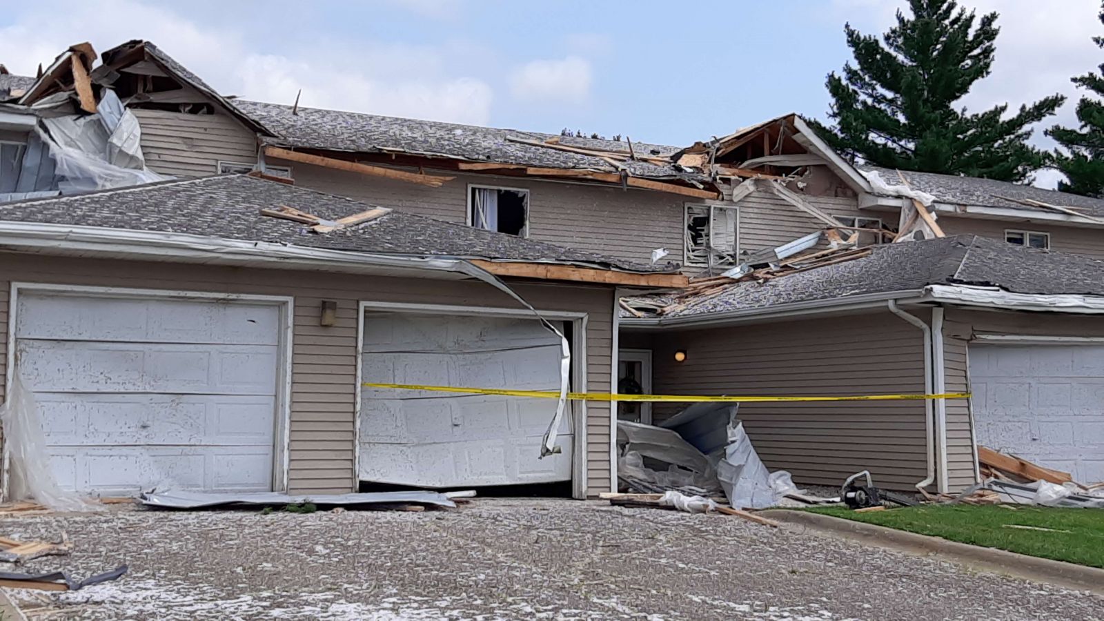
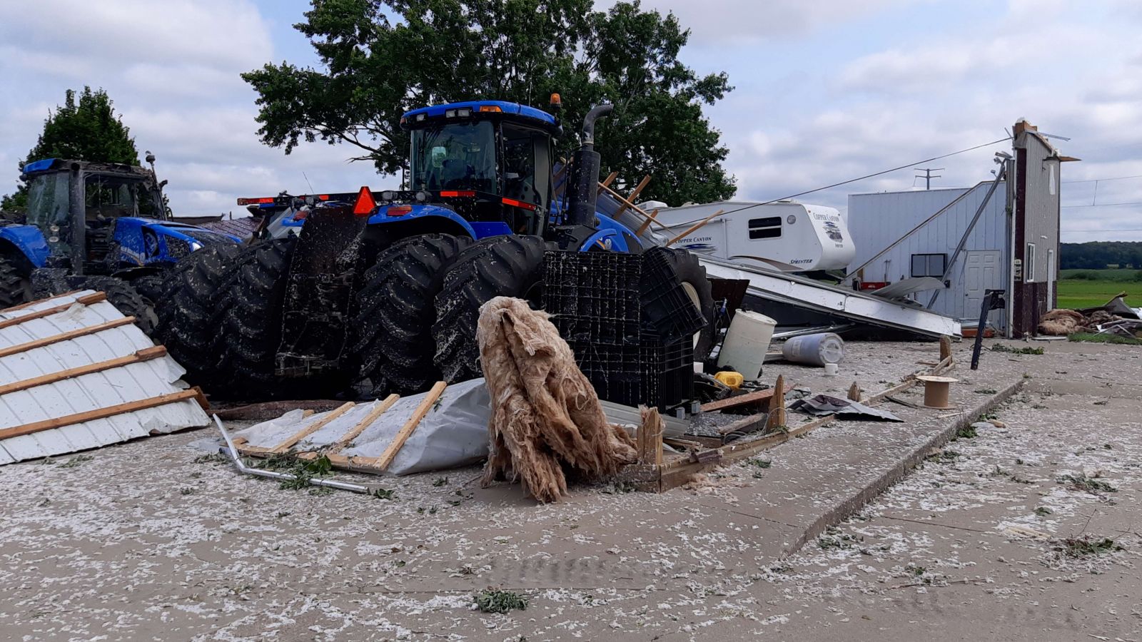
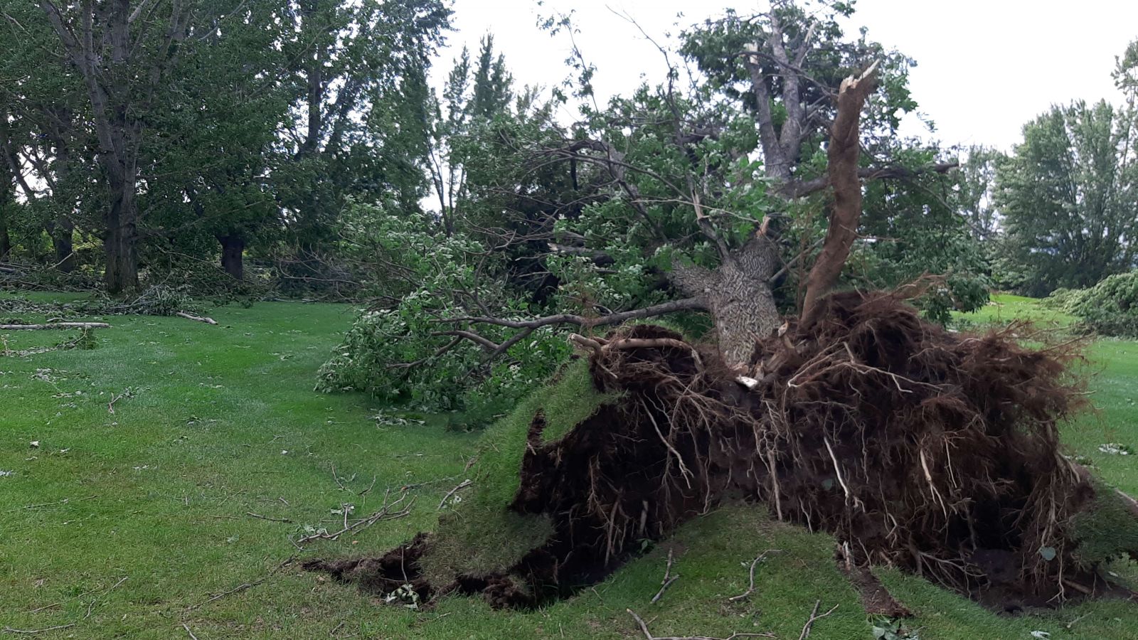
A pair of strong supercells formed along the front over central Minnesota during the late afternoon and travelled south-southeast through the evening. Initial storms produced very large hail up to 3 inches in diameter, with sporadic reports of wind damage. An EF-1 tornado impacted Melrose, MN as the supercells travelled through Stearns County.
***This page will continue to be updated as more information comes in***
Tornado
|
Tornado - Melrose, MN
|
||||||||||||||
|
||||||||||||||
The Enhanced Fujita (EF) Scale classifies tornadoes into the following categories:
| EF0 Weak 65-85 mph |
EF1 Moderate 86-110 mph |
EF2 Significant 111-135 mph |
EF3 Severe 136-165 mph |
EF4 Extreme 166-200 mph |
EF5 Catastrophic 200+ mph |
 |
|||||
Wind & Hail:
Add a written summary or simply an LSR map in this section. If writing an extensive report, you can break the report down into wind and hail below (otherwise delete).
Wind
Insert summary here.
| Caption | Caption | Caption | Caption |
Hail
Insert summary here.
| Caption | Caption | Caption | Caption |
Radar
Header
 |
|||
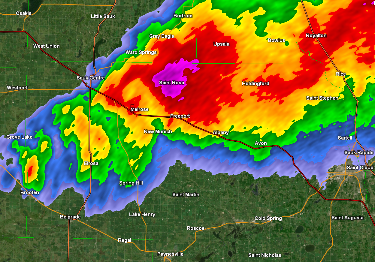
| Radar at 8:11 PM. The tornado touched down at the location of the red square. | Caption | Caption | Caption |
Storm Reports
Insert storm reports here. Copy in PNS or paste map.
 |
Media use of NWS Web News Stories is encouraged! Please acknowledge the NWS as the source of any news information accessed from this site. |
|