Overview
A potent severe weather environment resulted in a swath of large hail up to 2.75" in diameter stretching from SE South Dakota up through southern Minnesota into west central Wisconsin. A surface low pressure tracked from the Dakotas through central Minnesota on the afternoon of April 28. Thunderstorms developed along the a dryline boundary early afternoon across western Minnesota and eastern South Dakota. Several severe thunderstorms formed along the dryline and moved eastward through southern Minnesota into western Wisconsin in the afternoon and early evening hours of April 28. A significant severe weather set up was in place across the Upper Mississippi river valley with moderate surface instability and strong shear present along and ahead of the dryline. Initial supercells would congeal into a line of severe thunderstorms as they tracked across south central Minnesota after 430 PM. This line would produce several tornadoes and numerous reports of large hail across southern Minnesota and western Wisconsin through the evening hours. In total, at least 2 tornadoes impacted southern Minnesota & 5 in west-central Wisconsin.
Tornadoes
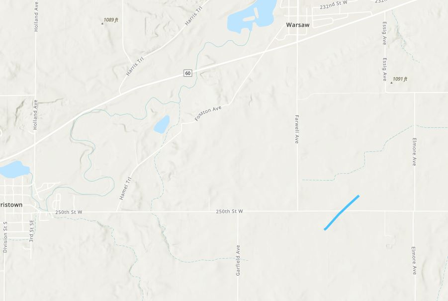
Tornado - 8 ESE Faribault, MN
Rice County
| Date |
4/28/2025 |
| Time (Local) |
5:52 PM - 5:55 PM |
| EF Rating |
EF-1 |
| Est. Peak Winds |
110 MPH |
| Path Length |
3.27 Miles |
| Max Width |
175 Yards |
| Injuries/Deaths |
0/0 |
|
Summary:
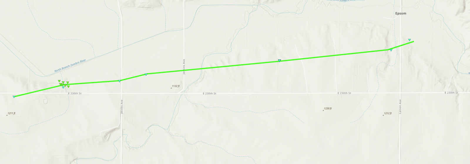
The tornado touched down south of E 230th st and travelled east-northeast, dissipating in an open field east of Larson Ave. A farm just north of E230th sustained significant damage to a new metal outbuilding including partial collapse of the walls. Several semi and tanker trailers were damaged and moved several hundred feet away. A barn and several sheds were completely destroyed. Numerous mature hardwood trees were snapped or badly damaged along the creek. Additional storm damaged was noted from strong inflow on this property. The tornado produced isolated tree damaged as it crossed several plowed fields before an outbuilding was badly damaged along Larson Ave.
|
Track Map
Downloadable KMZ File
|
 |
 |
 |
 |
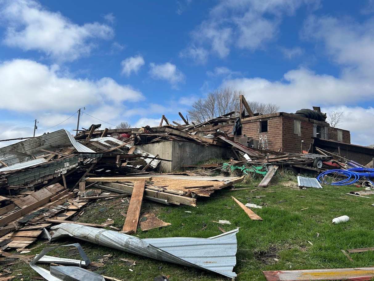
| Damaged barn and debris at farm near Faribault. |
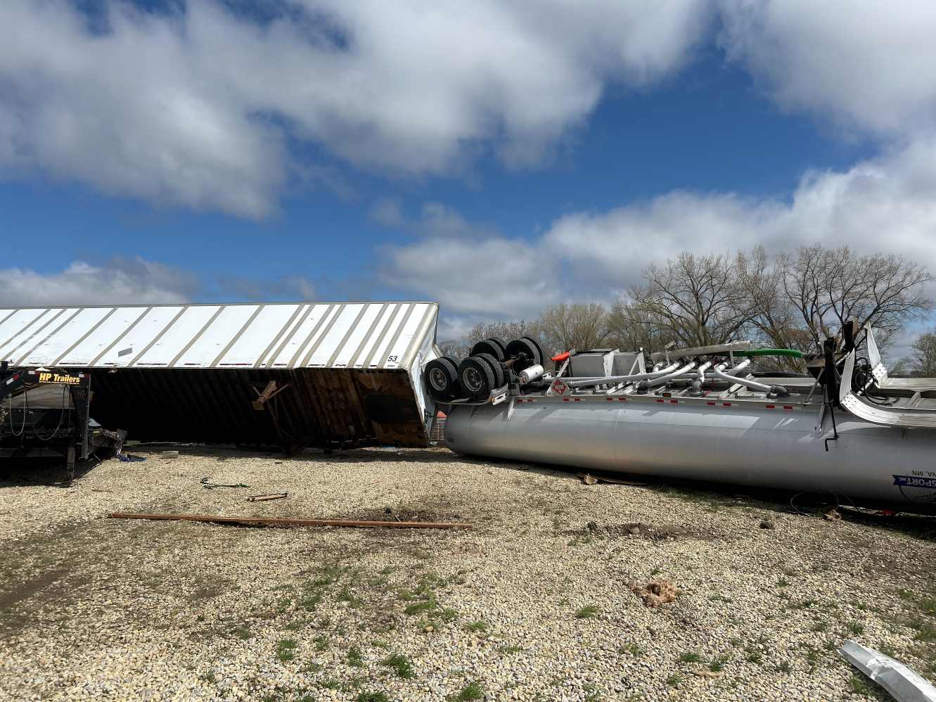
Flipped semi tanker and trailers at farm near Faribault. |
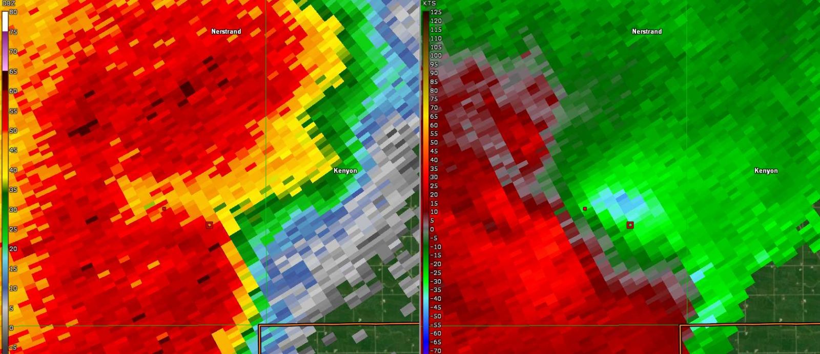
Base Reflectivity (Left) and Velocity (Right) at 5:50 PM |
Base Reflectivity (Left) and Velocity (Right) at 5:52 PM |
|
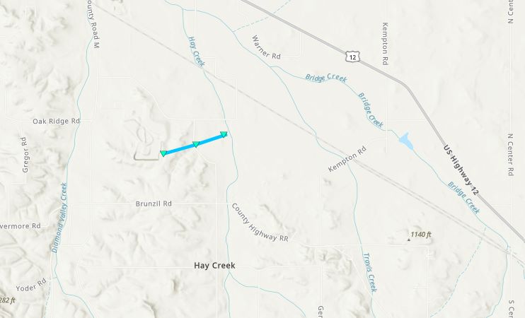
Tornado - 3 E Morristown, MN
Rice County
| Date |
4/28/2025 |
| Time (Local) |
5:38 PM - 5:39 PM |
| EF Rating |
EF-0 |
| Est. Peak Winds |
75 MPH |
| Path Length |
0.48 Miles |
| Max Width |
35 Yards |
| Injuries/Deaths |
0/0 |
|
Summary:
A brief EF-0 occurred E of Morristown. A group of trees sustained damage including a few large limbs. A farm outbuilding was badly damaged including the roof and walls.
|
Track Map
Downloadable KMZ File
|
| |
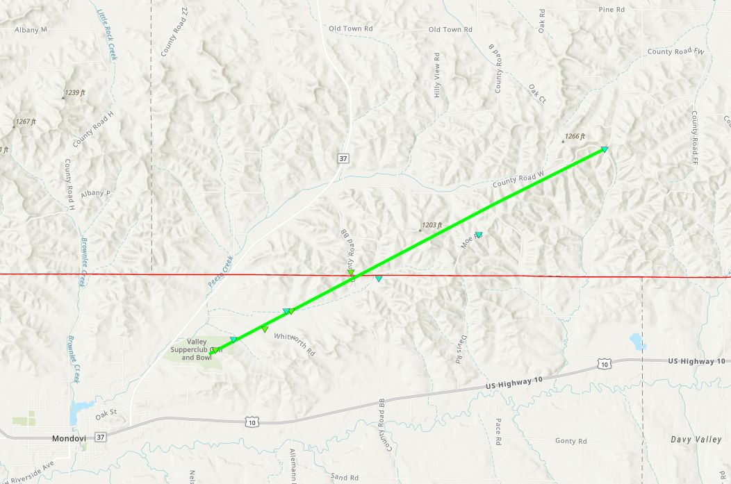
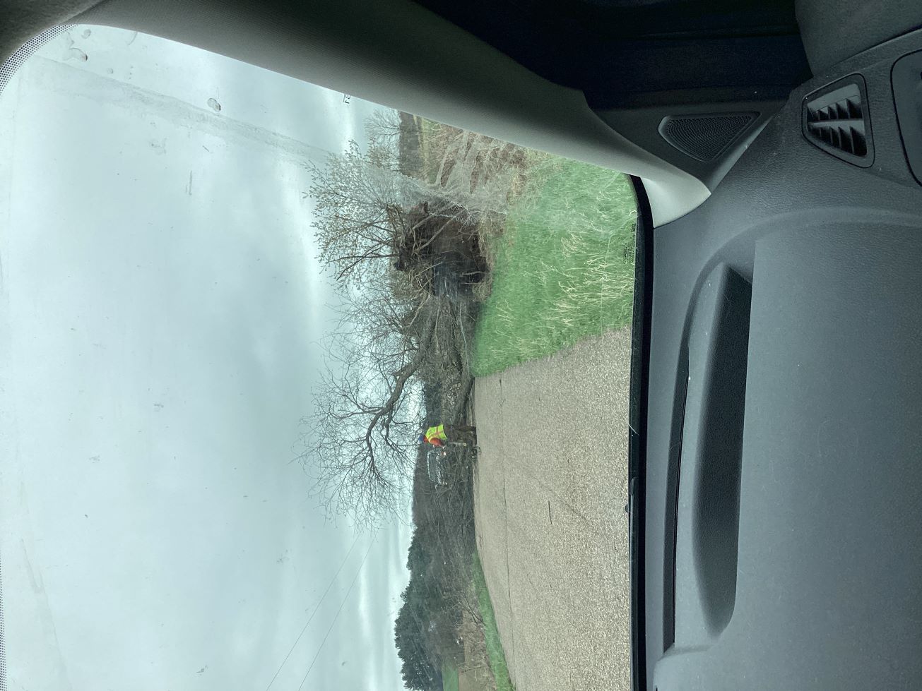
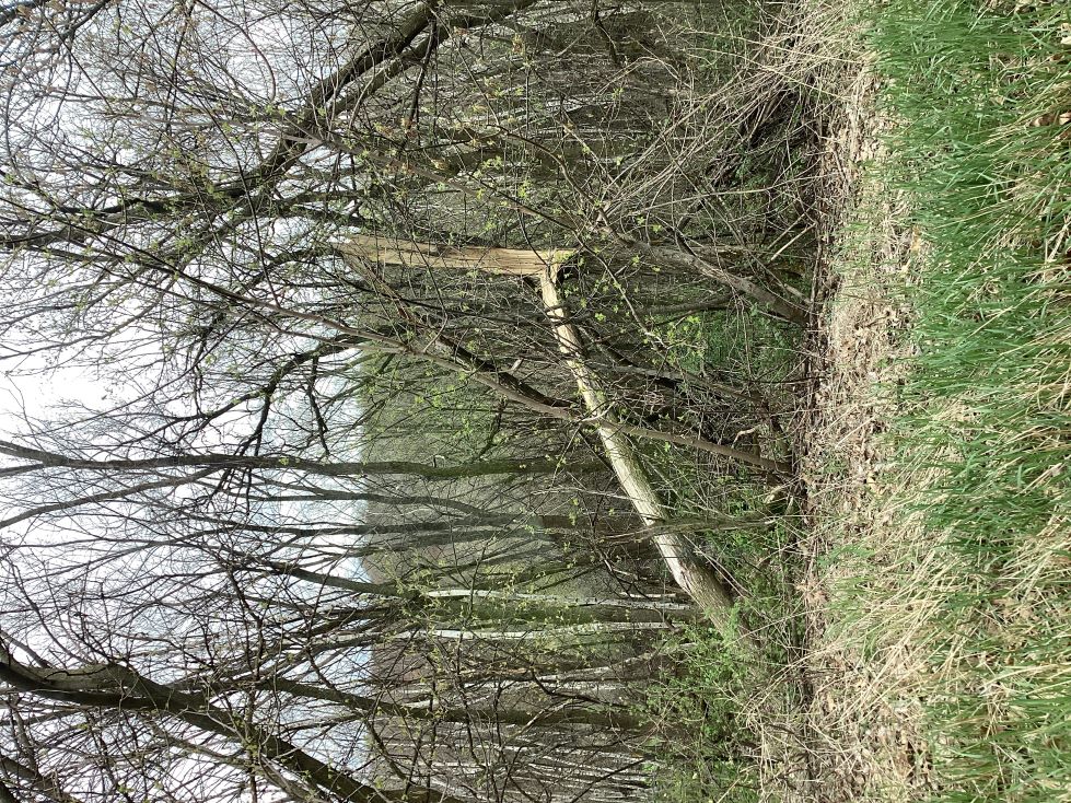
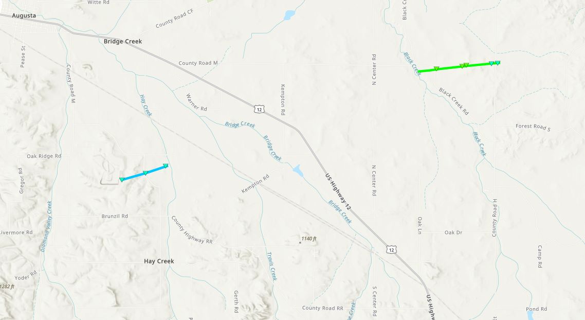
Tornado - 1 NE Mondovi, WI
Buffalo and Eau Claire Counties
| Date |
4/28/2025 |
| Time (Local) |
7:32 PM - 7:39 PM |
| EF Rating |
EF-1 |
| Est. Peak Winds |
95 MPH |
| Path Length |
5.42 Miles |
| Max Width |
50 Yards |
| Injuries/Deaths |
0/0 |
|
Summary:
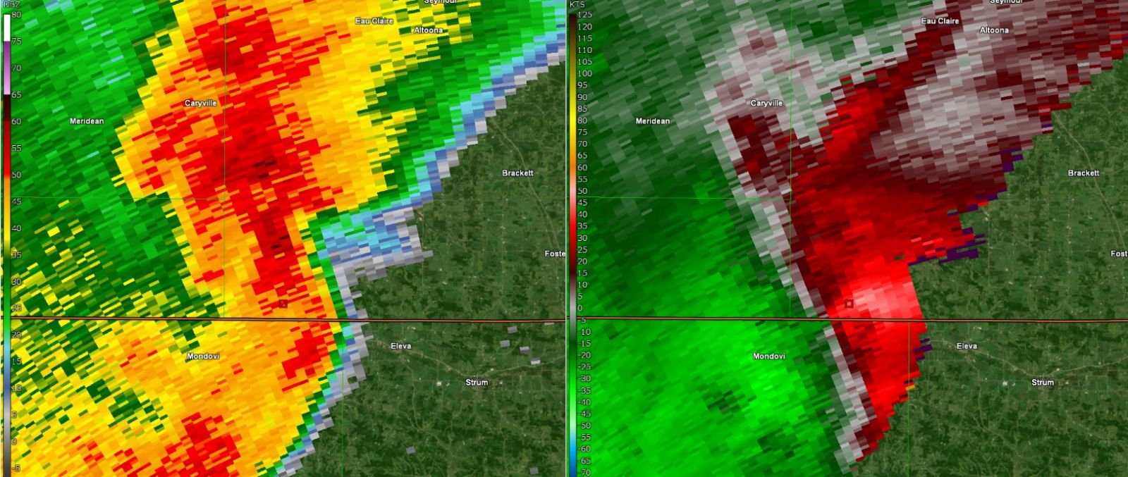
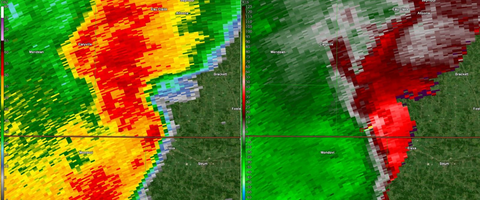
Damage to roofs and windows at houses on the northeast part of Mondovi near a golf course with an uprooted trees just to the northeast of town. The tornado tracked northeast into Eau Claire County with snapped trees initially and then large branches before it dissipated.
|
Track Map
Downloadable KMZ File
|
 |
 |
 |
 |
| Large tree uprooted across road. |
A group of damaged trees. |
Base Reflectivity (Left) and Velocity (Right) at 7:32 PM |
Base Reflectivity (Left) and Velocity (Right) at 7:34 PM |
|
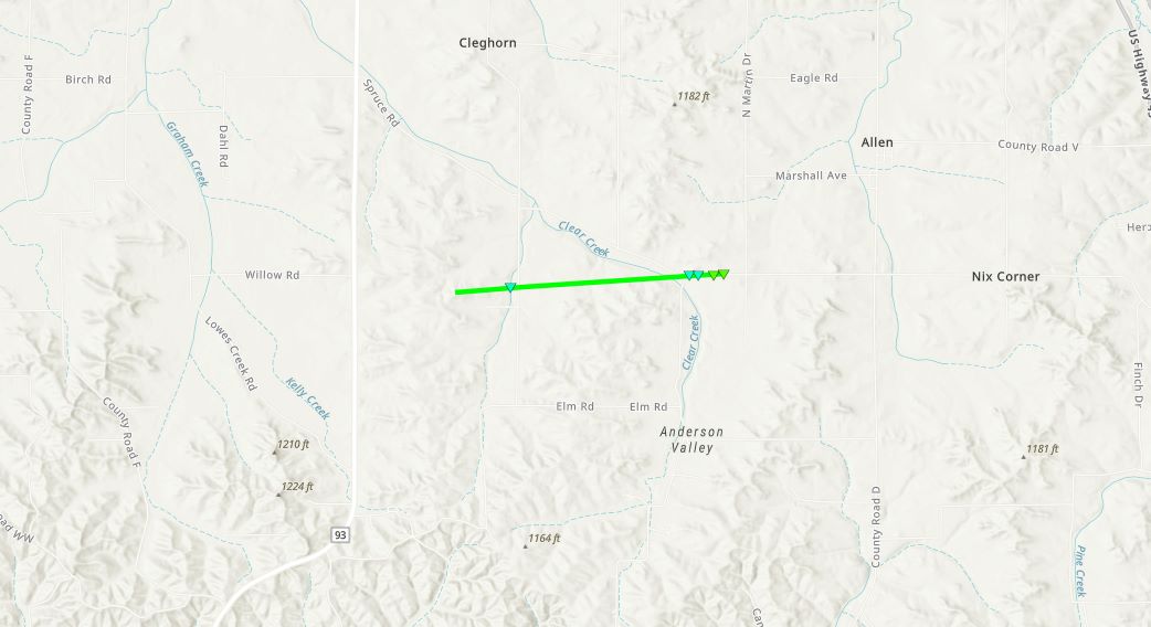
Tornado - SSW Cleghorn, WI
Eau Claire County
| Date |
4/28/2025 |
| Time (Local) |
7:44 PM - 7:47 PM |
| EF Rating |
EF-1 |
| Est. Peak Winds |
95 MPH |
| Path Length |
2.06 Miles |
| Max Width |
100 Yards |
| Injuries/Deaths |
0/0 |
|
Summary:
A pole barn was destroyed with parts of the barn in nearby trees and the field across the street. As the tornado traveled mainly east additional trees were uprooted and trunks snapped before it dissipated.
|
Track Map
Downloadable KMZ File
|
| |
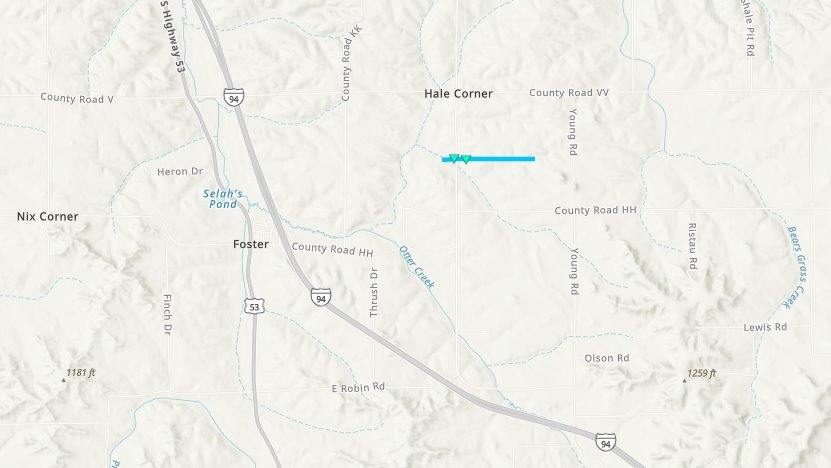
Tornado - 2 NNE Foster, WI
Eau Claire County
| Date |
4/28/2025 |
| Time (Local) |
7:55 PM - 7:56 PM |
| EF Rating |
EF-0 |
| Est. Peak Winds |
80 MPH |
| Path Length |
0.79 Miles |
| Max Width |
50 Yards |
| Injuries/Deaths |
0/0 |
|
Summary:
A very short tornado with large branches broken. Aerial imagery showed the short duration of this path with localized tree damage in a small line.
|
Track Map
Downloadable KMZ File
|
| |
Tornado - 3 SSW Augusta, WI
Eau Claire County
| Date |
4/28/2025 |
| Time (Local) |
8:07 PM - 8:08 PM |
| EF Rating |
EF-0 |
| Est. Peak Winds |
80 MPH |
| Path Length |
0.8 Miles |
| Max Width |
25 Yards |
| Injuries/Deaths |
0/0 |
|
Summary:
A short lived tornado developed southeast of Augusta and moved across County Road RR. It took part of the roof off of a barn. Several trees were broken before it dissipated.
|
Track Map
Downloadable KMZ File
|
| |
Tornado - 4.7 N Fairchild, WI
Eau Claire County
| Date |
4/28/2025 |
| Time (Local) |
8:13 PM - 8:15 PM |
| EF Rating |
EF-1 |
| Est. Peak Winds |
90 MPH |
| Path Length |
1.36 Miles |
| Max Width |
75 Yards |
| Injuries/Deaths |
0/0 |
|
Summary:
A short lived tornado moved mostly along County Road M. It took part of the roof off of an outbuilding at a farm. Some shingles were also torn off roof of houses. Several hundred trees were broken before it dissipated just east of County Road H.
|
Track Map
Downloadable KMZ File
|
| |
The Enhanced Fujita (EF) Scale classifies tornadoes into the following categories:
EF0
Weak
65-85 mph |
EF1
Moderate
86-110 mph |
EF2
Significant
111-135 mph |
EF3
Severe
136-165 mph |
EF4
Extreme
166-200 mph |
EF5
Catastrophic
200+ mph |
 |


