***All information is considered preliminary until investigations are finalized***
Overview
|
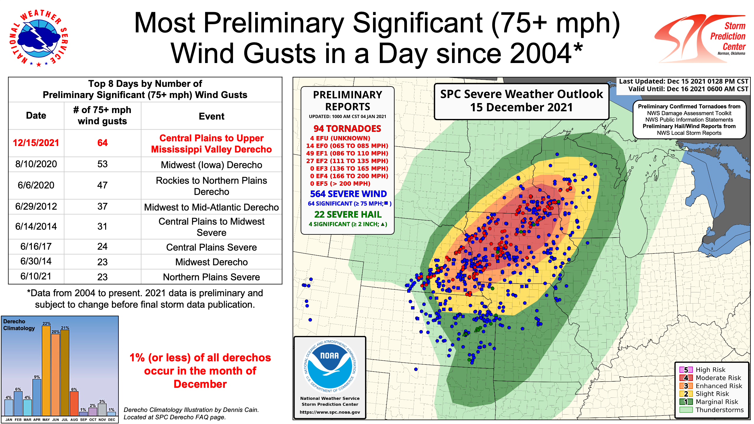
A low pressure system of historic strength led to a variety of high-end weather impacts from the central Plains to the Upper Midwest and Great Lakes December 15-16. An unprecedented December severe weather unfolded over portions of Minnesota and Wisconsin Wednesday evening, with the Storm Prediction Center issuing their farthest-north Moderate Risk for the month of December. A serial derecho moving at 60-80 mph tracked from Kansas to Wisconsin, resulting in over 560 reports of damaging wind and over 60 tornadoes. A total of 57 "significant severe" wind gusts (75+ mph) were reported, breaking the daily record of 53 set on August 10, 2020. Most of the damage across our area occurred from south-central Minnesota through west-central Wisconsin. Particularly widespread damage occurred in Hartland, Minnesota, and Stanley, Wisconsin where EF2 tornadoes were confirmed. Prior to this event, a tornado has never been reported in Minnesota in December. Before the thunderstorms, strong southerly winds led to record high temperatures at many sites across the Upper Midwest. Temperatures warmed into the mid to upper 50s across much of central Minnesota and western Wisconsin and even exceeded 60 degrees across southern Minnesota. The warm temperatures melted what was left of the snowpack from the December 10 winter storm, which led to widespread dense fog through much of the morning and afternoon. After the thunderstorms, strong gradient winds and widespread wind gusts in excess of 50 mph developed for several hours late Wednesday night and into the overnight hours. The Redwood Falls airport measured a gust of 78 mph at 11:30 PM. Temperatures quickly fell below freezing across western and central Minnesota Wednesday night, causing rain to change over to a wintry mix of freezing drizzle and snow. Snowfall accumulations of 1-4" inches, along with the strong gusty winds, led to low visibility and travel hazards late Wednesday night into Thursday morning. |
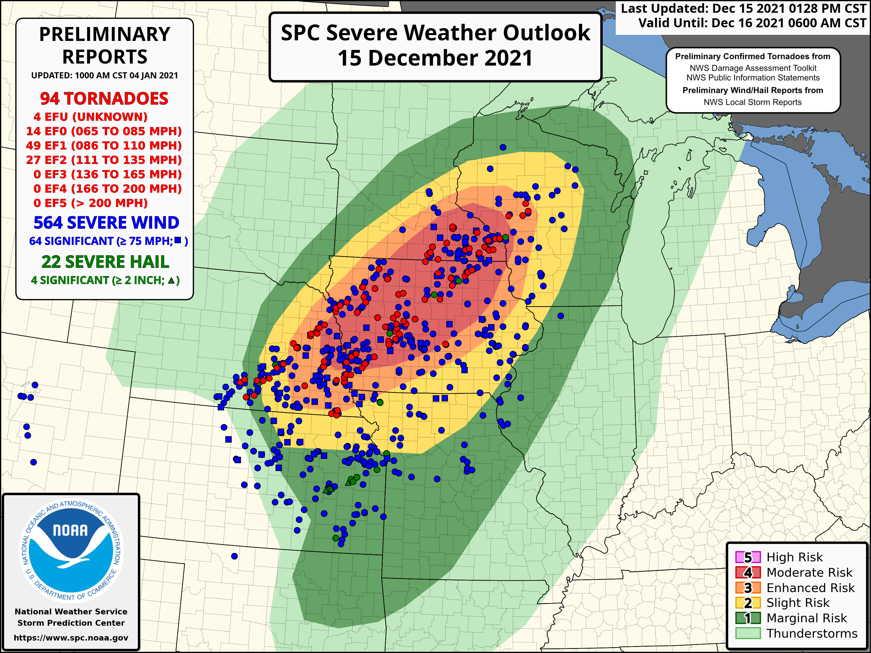 Map of storm reports and the convective outlook from December 15. The "Moderate Risk" is rare any time of year, let alone in December. One has never been issued so far north so late in the year. |
.jpg) |
 |
|
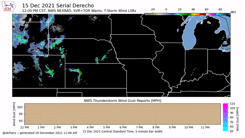
| Warnings Issued December 15 | Regional Loop of Radar, Warnings, and Wind Gust Reports (Courtesy: Iowa Environmental Mesonet) |
Tornadoes (in chronological order):
|
Tornado - Kiester
Track Map 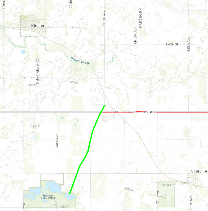  |
||||||||||||||||
|
Tornado - Alden 1
Track Map 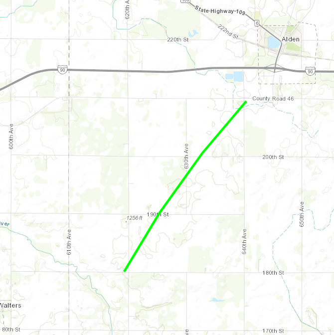 |
||||||||||||||||
|
Tornado - Alden 2
Track Map 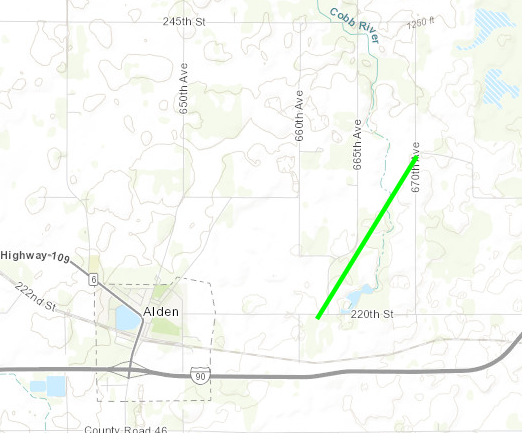 |
||||||||||||||||
|
Tornado - Hartland
Track Map .PNG) |
||||||||||||||||
|
Tornado - Myrtle
Track Map 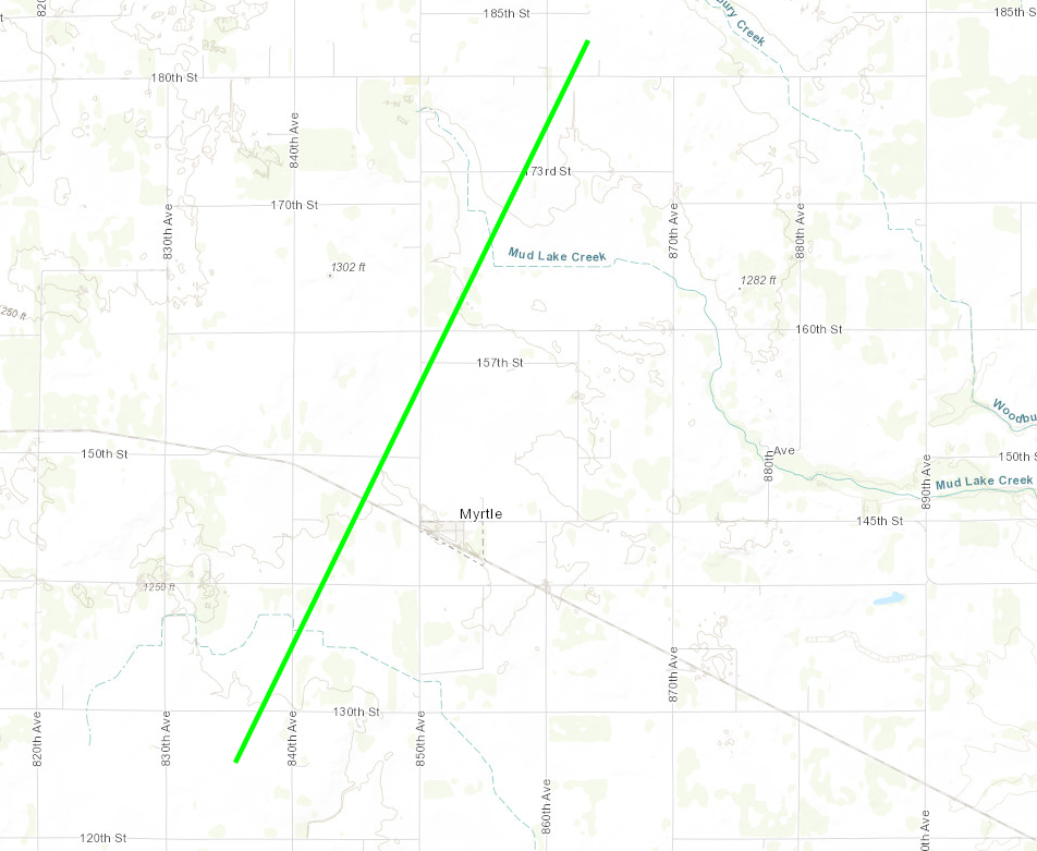 |
||||||||||||||||
|
Tornado - London NW
Track Map 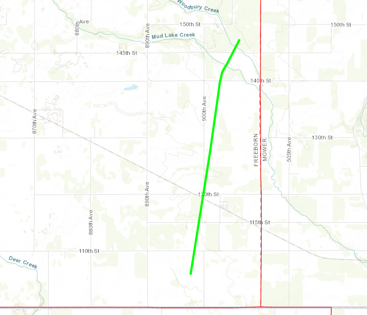 |
||||||||||||||||
|
Tornado - London SE
Track Map 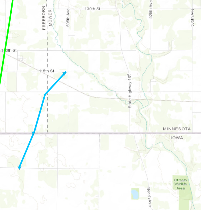 |
||||||||||||||||
|
Tornado - Glenville
Track Map 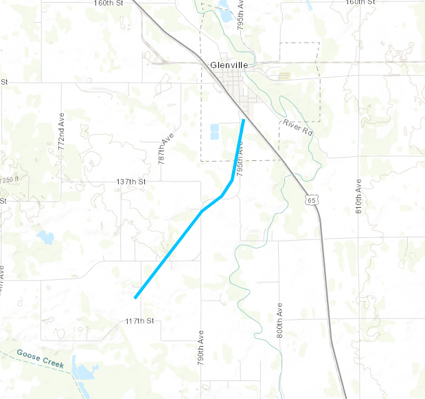 |
||||||||||||||||
|
Tornado - Hayward/I-90
Track Map 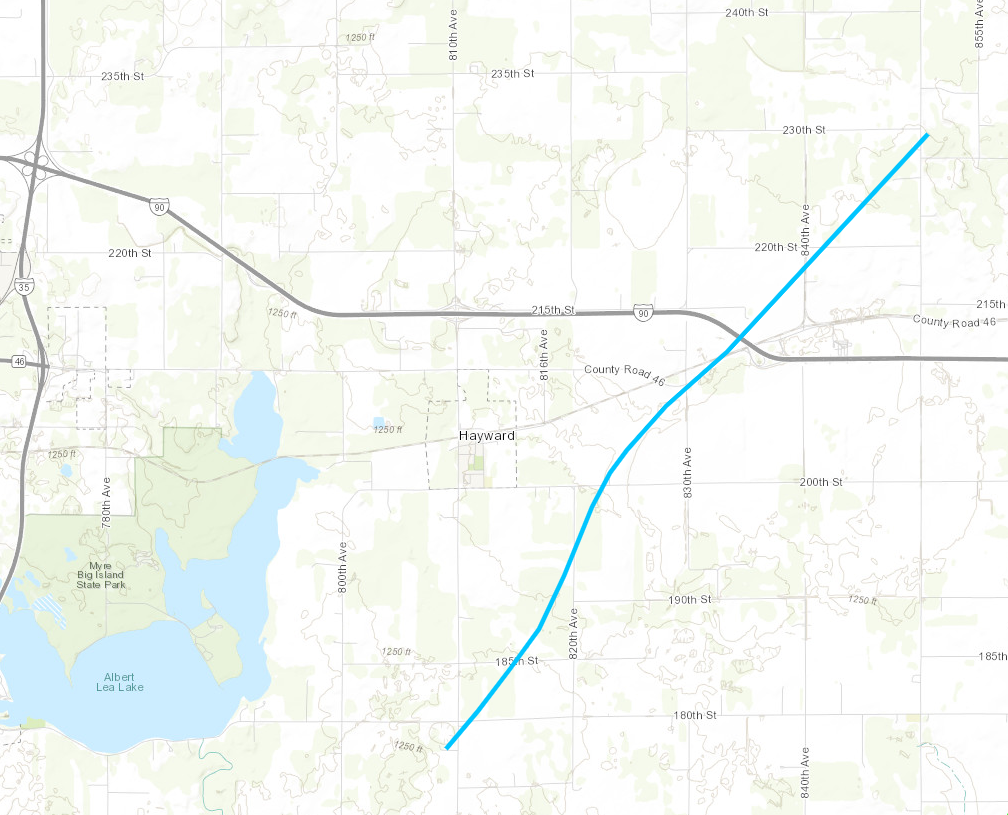 |
||||||||||||||||
|
Tornado - East Bixby
Track Map 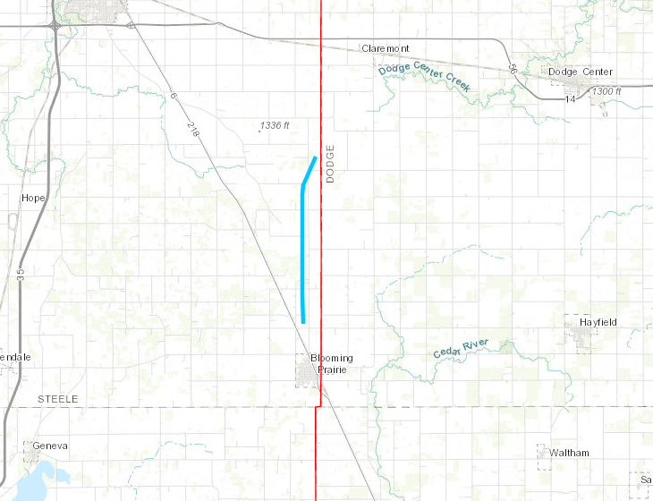 |
||||||||||||||||
|
Tornado - 5 SE Kenyon
Track Map 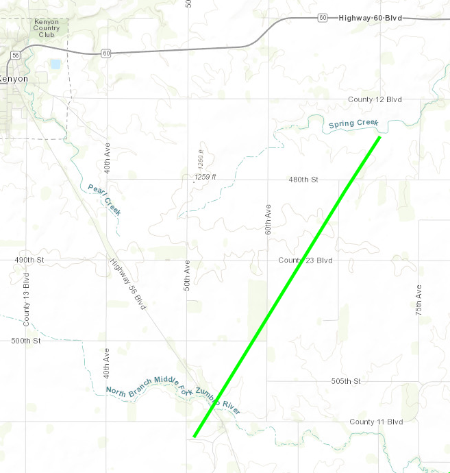 |
||||||||||||||||
|
Tornado - 7 SE Kenyon
Track Map 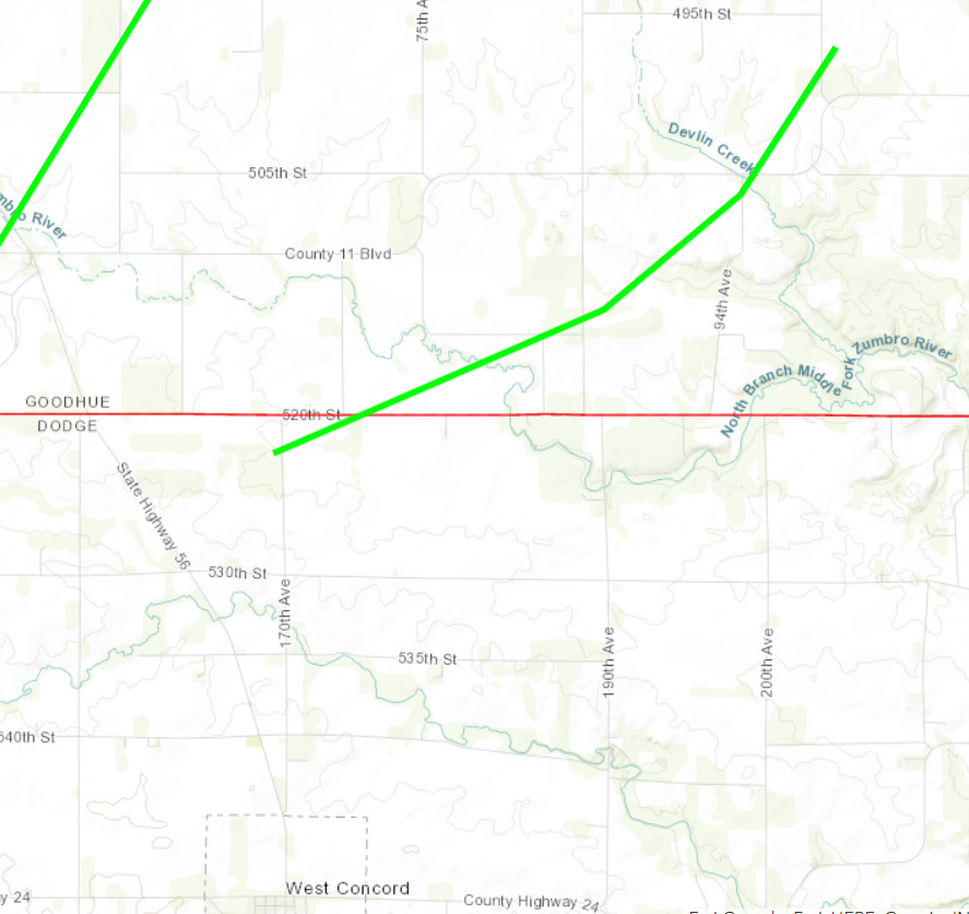 |
||||||||||||||||
|
Tornado - between Augusta & Fairchild
Track Map 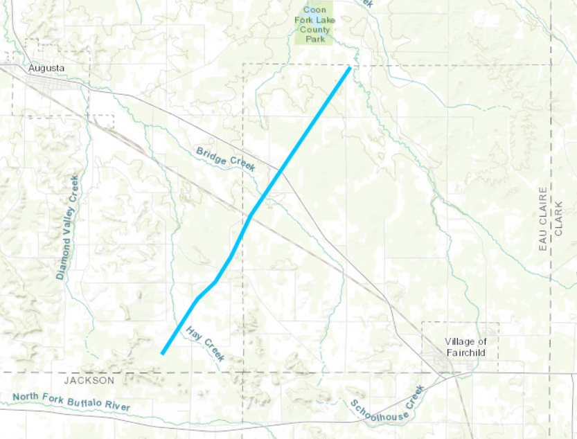 |
||||||||||||||||
|
Tornado - East side of Lake Wissota
Track Map 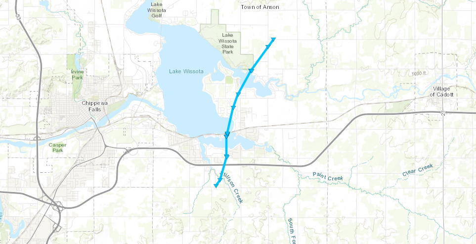 |
||||||||||||||||
|
Tornado - Stanley, WI
Track Map 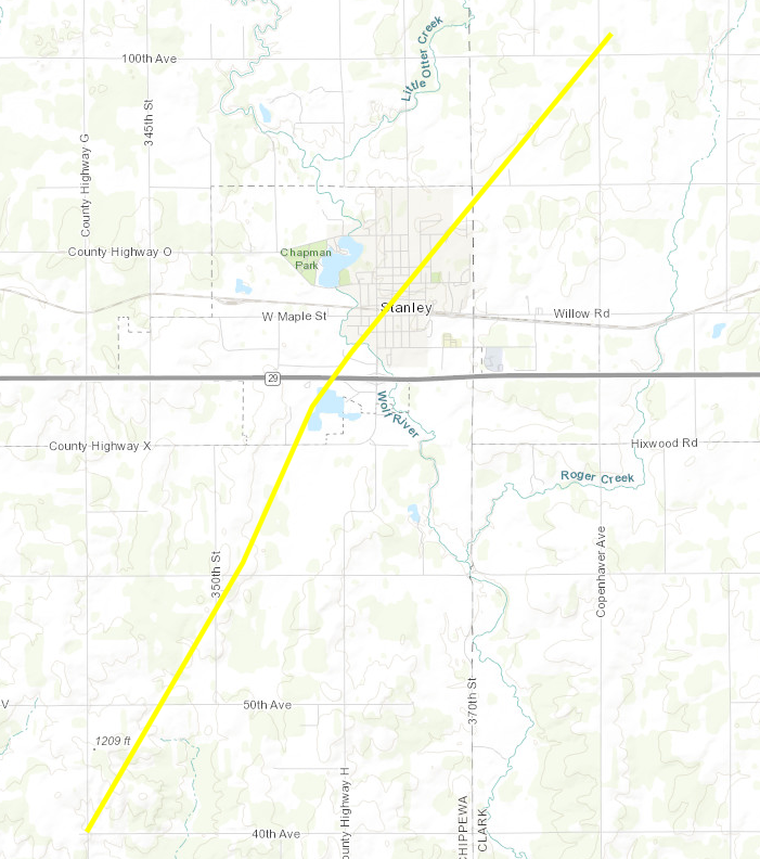 |
||||||||||||||||
The Enhanced Fujita (EF) Scale classifies tornadoes into the following categories:
| EF0 Weak 65-85 mph |
EF1 Moderate 86-110 mph |
EF2 Significant 111-135 mph |
EF3 Severe 136-165 mph |
EF4 Extreme 166-200 mph |
EF5 Catastrophic 200+ mph |
 |
|||||
Snow/Ice
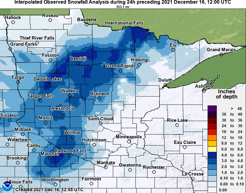
Public Information Statement
National Weather Service Twin Cities/Chanhassen MN
341 PM CST Thu Dec 16 2021

...SNOWFALL REPORTS FROM DECEMBER 15-16...

Location                     Amount    Time/Date       Provider
Farwell 5N                   3.5 in    0830 AM 12/16   COCORAHS
Donnelly 2WNW                2.4 in    0700 AM 12/16   COCORAHS
Prinsburg 0.1 WNW            2.1 in    0600 AM 12/16   COCORAHS
Long Prairie 2.1 NNE         2.0 in    0800 AM 12/16   COCORAHS
Belview 0.3 S                1.7 in    0700 AM 12/16   COCORAHS
Holdingford 6.0 NW           1.5 in    0800 AM 12/16   COCORAHS
1.0 NE Watson                1.5 in    0830 AM 12/16   COOP
Saint Joseph 2.5 N           1.4 in    0700 AM 12/16   COCORAHS
Alexandria                   1.4 in    0830 AM 12/16   COOP
Belgrade 8.0 ESE             1.3 in    0700 AM 12/16   COCORAHS
Camp Ripley 4E               1.3 in    0700 AM 12/16   COCORAHS
Hillman 8.3 N                1.3 in    0800 AM 12/16   COCORAHS
Long Prairie                 1.2 in    0600 AM 12/16   COOP
Danube 2WNW                  1.2 in    0700 AM 12/16   COCORAHS
Litchfield                   1.1 in    0800 AM 12/16   COOP
Saint Cloud 7.6 SW           1.1 in    1000 AM 12/16   COCORAHS
Bird Island 7SSE             1.0 in    0700 AM 12/16   COOP
Dawson                       1.0 in    0700 AM 12/16   COOP
Melrose                      1.0 in    0700 AM 12/16   COOP
Little Falls 1.2 SW          1.0 in    0700 AM 12/16   COCORAHS
Bird Island 7SSE             1.0 in    0700 AM 12/16   COCORAHS
Belgrade 0.4 WNW             1.0 in    0900 AM 12/16   COCORAHS
Peak Wind Speeds
...HIGHEST WIND REPORTS DECEMBER 15-16...

Some reports are from thunderstorms, but most are from non-thunderstorm
winds overnight.

Location                     Speed     Time/Date       Provider
Redwood Falls AP             78 MPH    1130 PM 12/15   ASOS
Fairmont AP                  70 MPH    1019 PM 12/15   AWOS
Eau Claire AP                67 MPH    0900 PM 12/15   ASOS
Ellendale 5NNE               65 MPH    1050 PM 12/15   MNDOT
Eden Prairie AP              63 MPH    0211 AM 12/16   ASOS
Cannon Falls 7SSE            63 MPH    0105 AM 12/16   MNDOT
St. James AP                 62 MPH    1155 PM 12/15   AWOS
Mankato AP                   62 MPH    1107 PM 12/15   AWOS
Owatonna AP                  62 MPH    1053 PM 12/15   AWOS
Twin Lakes 5SE               62 MPH    1110 PM 12/15   MNDOT
Minneapolis-St. Paul AP      61 MPH    0317 AM 12/16   ASOS
Red Wing 4W                  61 MPH    1235 AM 12/16   MNDOT
Waseca AP                    60 MPH    1135 PM 12/15   AWOS
Olivia AP                    60 MPH    1255 AM 12/16   AWOS
New Ulm AP                   60 MPH    1135 PM 12/15   AWOS
Waseca 1SSE                  60 MPH    1130 PM 12/15   MNDOT
Red Wing                     59 MPH    0206 AM 12/16   CWOP
Hanska                       59 MPH    0700 PM 12/15   CWOP
Lydia                        59 MPH    0116 AM 12/16   CWOP
Eau Claire                   59 MPH    0108 AM 12/16   CWOP
Hutchinson AP                59 MPH    1155 PM 12/15   AWOS
New Germany 1NW              59 MPH    1220 AM 12/16   MNDOT
Ganoe Hill                   59 MPH    0107 AM 12/16   RAWS
Hope                         58 MPH    1109 PM 12/15   CWOP
Stanton AP                   58 MPH    1115 PM 12/15   AWOS
Madelia 3ENE                 58 MPH    1150 PM 12/15   MNDOT
Minnesota Lake               57 MPH    1045 PM 12/15   CWOP
Silver Lake 3E               57 MPH    1206 AM 12/16   MNDOT
Clara City 2WSW              57 MPH    1110 PM 12/15   MNDOT
Winthrop 2W                  57 MPH    1140 PM 12/15   MNDOT
Mankato US-169 Mile Post 52  57 MPH    0100 AM 12/16   MNDOT
Easton                       56 MPH    1046 PM 12/15   CWOP
Albert Lea AP                56 MPH    1055 PM 12/15   AWOS
Willmar AP                   56 MPH    1215 AM 12/16   AWOS
Crystal AP                   56 MPH    0436 AM 12/16   ASOS
St. Paul Dwtn AP             56 MPH    0200 AM 12/16   ASOS
Litchfield 3S                56 MPH    0211 AM 12/16   RAWS
Glencoe AP                   55 MPH    1215 AM 12/16   AWOS

Observations are collected from a variety of sources with varying
equipment and exposures. We thank all volunteer weather observers
for their dedication. Not all data listed are considered official.
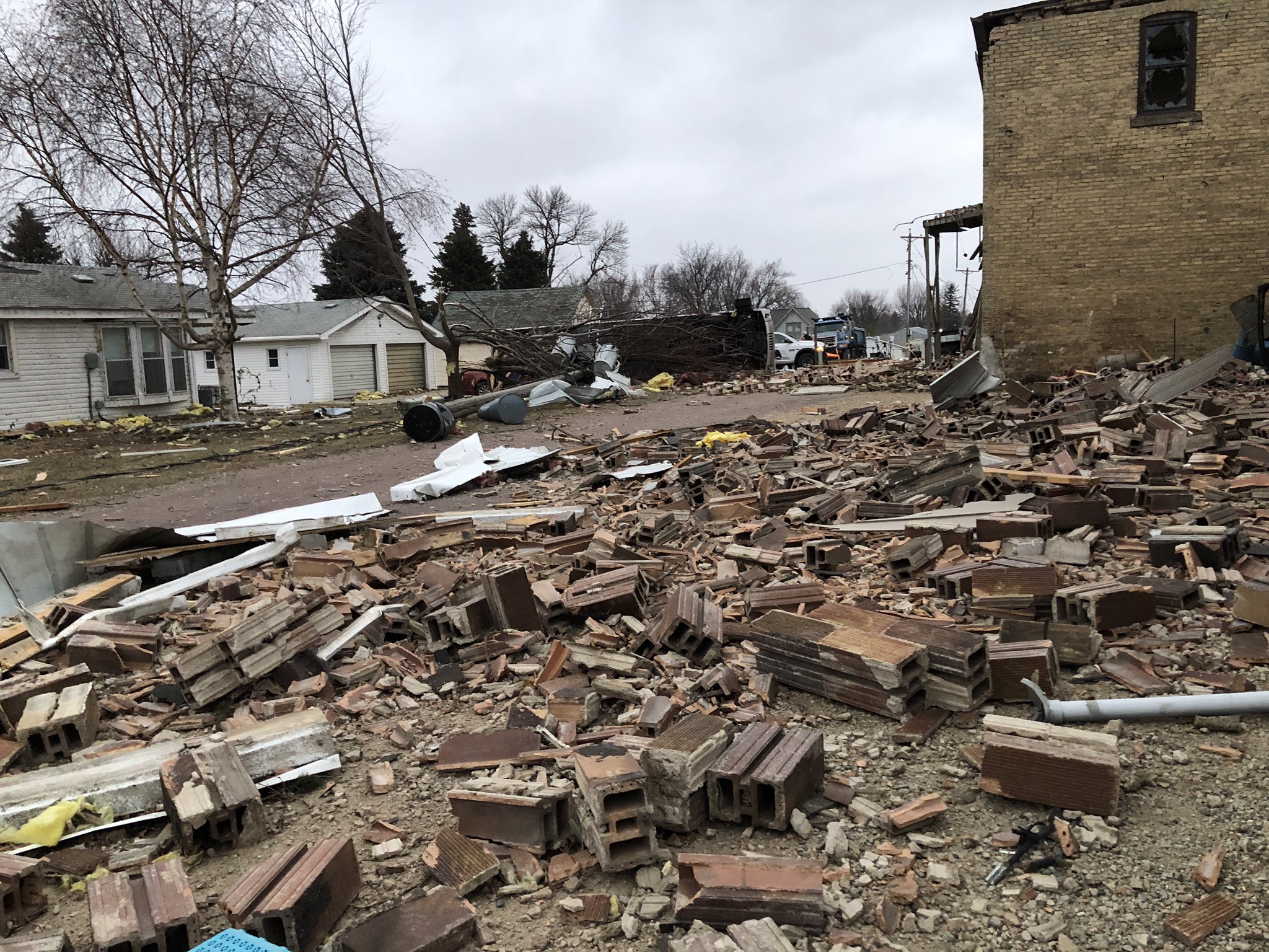
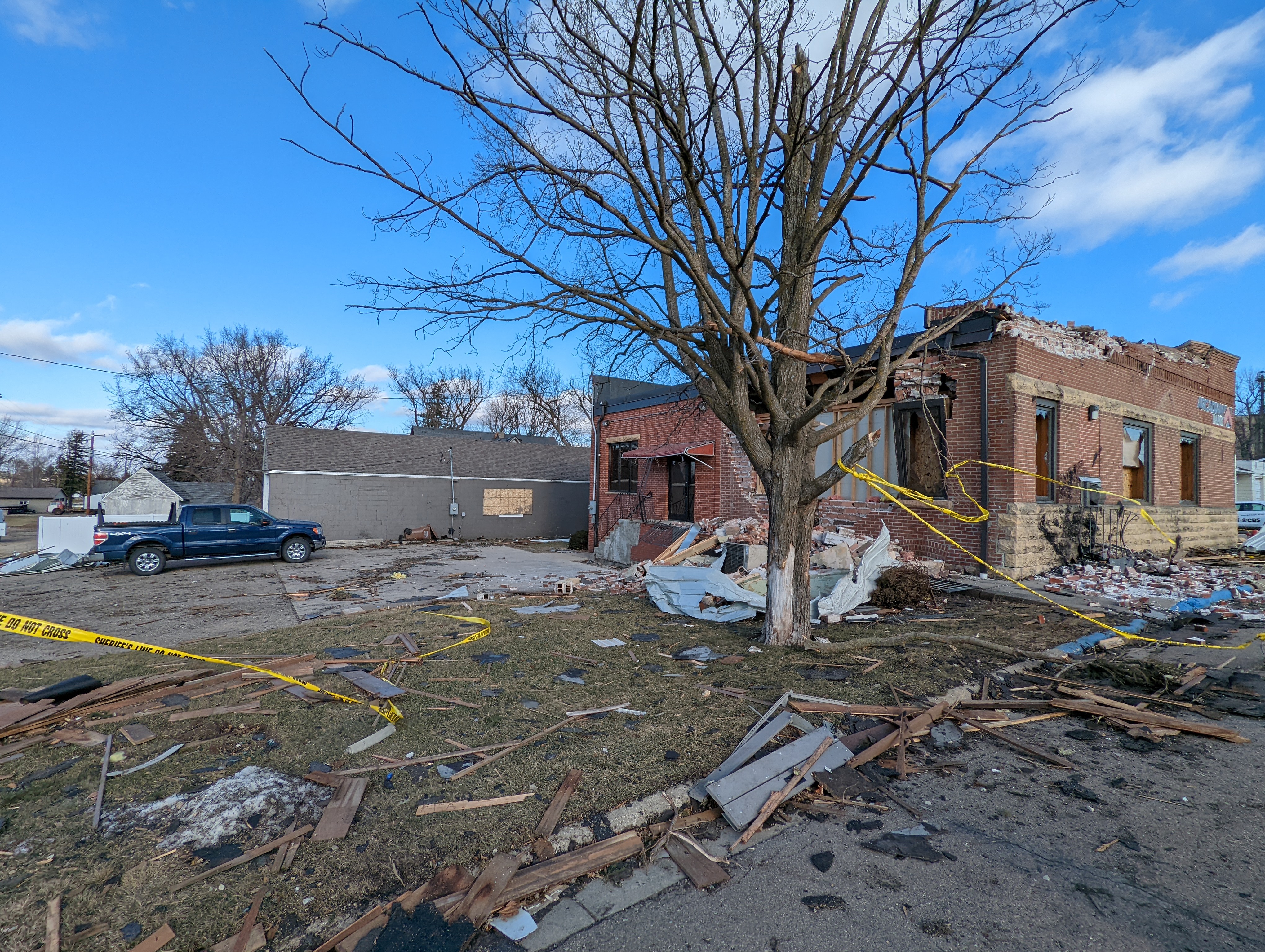
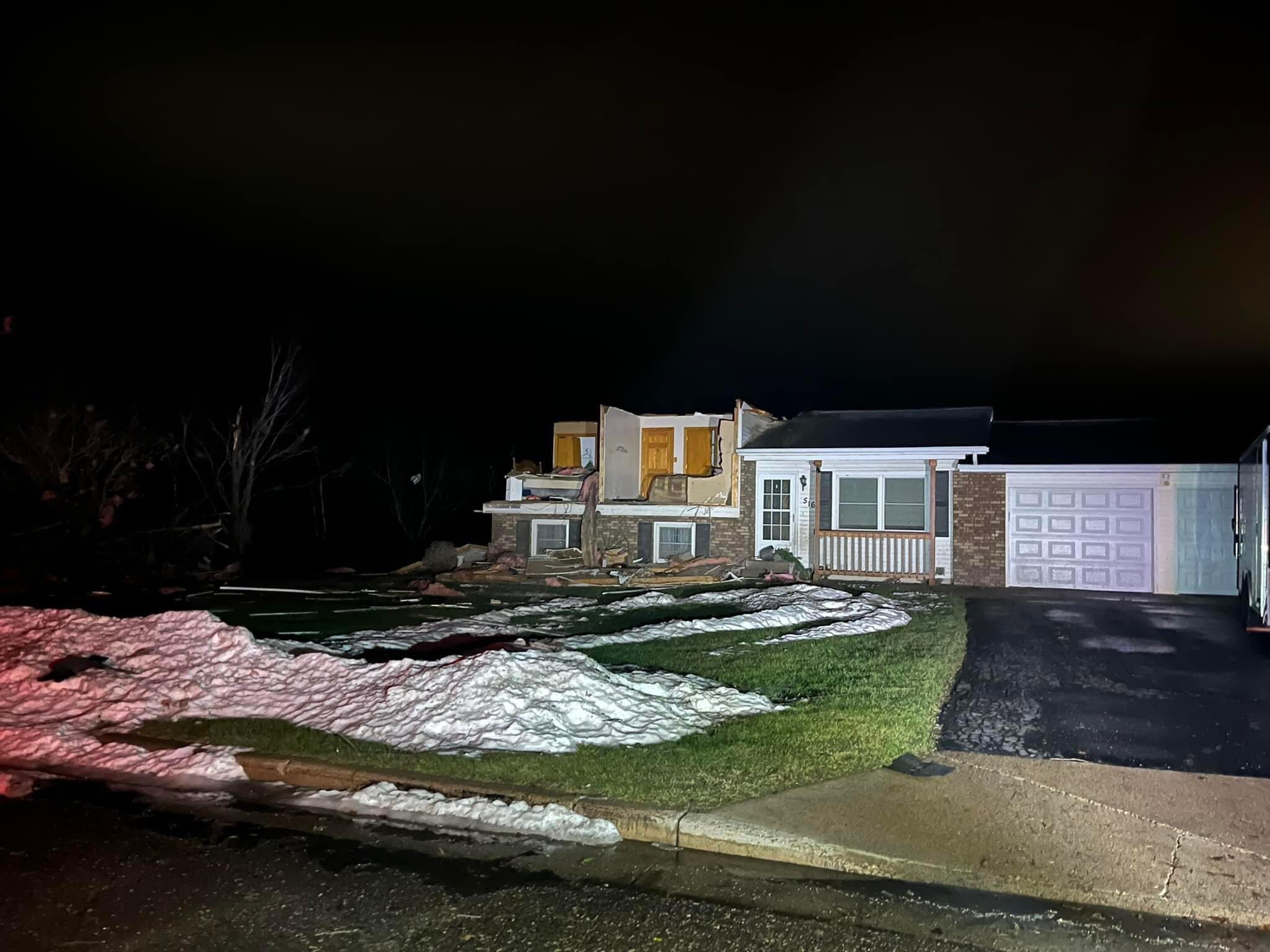
Photos & Video
Storm Damage
 |
 |
 |
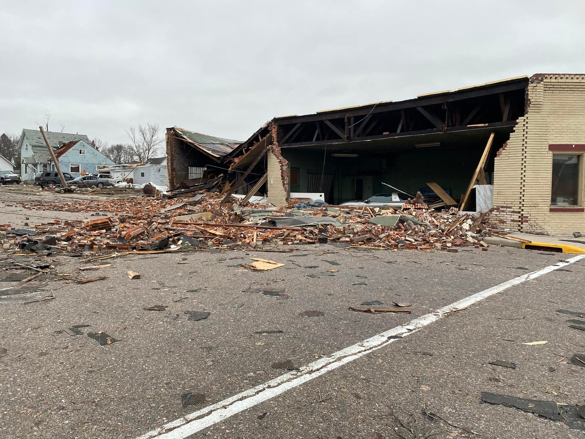 |
| Damage in Hartland, MN Source: Bill Keller-Fox 9 |
Damage in Hartland, MN Source: NWS Damage Survey |
Tornado Damage in Stanley, WI Source: Alyssa Lyons-WQOW TV |
Tornado Damage in Stanley, WI Source: Alyssa Lyons-WQOW TV |
Storm Damage
 |
 |
 |
 |
|
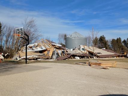
Tornado Damage NW of London, MN |
Tornado Damage N of Myrtle, MN | Tornado Damage W of Fairchild, WI | Tornado Damage S of Stanley, WI |
Storm Damage
| Caption (source) |
Caption (source) |
Caption (source) |
Caption (source) |
Snow/Fog
.png) |
|||
| Dense Fog On Bde Maka Ska Source: Patrick Mustain | Caption (source) |
Caption (source) |
Caption (source) |
Radar
 |
 |
||
| Radar Loop From 3 PM - 12 AM December 15 | Radar Loop From 12 AM - 12 PM December 16 |
Storm Reports
Link to storm reports from December 15, 2021: https://www.spc.noaa.gov/climo/reports/211215_rpts.html
Environment
-----
.gif/ezgif.com-gif-maker%20(1)__426x320.gif) |
MLCAPE.gif) |
0-3shear.gif) |
| Surface Map Loop | Mixed Layer CAPE | 0-3 km Bulk Shear |
-----
esrh.gif) |
0-500srh.gif) |
EHI.gif) |
| Effective Storm Relative Helicity | 0-500 m Storm Relative Helicity | 0-1 km Energy Helicity Index |
-----
STP.gif) |
.gif) |
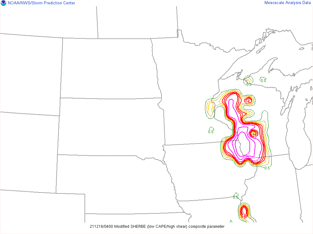 |
| Significant Tornado Parameter | Conditional Probability of a Significant Tornado | SHERBE (High Shear/Low Instability Parameter) |
Additional Information
 |
 |
 |
|
|
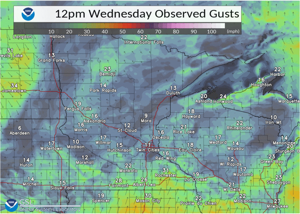
Loop of Observed Wind Gusts (12 PM December 15 - 12 PM December 16) |
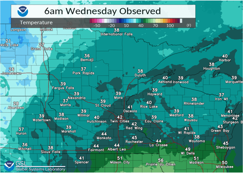
Loop of Observed Temperatures (6 AM December 15 - 6 AM December 16) |
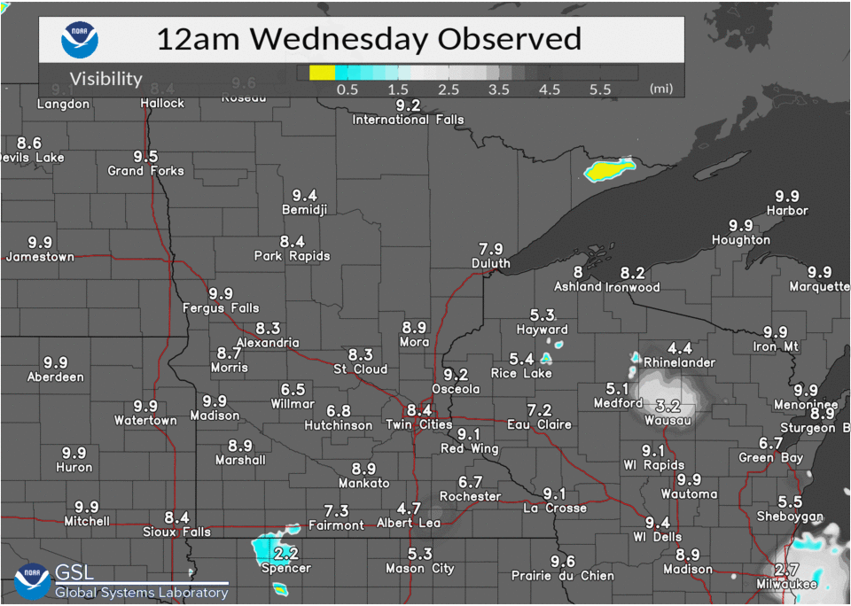
Loop of Observed Visibility (12 AM December 15 - 12 AM December 16) |
|
 |
|||
|
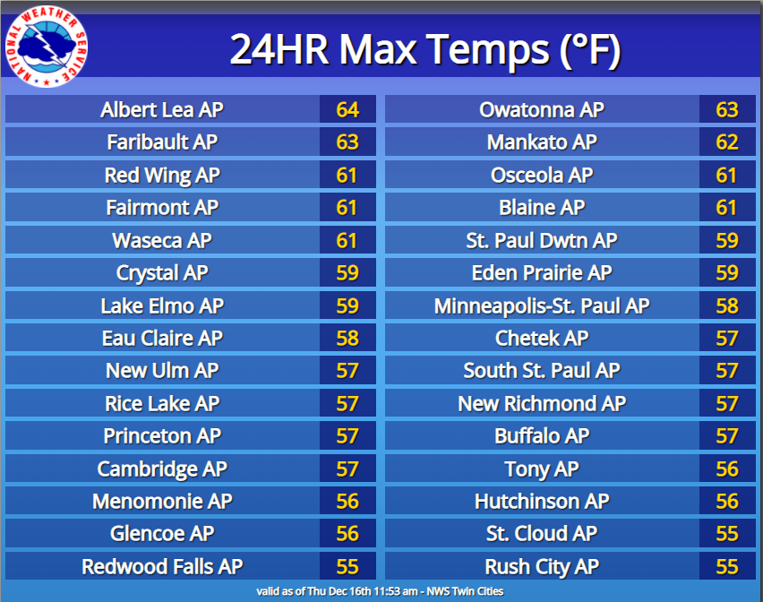
High Temperatures From December 15 |
|
Summaries from other NWS Offices
 |
Media use of NWS Web News Stories is encouraged! Please acknowledge the NWS as the source of any news information accessed from this site. |
|

