Overview
|
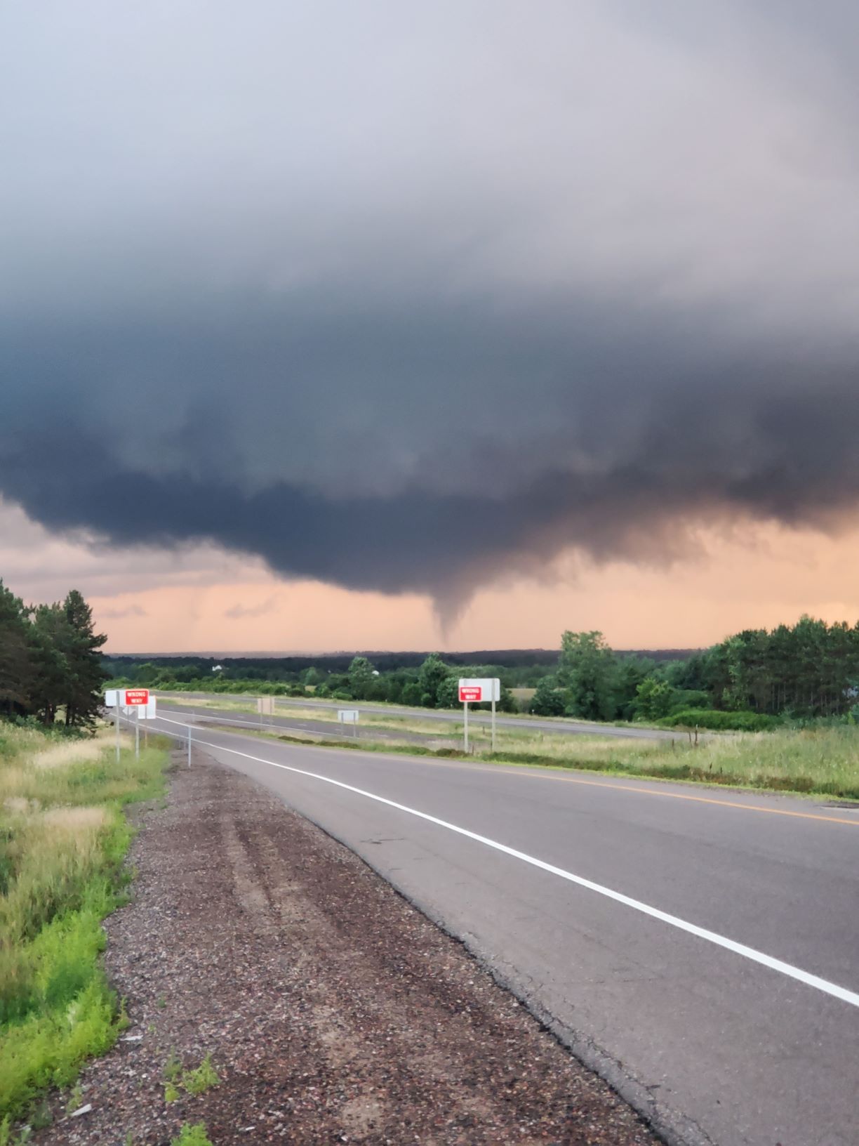
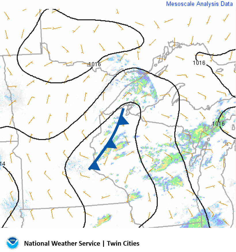
Several tornadoes developed across western Wisconsin on July 21, 2020. That map below shows where the confirmed touchdowns occurred (blue lines/triangles). All five tornadoes were rated EF-0. One tornado hit the town of Cadott Wisconsin. Many thanks goes out to all the storm spotters that submitted real-time reports. The image to the right shows the tornado as it approached Cadott, courtesy of Scott Graupner.
|
|
Radar
Radar reflectivity (left) and storm relative velocity (right)
.png/Radar1_638PM(1)__600x317.png) |
.png) |
.png) |
| Radar image at 638 PM. Isolated storms ahead of a cold front were rotating, and some managed to produce brief tornadoes. | Radar at 816 PM as the storm was producing a tornado east of Elk Mount. There was very radar-indicated rotation on the tornadic storm so the south, but the storm approaching Cadott did show broad rotation. | Radar at 846 PM from the NWS La Crosse WI office. A tight circulation was evident over the city of Cadott at this time. |
Storm Reports
This event was a "tornado or nothing" day, meaning that the atmosphere was conducive to rotating storms and tornadoes, but not wind damage or large hail. This is shown in the storm reports from the Storm Prediction Center. There were five confirmed tornadoes across western Wisconsin. All of them were rated EF-0, which means peak wind speeds of 65 to 85 MPH.
Environment
A few isolated storms formed ahead of an approaching cold front. Cloud bases were very low and there was adequate deep layer shear for rotating updrafts.
 |
 |
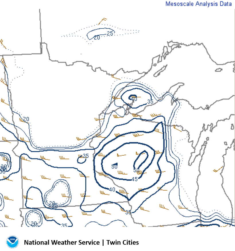 |
| Composite radar and surface analysis at 700 PM CDT showing a few storms across western Wisconsin ahead of a weak cold front. | Lifted Condensation Level (LCL) is around 500m, which means very low cloud bases. | Effective shear, or deep layer shear, is greater than 40 kts which is a favorable environment for supercells. |
An area of about 1000 J/kg of 100mb mixed layer CAPE was in place ahead of the approaching cold front. The winds at the surface were light.
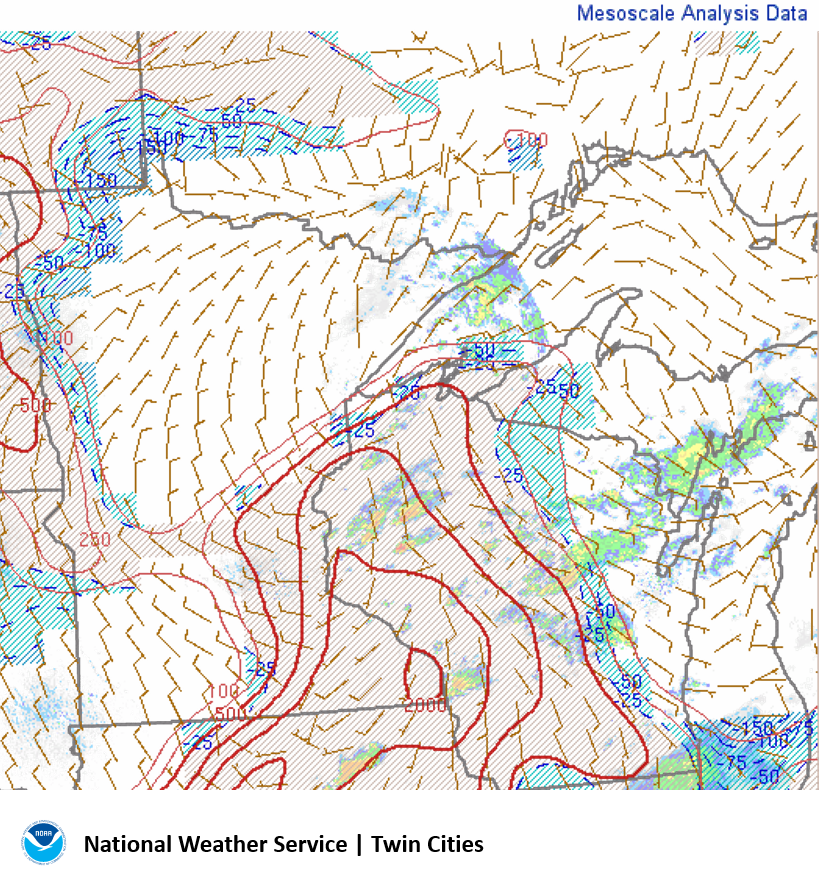 |
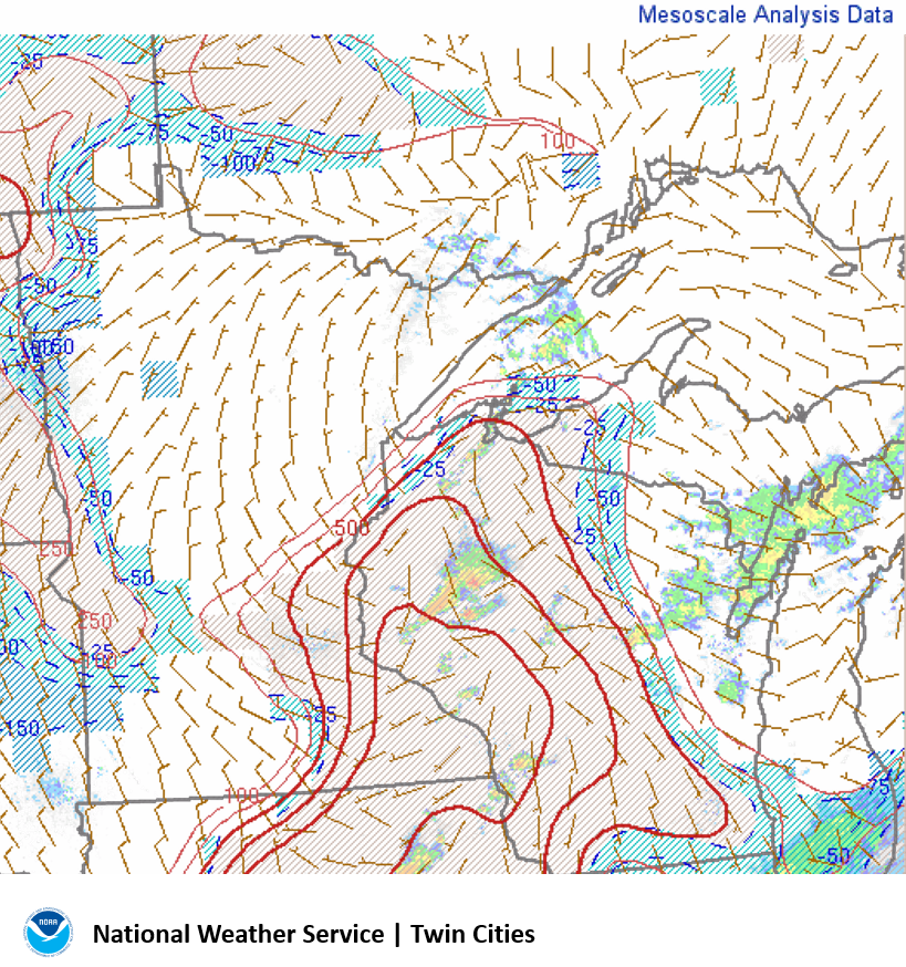 |
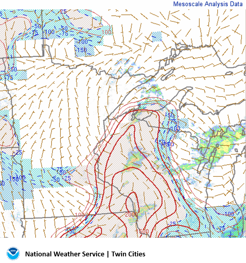 |
| MLCAPE at 700 PM CDT showing instability across western Wisconsin. | MLCAPE at 800 PM CDT. | MLCAPE at 900 PM CDT. |
The effective helicity was maximized across central Wisconsin, but it shifted eastward slightly as the storms moved in from the west.
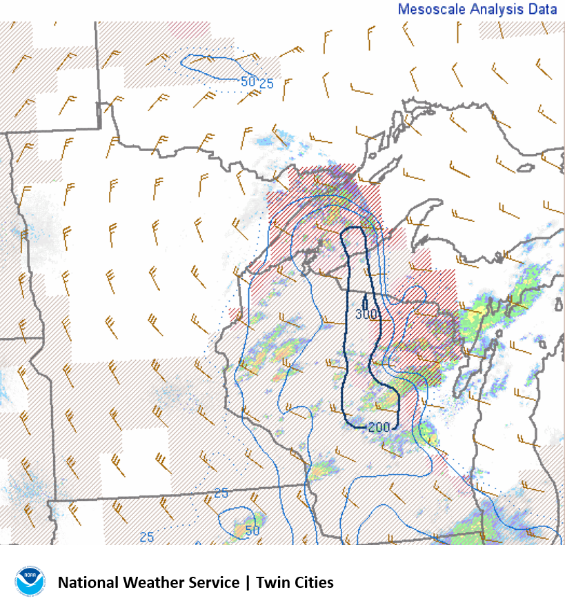 |
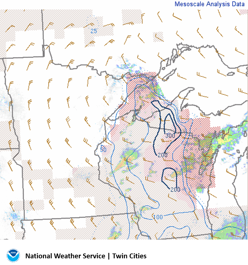 |
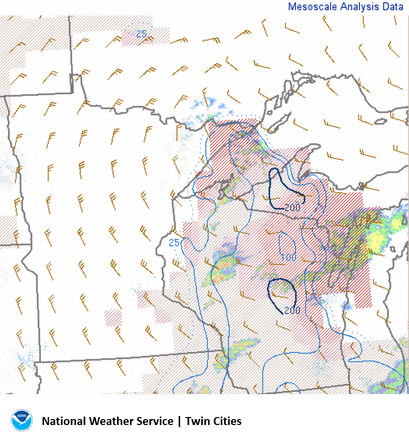 |
| Effective Storm Relative Helicity at 700 PM CDT showing a favorable environment for low level rotation across central Wisconsin. | Effective Storm Relative Helicity at 800 PM CDT | Effective Storm Relative Helicity at 900 PM CDT |
 |
Media use of NWS Web News Stories is encouraged! Please acknowledge the NWS as the source of any news information accessed from this site. |
|


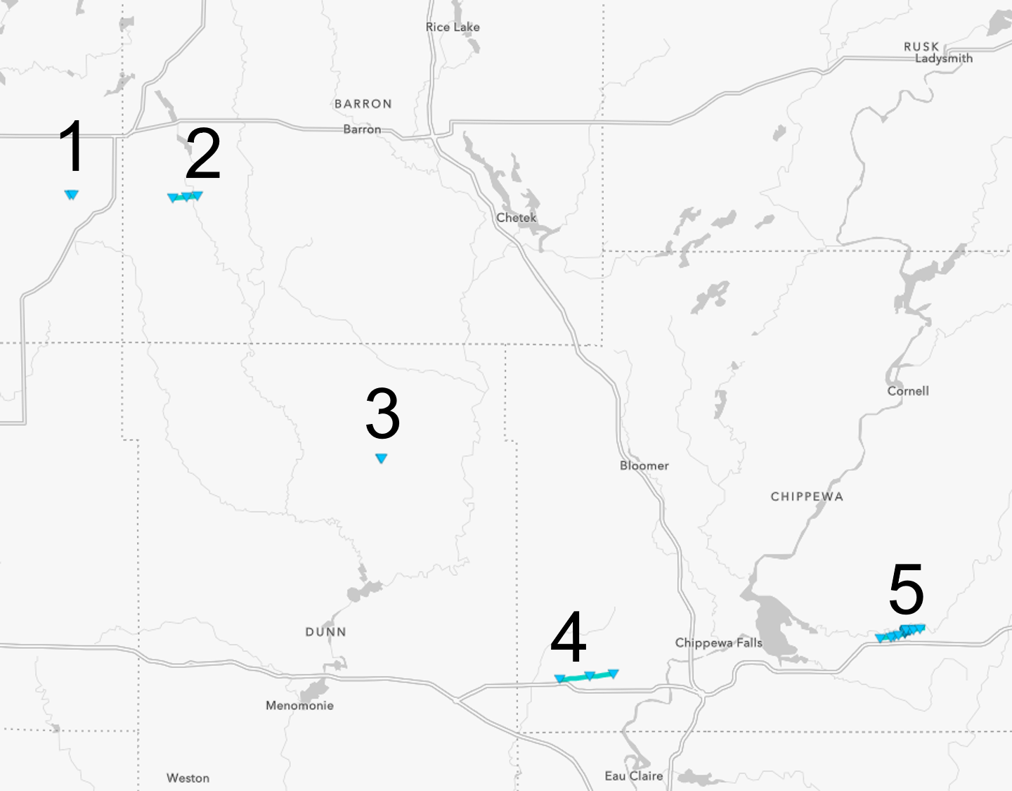 Tornado 1: 5:32 PM CDT, Path Length 0.2 miles. Confirmed via video.