Overview
|
A line of thunderstorms developed over western MN and progressed eastward during the evening of July 29th, 2025. As this line of storms reached eastern MN, storm intensity rapidly increased producing 60 58 to 70 mph damaging wind gusts across the Twin Cities metro down to Mankato. These storms the continued on into western WI and southern MN. Reports of trees down and power outages were reported across several areas that the storm had moved through. The strongest wind gust was recorded at Owatonna in Steele Co at 70mph. The strongest wind gusts from this event regional did occur south of MN/IA border in Spencer, IA with 92 mph and Waterloo, IA at 92 mph.
|
Caption |
Environment
Insert synoptic summary.
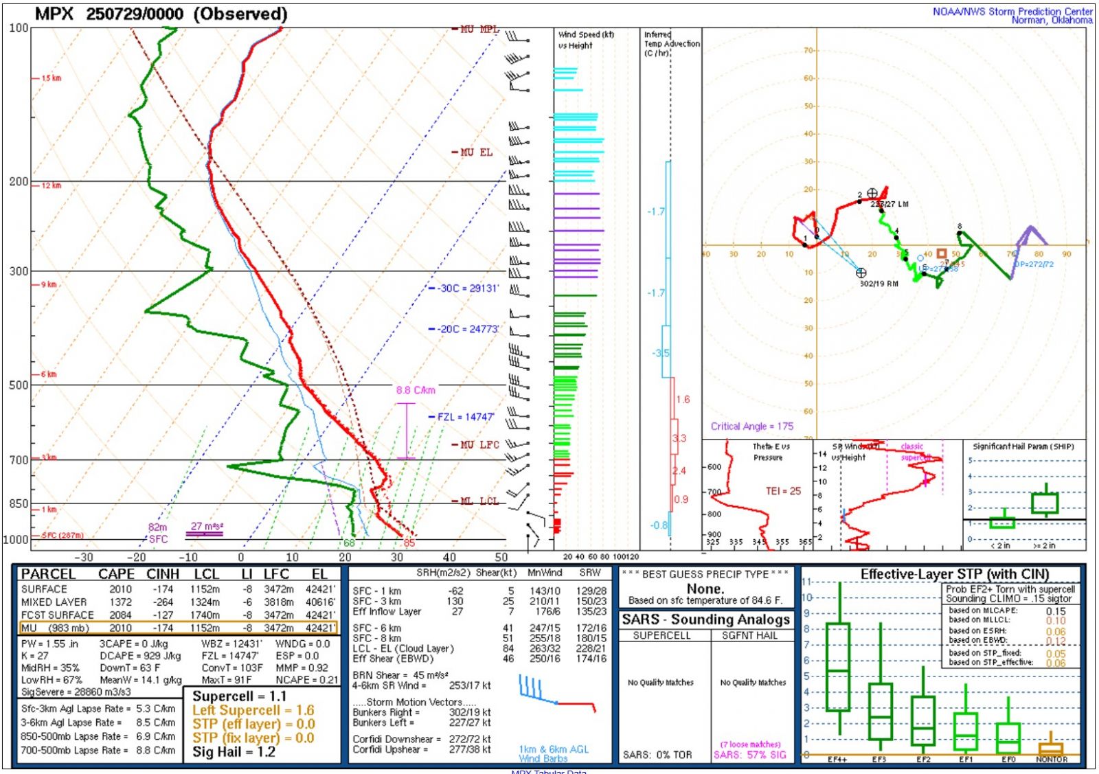 |
||
| 250mb Upper-Air Chart | 500mb Upper-Air Chart | 00z (7PM) Upper Air Sounding - MPX |
Near-storm environment summary.
| Figure 4: Caption | Figure 5: Caption | Figure 6: Caption |
Additional environmental data.
| Figure 7: Caption | Figure 8: Caption | Figure 9: Caption |
Storm Reports
Here is a link to severe weather reports. We'll continue to update those over as we receive more information.
Photos & Video
Header
| Caption (source) |
Caption (source) |
Caption (source) |
Caption (source) |
 |
Media use of NWS Web News Stories is encouraged! Please acknowledge the NWS as the source of any news information accessed from this site. |
|

