Overview
|
On March 06, 2017, an early spring severe weather outbreak produced large hail and damaging wind in Wisconsin, and even three tornadoes across Minnesota. This marks the earliest date in Minnesota history that a tornado was ever recorded. The previous record was March 18, 1968. The loop to the right shows a comparison of visible and infrared satellite imagery from the GOES16 satellite, along with radar reflectivity, lightning, and warnings at 5:00 PM March 06, 2017. The line of thunderstorms was located across Central Minnesota and extends southward into Iowa. |
.jpg) |
| Figure 1: Damage from Freeborn County in the town of Clarks Gove, Minnesota. |
.jpg) |
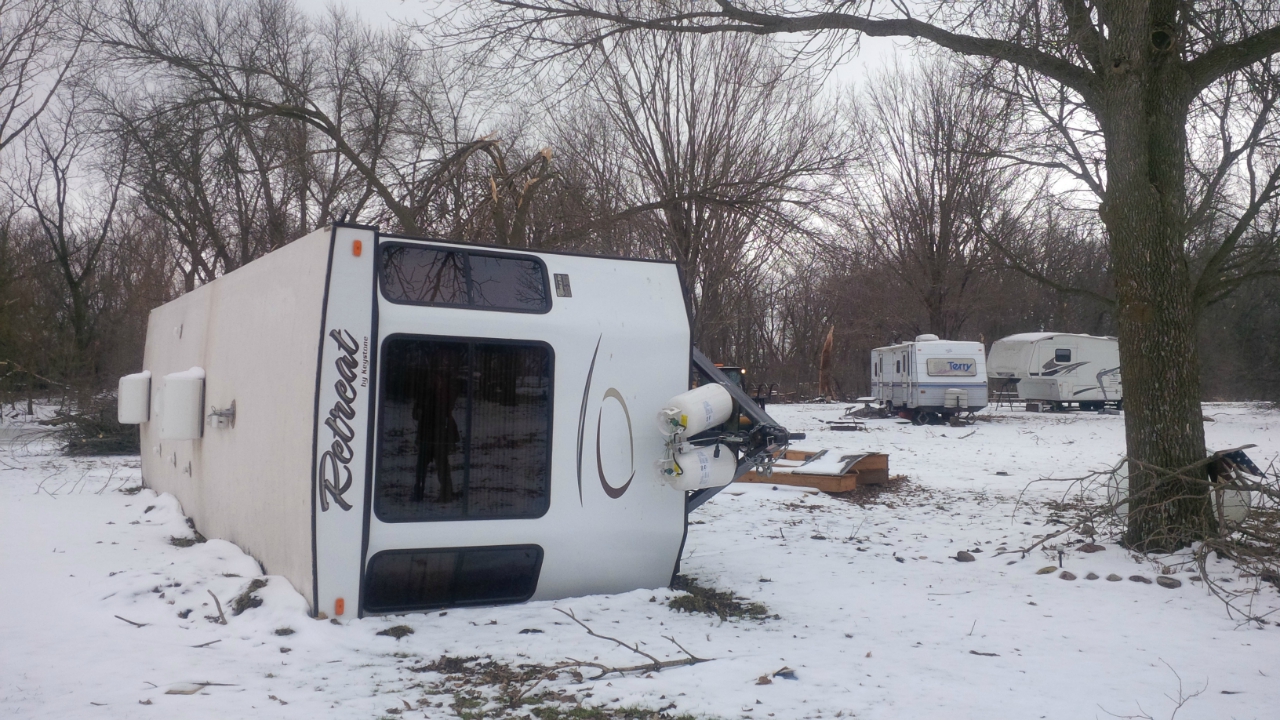 |
| Figure 2: Damage from Sherburne County near Elk Lake, Minnesota. | Figure 3: Damage from Faribault County by Rice Lake, Minnesota. |
Tornadoes:
|
Tornado - Zimmerman Area EF-1
Track Map 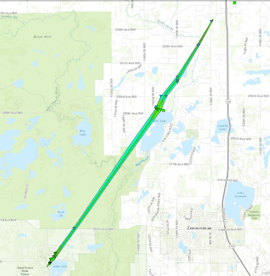 
--- |
||||||||||||||||
|
Tornado - Clark's Grove Area EF-1
Track Map 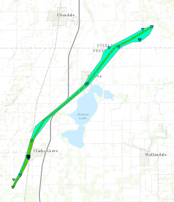
--- |
||||||||||||||||
|
Tornado - Bricelyn Area EF-1
Track Map 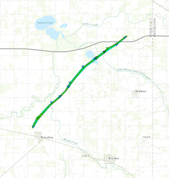
--- |
||||||||||||||||
The Enhanced Fujita (EF) Scale classifies tornadoes into the following categories:
| EF0 Weak 65-85 mph |
EF1 Moderate 86-110 mph |
EF2 Significant 111-135 mph |
EF3 Severe 136-165 mph |
EF4 Extreme 166-200 mph |
EF5 Catastrophic 200+ mph |
 |
|||||
Radar:
Header
  |
  |
|
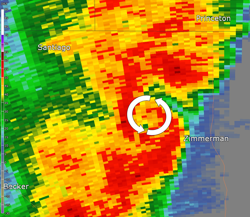
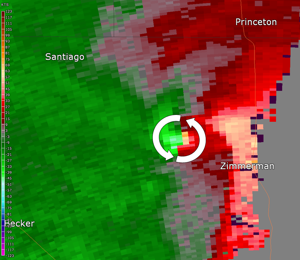
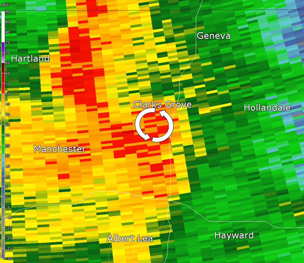
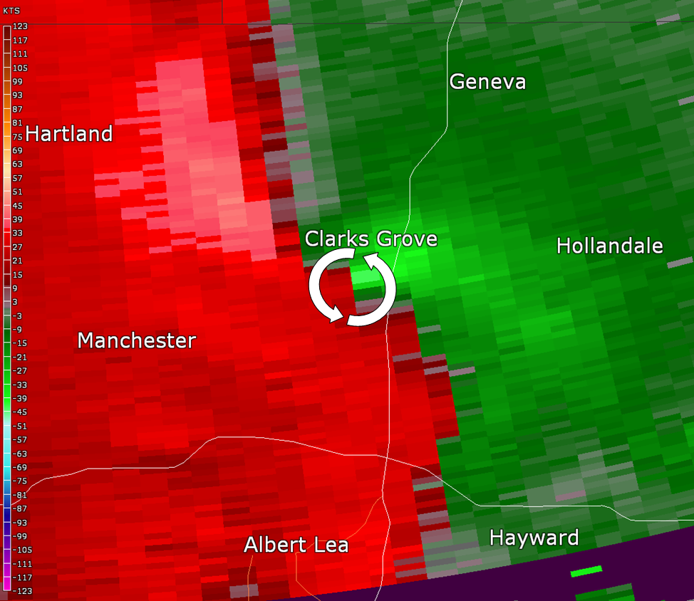
| Base Radar Reflectivity loop from 4:30 PM to 8:00 PM as the storms moved across Minnesota into Wisconsin. | Base Reflectivity (top) and Storm Relative Velocity (bottom) show the storm northwest of Zimmerman MN. The circulation is indicated by the white arrows | Base Reflectivity (top) and Storm Relative Velocity (bottom) show the storm near Clarks Grove MN. The circulation is indicated by the white arrows |
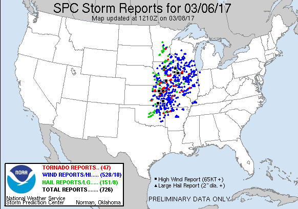
Storm Reports
|
The image to the right shows severe weather that was reported on Monday March 06, 2017. Several hundred reports of severe weather were observed across the central United States. Minnesota and Wisconsin had mostly damaging wind along with some large hail. See the full list of storm reports here. There was building damage and uprooted trees near Clarks Grove MN in Freeborn county in southern Minnesota. Meanwhile in Sherburne county there were large trees and power lines down. Most of this damage occurred between 5:00 PM and 7:00 PM on Monday, March 06, 2017.
|
 |
Environment
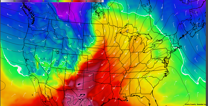
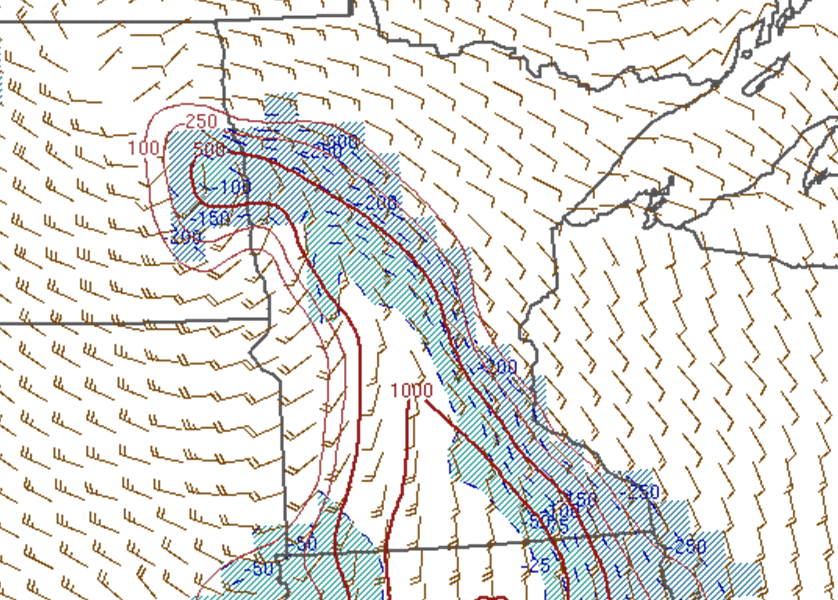
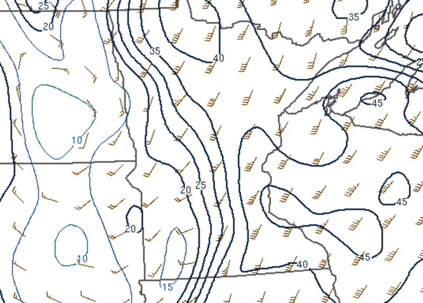
A powerful jet caused a surface low to develop over the eastern Dakotas. Warm moist air ahead of this surface low led to instability, and the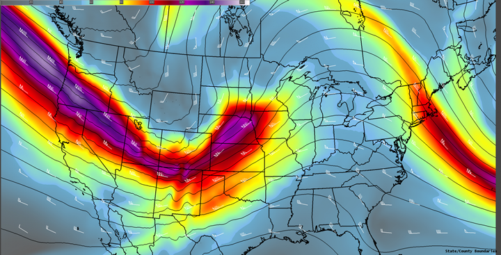 |
 |
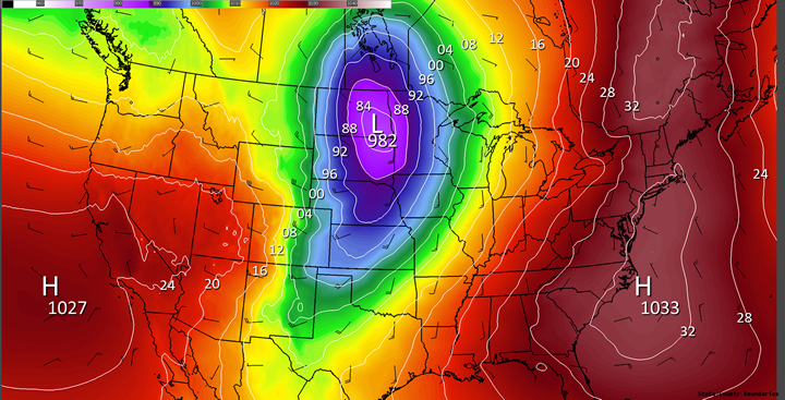 |
| Figure 1: 300 mb wind speed (fill), heights (contours), and winds - A strong upper level jet in a negatively tilted trough led to cyclogenesis across the Midwest. The strong winds created a wind shear profile favorable for severe thunderstorms. Data generated using the GFS 06.18 analysis. | Figure 2: 850 mb temperatures (fill), heights (contours), and winds - Very warm air was in place across the Upper Mississippi River Valley ahead of the surface low. Data generated using the GFS 06.18 analysis. | Figure 3: Surface pressure (fill and contours) and winds - A very deep surface low of 982 mb was located across the eastern Dakotas at 12:00 PM March 06, 2017. Data generated using the GFS 06.18 analysis. |
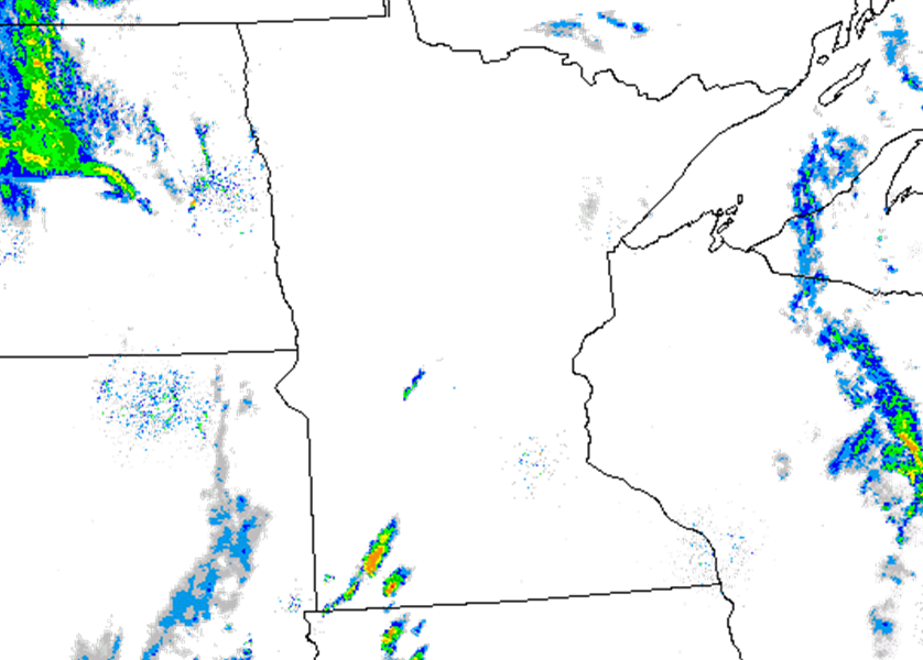
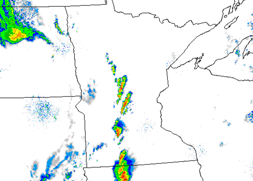
Storms developed quickly in the late afternoon and persisted through the evening.
 |
 |
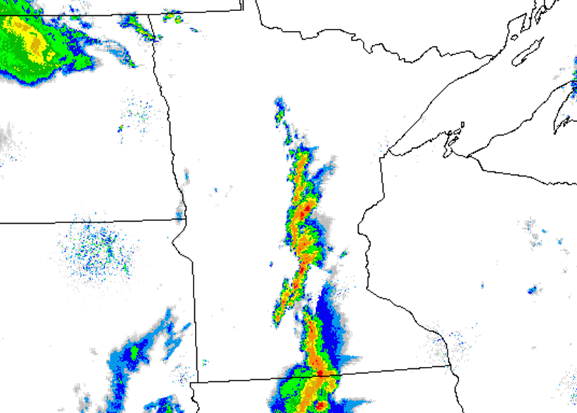 |
| Radar reflectivity at 3:00 PM. | Radar reflectivity at 4:00 PM. | Radar reflectivity at 5:00 PM. |
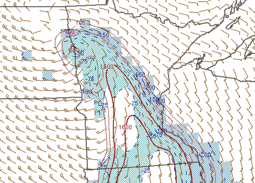
A narrow tongue of instability developed in the warm sector ahead of the cold front with MLCAPE values over 1000 J/kg by late afternoon.
 |
 |
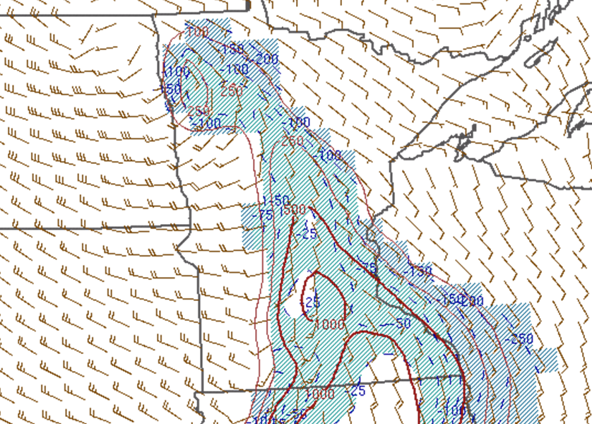 |
| Mixed layer CAPE (red contours) and CIN (blue shading) with surface winds at 3:00 PM. | Mixed layer CAPE (red contours) and CIN (blue shading) with surface winds at 4:00 PM. | Mixed layer CAPE (red contours) and CIN (blue shading) with surface winds at 5:00 PM. |
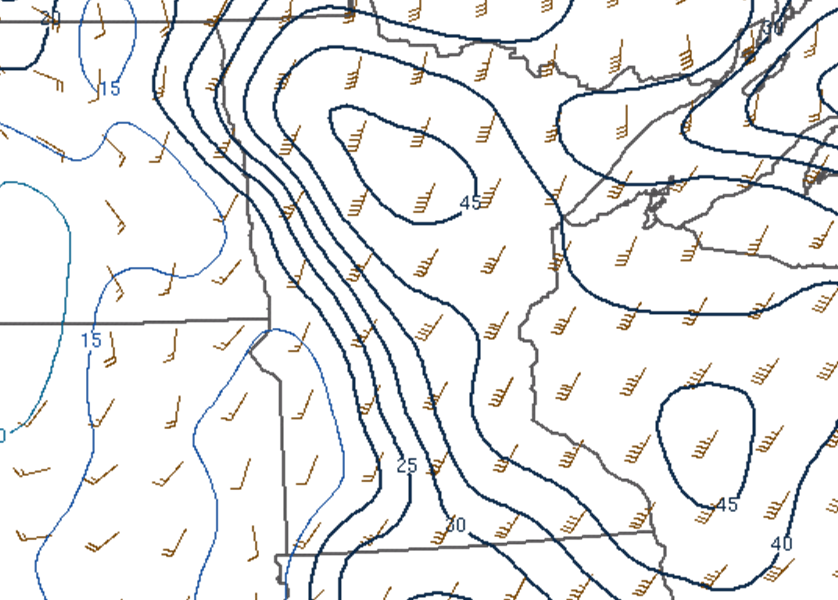
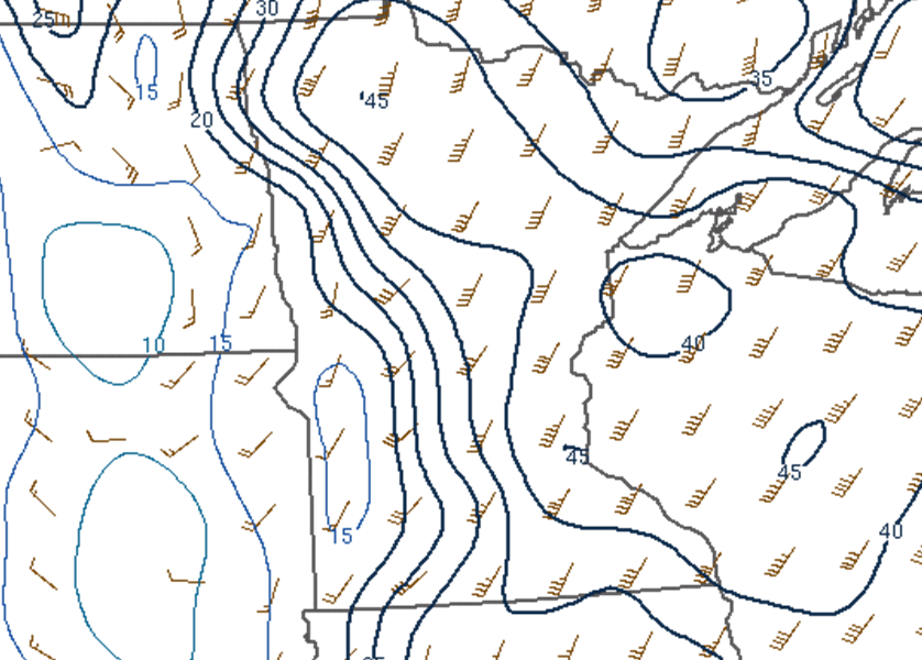
Strong low level shear supported rotation in the storms that developed along the cold front.
 |
 |
 |
| 0 to 1 km shear (blue contours and wind barbs) at 3:00 PM. | 0 to 1 km shear (blue contours and wind barbs) at 4:00 PM. | 0 to 1 km shear (blue contours and wind barbs) at 5:00 PM. |
 |
Media use of NWS Web News Stories is encouraged! Please acknowledge the NWS as the source of any news information accessed from this site. |
|

