Twin Cities, MN
Weather Forecast Office
Storm surveys continue to assess damage which occurred across the area from several severe weather events last week. Results from completed surveys can be accessed using the links below.
Here are preliminary maps of storm reports from last week's severe weather events.
Monday, May 9th
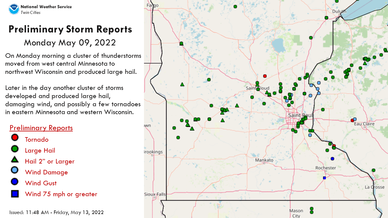
List of storm reports from Monday: https://www.spc.noaa.gov/climo/reports/220509_rpts.html
Wednesday, May 11th
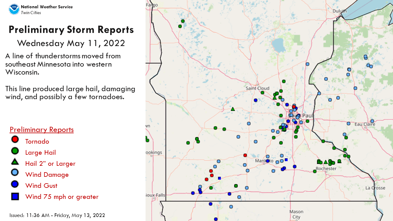
List of storm reports from Wednesday: https://www.spc.noaa.gov/climo/reports/220511_rpts.html
Thursday, May 12th

List of storm reports from Thursday: https://www.spc.noaa.gov/climo/reports/220512_rpts.html
US Dept of Commerce
National Oceanic and Atmospheric Administration
National Weather Service
Twin Cities, MN
1733 Lake Drive West
Chanhassen, MN 55317-8581
952-361-6670
Comments? Questions? Please Contact Us.


 lexandria Tornado Event
 /12/2022 Severe Wind Event