Twin Cities, MN
Weather Forecast Office
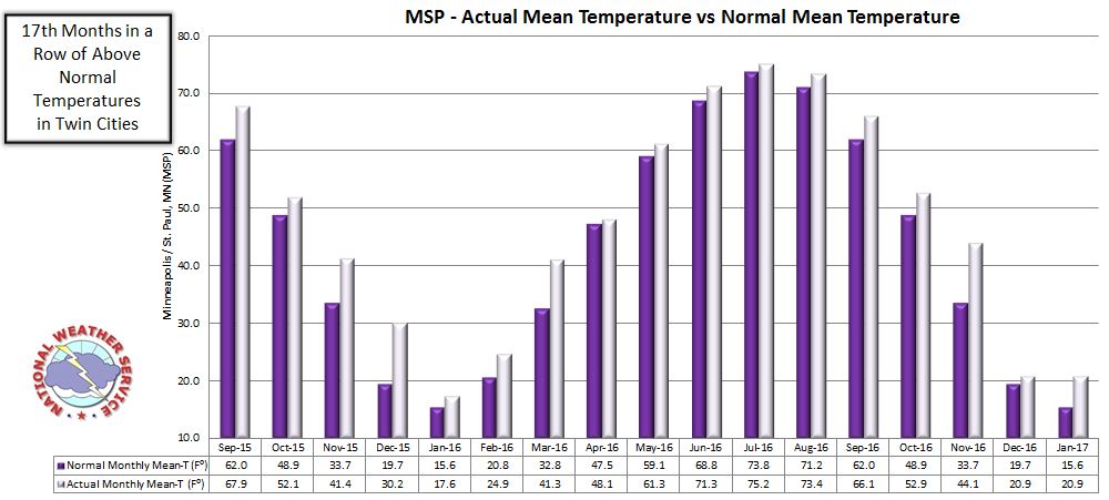
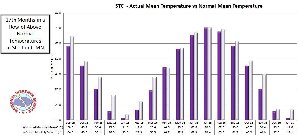
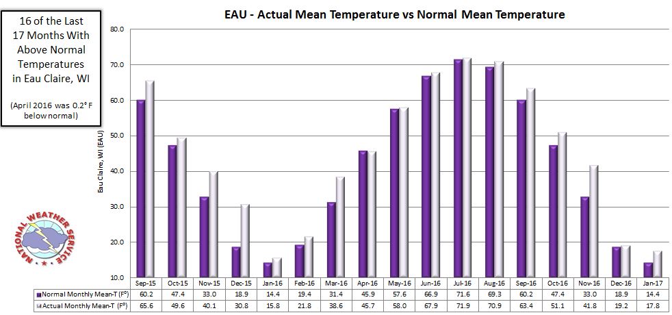
Monthly temperatures in the Twin Cities and St. Cloud have been above normal for the past 17 months in a row. In Eau Claire, 16 of the past 17 months have been above normal, with only April of 2016 falling below normal by 0.2 degrees F.
According to Kenny Blumenfeld at the Minnesota DNR - State Climatology Office, the current streak of 17 above normal months is unprecedented in the climate record for the Twin Cities. The next closest streak was 16 months in 2011-2012, and 15 months in 2005-2006 and 1920-1921. However, he highlighted the historical warm regime from February of 1930 to through September of 1932 as the most impressive on record. Twenty-nine of those 33 months were warmer than average.
The State Climatology Office also highlighted that only 5 of the past 32 months have been below normal in the Twin Cities (going back to June of 2014). In addition, the last time that there was a streak of 10 or more months with below normal temperatures in the Twin Cities was in 1964-1965. Click here to see additional information about how the 17 month warm streak compares to historical records.
The following graphs show the observed monthly temperatures back to September 2015 (when the above normal streak began), as compared to normal mean temperatures.
Twin Cities:
St. Cloud:
Eau Claire:
US Dept of Commerce
National Oceanic and Atmospheric Administration
National Weather Service
Twin Cities, MN
1733 Lake Drive West
Chanhassen, MN 55317-8581
952-361-6670
Comments? Questions? Please Contact Us.

