National Weather Service United States Department of Commerce

Heavy to Excessive Rainfall in the Southeast; Critical Fire Weather in the Northern Plains/Upper Midwest and Southwest

A slow-moving storm system will continue to bring thunderstorms, heavy rain and flooding potential from Southeast Florida, into the Southern to Central Appalachians and the Mid-Atlantic regions today into Wednesday. Gusty winds and dry fuels will support widespread critical fire weather in the northern Plains into the Upper Midwest and the Southwest. Read More >

MPX Recommended Spotter Activation Status


Map of MPX CWA  

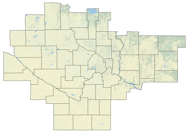
Spotter activation is recommended for the counties listed in Red, Spotter activation is not recommended for counties in Green. The data on this page will automatically update every 2 minutes.
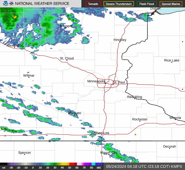

Local Radar

Severe Weather Outlook

Current Watches and Warnings


Disclaimer: Information displayed on this page is solely a recommendation for spotter activation by the NWS, may differ from local guidelines, and may not be updated as quickly or often as other official NWS products. Please use local notification procedures if applicable. Do not solely rely on this activation page as your only source of severe weather information - Please use additional information like outlooks, watches, and warnings to plan and prepare as needed.