Winter Weather Forecasts and Warnings
The National Weather Service provides a variety of differnt forecast products and watches/warnings.
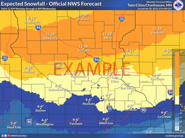
The latest forecasts for snowfall amounts, ice accumulations, timing graphics and the winter storm severity index can be found on our Winter Weather page
A map that shows the winter weather watches and warnings in effect can be found on the front page of the National Weather Service Twin Cities web site
On the NWS Twin Cities web site, you can click anywhere on the front page map or enter a zip code in the upper left corner to get a forecast specific to a single location
Watch/Warning Definitions
Winter Storm Watch: Severe weather conditions, including heavy snow, blowing snow, freezing rain and/or sleet , may soon affect your area. If a watch is issued for your area, you should pay special attention to future forecasts and statements, and begin to make safety preparations.
Winter Storm Warning: Severe winter weather conditions are occurring or are imminent. Most warnings are issued for heavy snow and wind, but may also be issued for ice and sleet storms. If a warning is issued for your area you should take immediate action to ensure the appropriate safety precautions have been taken.
Blizzard Warning: Visibilities are reduced to less than 1/4 mile for several hours due to falling and/or blowing snow, making travel virtually impossible. The wind will be at least 35 mph.
Snow Squall Warning: An exceptionally rare warning that most typically applies to lake effect snow squalls, where visibility drops to near-zero. It is issued for one hour or less for a small area, and is relayed as a Wireless Emergency Alert.
Advisories: These are issued for conditions which warrant increased public awareness and moderately hamper travel, but where the weather is not severe enough to merit a warning.
Extreme Cold Watch: Issued for the possibility of temperatures dropping to -35 or -40 without any wind, or if there is wind, wind chill values dropping -35 or -40. If a watch is issued for your area, you should pay special attention to future forecasts and statements and begin to make safety precautions. The criteria for a watch is potential for -40 for northern and most of central Minnesota, and -35 for the Twin Cities, southern Minnesota and western Wisconsin.
Extreme Cold Warning: Issued when it is likely that temperatures will drop to -35 or -40 without any wind, or if there is wind, wind chill values will drop to -35 or -40. If a warning is issued for your area, you should ensure the appropriate safety precautions have been taken. The criteria for a warning is the expectation for -40 for northern and most of central Minnesota, and -35 for the Twin Cities, southern Minnesota and western Wisconsin.
Cold Weather Advisory: Issued when it is likely that temperatures will drop to -25 or -30 without any wind, or if there is wind, wind chill values will drop to -25 or -30. The criteria for an advisory is the expectation for -30 for northern and most of central Minnesota, and -25 for the Twin Cities, southern Minnesota and western Wisconsin.
More detailed information concerning winter safety can be found on the following web pages:

