Event Summary
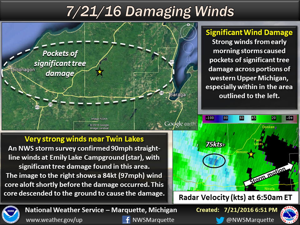
A strong line of thunderstorms that developed over North Dakota and southern Manitoba during the evening hours of Wednesday, July 20th, reached western Upper Michigan during the early morning hours of Thursday, July 21st. The line continued eastward through the morning, clearing eastern Upper Michigan by early afternoon. Very strong winds accompanied the line of storms across the northwest half of Upper Michigan. Several pockets of extensive wind damage were observed across Ontonagon and Houghton counties, with sporadic damage elsewhere along the line. This includes estimated winds of up to 90mph at the Emily Lake Campground south of Twin Lakes in Houghton County based off an NWS storm survey.
Overview:
 |
 |
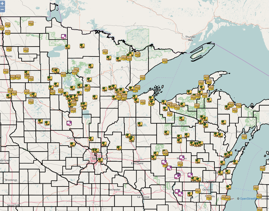
| Storm reports across the region as the line of thunderstorms moved through. | Pockets of more widespread wind damage were concentrated from Ontonagon to Twin Lakes in Ontonagon and Houghton counties. |
Photos:
 |
 |
 |
 |
|
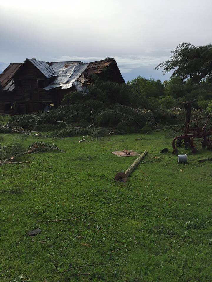
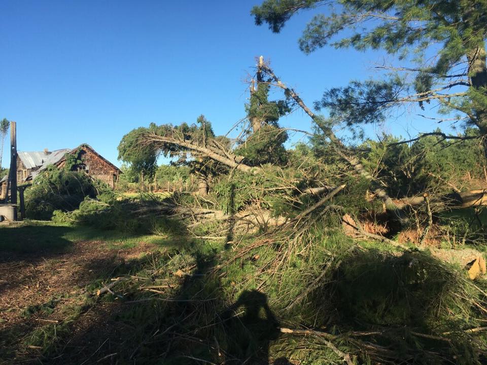
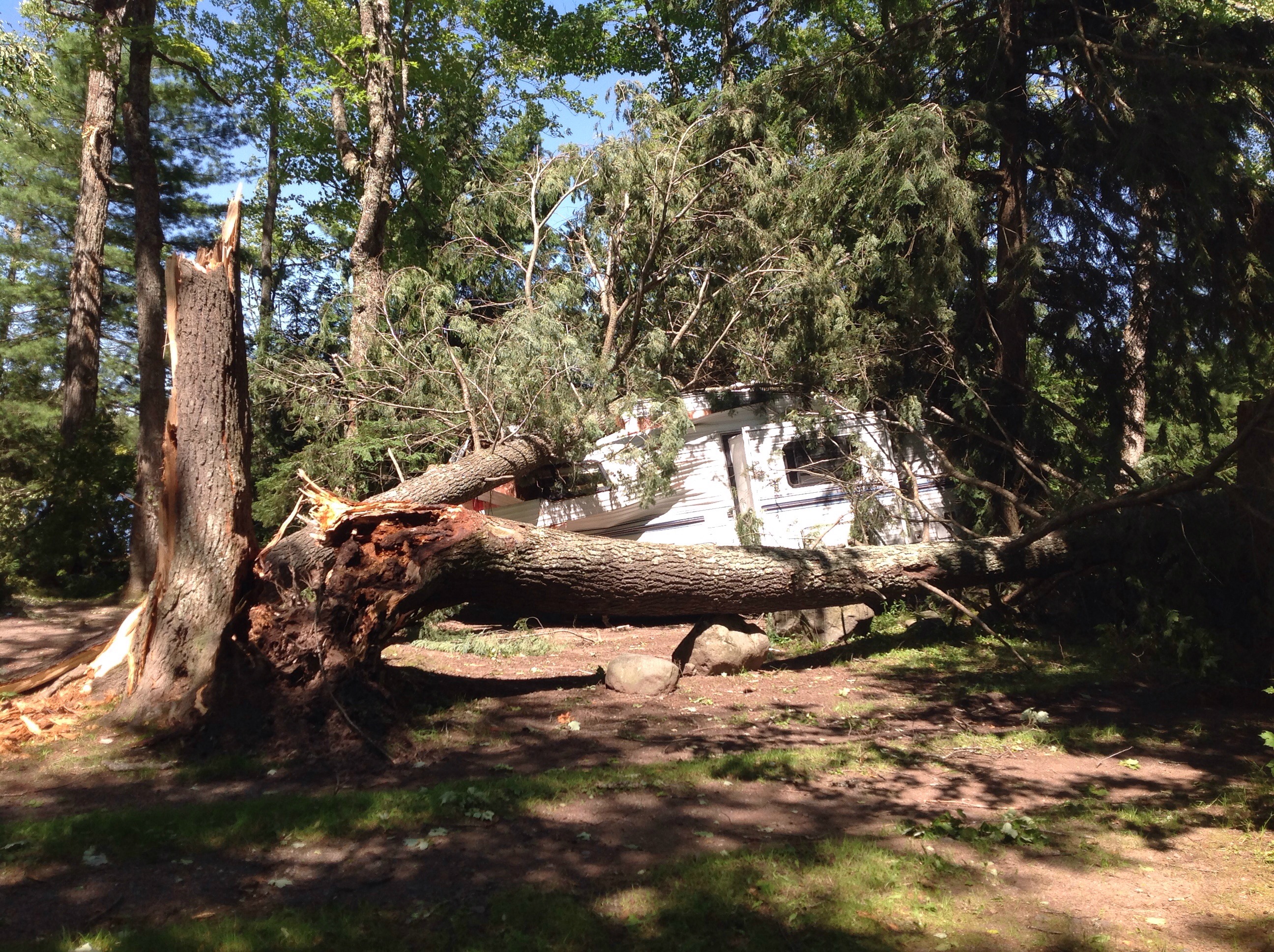
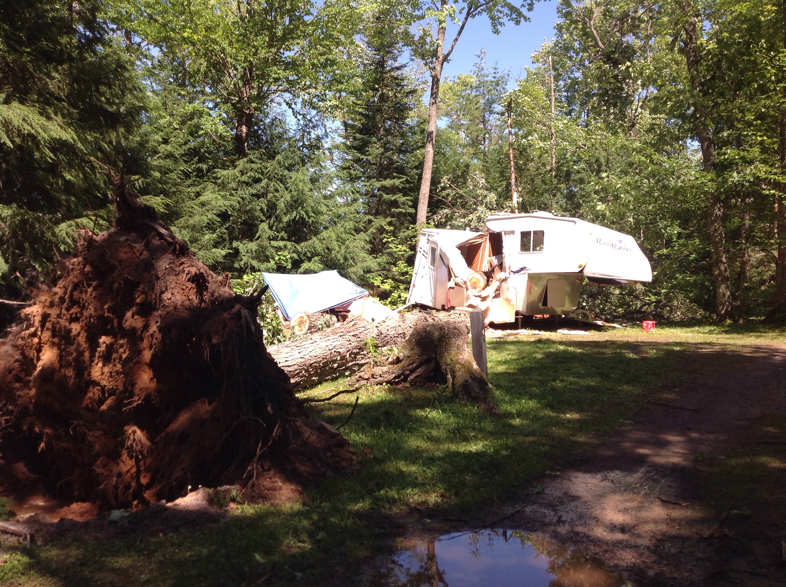
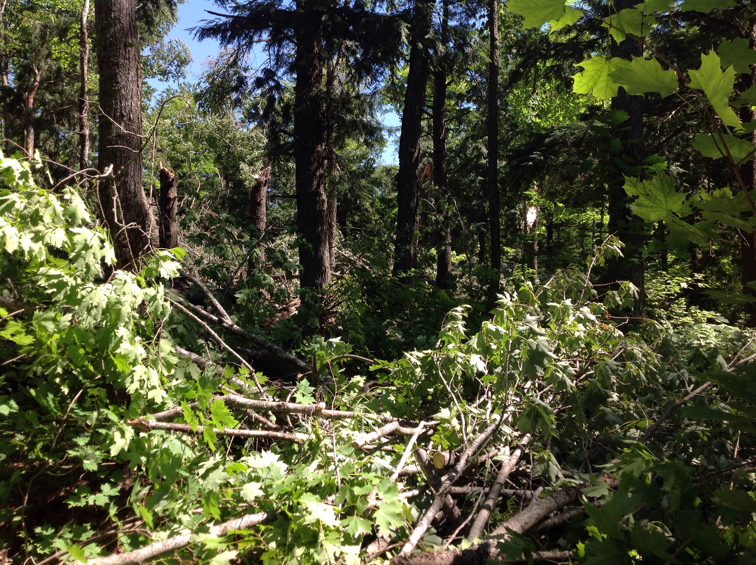
Storm damage from Emily Lake Campground near Twin Lakes in Houghton county. |
Storm damage from Emily Lake Campground near Twin Lakes in Houghton county. |
Storm damage from Emily Lake Campground near Twin Lakes in Houghton county. |
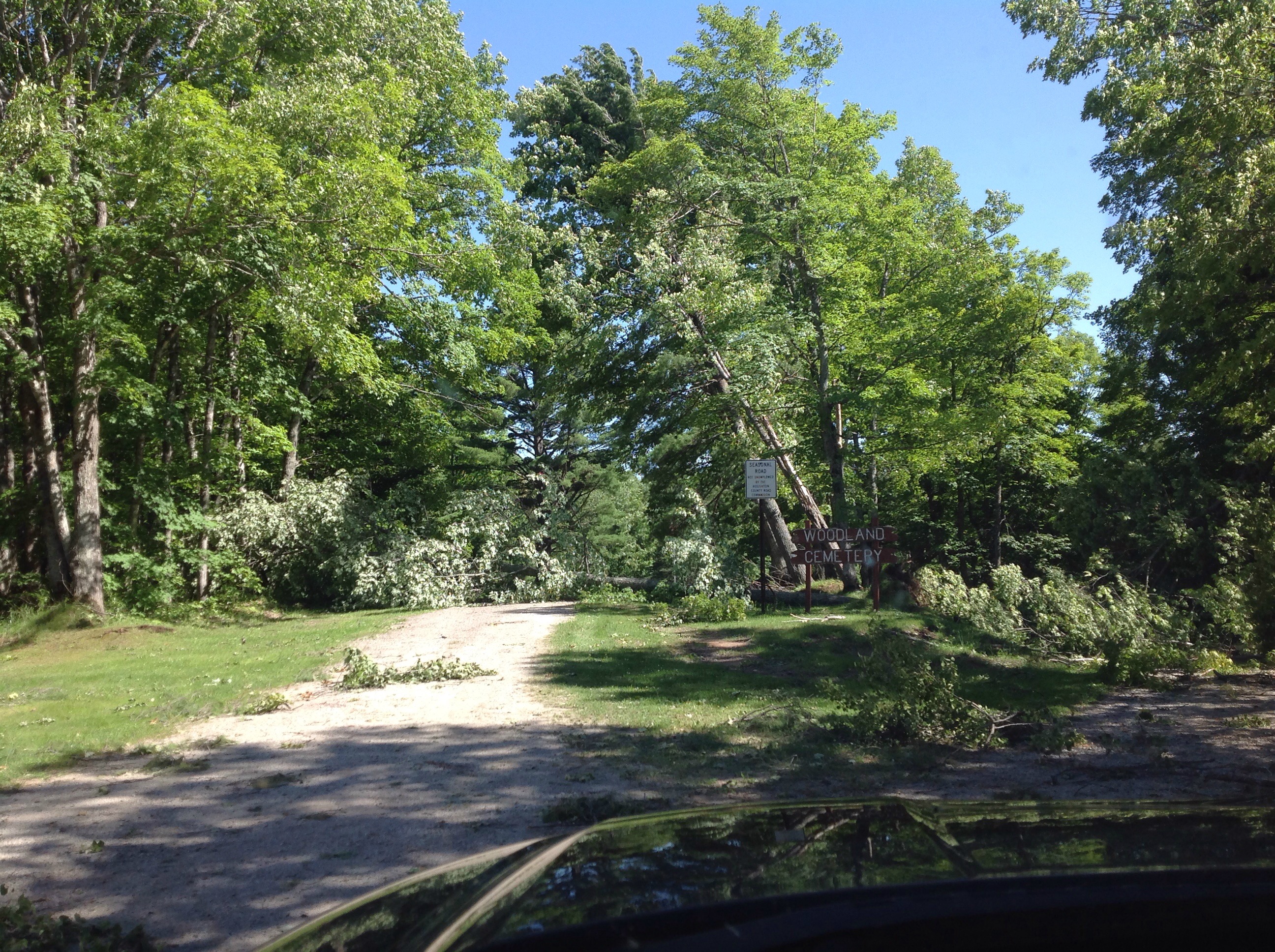
Storm damage at the Woodland cemetery near Twin Lakes in Houghton county. |
|
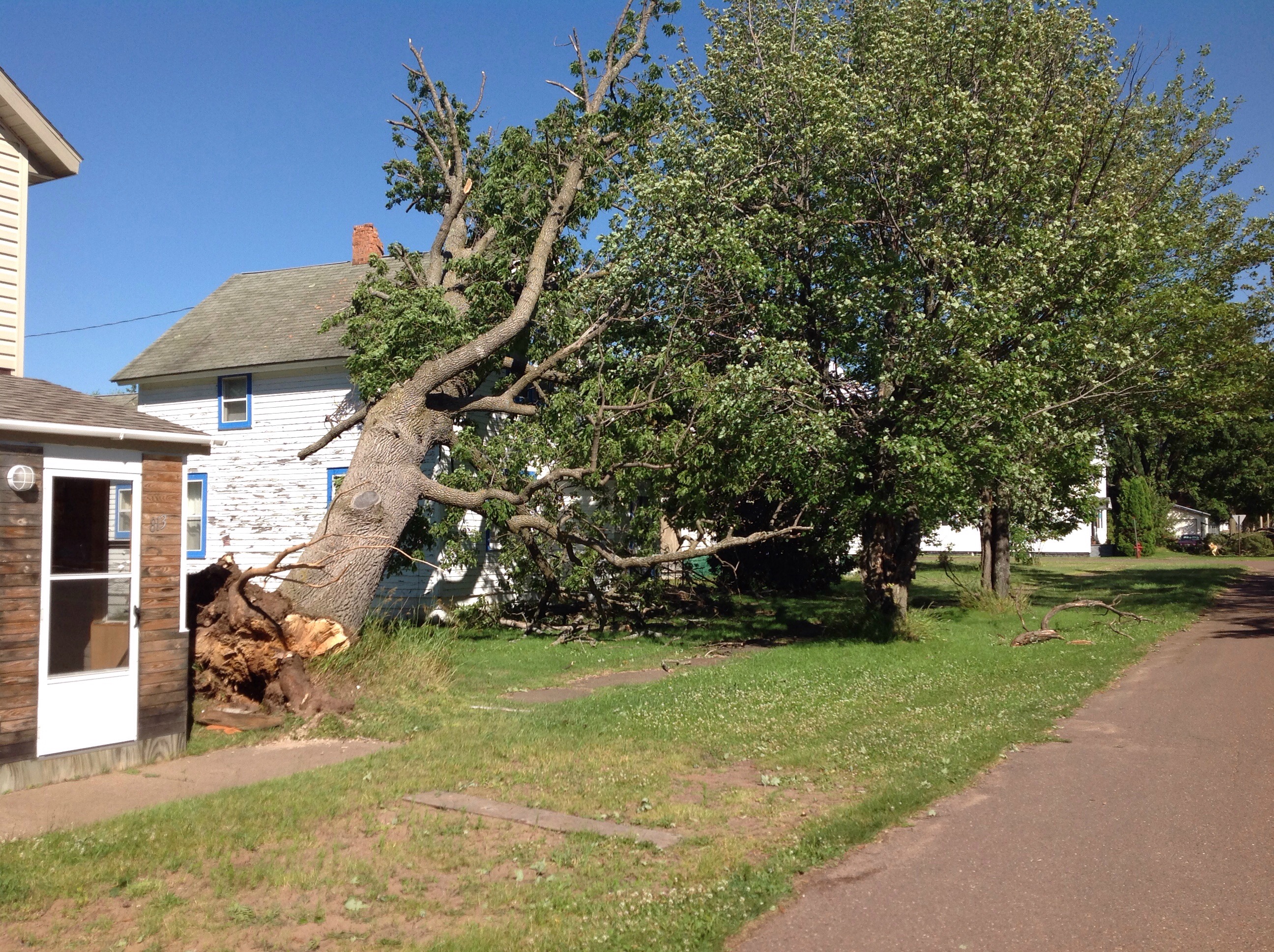
Storm damage in the village of Ontonagon in Ontonagon county. |
Storm damage in the village of Ontonagon in Ontonagon county. |
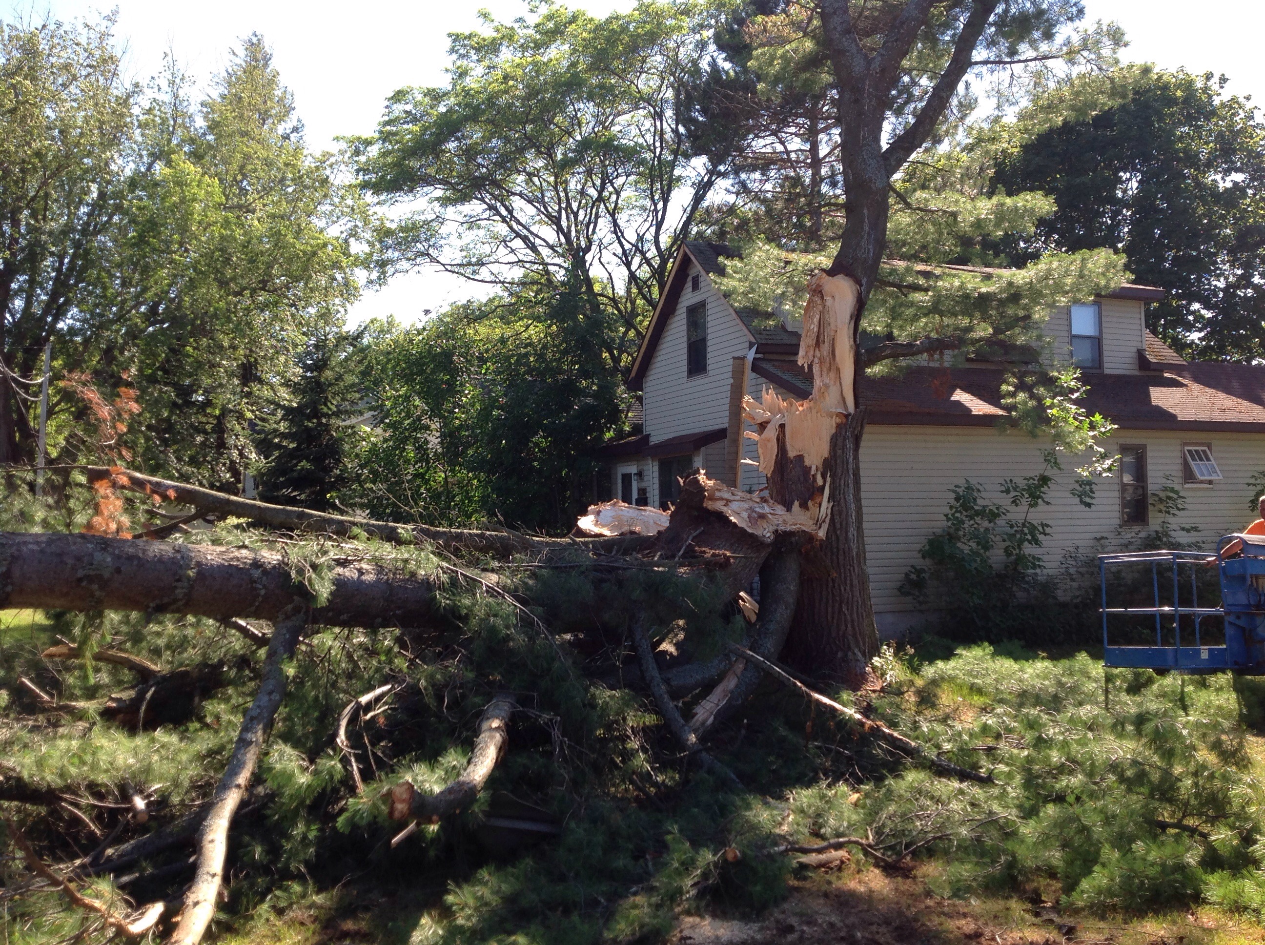
Storm damage in Jacobsville in Houghton county. Photo credit Andrea Rezabek. |
Storm damage in Jacobsville in Houghton county. Photo credit Annika Maki. |
Radar:
4:30am to 1:30pm ET on 7/21/16
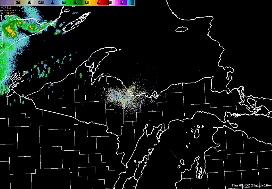 |
| Here is a the radar loop encompassing approximately nine hours from 4:30am to 1:30pm ET on 7/21/16. Note the acceleration of a portion of the line across southern Houghton County. Significant tree damage was reported and surveyed in this area. Several pockets of tree damage were also observed along the remainder of the line across the northwest half of Upper Michigan. |
Storm Reports
PRELIMINARY LOCAL STORM REPORT...SUMMARY
NATIONAL WEATHER SERVICE MARQUETTE MI
1017 PM EDT THU JUL 21 2016

..TIME...   ...EVENT...      ...CITY LOCATION...     ...LAT.LON...
..DATE...   ....MAG....      ..COUNTY LOCATION..ST.. ...SOURCE....
            ..REMARKS..

0720 AM     MARINE TSTM WIND 8 WNW CALUMET           47.30N 88.60W
07/21/2016  M38 MPH          LSZ243             MI   BUOY

            BUOY STATION 7 WNW CALUMET /45023/.

0908 AM     MARINE TSTM WIND 10 SE FORD RIVER        45.58N 87.00W
07/21/2016  M39 MPH          LMZ221             MI   MESONET

            MESONET STATION 9 SE FORD RIVER /XMAPV/.

0830 AM     TSTM WND GST     5 S SANDS               46.35N 87.40W
07/21/2016  M41 MPH          MARQUETTE          MI   AWOS

            AWOS STATION SAWYER AIRPORT /SAW/.

0710 AM     TSTM WND GST     6 E MASS CITY           46.77N 88.95W
07/21/2016  M41 MPH          ONTONAGON          MI   MESONET

            MESONET STATION 6 E MASS CITY /MC029/.

0700 AM     TSTM WND GST     2 SE ROCKLAND           46.72N 89.15W
07/21/2016  M43 MPH          ONTONAGON          MI   MESONET

            MESONET STATION ROCKLAND - MDOT /MC027/.

0840 AM     TSTM WND GST     3 WSW SHOT POINT        46.49N 87.23W
07/21/2016  M44 MPH          MARQUETTE          MI   MESONET

            MESONET STATION 6 E HARVEY - MDOT /MC001/.

0701 AM     TSTM WND GST     6 ESE WAKEFIELD         46.44N 89.83W
07/21/2016  M45 MPH          GOGEBIC            MI   MESONET

            MESONET STATION 6 ESE WAKEFIELD /WKFM4/.

0813 AM     TSTM WND GST     4 NE NEGAUNEE           46.53N 87.55W
07/21/2016  M46 MPH          MARQUETTE          MI   MESONET

            MESONET STATION NWS MARQUETTE /C4331/.

0724 AM     TSTM WND GST     HOUGHTON CO AIRPORT     47.17N 88.49W
07/21/2016  M47 MPH          HOUGHTON           MI   ASOS

            ASOS STATION HOUGHTON CO. AIRPORT /CMX/.

0615 AM     TSTM WND GST     5 NW BESSEMER           46.53N 90.13W
07/21/2016  M47 MPH          GOGEBIC            MI   AWOS

            AWOS STATION IRONWOOD /IWD/.

0713 AM     TSTM WND GST     3 SSW PELKIE            46.78N 88.66W
07/21/2016  M50 MPH          BARAGA             MI   MESONET

            MESONET STATION 3 SSW PELKIE /PIEM4/.

0730 AM     TSTM WND GST     6 ESE CHASSELL          47.00N 88.40W
07/21/2016  M51 MPH          HOUGHTON           MI   BUOY

            BUOY STATION 6 ESE CHASSELL /45025/.

0615 AM     TSTM WND GST     1 ENE BESSEMER          46.48N 90.04W
07/21/2016  M55 MPH          GOGEBIC            MI   MESONET

            MESONET STATION BESSEMER /E6504/.

0715 AM     TSTM WND GST     1 ESE TROUT CREEK       46.48N 88.99W
07/21/2016  M55 MPH          HOUGHTON           MI   MESONET

            MESONET STATION TROUT CREEK - MDOT /MC028/.

0630 AM     TSTM WND GST     1 W WAKEFIELD           46.48N 89.95W
07/21/2016  M59 MPH          GOGEBIC            MI   MESONET

            MESONET STATION WAKEFIELD /MC026/.

0704 AM     TSTM WND GST     FREDA                   47.14N 88.82W
07/21/2016  M63 MPH          HOUGHTON           MI   TRAINED SPOTTER

            .

0655 AM     TSTM WND DMG     3 ESE WINONA            46.86N 88.85W
07/21/2016                   HOUGHTON           MI   NWS STORM SURVEY

            NWS STORM SURVEY CONFIRMS THAT EXTENSIVE
            TREE DAMAGE AT EMILY LAKE CAMPGROUND WAS DUE
            TO STRAIGHT LINE WINDS ESTIMATED TO BE UP TO
            90MPH. LOCAL REPORTS INDICATE THE STRONG
            WINDS LASTED AT LEAST FIVE MINUTES. DAMAGE
            INCLUDED TREES DOWN ON TWO CAMPERS. NO
            INJURIES REPORTED. TIME ESTIMATED FROM
            RADAR.

0725 AM     TSTM WND DMG     1 SSE BEECHWOOD         46.15N 88.76W
07/21/2016                   IRON               MI   LAW ENFORCEMENT

            TREES DOWN.

0620 AM     TSTM WND DMG     5 SSE MERRIWEATHER      46.51N 89.60W
07/21/2016                   ONTONAGON          MI   PUBLIC

            SEVERAL TREES DOWN AROUND LAKE GOGEBIC.

0637 AM     TSTM WND DMG     ONTONAGON               46.87N 89.31W
07/21/2016                   ONTONAGON          MI   EMERGENCY MNGR

            DOZENS OF TREES DOWN IN AND AROUND THE
            VILLAGE OF ONTONAGON...INCLUDING SEVERAL
            DOWN ON HOMES. POWER OUT IN THE VILLAGE FOR
            NEARLY 8 HOURS.

0705 AM     TSTM WND DMG     TOIVOLA                 47.00N 88.77W
07/21/2016                   HOUGHTON           MI   TRAINED SPOTTER

            WIDESPREAD TREE DAMAGE AROUND TOIVALA,
            DONKEN, AND TWIN LAKES. M26 IS BLOCKED BY
            FALLEN TREES.

0808 AM     TSTM WND DMG     NEGAUNEE                46.50N 87.61W
07/21/2016                   MARQUETTE          MI   NWS EMPLOYEE

            MULTIPLE TREES AND LARGE LIMBS DOWN ACROSS
            THE CITY OF NEGAUNEE. WINDS ESTIMATED AT
            50MPH FOR ABOUT 5 MINUTES. REPORTS FROM
            VARIOUS SOURCES.

0718 AM     TSTM WND DMG     5 ESE CHASSELL          47.00N 88.43W
07/21/2016                   HOUGHTON           MI   PUBLIC

            DELAYED REPORT. MULTIPLE REPORTS OF TREES
            DOWN ON EITHER SIDE OF THE PORTAGE CANAL
            NEAR JACOBSVILLE. REPORT VIA SOCIAL MEDIA.

0551 AM     TSTM WND DMG     2 SW LITTLE GIRLS POINT 46.59N 90.37W
07/21/2016                   GOGEBIC            MI   LAW ENFORCEMENT

            SEVERAL TREES DOWN ALONG LAKE RD NEAR LITTLE
            GIRLS POINT.

0730 AM     TSTM WND DMG     IRON RIVER              46.10N 88.64W
07/21/2016                   IRON               MI   LAW ENFORCEMENT

            SEVERAL TREES REPORTED DOWN.

0715 AM     TSTM WND DMG     ALBERTA                 46.65N 88.48W
07/21/2016                   BARAGA             MI   LAW ENFORCEMENT

            NUMEROUS TREES DOWN ACROSS BARAGA COUNTY.
            TREE BLOCKING US 41 SOUTH OF LANSE.

0616 AM     TSTM WND DMG     WAKEFIELD               46.48N 89.94W
07/21/2016                   GOGEBIC            MI   LAW ENFORCEMENT

            TREES AND POWERLINES DOWN IN WAKEFIELD.

0635 AM     TSTM WND DMG     ONTONAGON               46.87N 89.32W
07/21/2016                   ONTONAGON          MI   PUBLIC

            TREES DOWN.

0700 AM     TSTM WND DMG     2 ESE WINONA            46.86N 88.86W
07/21/2016                   HOUGHTON           MI   LAW ENFORCEMENT

            OVER HALF ACRE OF TREES BLOWN DOWN. TREES ON
            CAMPERS AT EMILY LAKE CAMPGROUND AT TWIN
            LAKES STATE PARK. NO INJURIES.

0805 AM     TSTM WND DMG     2 WSW NATIONAL MINE     46.44N 87.72W
07/21/2016                   MARQUETTE          MI   LAW ENFORCEMENT

            SEVERAL TREES DOWN BLOCKING BEAGLE CLUB RD.

0810 AM     TSTM WND DMG     2 W FELCH               46.00N 87.87W
07/21/2016                   DICKINSON          MI   DEPT OF HIGHWAYS

            TREE DOWN ON METROPOLITAN RD. TIME ESTIMATED
            FROM RADAR.

0652 AM     TSTM WND DMG     1 N MASS CITY           46.77N 89.08W
07/21/2016                   ONTONAGON          MI   LAW ENFORCEMENT

            NUMEROUS TREES DOWN IN AND AROUND MASS CITY.
 |
Media use of NWS Web News Stories is encouraged! Please acknowledge the NWS as the source of any news information accessed from this site. |
|