Overview of the December 5, 2021 Winter Storm
|
A modest area of low pressure located within an amplifying upper-level pattern tracked eastward from the Northern Plains to Lake Superior on Sunday December 5, 2021, spreading snow across the U.P. The surface low ended up tracking directly over the U.P. Such a track is often unfavorable for snow, because it means warm air being drawn north into the center of the low would change precipitation to an icy mix of sleet and freezing rain, or even just rain. However in this case the low began occluding as it reached the area, allowing enough cold air to remain in place for all of the precipitation to fall as snow. The track of the low also meant there was southeast-wind lake effect snow for the Keweenaw Peninsula, and lake enhancement off of Lake Michigan for the south-central. The snow mostly fell on Sunday, and tapered off to flurries and light freezing drizzle Sunday night. The following day, cold air rushing in behind an Arctic cold front led to a brief snow squall across the area, followed by additional lake effect snow. This system was also responsible for strong wind gusts, mostly over the water. |
|
Snowfall & Wind Reports
 |
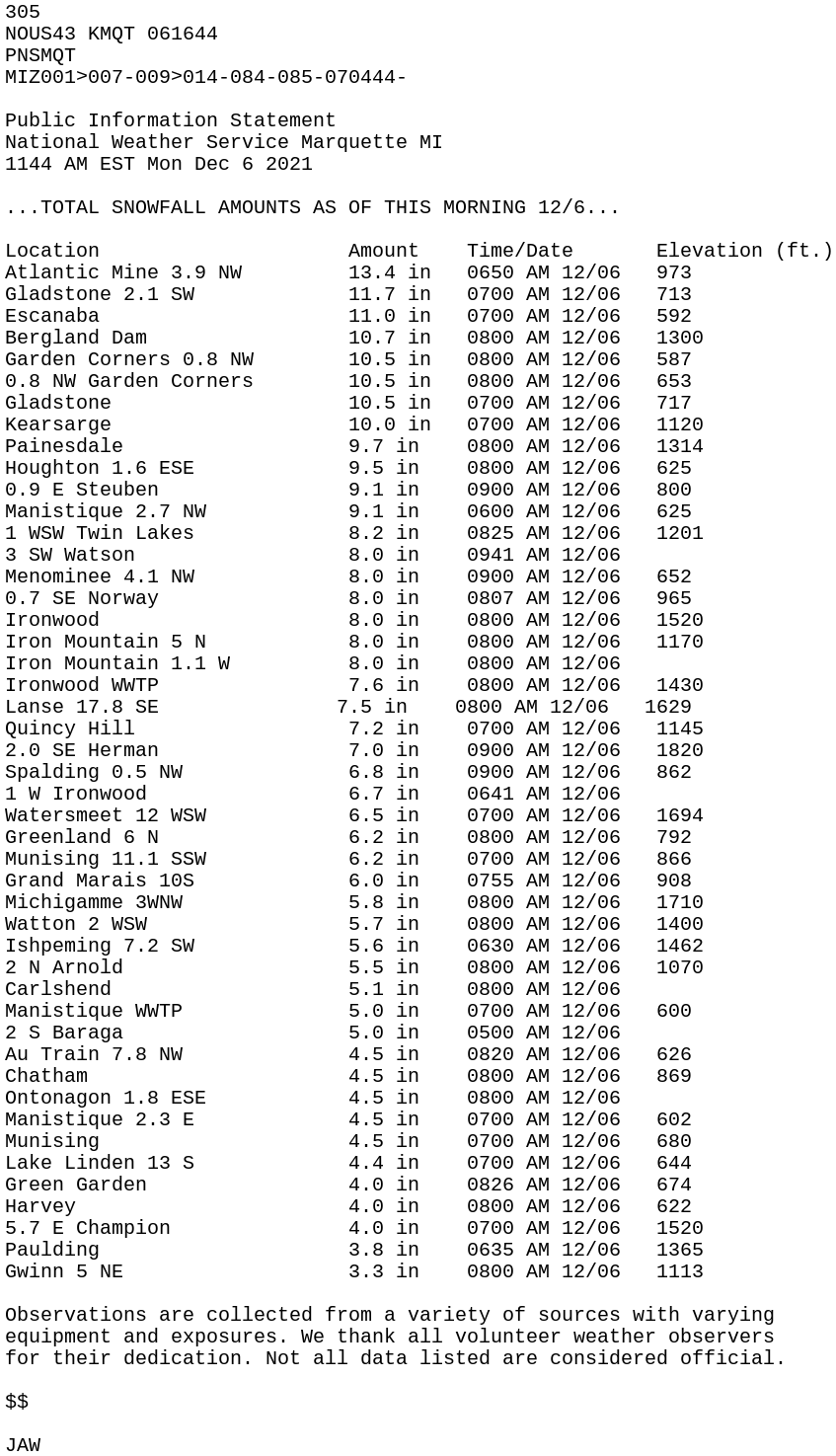 |
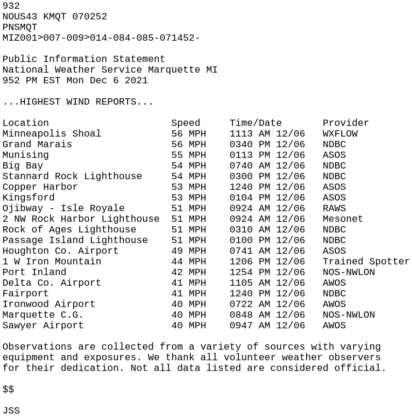
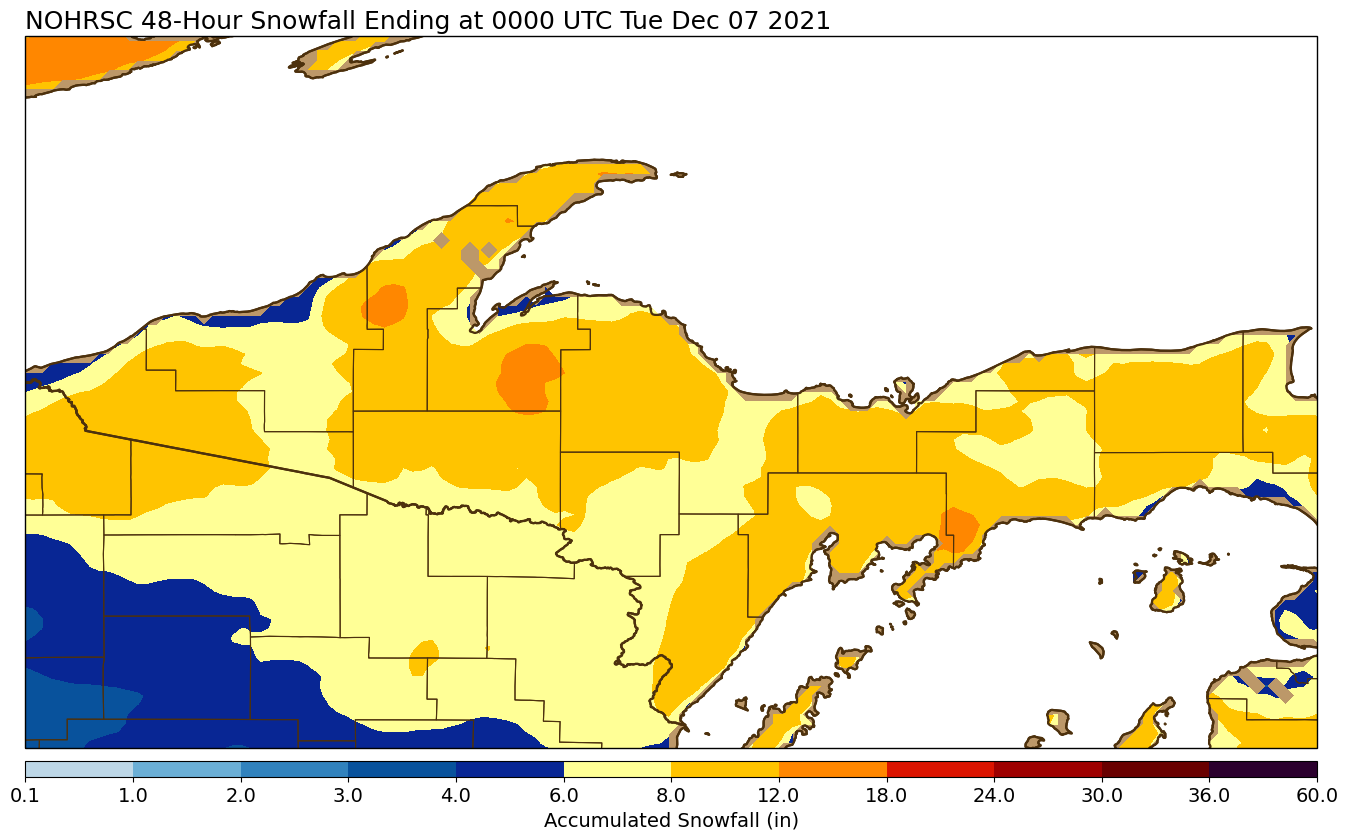
| Highest wind reports from this storm | Snowfall reports through Monday morning. Additional light lake effect snow continued on Monday and is not accounted for in these totals. |
Meteorology of this Storm
 |
 |
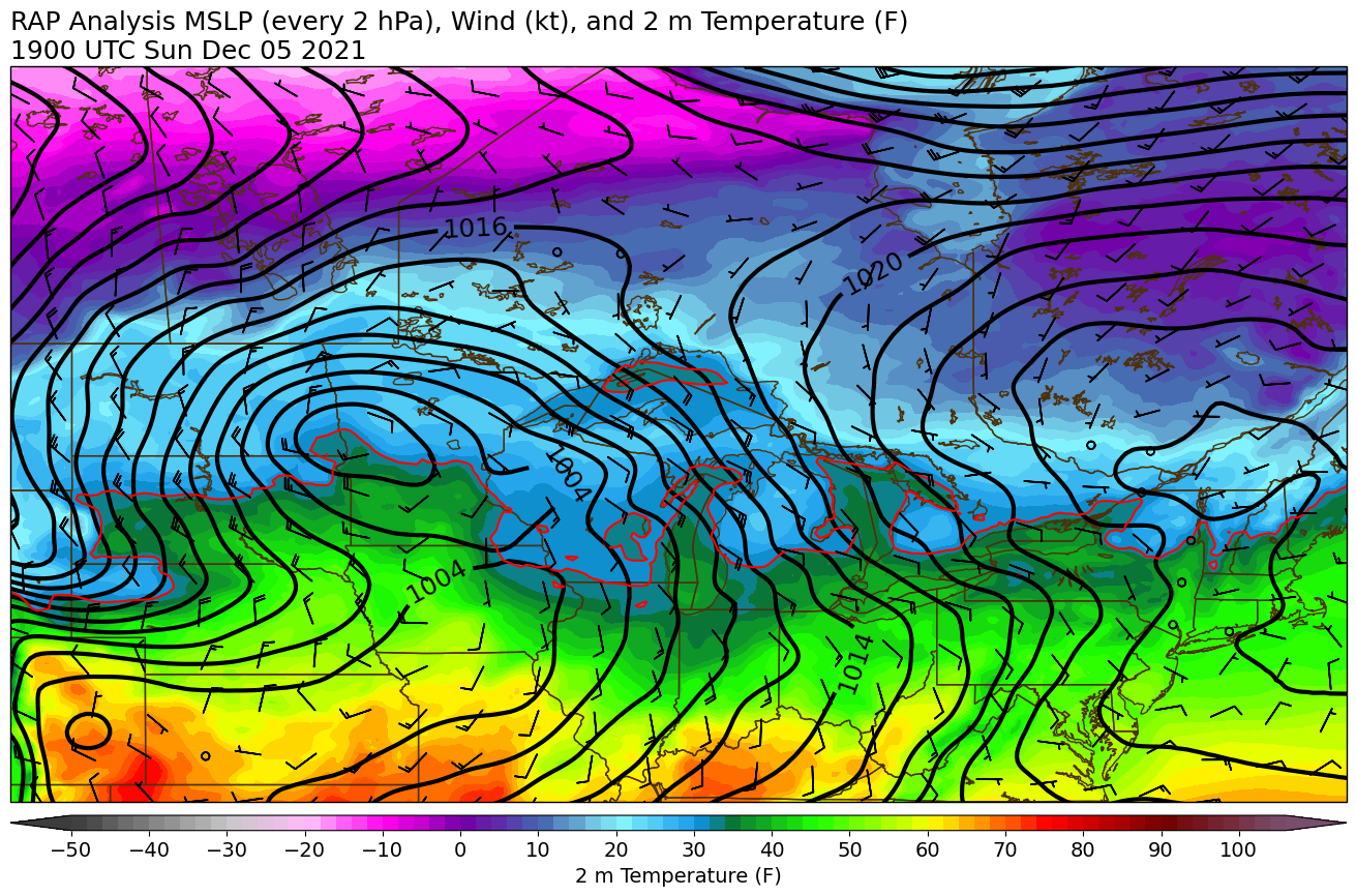 |
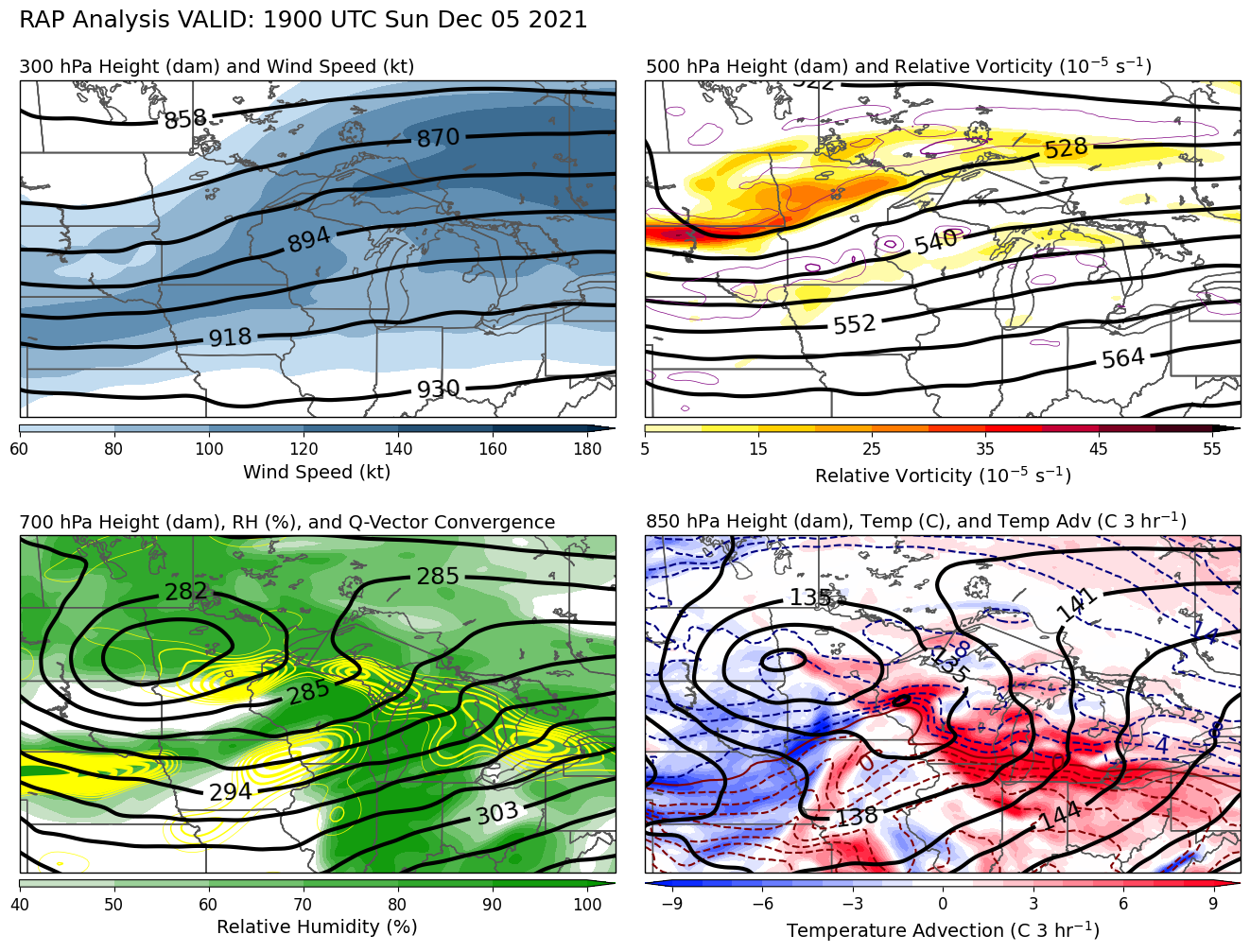
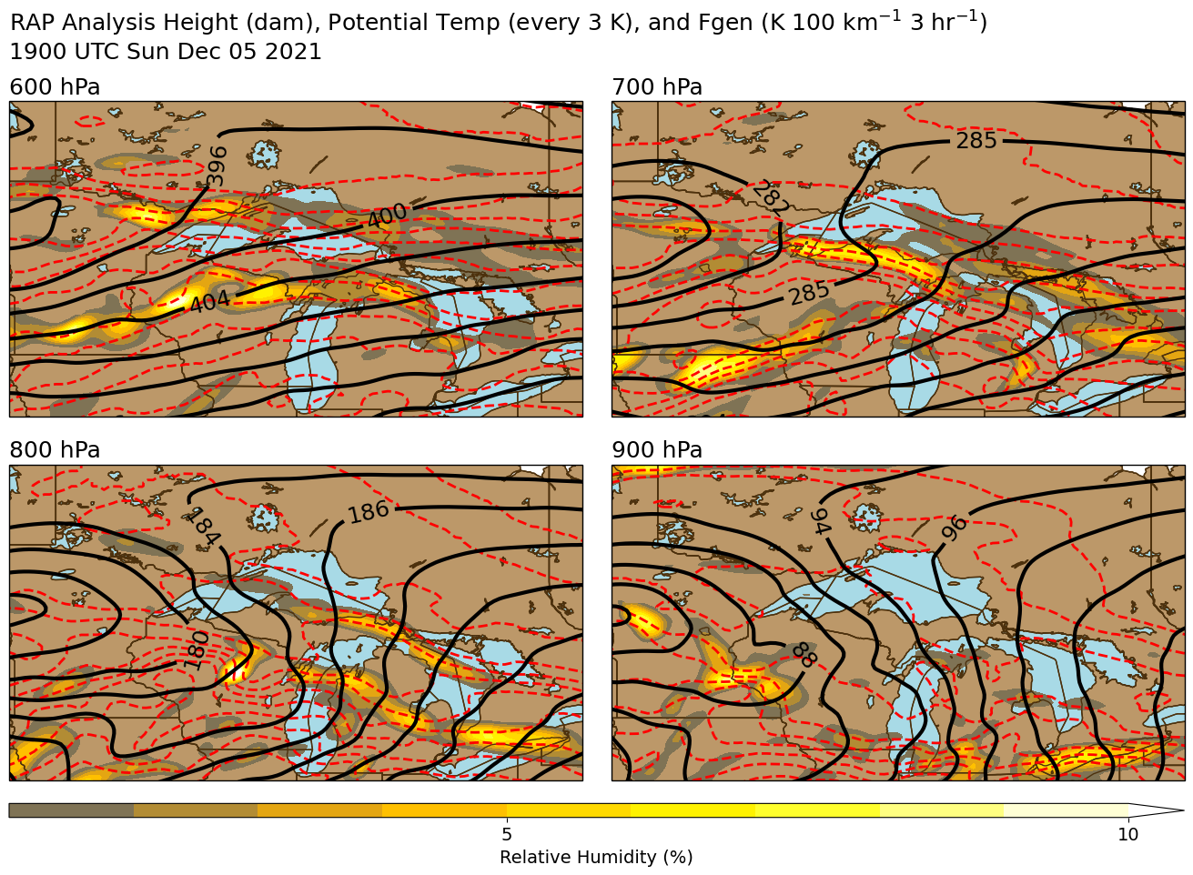
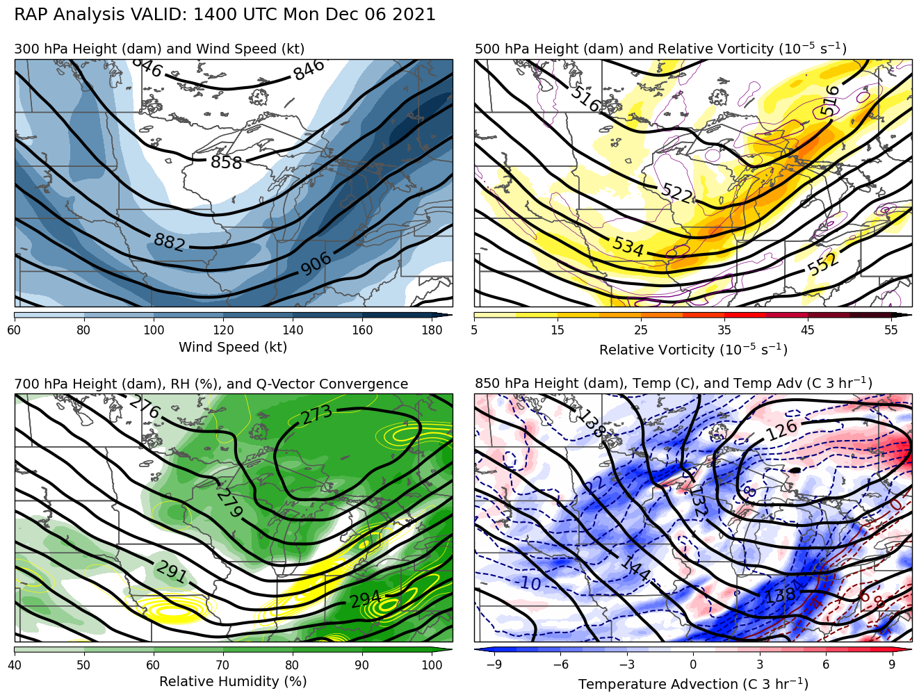
| Synoptic plot at 2 pm EST Sun Dec 5 showing a developing low pressure system over the Northern Plains and broad mid-level WAA and Q-vector convergence moving into the U.P. from the southwest. | At 2 pm EST Sun Dec 5, moderate to strong frontogenesis at 700 mb was oriented in a WNW-ESE band across the U.P. leading to some local enhancement to an otherwise broad area of light to moderate snow. | Plot of mean sea level pressure and surface temperature at 2 pm EST Sun Dec 5 shows the surface low still well to the west, in western Minnesota. However, snow is falling because of warm air advection aloft ahead of the system. |
 |
 |
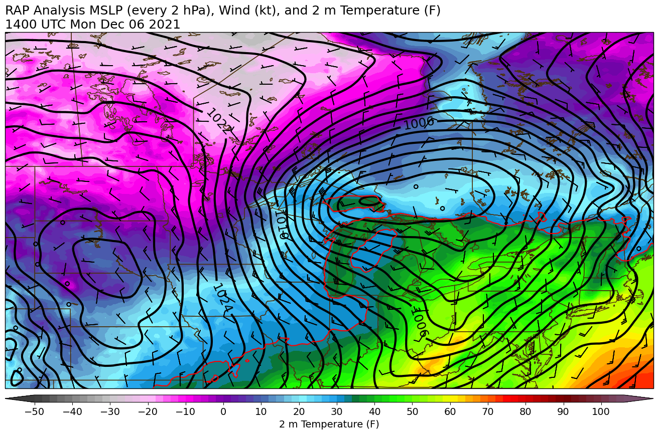 |
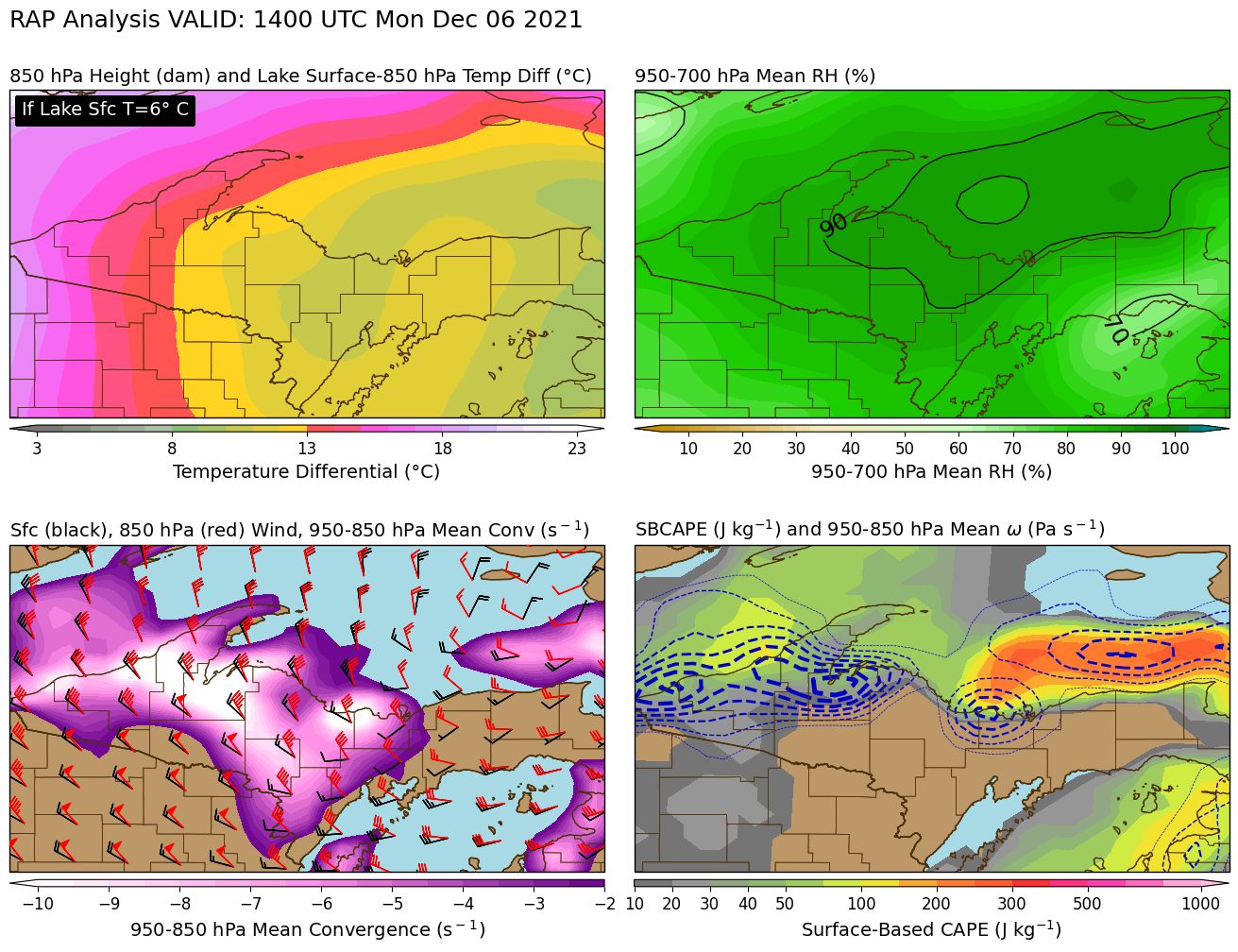
| Synoptic plot at 9 am EST Mon Dec 6 showing the system departing to the east and Arctic air moving into the U.P. behind it. Notice the two areas of blue shading (cold air advection): one in Lower Michigan and the Ohio Valley, and the second in the U.P. and the Northern Plains. This second round of cold air advection is what brought the Arctic air and snow squall to the U.P. | At 9 am EST Mon Dec 6 cold air was rushing in behind the system. In the top left, areas in red and pink are where it's now cold enough for lake effect snow. In the bottom panels we see strong convergence and vertical motion associated with the secondary push of cold air, leading to a lake-enhanced snow squall. | By 9 am EST Mon Dec 6, the surface low was now centered east of the area. The tight packing of isobars on the west side indicates strong NNW winds occurring along with the lake-enhanced snow squall. Winds briefly gusted to 40-55 mph Monday morning into the early afternoon. |
 |
Media use of NWS Web News Stories is encouraged! Please acknowledge the NWS as the source of any news information accessed from this site. |
|


Social Media Messaging