Marquette, MI
Weather Forecast Office
Overview
|
Strong winter storm lifted through the Great Lakes Monday March 4 through Thursday morning. This produced freezing rain, rain, and then widespread heavy, wet snow, strong winds, and blizzard conditions. Widespread 6 to 24 inches of snow was observed across Upper Michigan as well as 35 to 50 mph winds. Highest storm total snow reported was 24 inches 2 miles from WFO MQT and the highest wind observed was 62 mph at the Marquette Coast Guard Station and 66 mph at the University of Michigan observation at Stannard Rock. WFO Marquette's storm total snow was 22.7 inches. The office also set records for daily maximum QPF at 2.55 inches and daily snowfall 20.8 inches for March 5th. Blizzard conditions were observed for nearly 12 hours at KSAW. |
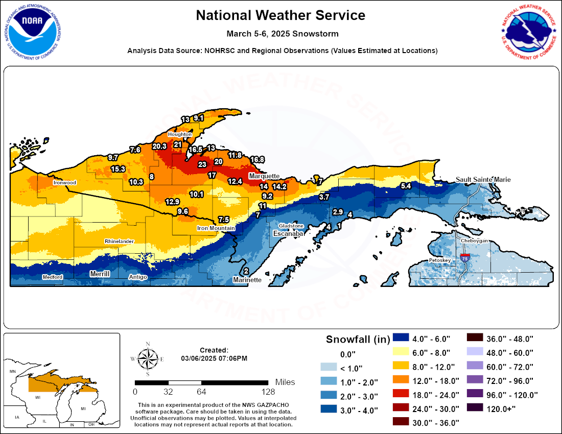 Snowfall reports from the March 5-6, 2025 storm. Values between reports are interpolated and may not be accurate. Click to enlarge. |
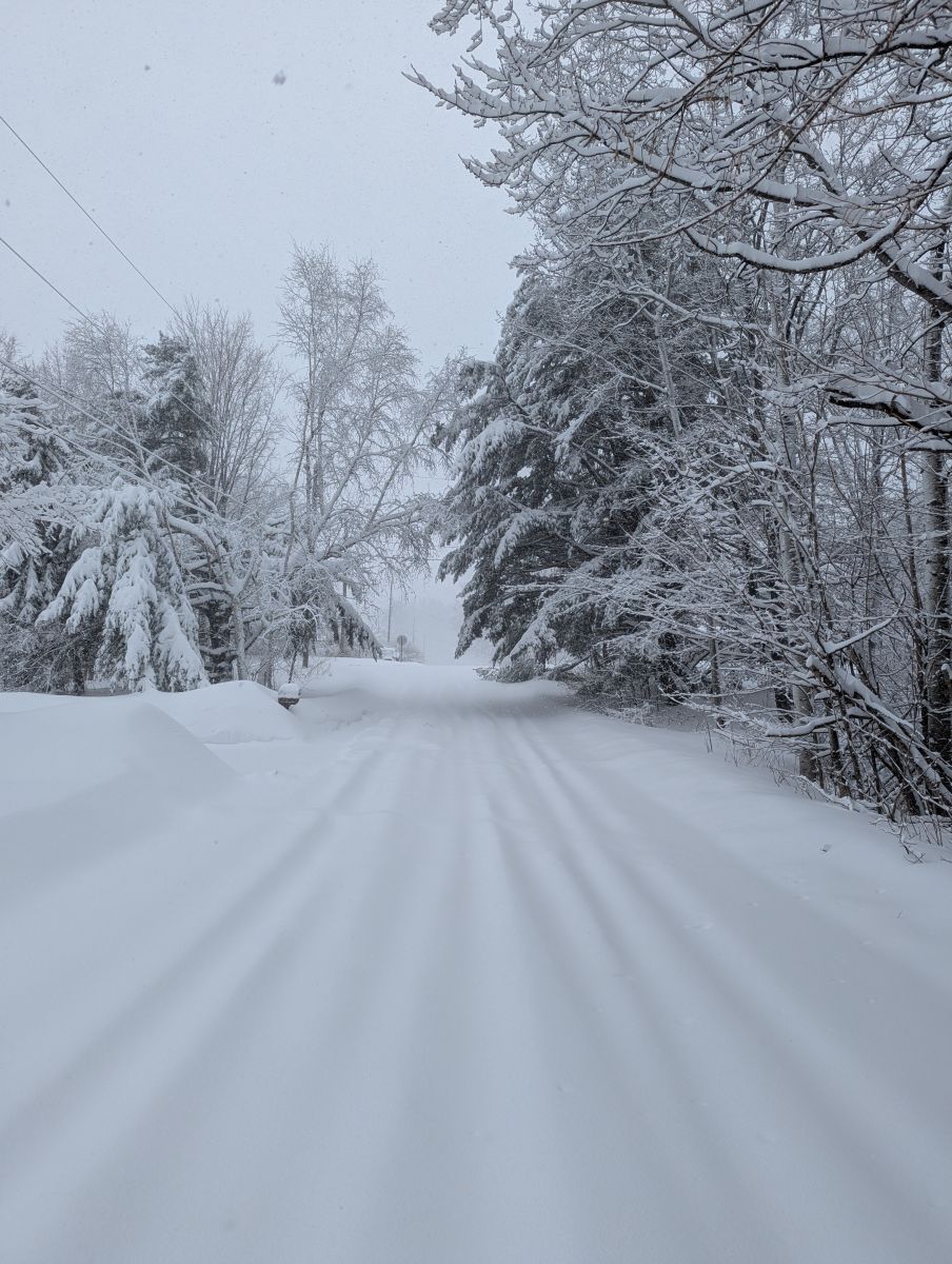
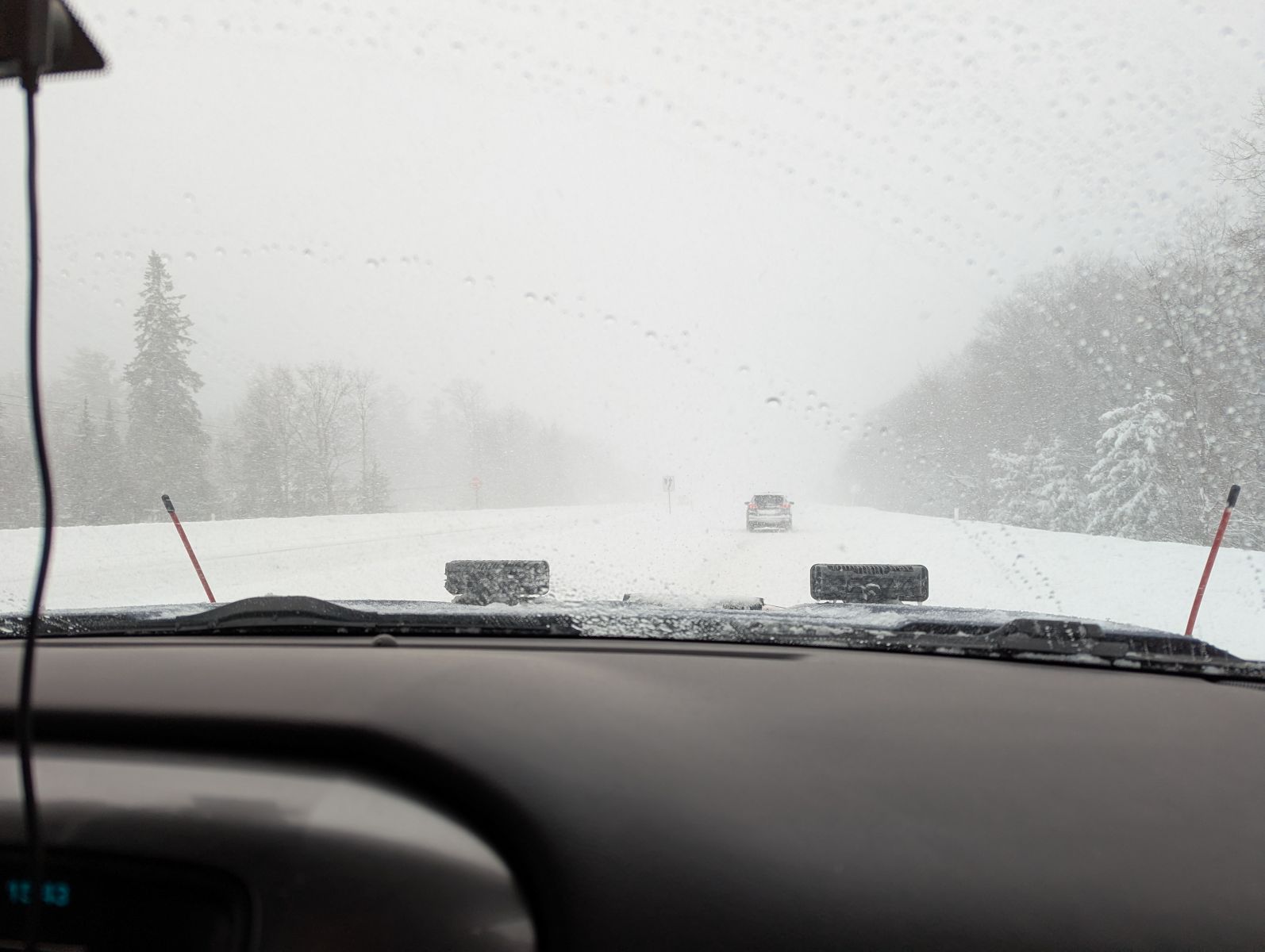
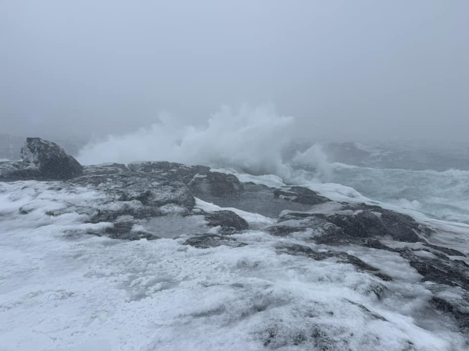
Photos & Video
 |
 |
 |
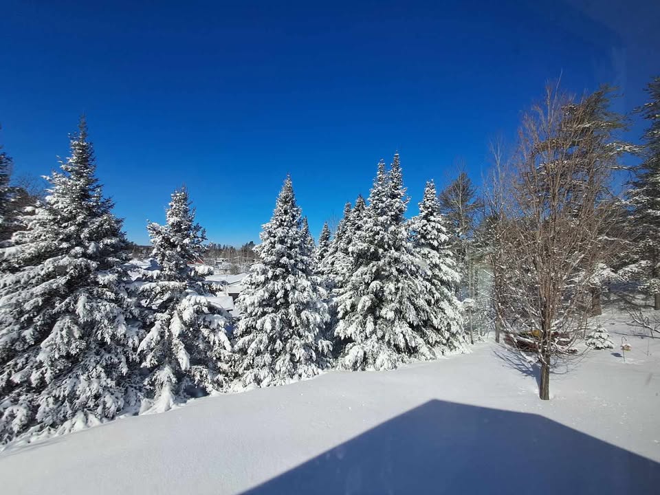 |
| Trowbridge Park (source: NWS Employee) |
US-41 in Marquette Township (source: NWS Employee) |
Presque Isle Park, Marquette (source: Craig Hess) |
South Ely Township (source: NWS Employee) |
Radar
KMQT Radar Loop
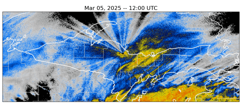 |
| KMQT radar reflectivity loop from 1200-2400Z 5 March 2025 (7am to 7 pm EST). Click to enlarge. |
 |
Media use of NWS Web News Stories is encouraged! Please acknowledge the NWS as the source of any news information accessed from this site. |
|
US Dept of Commerce
National Oceanic and Atmospheric Administration
National Weather Service
Marquette, MI
112 Airpark Drive South
Negaunee, MI 49866
906-475-5212
Comments? Questions? Please Contact Us.

