Overview
|
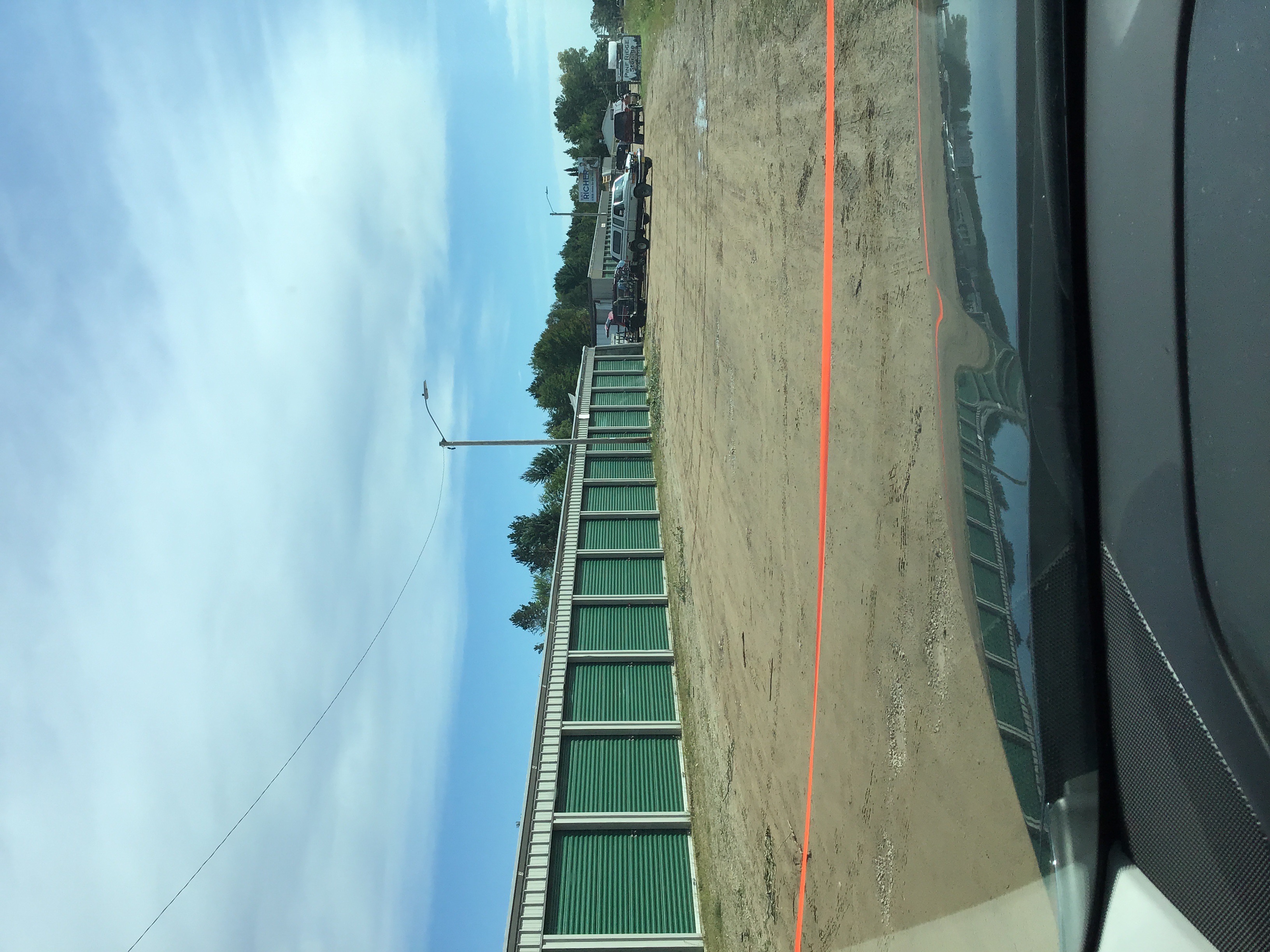
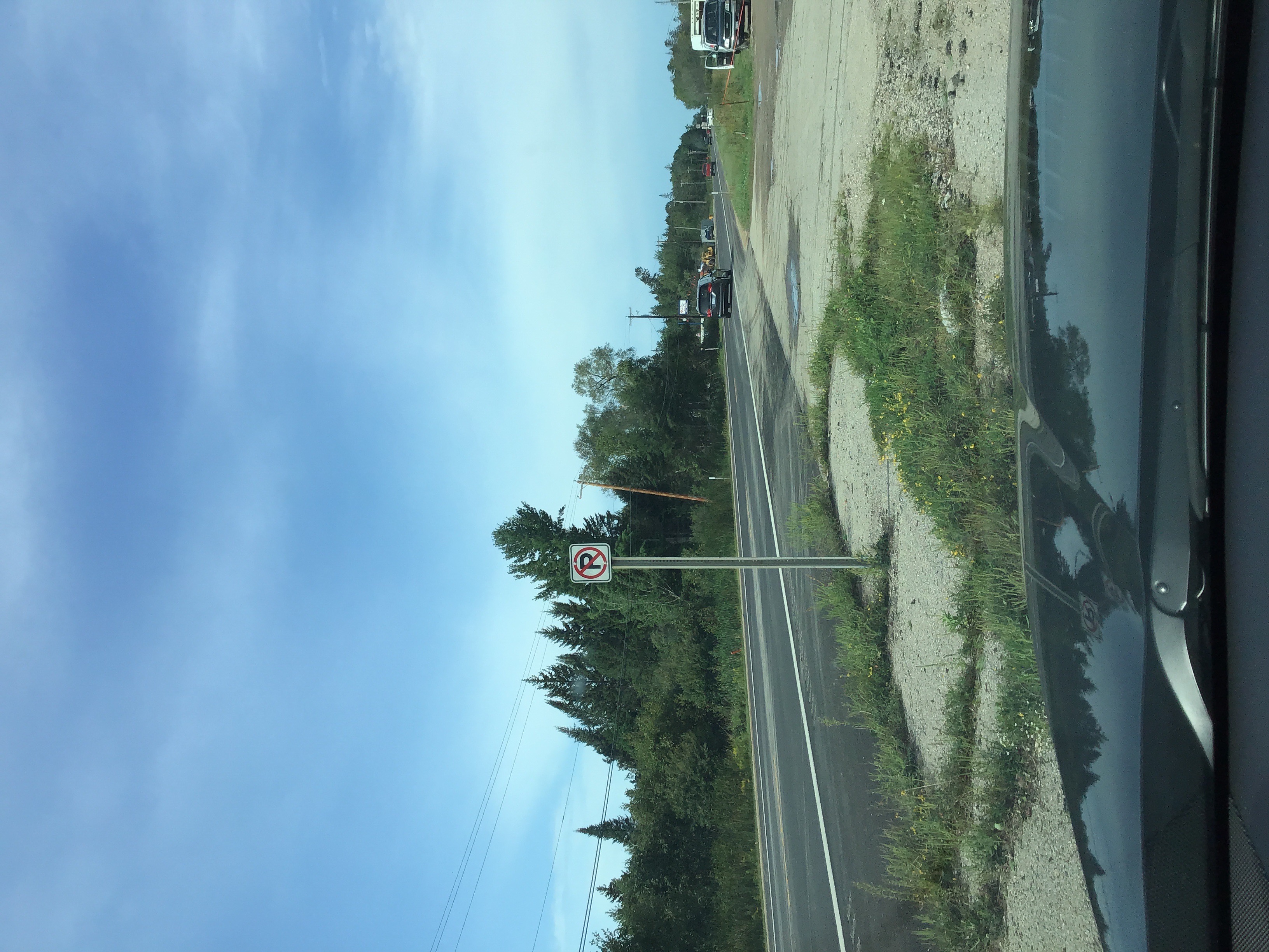
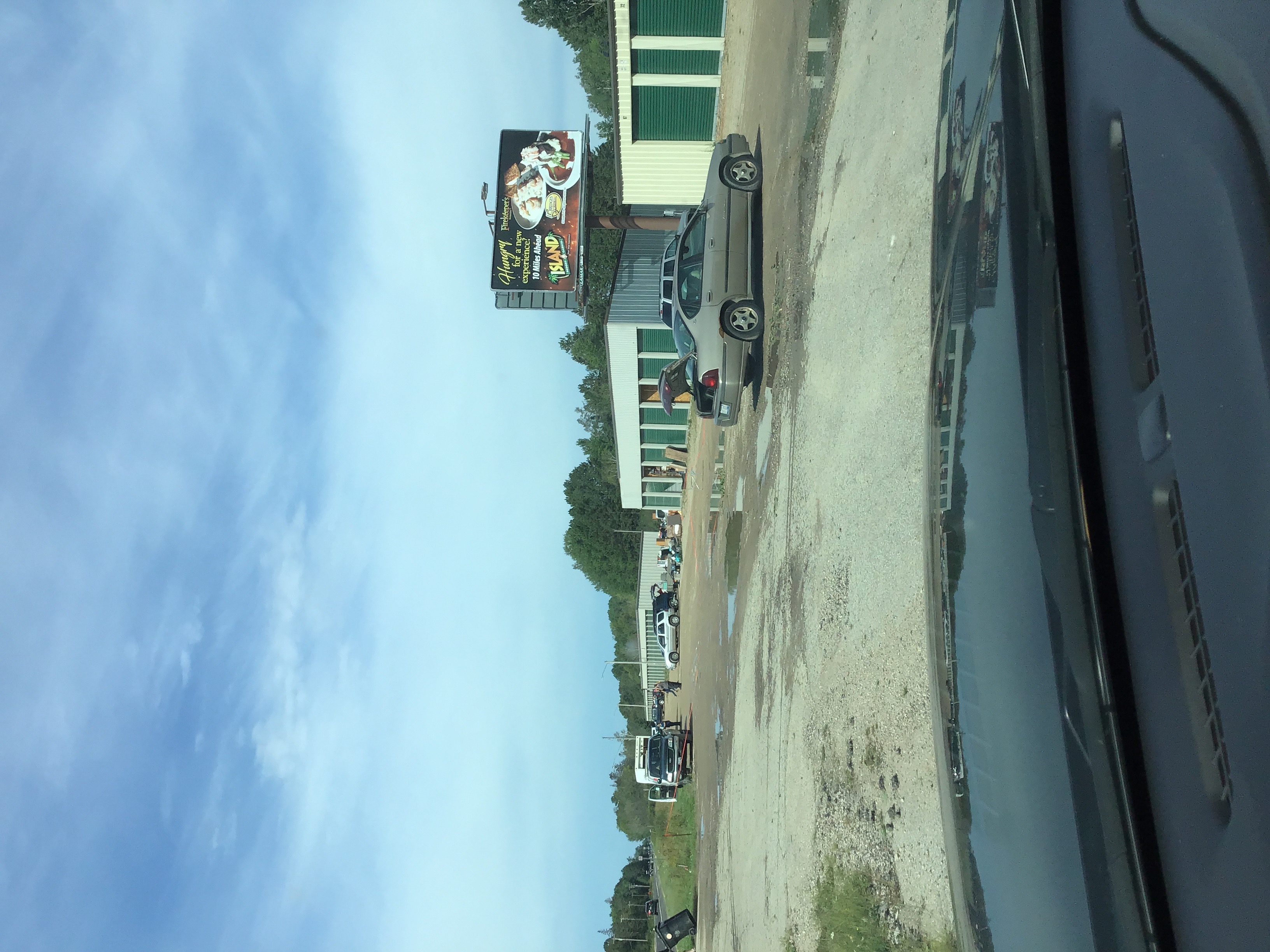
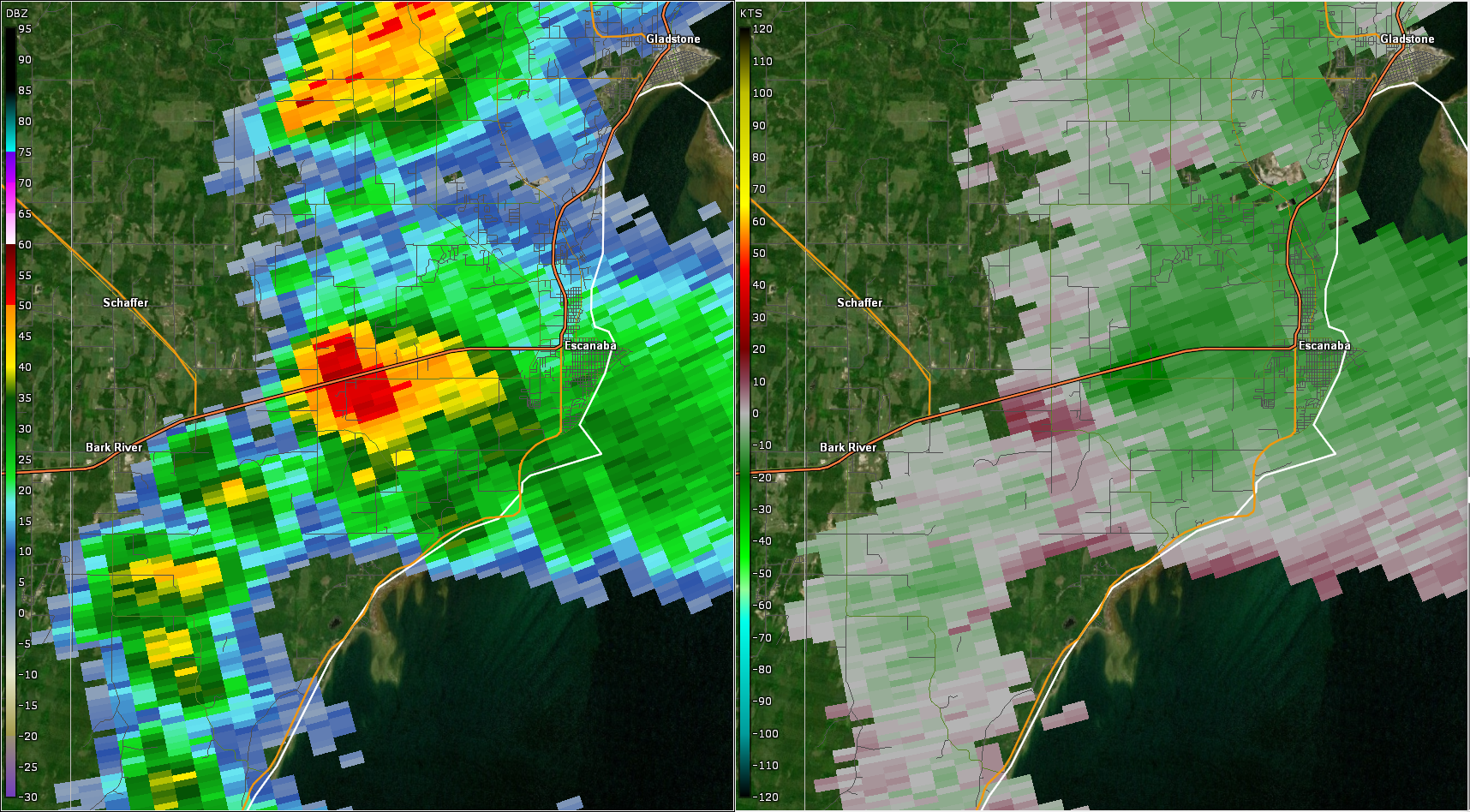
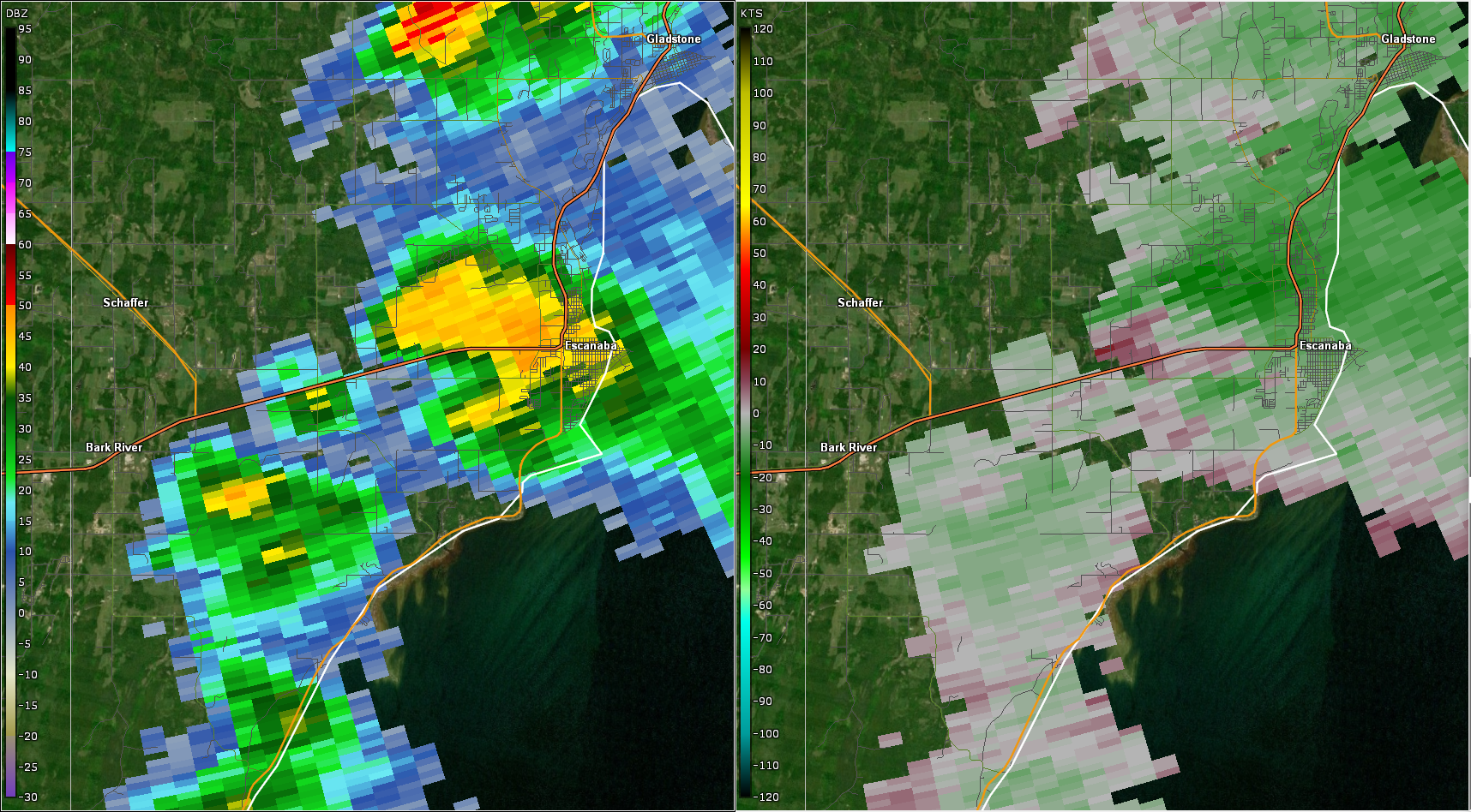
A strong cold front passing across Upper Michigan during the day caused widespread showers to develop throughout Upper Michigan. In the afternoon, skies cleared across parts of central and south-central Upper Michigan ahead of the cold front. Numerous low-topped supercells, sometimes called "mini supercells", developed along the front in an environment that was only very marginally supportive of severe weather. Almost no lightning was observed with these low-topped supercells. However, one of them produced a brief tornado in Delta County, about 5 miles west of Escanaba. The tornado crossed US-2 and was observed by numerous motorists on the highway. It significantly damaged part of a storage facility on the north side of the highway. The tornado then dissipated, and the storm collapsed. The outflowing wind from the collapse of the storm caused numerous trees to be uprooted in a heavily forested area north of the damaged storage facility. The NWS storm survey team rated the tornado as an EF1, with winds estimated to be around 95 mph. |
|
Tornado:
|
Tornado - 5 Miles West of Escanaba, MI
Track Map 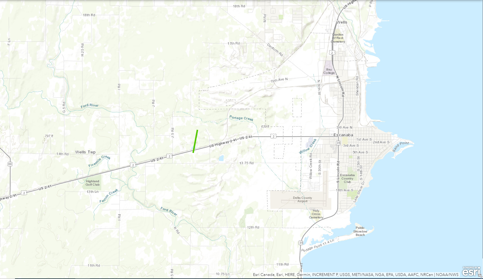 
|
||||||||||||||||
The Enhanced Fujita (EF) Scale classifies tornadoes into the following categories:
| EF0 Weak 65-85 mph |
EF1 Moderate 86-110 mph |
EF2 Significant 111-135 mph |
EF3 Severe 136-165 mph |
EF4 Extreme 166-200 mph |
EF5 Catastrophic 200+ mph |
 |
|||||
Photos
Storm Damage Photos
 |
 |
 |
 |
 |
 |
|
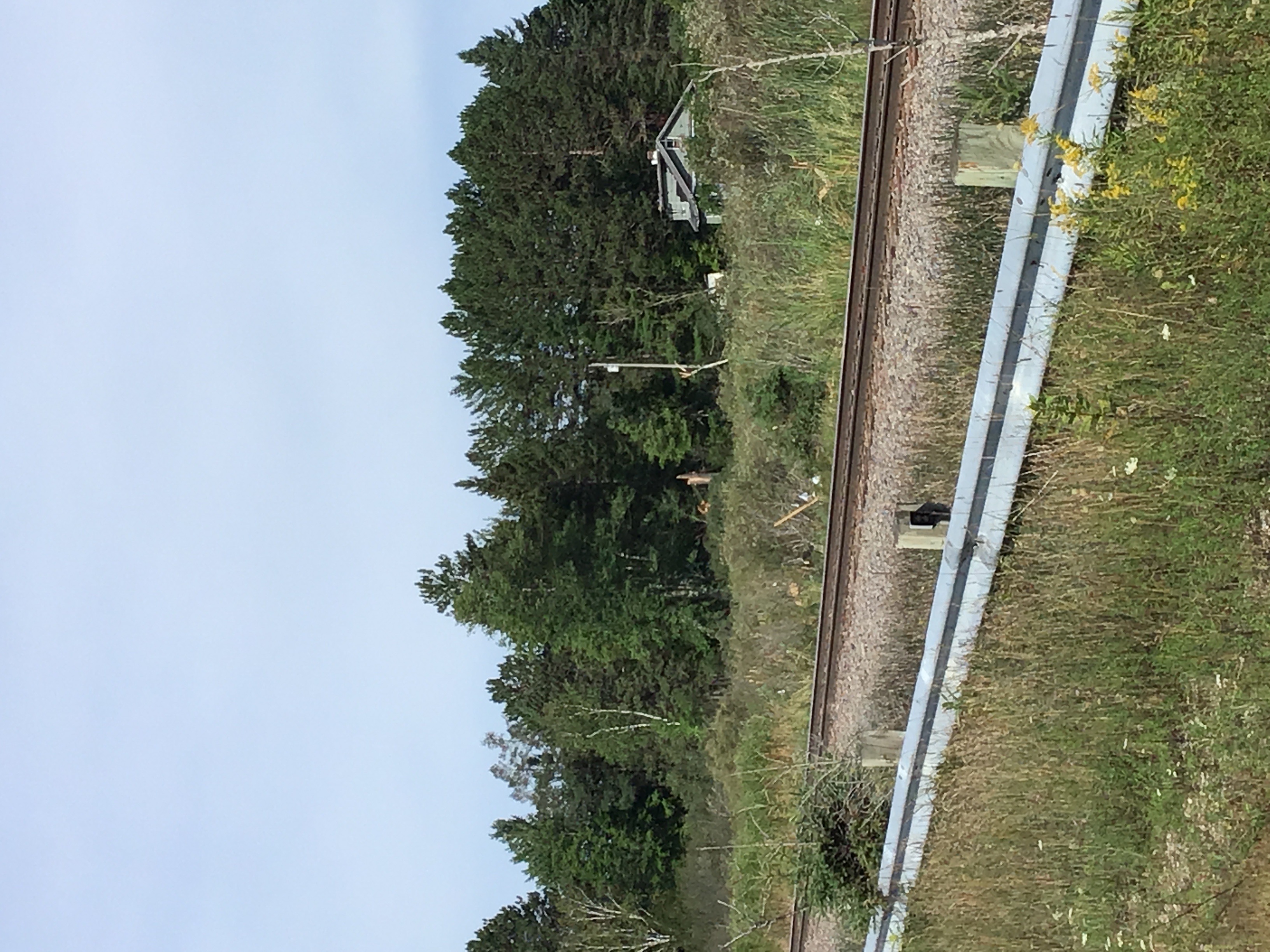
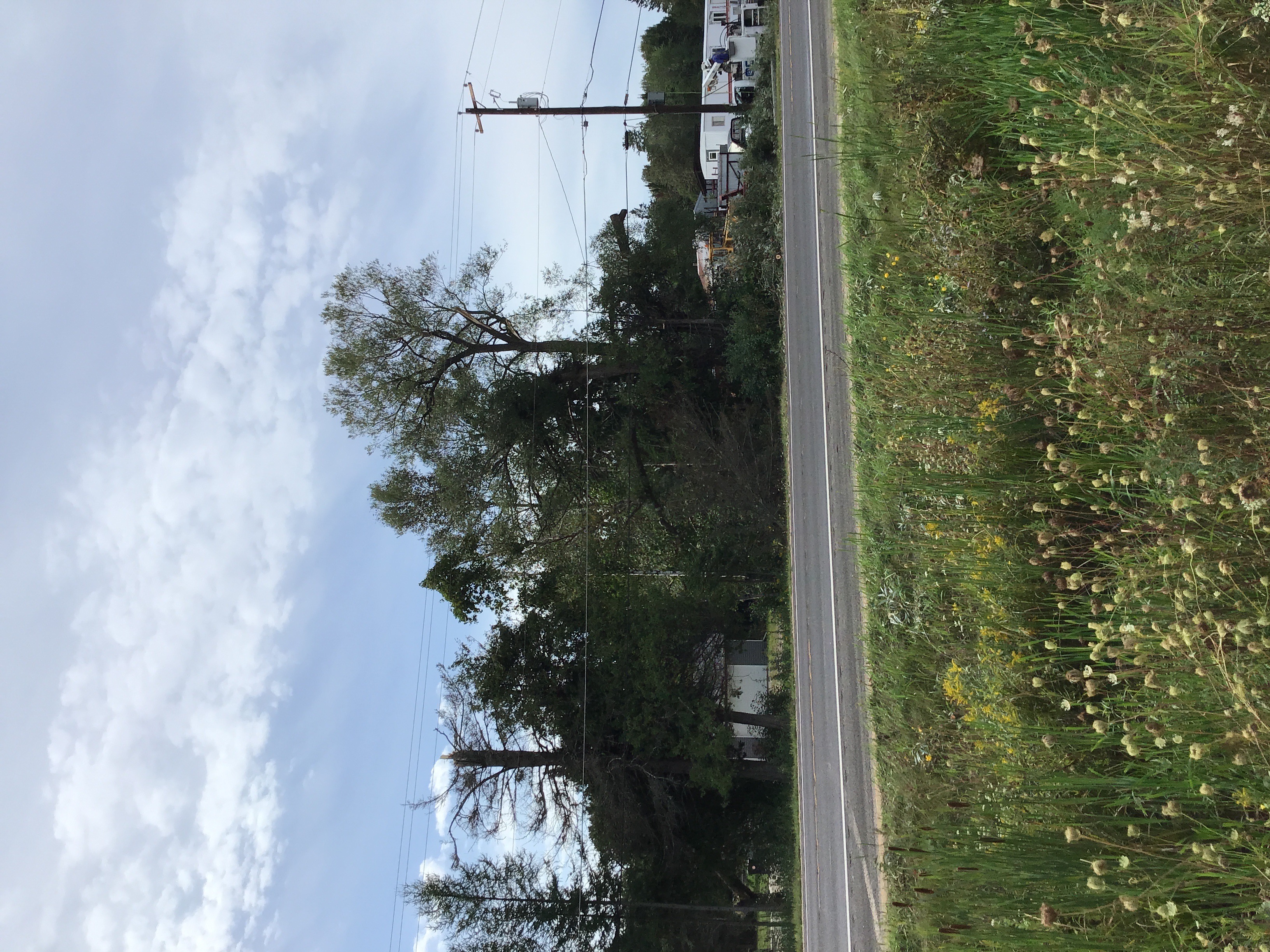
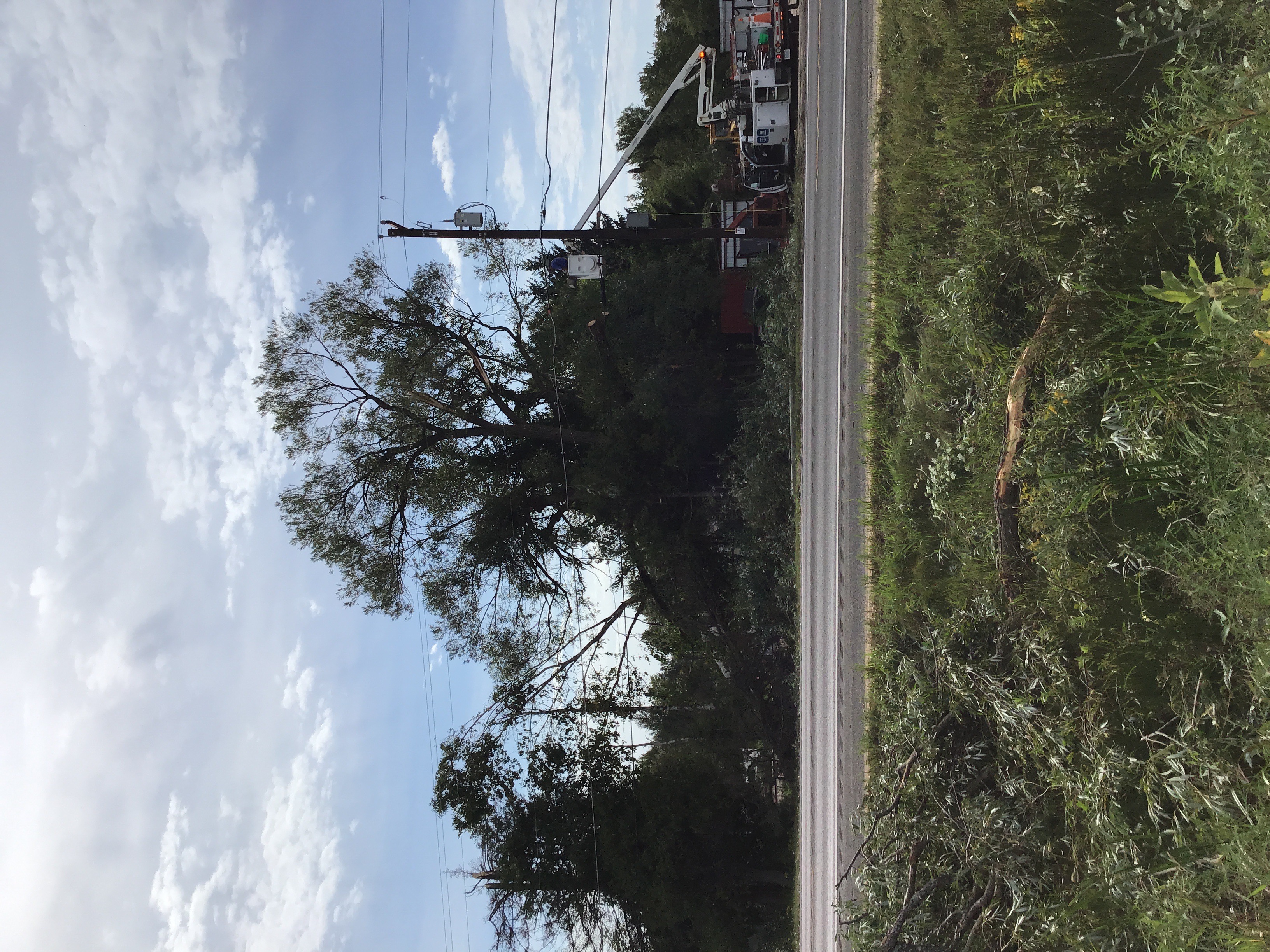
| Various pictures of the tornado damage west of Escanaba, MI. | |||
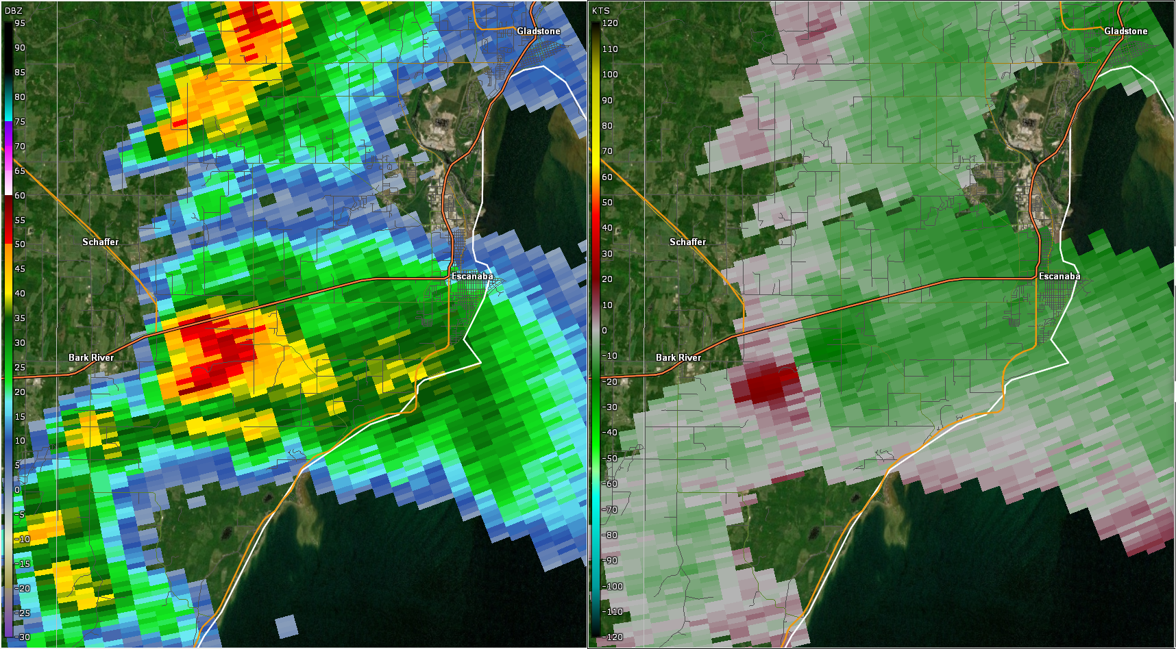
Radar
These images show base reflectivity (left) and storm-relative velocity (right). This low-topped supercell did not exhibit any of the common characteristics of a tornado-producing storm, including any debris signature.
 |
 |
 |
|
5:24 PM EDT |
5:28 PM EDT |
5:33 PM EDT |
 |
Media use of NWS Web News Stories is encouraged! Please acknowledge the NWS as the source of any news information accessed from this site. |
|

