Overview Severe Weather on August 9th, 2020
|
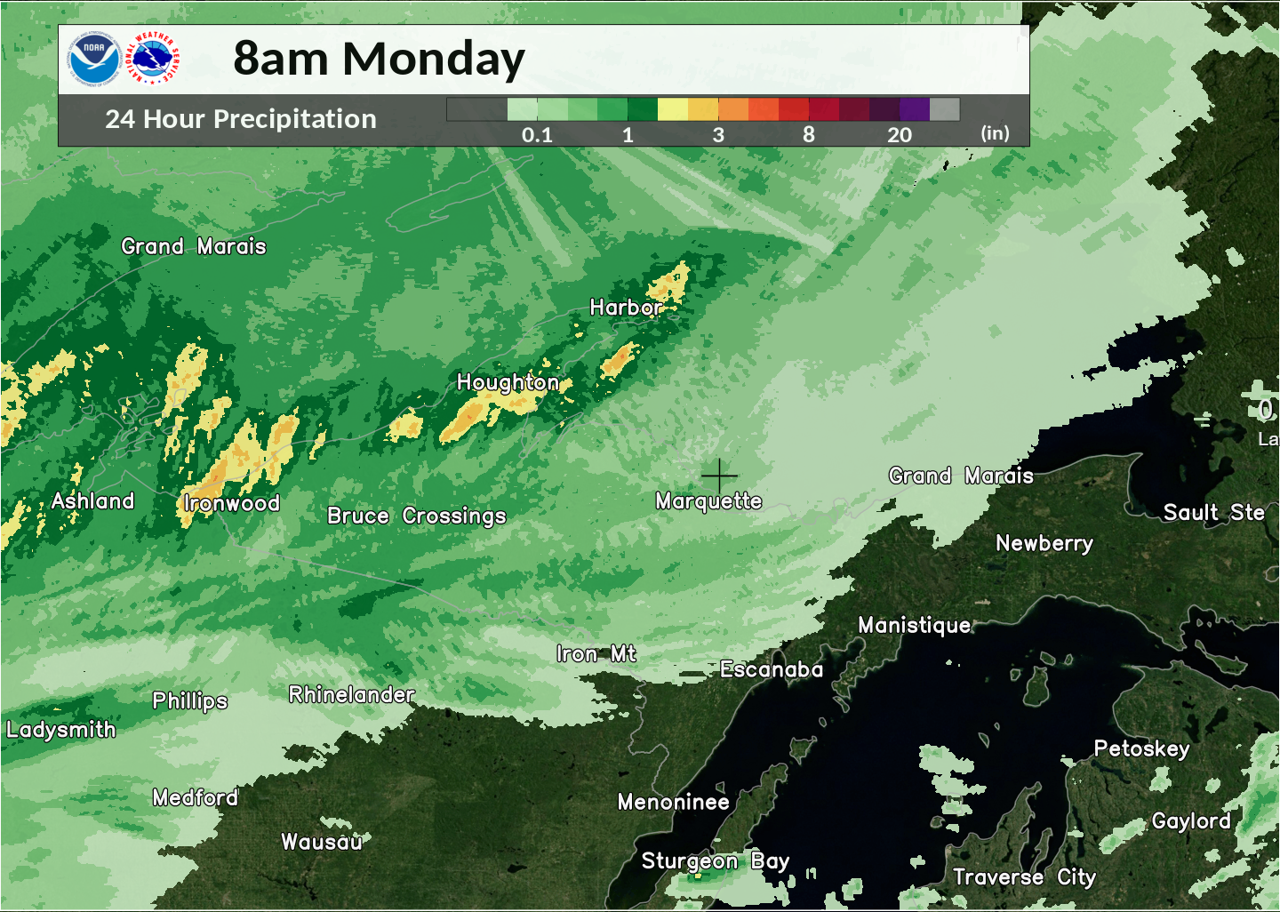
Severe thunderstorms moved through the western and central Upper Peninsula bringing wind damage to parts of Iron and Marquette counties. A tornado touched down near Peavy Pond bringing down many large healthy trees. Torrential rainfall was also observed with thunderstorm activity. The highest rainfall totals of 3 to 4 inches were estimated and observed across northern Houghton County, along the higher terrain mostly between Lake Roland and South Range. A few isolated areas of flash flooding were reported as a result. *This page will be updated to include additional information including radar images, atmospheric environment and storm reports. Click here to see a summary of storm reports from this event. |
|
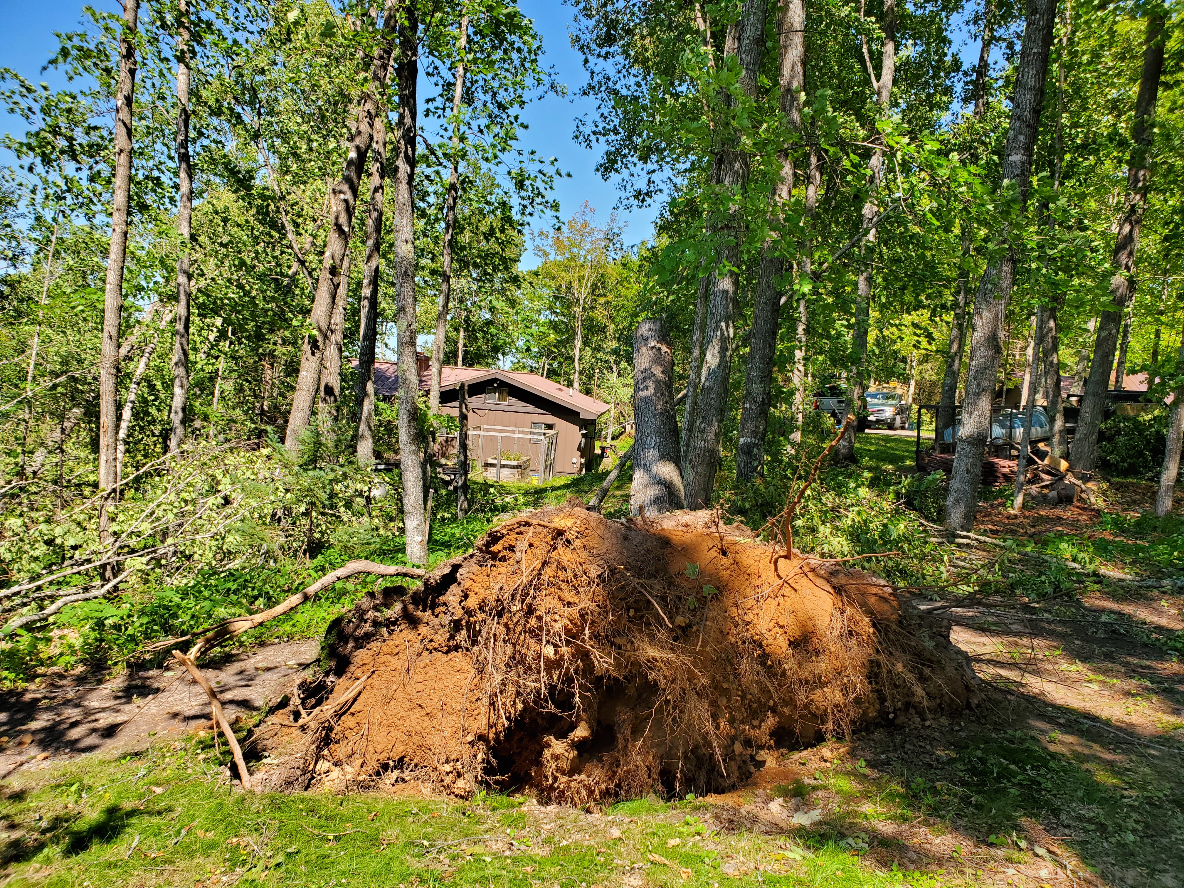
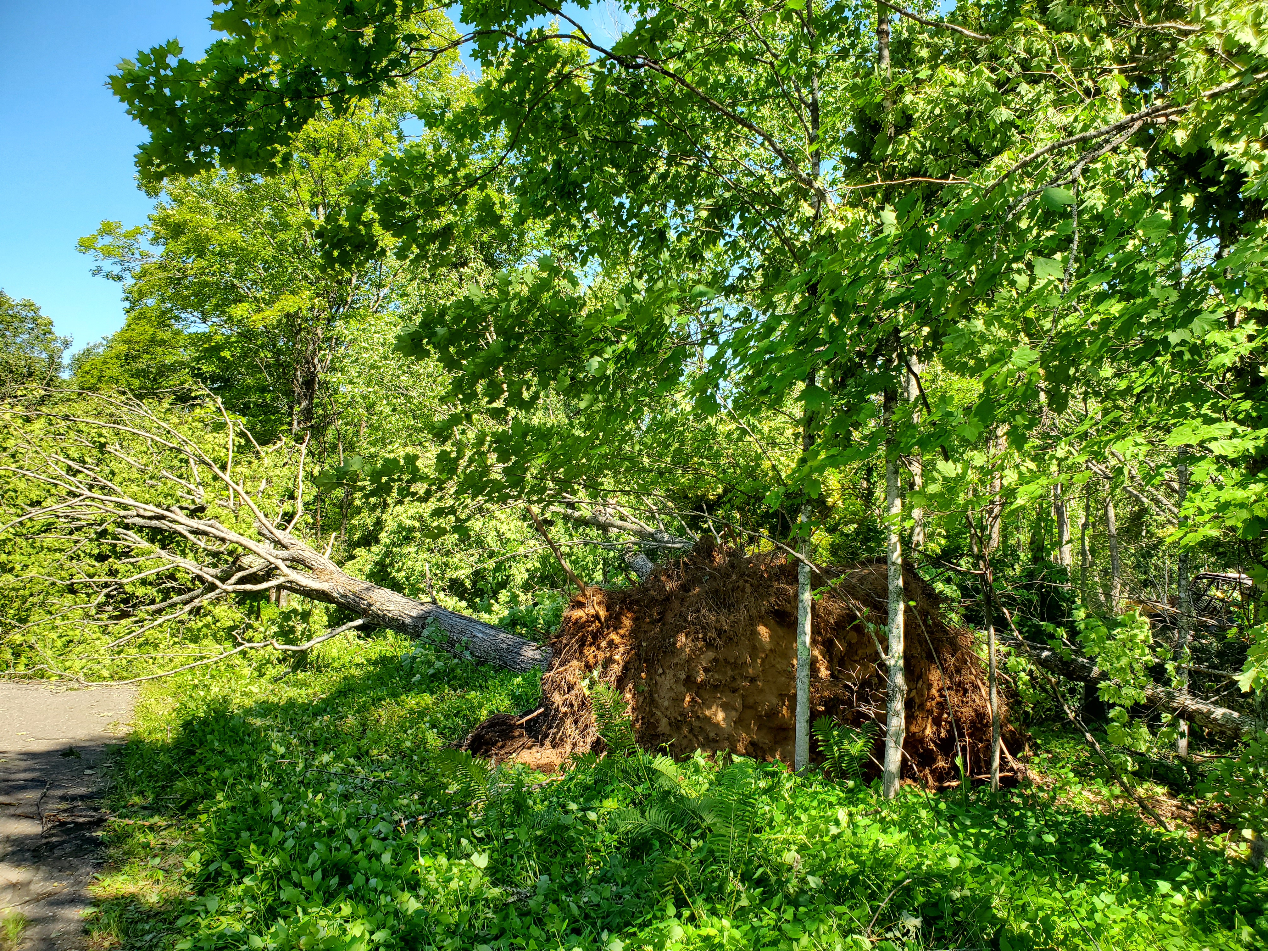
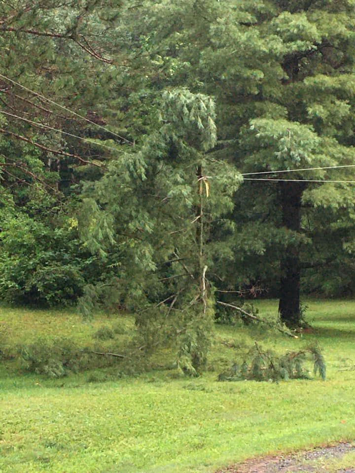
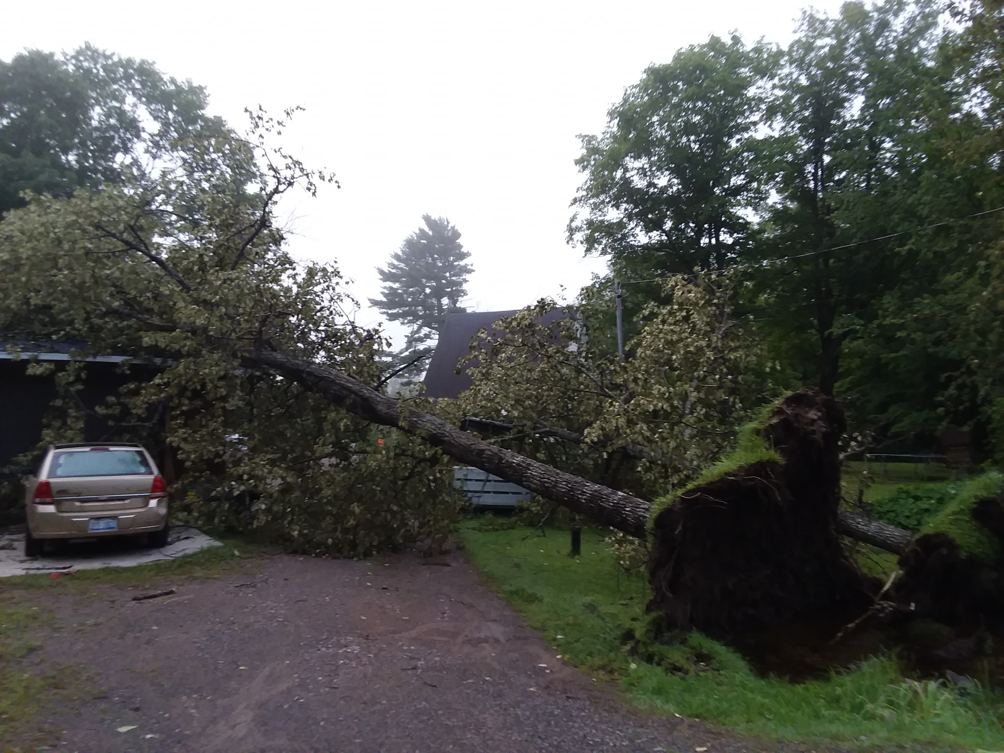
| Large tree uprooted near Golden Lake |
 |
 |
 |
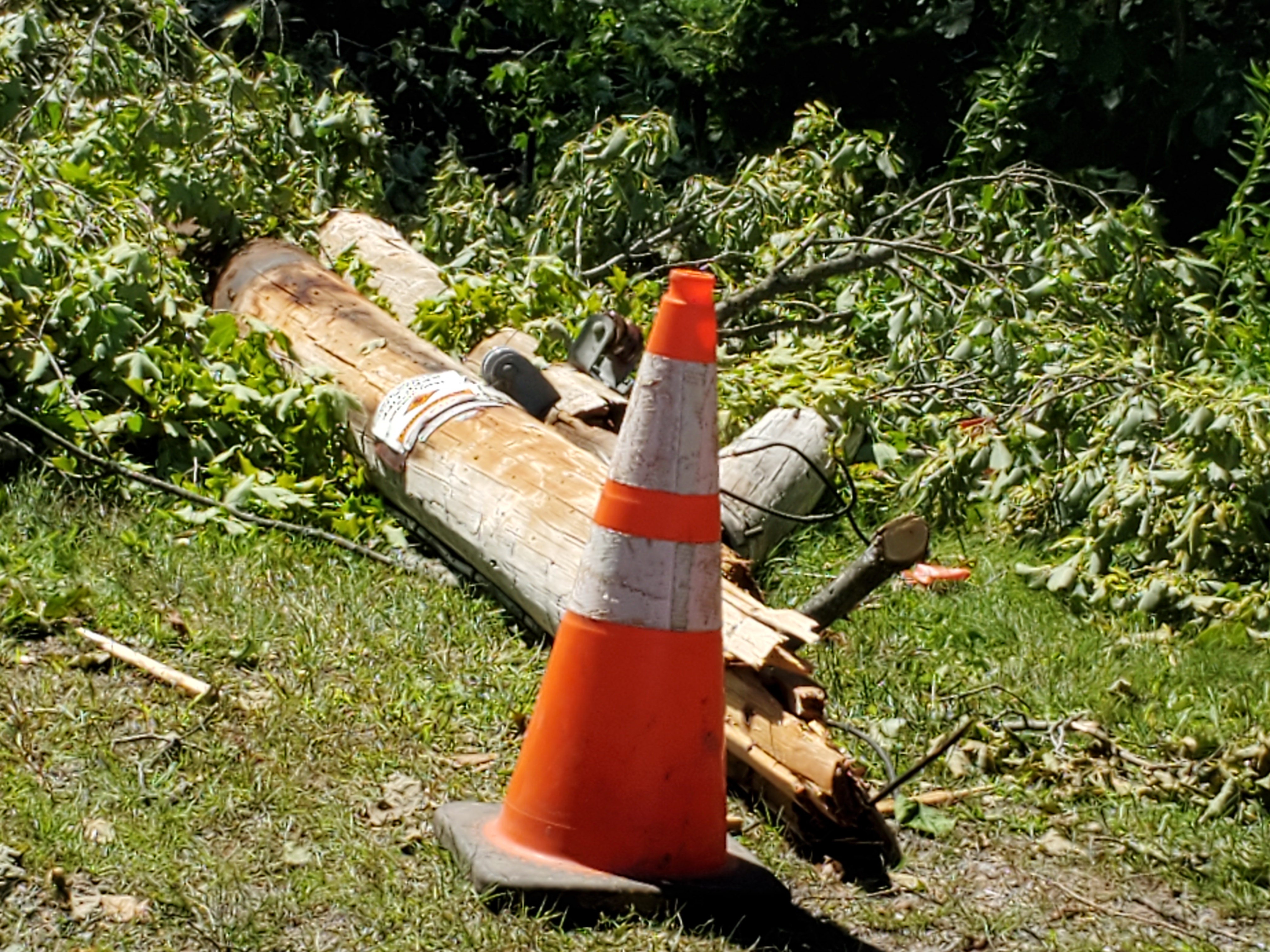
| Power Pole snapped at Golden Lake | Large uprooted tree at Golden Lake | Multiple trees uprooted and snapped along Peavy Pond Rd |
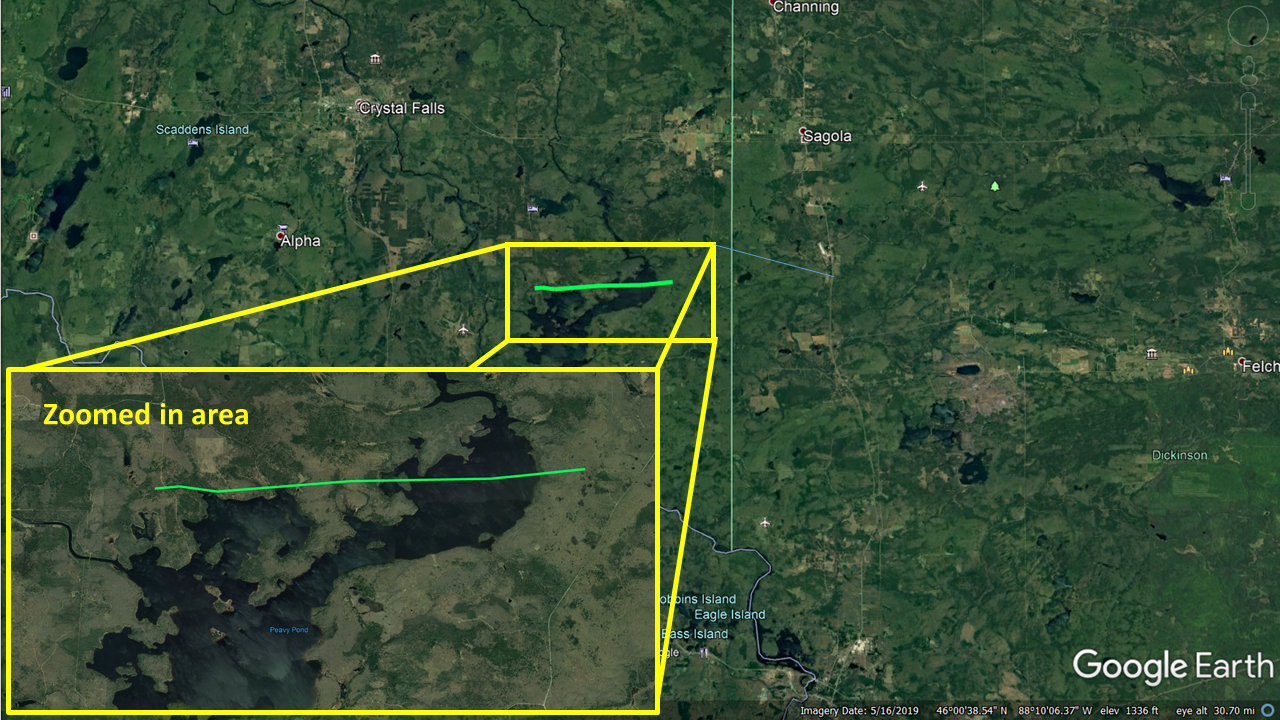
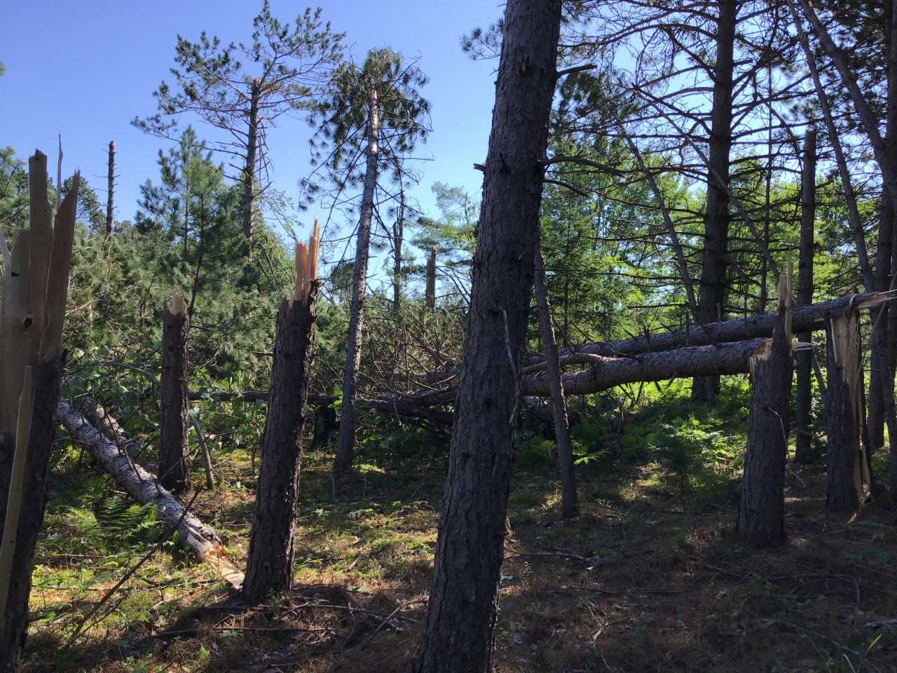
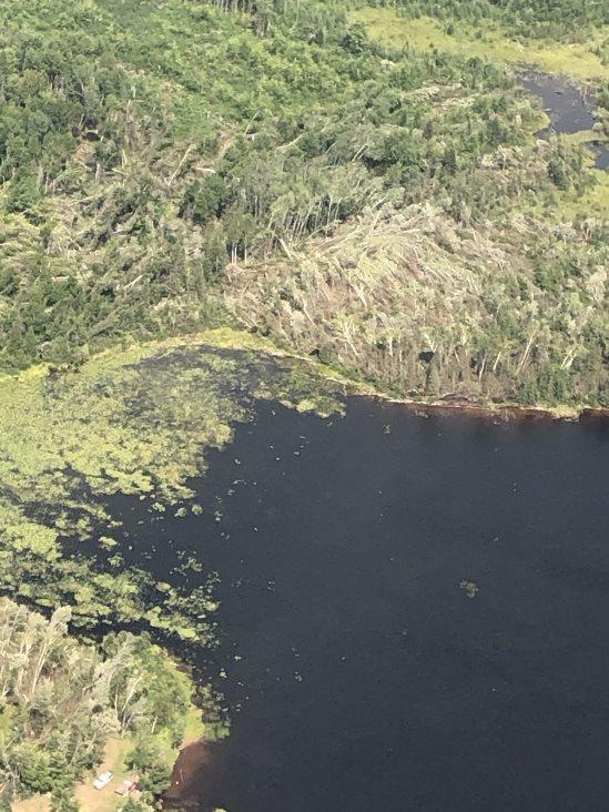
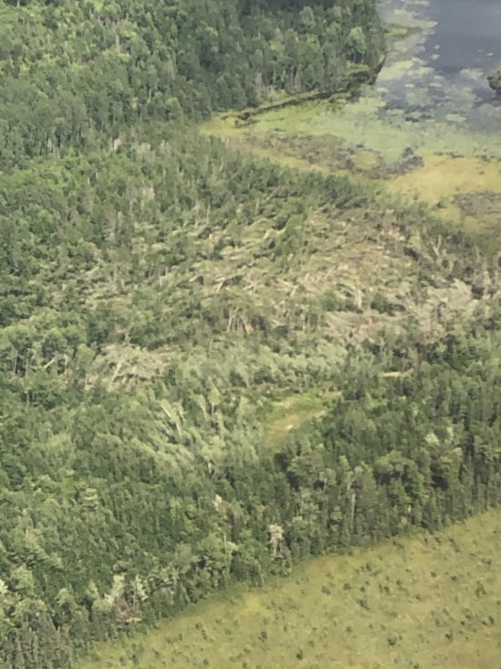
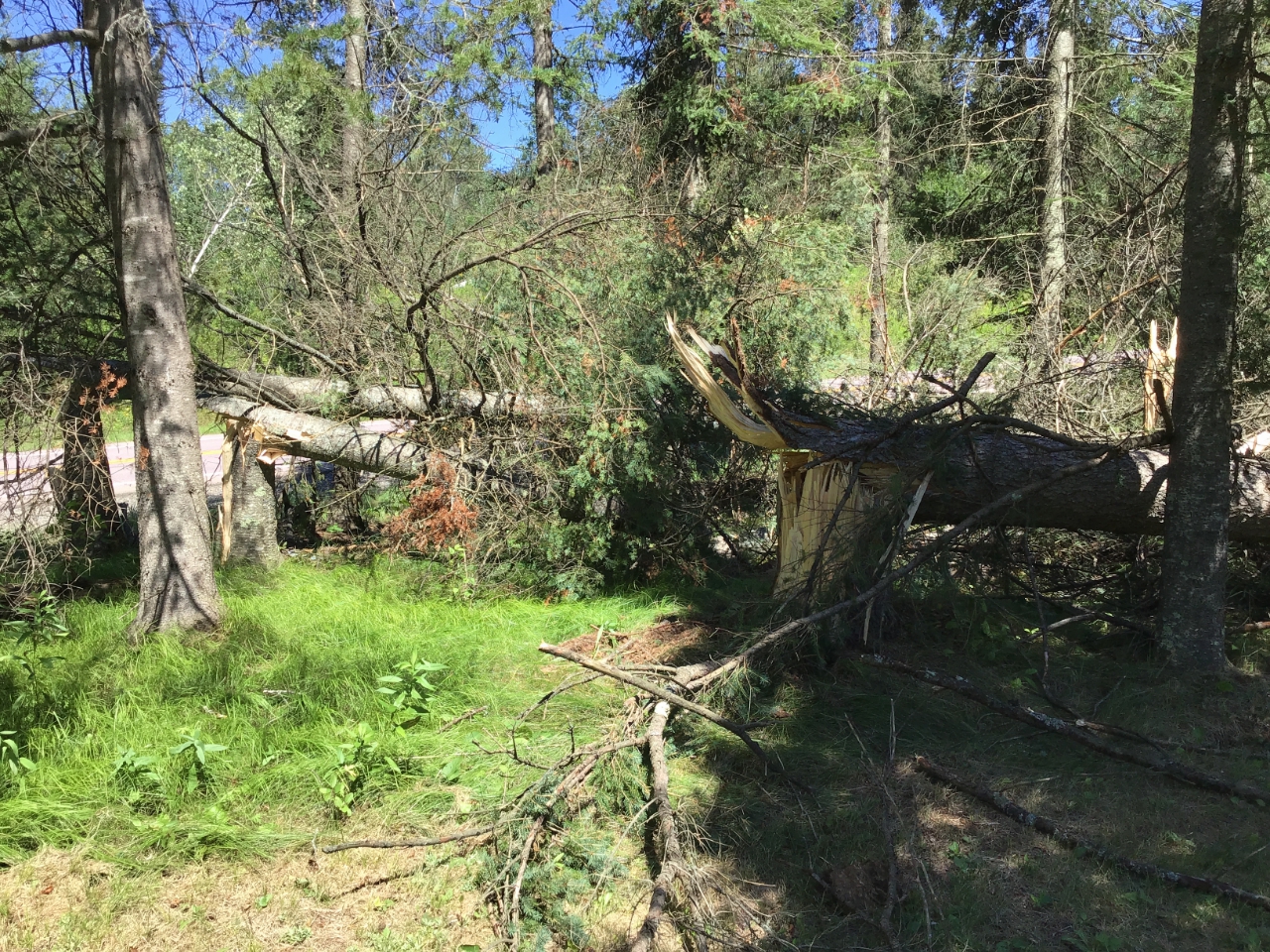
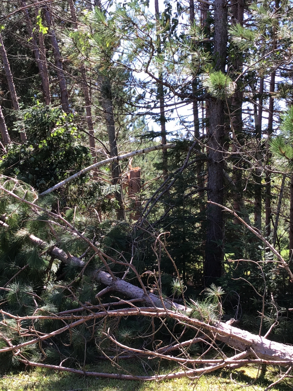
Tornado Near Peavy Pond
|
Tornado - Peavy Pond Road
|
||||||||||||||||
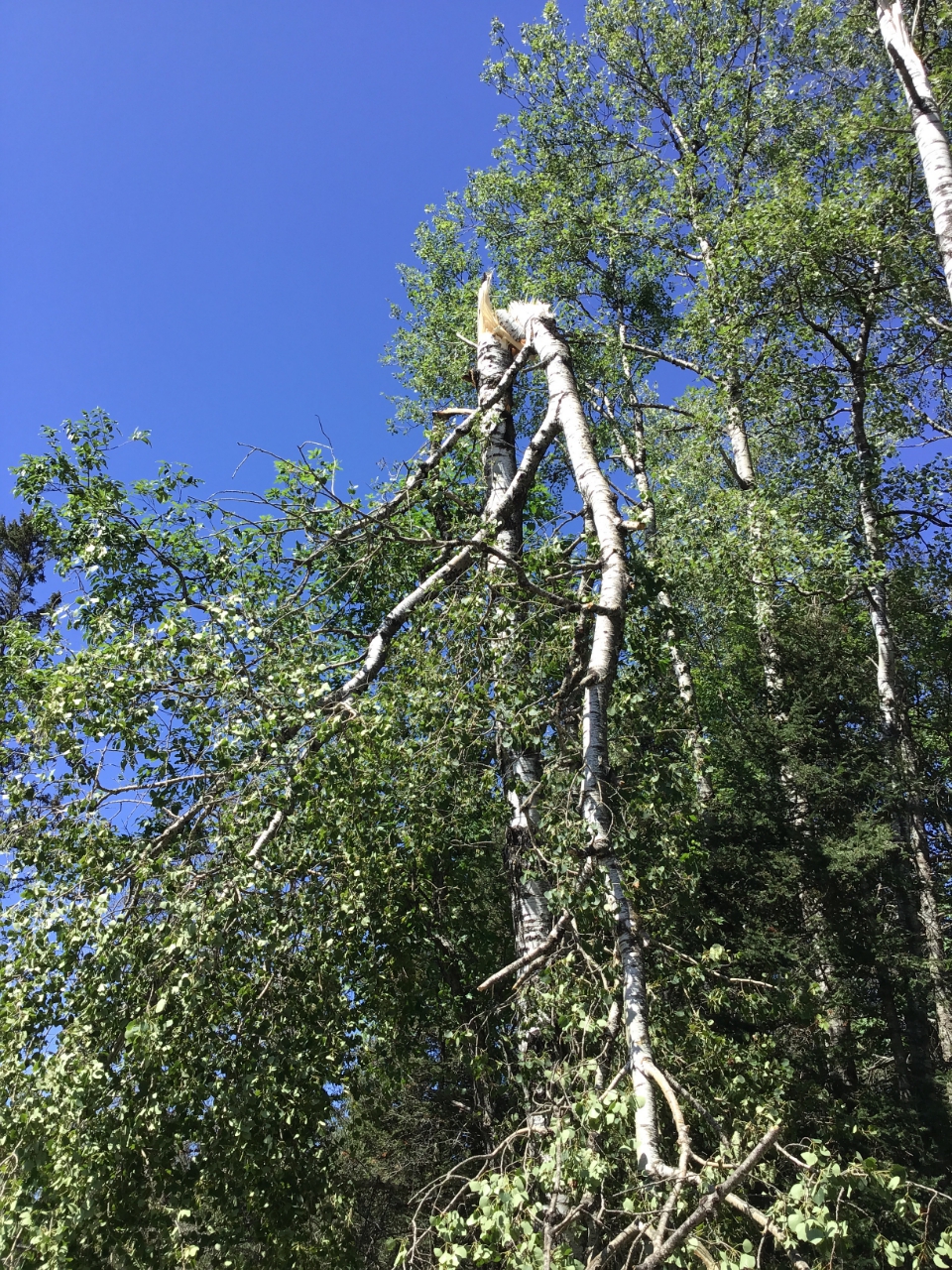
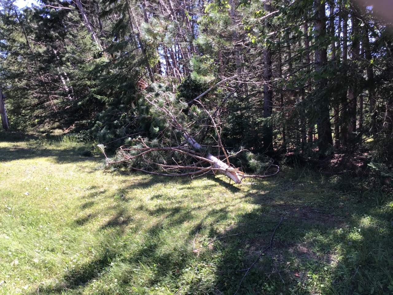
Damage Pictures
 |
 |
 |
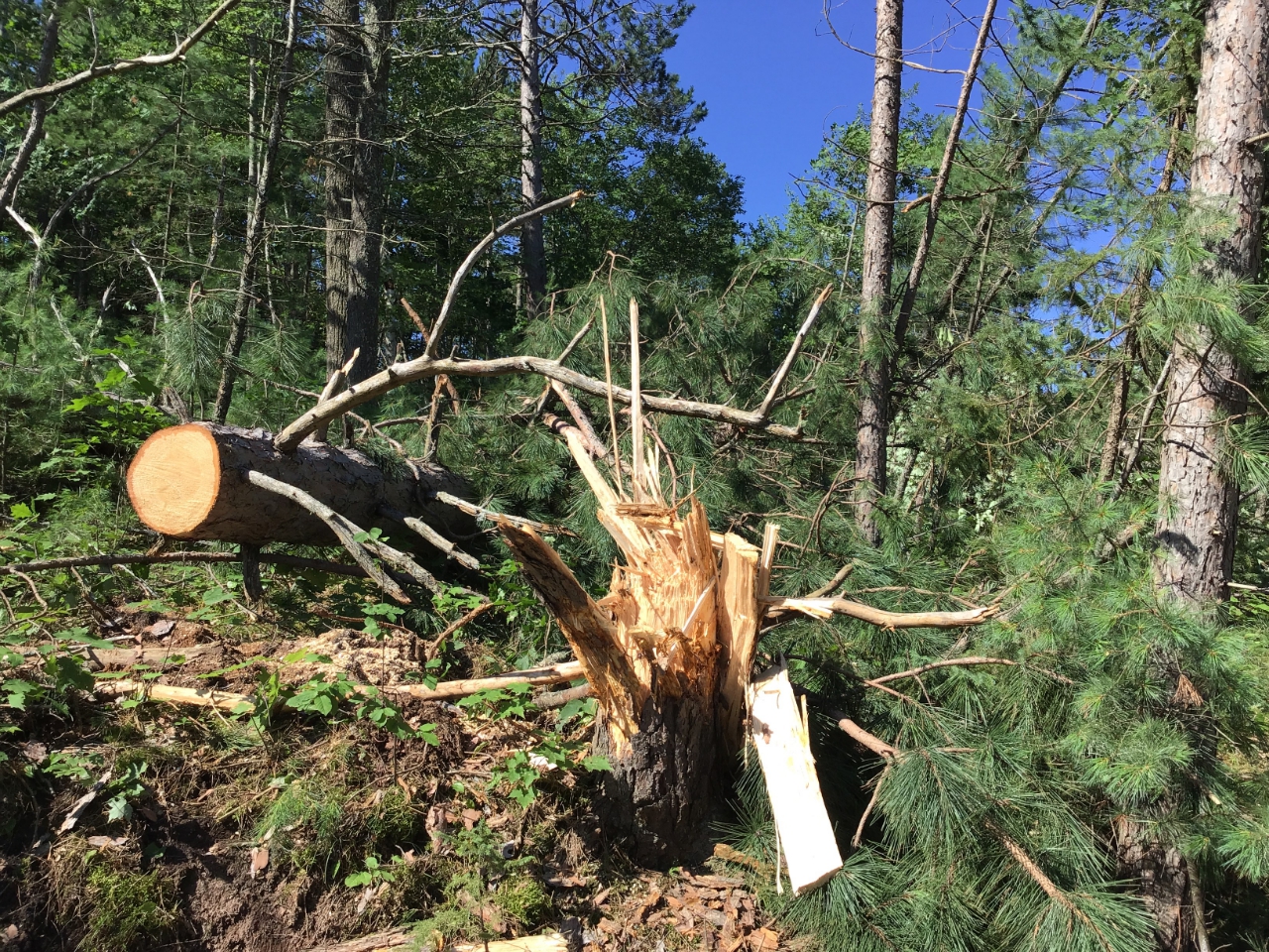 |
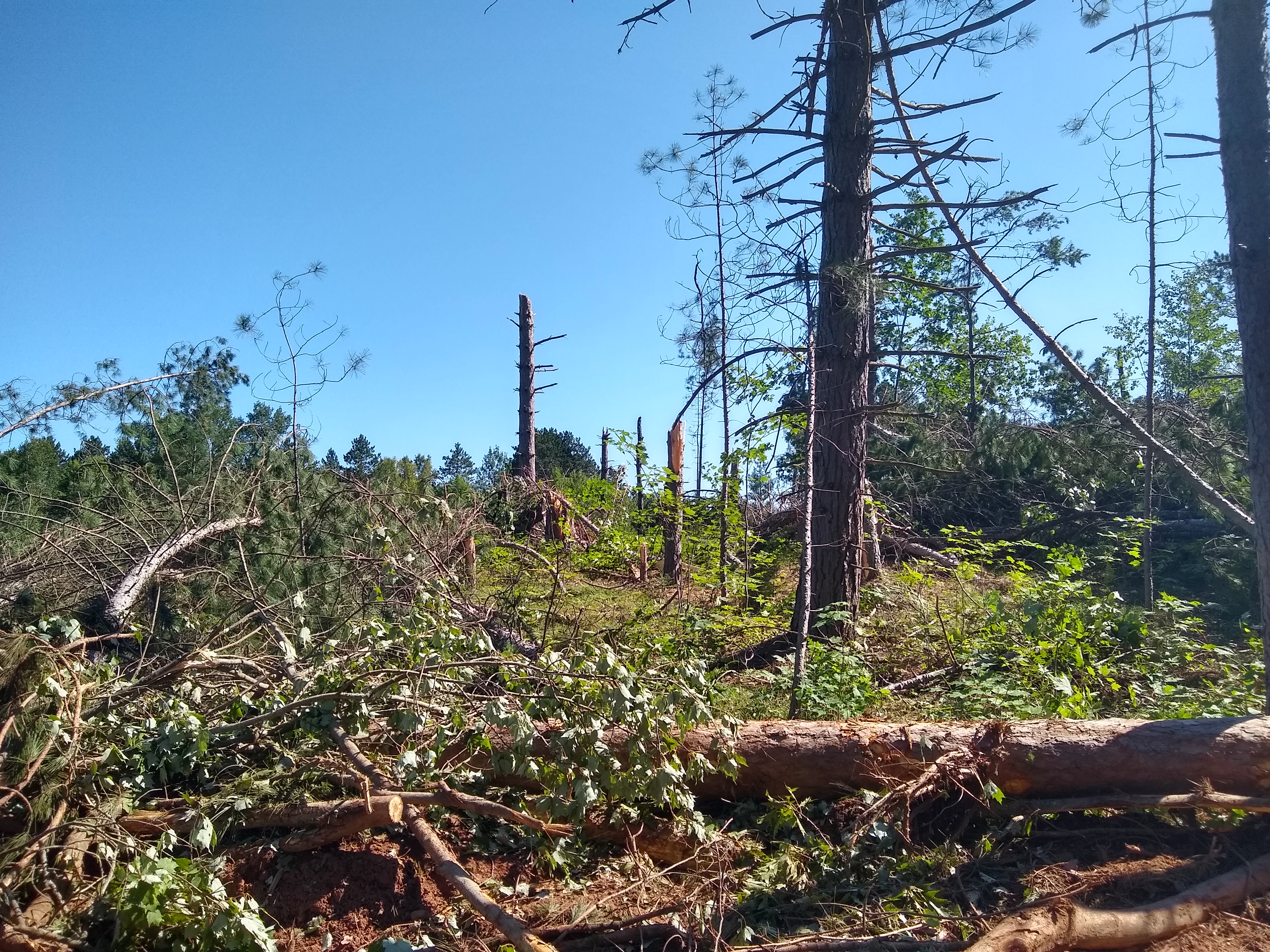
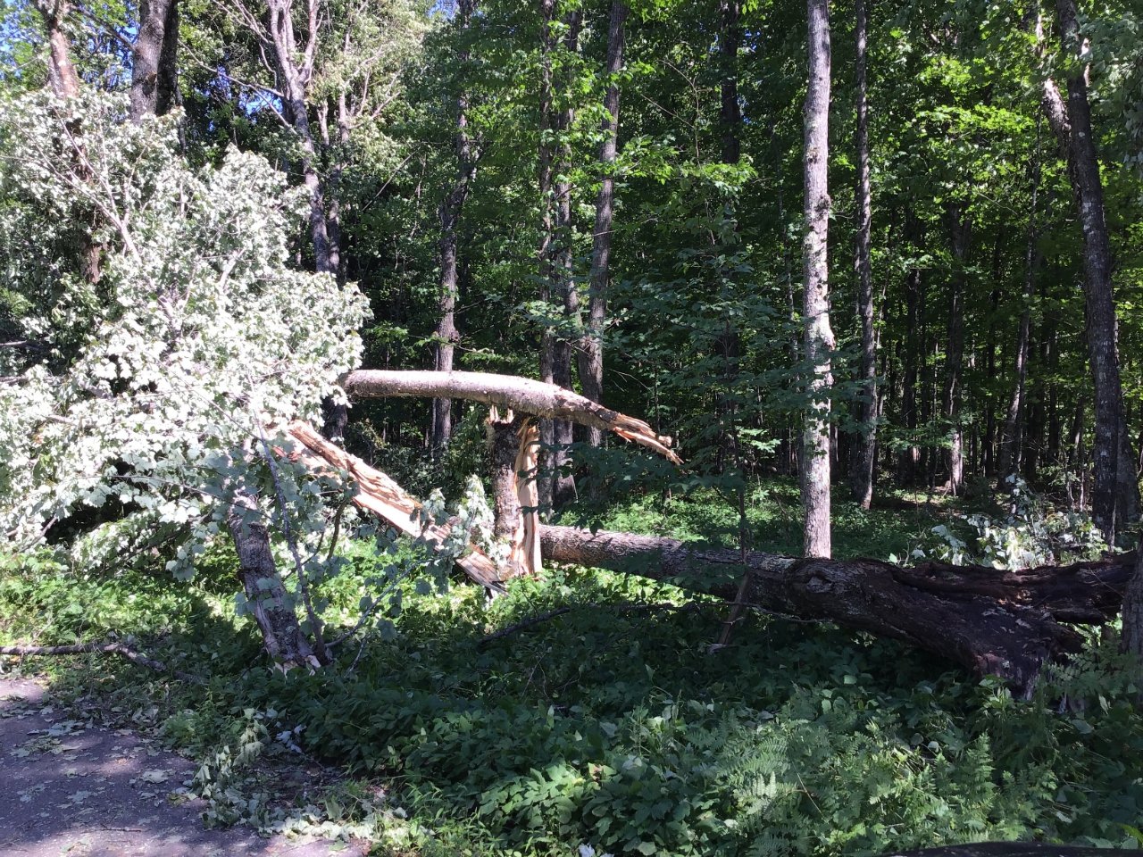
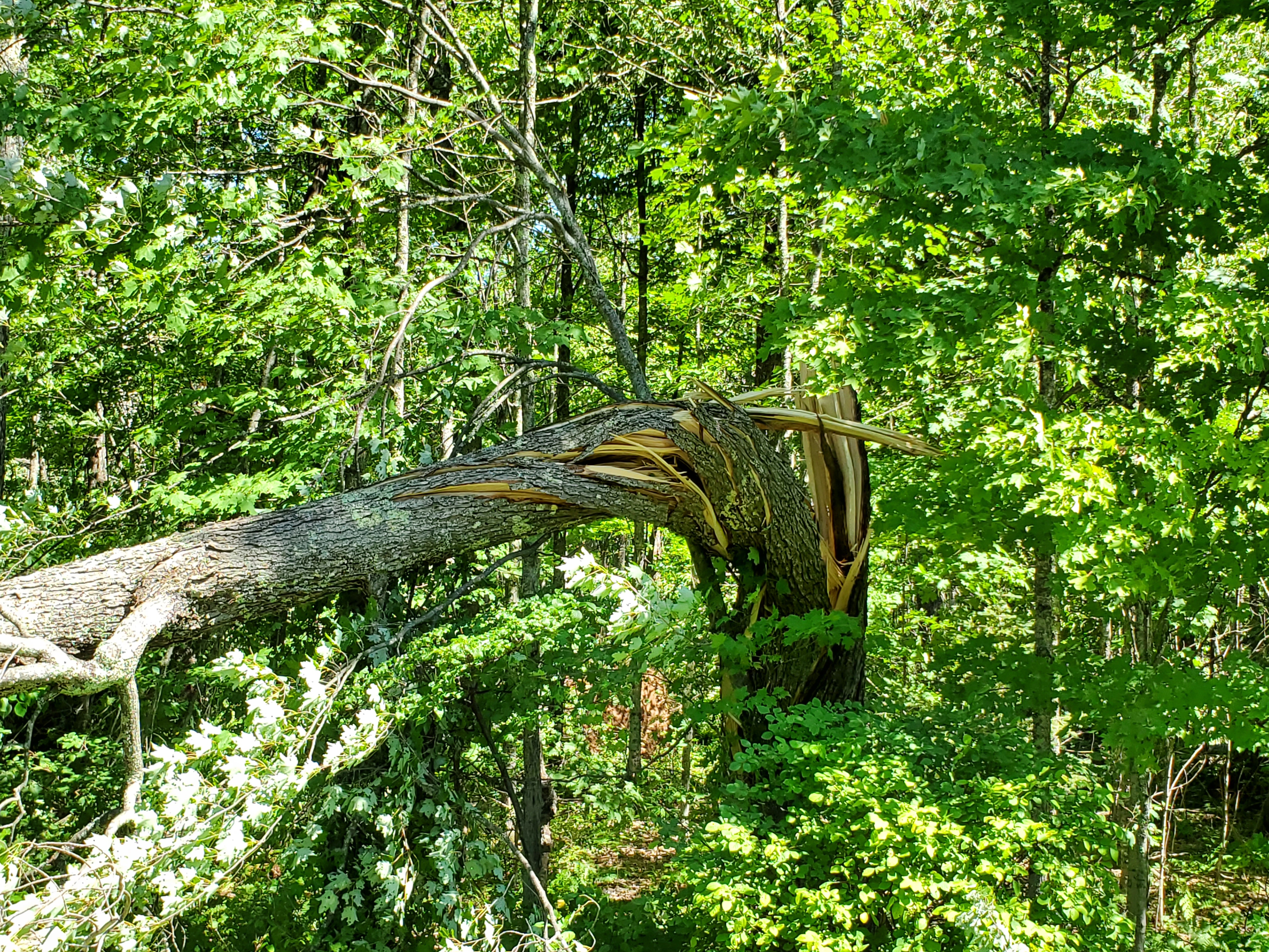
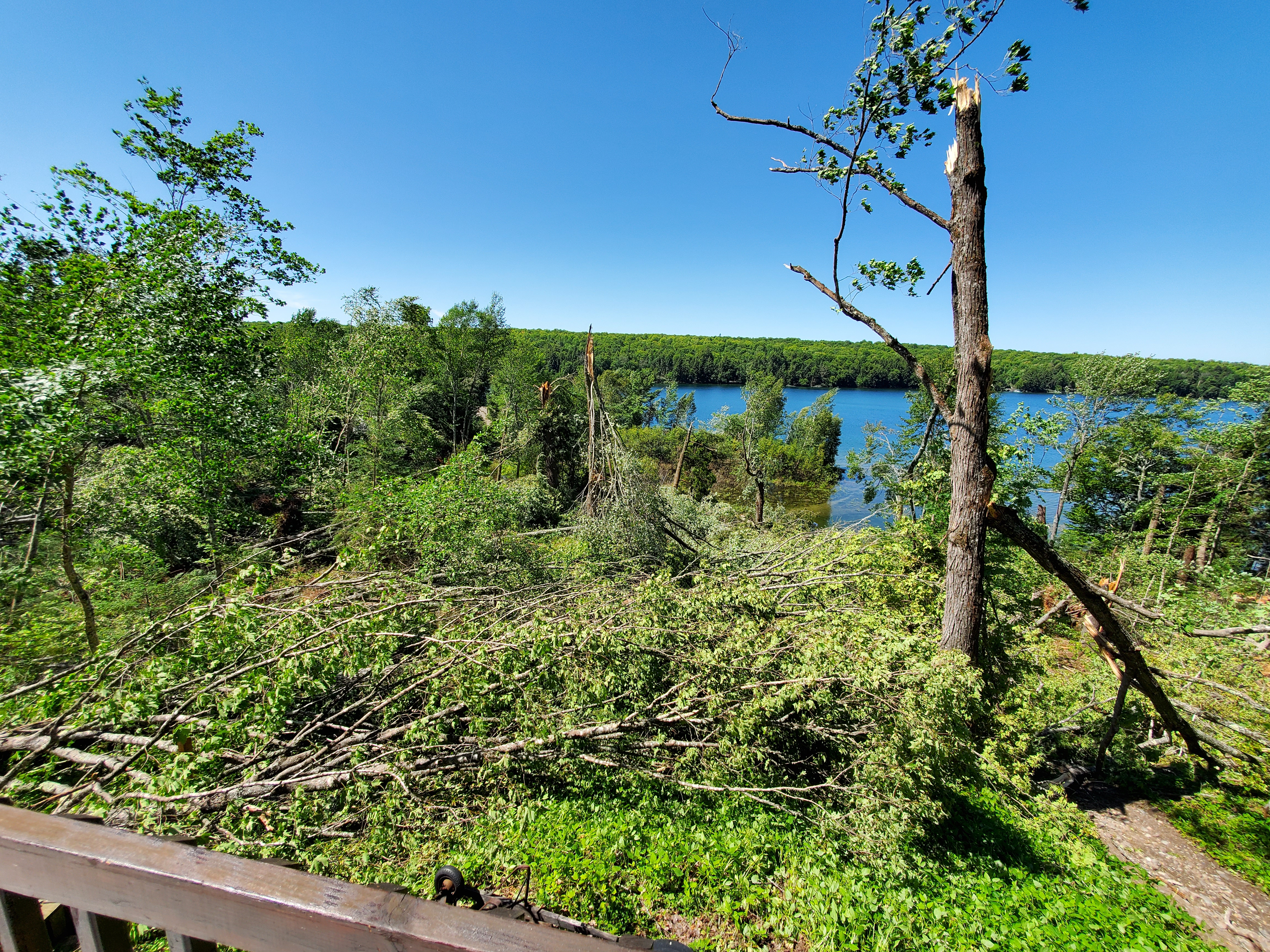
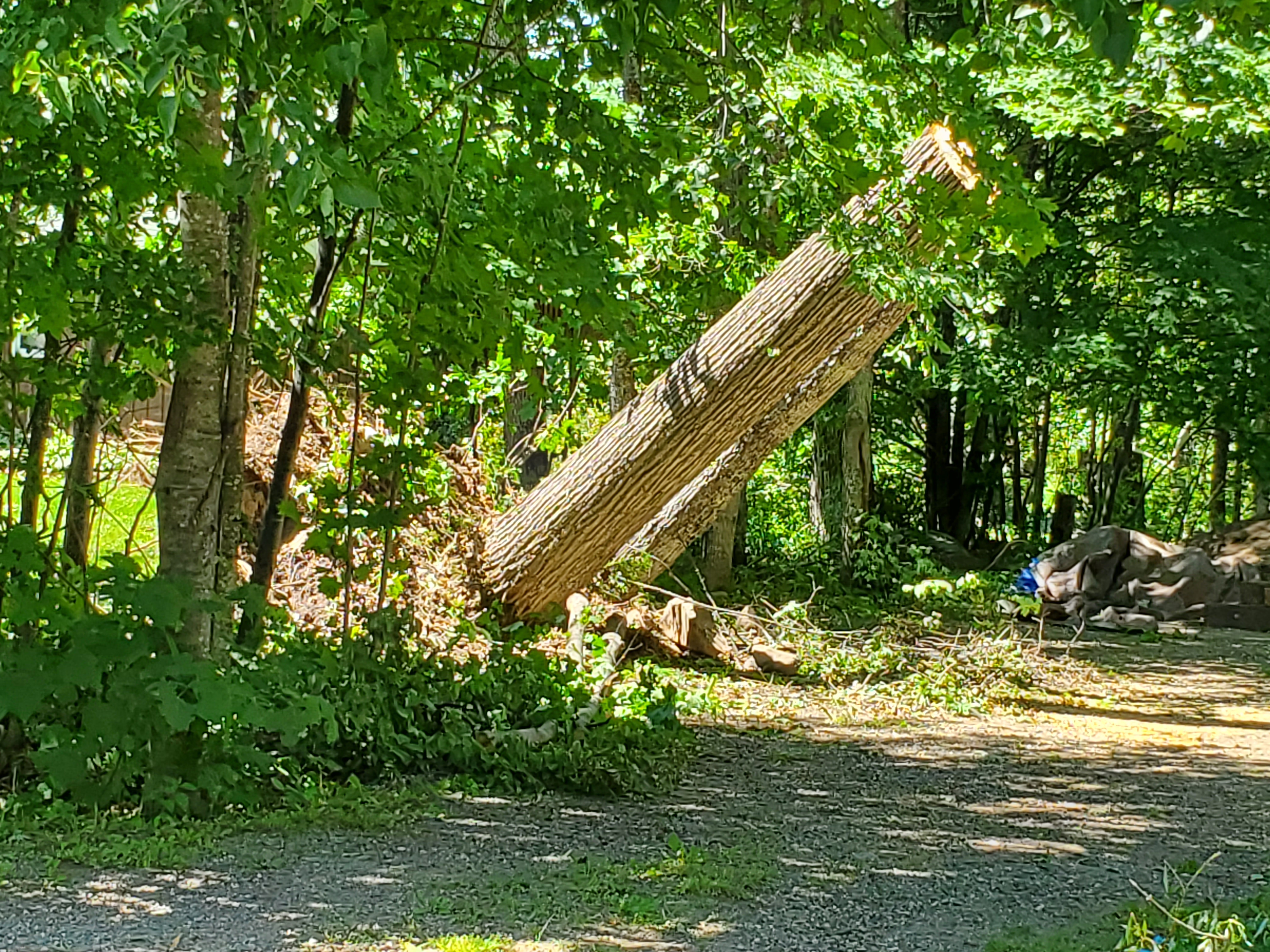
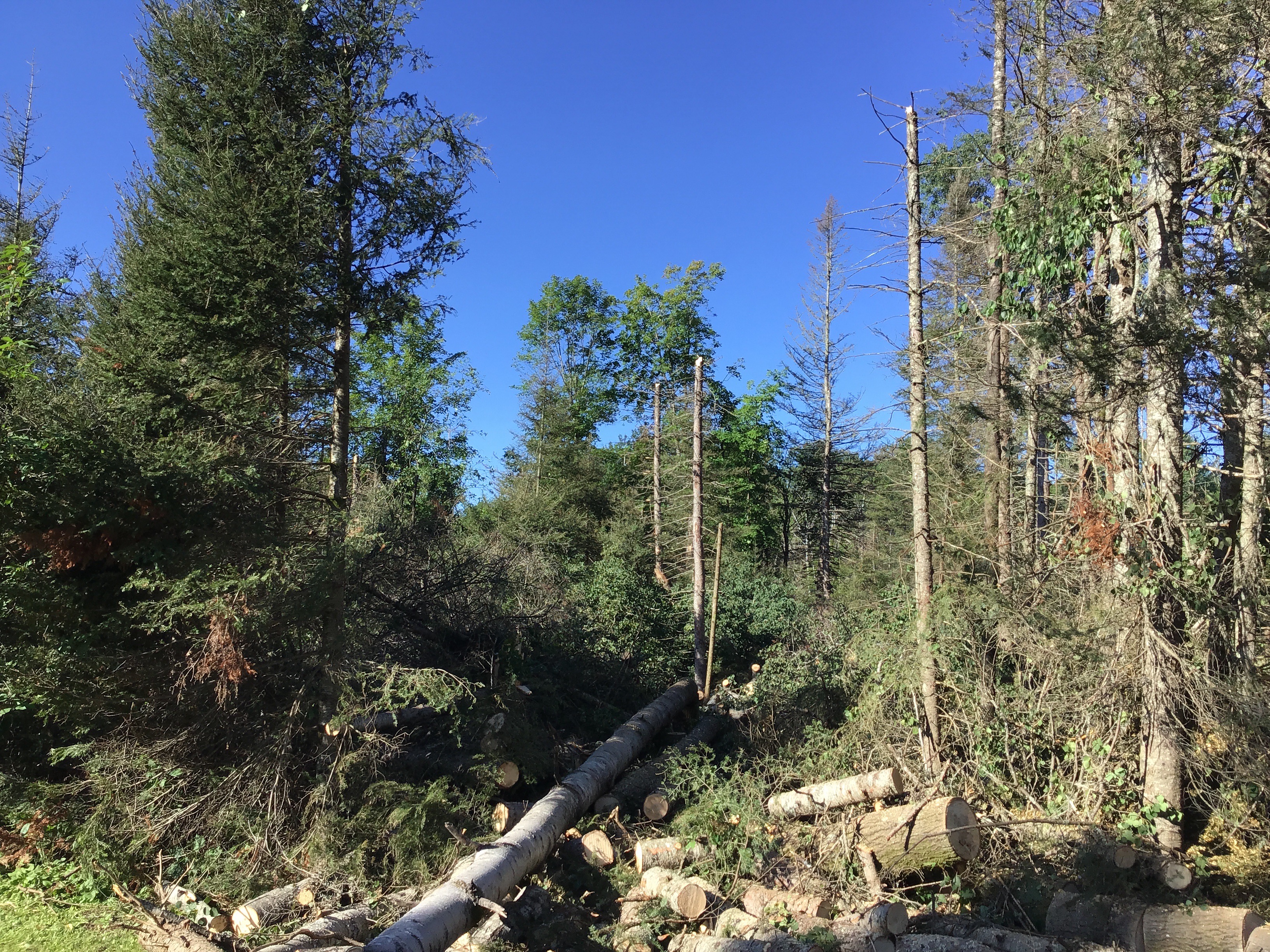
| Large uprooted tree | Many trees snapped and uprooted trees | Several snapped pines | Large pine tree snapped |
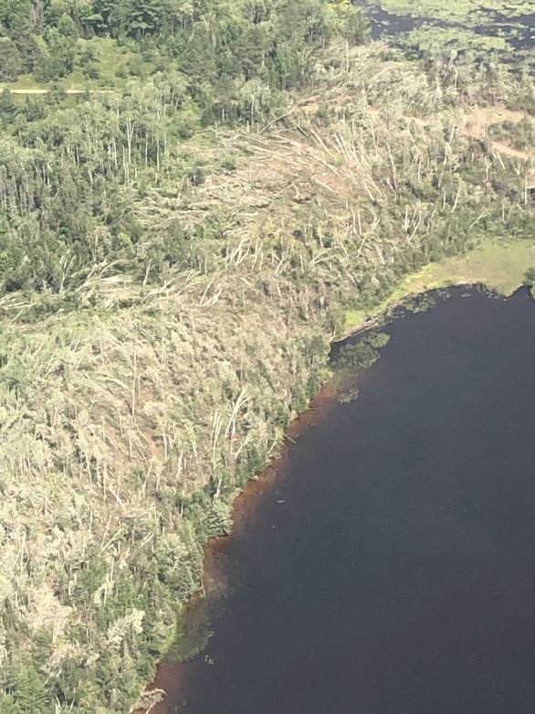
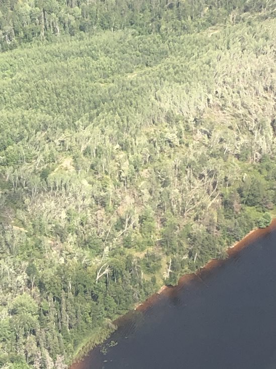
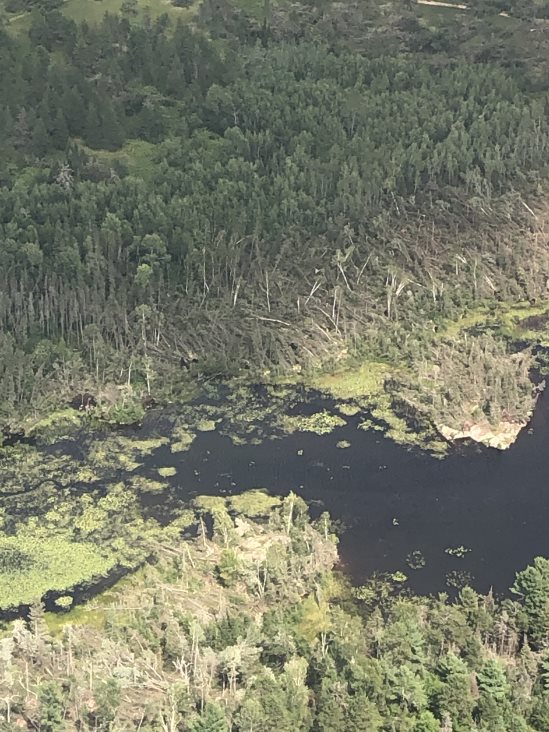
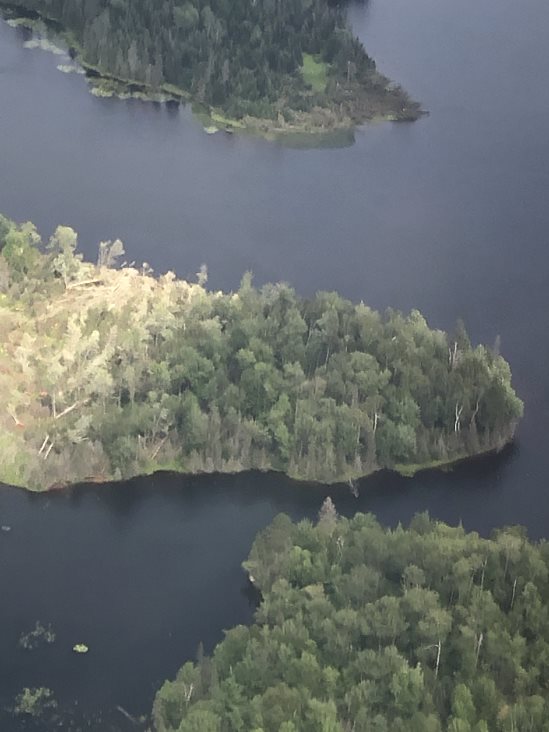
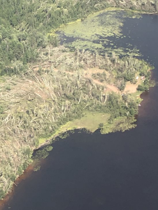
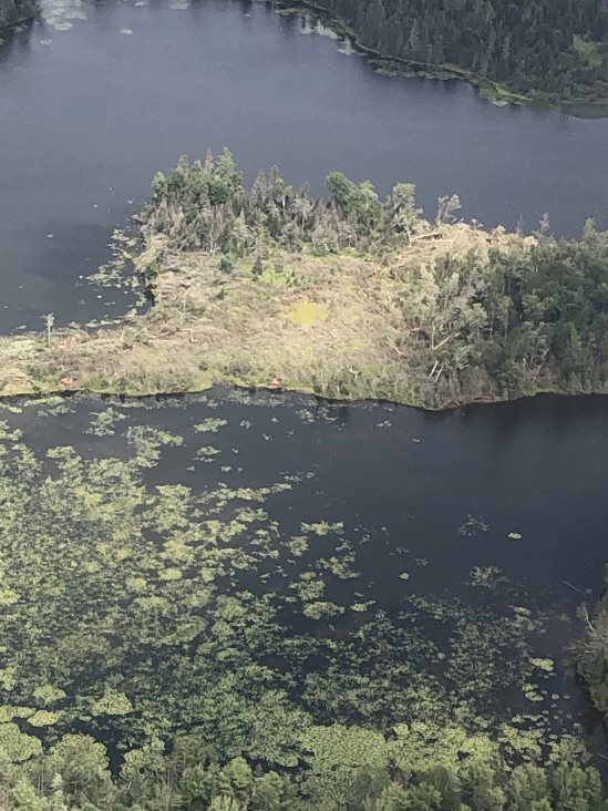
Aerial Survey Photos from Caleb Funk/Michigan DNR
 |
 |
 |
 |
 |
 |
 |
 |
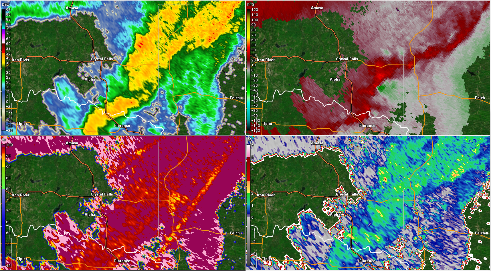
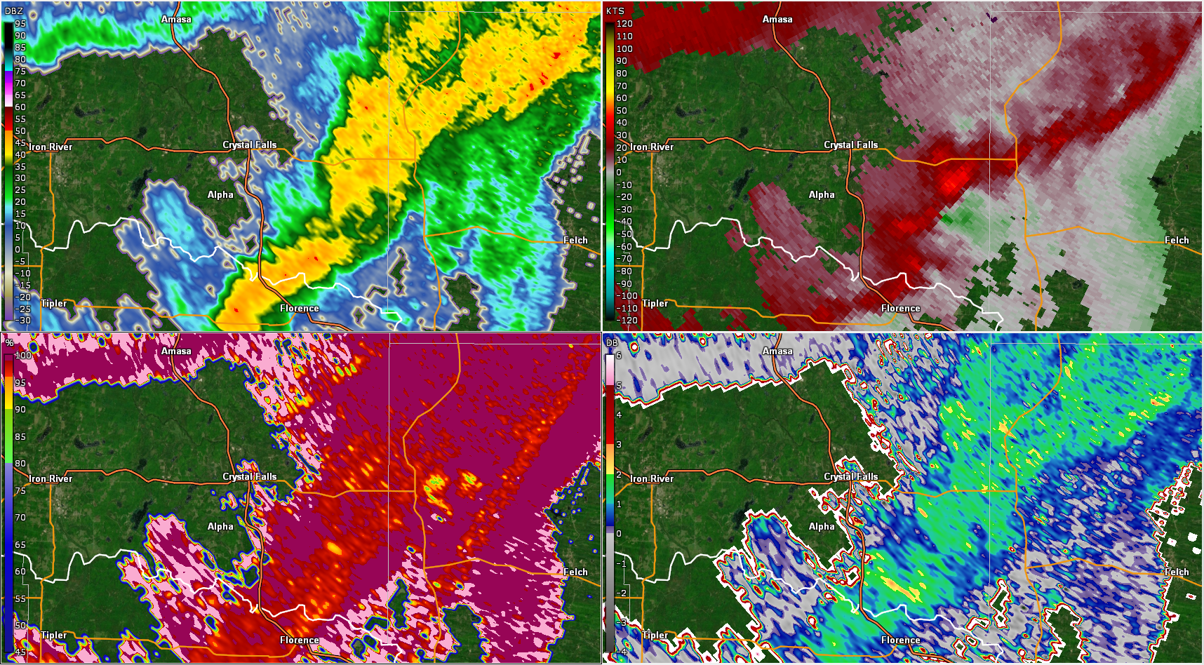
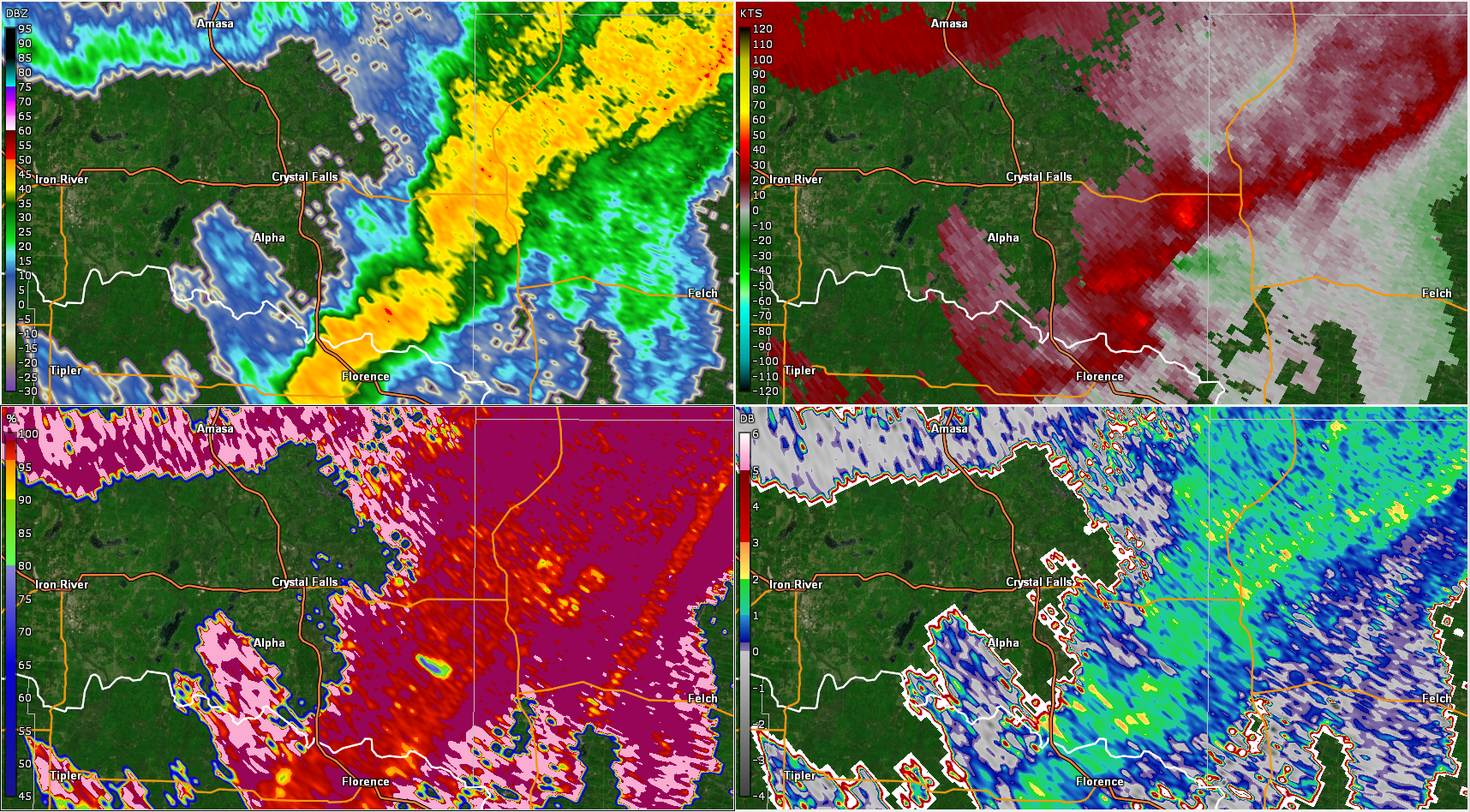
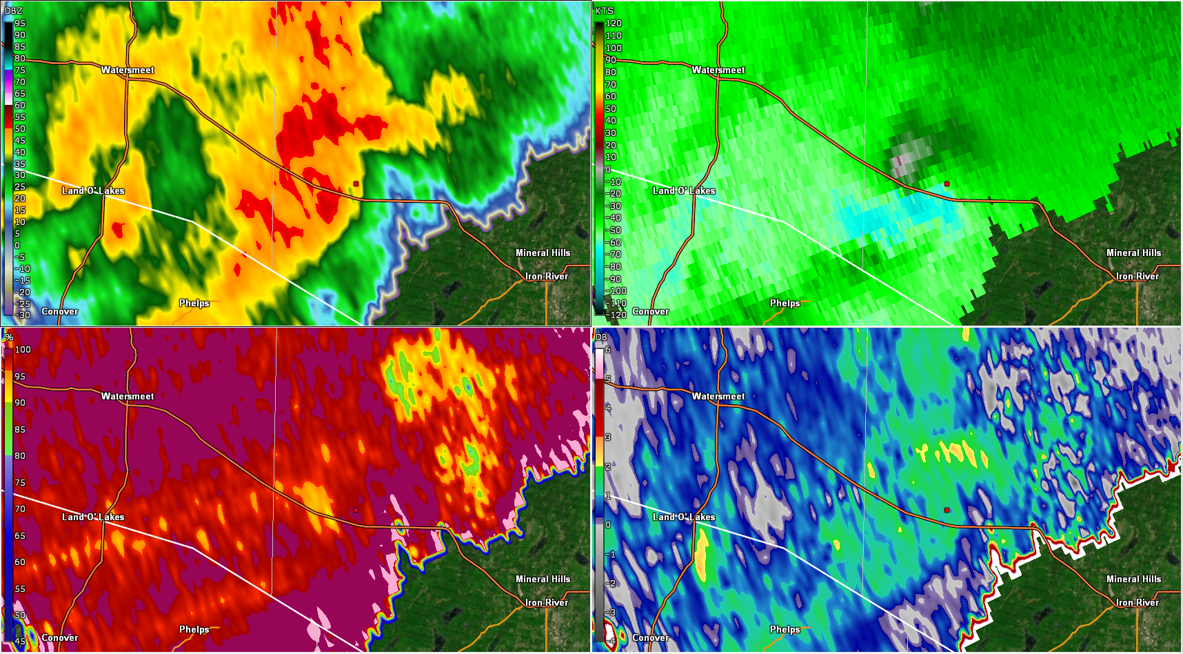
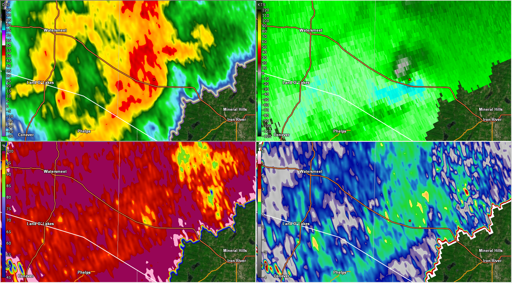
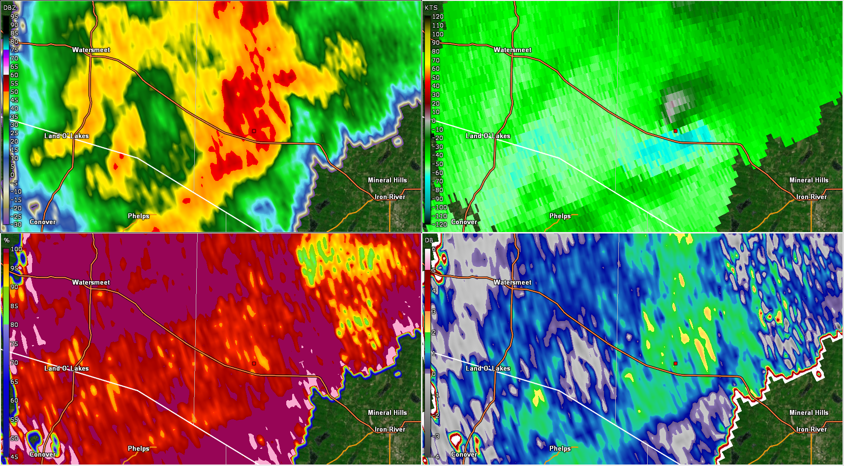
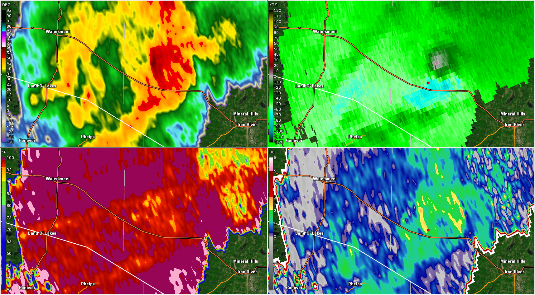
Radar Images
From top left to bottom right: Reflectivity (Z), Storm Relative Velocity (SRV), Correlation Coefficient (CC), and Differential Reflectivity (ZDR).
The SRV "couplet" of inbound (green) and outbound (red) velocities, relative to the motion of the storm, is not particularly strong. However, notice the development of a small circular area of lower CC values. When co-located with a velocity couplet, this signature indicates tumbling debris being sucked up into a storm by a tornado. The random orientation of tumbling pieces of debris causes the radar to observe these targets as having an average shape of a sphere, which is represented by a ZDR of 0. This is in contrast to rain drops which are flat and round like a pancake, and show up with a ZDR > 1. The combination of a velocity couplet, low CC values, and ZDR near 0, in a small circular area, is an almost sure sign that a tornado has touched down. This signature is known as a Tornado Debris Signature, or TDS.
 |
 |
 |
 |
| 9:52 PM CDT | 9:54 PM CDT | 9:56 PM CDT | 9:58 PM CDT |
The Enhanced Fujita (EF) Scale classifies tornadoes into the following categories:
| EF0 Weak 65-85 mph |
EF1 Moderate 86-110 mph |
EF2 Significant 111-135 mph |
EF3 Severe 136-165 mph |
EF4 Extreme 166-200 mph |
EF5 Catastrophic 200+ mph |
 |
|||||
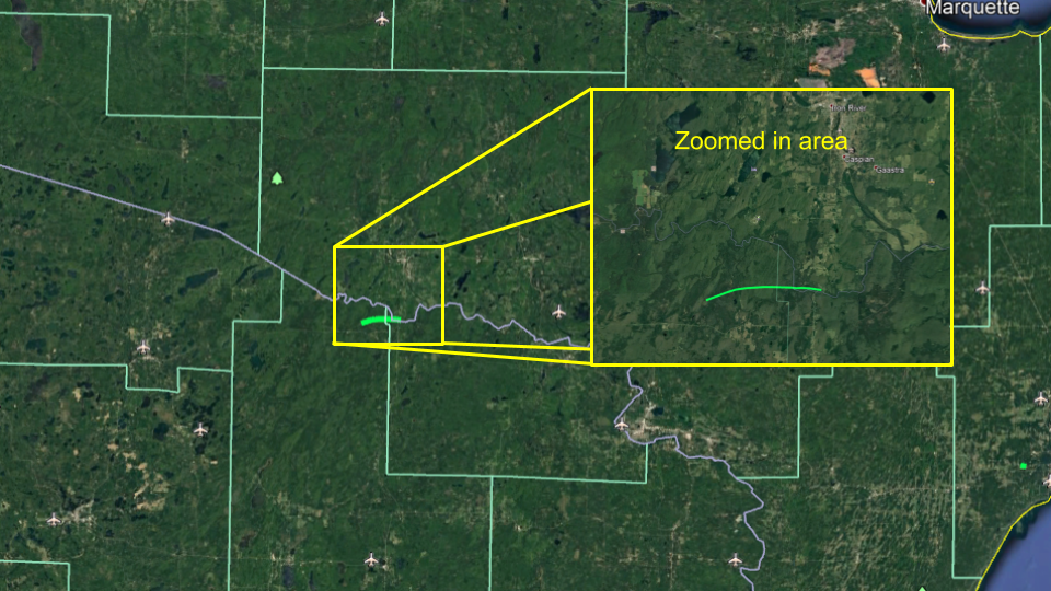
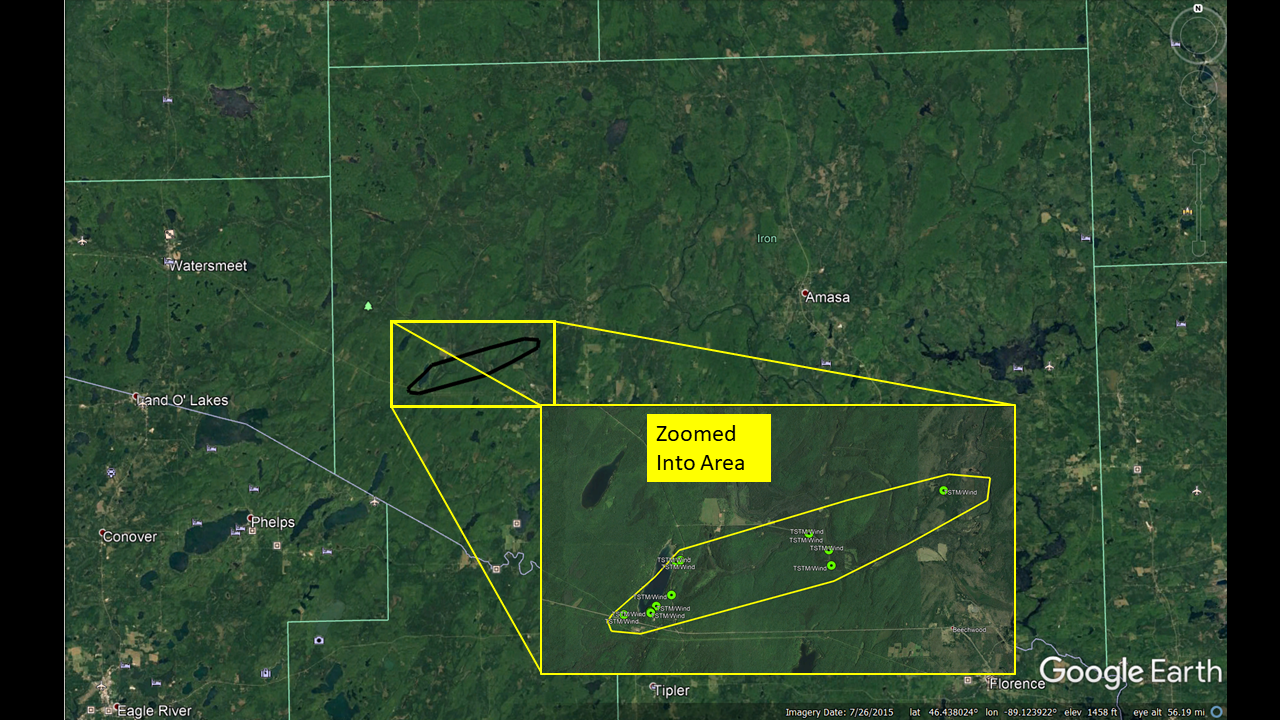
Tornado Near Brule River at M-189
|
Tornado - Brule River and M-189
Track Map
|
||||||||||||||||
Damage Pictures
 |
 |
 |
 |
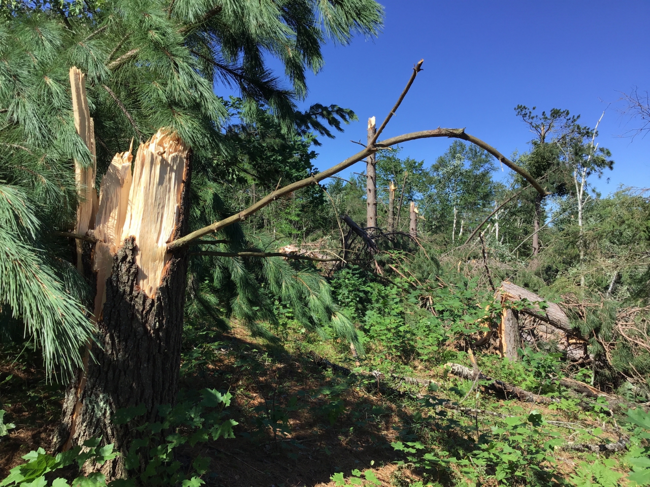
| Large uprooted tree | Many trees snapped and uprooted trees | Several snapped pines | Large pine tree snapped |
The Enhanced Fujita (EF) Scale classifies tornadoes into the following categories:
| EF0 Weak 65-85 mph |
EF1 Moderate 86-110 mph |
EF2 Significant 111-135 mph |
EF3 Severe 136-165 mph |
EF4 Extreme 166-200 mph |
EF5 Catastrophic 200+ mph |
|
|||||
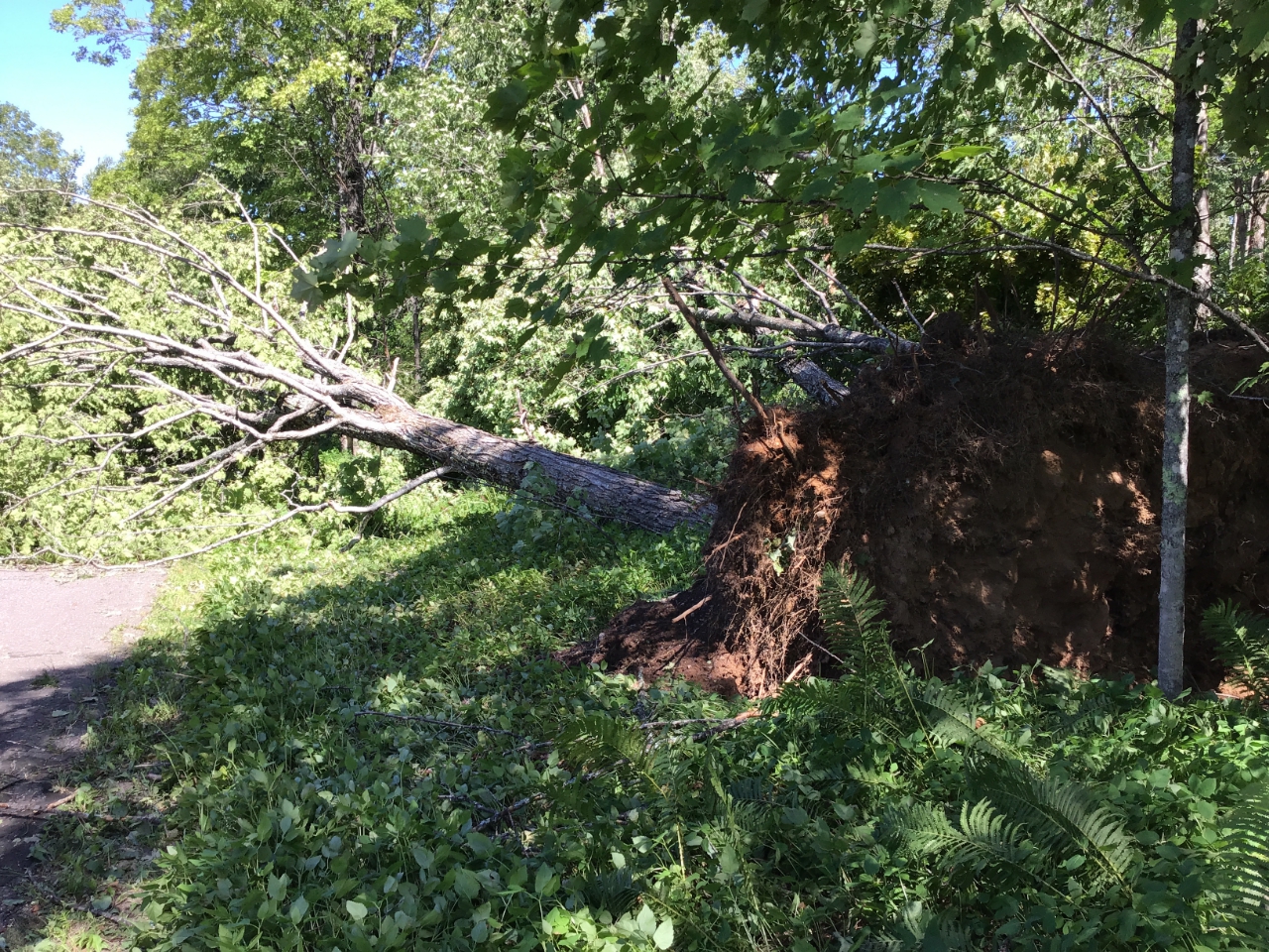
Damaging Winds Near Golden Lake
Across western Iron County, estimated 80 mph straight-line damaging winds uprooted and snapped hundreds of healthy hardwood and softwood trees on both side of the Golden Lake, impacting the Golden Lakes Campground as well. Additional tree damage and snapped power lines were sporadically reported across Iron and Marquette counties as convection congealed into a bowing segment that pushed northeast across central Upper Michigan late Sunday evening.
| Date | Sunday, August 9th |
| Time (Local) | 841 pm to 854 pm CDT |
| Est. Peak Winds | 80 mph |
|
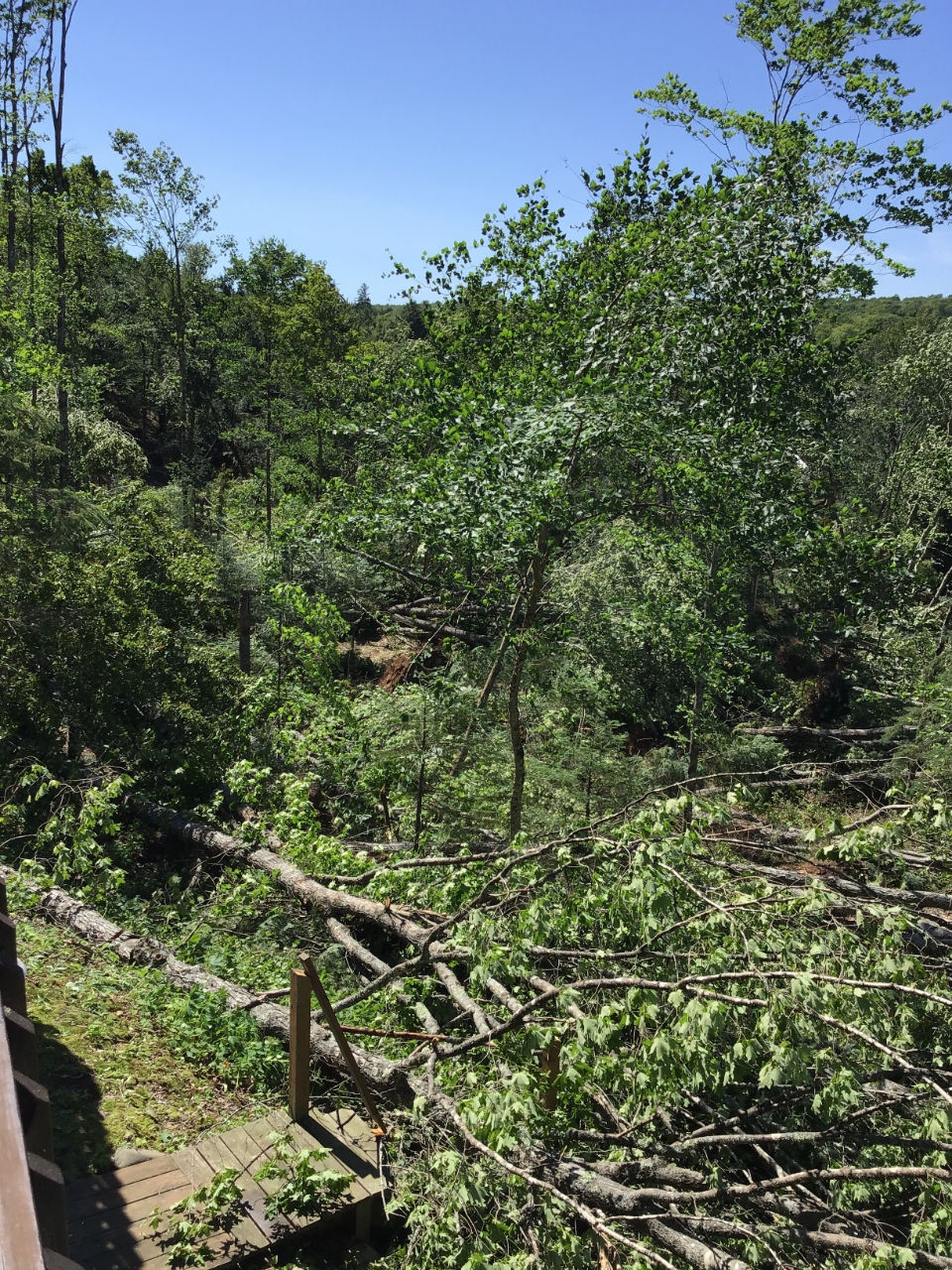
Summary: An area of damaging straight line winds snapped and uprooted hundreds of trees around Golden Lake. The path of wind damage appears to be about 9 miles long, initiating near the southwest side of Golden Lake. |
|
 |
 |
 |
 |
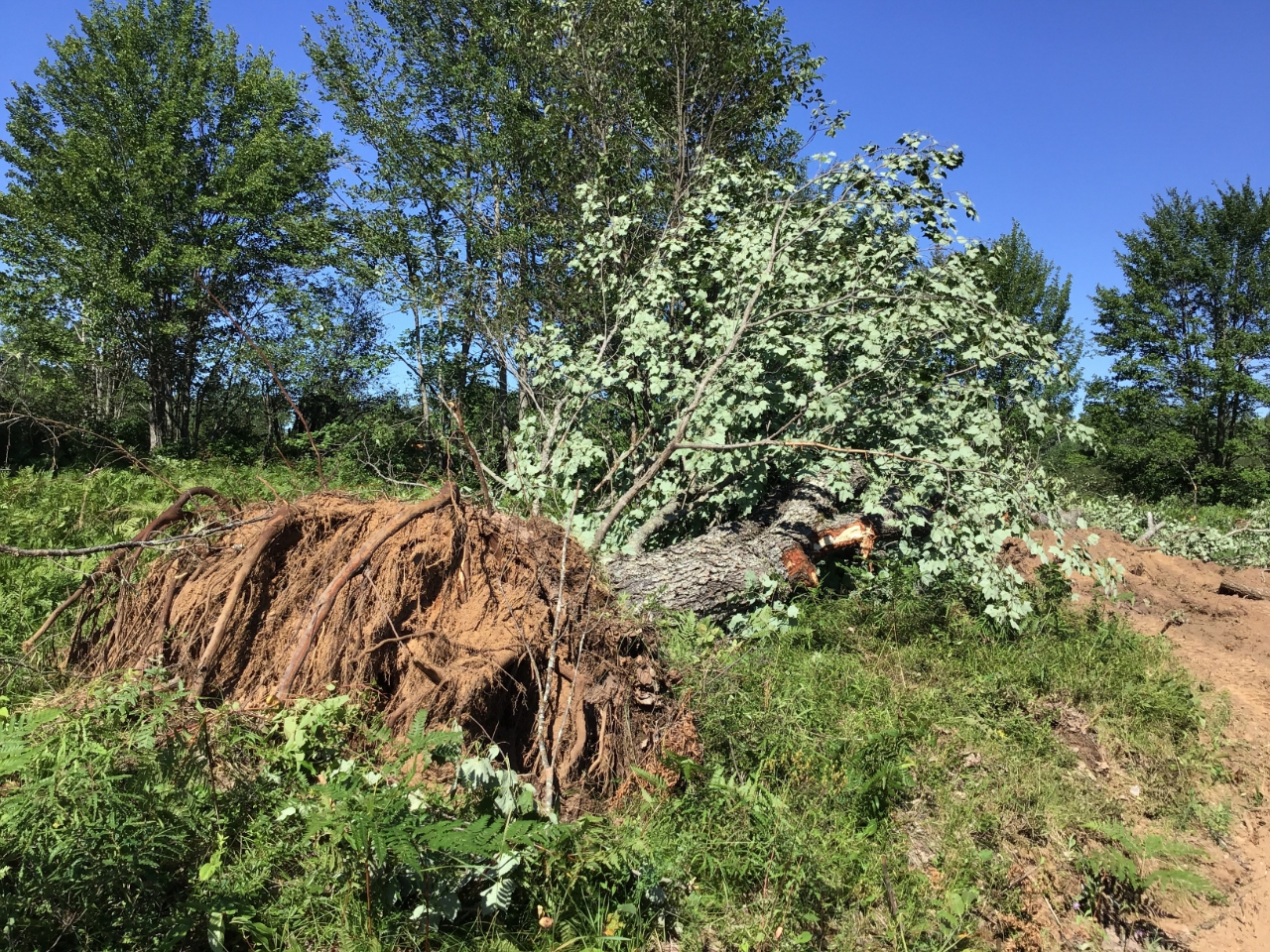
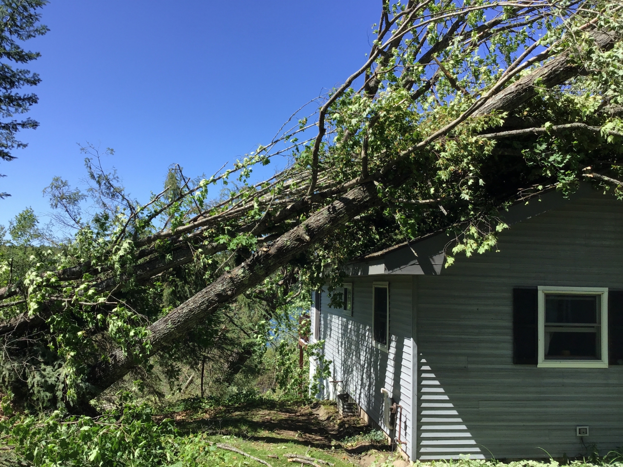
| Large uprooted trees | Several trees on home | Large tree trunk snapped | Several trees broken or uprooted on home owner's property |
 |
 |
 |
 |
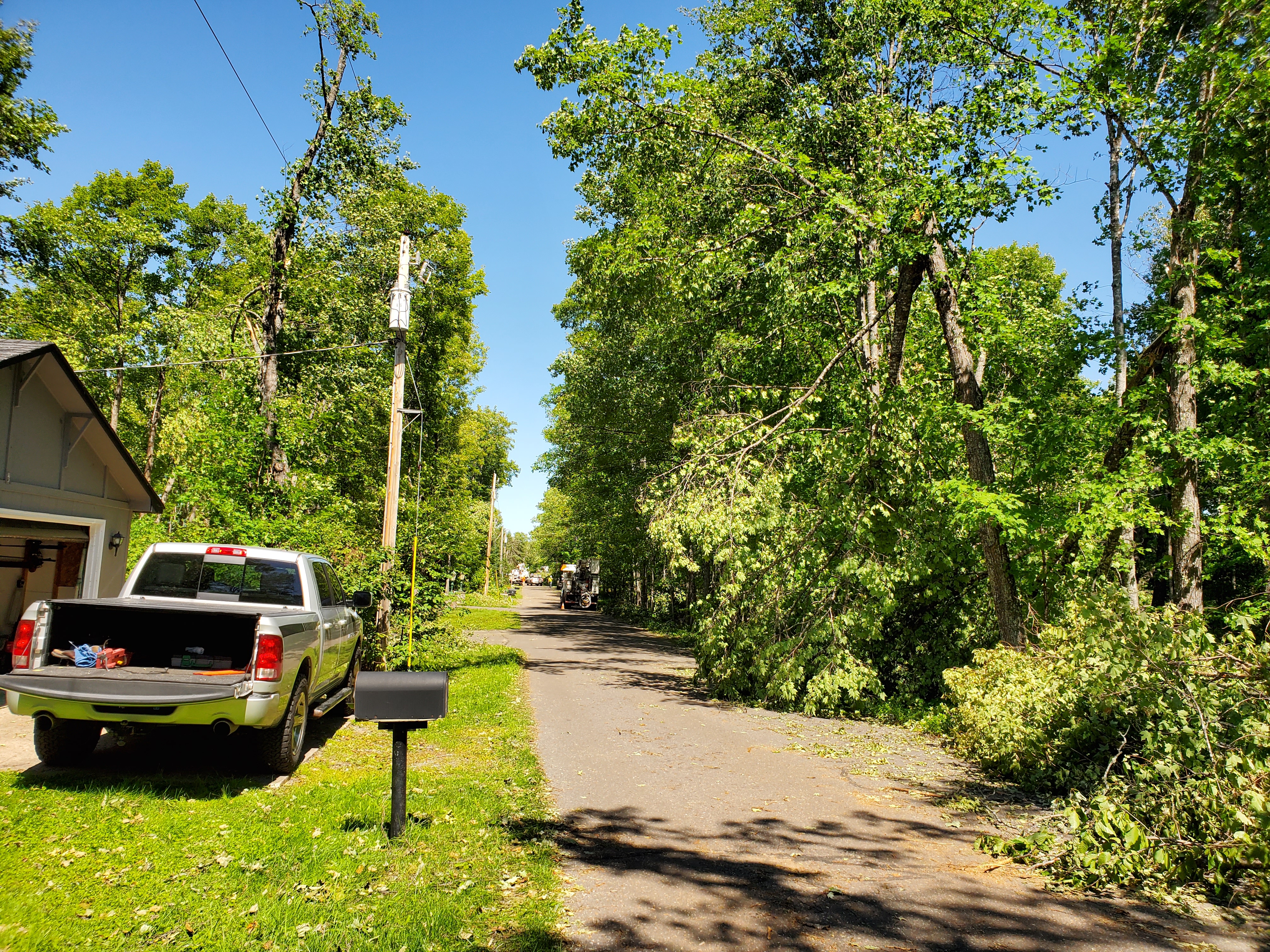
| Downed trees blocking Golden Lake Trail | Tree trunk snapped and twisted at the base | Numerous trees snapped on a home owner's property | Another large uprooted tree |
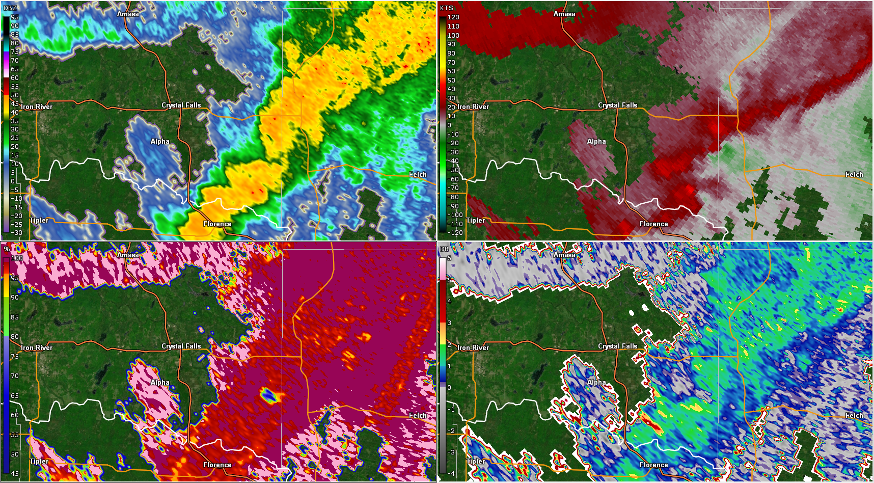
Radar Images
From top left to bottom right: Reflectivity (Z), Base Velocity (BV), Correlation Coefficient (CC), and Differential Reflectivity (ZDR). The red marker indicates the location of Golden Lake.
In this case, the BV "couplet" of inbound (green) and outbound (red) velocities is more broad. This radar scan is the closest to the ground available, which is at about 5500 feet above ground. At 8:42 PM, the radar detected inbound velocities of 95 knots (109 mph) at this elevation over Golden Lake. However, not all of that wind reaches the ground. Velocity estimates on radar are almost always higher than what is observed at the ground. The number of trees that were snapped and uprooted in this area suggests that the maximum wind at the ground was about 80 mph.
 |
 |
 |
 |
| 8:41 PM CDT | 8:42 PM CDT | 8:44 PM CDT | 8:45 PM CDT |
Other Wind Damage and Flooding
Damage Pictures
Outside of Iron County, wind damage was much more sporadic. Minor to locally moderate tree damage was observed in Marquette County and southern Houghton County. Heavy rain led to minor flooding and partial road washouts in northern Houghton County, near Twin Lakes and Chassell.
Damage Pictures
 |
 |
 |
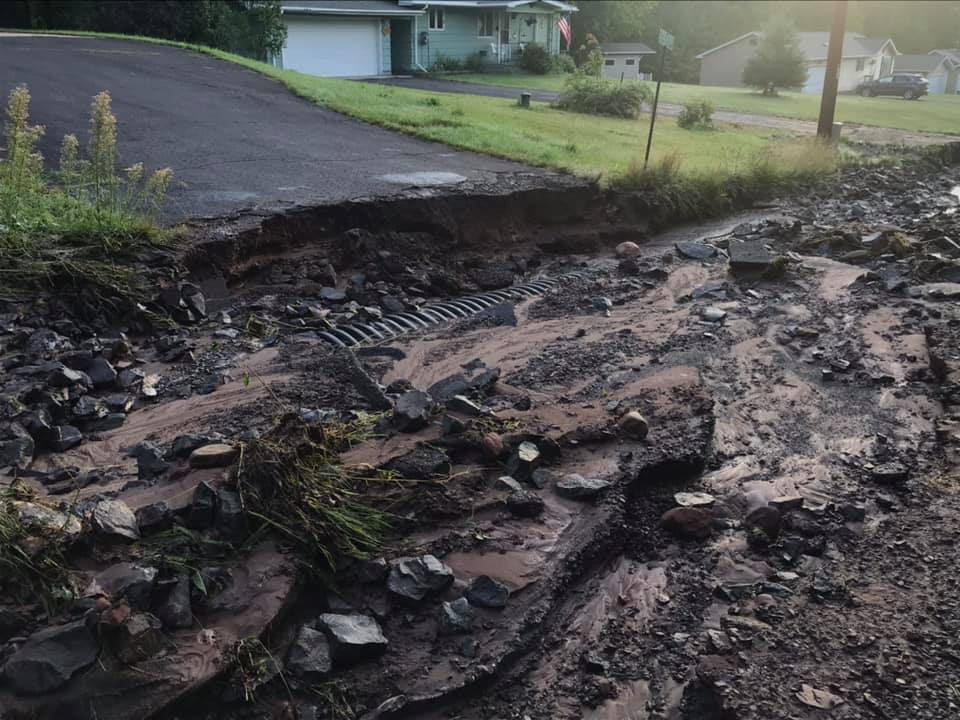 |
| Tree down on power lines in Sidnaw, courtesy of Mary Ellen Bowers | Trees uprooted in Champion, courtesy of Amy Richards | Trees snapped in Clarksburg | Road washed out in Chassell, courtesy of Ashton Brooke |
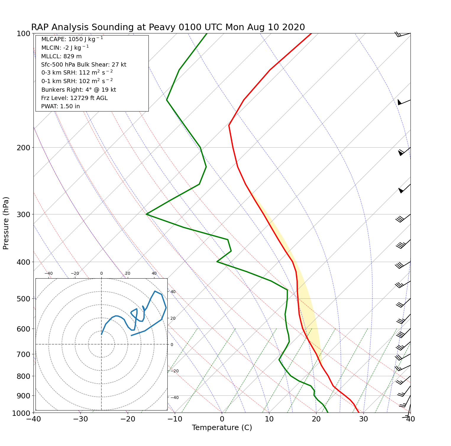
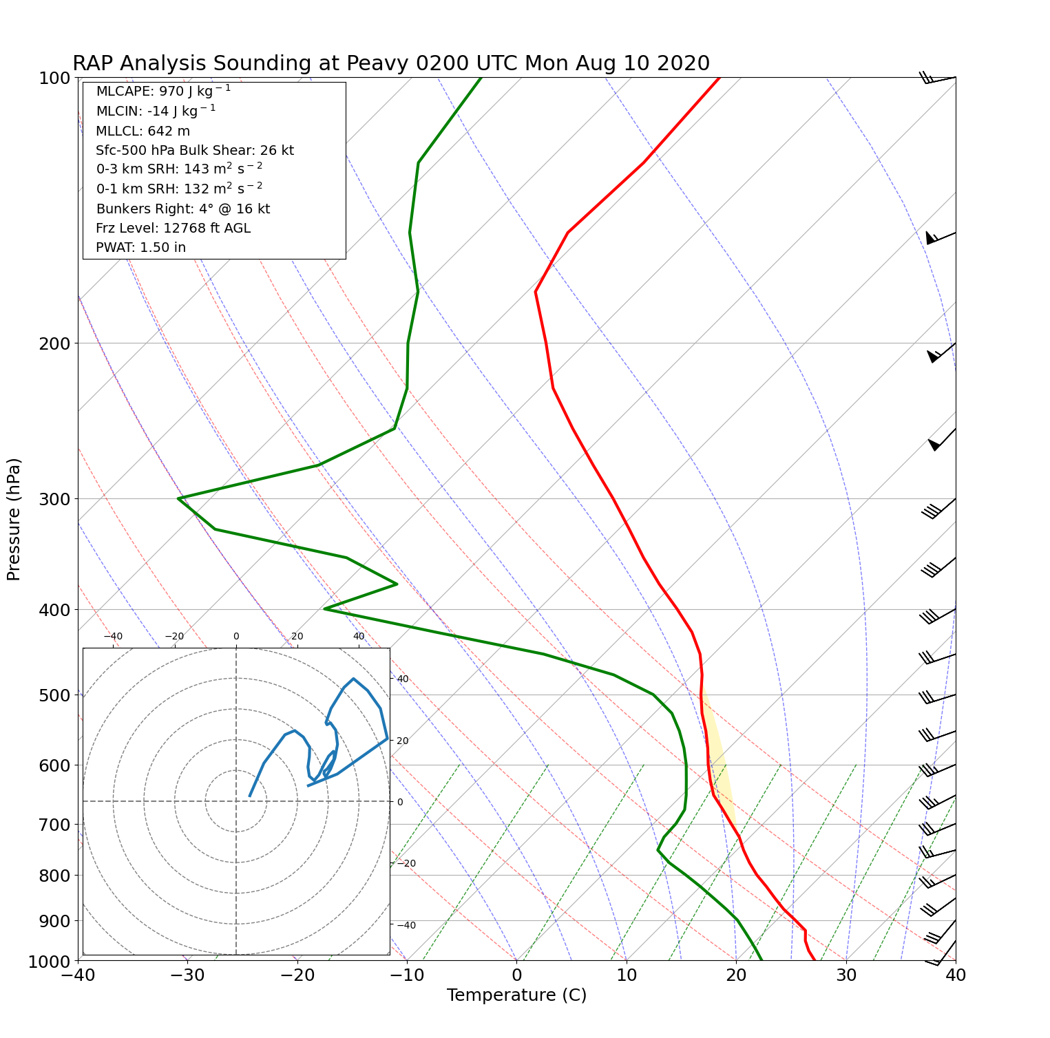
Radar & Environment
This section will continue to be updated!
 |
|
| Radar loop showing the evolution of convection across the Keweenaw, followed by the main line of convection that bowed out as it moved across central Upper Michigan Sunday night. | Precipitation totals were highest over the west and up the spine of the Keweenaw, where storms lingered and trained over the same area compared to the rest of Upper Michigan where storms remained more progressive. |
 |
 |
 |
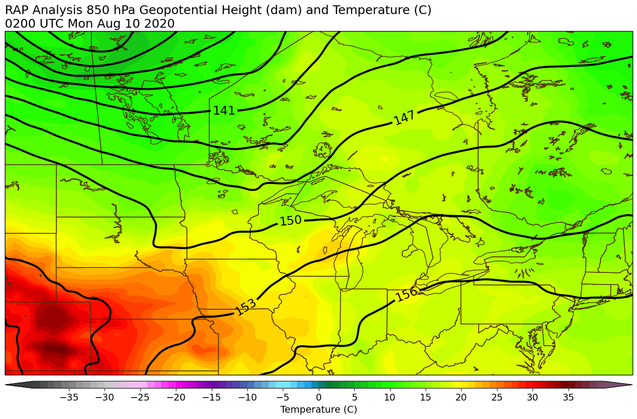 |
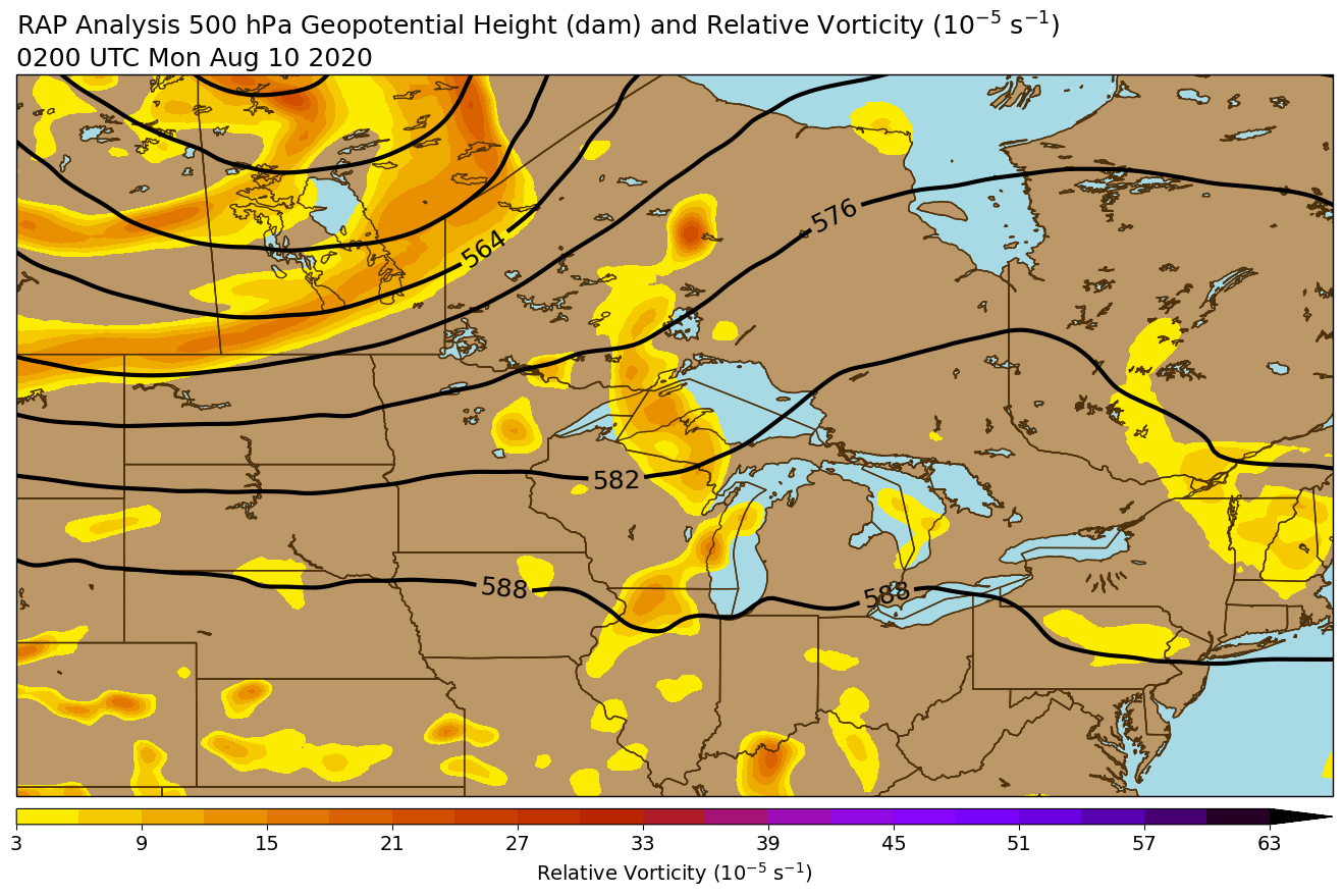
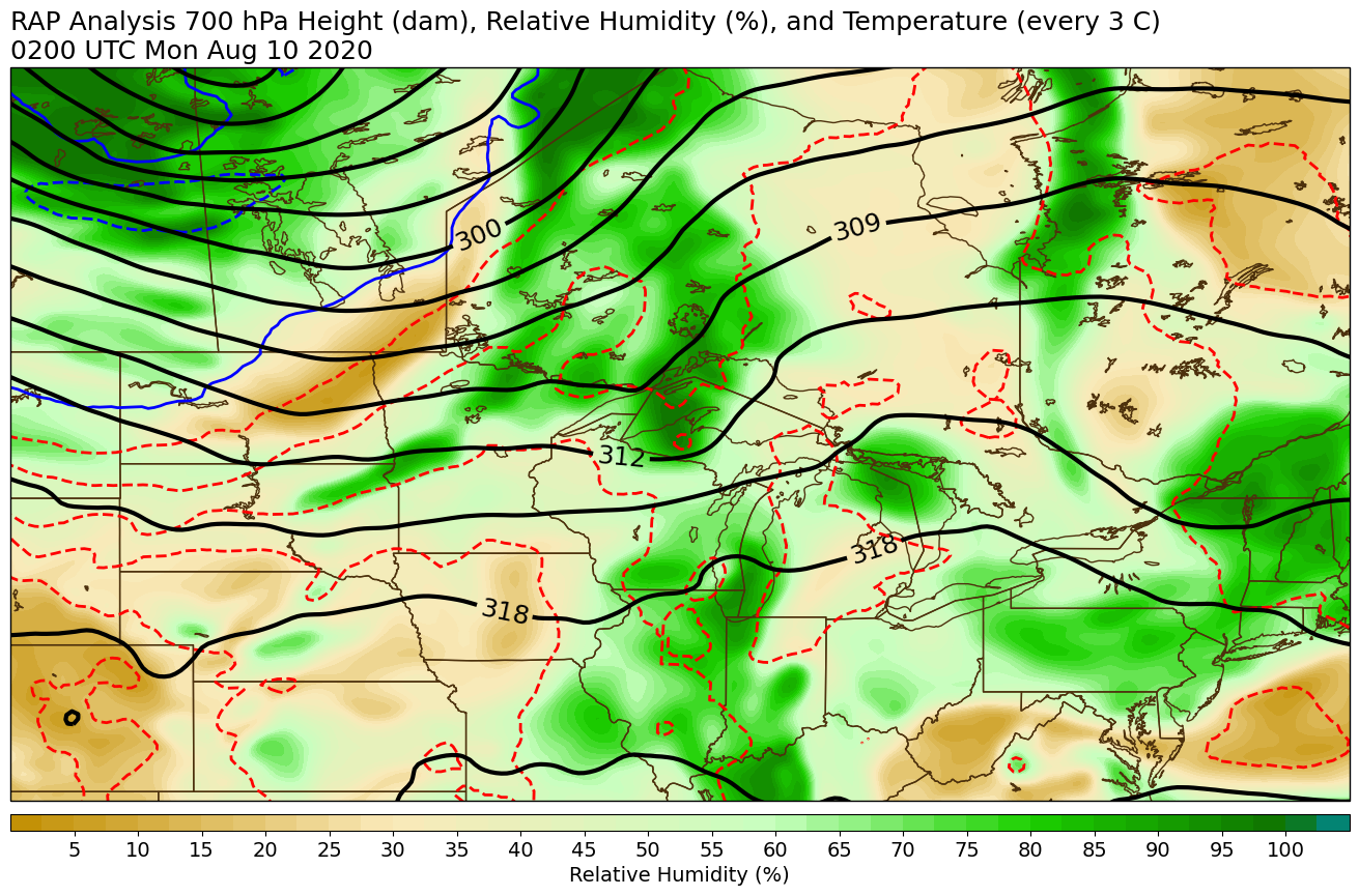
| 300 mb Height and Wind at 10 pm EDT Aug 9 | 500 mb Height and Vorticity at 10 pm EDT Aug 9 | 700 mb Height and Relative Humidity at 10 pm EDT Aug 9 | 850 mb Height and Temperature at 10 pm EDT Aug 9 |
 |
 |
 |
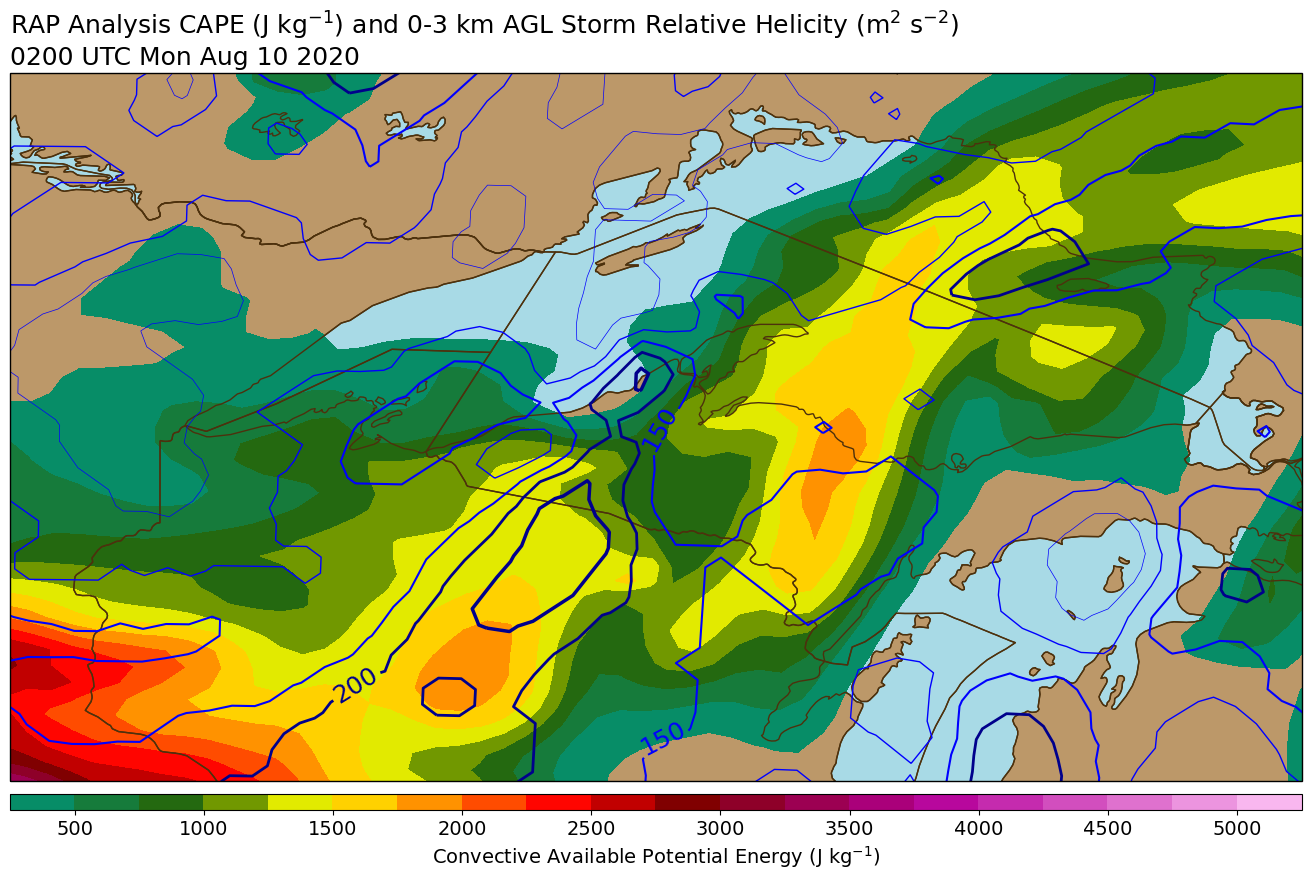 |
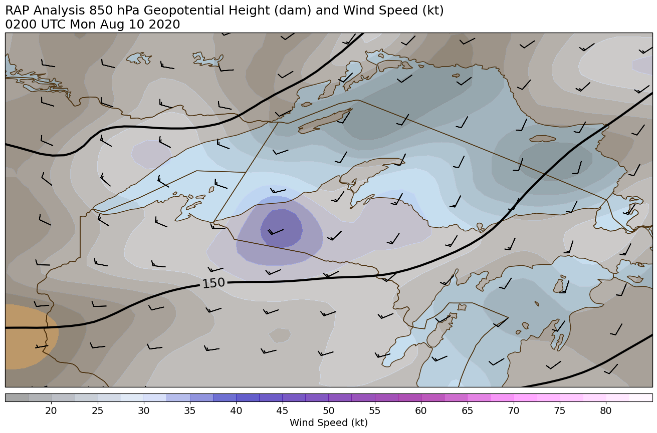
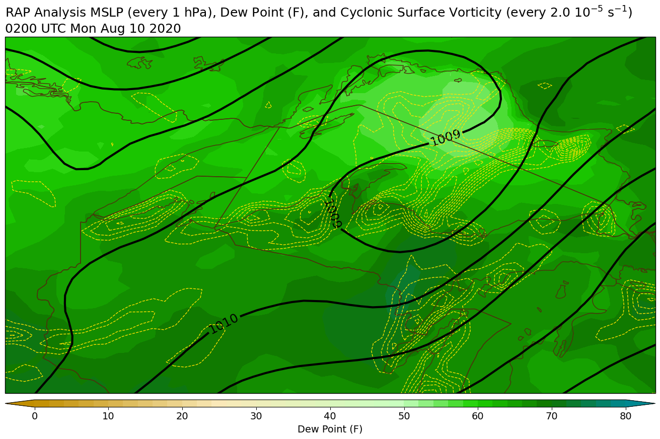
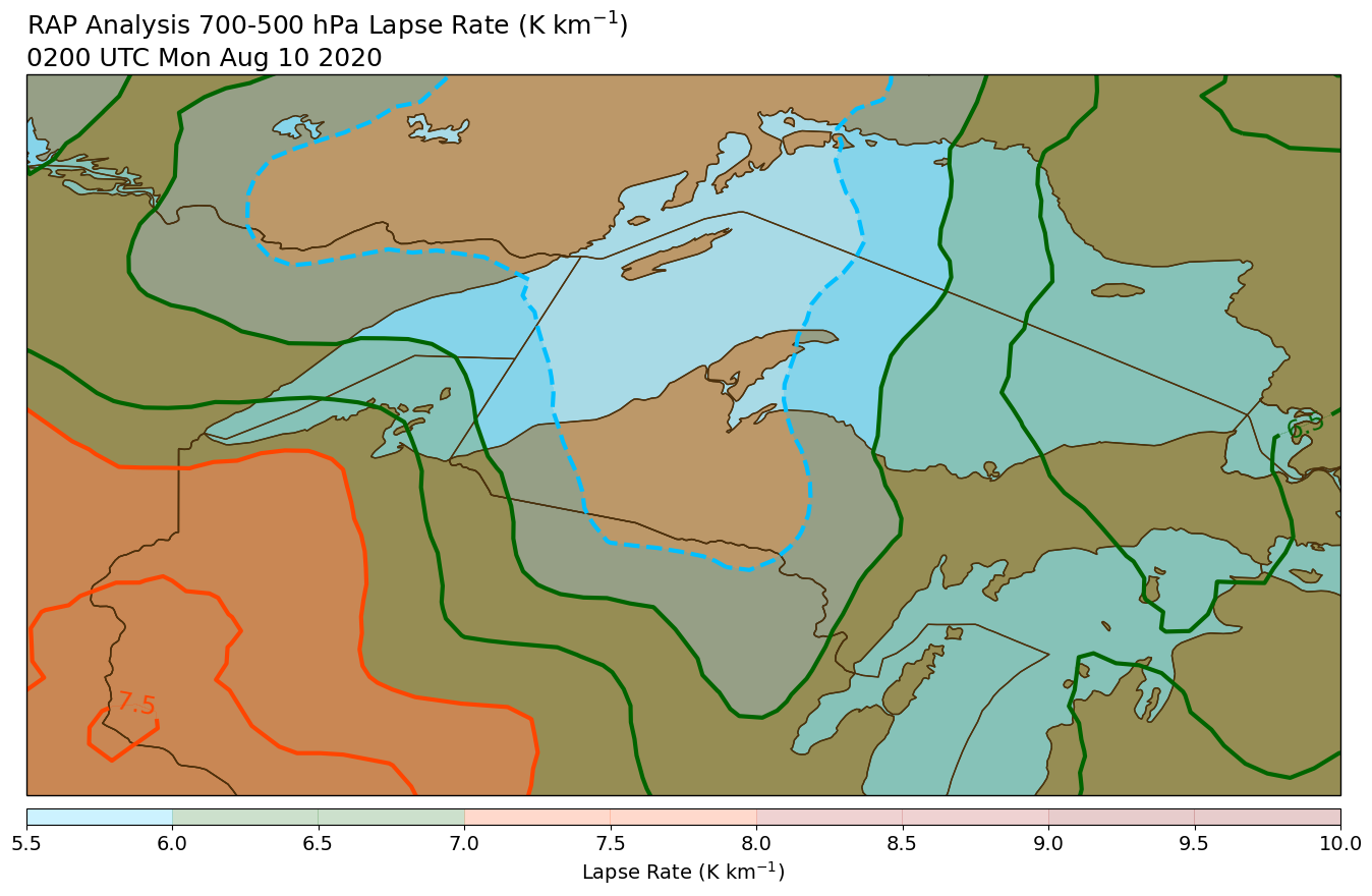
| 850 mb Height and Wind at 10 pm EDT Aug 9 | Mean Sea Level Pressure and Surface Dew Point at 10 pm EDT Aug 9 | 700-500 mb Lapse Rates at 10 pm EDT Aug 9 | Surface-based CAPE and 0-3 km Storm Relative Helicity at 10 pm EDT Aug 9 |
 |
 |
 |
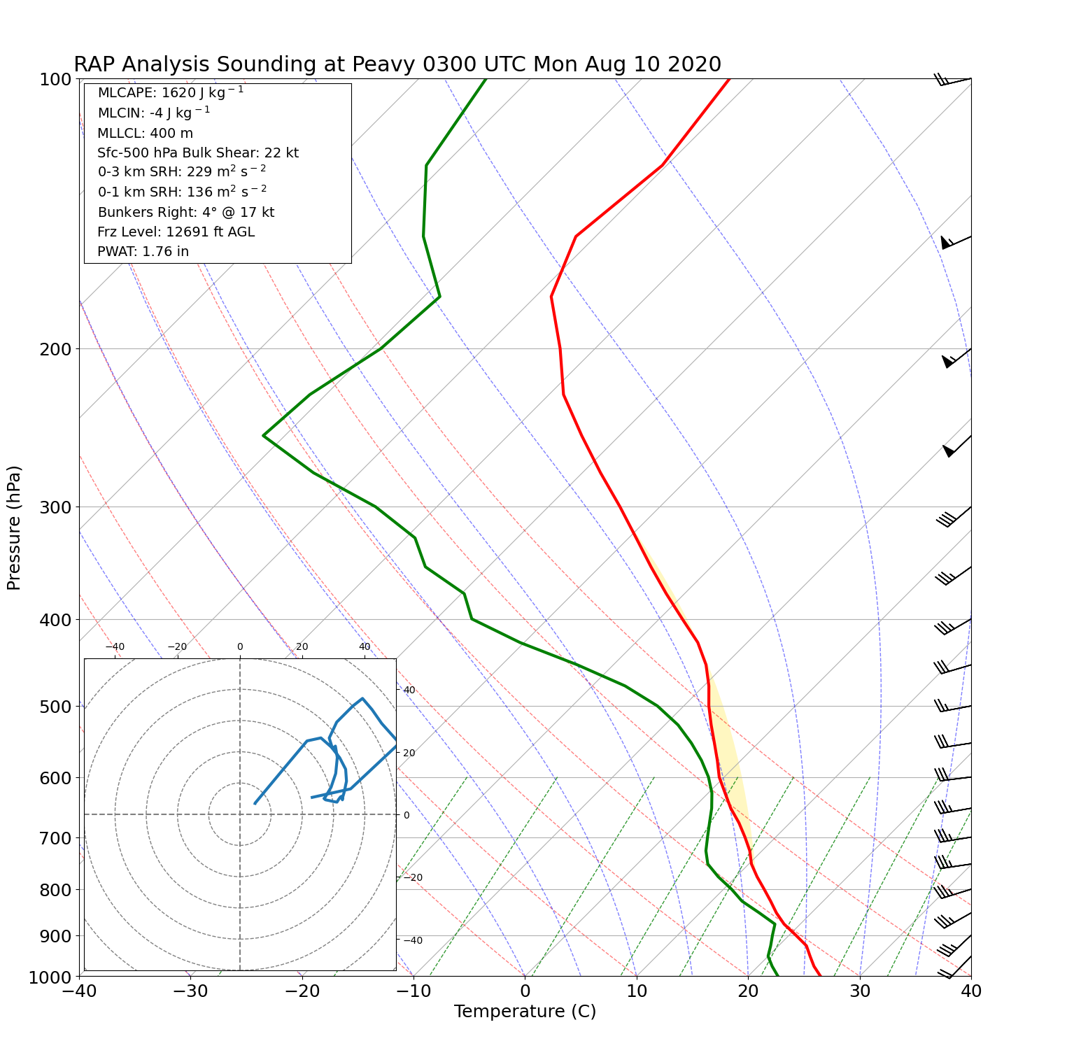 |
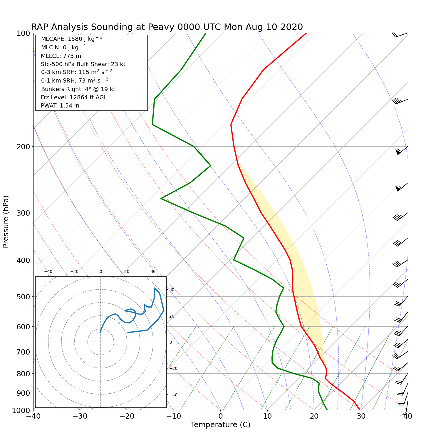
| Vertical profile near Peavy Falls at 8 pm EDT Aug 9 | Vertical profile near Peavy Falls at 9 pm EDT Aug 9 | Vertical profile near Peavy Falls at 10 pm EDT Aug 9 | Vertical profile near Peavy Falls at 11 pm EDT Aug 9 |
 |
Media use of NWS Web News Stories is encouraged! Please acknowledge the NWS as the source of any news information accessed from this site. |
|