Overview
|
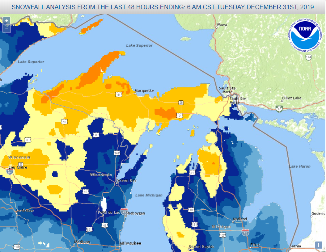
This winter storm hit in multiple rounds. First, freezing rain fell over parts of interior western Upper Michigan the evening of Saturday December 28 into the following morning. Ice only accumulated to about a tenth of an inch, but this was enough to cause some back roads to become treacherous. This freezing rain changed over to just rain on Sunday before ending in the afternoon. Sunday night, a second round of rain lifted north into Upper Michigan, dropping over an inch of rain in many areas. The rain then changed over to snow from west to east early Monday morning, December 30 as a new area of low pressure developed to the southeast of the area and moved straight north. Temperatures were right around freezing, so this was a wet, slushy snow with snow-to-liquid ratios around just 6:1 at the beginning, though SLRs rose as colder air wrapped into the system later on Monday. As the low pressure system drifted west and then stalled out over Lake Superior, fluffier lake-effect snow took over. This lighter snow continued into Tuesday before coming to an end. |
Loop of radar images and Mean Sea Level Pressure analysis for the storm |
Social Media Graphics
 |
 |
 |
 |
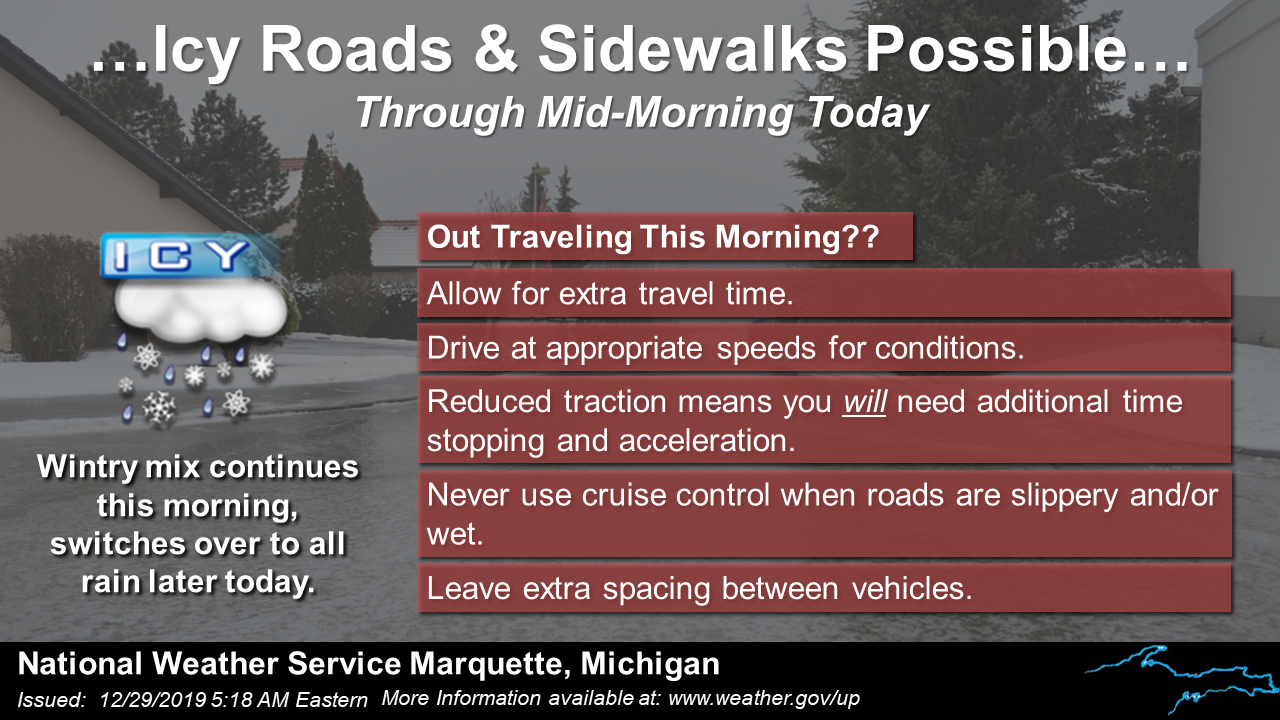
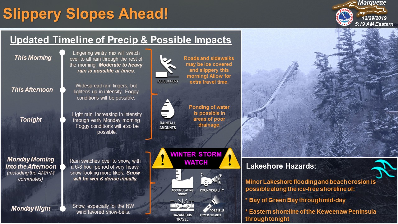
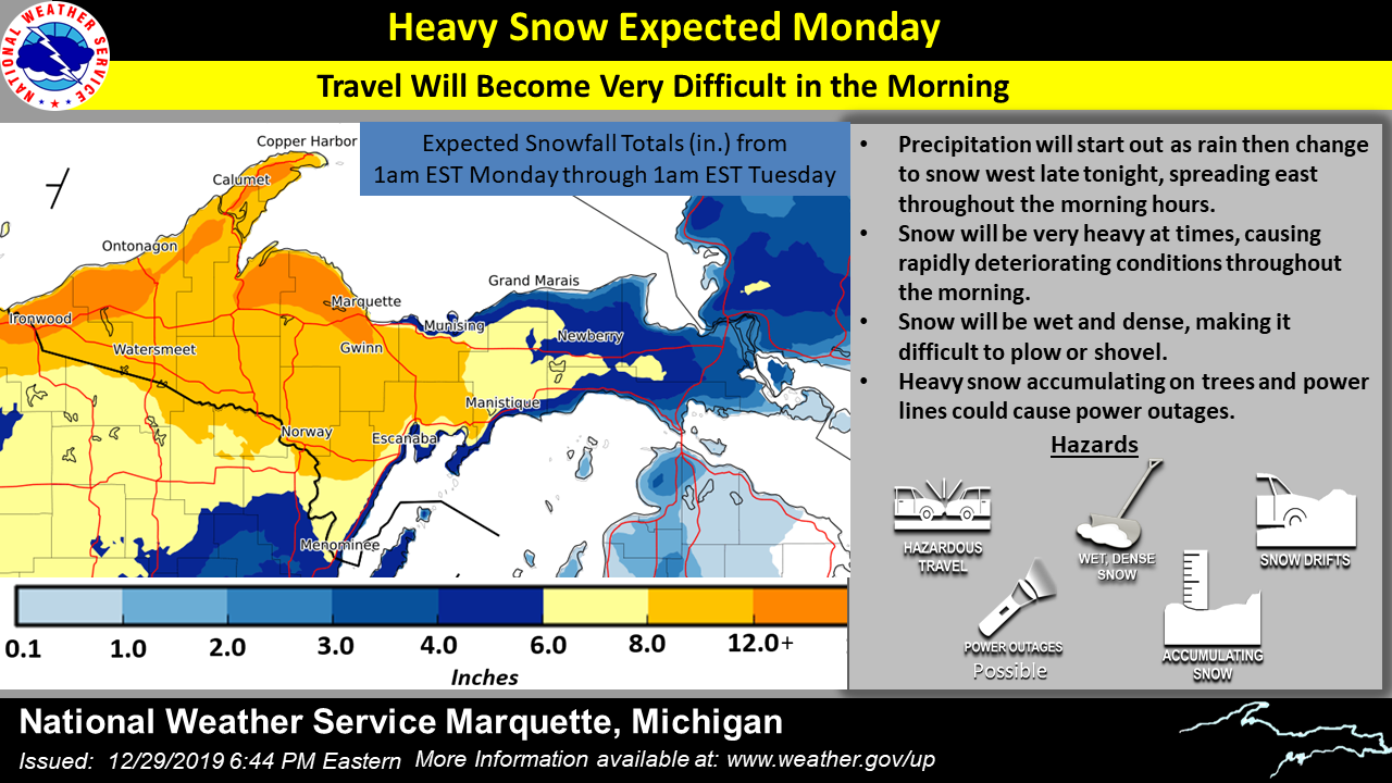
| Graphics Sunday morning highlighted icy roads and sidewalks from freezing rain overnight. | Graphics Sunday morning also timed out the expected rain and snow still to come from this storm. | Sunday night's graphic showed forecast snow amounts for round #2 and highlighted that the snow would be wet and dense. | A Monday morning update on expected winter storm impacts. |
 |
 |
 |
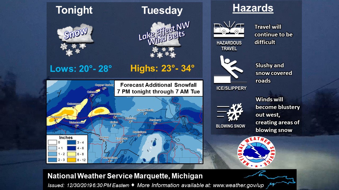 |
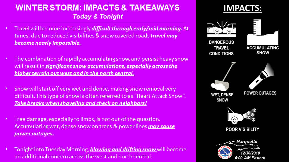
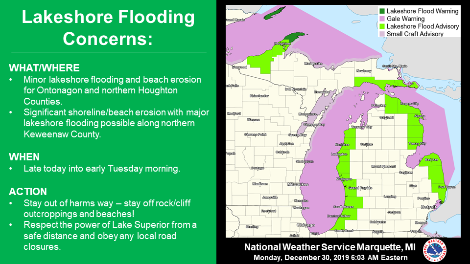
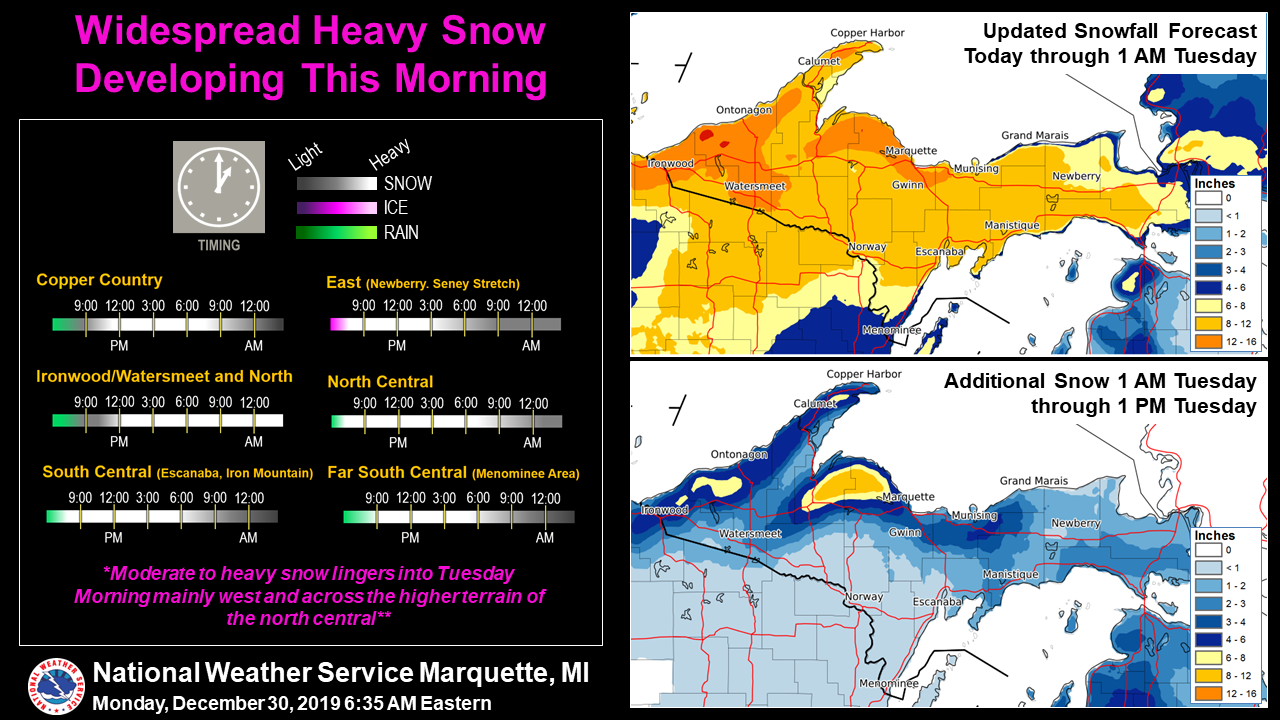
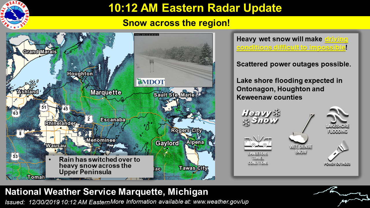
| With a strong wind from the east and southeast, lakeshore flooding was once again a concern with this storm. | Monday morning's graphic timed out the transition from rain to snow. It also updated the snowfall forecast showing the wet and dense phase, followed by the fluffier lake-effect phase. | As the storm was underway Monday morning, a radar and webcam update showed Upper Michigan residents that driving conditions were quickly becoming poor. | Graphics Monday night showed how much lake-effect snow was still to come. |
Snowfall Amounts
 |
Environment
 |
 |
 |
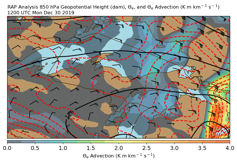 |
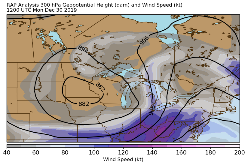
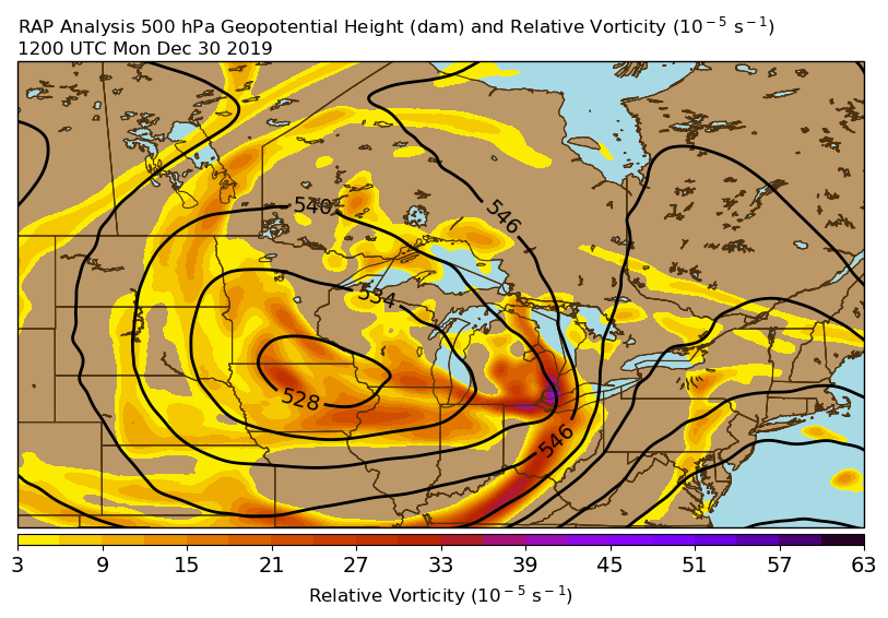
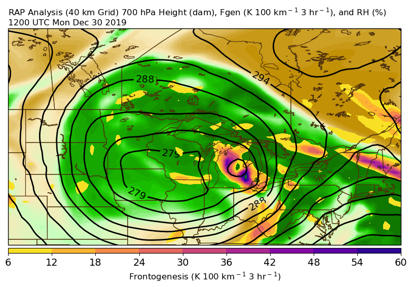
| 300 mb Height and Wind at 12z (7 am EST) Monday, December 30. Notice the original system is now dislocated from the jet stream, which is an indication that it is weakening and that a new system is developing on the northwestern "corner" of the jet stream. | 500 mb Height and Vorticity at 12z (7 am EST) Monday, December 30. The original system can be seen centered over northeastern Iowa while another wave rotating around that system, near Detroit at this point, is helping to develop a new area of low pressure. | 700 mb Height, Relative Humidity, and Frontogenesis at 12z (7 am EST) Monday, December 30. The strong frontogenesis over lower Michigan indicates heavy precipitation is falling there associated with the newly develop second low. That heavy precip is lifting north into Upper Michigan at this time. | 850 mb Height, Wind, Theta-e, and Theta-e Advection at 12z (7 am EST) Monday, December 30. This shows where the strongest forcing for precipitation was located at this time. Heavy precip was falling over Lake Huron, but was still rain at this point. |
 |
 |
 |
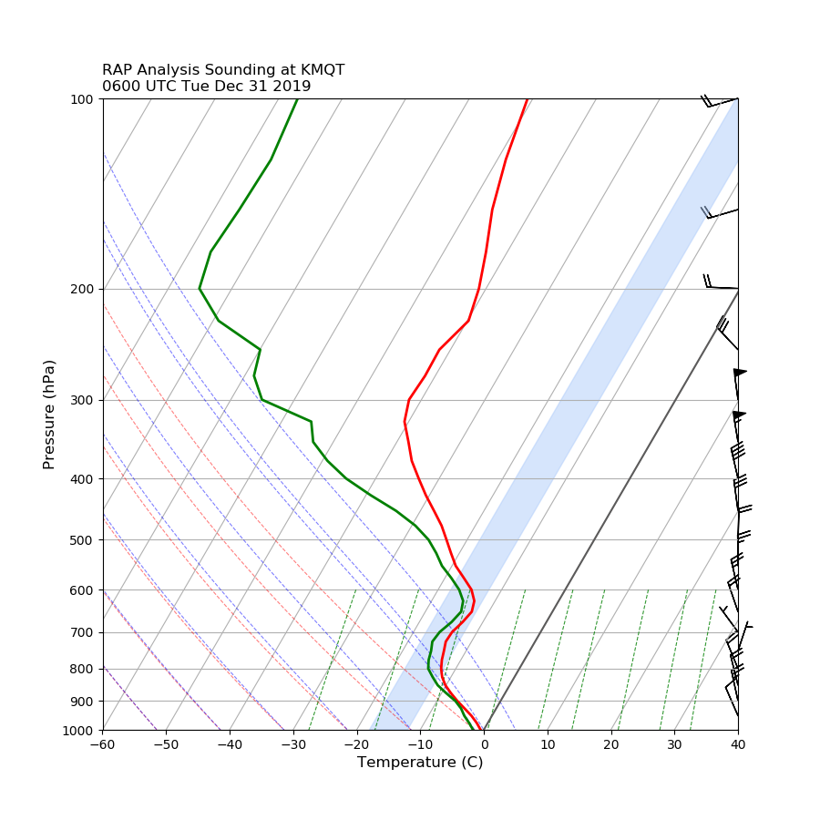 |
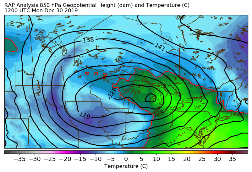
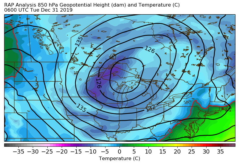
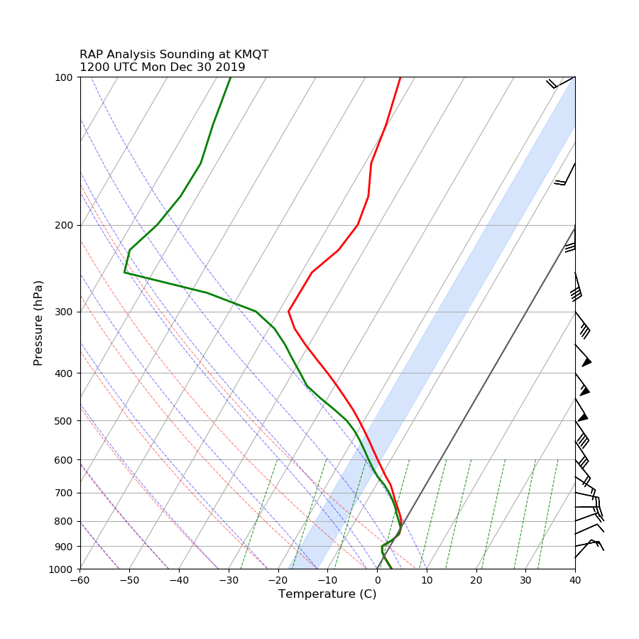
| 850 mb Height and Temperature at 12z (7 am EST) Monday, December 30. At this point, temperatures aloft were near or slightly above freezing across most of Upper Michigan, leading to a rain/snow mix. | 850 mb Height and Temperature at 06z (1 am EST) Tuesday, December 31. By this point, temperatures aloft were much cooler, so the precipitation was all snow and was a drier, fluffier lake-effect driven snow. | Vertical profile of the atmosphere at WFO MQT at 12z (7 am EST) Monday, December 30 showing the temperature cooling quickly through the snow growth region (shaded in blue) and low-level temperatures right near freezing. Both of these attributes contributed to this being a wet and dense snow. | Vertical profile of the atmosphere at WFO MQT at 06z (1 am EST) Tuesday, December 31 now shows a much greater overlap between the temperature curve and the snow growth region, as well as much colder low-level temperatures. Snow falling at this point was much fluffier. |
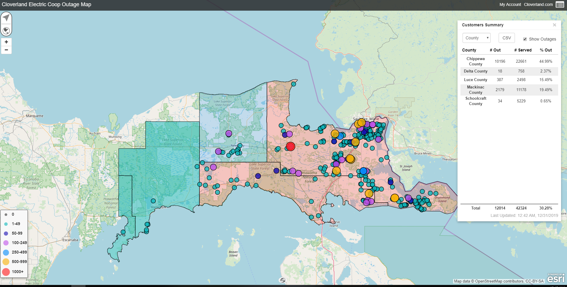
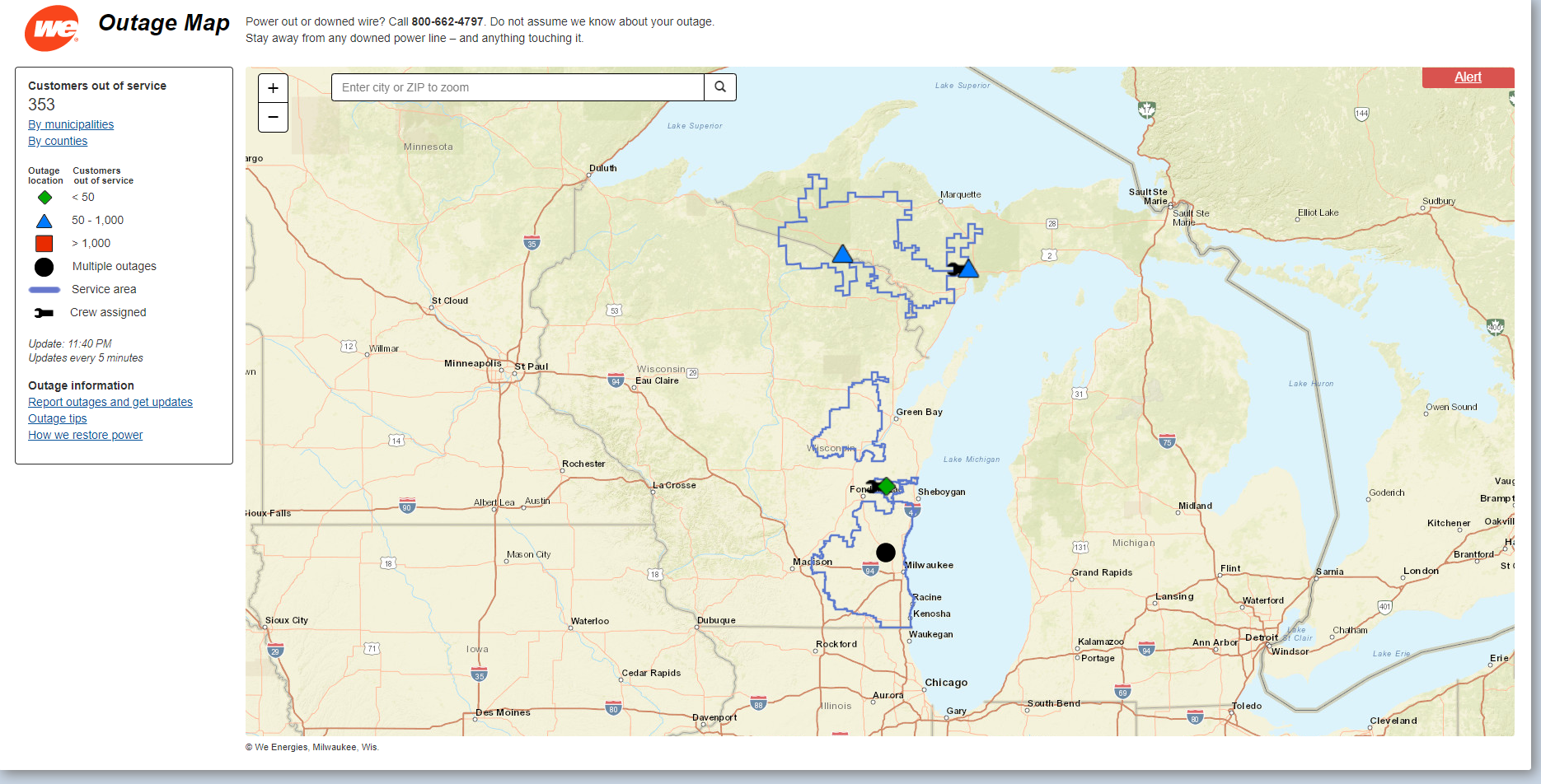
Power Outages/Impacts
 |
 |
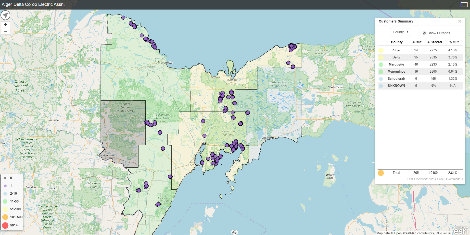 |
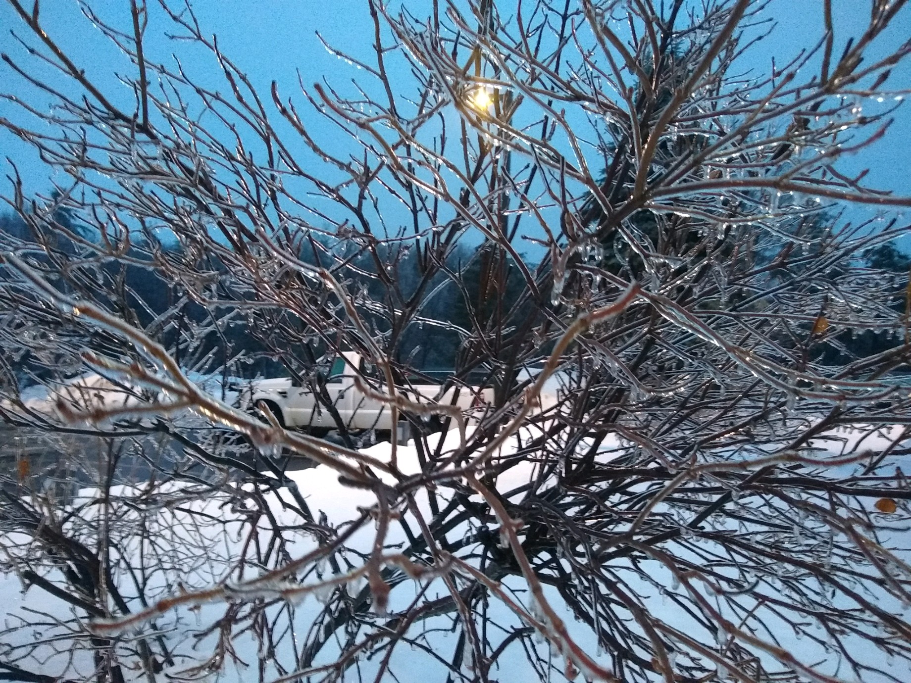
| Photo showing a glaze of ice on tree branches at the NWS office Sunday morning | UPPCO power outages during the storm | Power outages in Alger and Delta counties during the storm |
 |
 |
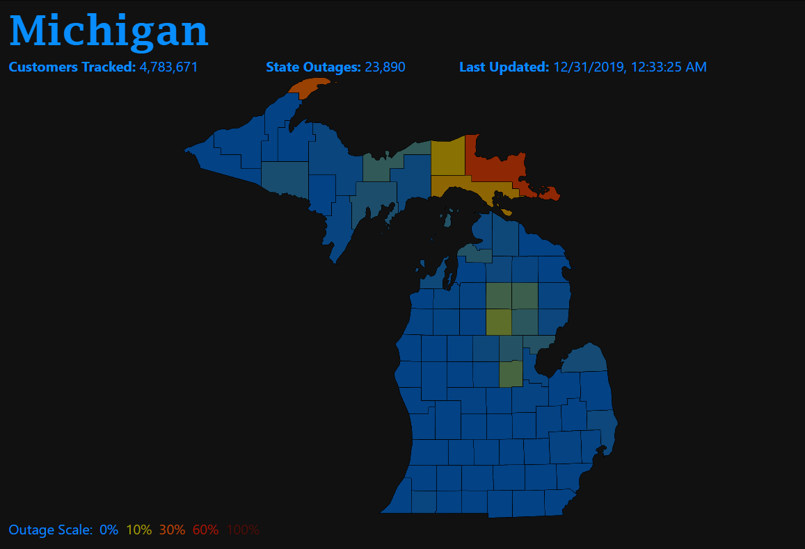 |
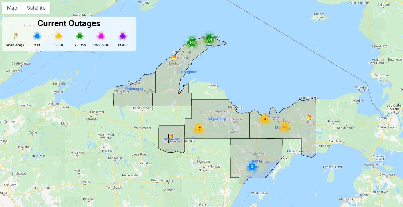
| Cloverland power outages over eastern Upper Michigan during the storm. This area was hit particularly hard with a combination of freezing rain and wet snow that left power out for several days in some areas. | WeEnergies power outages during the storm | Image from poweroutages.us showing the Keweenaw Peninsula and eastern Upper Michigan being hit particularly hard with power outages. |
 |
Media use of NWS Web News Stories is encouraged! Please acknowledge the NWS as the source of any news information accessed from this site. |
|


