Overview
|
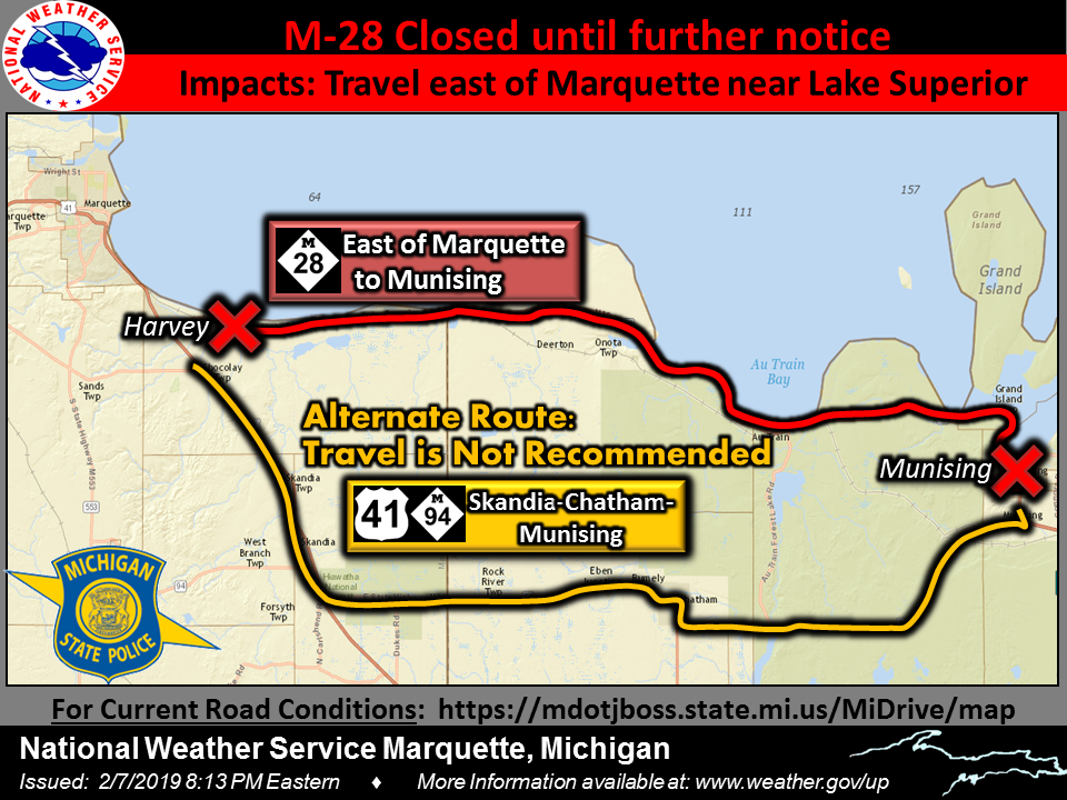
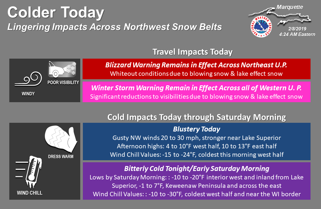
A quick-moving winter storm dropped anywhere from 3 to 6 inches over southern and eastern Upper Michigan, and 6 to 12 inches across northern and western Upper Michigan, with up to 16 inches over the Keweenaw Peninsula. Most of this snow fell in about an 8-hour period. As snow caked onto tree branches and power lines that were still coated in ice from an ice storm three days earlier and winds increased behind the system, there were a few power outages reported, mainly in Marquette and Alger Counties. Blizzard conditions also forced the closure of M-28 between Harvey and Munising. |
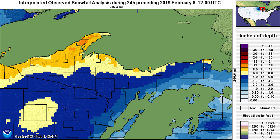 NOHRSC Snowfall Analysis |
Social Media
 |
 |
 |
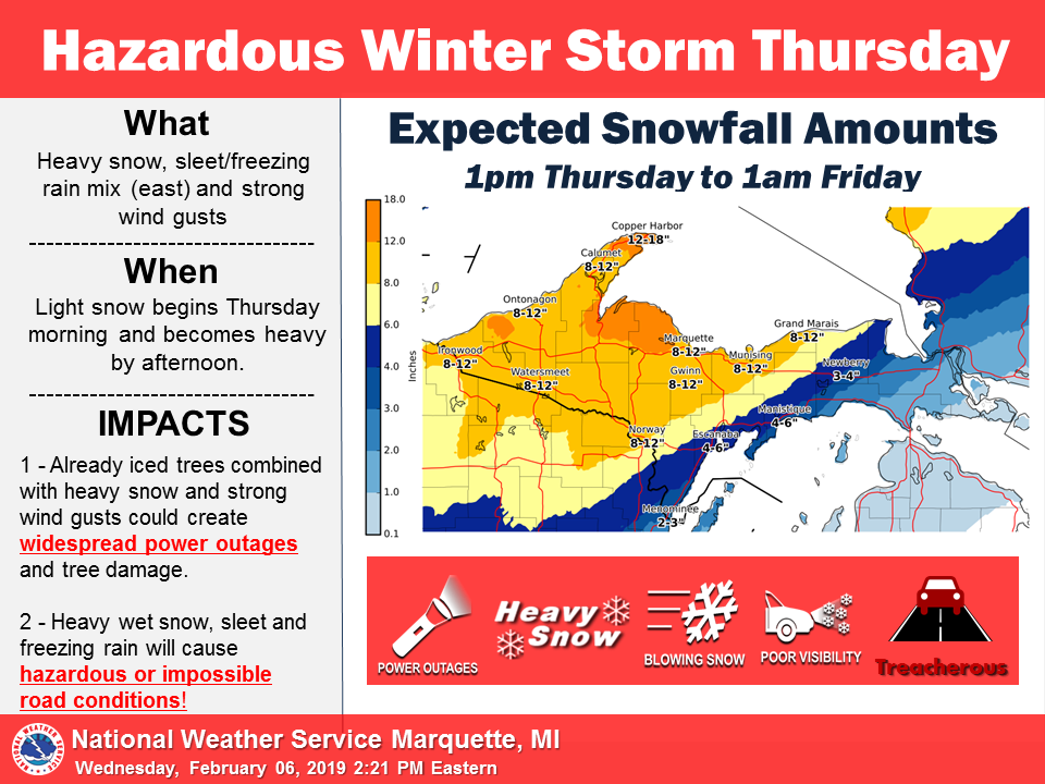 |
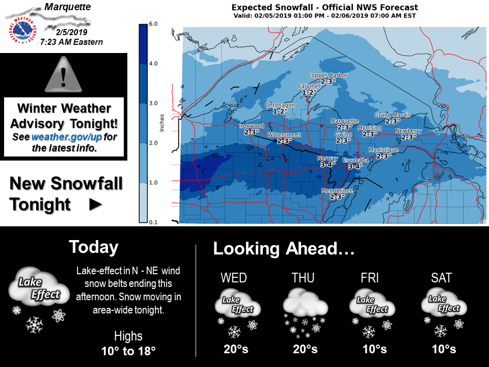
| Messaging was complicated by an earlier winter storm the evening of February 5th. The forecast snowfall amounts from that event form the majority of this graphic, but the extended forecast at the bottom provides the first indication of significant snow on Thursday. | Messaging of a more impactful winter storm with the potential for heavy snow and widespread power outages began in earnest on the evening of February 5th. | The first mention of snowfall amounts, though not yet specific, came with the morning weather story on February 6th. | By the afternoon of February 6th, a new graphic was produced to be more specific about forecasted snowfall totals. |
 |
 |
 |
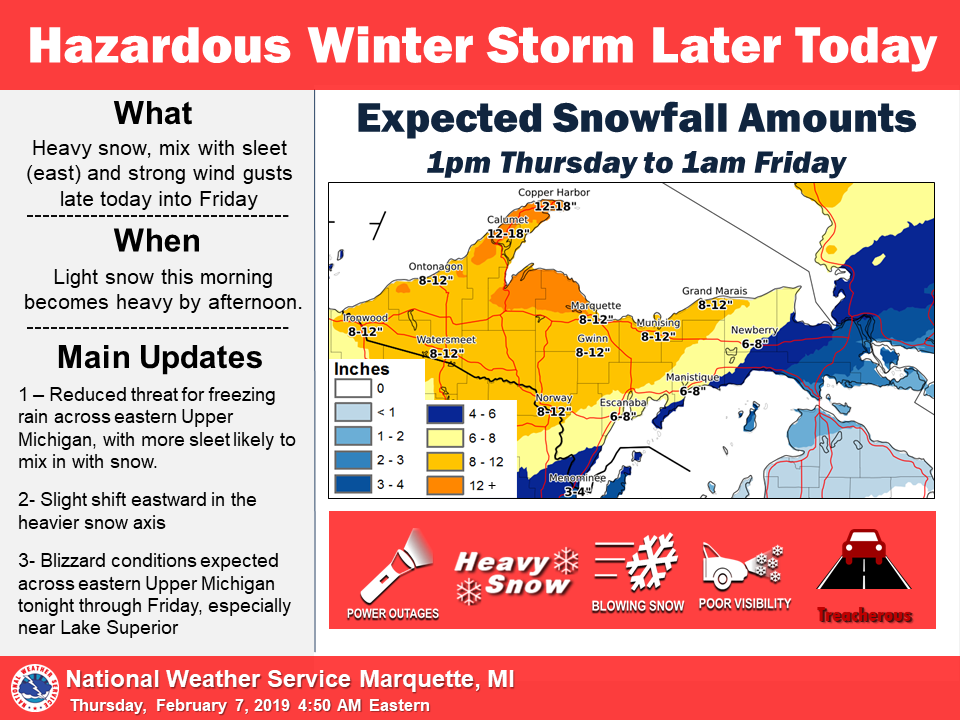 |
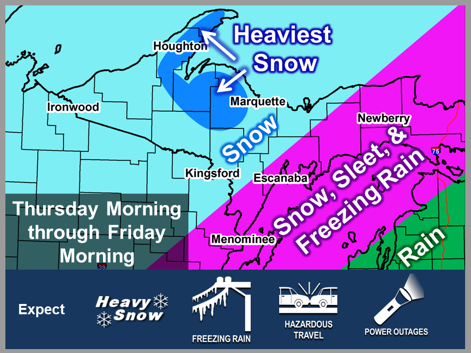
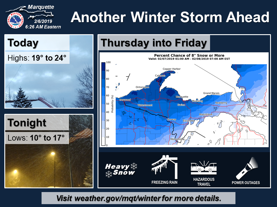
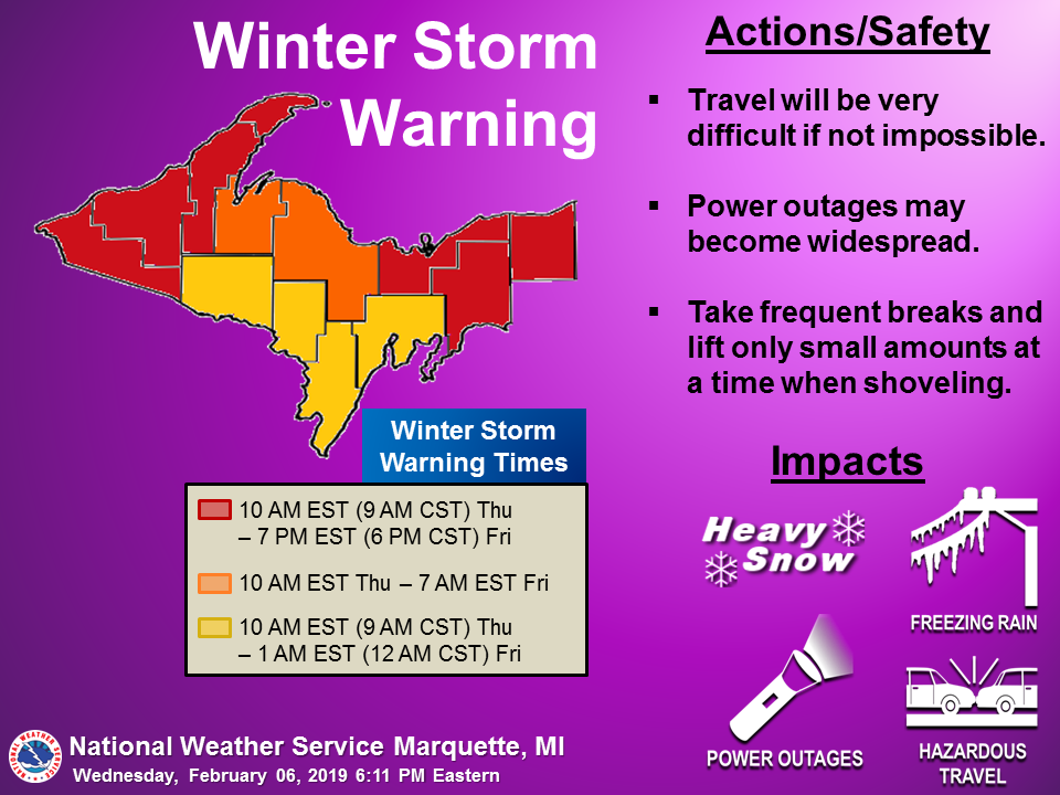
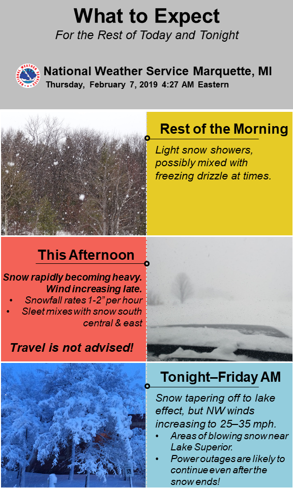
| A Winter Storm Warning was issued for the entirety of NWS Marquette's County Warning Area with the afternoon forecast package on February 6th. | As details about the winter storm came into focus, information on precipitation type and intensity specific to sub-regions of the County Warning Area was messaged. | On Friday morning, the emphasis was still on the expected rapid degradation in conditions with the onset of heavy snow that afternoon. | The previous hazards graphic was updated slightly with new snowfall totals Thursday morning. |
 |
 |
 |
 |
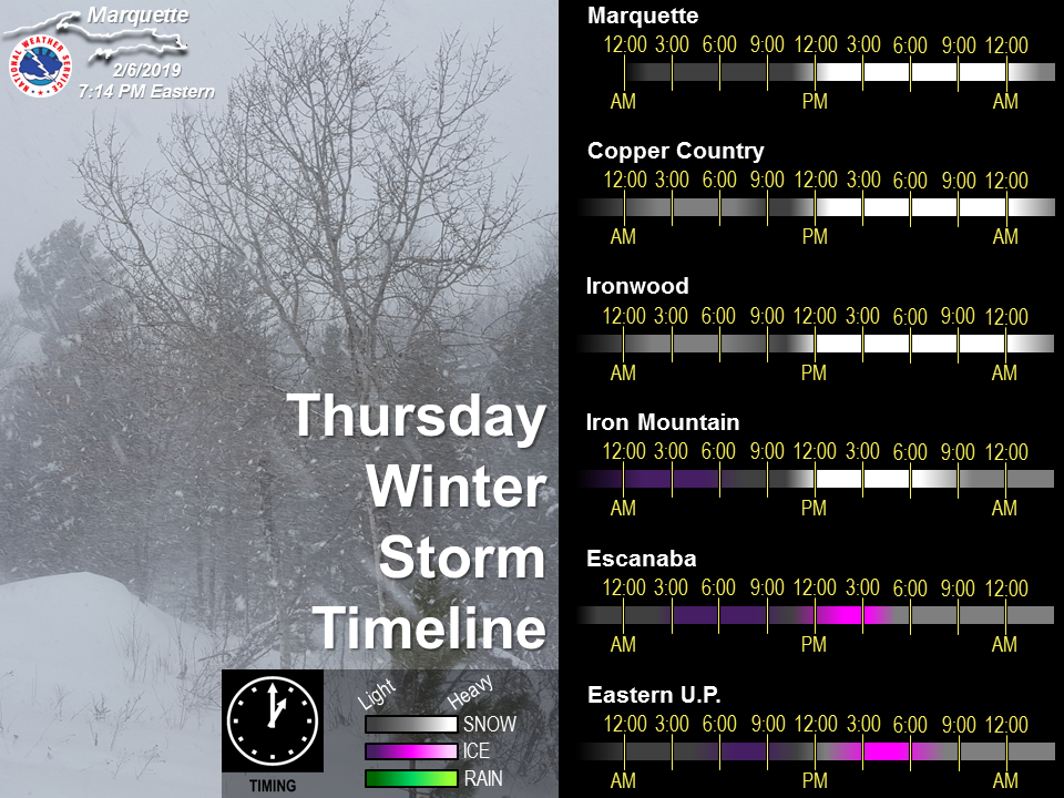
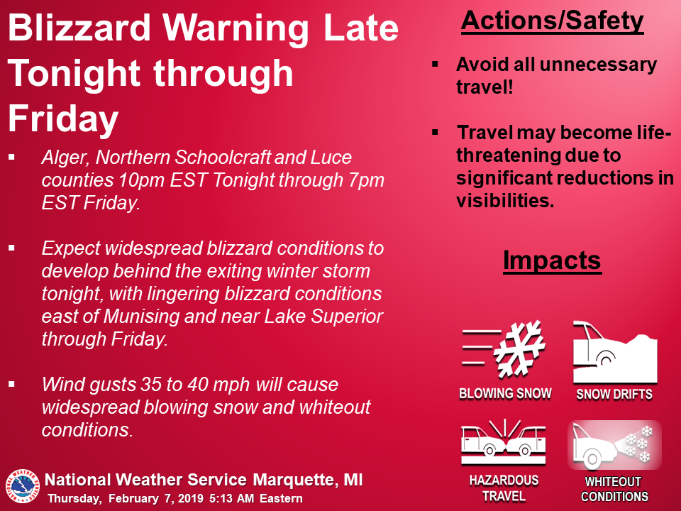
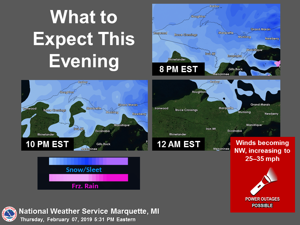
| A Blizzard Warning was issued with the Thursday morning forecast package for the NW wind snowbelt areas downwind of Lake Superior to the east of Marquette. | The evening update shows synoptic-scale snow quickly wrapping up. | As winds picked up and snow transitioned to lake-effect, Michigan State Police closed M-28 between Harvey and Munising due to whiteout conditions. | As the majority of the snow ended Friday morning, attention turned to the blustery conditions behind the storm which caused areas of blowing snow and cold wind chills. |
Environment
Insert synoptic summary.
 |
 |
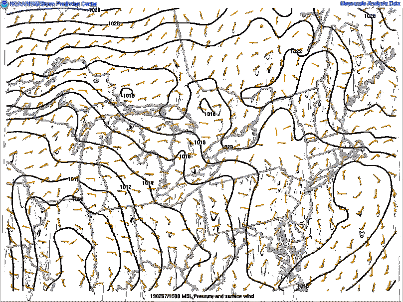 |
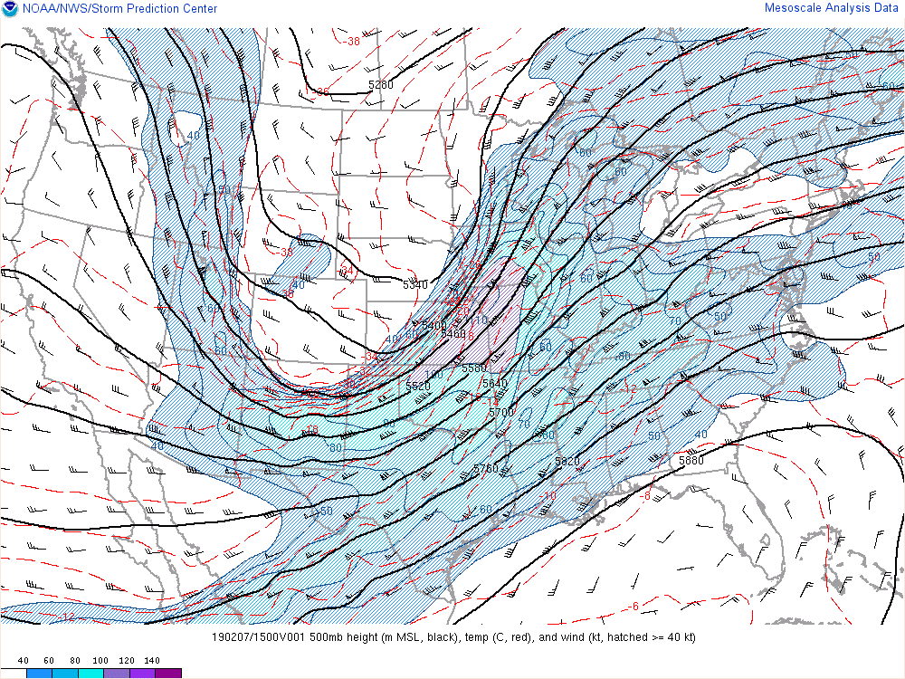
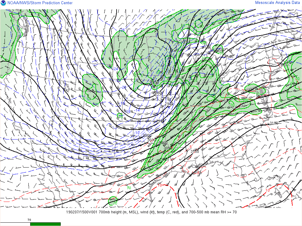
| 500 mb Analysis | 700 mb Analysis | Surface Analysis |
 |
Media use of NWS Web News Stories is encouraged! Please acknowledge the NWS as the source of any news information accessed from this site. |
|

