Overview
Enter summary/what happened:Tornadoes:
|
Tornado - Near Bessemer, MI
Track Map 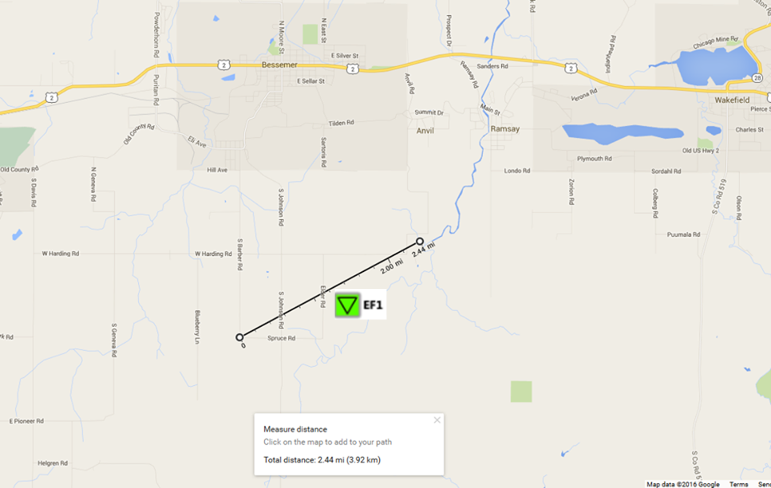 
|
||||||||||||||||
|
||||||||||||||||
The Enhanced Fujita (EF) Scale classifies tornadoes into the following categories:
| EF0 Weak 65-85 mph |
EF1 Moderate 86-110 mph |
EF2 Significant 111-135 mph |
EF3 Severe 136-165 mph |
EF4 Extreme 166-200 mph |
EF5 Catastrophic 200+ mph |
 |
|||||
Wind:
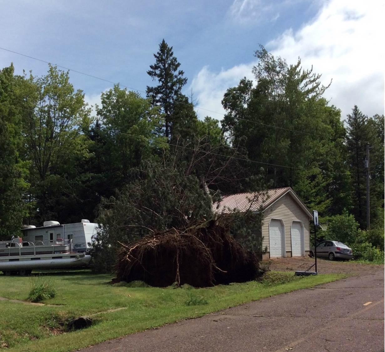
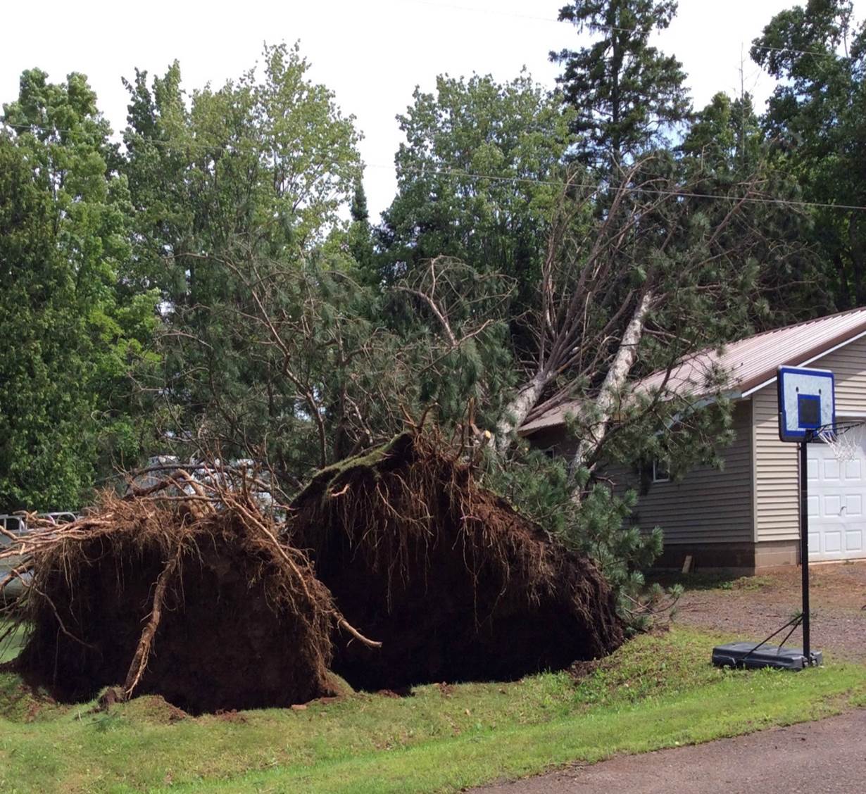
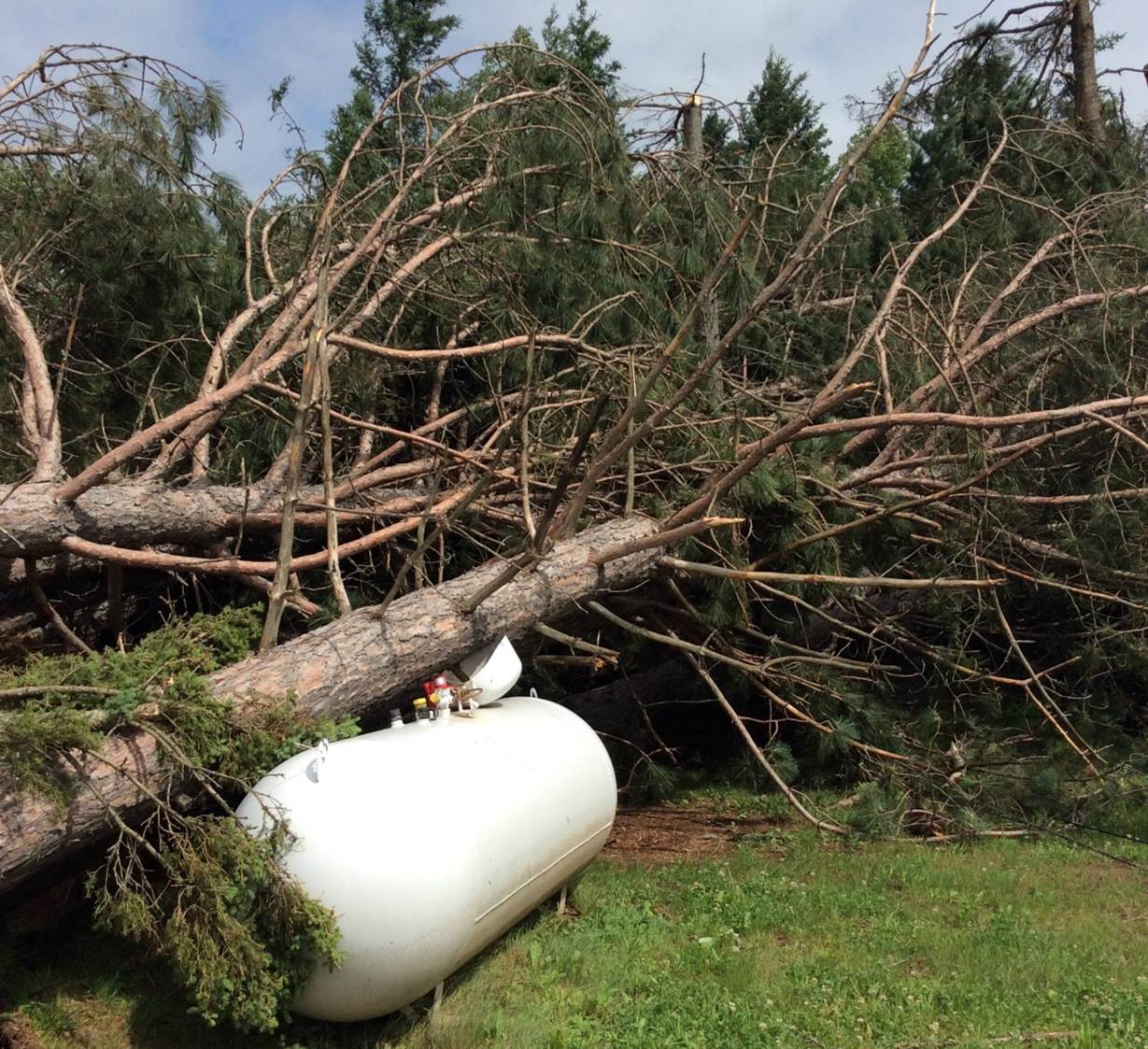
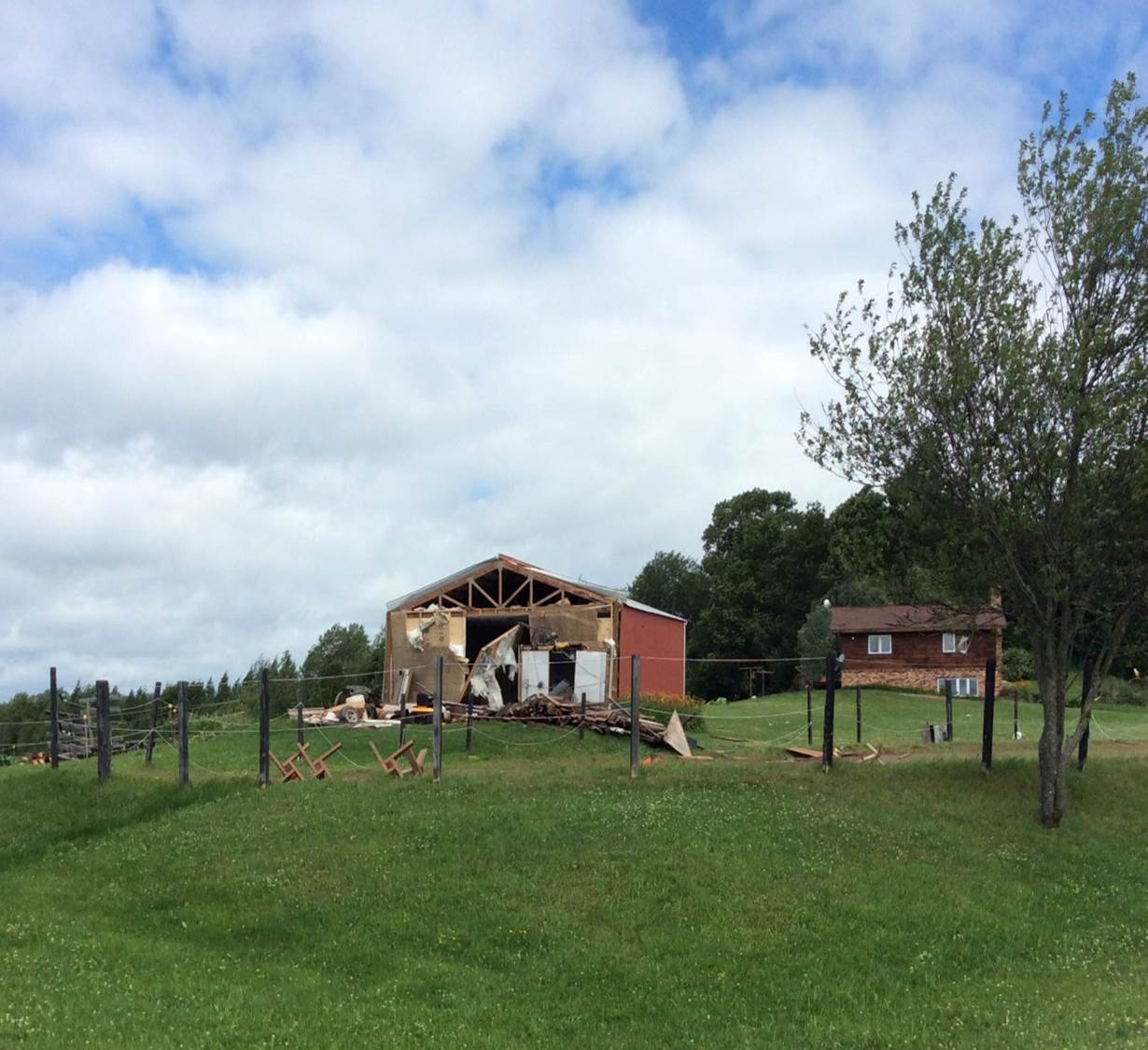
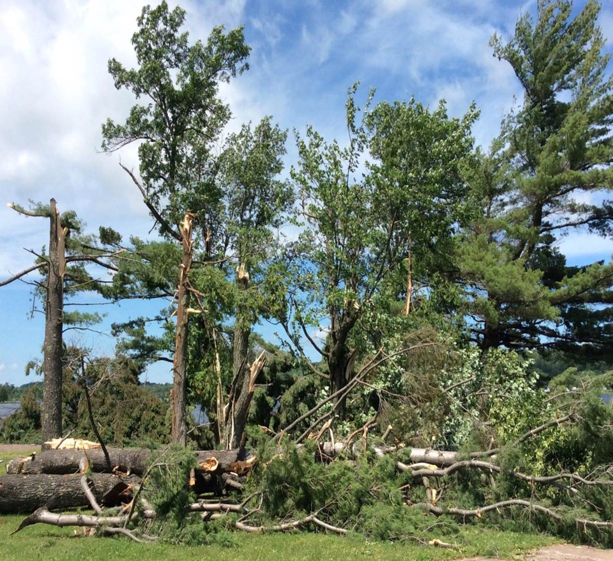
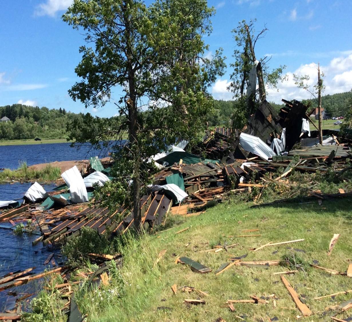
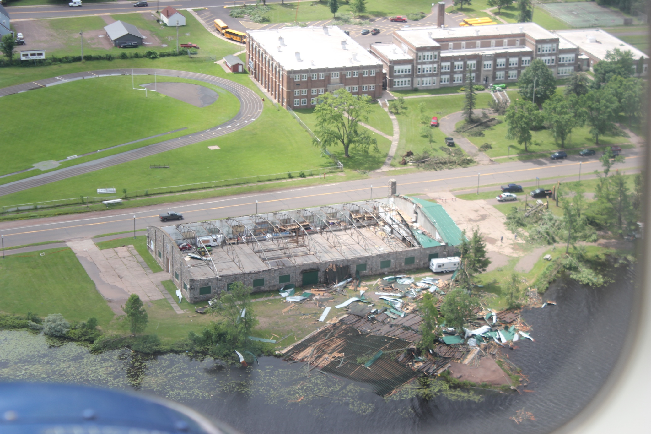
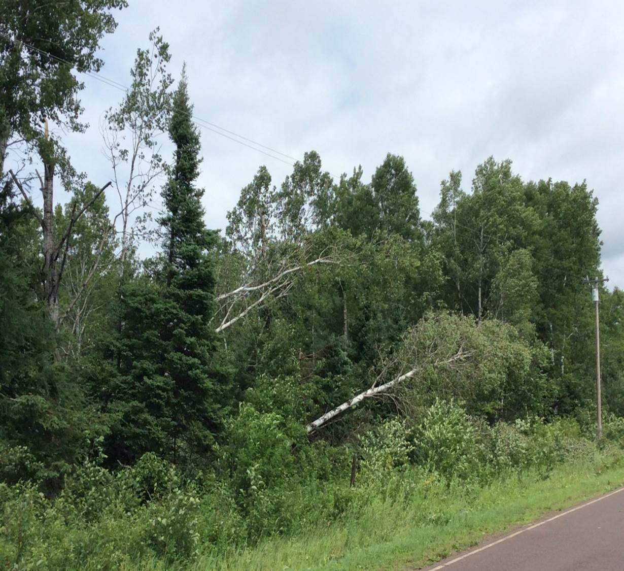
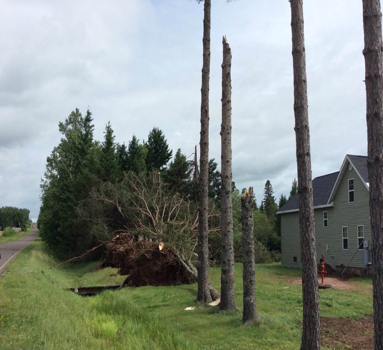
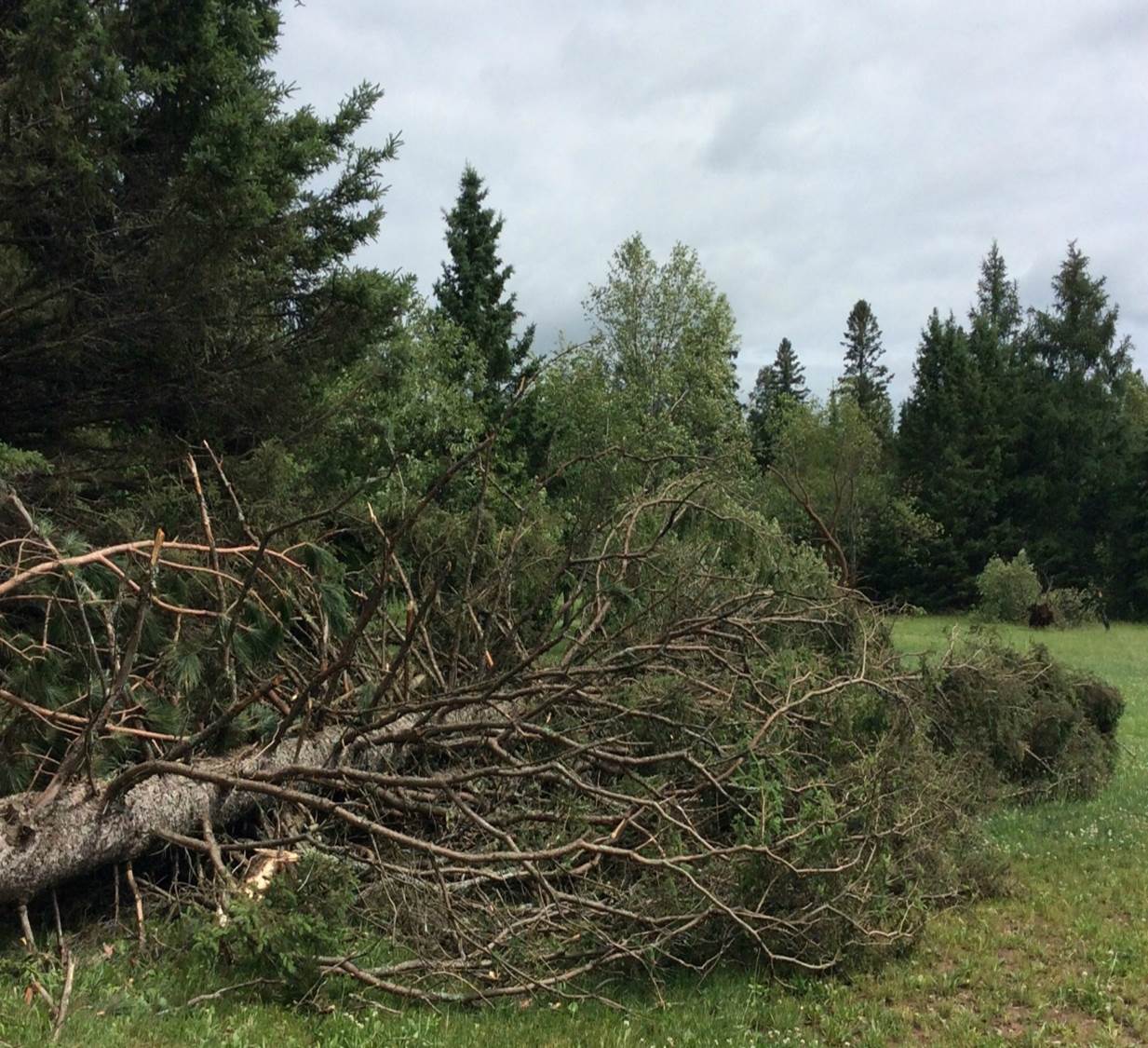
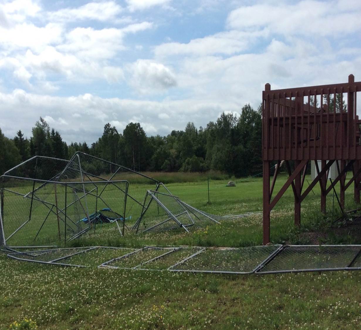
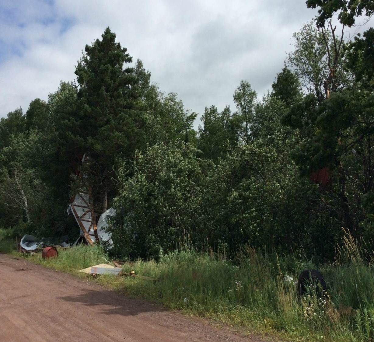
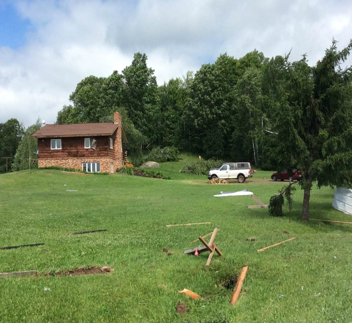
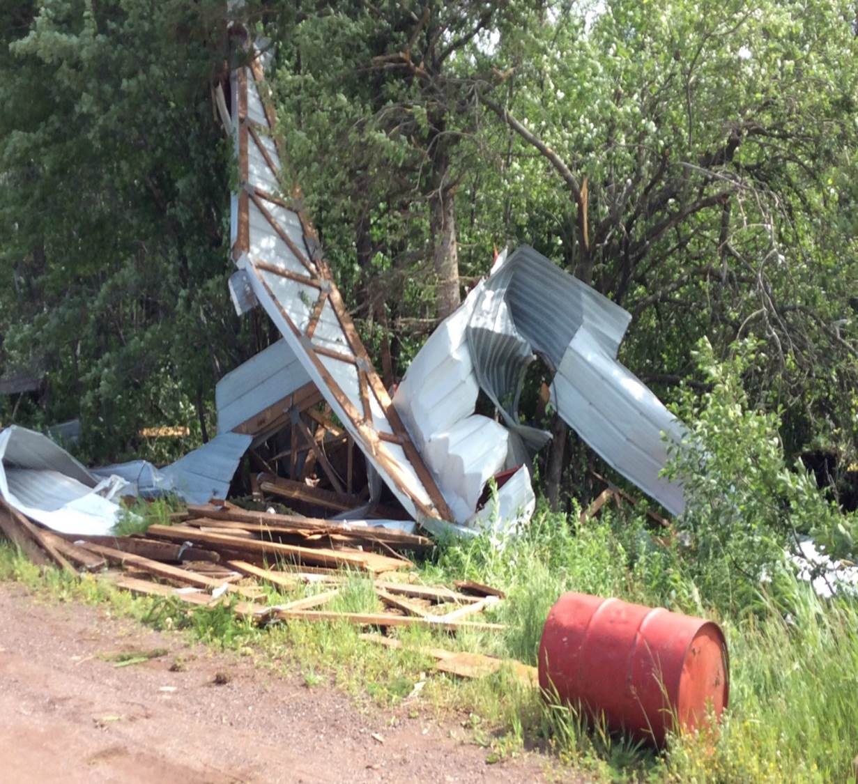
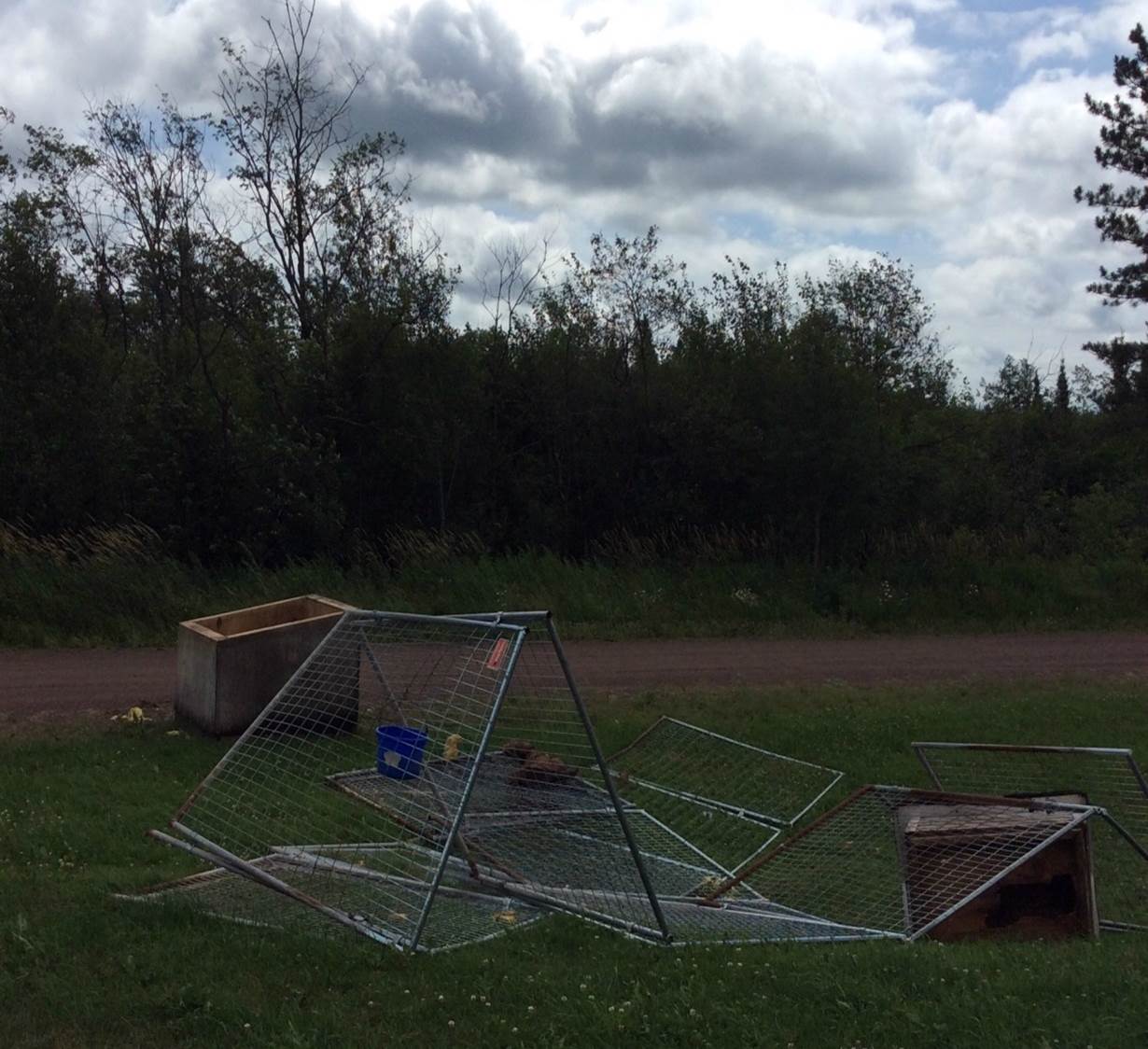
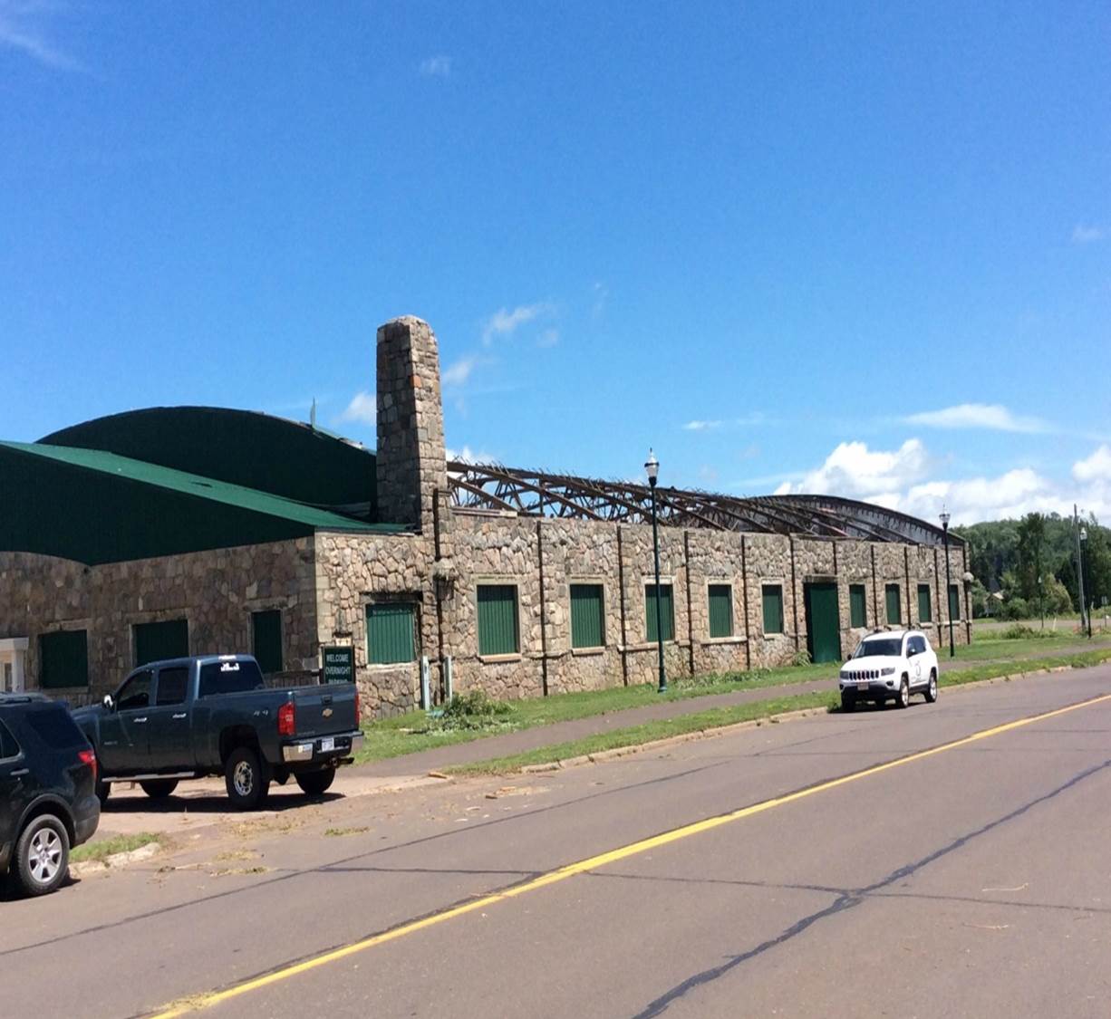
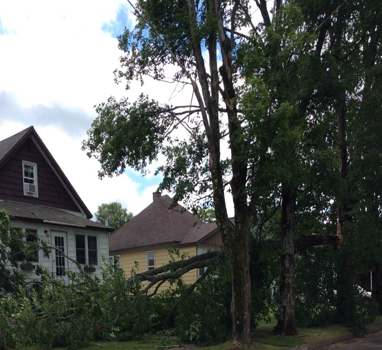
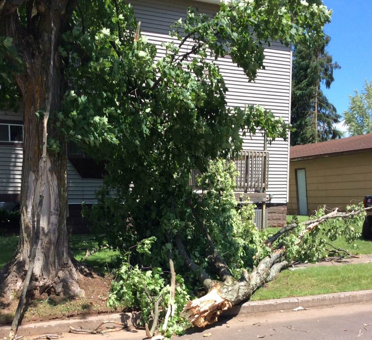
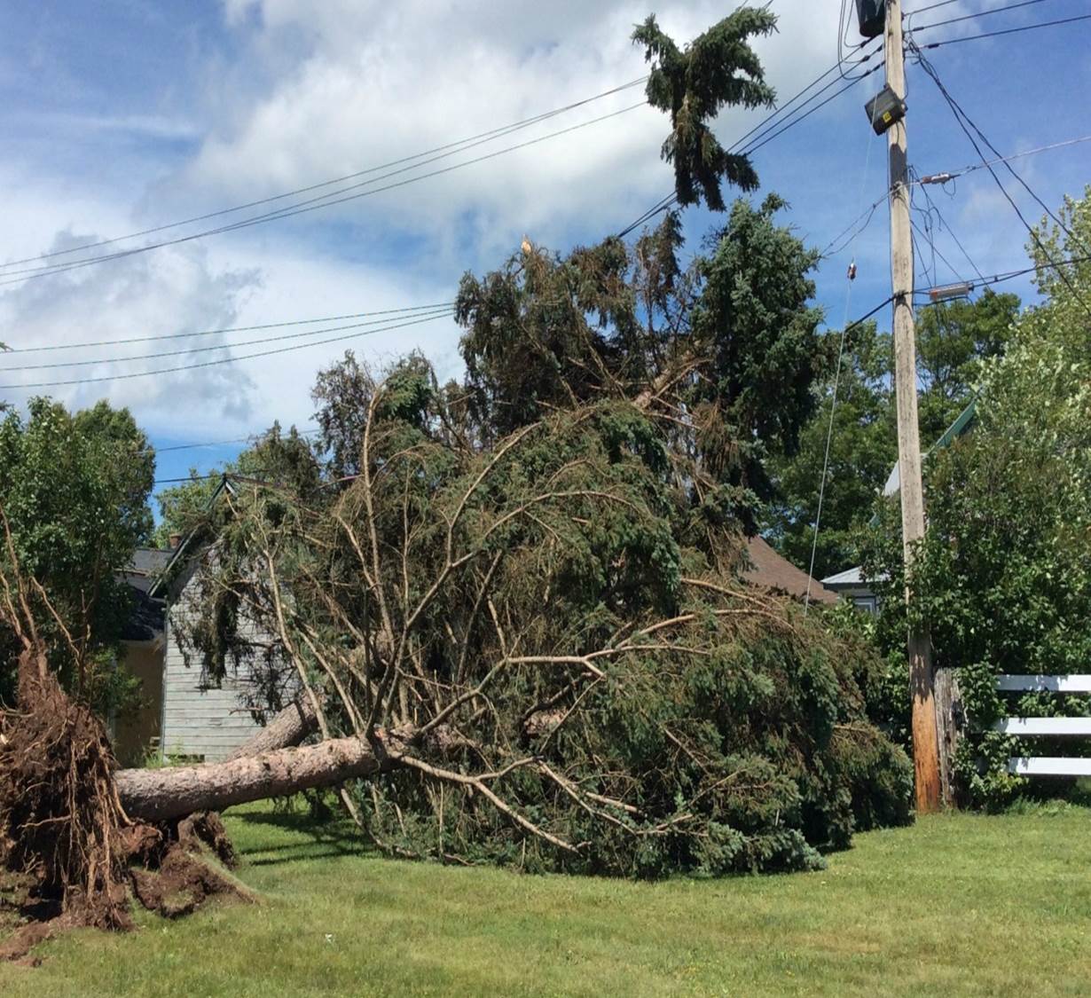
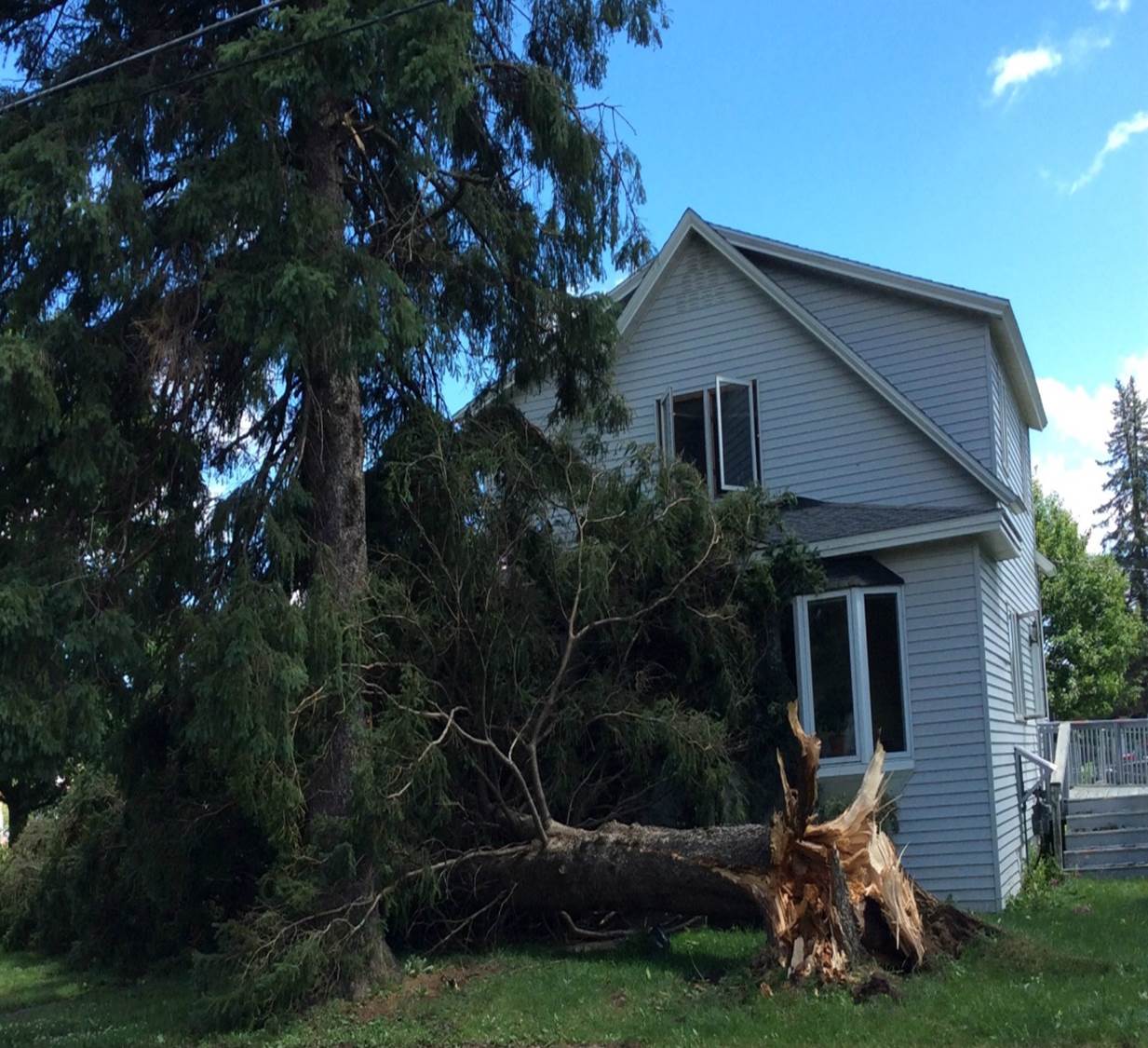
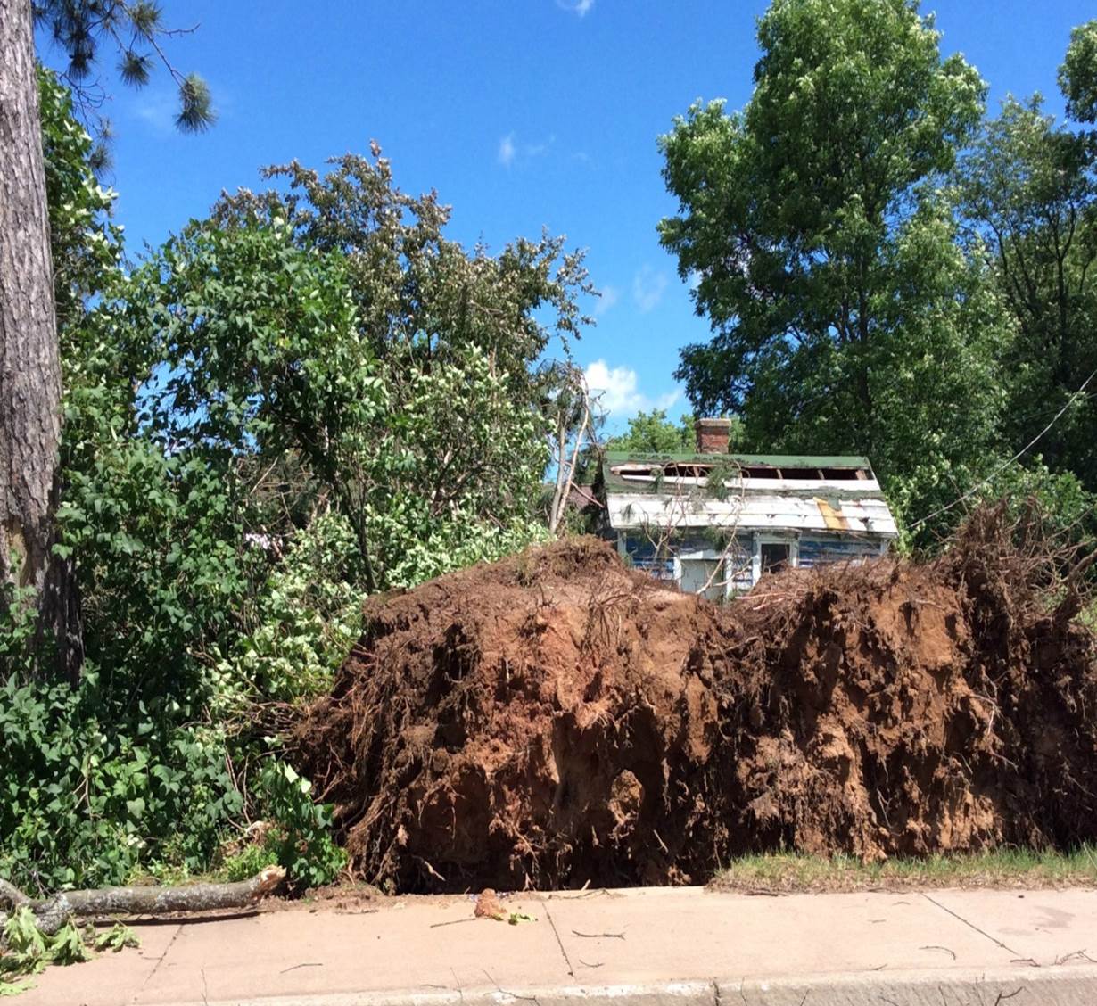
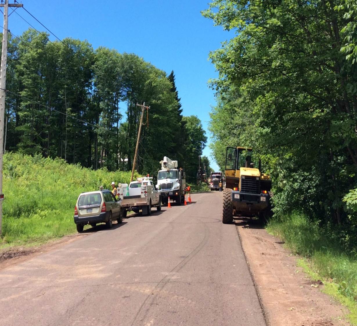
National Weather Service storm survey team concluded that damage in and immediately surrounding Wakefield was caused by straight-line thunderstorm winds up to 90 mph. A camping trailer was overturned, a large building had the roof ripped off, a few outbuildings were damaged or destroyed, several trees were downed on houses and vehicles and hundreds of trees were uprooted or snapped. The survey team could not access all areas due to the number of downed trees. Time based on radar and interviews of individuals in the area. Additional severe thunderstorm wind damage occurred earlier in the night around 8:45 pm EDT 4 miles east-southeast of Little Girl's Point in western Gogebic County. The Sheriff's office reported several large trees in excess of 12" in diameter were downed across Lake Road, near Upper Powers Road. The Gogebic County Road Commission had to use front-end loaders to clear the debris. Damage photos from this event are not shown as the National Weather Service survey team could not access the area due to washed-out roads.
 |
 |
 |
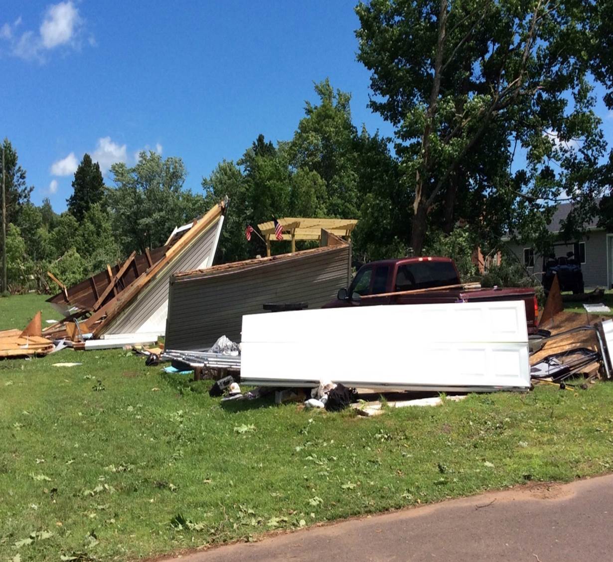 |
| NWS Storm Survey Images from Straight Line Wind Damage around Wakefield. Aerial photo of old skating rink in Wakefiled, MI was provided by the Michigan State Police. | |||
Flooding
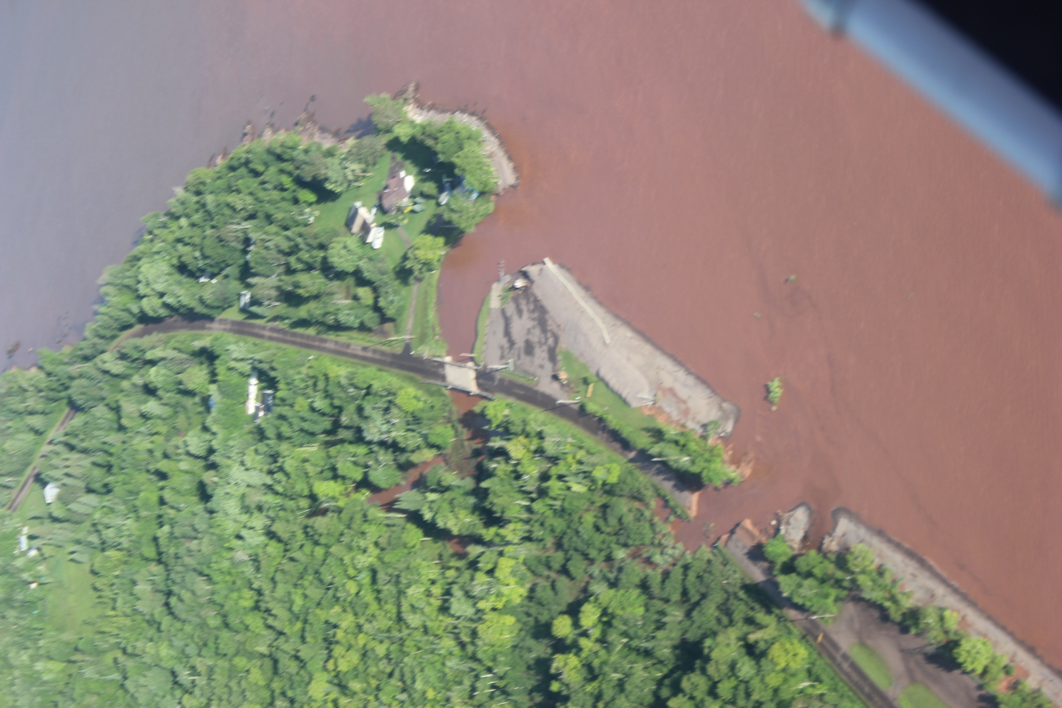
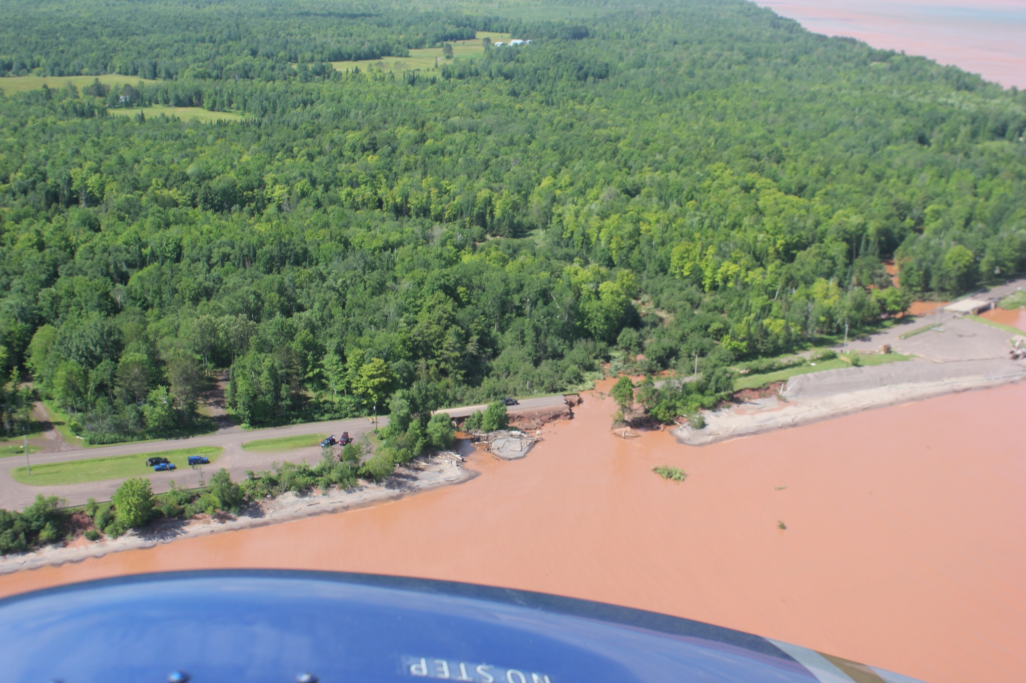
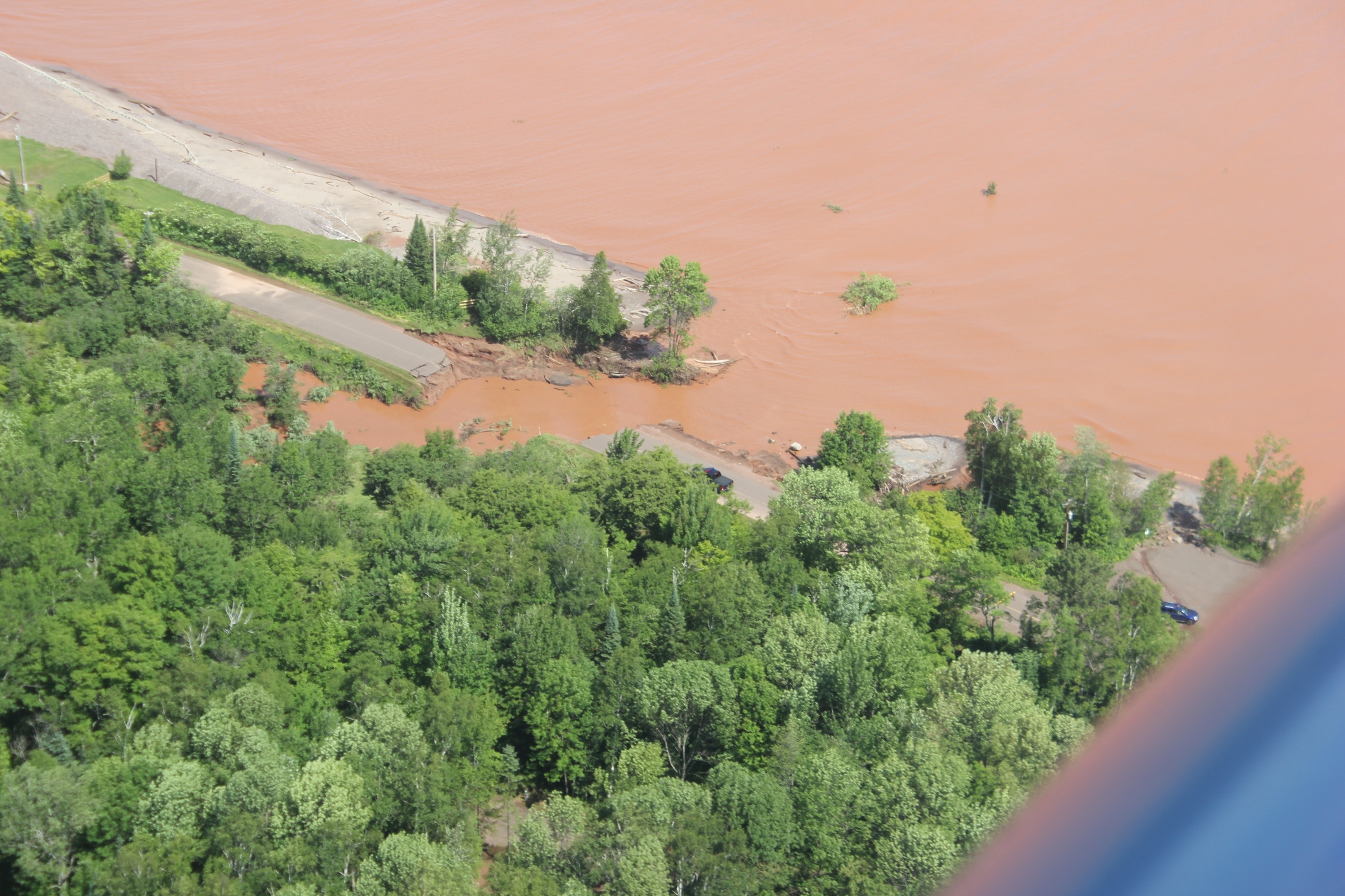
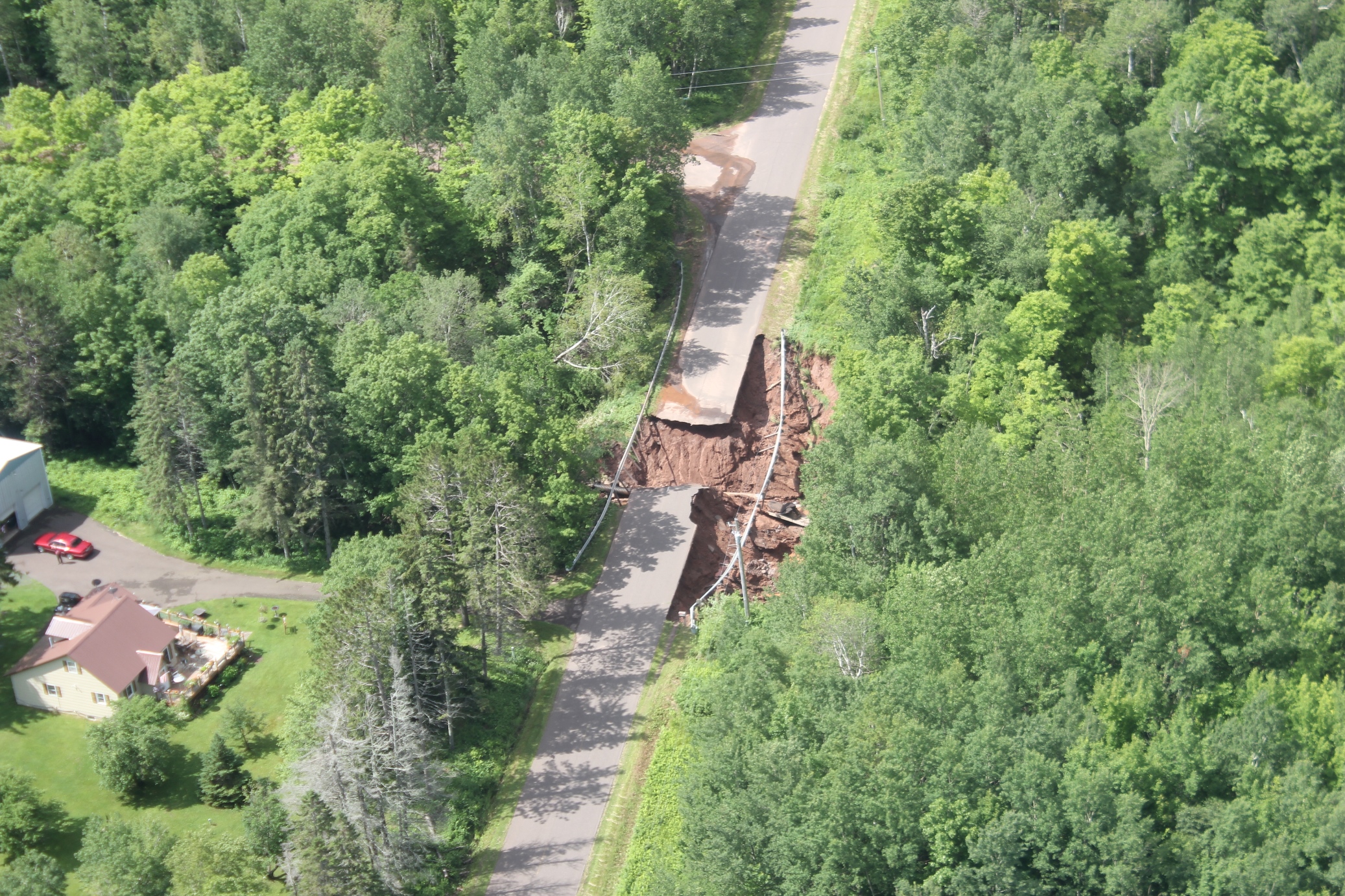
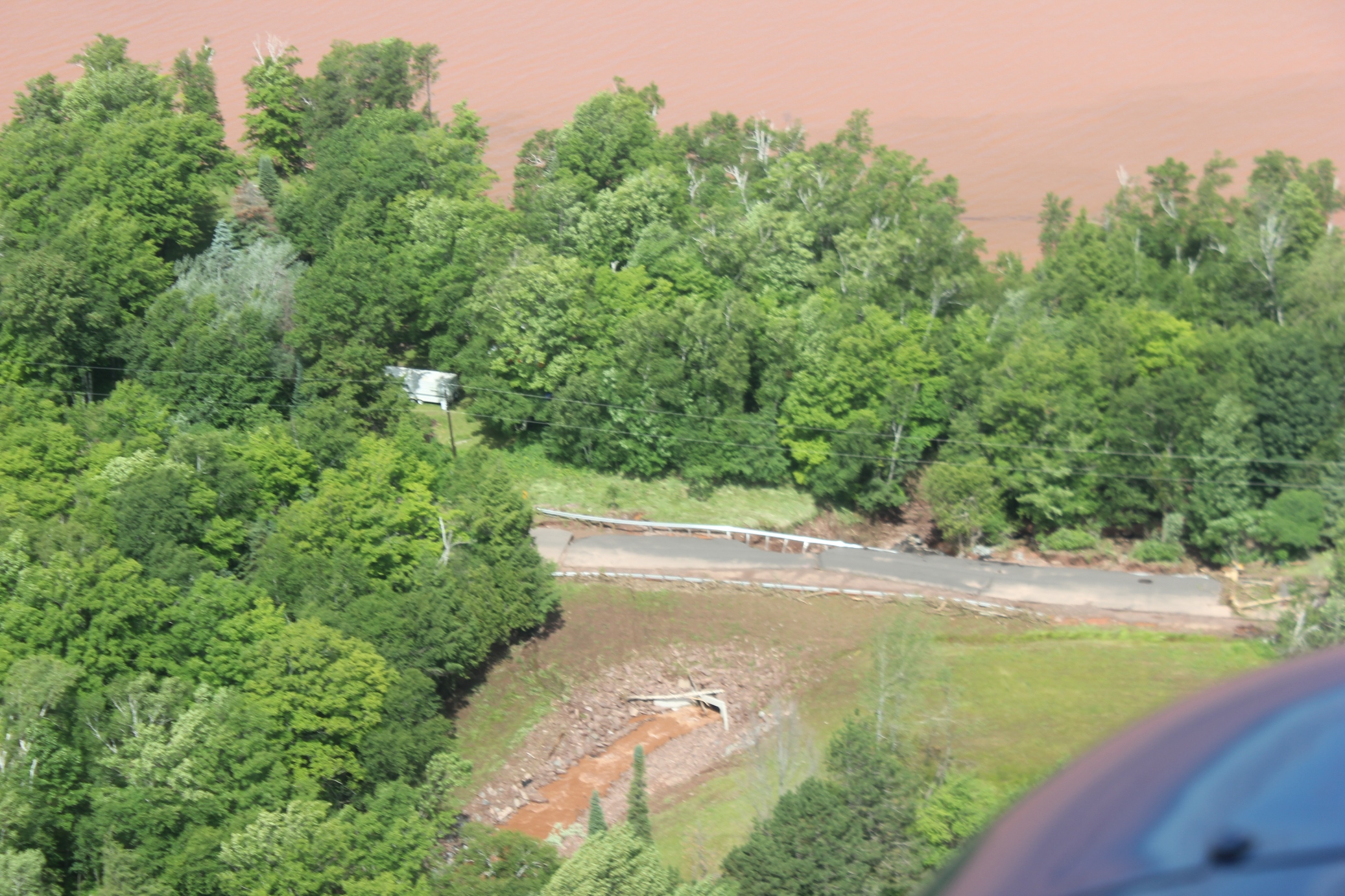
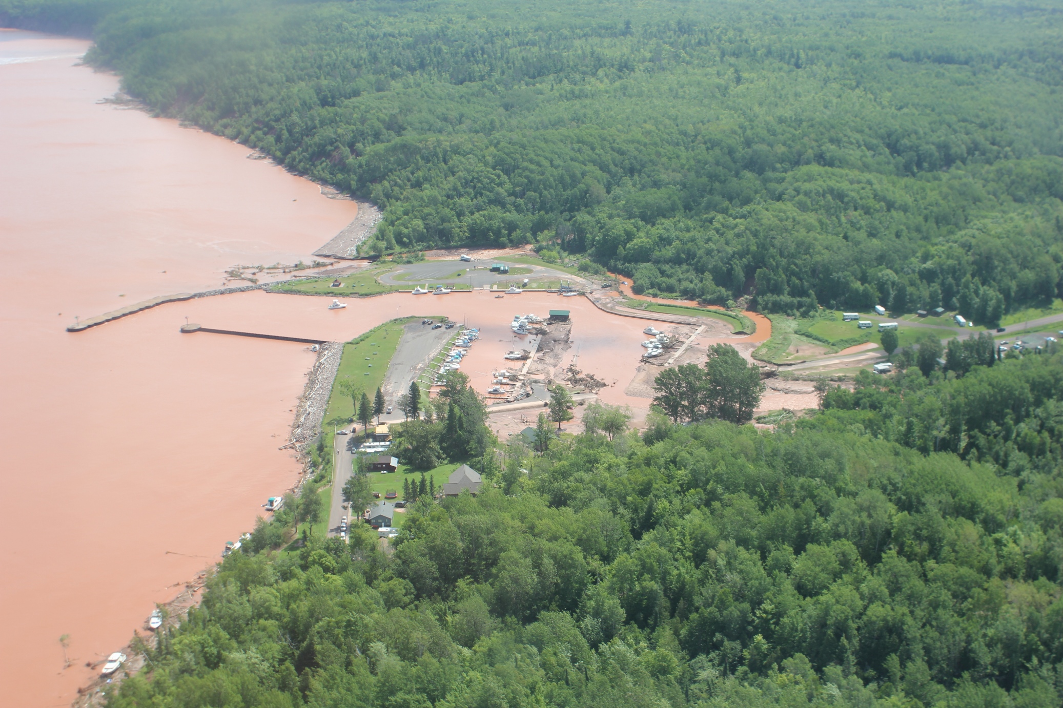
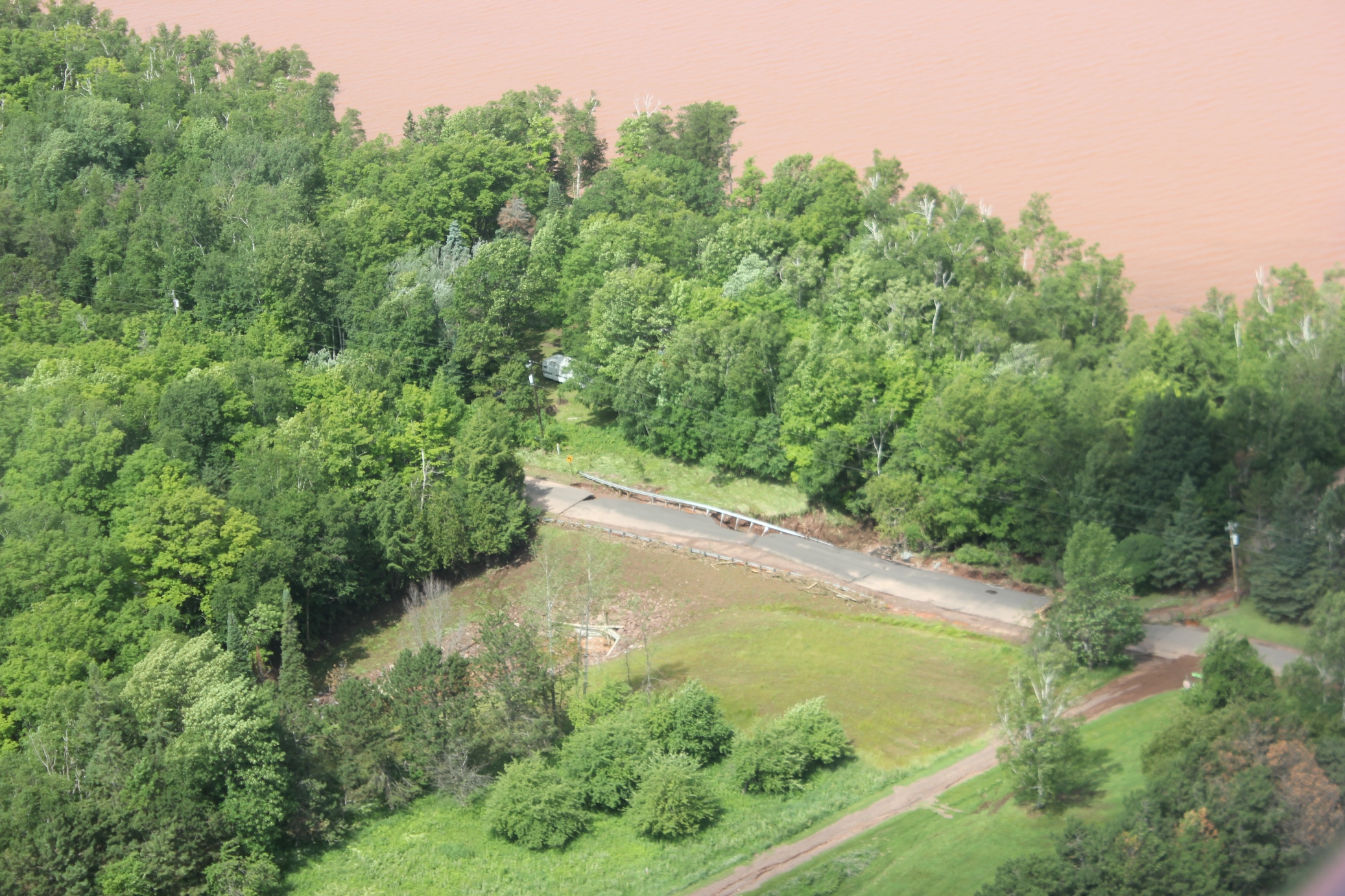
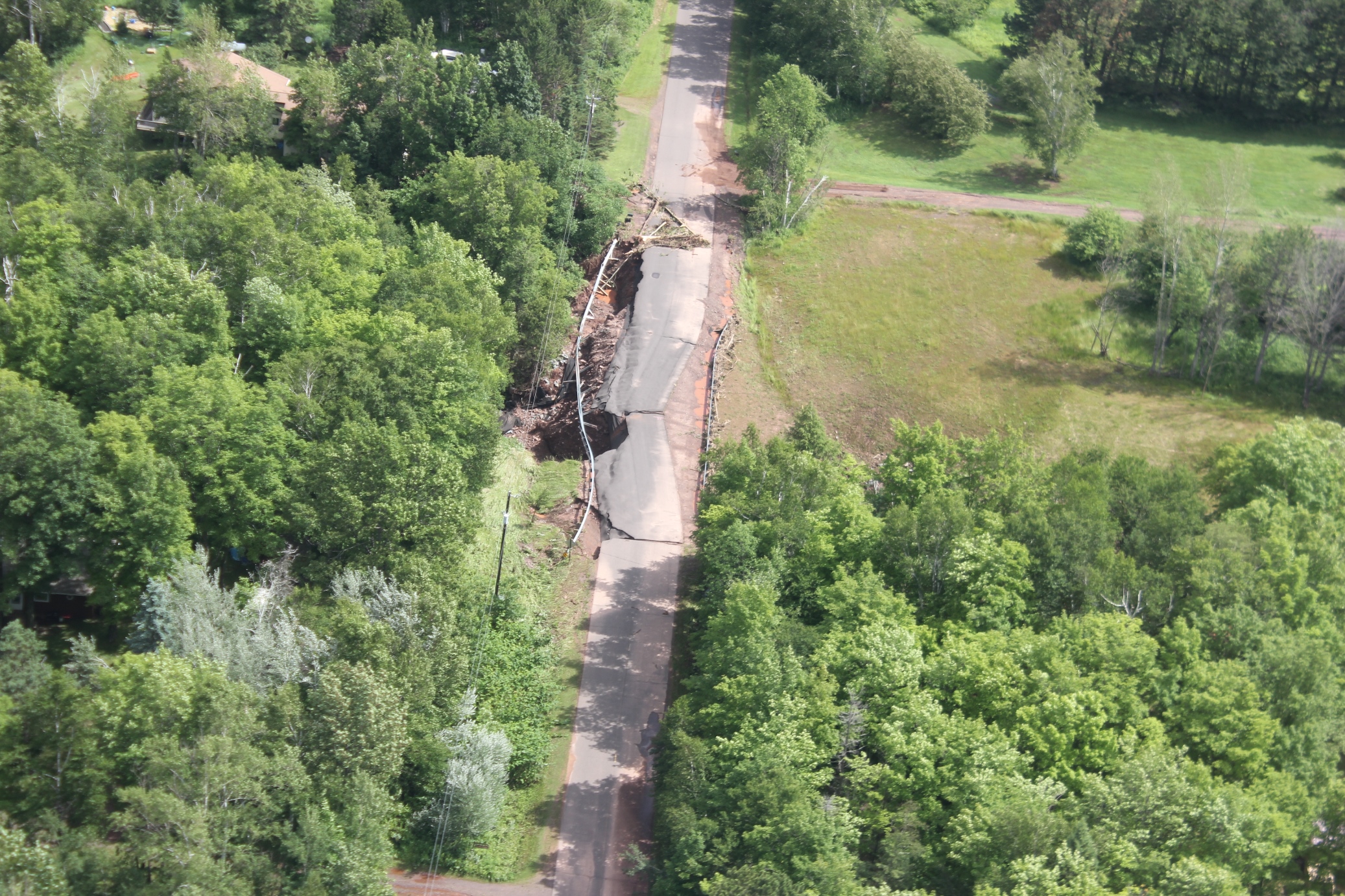
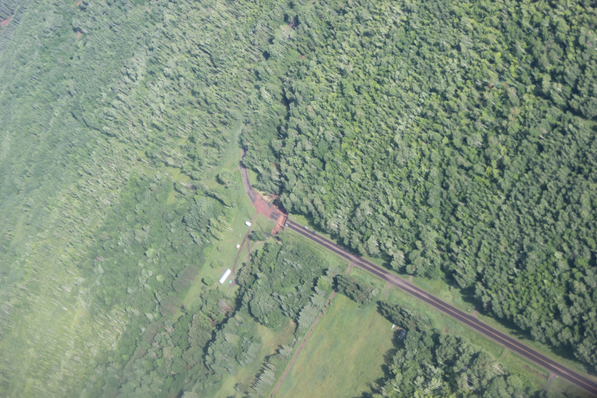
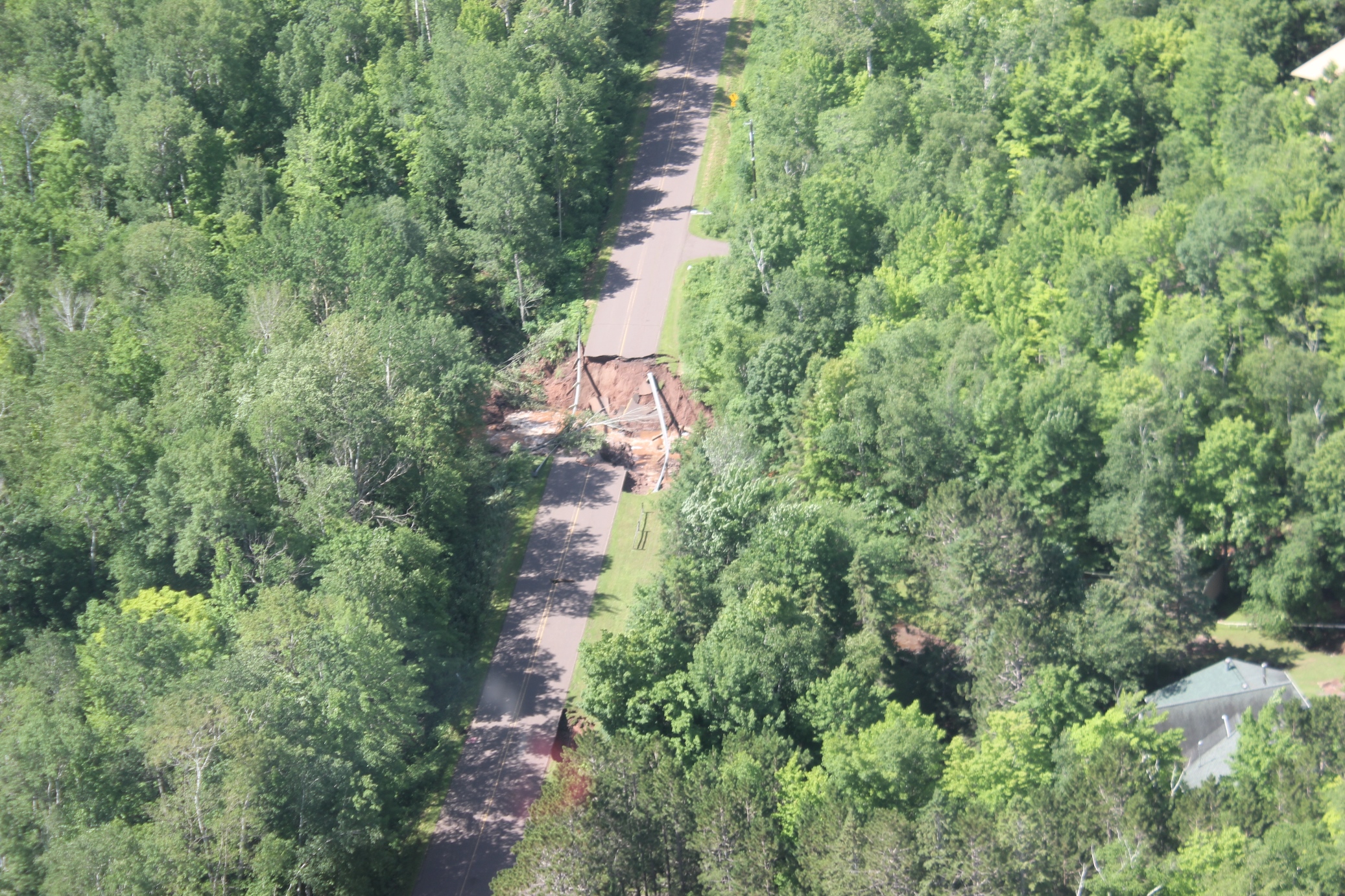
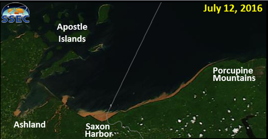
Major flash flooding occurred with this event over far western Upper Michigan, mainly over far western Gogebic County. Many sections of road were washed out and impassible. Many people were stranded in those areas and had to be rescued. Additionally, temporary bridges had to be built to gain access to many of these areas. A Gogebic County patrol car was lost in the flood waters; however, the Sheriff or Deputy driving the car was rescued. Northwestern Wisconsin also had significant flooding with the area near Saxon Harbor sustaining major damage. Many boats were lost in the flooding as the docks were washed out and some of the boats on land were washed out into Lake Superior. It is estimated that the damage totals will be in the millions if not tens of millions of dollars.
Flash Flooding Imagery
 |
 |
 |
 |
 |
 |
 |
 |
| Aerial Survey Images of Flash Flooding near Saxon Harbor and Along Lake Road in far Western Gogebic County. Courtesy of the Michigan State Police. | |||
Photos & Video:
Additional Tornado Damage Photos
 |
 |
 |
 |
 |
 |
 |
 |
|
Additional NWS Survey Team Tornado Damage Survey Pictures taken just South of Bessemer, MI
|
|||
Additional Straight-Line Wind Damage Photos
 |
 |
 |
 |
 |
 |
 |
 |
| Additional NWS Storm Survey Team Straight-Line Wind Damage Pictures taken around Wakefield, MI | |||
Additional Flash Flooding Images
 |
 |
 |
 |
 |
 |
 |
 |
|
Aerial Survey Imagery of the Flash Flooding over Western Upper Michigan and Portions of Northwest Wisconsin, courtesy of the Michigan State Police.
|
|||
Radar:
Header
 |
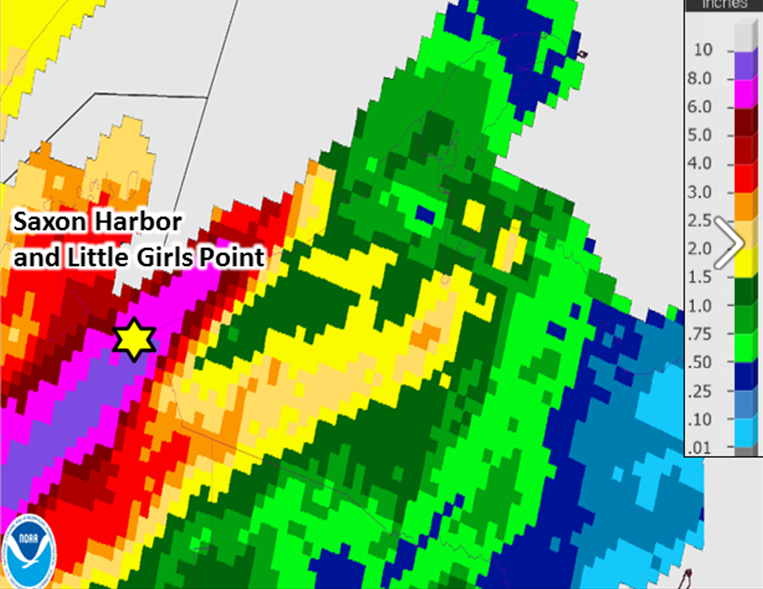 |
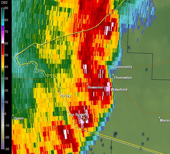
| Radar Reflectivity as of 11:54 pm EDT, around the time of the tornado. | Storm total estimate based on radar data. |
Storm Reports
PRELIMINARY LOCAL STORM REPORT...SUMMARY...CORRECTED
NATIONAL WEATHER SERVICE MARQUETTE MI
413 AM EDT TUE JUL 12 2016

..TIME...   ...EVENT...      ...CITY LOCATION...     ...LAT.LON...
..DATE...   ....MAG....      ..COUNTY LOCATION..ST.. ...SOURCE....
            ..REMARKS..

1146 PM     FLASH FLOOD      4 SW LITTLE GIRLS POINT 46.58N 90.40W
07/11/2016                   GOGEBIC            MI   LAW ENFORCEMENT

            GOGEBIC COUNTY SHERIFFS REPORT THAT THE
            GUARD RAIL ON LAKE RD. AT THE FLINK CREEK
            RAVINE HAS WASHED OUT TONIGHT.

1145 PM     FLASH FLOOD      5 SW LITTLE GIRLS POINT 46.56N 90.41W
07/11/2016                   GOGEBIC            MI   LAW ENFORCEMENT

            GOGEBIC COUNTY SHERIFFS REPORT THAT THE
            MONTREAL RIVER BRIDGE IS FLOODED ON LAKE RD.
            AT THE MICHIGAN AND WISCONSIN BORDER. THE
            GOGEBIC COUNTY ROAD COMMISSION HAS CLOSED
            LAKE RD. FROM NEAR SAXON WI TO LOWER POWERS
            ROAD.
PRELIMINARY LOCAL STORM REPORT
NATIONAL WEATHER SERVICE MARQUETTE MI
129 PM EDT TUE JUL 12 2016

..TIME...   ...EVENT...      ...CITY LOCATION...     ...LAT.LON...
..DATE...   ....MAG....      ..COUNTY LOCATION..ST.. ...SOURCE....
            ..REMARKS..

1255 AM     TORNADO          3 S BESSEMER            46.43N 90.05W
07/12/2016                   GOGEBIC            MI   NWS STORM SURVEY

            NWS STORM SURVEY CONFIRMS LOW END EF1 TORNADO ABOUT 3
            MILES SOUTH OF BESSEMER. WINDS WERE ESTIMATED AT AROUND
            90 MPH. THE TORNADO TOUCHED DOWN NEAR THE INTERSECTION OF
            S. BARBER RD AND SPRUCE RD AND ENDED 2.4 MILES TO THE
            ENE...JUST NORTHEAST OF THE INTERSECTION OF W. HARDING RD
            AND KOSKI RD. DAMAGE PATH WAS LESS THAN 200 YARDS WIDE
            AND 2.4 MILES LONG. OCCURRED JUST BEFORE MIDNIGHT CDT/1AM
            EDT.
PRELIMINARY LOCAL STORM REPORT
NATIONAL WEATHER SERVICE MARQUETTE MI
351 PM EDT TUE JUL 12 2016

..TIME...   ...EVENT...      ...CITY LOCATION...     ...LAT.LON...
..DATE...   ....MAG....      ..COUNTY LOCATION..ST.. ...SOURCE....
            ..REMARKS..

1254 AM     TSTM WND DMG     WAKEFIELD               46.48N 89.93W
07/12/2016                   GOGEBIC            MI   NWS STORM SURVEY

            NWS STORM SURVEY CONCLUDED THAT DAMAGE IN AND IMMEDIATELY
            SURROUNDING WAKEFIELD WAS CAUSED BY STRAIGHT LINE
            THUNDERSTORM WINDS UP TO 90 MPH. A CAMPER TRAILER WAS
            OVERTURNED...A LARGE BUILDING HAD THE ROOF RIPPED OFF...A
            FEW OUTBUILDINGS WERE DAMAGED OR DESTROYED...SEVERAL
            TREES WERE DOWNED ON HOUSES AND VEHICLES...AND HUNDREDS

            OF TREES WERE UPROOTED OR SNAPPED. SURVEY TEAM COULD NOT
            ACCESS ALL AREAS DUE TO THE NUMBER OF DOWNED TREES. TIME
            BASED ON RADAR AND INTERVIEWS OF INDIVIDUALS IN THE AREA.
PRELIMINARY LOCAL STORM REPORT
NATIONAL WEATHER SERVICE MARQUETTE MI
1026 PM EDT MON JUL 11 2016

..TIME...   ...EVENT...      ...CITY LOCATION...     ...LAT.LON...
..DATE...   ....MAG....      ..COUNTY LOCATION..ST.. ...SOURCE....
            ..REMARKS..

0848 PM     TSTM WND DMG     4 ESE LITTLE GIRLS POIN 46.58N 90.26W
07/11/2016                   GOGEBIC            MI   LAW ENFORCEMENT

            GOGEBIC COUNTY SHERIFF'S OFFICE REPORTS LARGE
            TREES IN EXCESS OF 12" DIAMETER DOWNED
            ACROSS LAKE RD. NEAR UPPER POWERS RD.
            GOGEBIC COUNTY ROAD COMMISSION IS CLEARING
            THE ROAD WITH FRONT END LOADERS.
Rain Reports
PRELIMINARY LOCAL STORM REPORT
NATIONAL WEATHER SERVICE MARQUETTE MI
949 AM EDT TUE JUL 12 2016

..TIME...   ...EVENT...      ...CITY LOCATION...     ...LAT.LON...
..DATE...   ....MAG....      ..COUNTY LOCATION..ST.. ...SOURCE....
            ..REMARKS..

0800 AM     HEAVY RAIN       2 WNW IRONWOOD          46.47N 90.18W
07/12/2016  M2.59 INCH       GOGEBIC            MI   CO-OP OBSERVER

            CO-OP OBSERVER STATION IRONWOOD WWTP
            /IRMM4/.

0800 AM     HEAVY RAIN       8 N MASS CITY           46.87N 89.10W
07/12/2016  M2.02 INCH       ONTONAGON          MI   CO-OP OBSERVER

            CO-OP OBSERVER STATION 6 N GREENLAND
            /GNLM4/.

0745 AM     HEAVY RAIN       PAULDING                46.40N 89.18W
07/12/2016  M1.96 INCH       ONTONAGON          MI   CO-OP OBSERVER

            CO-OP OBSERVER STATION PAULDING /PDGM4/.

0800 AM     HEAVY RAIN       1 ESE BERGLAND          46.59N 89.55W
07/12/2016  M1.69 INCH       ONTONAGON          MI   CO-OP OBSERVER

            CO-OP OBSERVER STATION BERGLAND DAM /BERM4/.

0700 AM     HEAVY RAIN       11 WSW WATERSMEET       46.22N 89.41W
07/12/2016  M1.55 INCH       GOGEBIC            MI   CO-OP OBSERVER

            CO-OP OBSERVER STATION WATERSMEET 12WSW
            /WTRM4/.

0935 AM     HEAVY RAIN       1 ENE BESSEMER          46.48N 90.04W
07/12/2016  M1.53 INCH       GOGEBIC            MI   MESONET

            MESONET STATION BESSEMER /E6504/.

0800 AM     HEAVY RAIN       1 ESE THREE LAKES       46.55N 88.18W
07/12/2016  M1.25 INCH       BARAGA             MI   CO-OP OBSERVER

            CO-OP OBSERVER STATION MICHIGAMME 3WNW
            /MIEM4/.

0800 AM     HEAVY RAIN       ONTONAGON               46.87N 89.31W
07/12/2016  M1.25 INCH       ONTONAGON          MI   COCORAHS

            COCORAHS STATION ONTONAGON /MI-ON-1/.

0815 AM     HEAVY RAIN       2 S WITCH LAKE          46.25N 88.01W
07/12/2016  M1.05 INCH       DICKINSON          MI   CO-OP OBSERVER

            CO-OP OBSERVER STATION MICHIGAMME RIVER NEAR
            WITCH LAKE /WLKM4/.
 |
Media use of NWS Web News Stories is encouraged! Please acknowledge the NWS as the source of any news information accessed from this site. |
|