Heavy End of the Year Lake Effect Snow
|
Heavy lake effect snow impacted the west to north wind snow belts beginning Friday, December 29th through Saturday, December 30th. Along with the accumulating lake effect snow, dangerous travel conditions unfolded as white-out conditions were observed in the heavier bands. With strong and gusty west to north winds during this event, wind chills of 15 to 25 below were observed along with blowing and drifting snow. This event is a great reminder that lake effect snow events, especially when meso-lows are involved, can be highly variable over short distances and lead to rapidly deteriorating conditions within a matter of minutes!
|
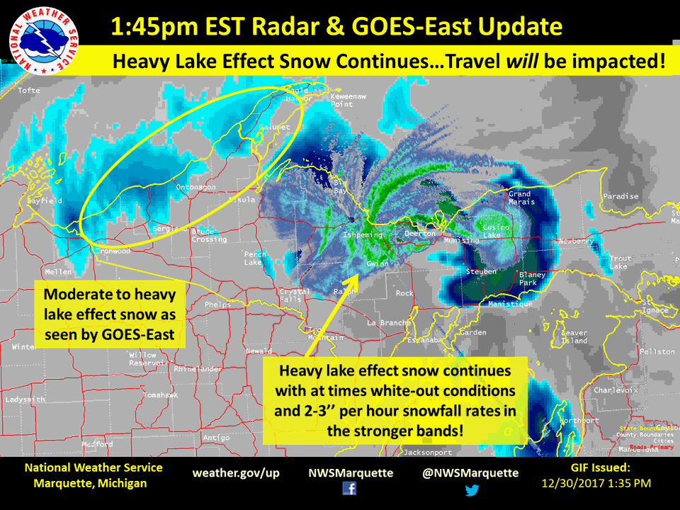
 Visible satellite imagery from GOES-East showing the impressive meso-lows coming onshore across Marquette and Alger Counties, and continued moderate to heavy lake effect snow across the west on the morning hours of December, 30th. |
Radar:
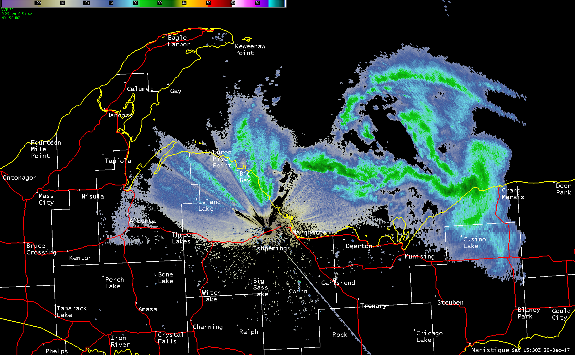
This radar section will highlight the heavy lake effect and the resulting deteriorating conditions across north central Upper Michigan as adequate radar coverage across the west, where additional moderate to heavy lake effect occurred throughout this event, are not available.
.gif) |
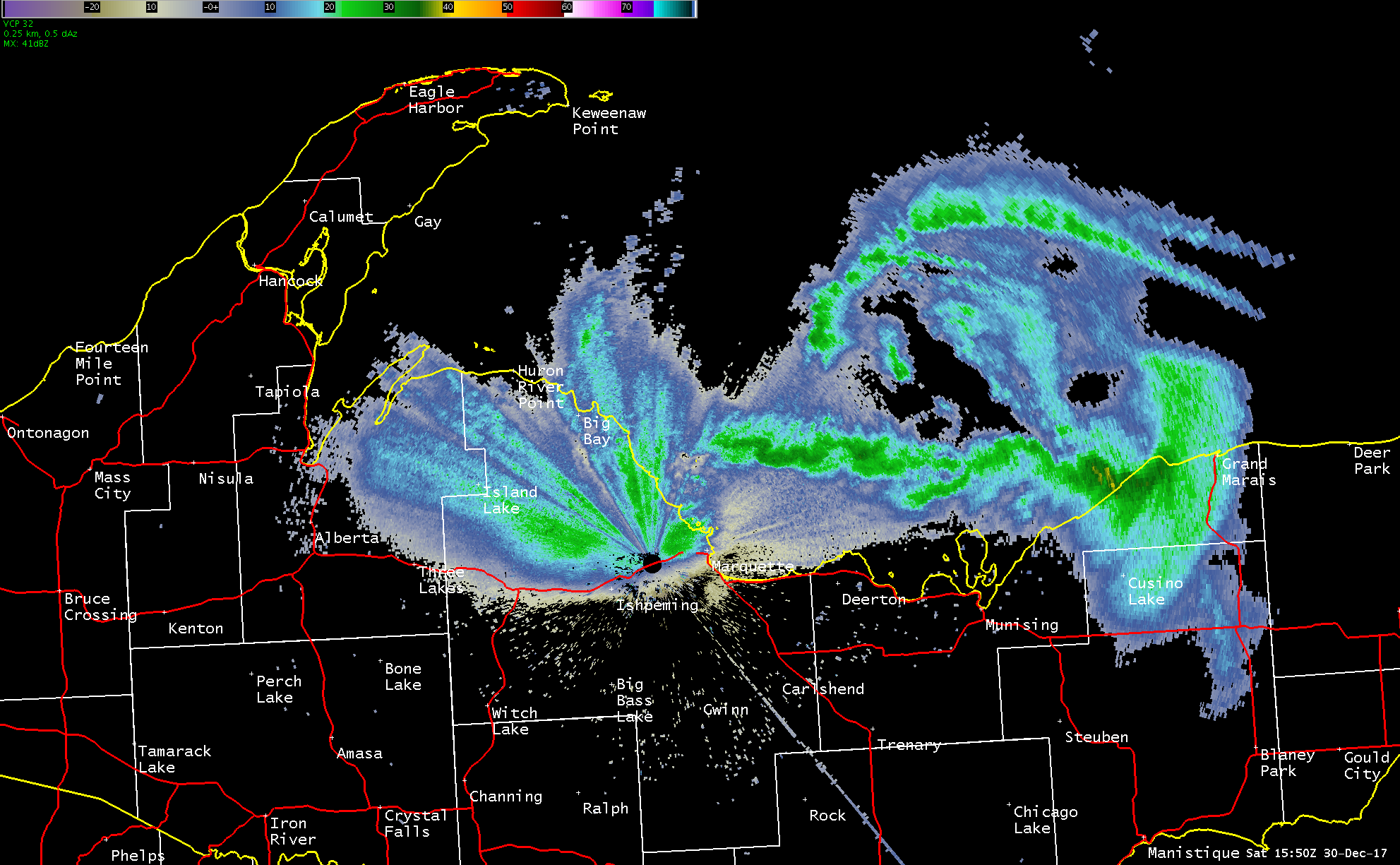
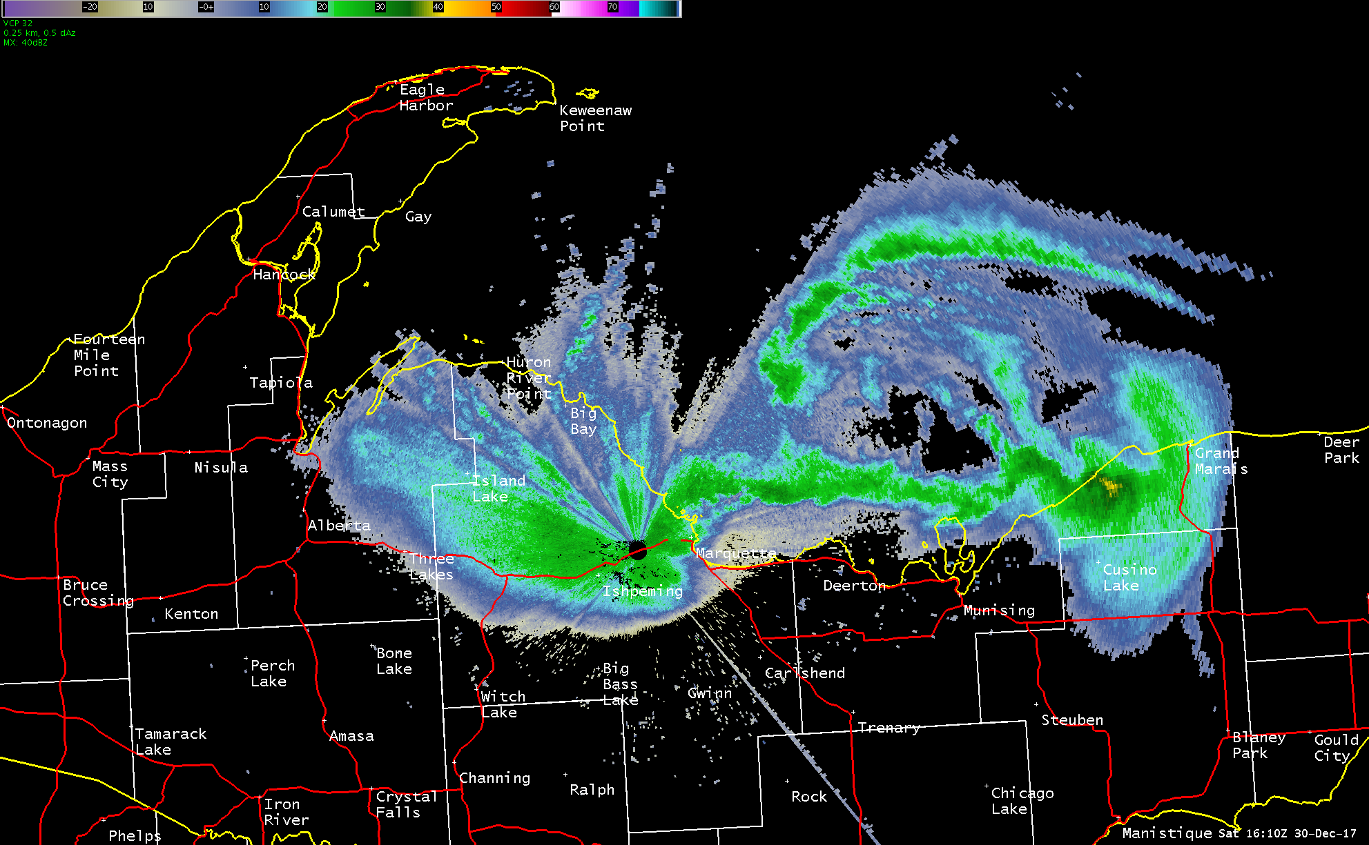
| Radar imagery from the morning of Saturday, December 30th through the morning hours of December 31st shows the evolution of the heavy lake effect snow across central Upper Michigan. |
Below is the evolution of the conditions at our forecast offices as the meso-low impacted north central Upper Michigan during the late morning through the afternoon hours on Saturday, December 30th.
 |
 |
 |
 |
 |
 |
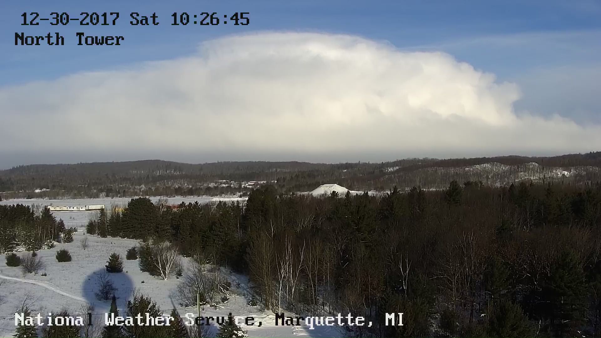
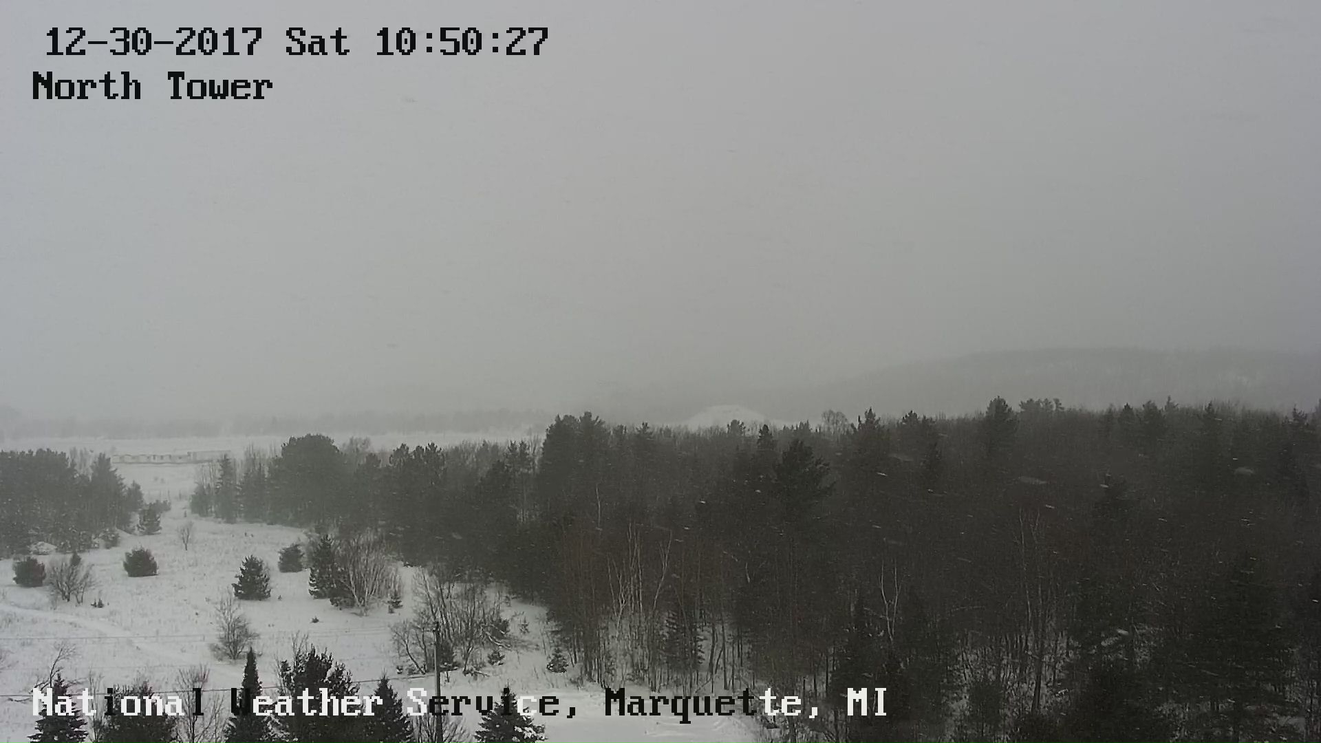
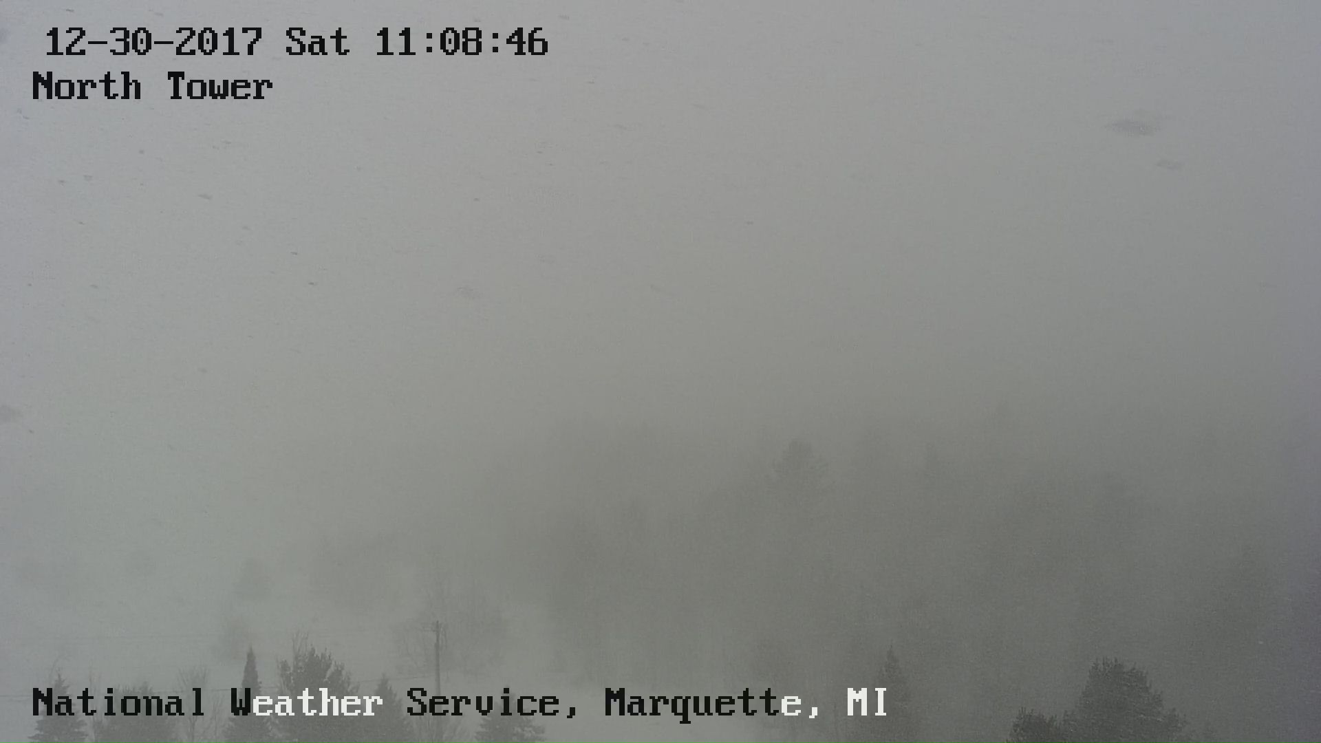
| Above are the corresponding views of the impressive meso-low both from our office webcam and on radar around 10:45am EST. | Above are the corresponding views of the impressive meso-low both from our office webcam and on radar around 10:50am EST. | Above are the corresponding views of the impressive meso-low both from our office webcam and on radar around 11:08am EST. |
Due to the lack of radar coverage out west and upper-level clouds early on during this event, below is the IR satellite imagery showing the widespread lake effect snow across the west and north central during the morning hours on Saturday, December 30th. At times, cloud-top temperatures of -35C to -45C were detected by GOES-East, thus showing just how deep and convective the strongest bands of lake effect snow were!
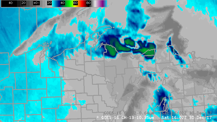 |
| IR Goes-East data during the morning of Saturday, December 30th, 2017. |
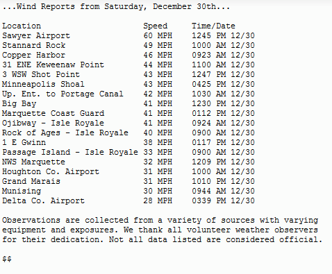
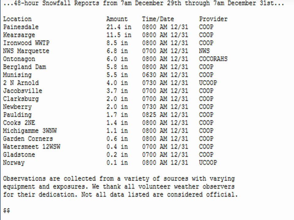
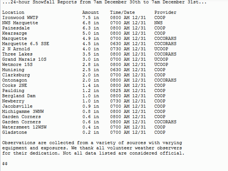
Storm Reports
Below are some of the highest recorded wind speeds and both 48-hr and 24-hr snowfall totals from this event. Most of the 24-hour snowfall totals from 7am December 30th through 8am December 31st occurred withing a 4 to 8 hour window when snow fell heavily. During the event on morning and afternoon hours of December 30th, 2-4'' per hour snowfall rates were reported and observed within the heavier bands of snow that pushed onshore, mainly across Marquette County.
 |
 |
 |
Environment
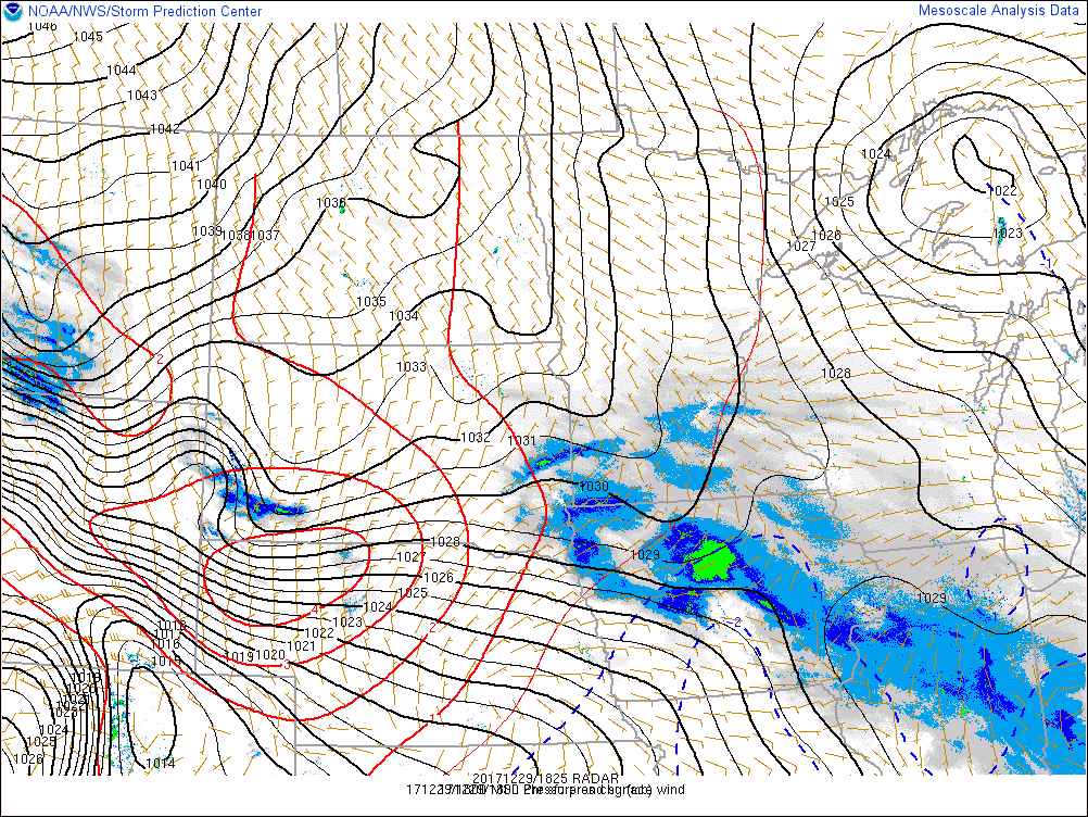
Below are various animations showing the evolution of the atmosphere across the region during the afternoon of Friday, December 29th through afternoon on the 30th as a shortwave trough rapidly dug across the Upper Great Lakes. The lingering surface trough that was already in place across Lake Superior strengthened slightly in response to height falls from the digging shortwave throughout the three day period. With the surface trough oriented primarily west to east across the region and lingering cold, arctic air still impacting the region, this allowed to heavy lake effect snow to impact the west beginning on December 29th. During the day on December 29th, a plethora of meso-lows were observed across the heart of Lake Superior as the synoptic-scale flow was relatively weak and enhanced convergence developed in certain locations. As the surface trough begin to strengthen and push south across Upper Michigan on morning of December 30th, the above mentioned meso-lows tracked across the lake and pushed inland across the tip of the Keweenaw, Marquette, and Alger Counties. With the surface and 850mb low tracking southeast across the region, this allowed the lake effect snow to transition from the west wind snow belts early on in the event to the north wind snow belts with the meso-low leading the way, and then eventually the northwest wind snow belts by Sunday, December 31st. Therefore, all of the Lake Superior snow belts saw accumulating snow during this event, with the most snow falling out west.
The other aspect of this event was the continued cold conditions and the strong, gusty winds that developed on the backside of the surface trough as it pushed inland. The strong winds led to blowing and drifting snow, but also worked in concert with the lingering cold conditions to create wind chills of 15 to 25 degrees below zero at times.
 |
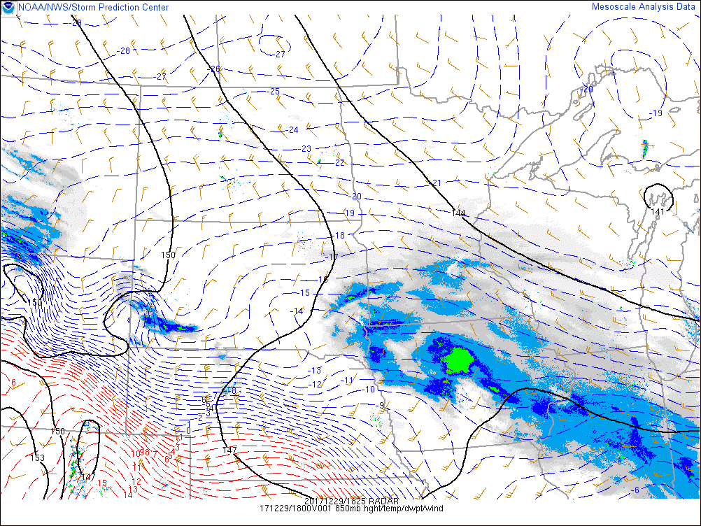 |
| Mosaic Radar, MSLP, 10-m winds, and 2-hr pressure changes | Mosaic Radar, 850mb heights, winds and temperatures |
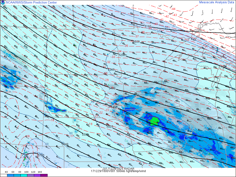 |
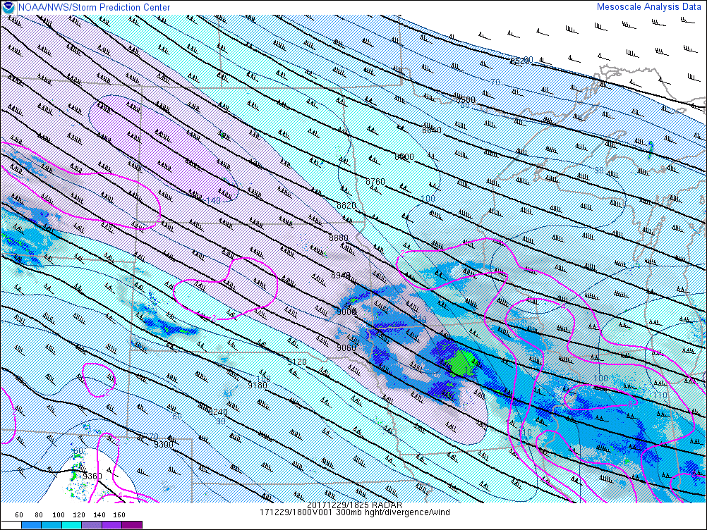 |
| Mosaic Radar, 500mb heights, winds (isotachs color filled) and temperatures | Mosaic Radar, 300mb heights, winds (isotachs color filled) and temperatures |
Low-level lapse rates are shown below with significant steepening due to the air-lake temperature differences resulting in significant lake-induces CAPE or instability, which allowed the lake effect snow bands through the first half of this event to become highly convective.
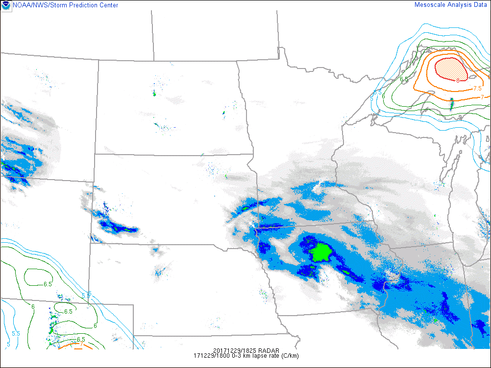 |
| Mosaic Radar, 0-3km lapse rates with numbers above 8.0 C/km color filled |
Social Media/Services
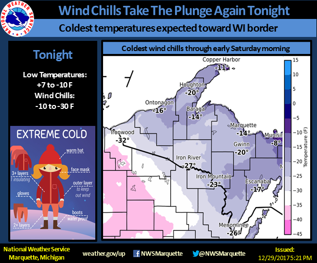
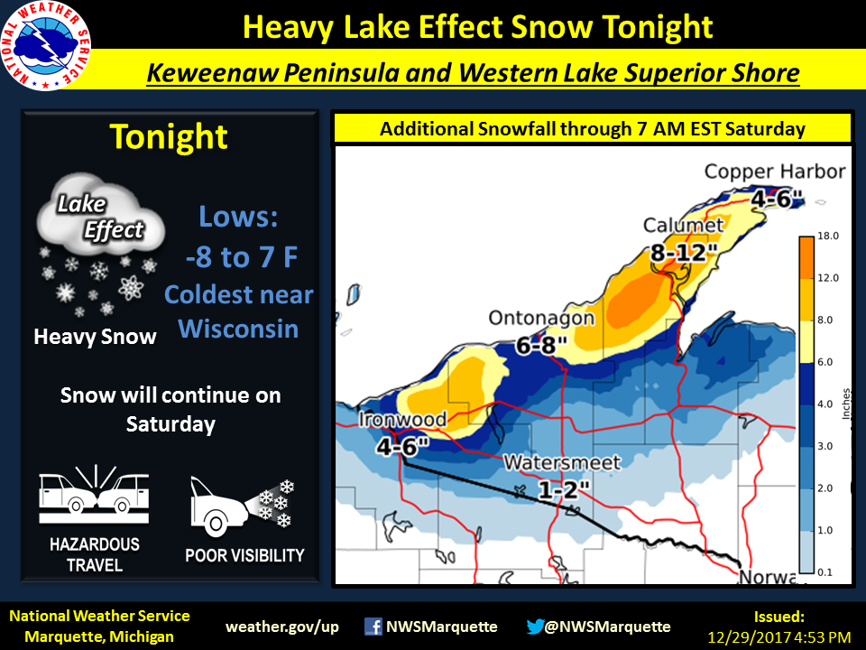
Weather stories highlighting the continued cold and expected snowfall and impacts for the event:
 |
 |
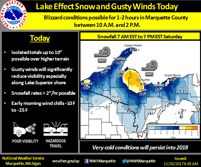 |
Nowcast Graphics issued during the event highlighting the heavy lake effect snow to help communicate expected deteriorating conditions and impacts:
 |
 |
 |
Media use of NWS Web News Stories is encouraged! Please acknowledge the NWS as the source of any news information accessed from this site. |
|

