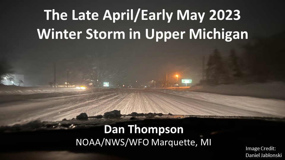
The Historic Late April/Early May 2023 Snowstorm
|
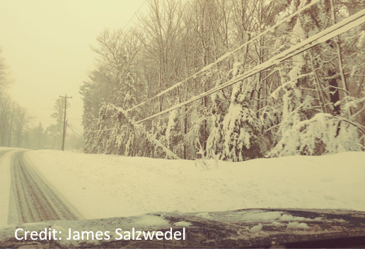
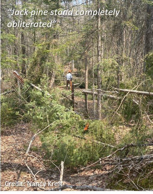
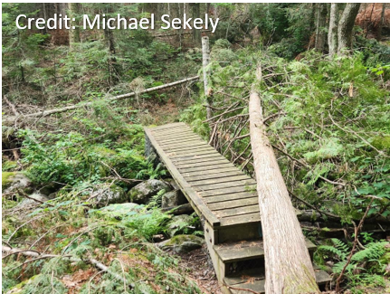
A historic late-season winter storm brought record snowfall and high winds to the UP between 29 April and 2 May, 2023, resulting in dangerous travel conditions, extensive tree damage, and numerous power outages. This event was the result of a slow-moving low pressure system that entrained copious moisture from the Gulf of America and Atlantic Ocean, providing favorable conditions for a long-duration, heavy precipitation event. Snowfall totals ranged from 9–18" over the western UP and 24–48" over the north-central, with May snowfall records broken in some areas. There was a sharp gradient in snowfall amounts along the Lake Superior shoreline due to warmer temperatures. Wind gusts of 40–50 mph combined with heavy, wet snow led to numerous power outages and hazardous to impassable road conditions. The subsequent melt-off of the record snowpack resulted in some flooding impacts as well. |
Click here for a complete list of snowfall reports from this storm |
Photos
 |
 |
 |
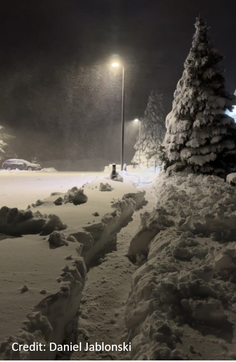
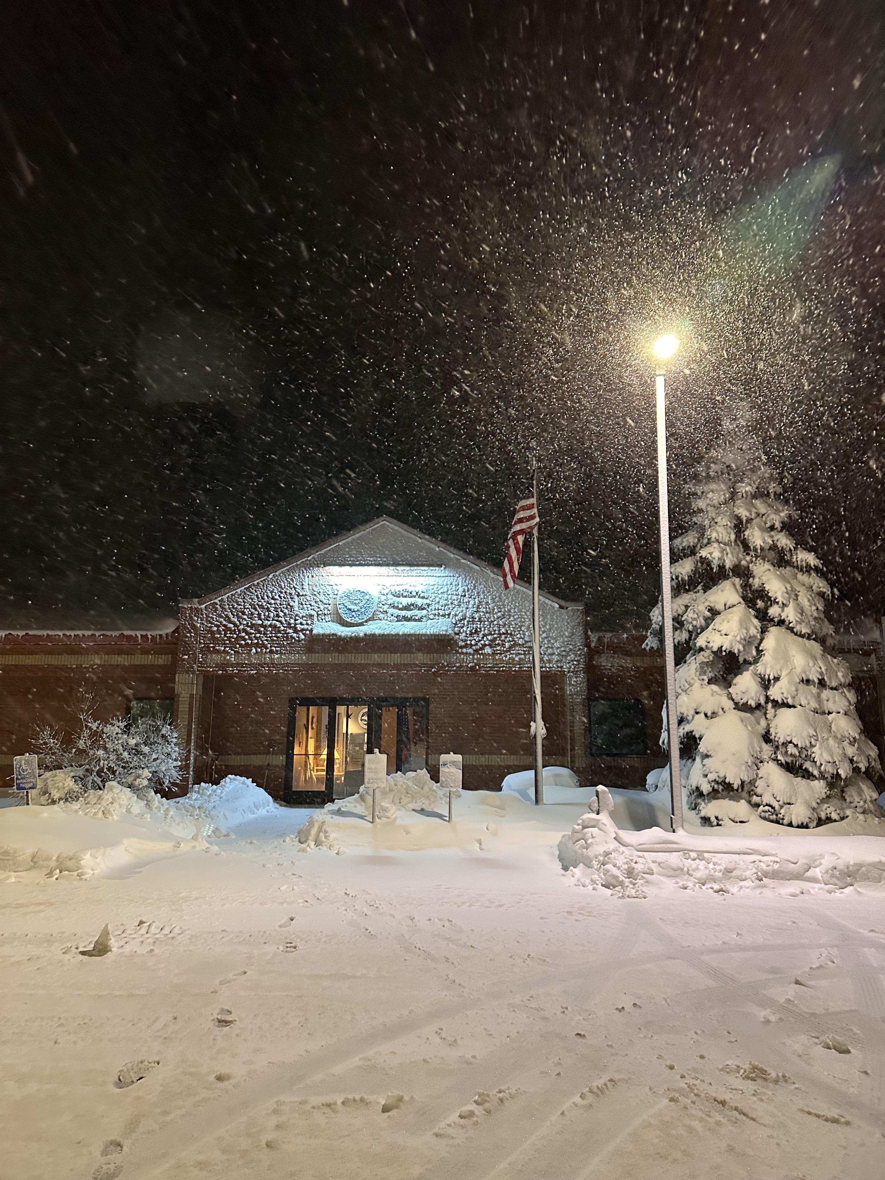
| At NWS Marquette | At NWS Marquette (Credit: Daniel Jablonski) | Near US41 and Brickyard Rd. |
 |
 |
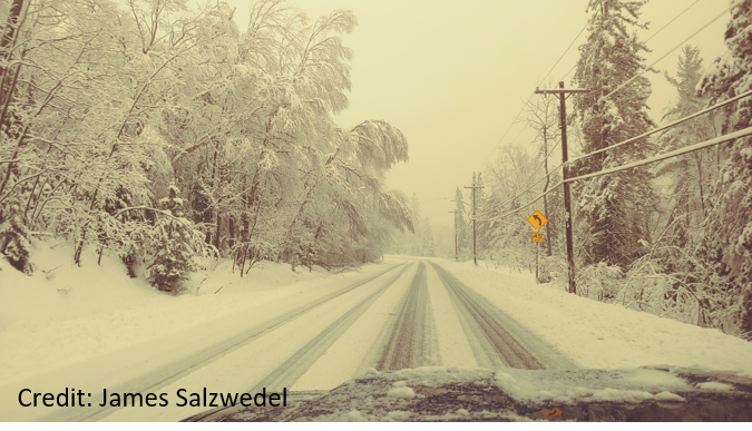 |
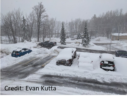
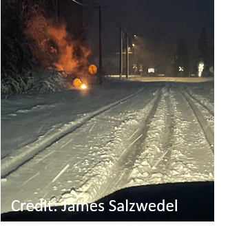
| Difficult road conditions in Little Lake | Downed tree due to heavy, wet snow in Tilden Township, Marquette County | Difficult travel conditions in Tilden Township, Marquette County |
 |
 |
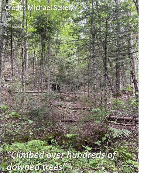 |
| Tree damage in Craig Lake State Park. Credit: Nancy Kreft via North Country Trail Association Marquette Chapter Facebook page | Tree damage in Craig Lake State Park. Credit: Michael Sekely via North Country Trail Association Marquette Chapter Facebook page | Tree damage in Craig Lake State Park. Credit: Michael Sekely via North Country Trail Association Marquette Chapter Facebook page |
Meteorology of this Storm
 |
Observations and Records
Click here for a complete list of snowfall reports from this storm
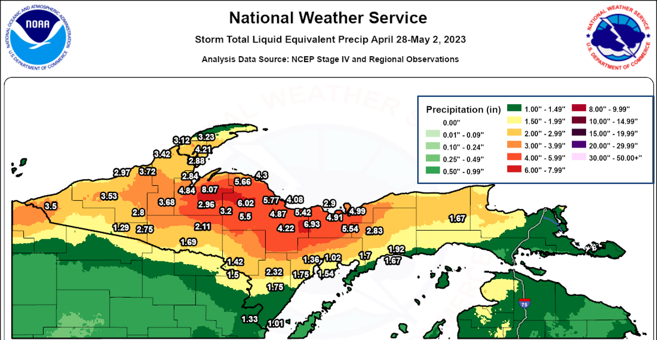
Click here for a complete list of liquid equivalent precipitation reports from this storm
.png) |
 |
| Approximate snowfall totals April 29-May 2, 2023. Numbers are actual observations from observers. Shading is a blend of interpolated observations and NOHRSC analysis. |
Approximate liquid equivalent totals April 29-May 3. Numbers are actual observations from observers. Shading is a blend of interpolated observations and NCEP Stage IV data.
|
 |
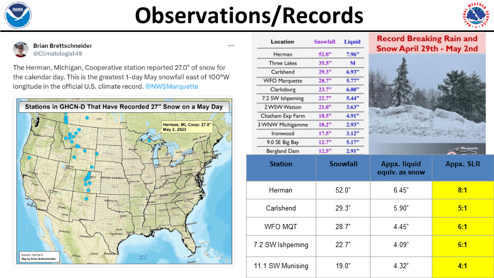 |
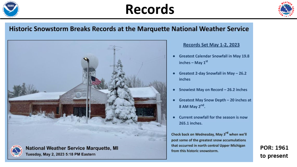
| Graphic showing records set at WFO Marquette | Selected observations and graphic courtesy Brian Brettschneider showing record 24-hour May snowfall east of the Rockies at Herman, MI. |
 |
Media use of NWS Web News Stories is encouraged! Please acknowledge the NWS as the source of any news information accessed from this site. |
|

