EF0 Tornado Confirmed in Iron County
Thunderstorms that moved across portions of western Upper Michigan back on Friday, April 30th produced a tornado in Iron County.
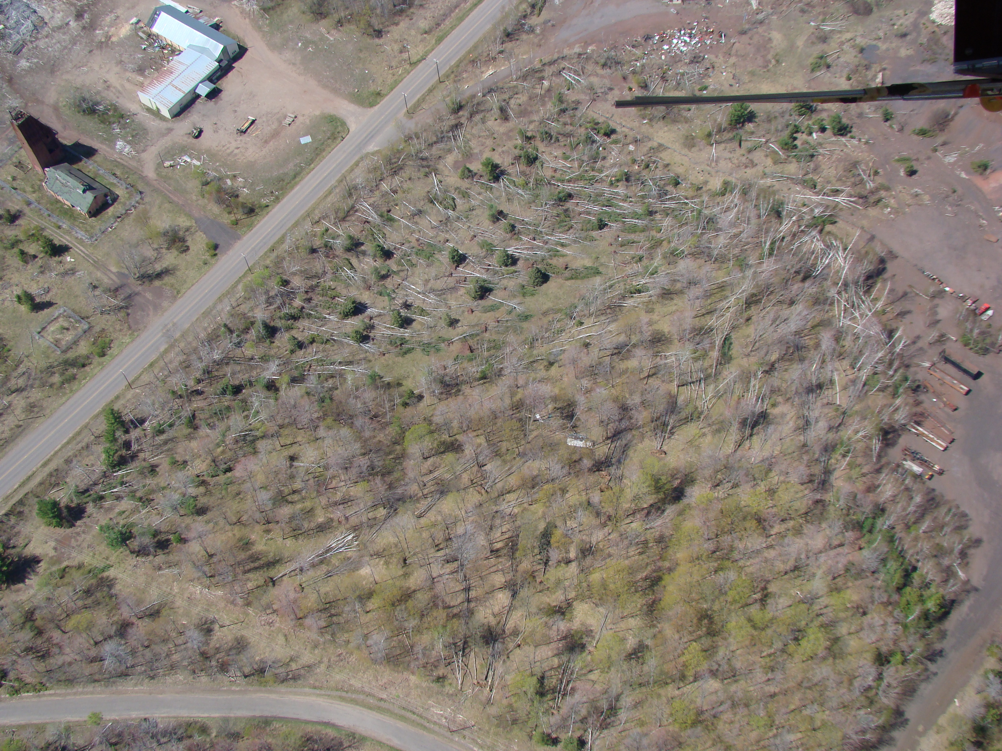
The National Weather Service in Marquette conducted a ground survey of storm damage and analyzed aerial photographs provided by the Michigan DNR. The result of the analysis and survey indicated that the damage was caused by a tornado.
The tornado touched down at 5:50 PM CDT on Friday, April 30th just west of Homer Road between Forbes Road and West Mineral Avenue approximate 1 ½ miles northwest of Iron River. The tornado then tracked northeastward across Homer Road and lifted in an open area just south of Forbes Road. The tornado was on the ground for just under a half mile (.40 miles) and had an average width of about 100 yards. The maximum wind speeds were estimated at 85 mph, which made it a strong EF0 tornado on the Enhanced Fujita scale.
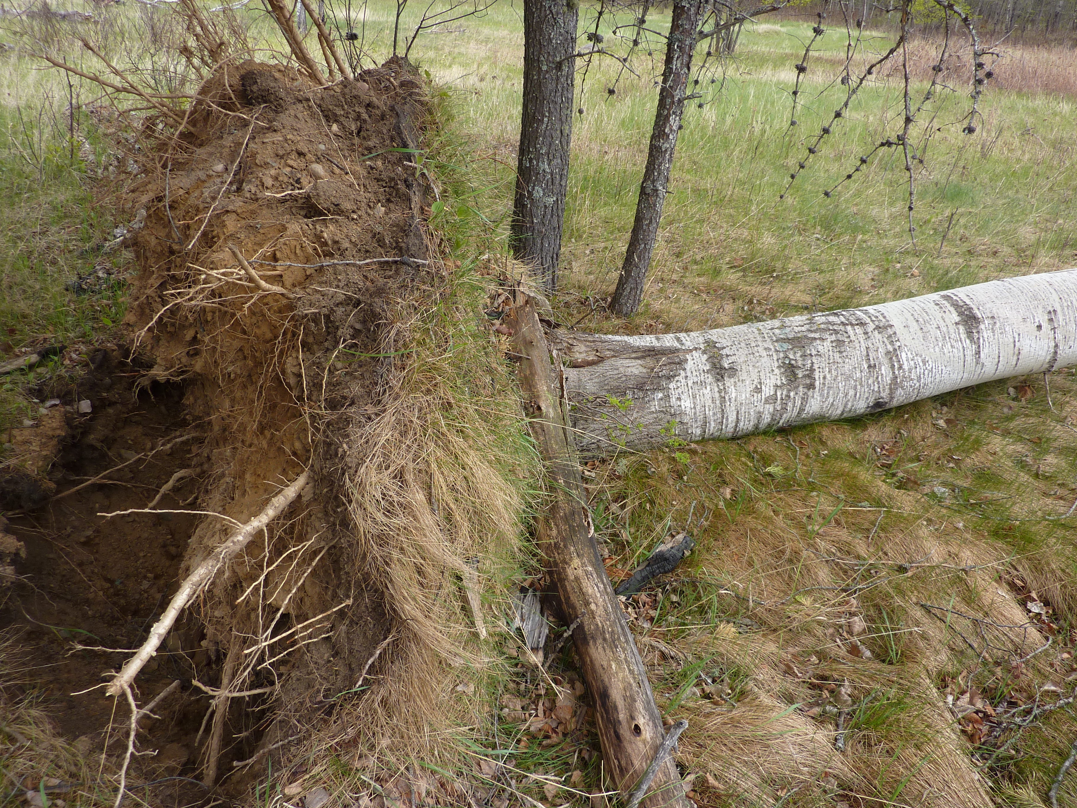
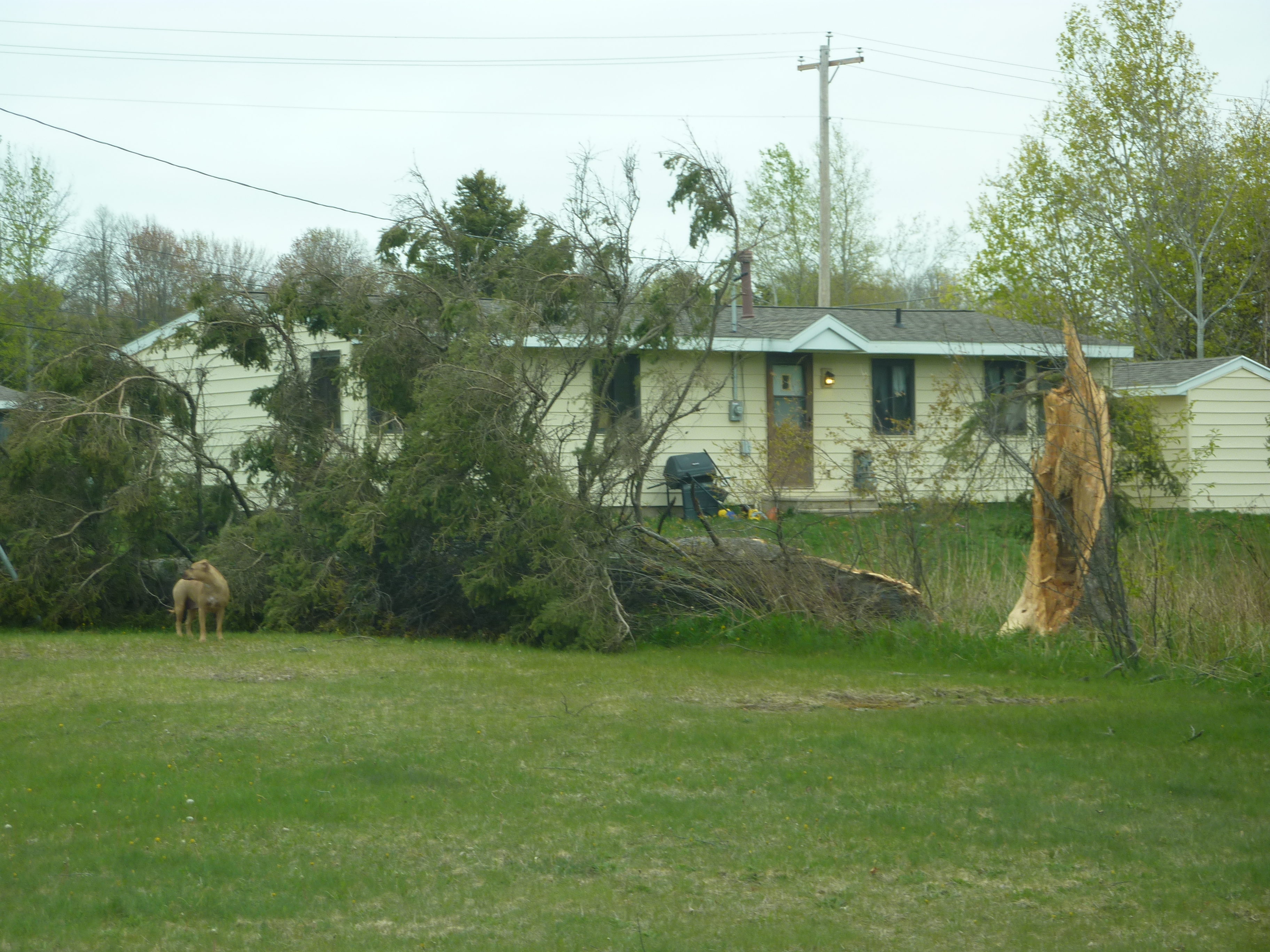
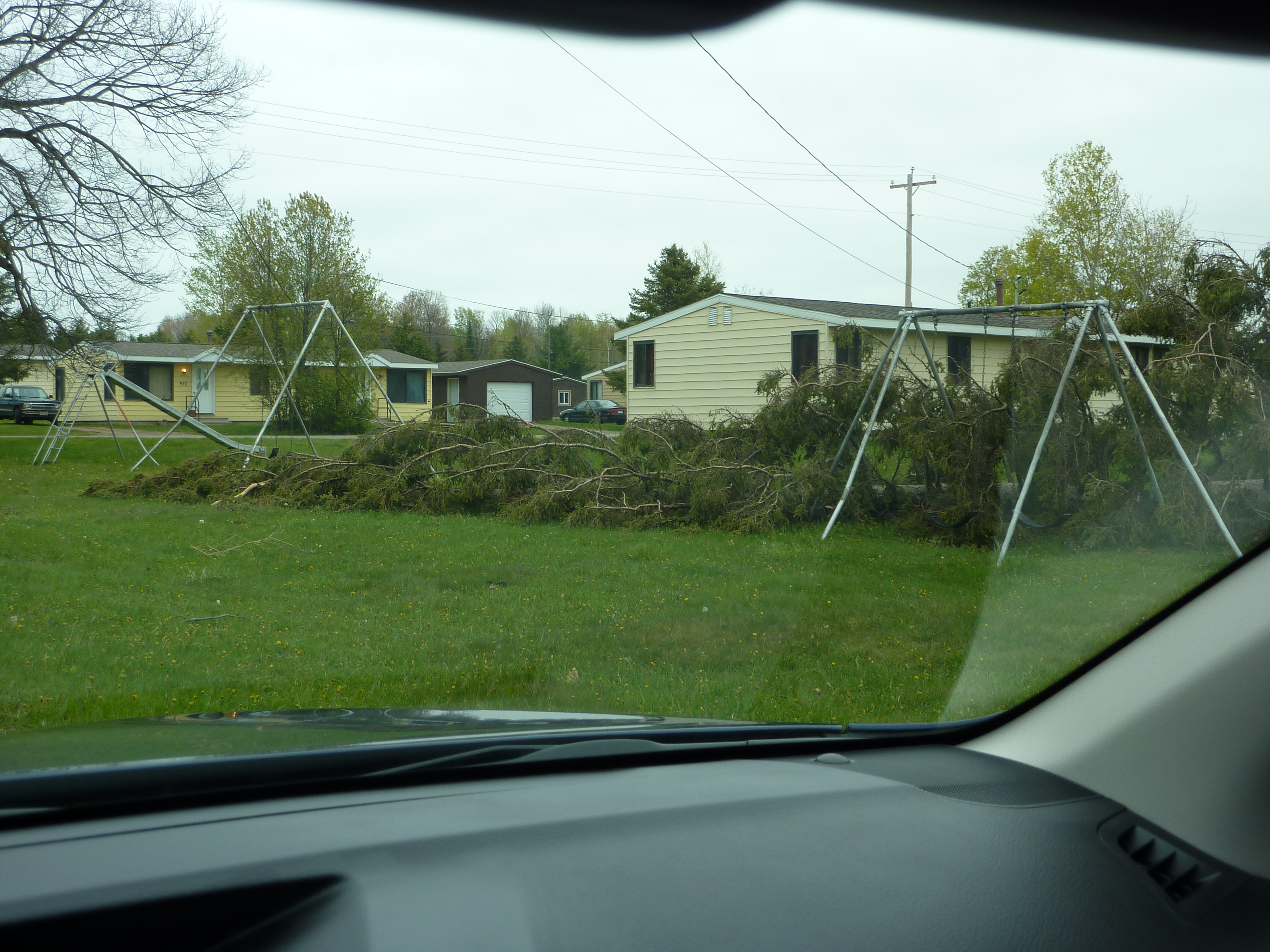
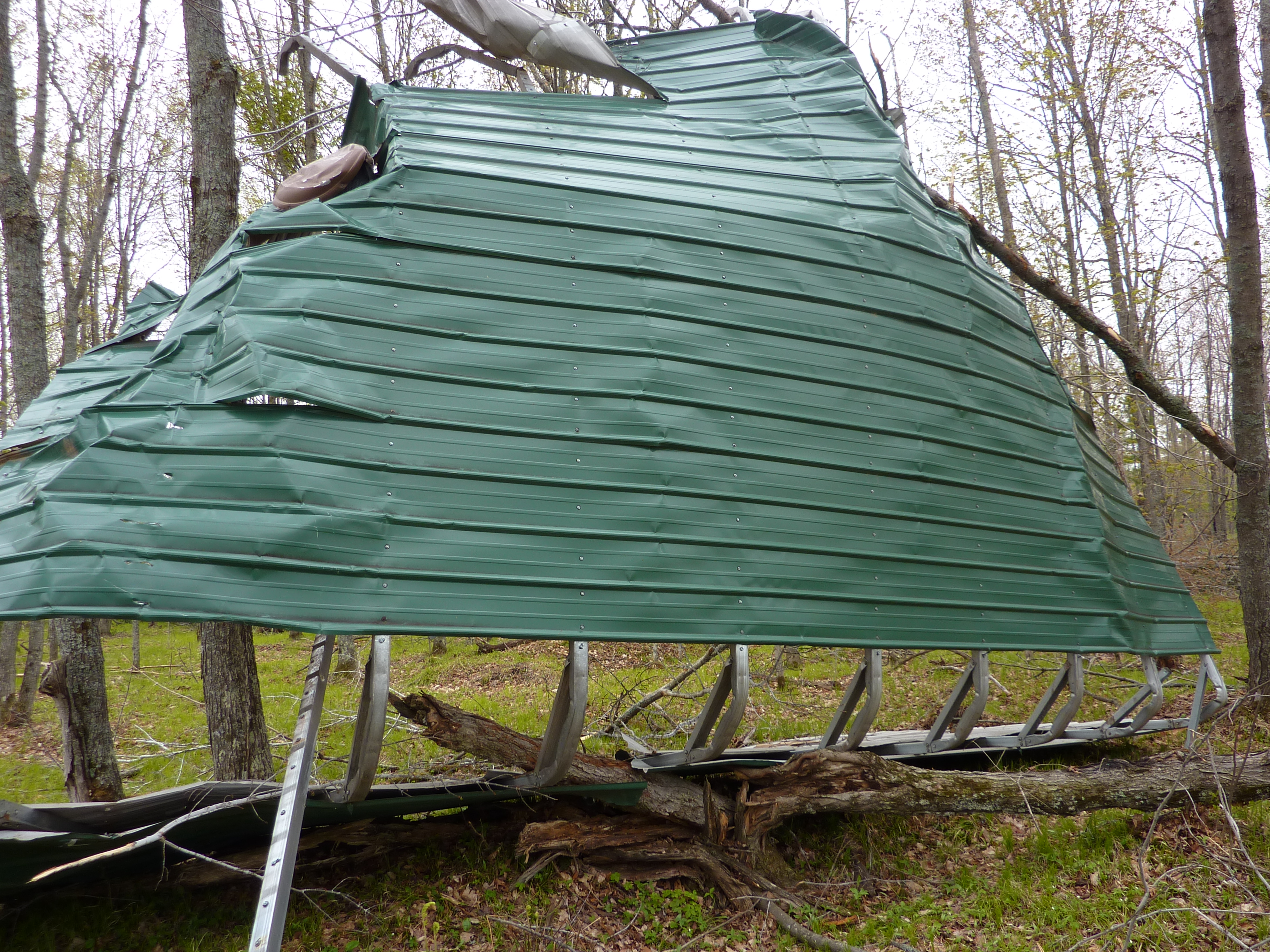
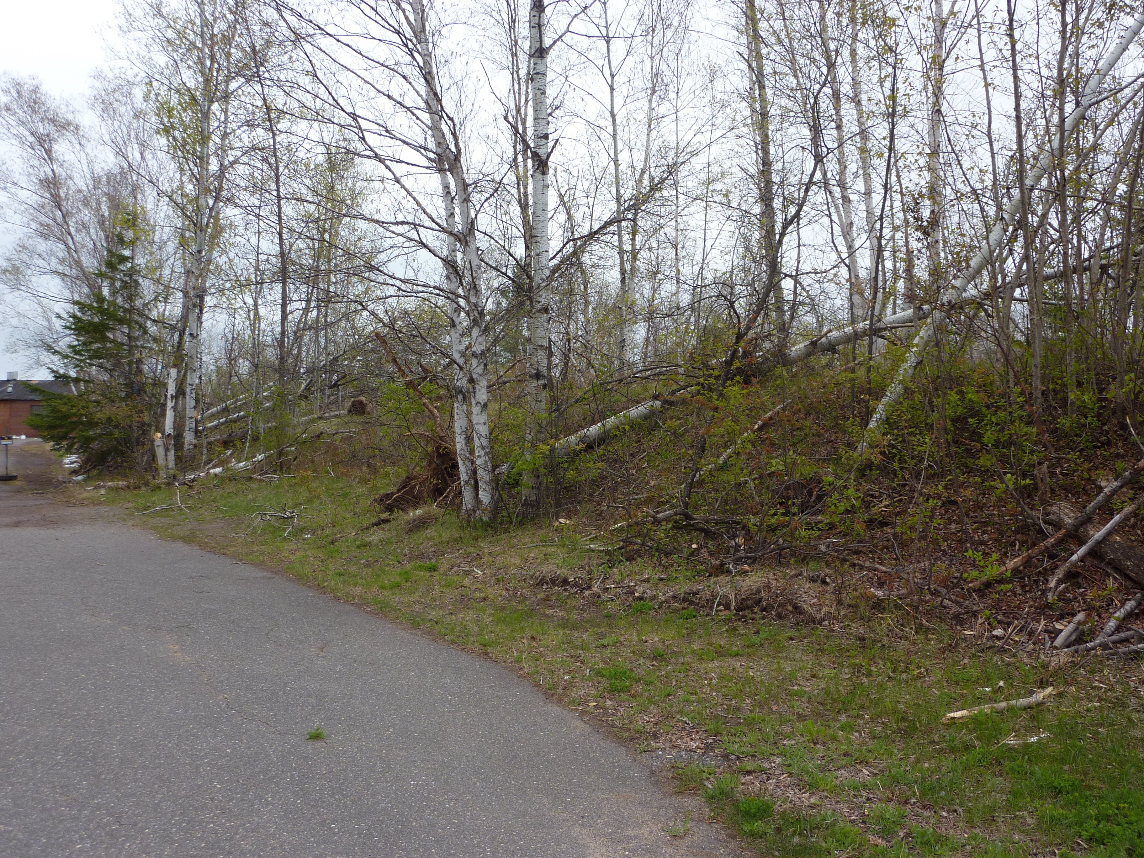
Fortunately, most of the significant damage was confined to uprooted trees but there appeared to be some roof damage and damage to a few out buildings near the path of the tornado.
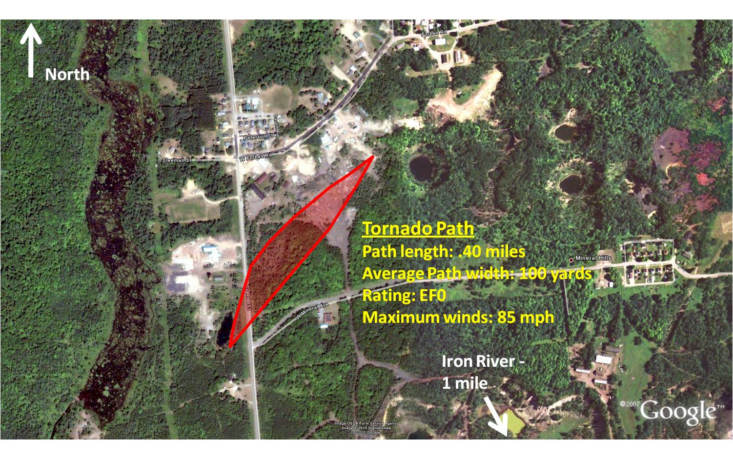 |
| Approximate path of the Iron County Tornado. |
 |
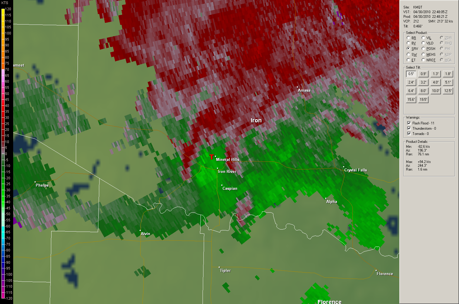 |
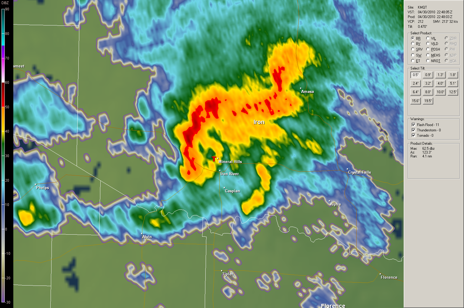
| Radar base reflectivity (left) and storm relative velocity (right). This brief spin-up looks as if it would have been rain-wrapped and tough to detect as the rotation signature was not incredibly tight. With that said, the storm does show broad rotation as indicated by the reds (outbound velocity) and greens (inbound velocity) in close proximity. | |
The images below are from the National Weather Service storm survey and analyzed aerial photographs provided by the Michigan DNR. The result of the analysis and survey indicated that the damage was indeed caused by a tornado.
 |
 |
 |
 |
 |
 |

