Overview
|
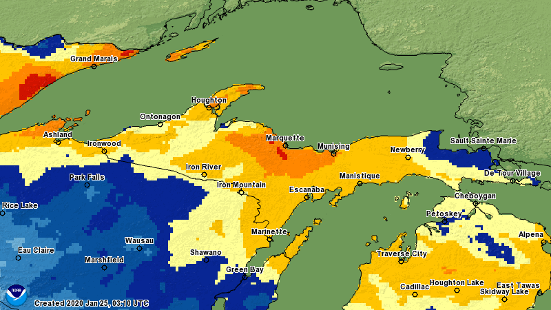
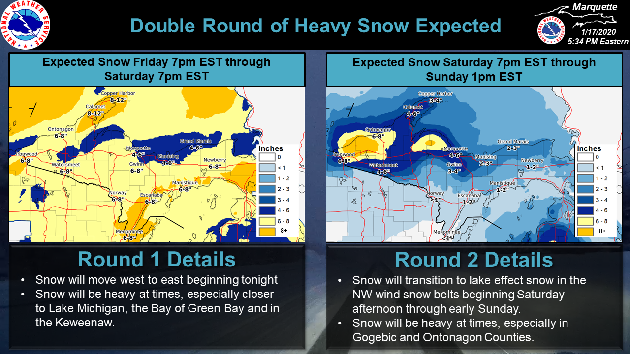
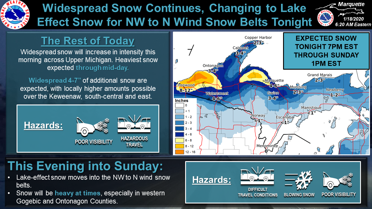
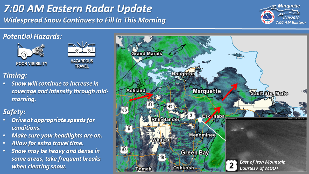
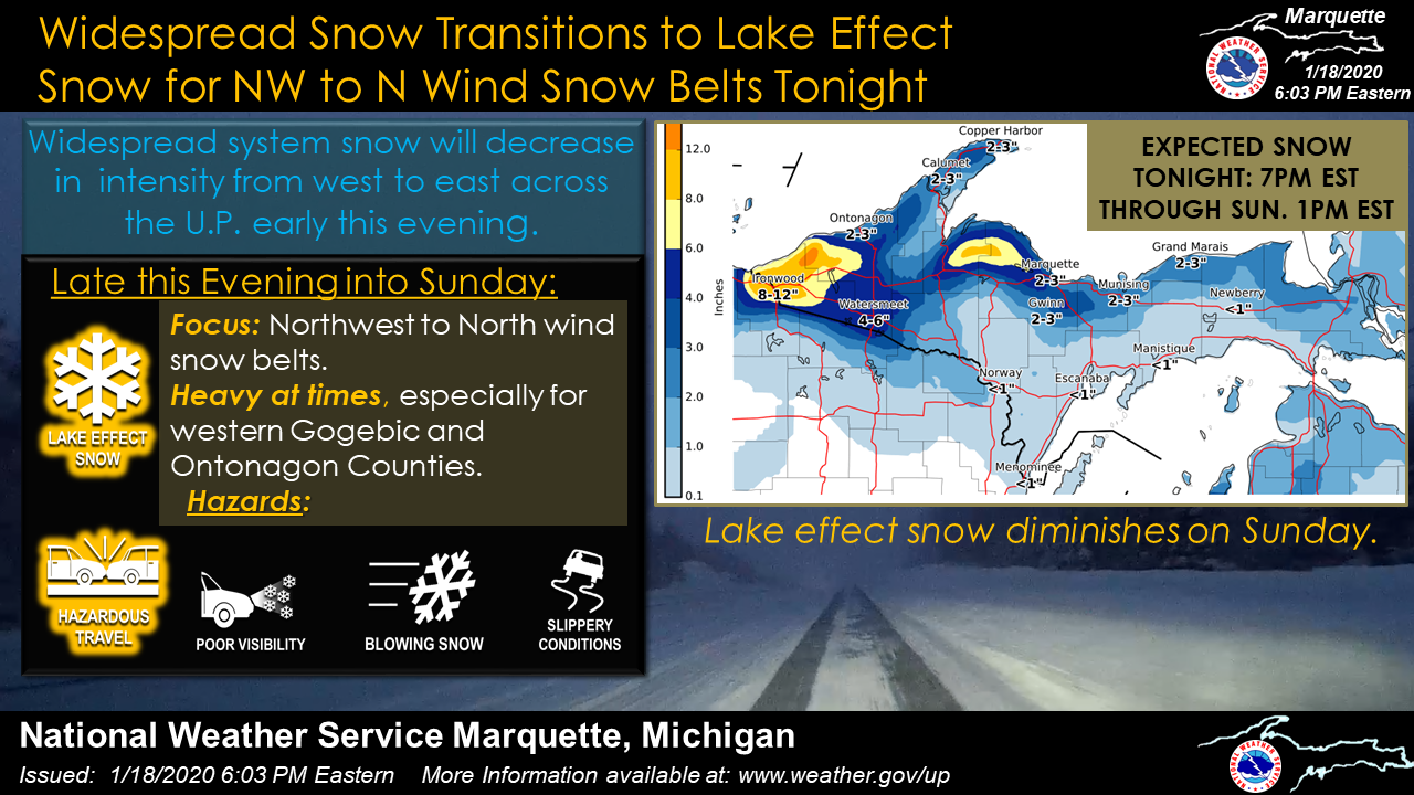
A winter storm affected all of Upper Michigan the weekend of January 18-19, 2020. Light snow began late Friday night January 17, then became heavy over central and eastern parts of Upper Michigan the following morning. Snowfall rates of 1-2 inches per hour were observed in many locations. Lake-enhancement from Lake Michigan also contributed to heavier snowfall rates in areas downwind of the lake. Snow tapered off Saturday afternoon in most areas, but transitioned to lake-effect snow bands in the north wind snow belts that continued through Saturday night. The highest snow amounts were on the Keweenaw Peninsula where east wind contributed to lake enhancement Saturday morning, and then lake-effect continued through Saturday night. Higher totals were also observed along the rest of the western shore of Upper Michigan down to Ironwood. |
Loop of radar images and Mean Sea Level Pressure analysis for the storm
|
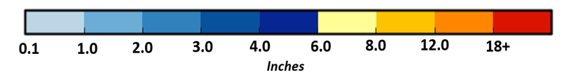
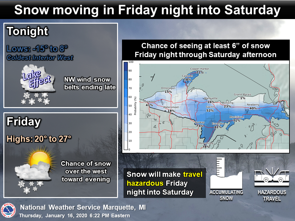
Social Media Graphics
 |
 |
 |
| Thursday evening update | Friday morning update | Friday evening update |
 |
 |
 |
| Saturday morning update | Saturday morning radar update showing hazardous driving conditions | Saturday evening update |
Environment
 |
 |
 |
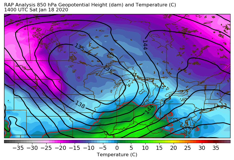 |
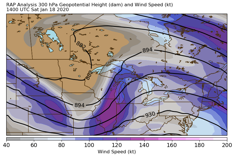
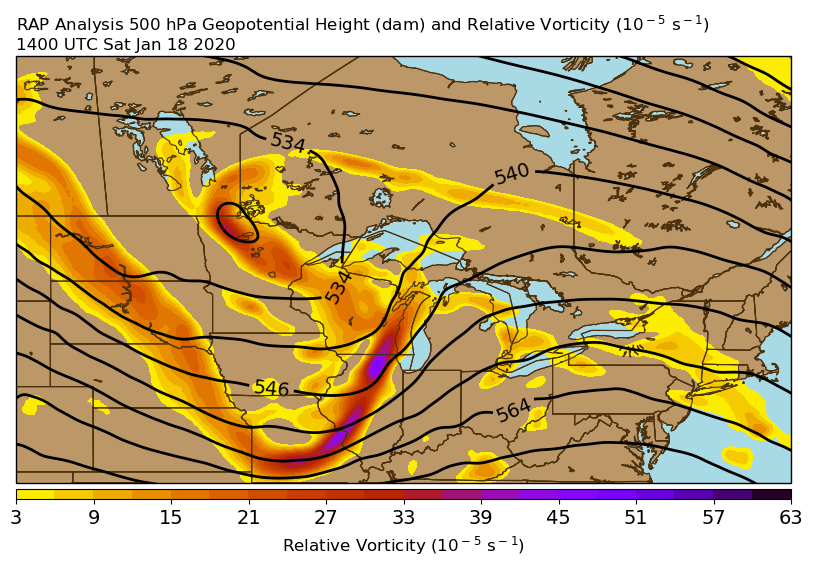
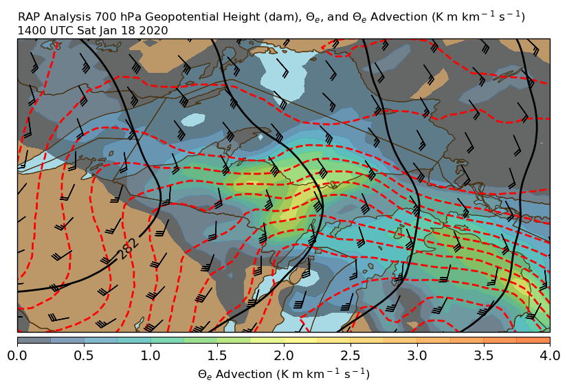
| 300 mb Height and Wind at 14z (9 am EST) Saturday, January 18 | 500 mb Height and Vorticity at 14z (9 am EST) Saturday, January 18 | 700 mb Height and Theta-e Advection at 14z (9 am EST) Saturday, January 18 | 850 mb Height and Temperature at 14z (9 am EST) Saturday, January 18 |
 |
Media use of NWS Web News Stories is encouraged! Please acknowledge the NWS as the source of any news information accessed from this site. |
|