Overview
|
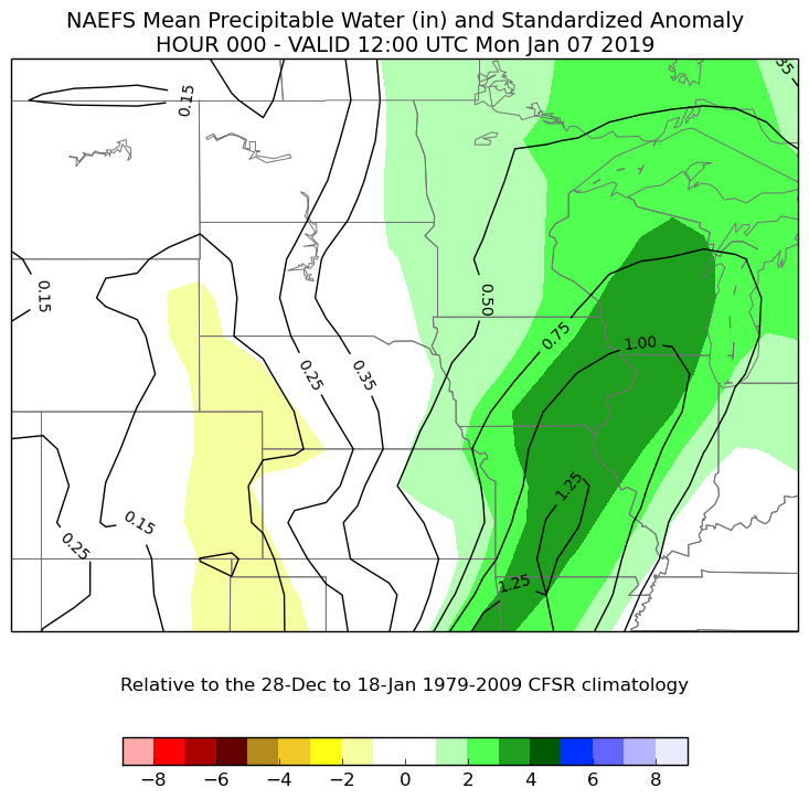
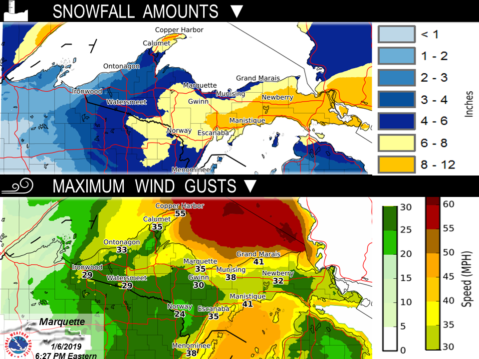
The combination of an anomalously high precipitable water for this time of year worked in concert with strong synoptic-scale lift, as shortwave energy lifting through the region took on a negative tilt, to bring accumulating wet, heavy snow across much of the Upper Peninsula on Monday, January 7th, 2019. As the mid-level trough axis shifted from a neutral to negative tilt throughout the event, this allowed ongoing strong warm air advection/istentropic lift and vorticity advection to line up, favoring strong, deep lift across the region. Snow that fell took on a very wet, dense characteristics as the majority of the lift fell outside of the dendritic growth zone. This wet, heavy snow make for very difficult travel at times across the Upper Peninsula, especially Monday morning through the afternoon hours. The highest snowfall amounts were observed across central and eastern Upper Michigan, and then across the tip of the Keweenaw Peninsula where southeast winds aided in additional moisture off of the Great Lakes and lift was locally enhanced due to upslope flow across the areas. |
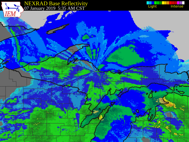 Radar loop that shows the initial surge of snow early Monday Morning across all of Upper Michigan, and then additional wet, heavy snow impacting mainly the tip of the Keweenaw Peninsula and central and eastern Upper Michigan through the rest of the day on Monday. |
 |
 |
 |
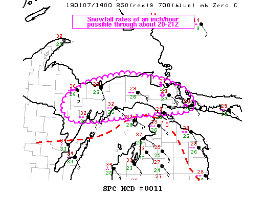
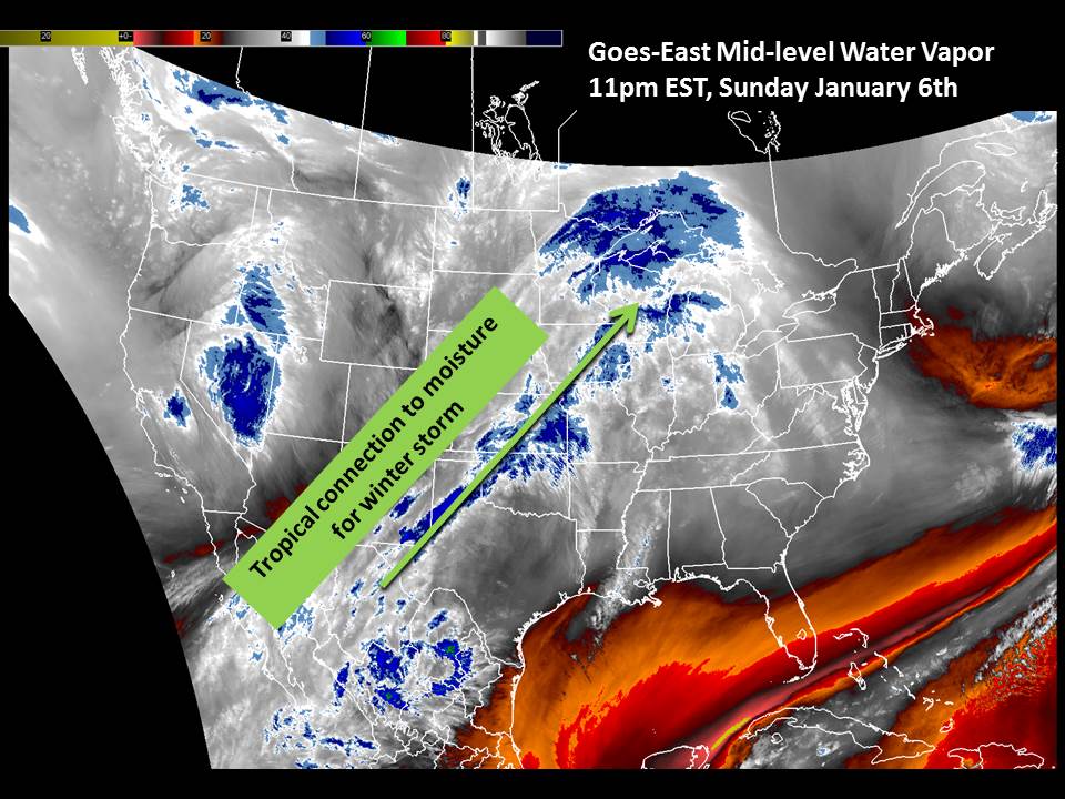
| Mesoscale Discussion Issued by the Storm Prediction Center just before 11am EST highlighting the potential for high snowfall rates. Details can be found at: https://www.spc.noaa.gov/products/md/md0011.html | Mid-level water vapor showing a tropic connection to remnants of Pacific Moisture feeding into our winter storm ahead of the main longwave trough moving across the central CONUS late Sunday night into early Monday morning. | The tropical connection allowed for anomalously deep moisture, all the way through 500 mb (around 15,000-20,000 feet above ground level). Image courtesy of the NWS Western Region Ensemble Situational Awareness Table. |
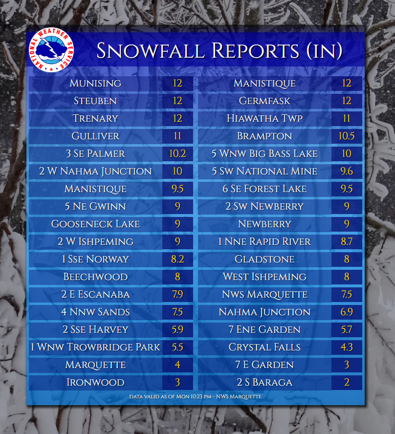
Snowfall Reports:
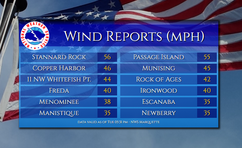
Peak Wind Gusts:
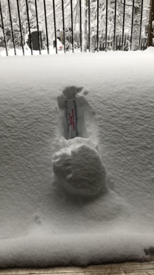
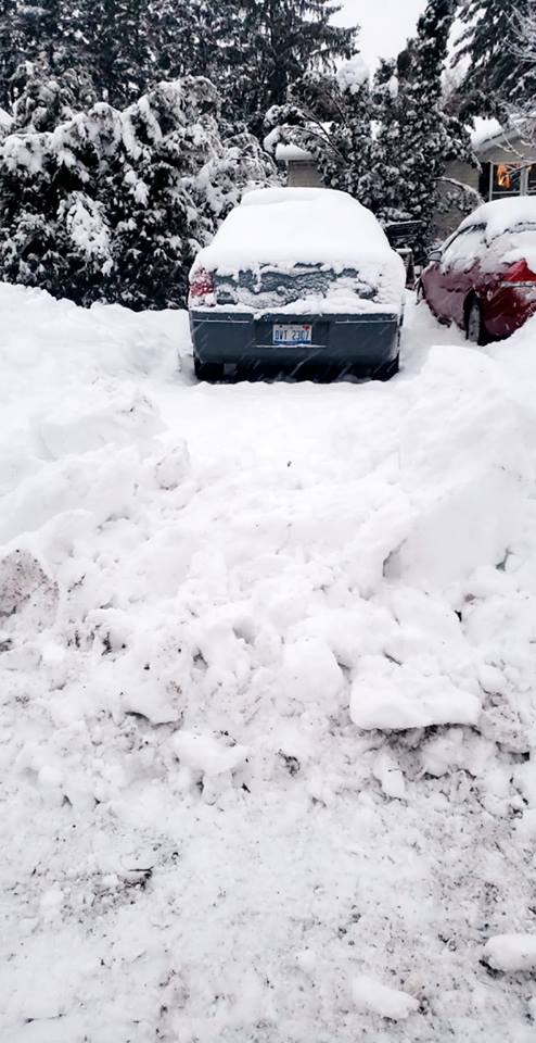
Photos & Video:
Coming Soon!
 |
 |
 |
 |
| Ishpeming Courtesy Ray Wickham |
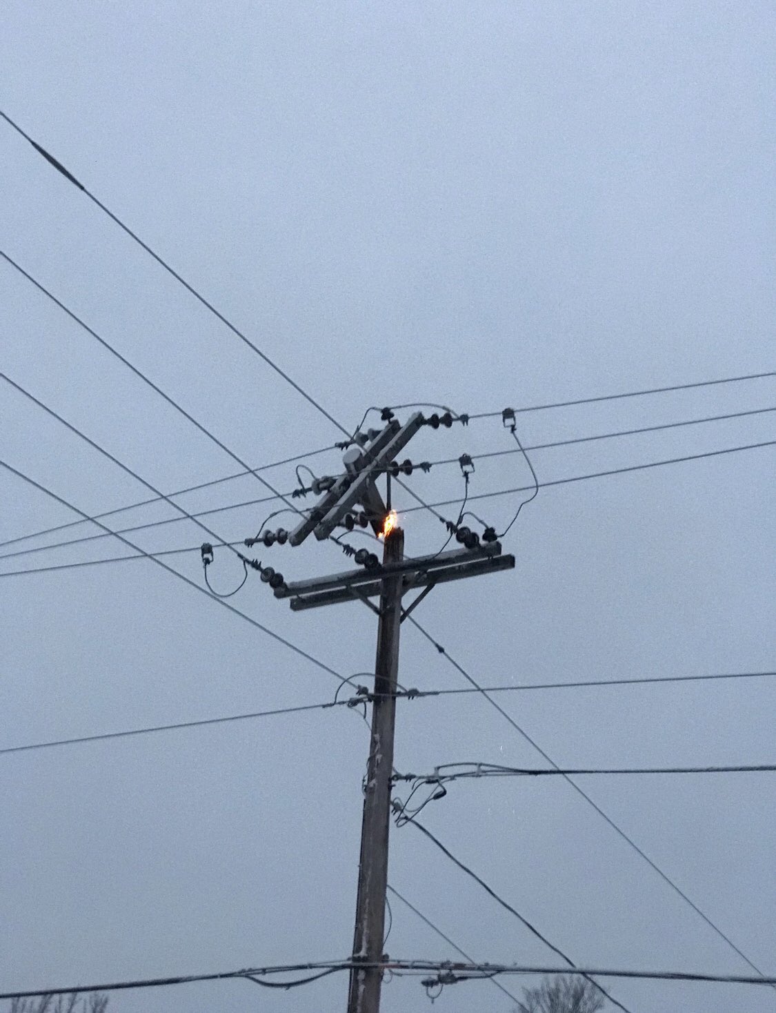
A power pole on fire in Ishpeming Courtesy UPPCO Twitter |
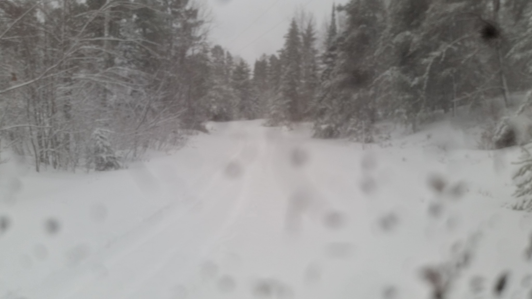
Lac La Belle; 14 inches of new snow Courtesy Steve Erbisch |
Manistique; 12 inches of new snow Courtesy Dakota Goldi |
Environment:
More updates coming soon!
Anomalously deep amount of moisture associated with this system due to the tropical connection all the way from the Pacific, and the anomalously strong low-level jet of 50 to 60 knots.
|
 |
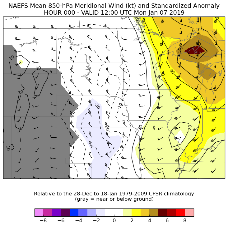 |
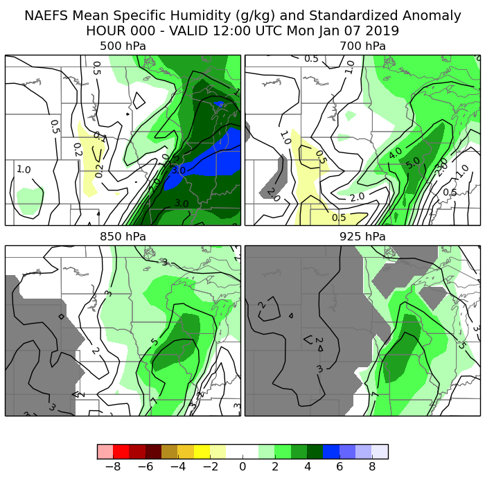
| Goes-East Mid-level water vapor as of 11pm EST on Sunday night into early Monday morning. | Mean Precipitable Water and Standardized Anomalies. Image courtesy of the NWS Western Region Ensemble Situational Awareness Table. | Mean 850 mb meridional (southerly component to the wind in this case) and Standardized Anomalies. Image courtesy of the NWS Western Region Ensemble Situational Awareness Table. |
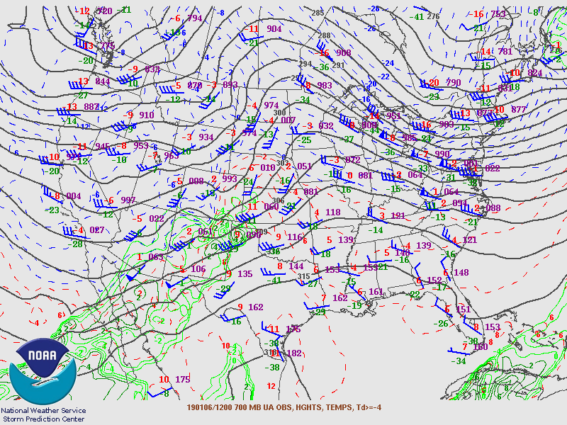
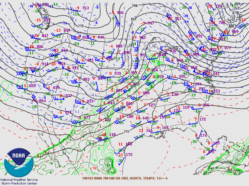
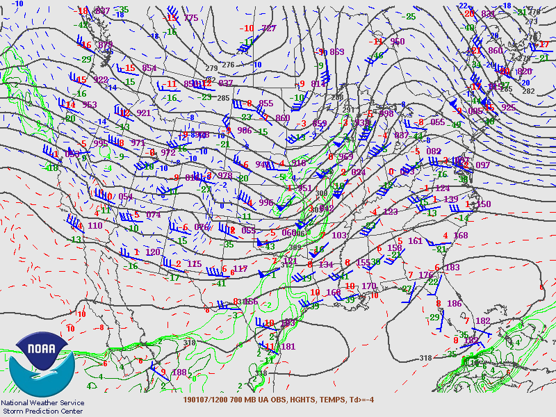
700 mb analysis:
 |
 |
 |
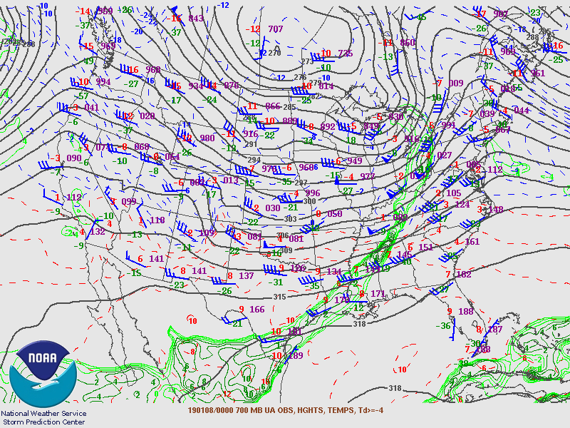 |
| 700 mb Analysis - 7am EST Sunday, January 6th | 700 mb Analysis - 7pm EST Sunday, January 6th | 700 mb Analysis - 7am EST Monday, January 7th | 700 mb Analysis - 7pm EST Monday, January 7th |
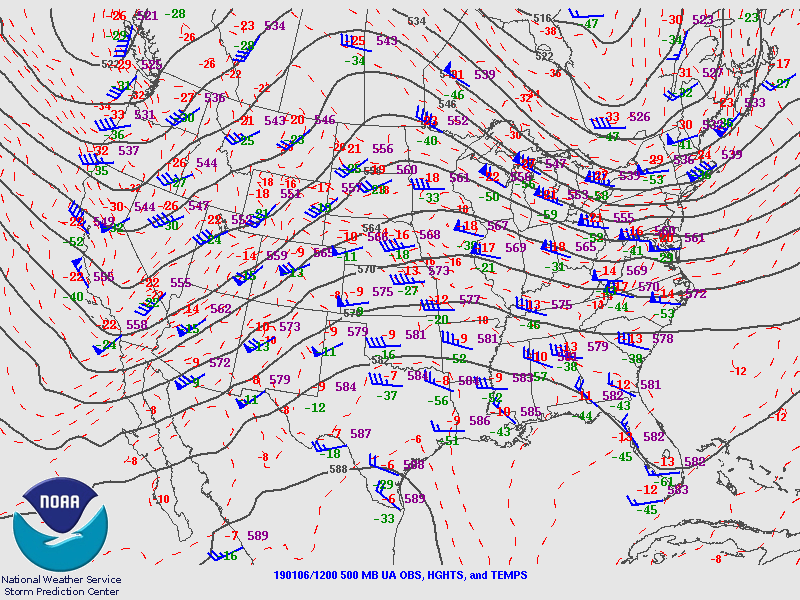
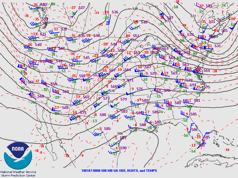
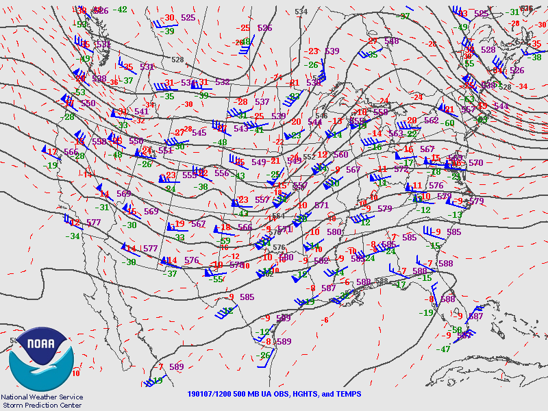
500 mb analysis:
 |
 |
 |
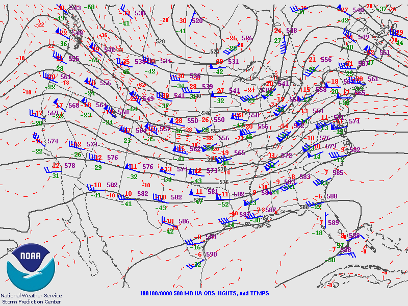 |
| 500 mb Analysis - 7am EST Sunday, January 6th | 500 mb Analysis - 7pm EST Sunday, January 6th | 500 mb Analysis - 7am EST Monday, January 7th | 500 mb Analysis - 7pm EST Monday, January 7th |
Services Provided:
Weather Stories/Social Media
 |
 |
||
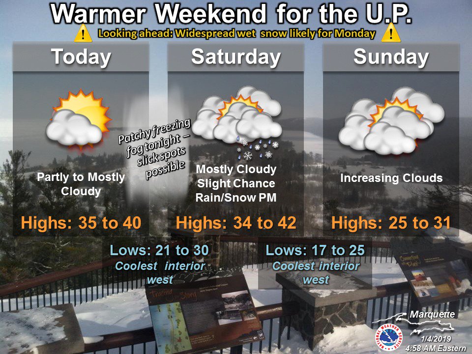
| Friday Morning's Weather Story | Friday Evening's Weather Story Update | ||
 |
 |
 |
|
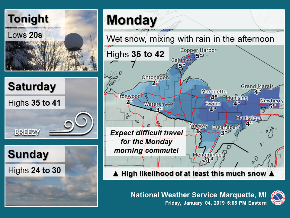
| Saturday Morning Weather Story | Saturday Morning Messaging of Hazards for Monday | Saturday Evening Weather Story Update | |
 |
 |
 |
|
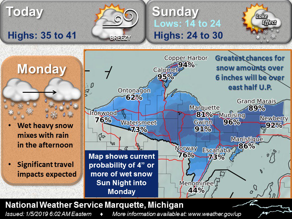
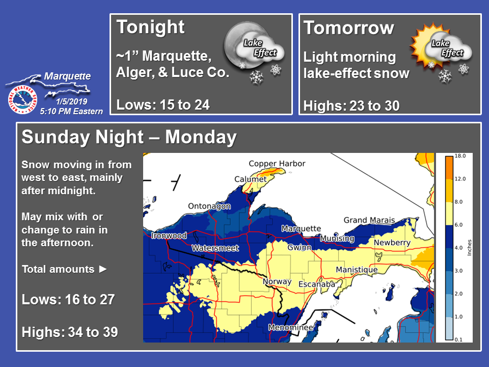
| Sunday Morning Snowfall Updates | Sunday Morning Timing Graphic | Sunday Morning Updated Hazards for Monday | |
 |
 |
 |
|
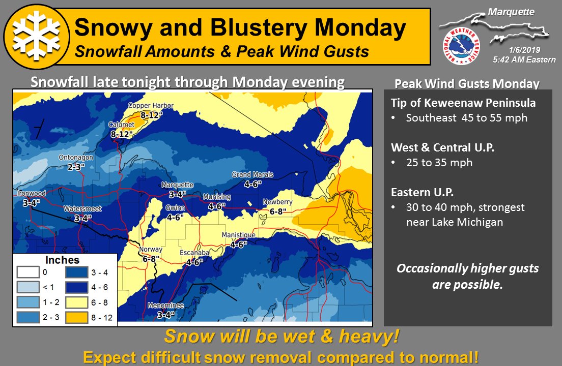
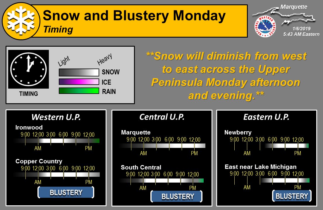
| Sunday Evening Snowfall Updates | Sunday Evening Timing Update | Sunday Evening Update on Winter Storm Warning | |
 |
 |
 |
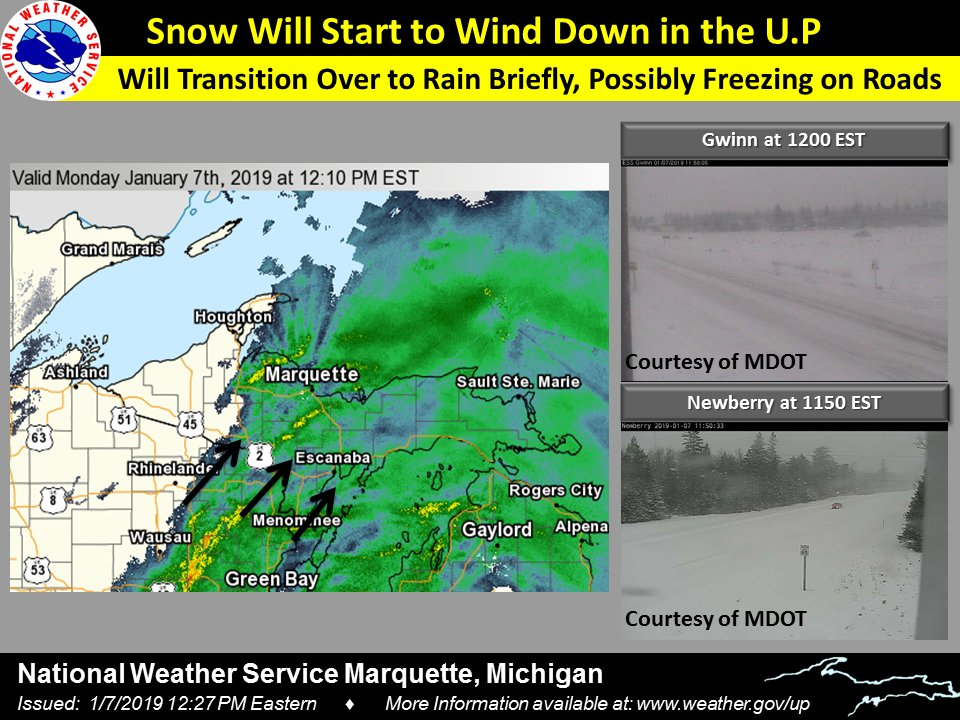 |
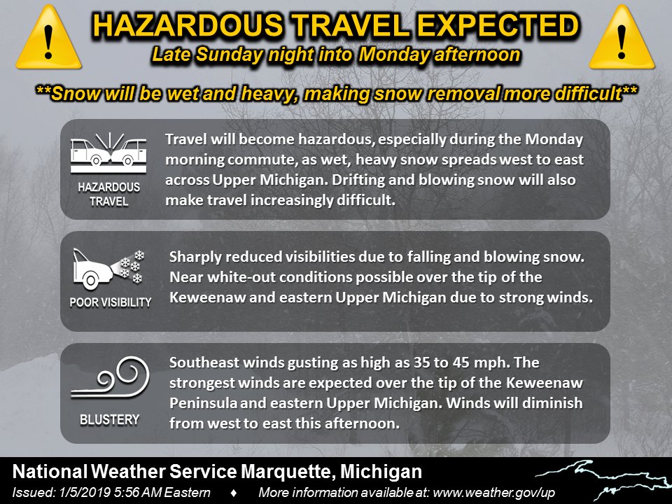
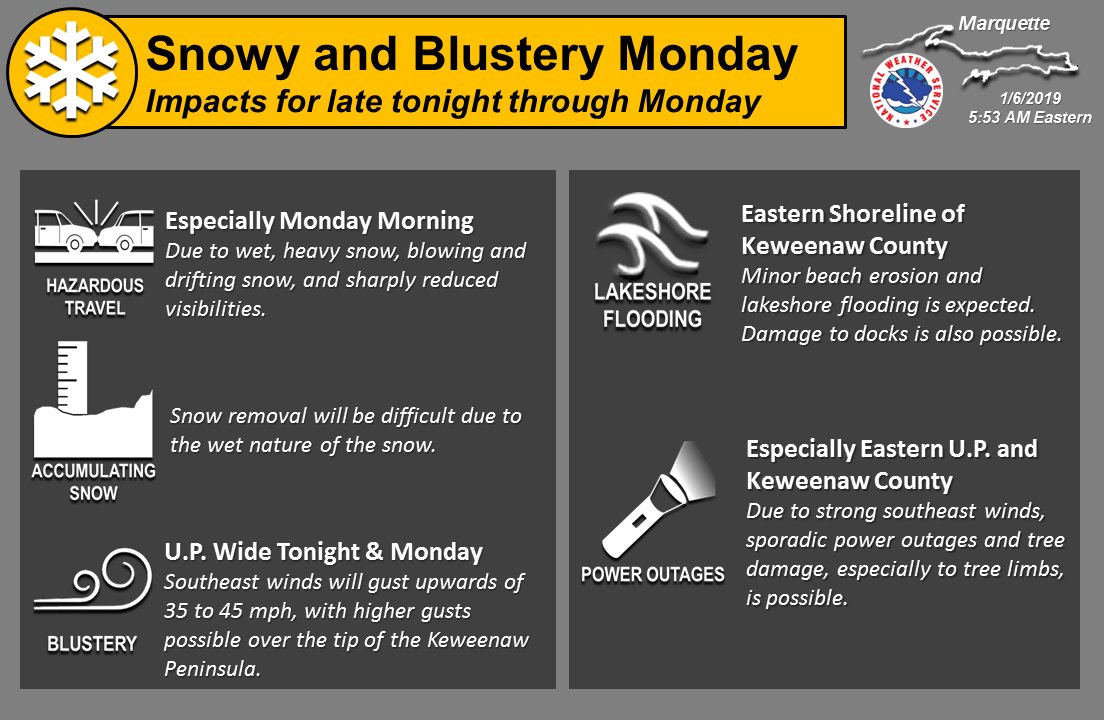
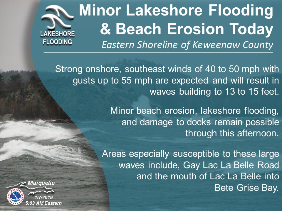
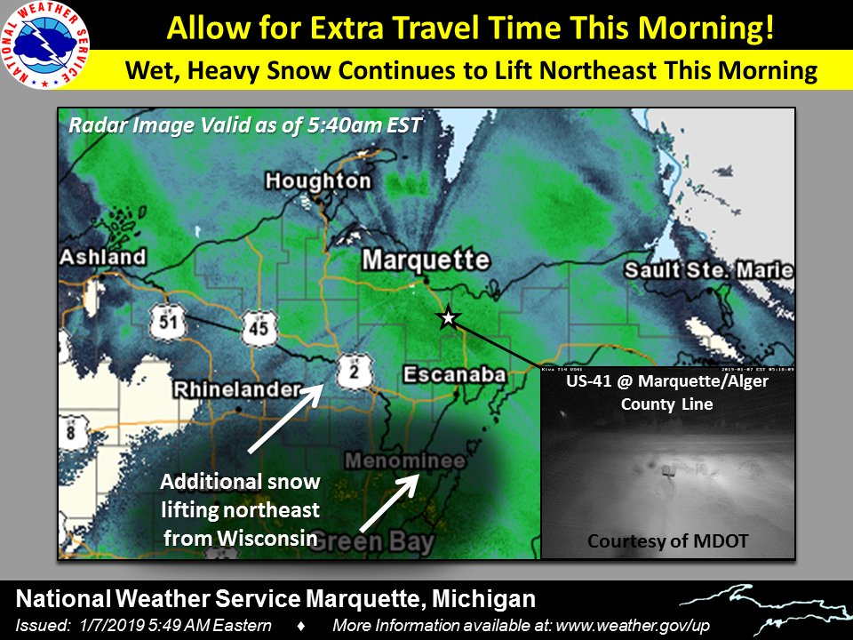
| Update hazards and timeline for ongoing Winter Storm | Update on Lakeshore Flood Hazards on eastern Shore of Keweenaw County | Radar Update Monday Morning highlighting snow covered roads and the need for extra travel time due to wet, heavy snow continuing. Also, highlights the next round of snow lifting northeast from Wisconsin. | Radar Update Monday Afternoon highlighting snow covered roads with snow winding down from west to east through the rest of the day. Also, highlights the transition over to rain and potential impacts on roadways. |
Timeline of Services and Products for Monday's Winter Storm and Gale/Storm Wind Event over Great Lakes
|
Land Based Product & General Area |
Marine and Coastal Based Product & General Area |
Day |
| Mentions of several inches of wet snowfall in Hazardous Weather Outlook. | Mentions of gales possible over Lake Superior in the Hazardous Weather Outlook | Thursday |
| Messaging began on Social Media Graphics for the Potential for Accumulating Snow Monday | Mentions of gales possible over Nearshore of Lake Michigan in the Hazardous Weather Outlook. | Friday |
|
Special Weather Statement was issued Saturday morning, and updated that evening, across the NWS Marquette, Michigan Forecast Area and messaging ramped up on Social Media.
Situation Report was issued to Marine Partners for high-end gales, and did include mentions of storm force gusts possible. |
Gale watch for high-end gales issued on Saturday morning, upgraded to gale warnings for much of Lake Superior on Saturday afternoon. Mentions of a few storm force gusts in Open Water Forecast for Great Lakes. A lakeshore flood advisory was also issued for Keweenaw County for the expected large, pounding waves. |
Saturday |
|
Winter Weather Headlines were issued Sunday morning (widespread Winter Weather Advisories with Keweenaw County in a Winter Storm Warning). The Winter Weather Advisory was upgraded Sunday afternoon to a Winter Storm Warning for all of central and eastern Upper Michigan as confidence in higher snowfall amounts grew. Briefing packet was issued to core partners early Sunday afternoon. An updated Situation Report was issued Sunday morning to Marine Partners for upgrade to Storm Warnings over north central and eastern Lake Superior. |
Gale Warning was upgraded to Storm Warning over north central and eastern Lake Superior. Gale Warnings remained in place for portions of western and south central Lake Superior, and nearshore zones down on Lake Michigan. | Sunday |
| Winter Weather Headlines remained in effect Monday morning and gradually came to an end from west to east across Upper Michigan and the wet, heavy system snow vacated the region. | All products remained in effect until the event was over. | Monday |
Summaries from other NWS Offices
 |
Media use of NWS Web News Stories is encouraged! Please acknowledge the NWS as the source of any news information accessed from this site. |
|

