Overview
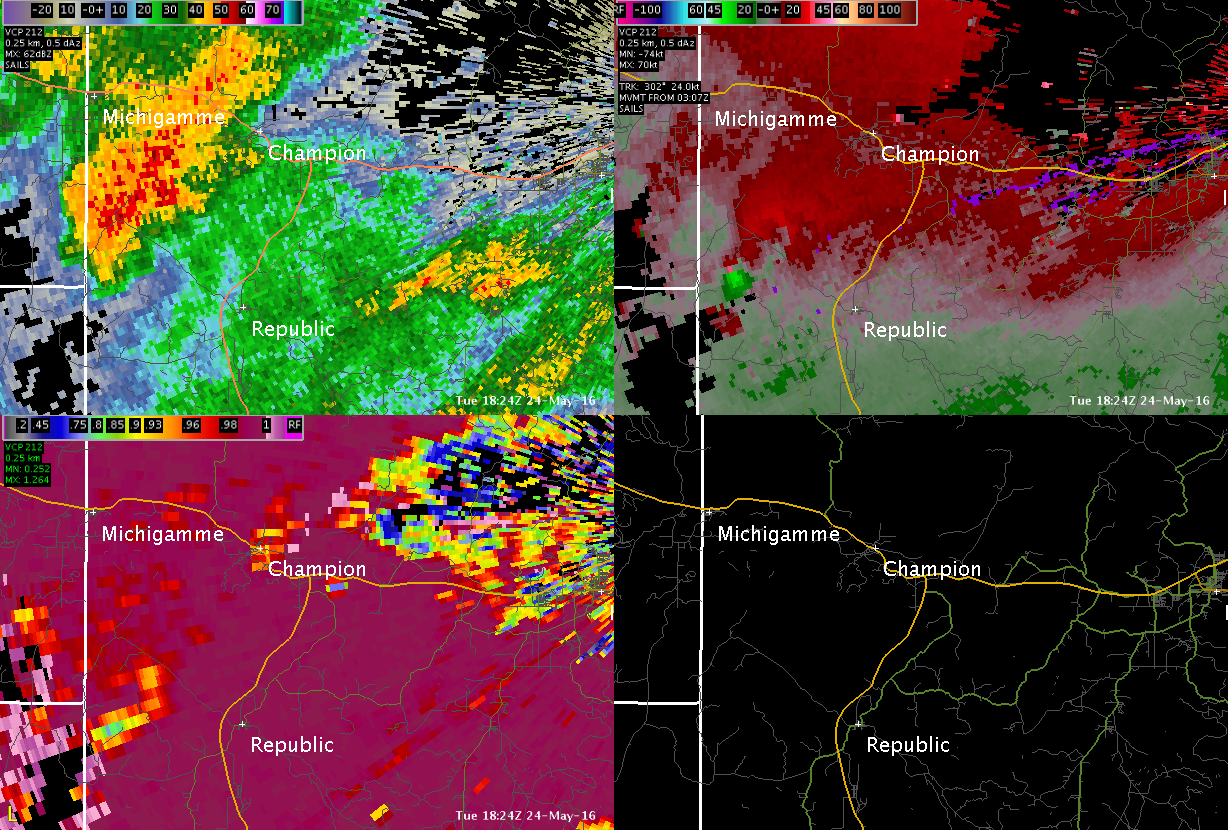
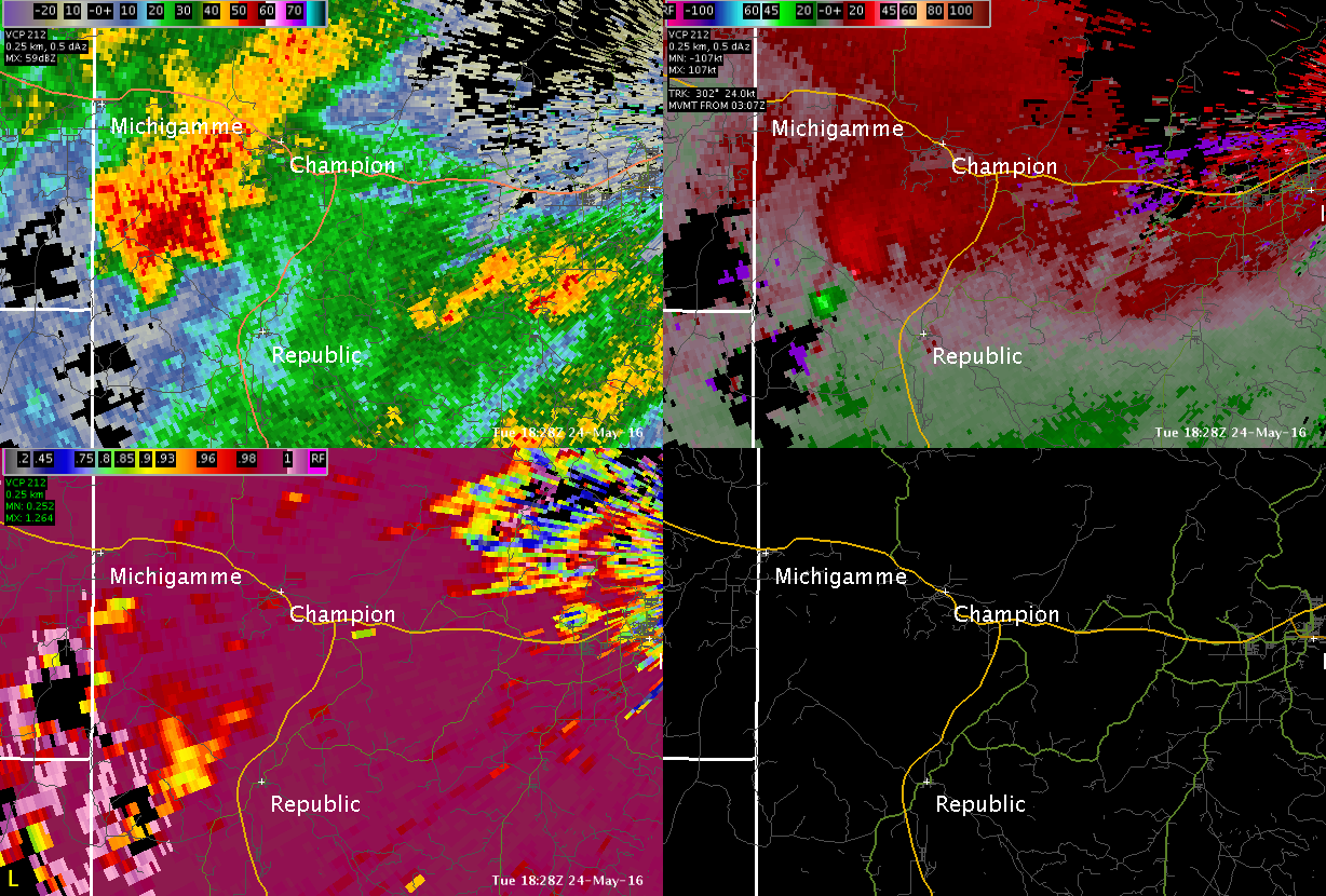
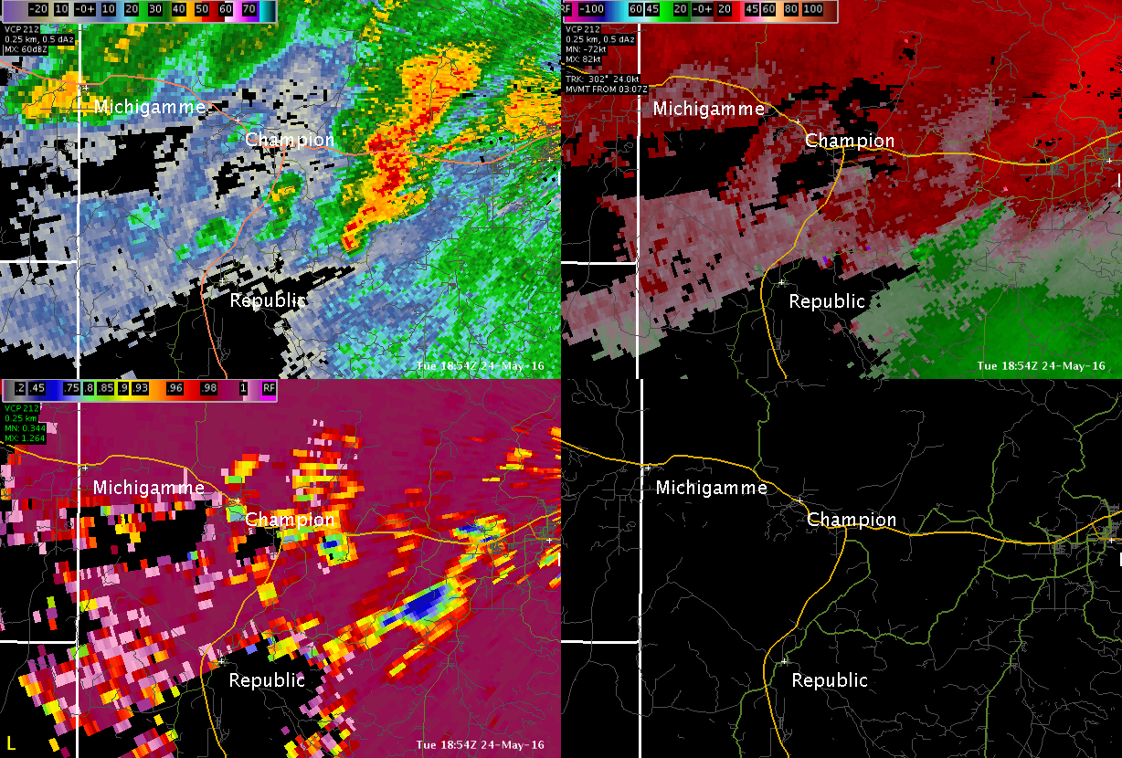
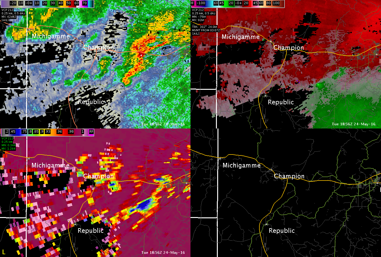
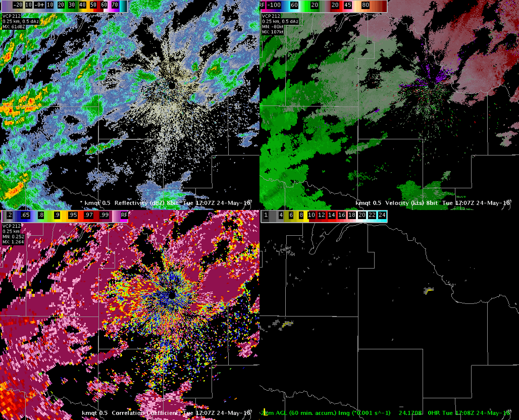
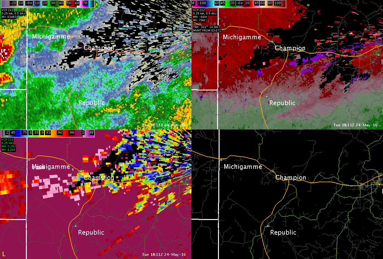
Showers and thunderstorms developed Tuesday afternoon 5/24/2016 across much of the west half of Upper Michigan. A boundry helped to focus additional forcing across the south half of Marquette County. This boundary also allowed low-level shear (turning of winds with height) to increase across Marquette County. As the storm hit the boundary they begin to show signs of rotation as well as debris signatures in dual-pol products. After the event had ended the Marquette NWS sent out a survey team to evaluate the damage. The survey team found several snapped trees stretching from just west-northwest of Republic eastward to just south of Greenwood Reservoir and points east to County Road 581. The damage included trees pulled toward a convergent center in several locations along with trees that fell next to each other in opposing directions. These are all good indicators that a tornado did indeed touch down. There was also damage to a chimney at a seasonal camp. Due to the proximity to Ishpeming, Negaunee and Marquette and the time of day, the schools held students over for an hour or more for safety concerns.Tornadoes:
|
Tornado - Marquette County
Track Map 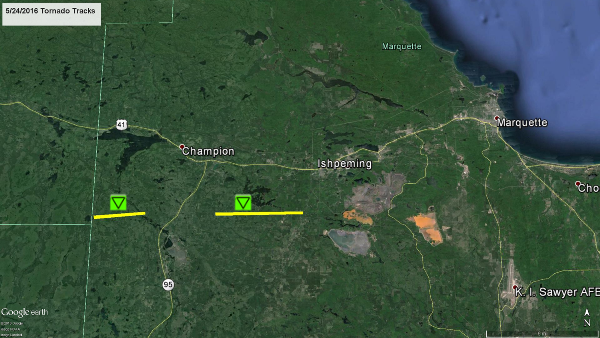 
|
||||||||||||||||
|
||||||||||||||||
The Enhanced Fujita (EF) Scale classifies tornadoes into the following categories:
| EF0 Weak 65-85 mph |
EF1 Moderate 86-110 mph |
EF2 Significant 111-135 mph |
EF3 Severe 136-165 mph |
EF4 Extreme 166-200 mph |
EF5 Catastrophic 200+ mph |
 |
|||||
Photos & Video:
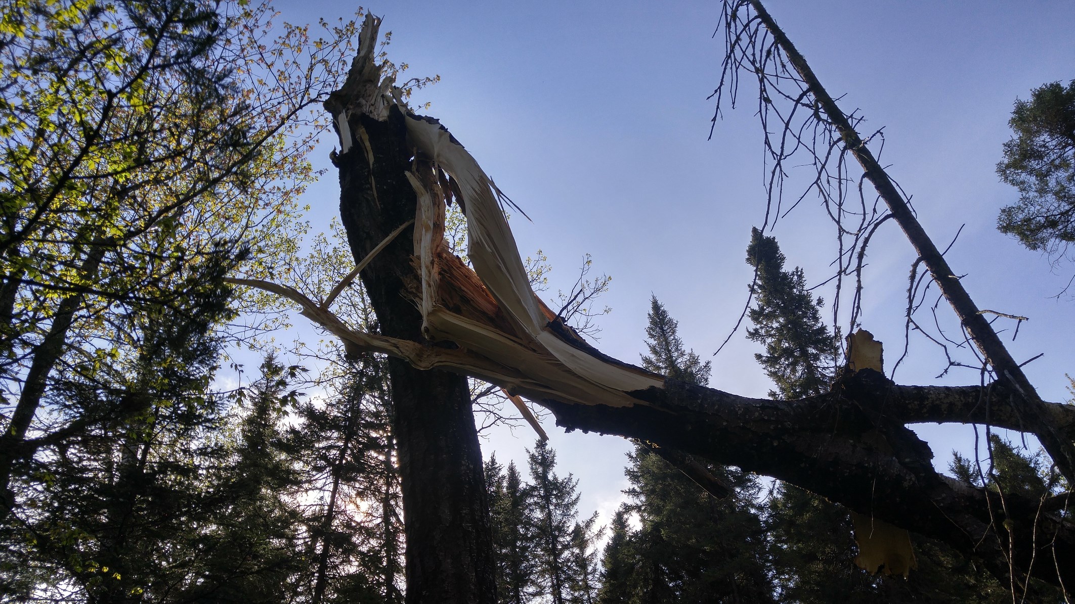
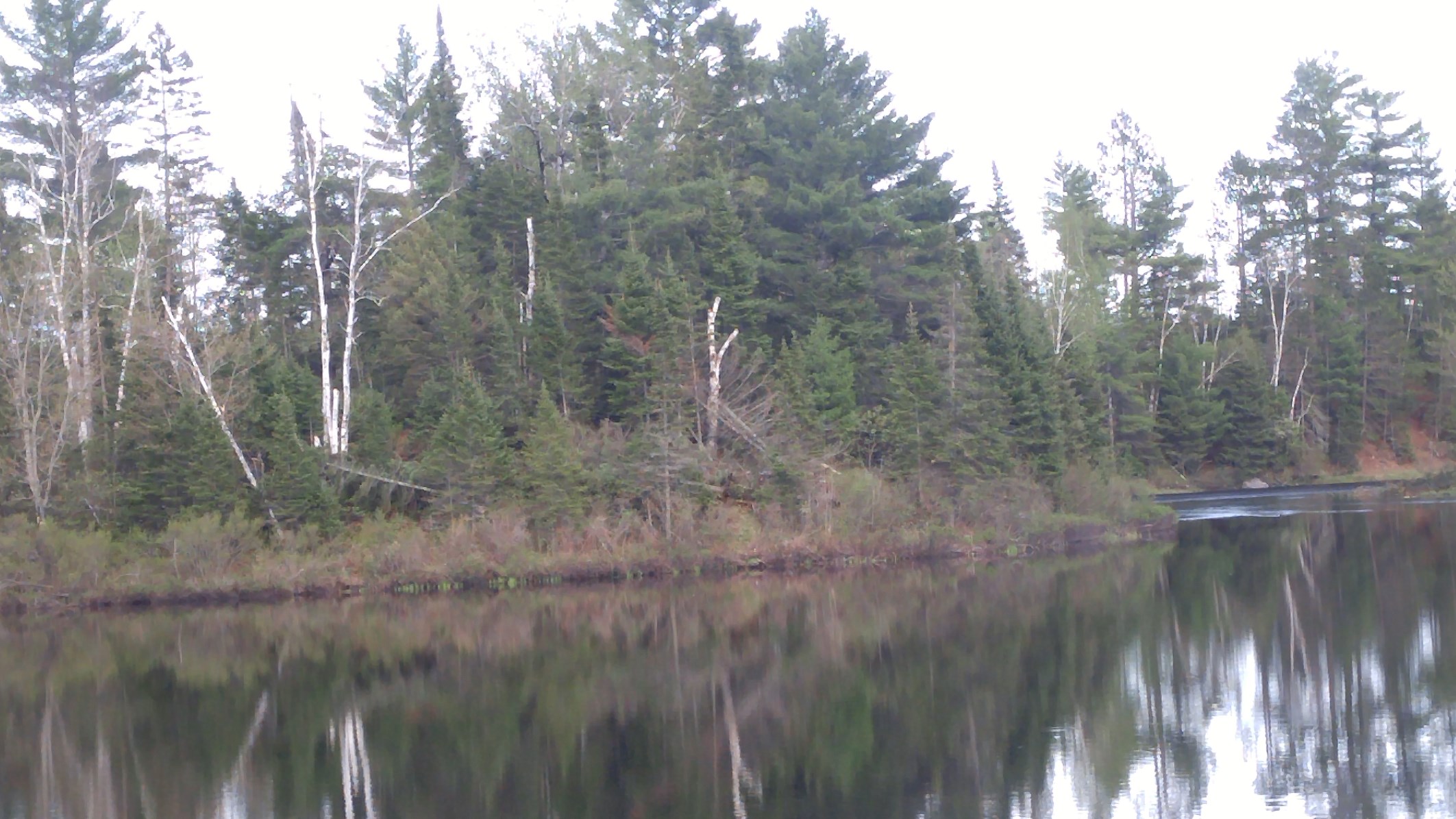
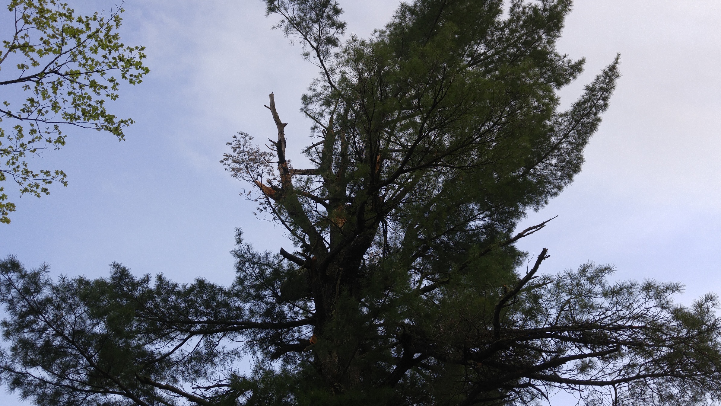
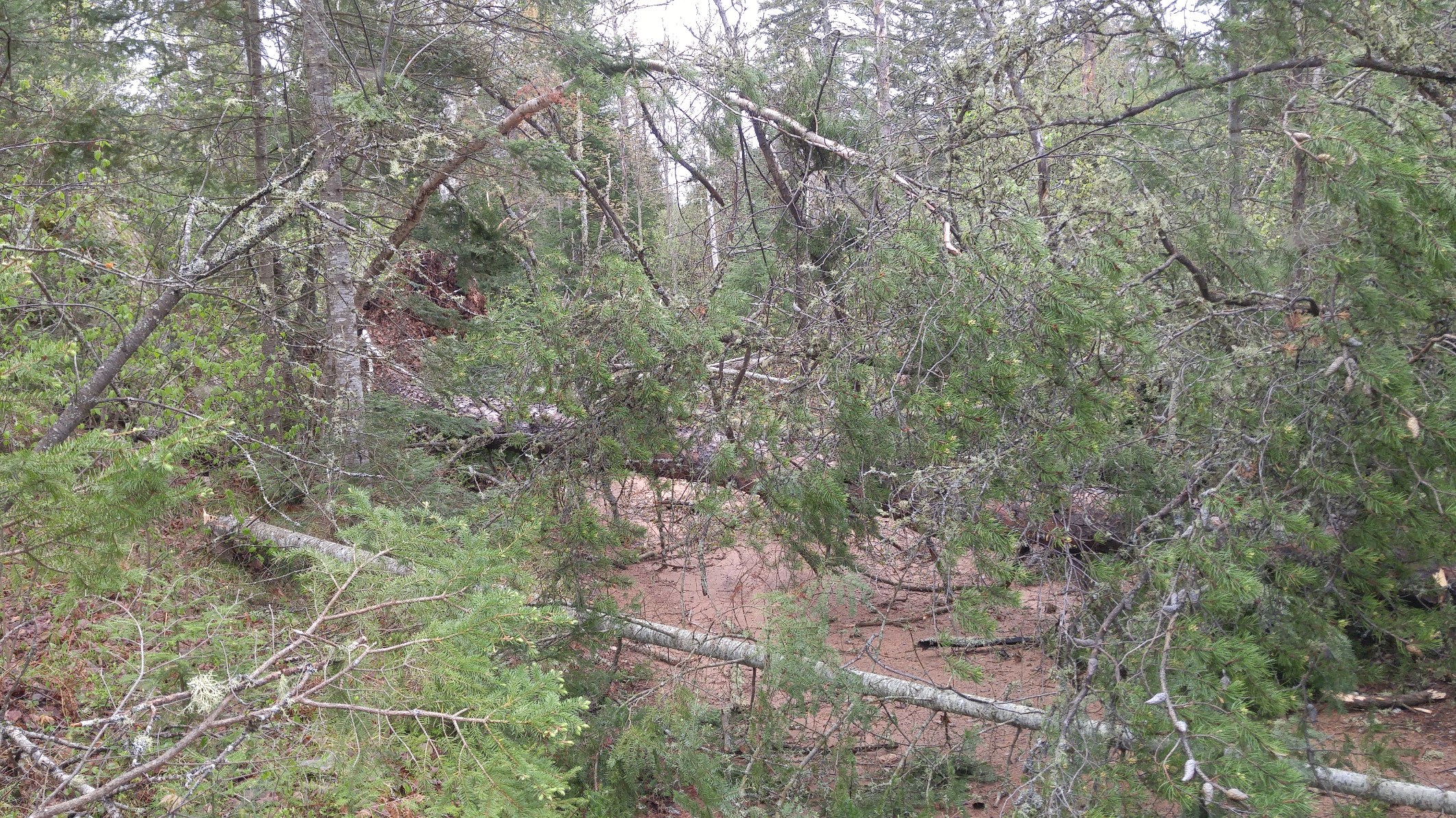
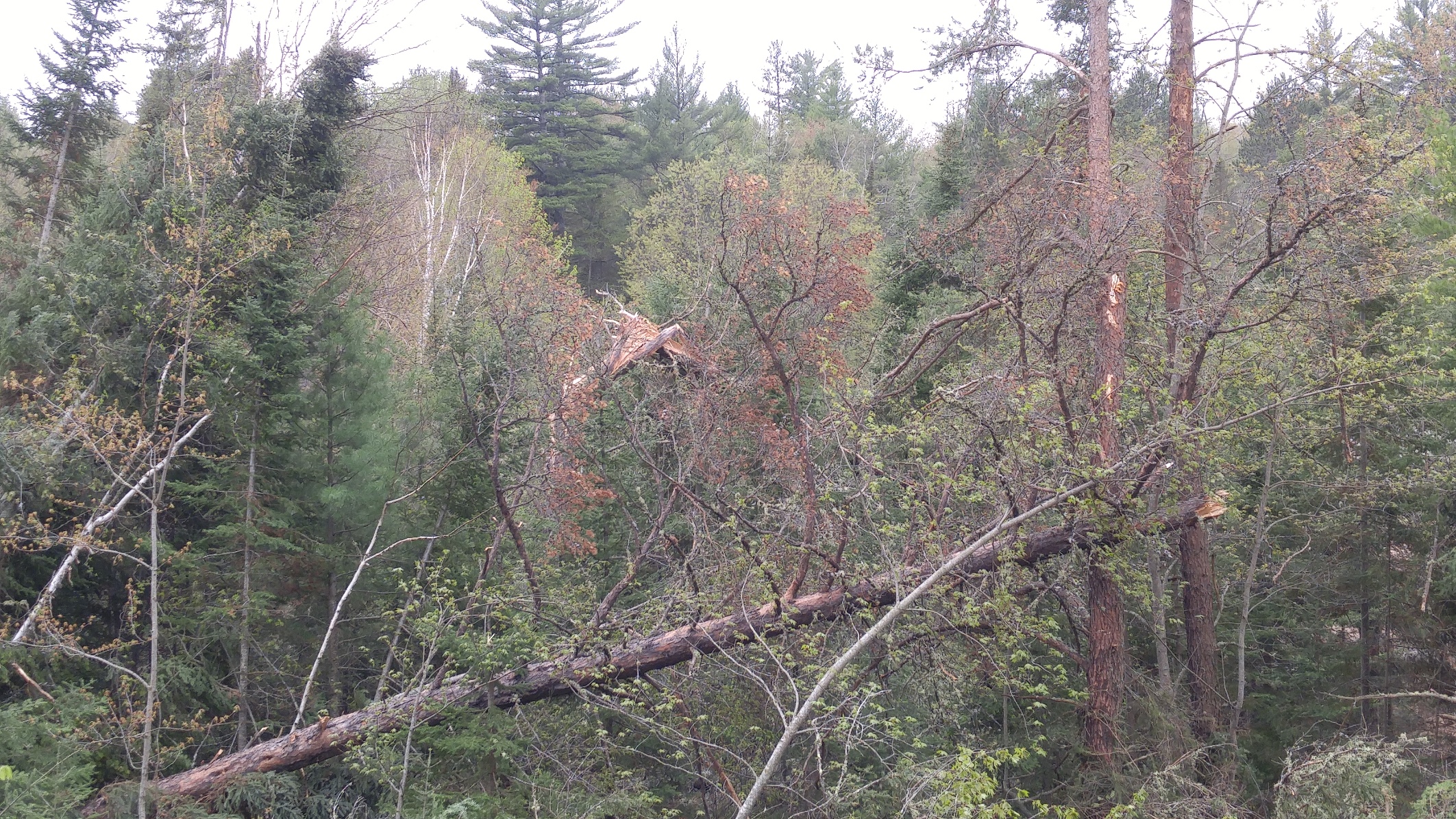
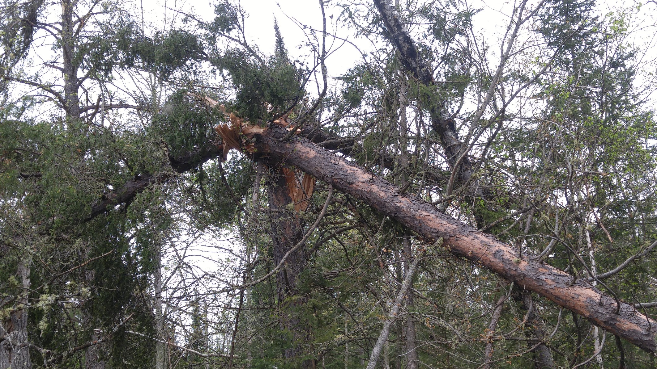
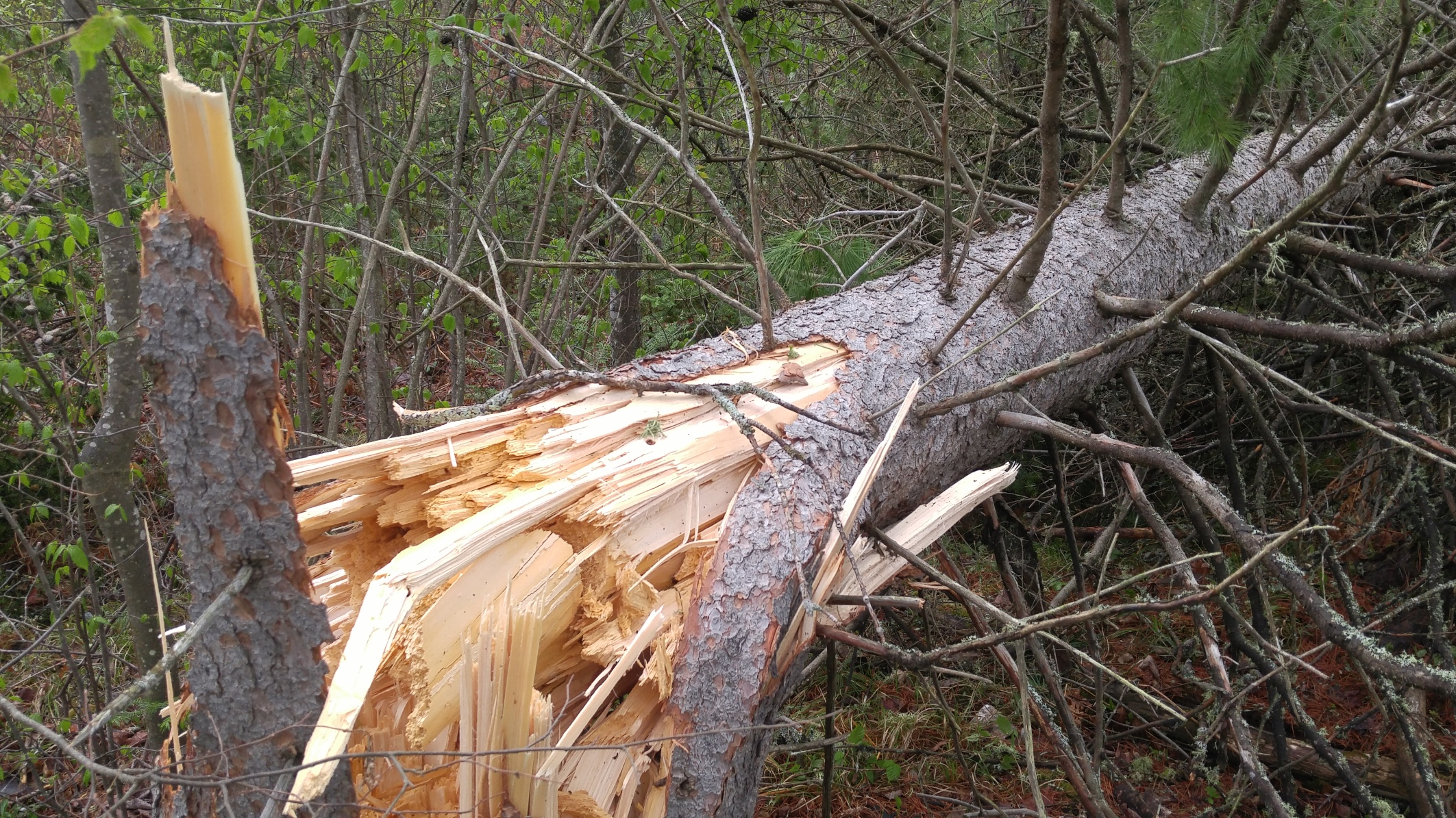
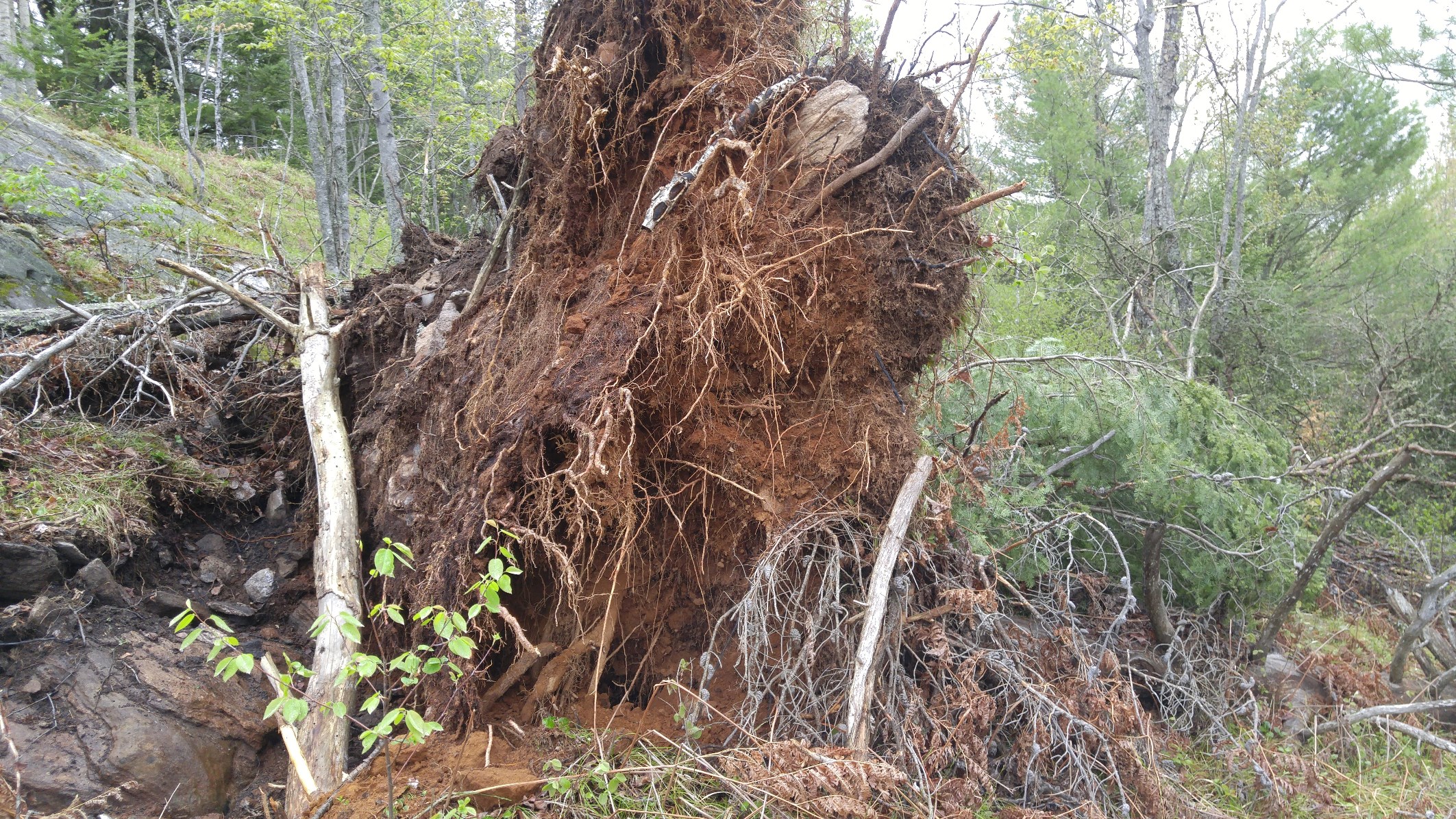
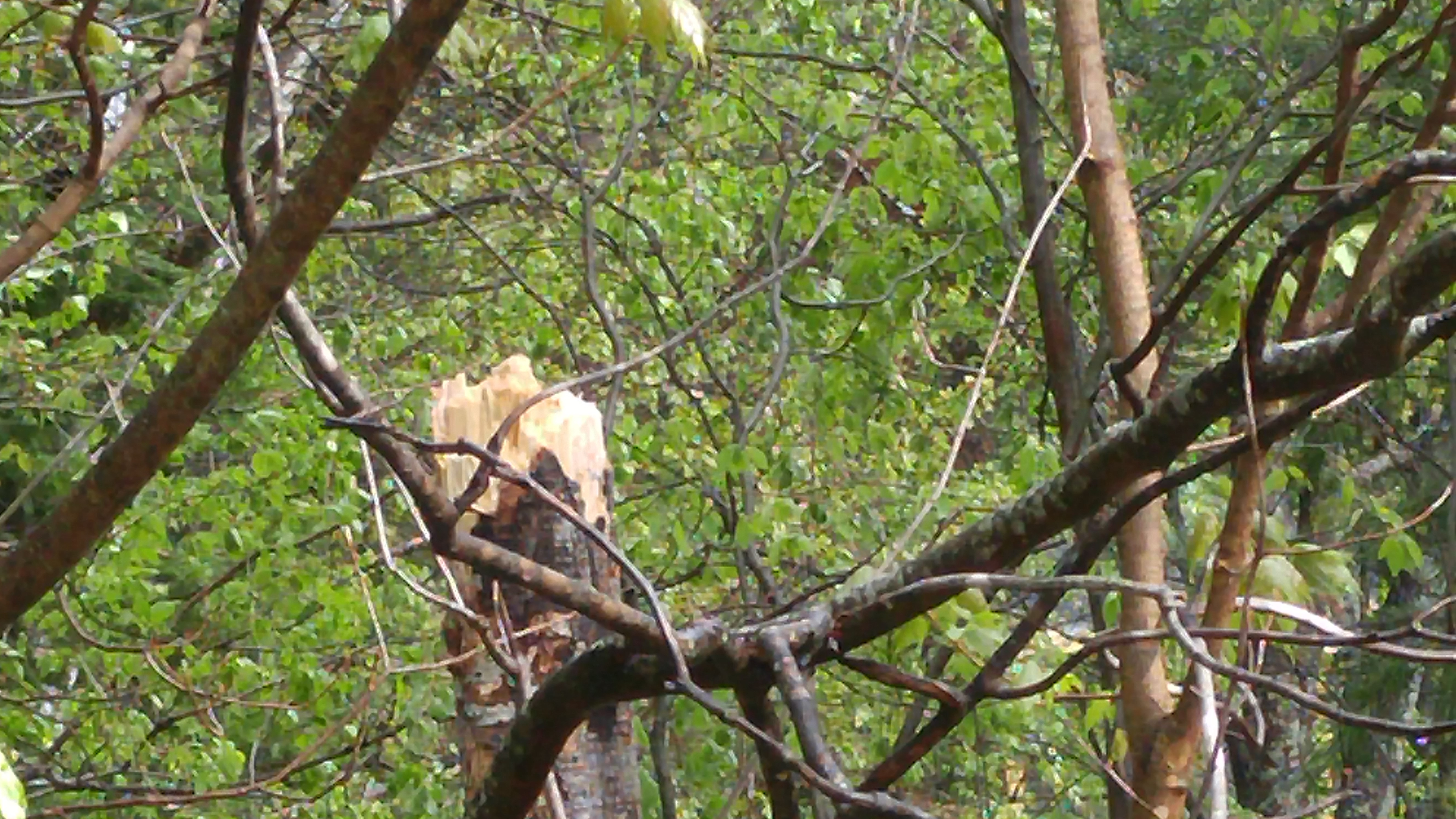
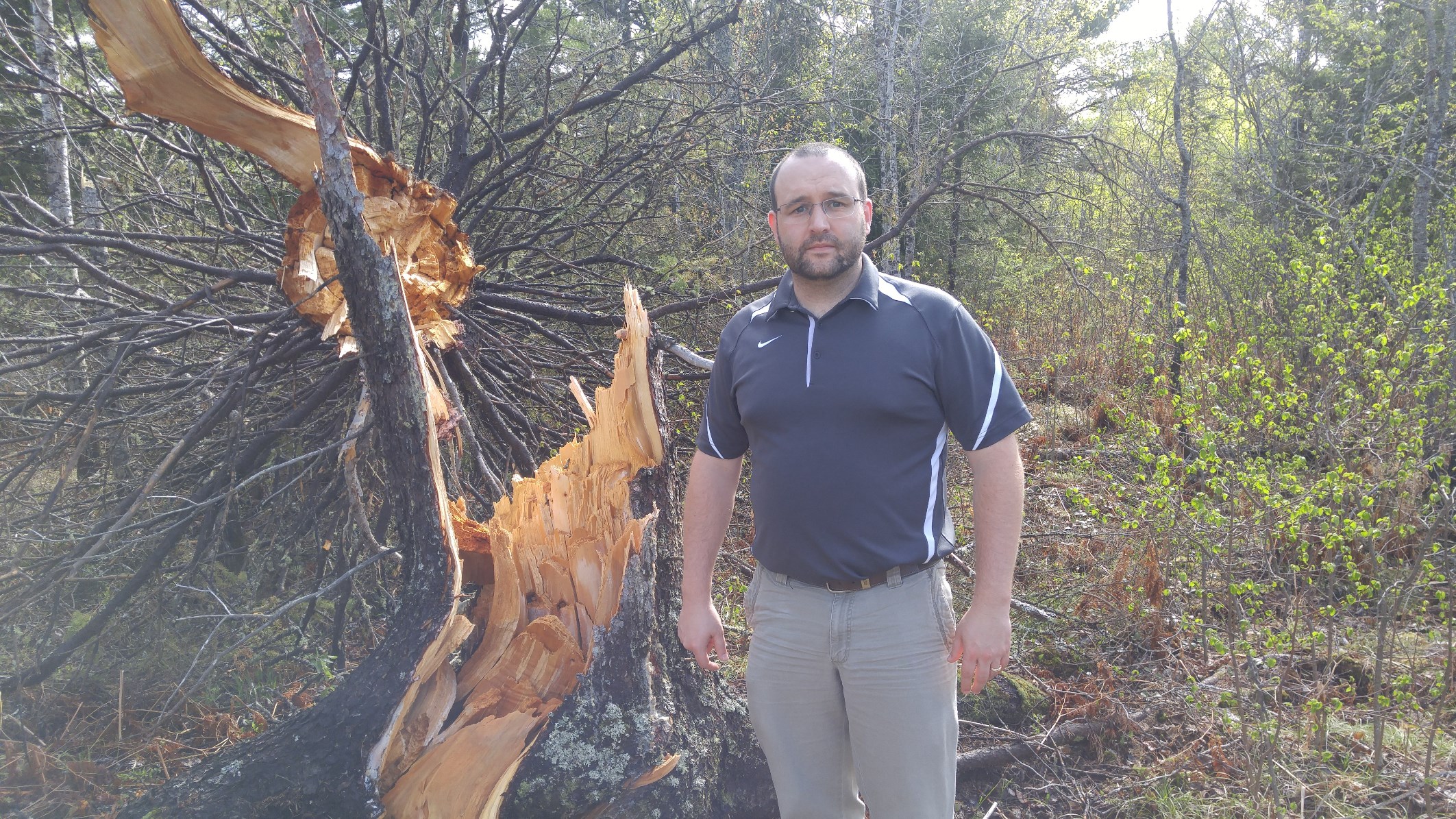
Tornado Damage West-Northwest of Republic, MI
 |
 |
 |
 |
 |
 |
 |
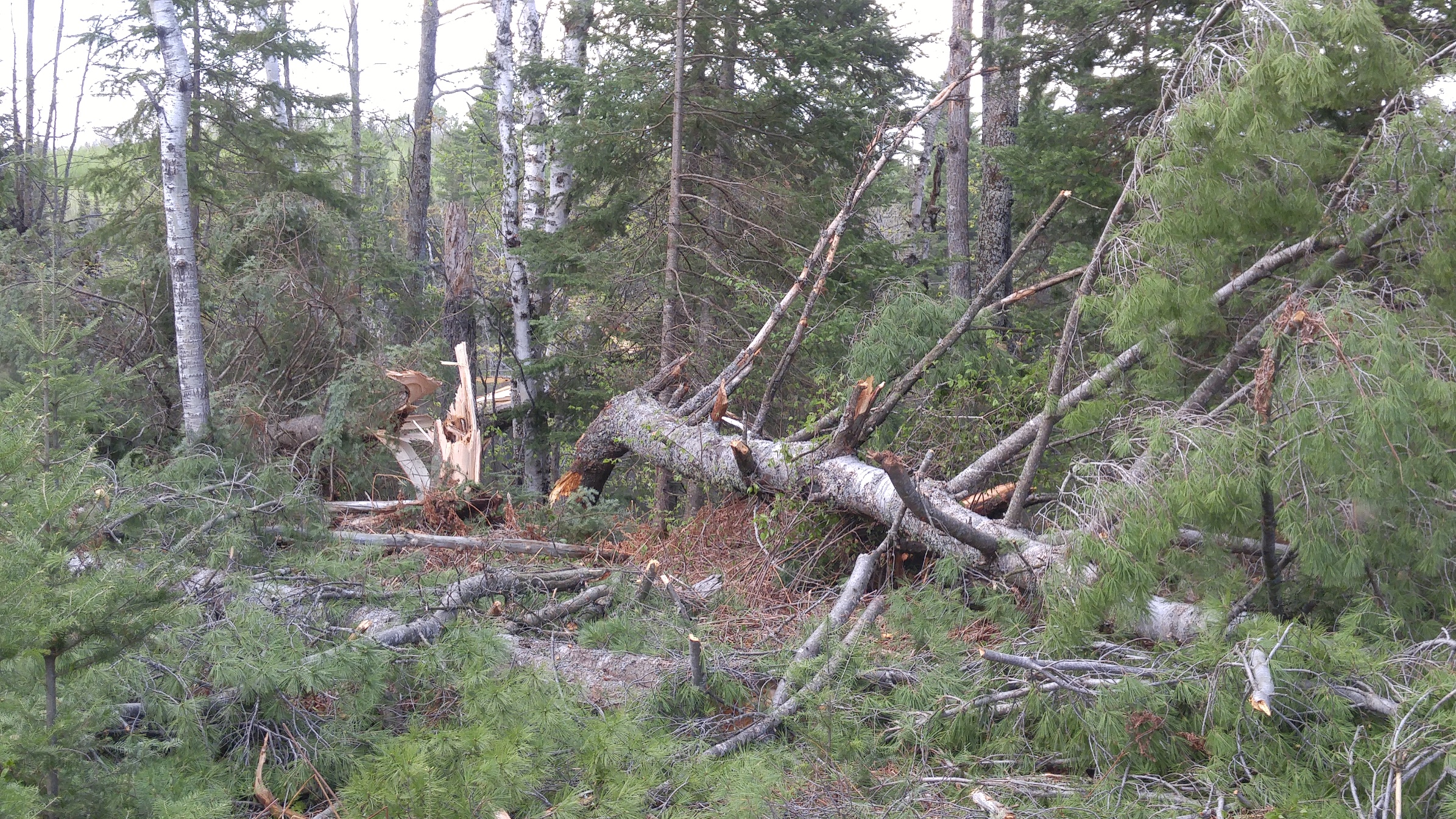 |
| Tree damage along first tornado path to the west northwest of Republic along River Rd. Majority of trees snapped were a foot to a foot and a half in diameter. | |||
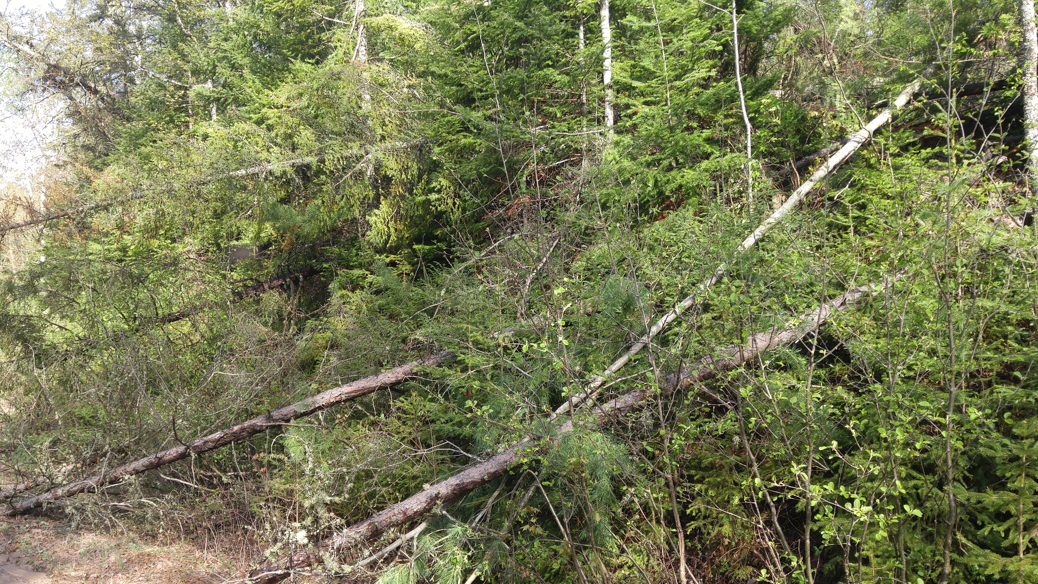
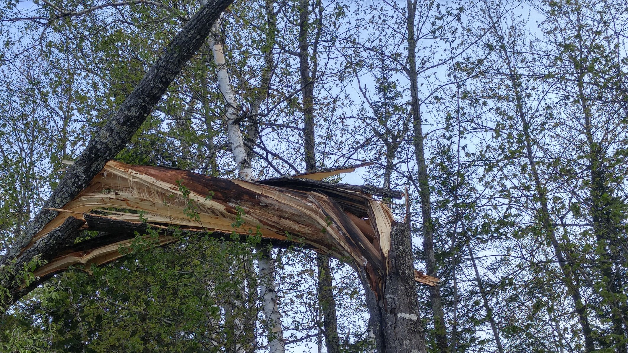
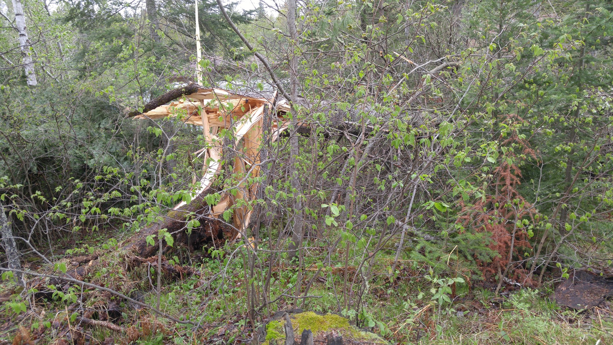
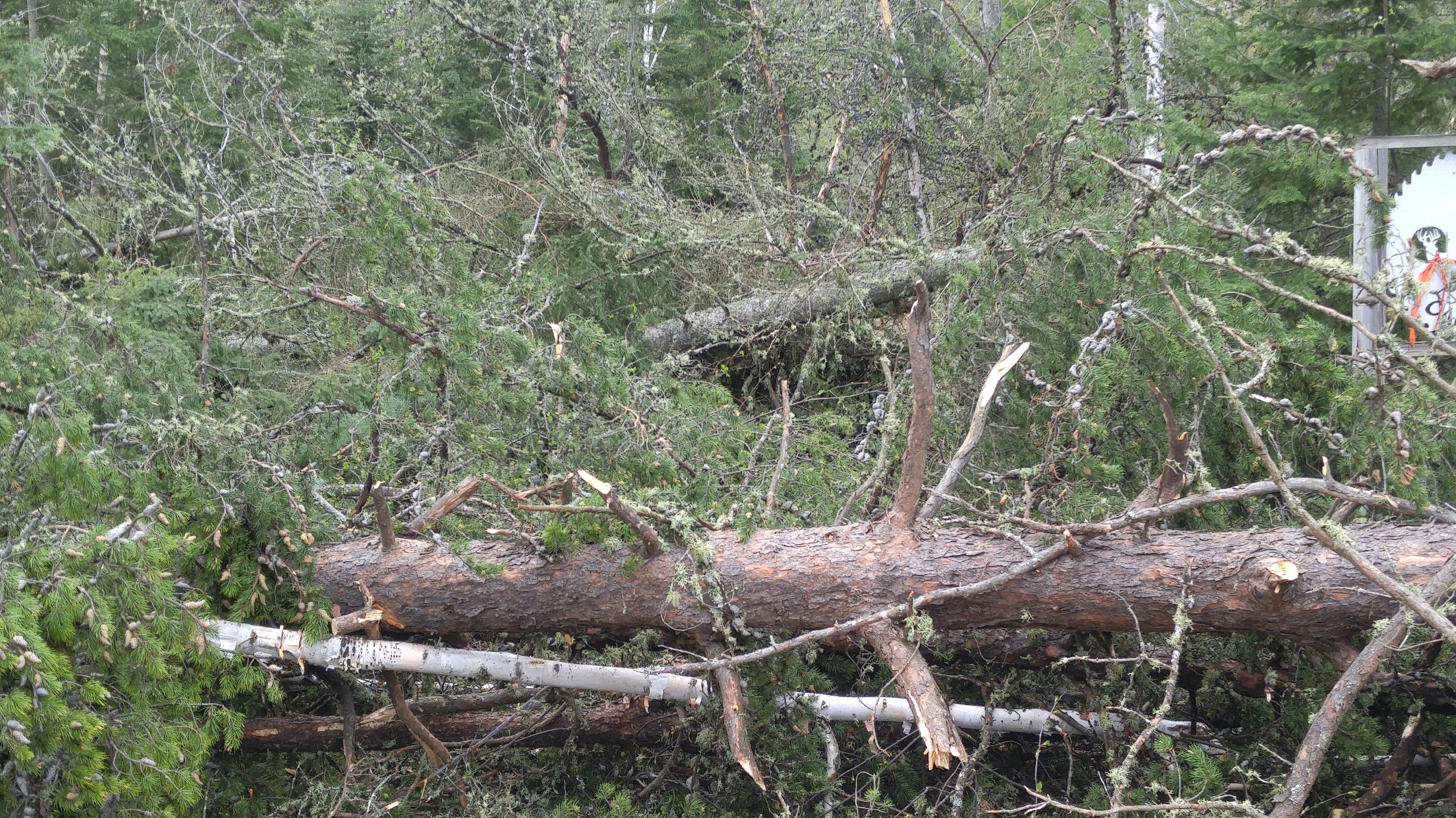
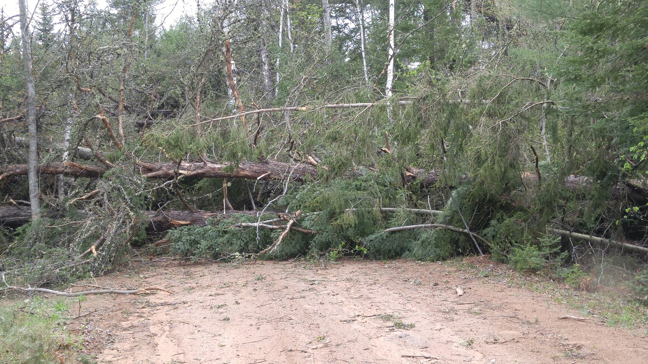
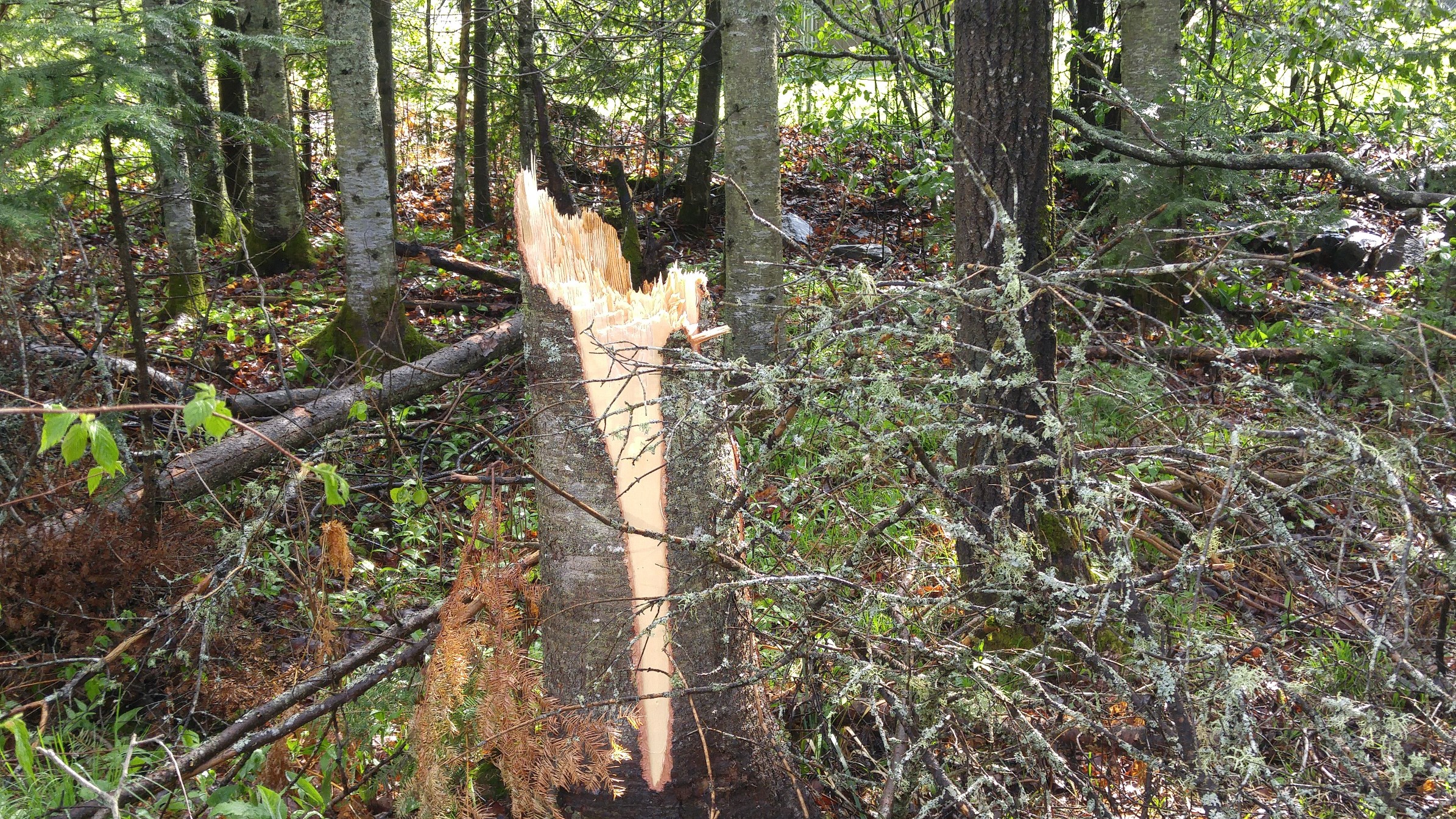
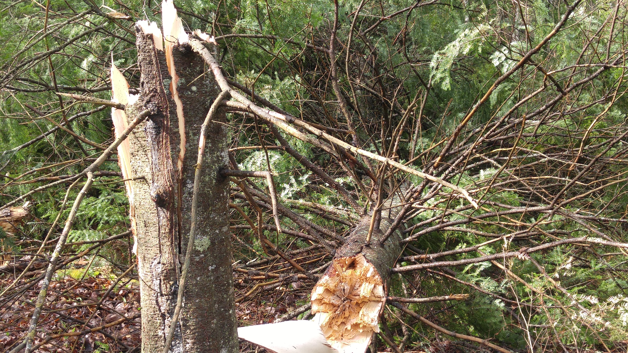
Tornado Damage Near Tasson Road near West Ely Township
 |
 |
 |
 |
 |
 |
 |
 |
 |
 |
 |
 |
| Tree damage along second tornado path near Tasson Road near west Ely Township. Trees snapped or uprooted were between one foot and two feet in diameter. | |||
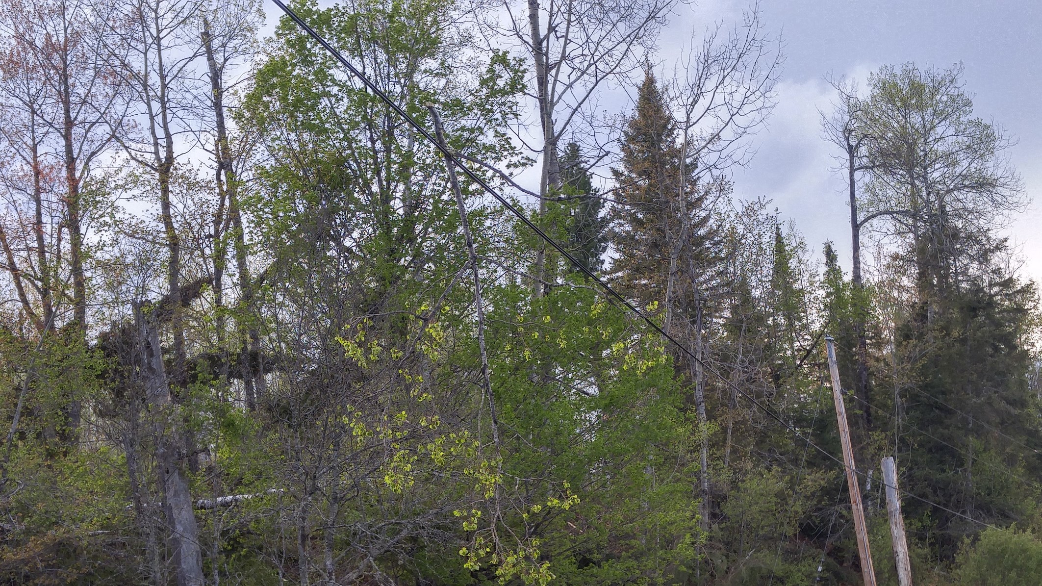
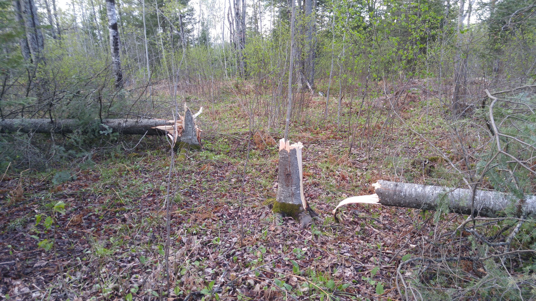
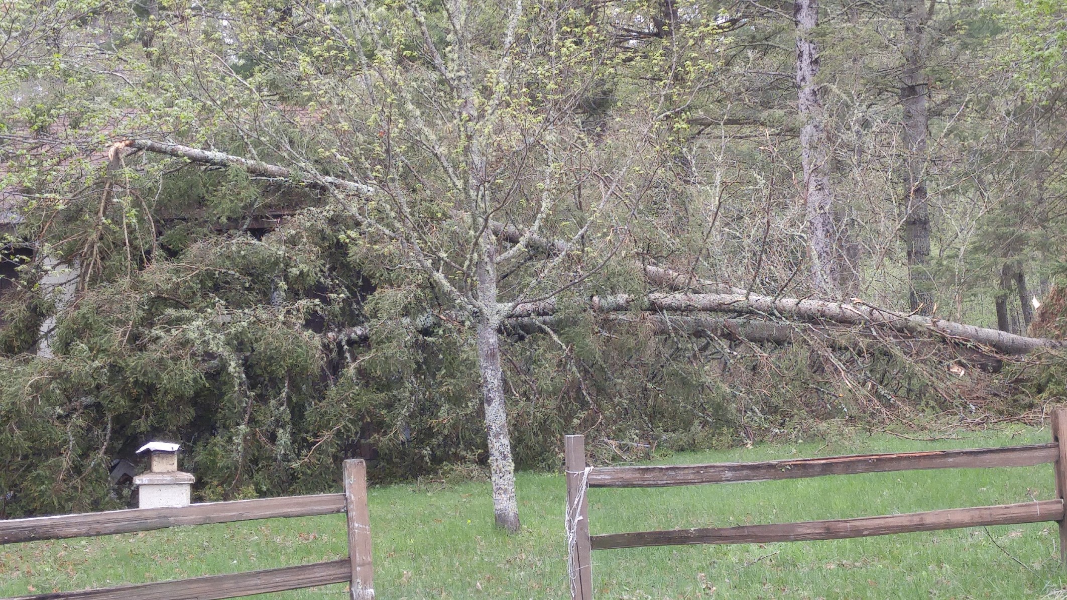
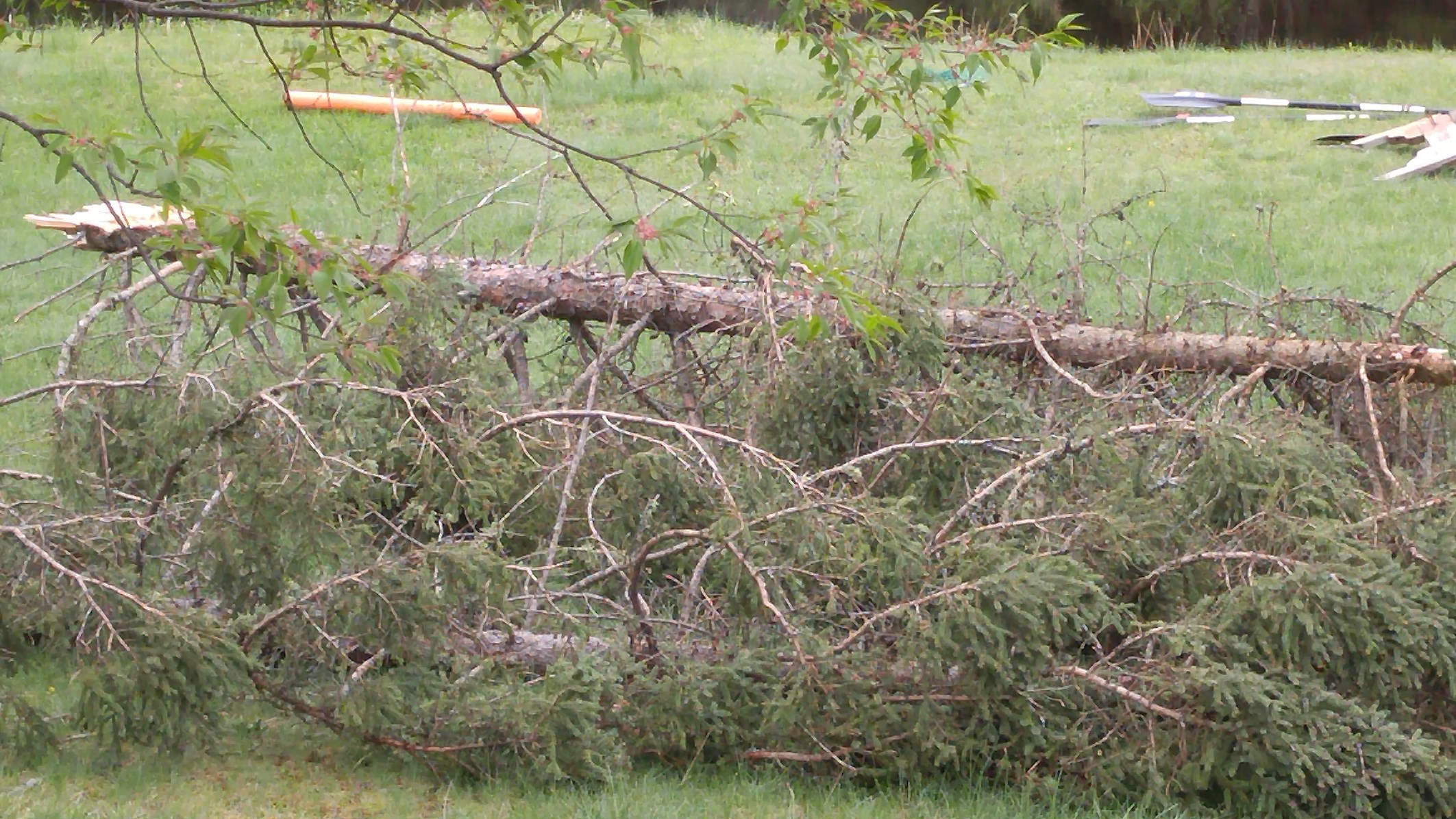
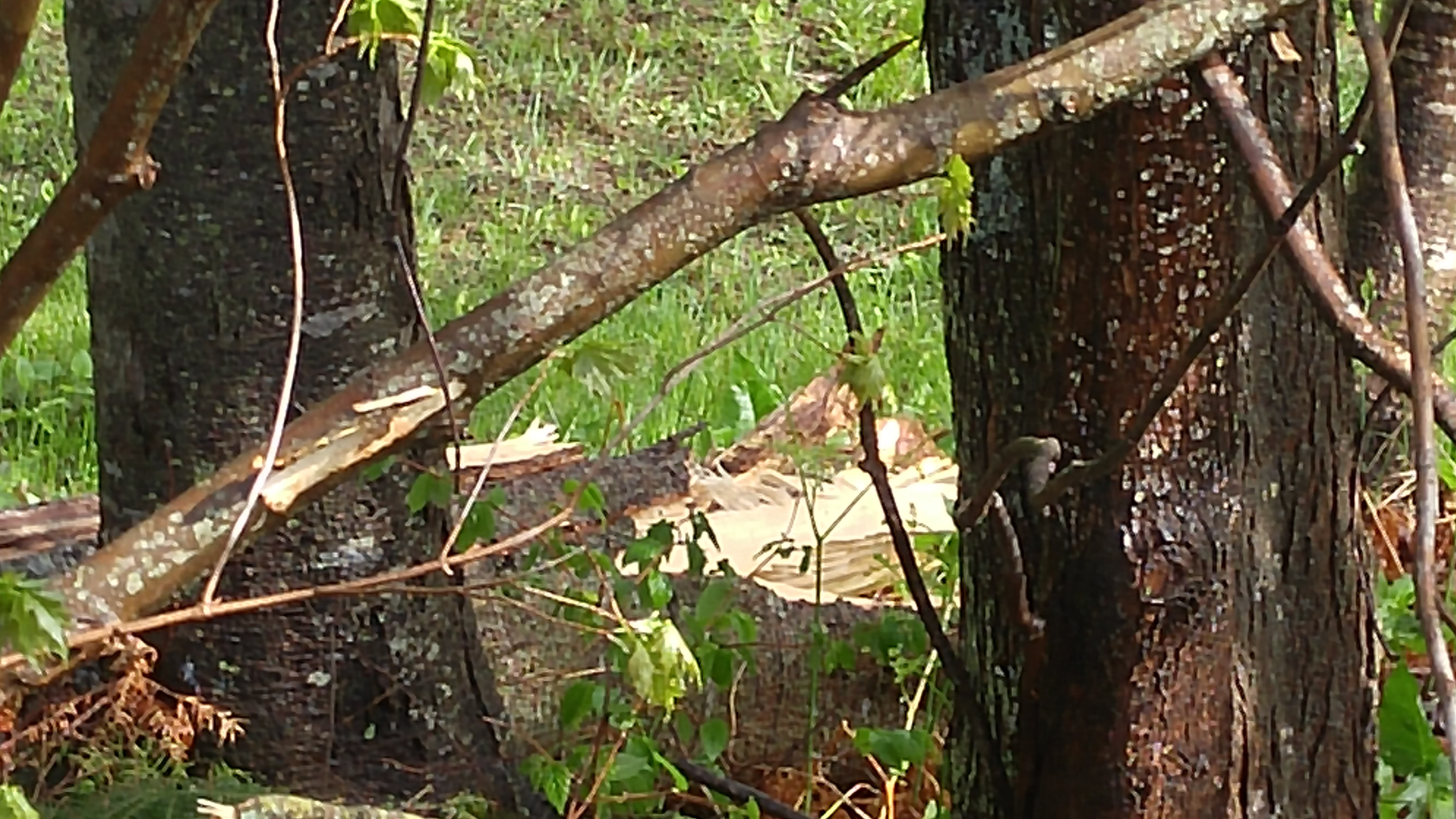
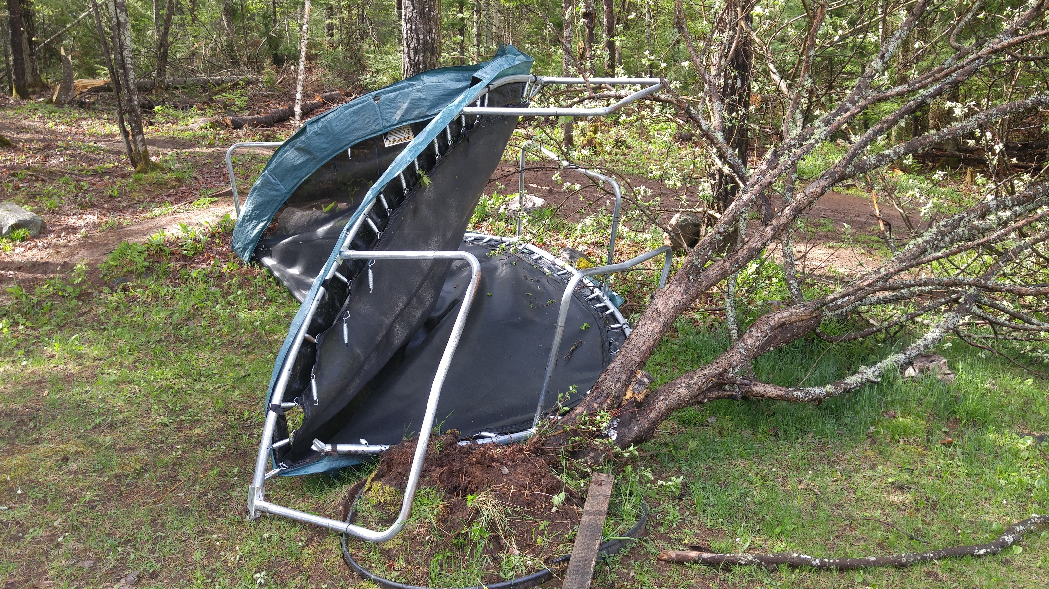
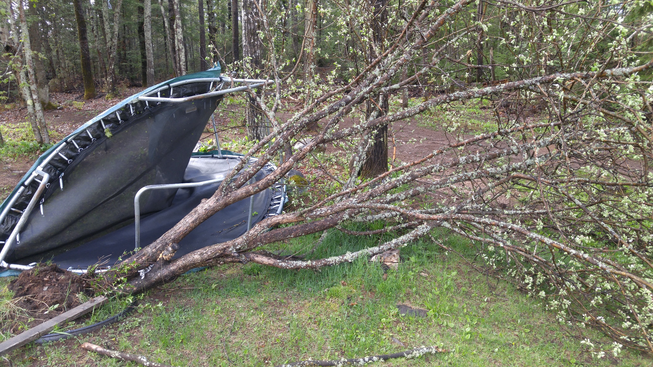
Tornado Damage - Off Mail Route Road to the Northeast of Lawer Drive in Ely Township
 |
 |
 |
 |
 |
 |
 |
 |
| Damage along second tornado path off of the Mail Route Road to the northeast of Lawer Drive in Ely Township. Trees snapped or uprooted were between one foot and two feet in diameter. | |||
Radar:
 |
 |
||
Storm Reports
...NWS DAMAGE SURVEY FOR 05/24/2016 TORNADO EVENT...

.OVERVIEW...A surface front across Upper Michigan on Tuesday helped
ongoing thunderstorms to develop into tornadic storms over portions
of western Marquette county. An NWS survey team found several snapped
or uprooted trees from just west northwest of Republic, MI eastward to
south of the Greenwood Reservoir to points east to County Road 581 to
the southwest of Ishpeming, MI. The damage included trees pulled toward
a convergent center in several locations along with trees that fell next
to each other in opposing directions. There was also damage to a chimney
at a seasonal cabin.

.TORNADO west northwest of Republic...

Rating:                 EF-1
Estimated peak wind:    90 mph
Path length /Statute/:  4 miles
Path width /Maximum/:   1/8 to 1/4 mile
Fatalities:             0
Injuries:               0

Start date:             05/24/2016
Start time:             2:21 pm EDT
Start location:         7 miles WNW of Republic, MI

End date:               05/24/2016
End time:               2:33 pm EDT
End location:           3 miles WNW of Republic, MI

.TORNADO southwest of Greenwood Reservoir to near County Road 581...

Rating:                 EF-1
Estimated peak wind:    90 mph
Path length /Statute/:  7 miles
Path width /Maximum/:   1/8 to 1/4 mile
Fatalities:             0
Injuries:               0

Start date:             05/24/2016
Start time:             2:54 pm EDT
Start location:         12 miles WSW Ishpeming, MI

End date:               05/24/2016
End time:               3:02 pm EDT
End location:           6 miles SW Ishpeming, MI


EF Scale: The Enhanced Fujita Scale Classifies Tornadoes
into the following categories.

EF0...Weak......65 to 85 mph
EF1...Weak......86 to 110 mph
EF2...Strong....111 to 135 mph
EF3...Strong....136 to 165 mph
EF4...Violent...166 To 200 mph
EF5...Violent...>200 mph

NOTE:
The information in this statement is PRELIMINARY and subject to
change pending final review of the event and publication in
NWS Storm Data.
 |
Media use of NWS Web News Stories is encouraged! Please acknowledge the NWS as the source of any news information accessed from this site. |
|