Overview
|
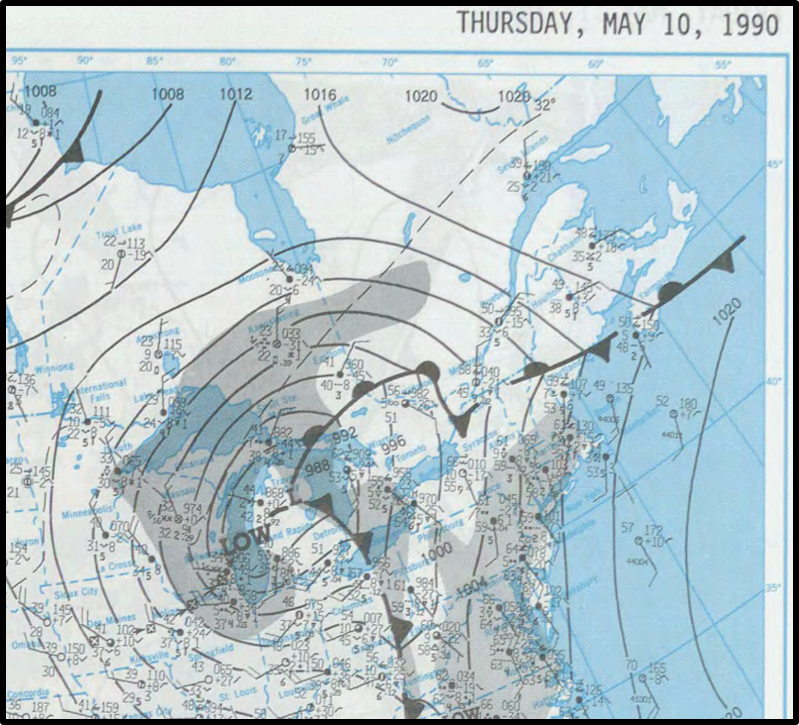
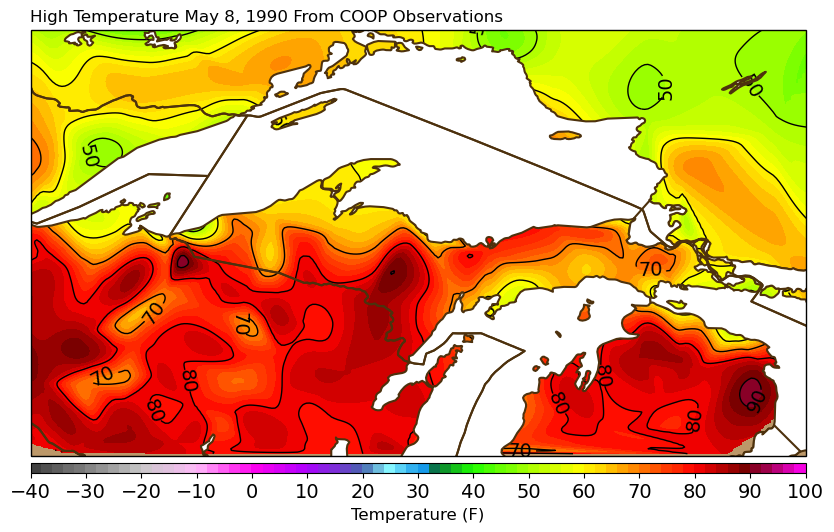
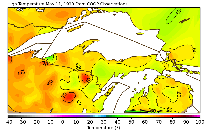
One of the most significant late-season snowstorms in Upper Michigan history occurred May 9-10, 1990. Very warm temperatures on May 8 with highs in the 70s and even in the mid 80s in some spots gave way to rain on May 9 as an area of low pressure moved through Wisconsin. By the afternoon of the 9th, rain began changing over to slushy snow. Despite it being May, and despite the very warm temperatures a day before, snow began sticking by the evening and then rapidly accumulated overnight into the morning of May 10. The higher elevations of the central Upper Peninsula and northern Wisconsin were hit the hardest, with the NWS office in Negaunee measuring an amazing 22.4 inches of snow from this storm! Road crews said this snow took twice as long as normal to clear because it was so wet and heavy, according to reports in the Marquette Mining Journal. The snow didn't stick around long, however. By the next day, high temperatures were back in the 50s and 60s. Only a Trace of snow depth was reported at the NWS office in Negaunee on May 14, and by May 15 the snow was completely gone. At the NWS office, the 14.2 inches of snow that fell after midnight on May 10 still holds the record for most snowfall on any singe day in the month of May since records began being kept in 1961. However there have been even later snowfalls in May - just none as heavy as this one. The latest snowfall of 1 inch or greater was on May 16, 1997. |
Surface map showing the area of low pressure moving out of Wisconsin and over Lake Michigan |
Environment
 |
 |
 |
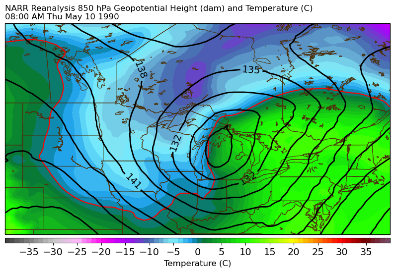 |
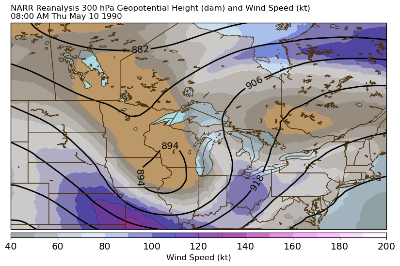
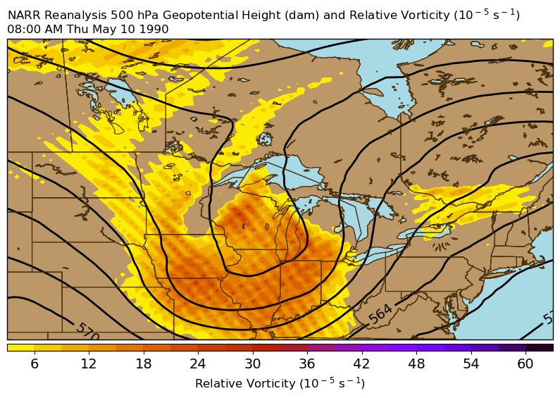
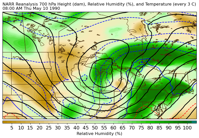
| 300 mb Height and Wind at 8 am EDT May 10, 1990 | 500 mb Height and Vorticity at 8 am EDT May 10, 1990 | 700 mb Height and Relative Humidity at 8 am EDT May 10, 1990 | 850 mb Height and Temperature at 8 am EDT May 10, 1990 |
 |
 |
 |
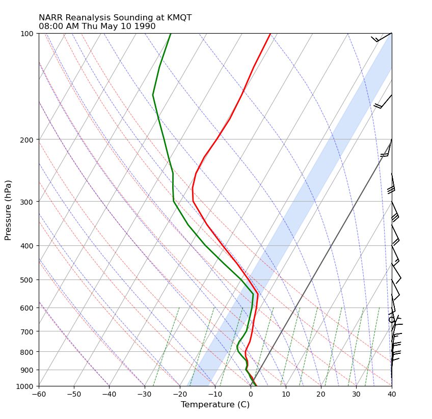 |
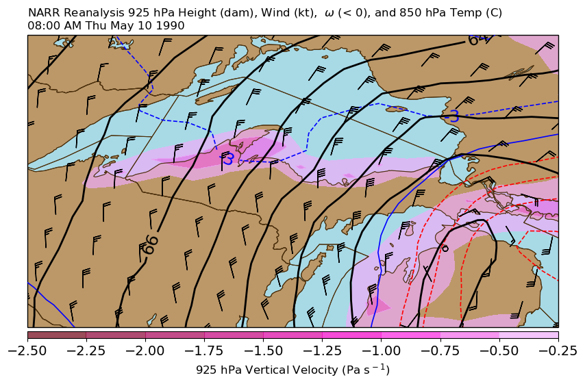
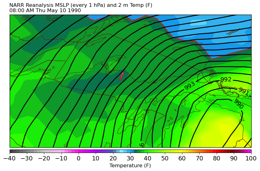
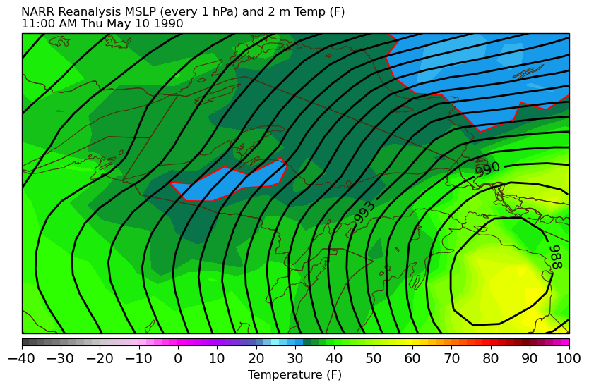
| 925 mb Height, Wind, and Vertical Velocity at 8 am EDT May 10, 1990 | Mean Sea Level Pressure and Surface Temperature at 8 am EDT May 10, 1990. Even when snow was falling, temperatures were slightly above freezing. | Mean Sea Level Pressure and Surface Temperature at 11 am EDT May 10, 1990. The data source for these images is somewhat coarse. Temperatures may been locally colder, especially over the higher terrain. | Vertical profile of temperature and dew point at NWS Marquette at 8 am EDT May 10, 1990 |
High Temps May 8
 |
 |
| Map of high temperatures on May 8 | High temperatures on May 8 at selected cities |
Snowfall Reports May 10
.png) |
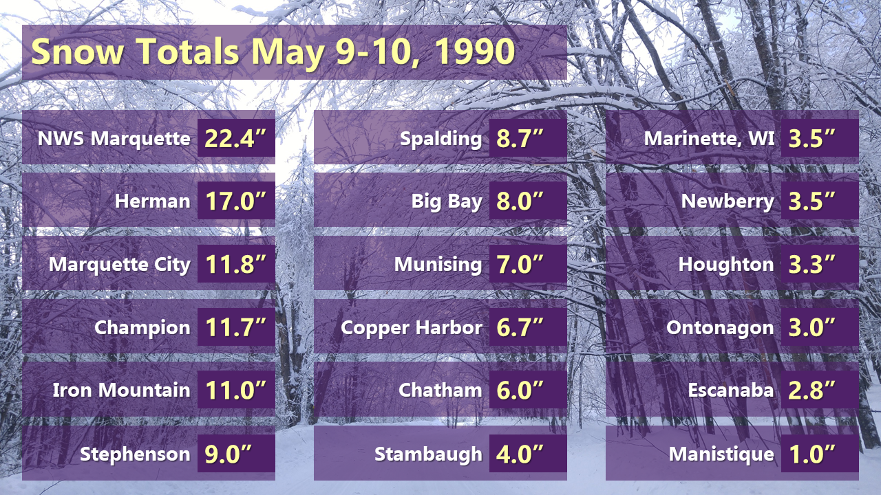 |
| Map of snowfall from this storm | Snowfall totals at selected cities |
High Temps May 11
 |
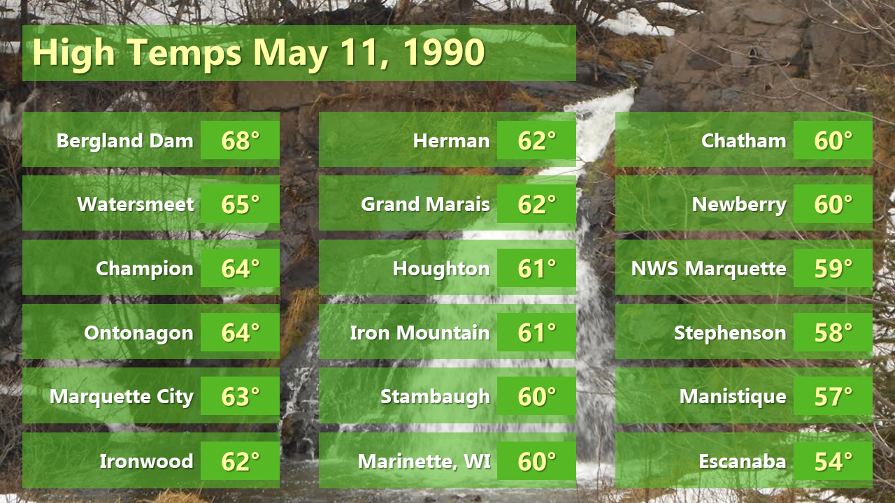 |
| Map of high temperatures on May 11 | High temperatures on May 11 at selected cities |
Photos
Check back for more photos coming soon!
 |
| Image courtesy of Karl Bohnak |
 |
Media use of NWS Web News Stories is encouraged! Please acknowledge the NWS as the source of any news information accessed from this site. |
|