Marquette, MI
Weather Forecast Office
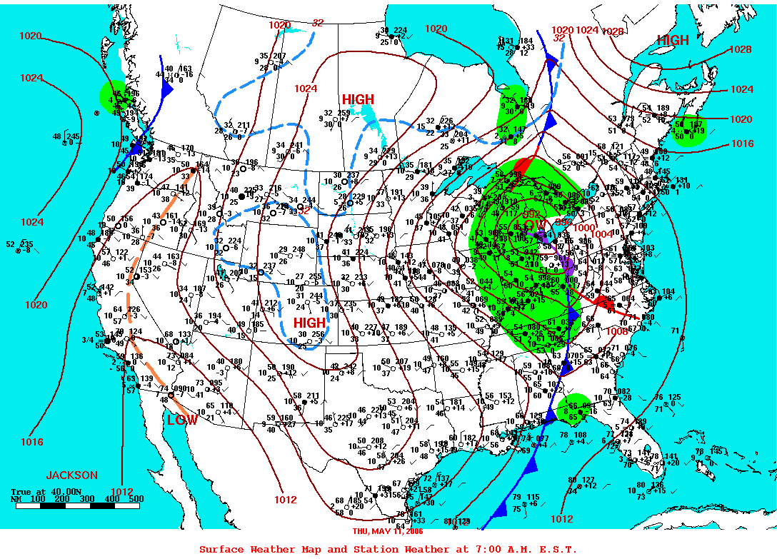
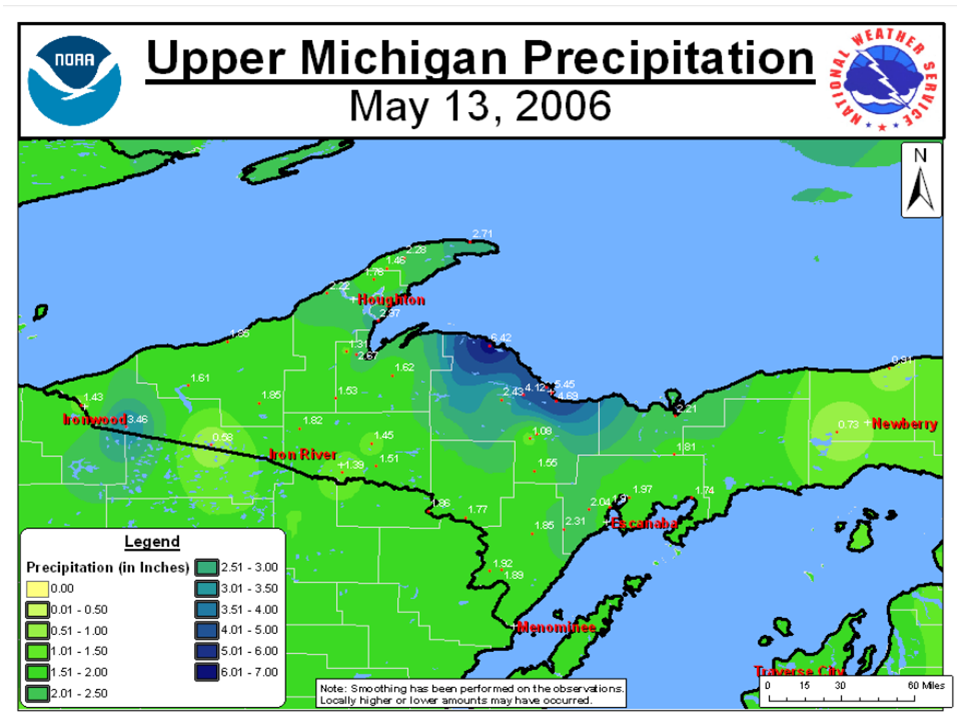
On this day eleven years ago in 2006, a rapidly deepening and powerful storm system tracking through Lower Michigan dumped heavy rain across much of northern Upper Michigan from May 11th into May 12th. The National Weather Service in Negaunee Township measured 3.15 inches on May 11, 2006, which was the highest calendar day precipitation total ever for May and the third highest total all-time. This was followed up by another 1.07 inches of rain on the 12th. The heavy rain over these two days, more than six inches at some locations and more than 700 percent of normal for that week in May, caused widespread flooding over northern Marquette County which lasted for several days. Significant road damage from washouts was reported along County Road 550 between Big Bay and Marquette and also along County Road 510. The Chocolay River at Harvey exceeded a flood stage of 9 feet on the morning of May 12th and crested at nearly 12 feet on the evening of the 12th before subsiding below flood stage late on May 14th. The Chocolay River inundated some roads and several properties around Harvey.
Heavy rain of two to three inches also caused some minor flooding in Keweenaw, Houghton and Baraga counties. Colder air wrapping around the strong storm system resulted in heavy wet snow over portions of Gogebic and Ontonagon counties where tree damage and frequent power outages were reported. Strong winds also downed numerous trees and power lines over central and southern Menominee County.
Images below are courtesy of WPC (left) and Dave Pearson (right) respectively.
US Dept of Commerce
National Oceanic and Atmospheric Administration
National Weather Service
Marquette, MI
112 Airpark Drive South
Negaunee, MI 49866
906-475-5212
Comments? Questions? Please Contact Us.

