Overview
|
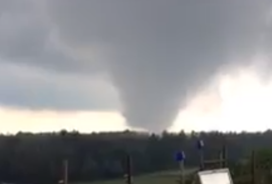
A low pressure system passing across Upper Michigan during the day allowed widespread showers to develop throughout the U.P. During the afternoon and early evening hours the clouds broke up just enough to allow some insolation, which created enough instability to create a brief tornado spin-up over northern Menominee county, near Hermansville. An interesting thing to note about this storm is that there was no lightning detected by the lightning network. A majority of the damage remained over rural areas and was limited to forested areas; however, there was a close call as the tornado moved about 100 yards away from an individuals farm and home. The NWS storm survey team rated the tornado as an EF1, with winds estimated to be around 90 mph. |
(Image and video courtesy of: Chelsea Blahnik) |
Tornadoes:
|
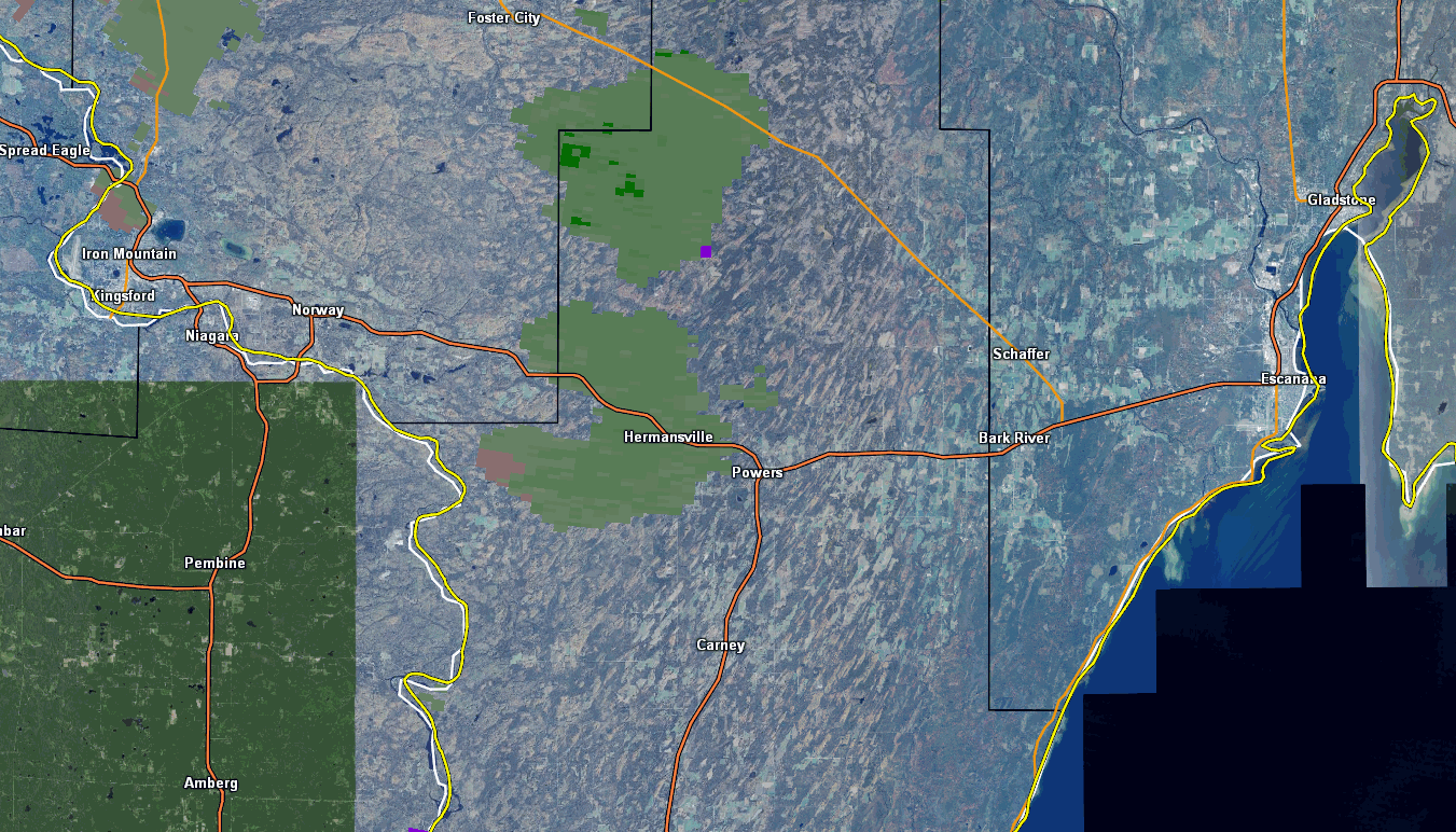
Tornado - Near Hermansville, MI
Track Map 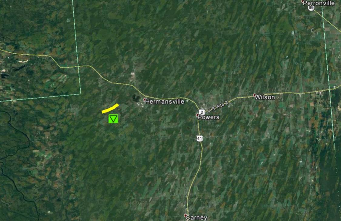 
|
||||||||||||||||
|
||||||||||||||||
The Enhanced Fujita (EF) Scale classifies tornadoes into the following categories:
| EF0 Weak 65-85 mph |
EF1 Moderate 86-110 mph |
EF2 Significant 111-135 mph |
EF3 Severe 136-165 mph |
EF4 Extreme 166-200 mph |
EF5 Catastrophic 200+ mph |
 |
|||||
Photos & Video:
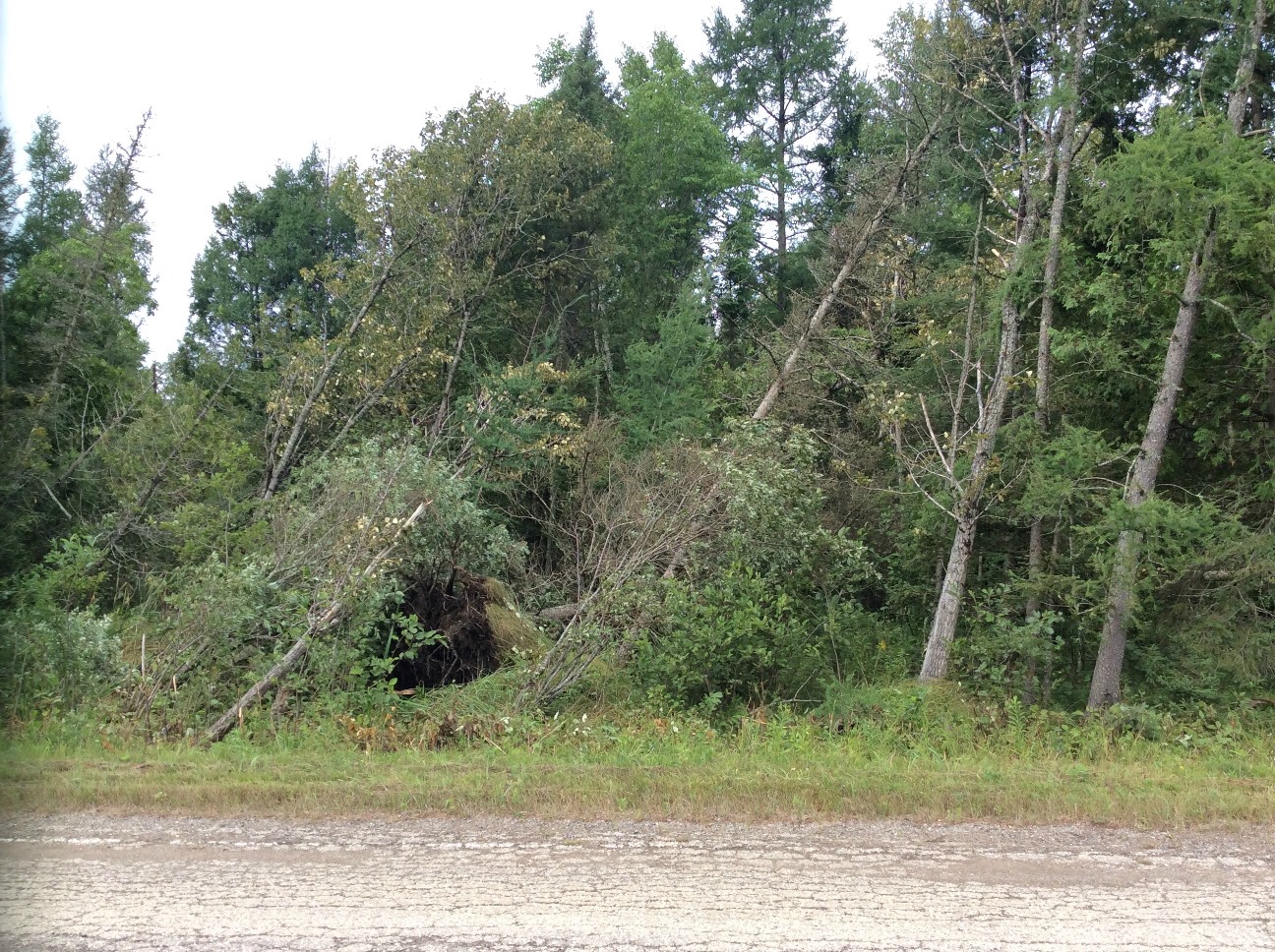
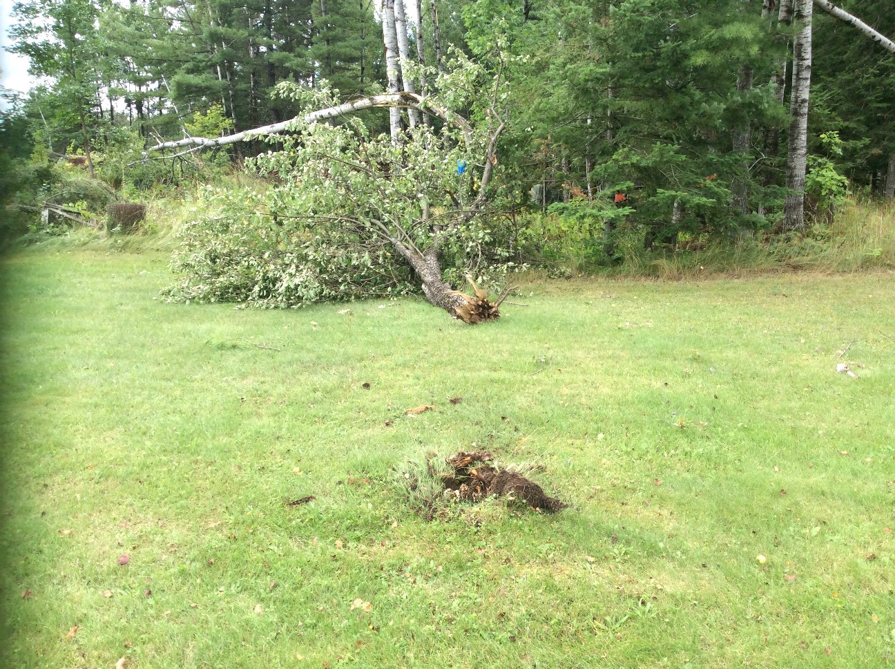
Storm Damage Photos
 |
 |
 |
 |
 |
 |
 |
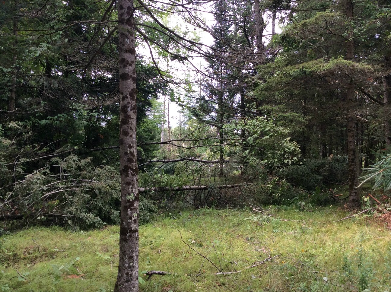 |
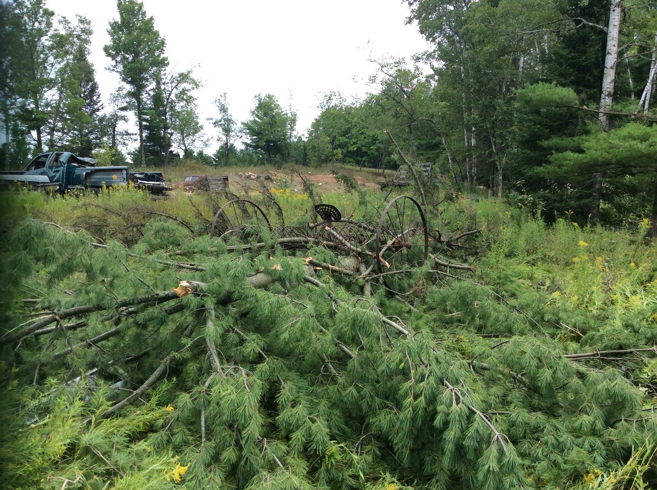
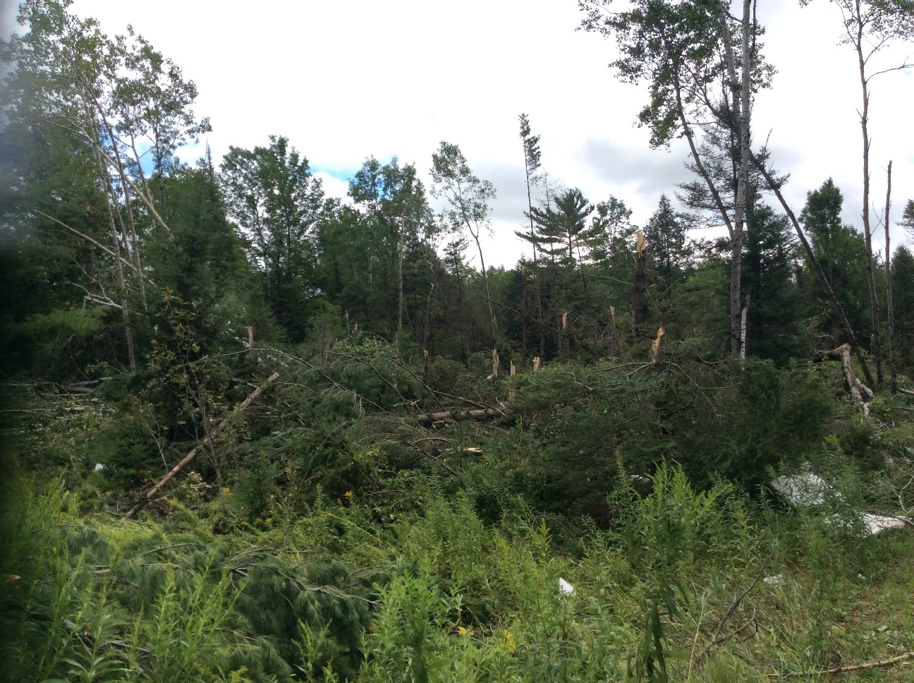
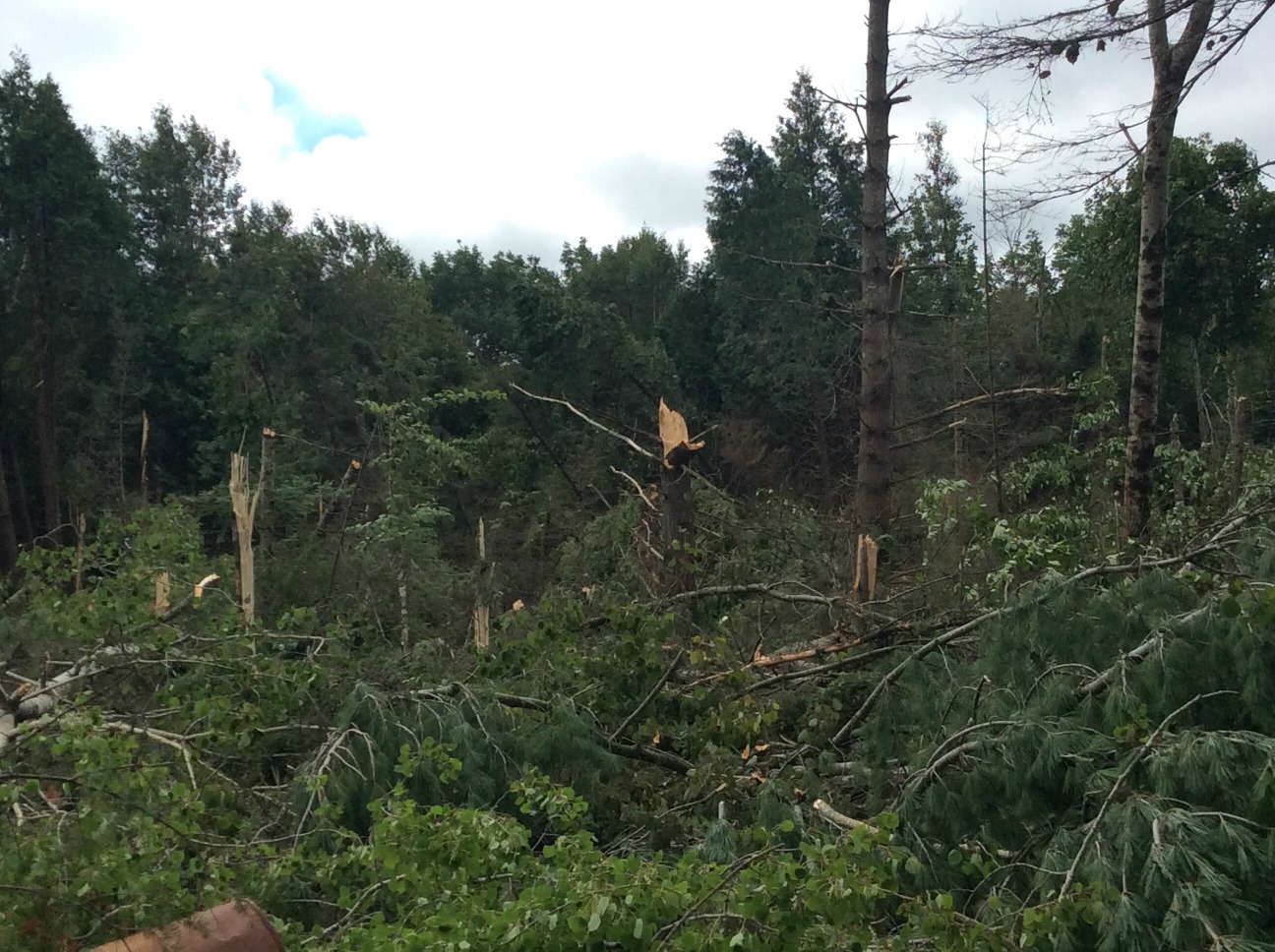
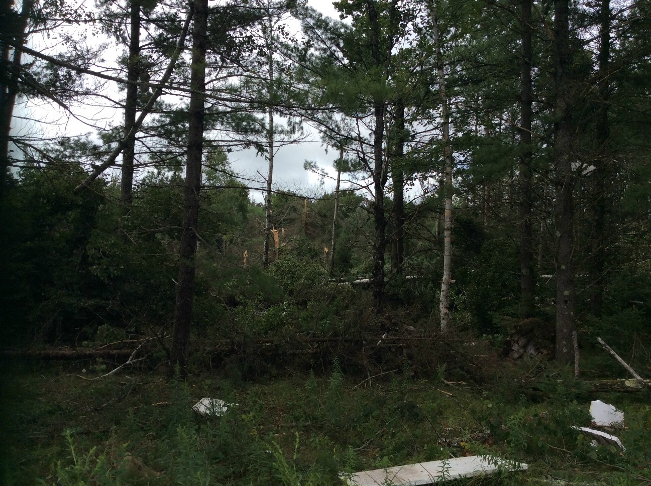
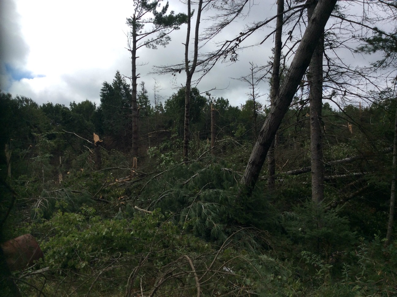
| Various pictures of the tornado damage southwest of Hermansville, MI. | |||
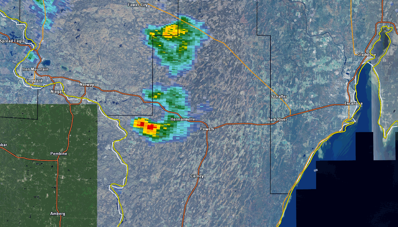
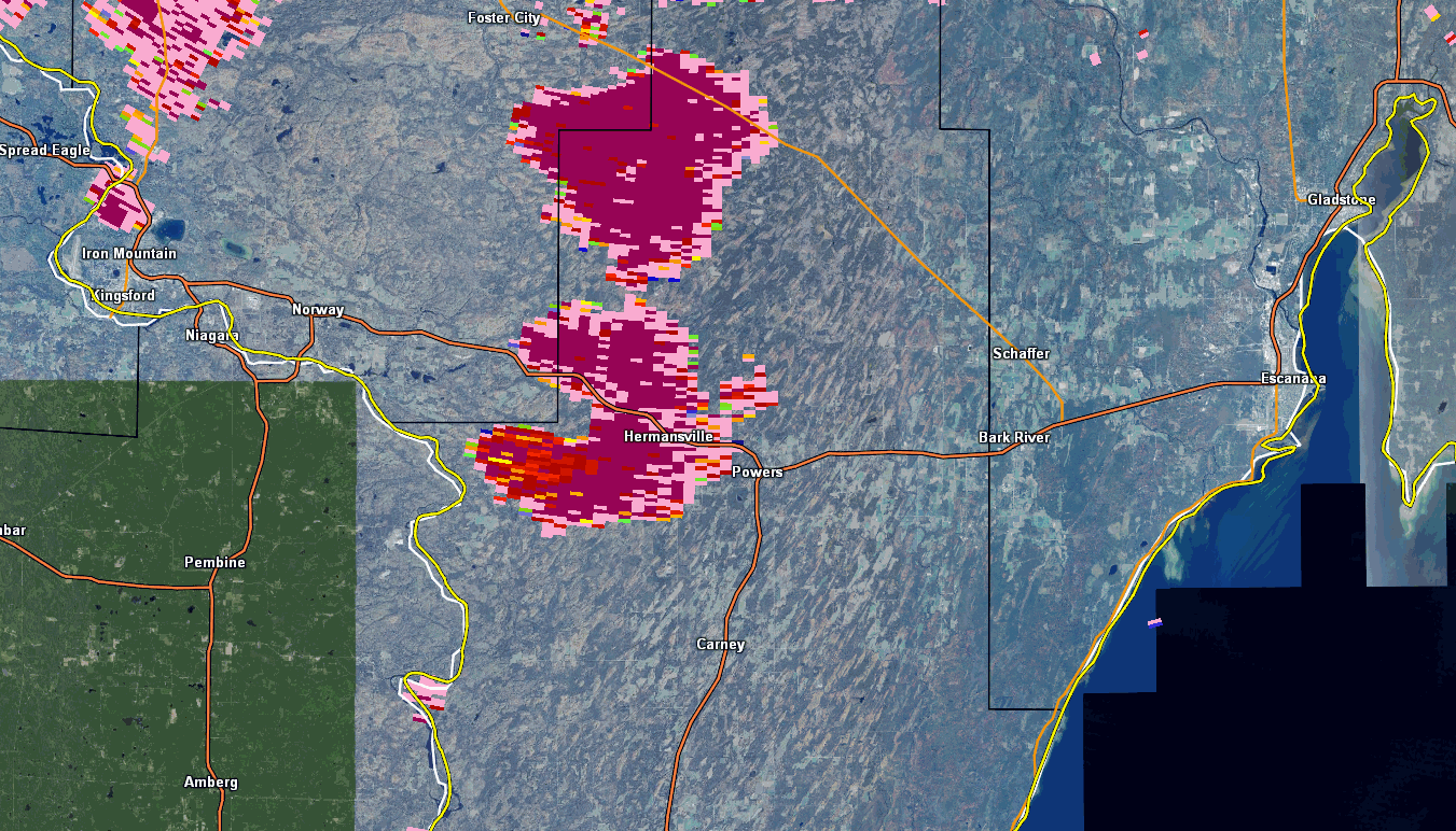
Radar:
 |
 |
 |
 |
|
0.5 Base Reflectivity 4:23 pm - 4:40 pm CDT |
Correlation Coefficient 4:23 pm - 4:40 pm CDT |
Storm Relative Velocity 4:23 pm -4:40 pm CDT |
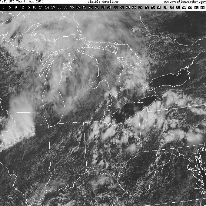
Visible Satellite Imagery 2:45 pm - 5:30 pm CDT |
Storm Reports
The tornado touched down just south of the intersection of County Roads 579 and 388 and traveled northeast for 1.25 miles, lifting as it crossed County Road 388. The damage path was estimated to be 200 yards wide. Numerous trees were snapped and uprooted along the path. Small farm equipment was also tossed around as it passed close to a nearby farm and home.
 |
Media use of NWS Web News Stories is encouraged! Please acknowledge the NWS as the source of any news information accessed from this site. |
|