Storm Survey of EF1 Microburst over South Central Upper Michigan
on July 17, 2008
National Weather Service, Marquette, MI
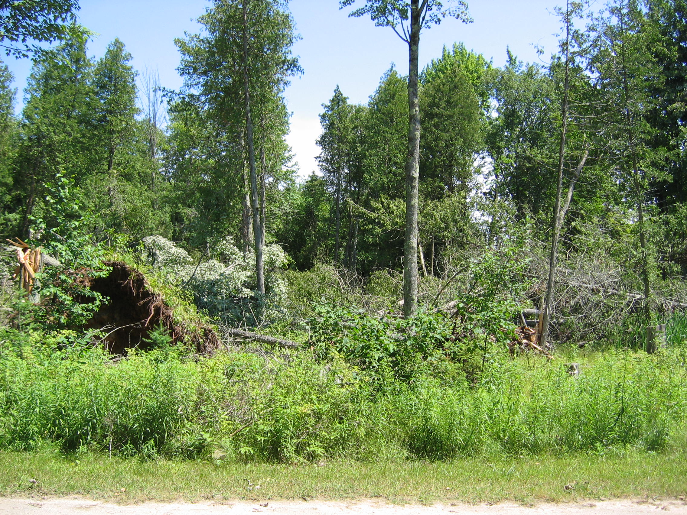
On the afternoon of July 17, 2008, a warm and humid airmass was in place over Upper Michigan. As a cold front approaching from Minnesota ran into this airmass, showers and thunderstorms developed across northeast Minnesota and northern Wisconsin during the mid afternoon. These storms then tracked into Upper Michigan, producing heavy rainfall and gusty winds. However, there was one particular cluster of storms that produced very strong winds across central Menominee and extreme southwestern Delta counties. The first report of damage came in at 545 pm EDT from a cooperative observer 4 miles west of Daggett, who had some 8 inch diameter branches down in the yard, and estimated winds around 54 mph. After hearing this report and looking at radar data, a severe thunderstorm warning was then issued for eastern Menominee and southwest Delta counties. A second report of damage came in the next day from an observer 11 miles south of Bark River, who had numerous trees down. Given this information, a storm survey was conducted. During the survey, much of the damage was done to trees. However, at the OB Fuller County Park and Campground in Delta County, the falling trees caused damage to a motorcycle and a camping trailer. No injuries or fatalities occurred, likely because it was a Thursday when campgrounds are usually not as busy. The following is a map of where damage occurred and the estimated wind speeds that caused the damage:
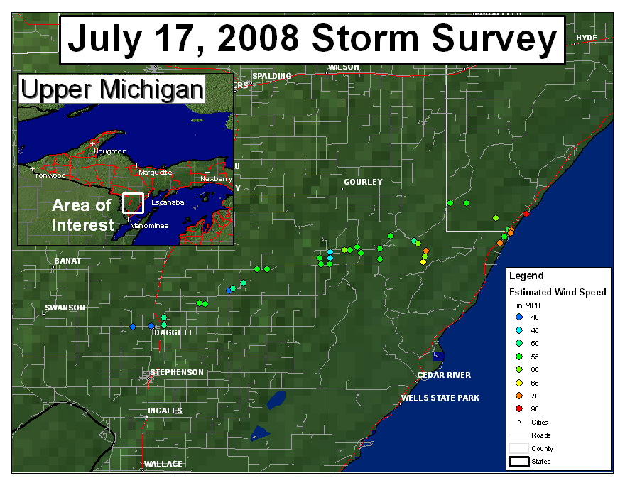 |
As indicated on the map, the estimated wind speeds increased from Daggett to the Bay of Green Bay shoreline, and was also in a narrow zone. This could be similar to what a tornado would produce, however, all the trees were generally laying southwest to northeast which was also the motion of the cluster of storms. Therefore straight-line winds resulting from a microburst were ruled the cause of all the damage. Note the estimate of 90 mph winds in southwest Delta County near the bay. This means that the straight-line wind damage was equivalent to that of an EF1 tornado. The greatest damage occurred in a very small area with a path width of only several hundred yards.
The following are a few radar images of the storm, in addition to some damage pictures:
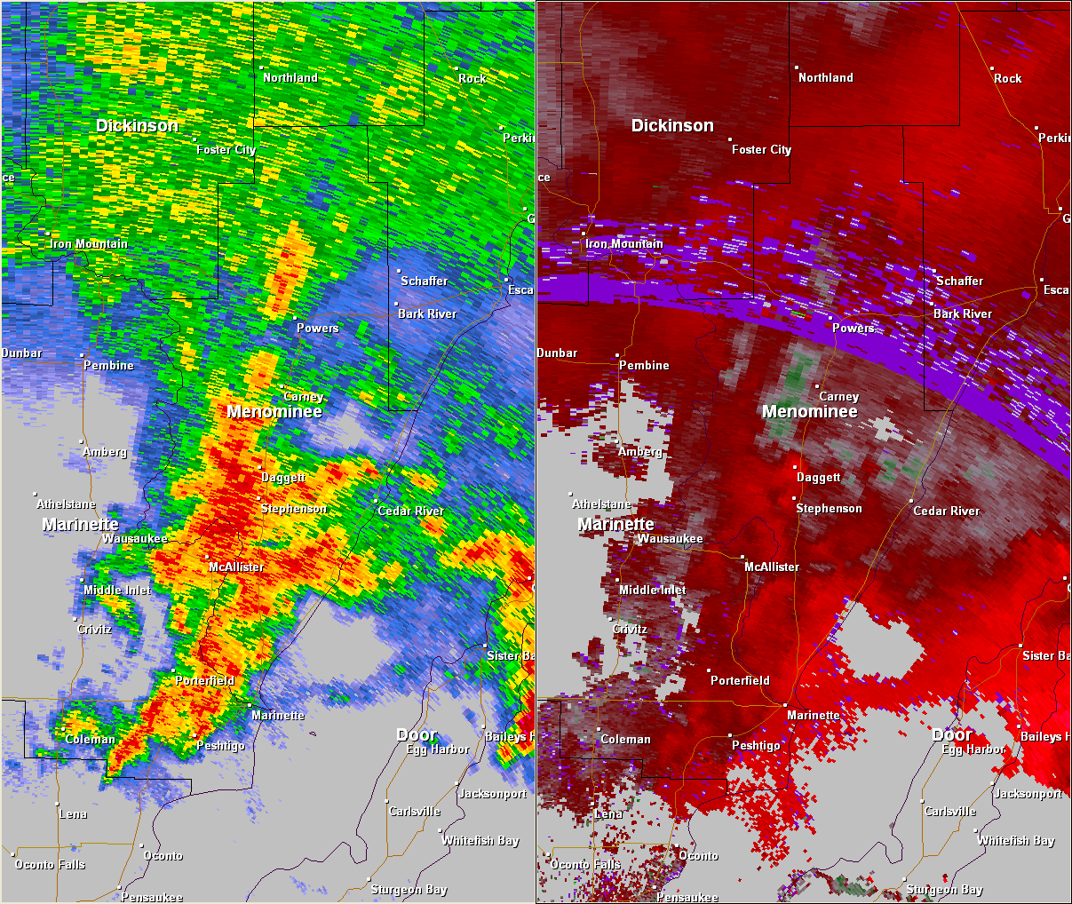 |
Reflectivity (left) and Velocity (right) images from the WSR 88-D in Green Bay, WI from 545 pm EDT (445 pm CDT). Note the core of stronger winds (noted in the bright red) over Daggett, MI. Estimated doppler velocity values over Daggett were around 45 mph.
 |
Reflectivity (left) and Velocity (right) images from the WSR 88-D in Green Bay, WI from 604 pm EDT (504 pm CDT). Note the core of stronger winds (noted in the bright red/pink) over extreme southern Delta County. Estimated doppler velocity values in this region were around 90 mph.
 |
 |
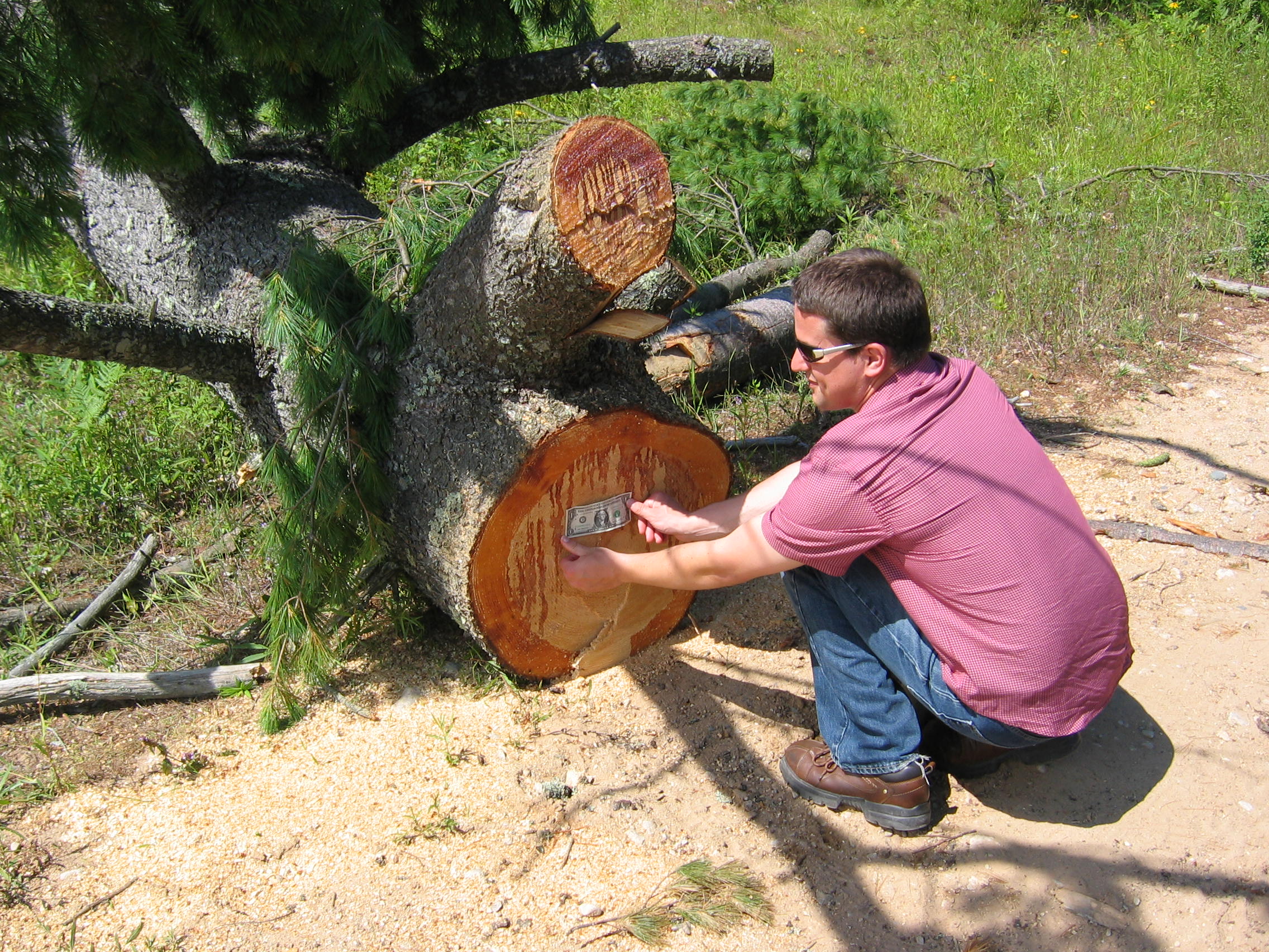
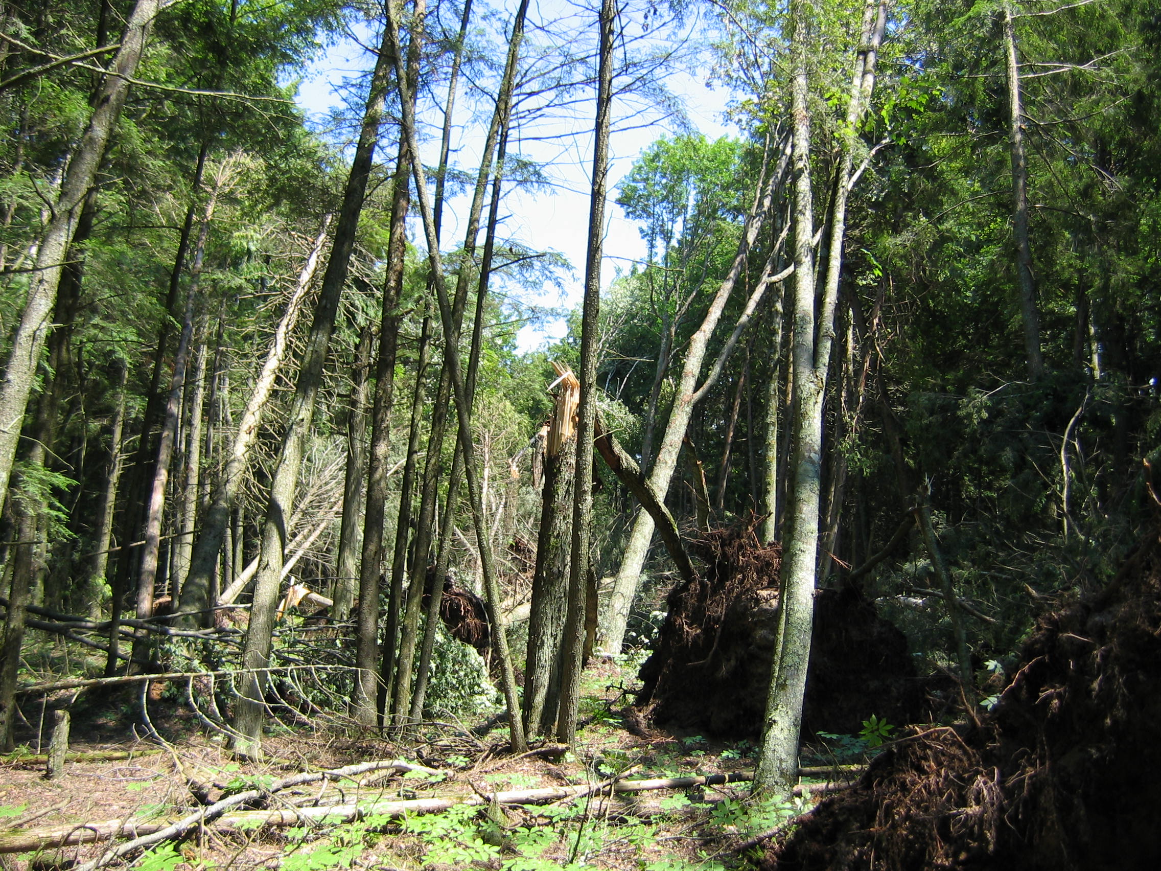
15 inch diameter uprooted Cedar Tree, 10 mi N Cedar River (Science and Operations Officer Mike Dutter shown)
 |
 |
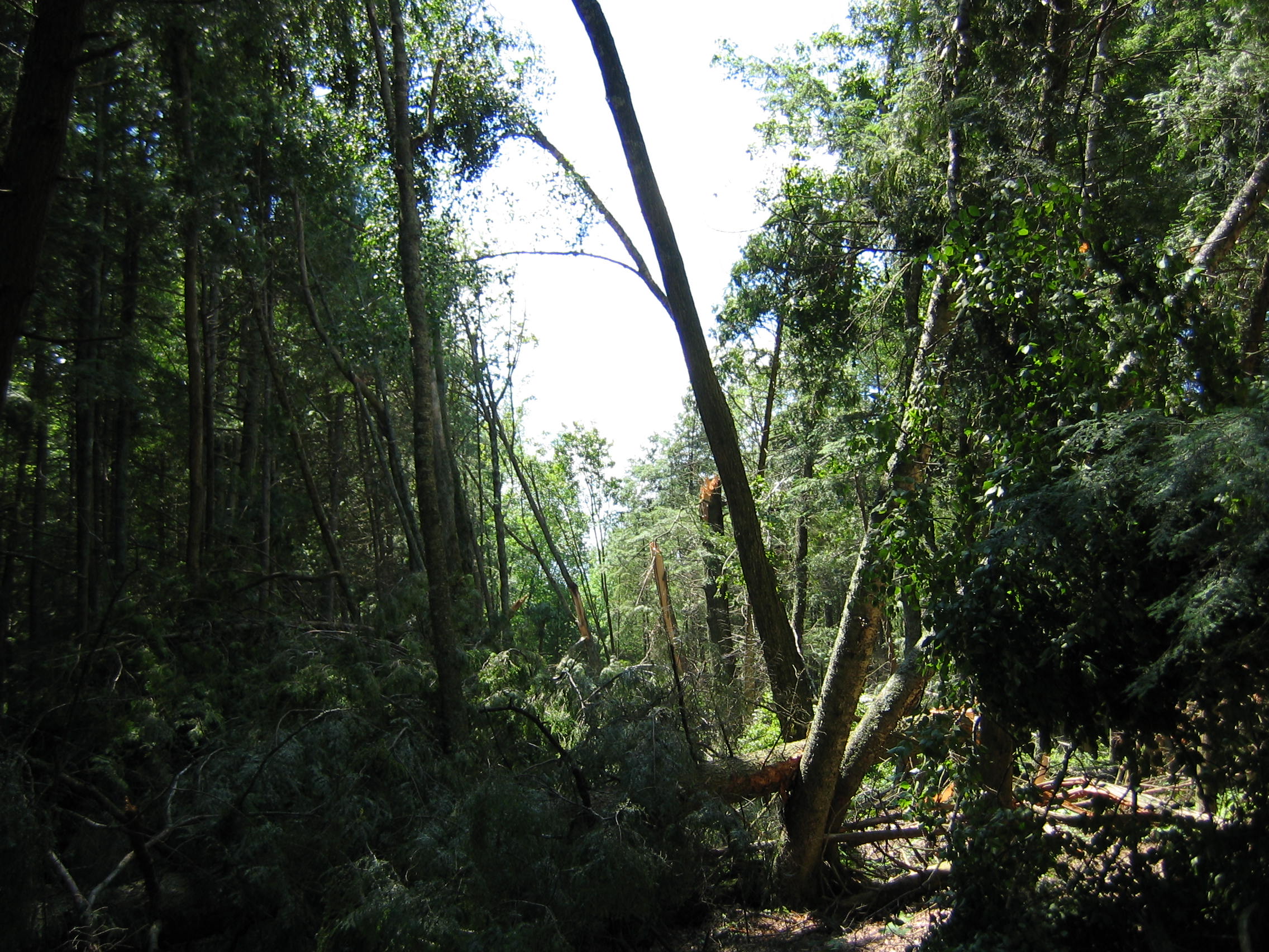 |
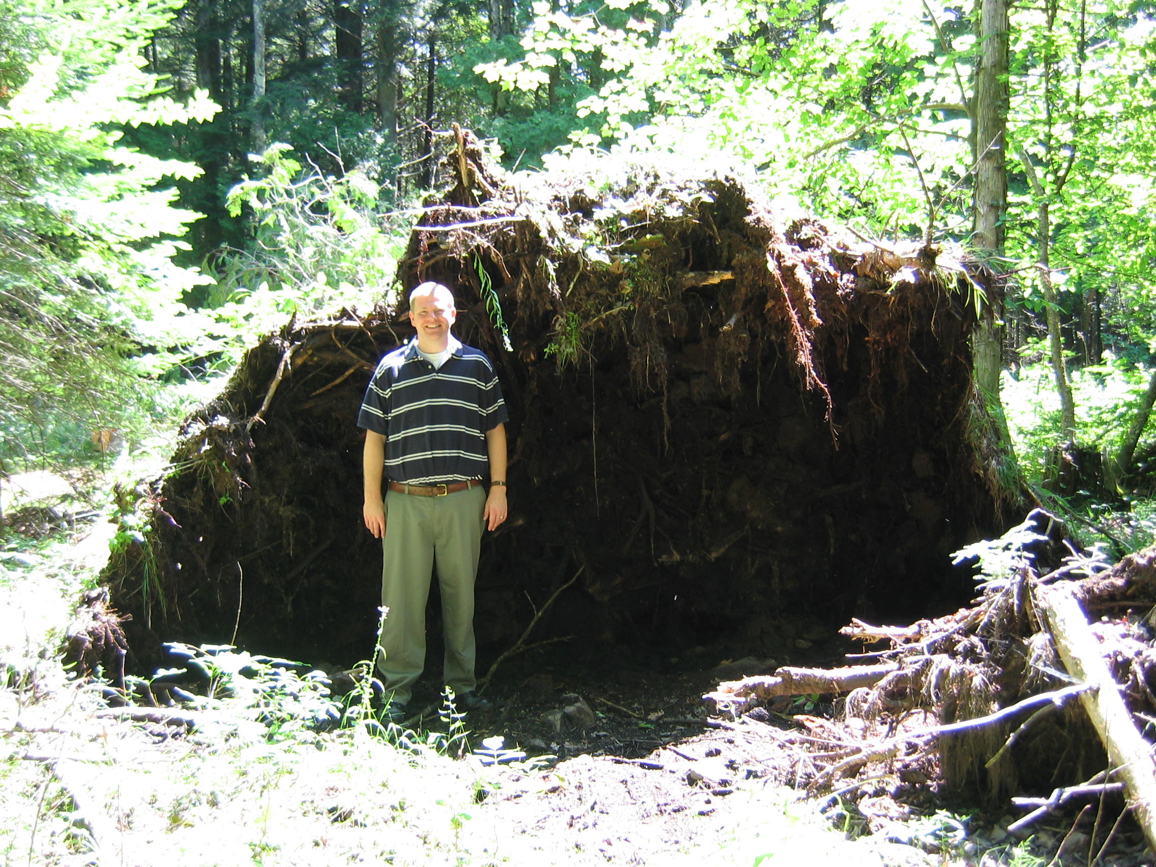
Microburst at OB Fuller County Park and Campground (estimated 90 mph or EF-1 winds)

