Overview
|
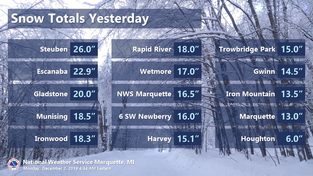
The second major winter storm in less than a week dropped another one to two+ feet of wet, heavy snow over most of Upper Michigan. Unlike the storm the day before Thanksgiving, the heaviest snow with this storm was along Lake Michigan due to wind from the east and cold air aloft generating lake-enhanced snow. This storm featured a strong cutoff in snow amounts on the northern edge. While most areas saw at least a foot of snow, Houghton recorded just 6 inches and Copper Harbor only saw a trace of snow! Although the snow was not as slushy and the wind was not as strong with this storm as compared to the storm the day before Thanksgiving, the deep snow still hampered ongoing efforts to restore power that remained out in some areas since the day before Thanksgiving. |
Loop of radar images and Mean Sea Level Pressure analysis for the storm
|
Social Media Graphics
 |
 |
 |
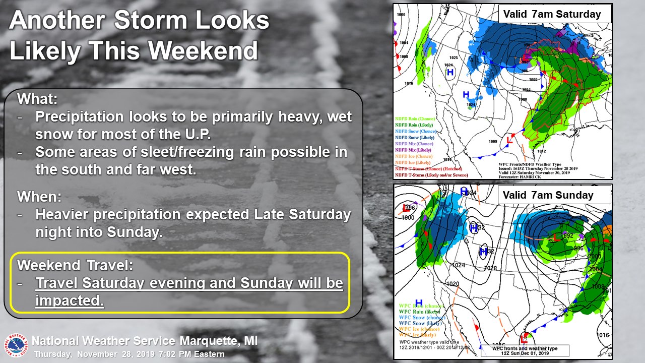
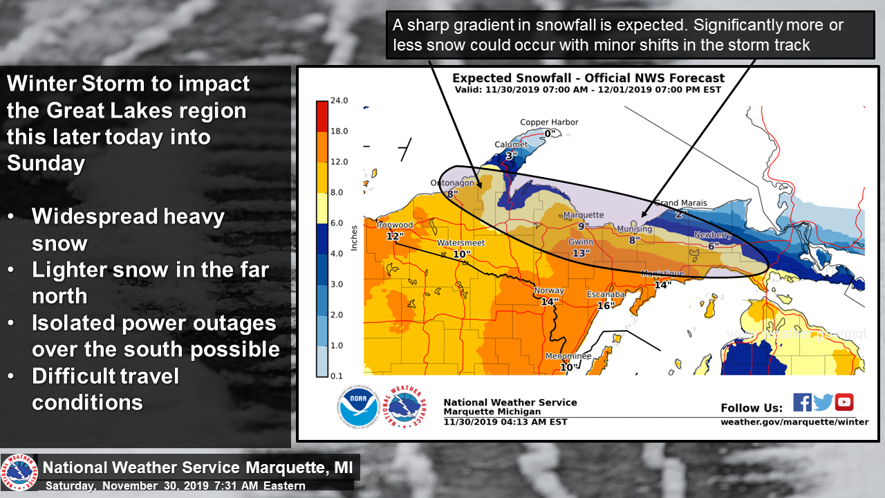
| As residents were still cleaning up from a major winter storm the previous day, we began messaging the potential for this storm with Thursday evening's weather story. | By Saturday morning, it was clear that this would be another major storm for part of the area. But it was still unclear just how far north the heaviest snow would get. | Social media graphics highlighted that travel would again become dangerous. |
 |
 |
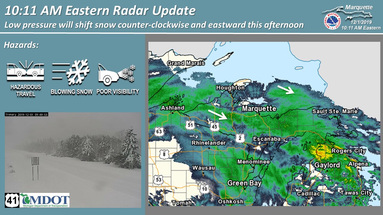 |
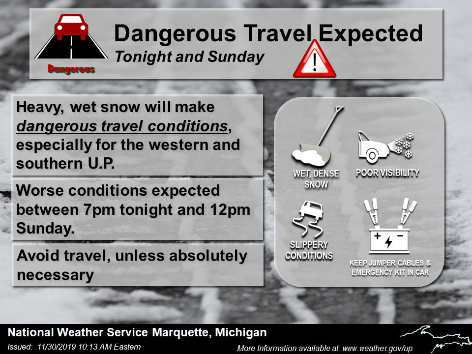
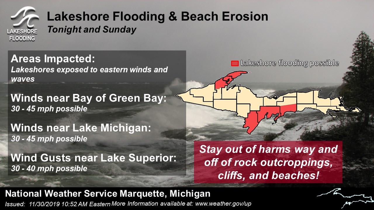
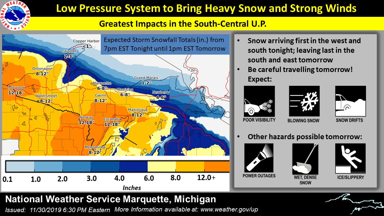
| Although not as significant as with the storm right before Thanksgiving, lakeshore flooding was again a concern. | Forecast snowfall totals continued to be refined Saturday evening. | As the storm was underway Sunday morning, a radar and webcam update showed Upper Michigan residents how dangerous driving conditions were. |
Environment
 |
 |
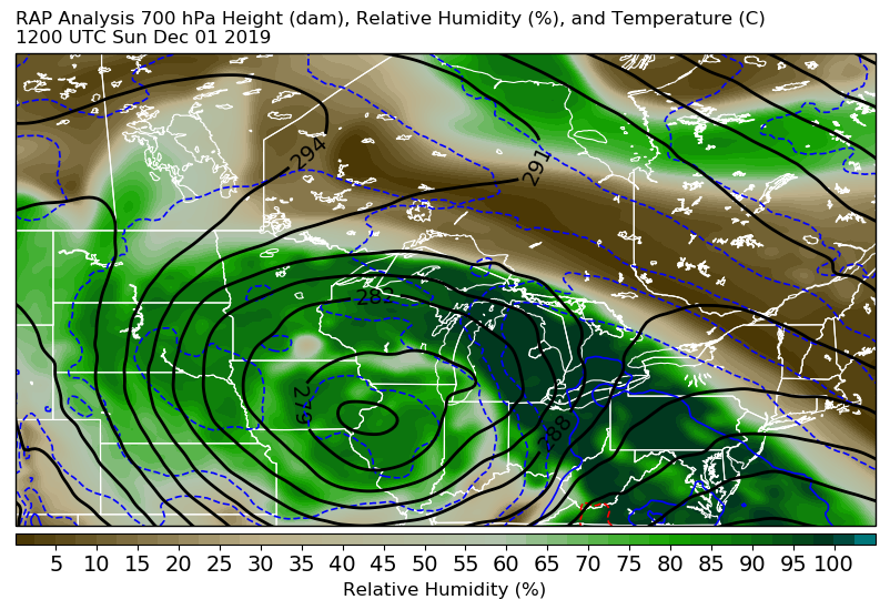 |
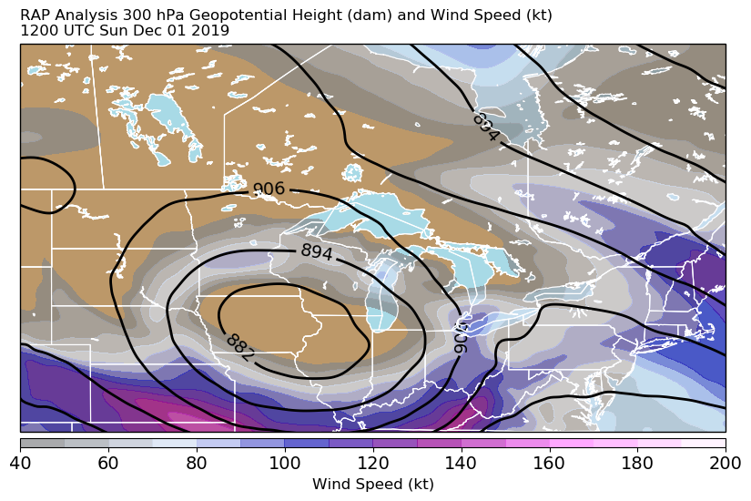
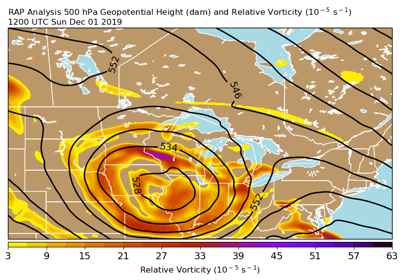
| 300 mb Height and Wind at 12z (7 am EST) Sunday, December 1 | 500 mb Height and Vorticity at 12z (7 am EST) Sunday, December 1 | 700 mb Height and Relative Humidity at 12z (7 am EST) Sunday, December 1 |
 |
 |
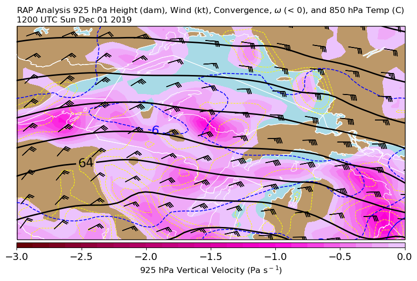 |
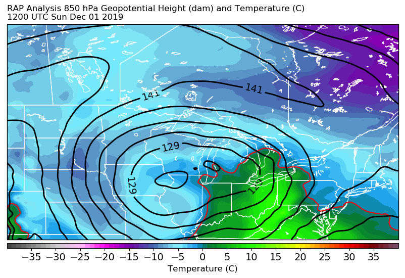
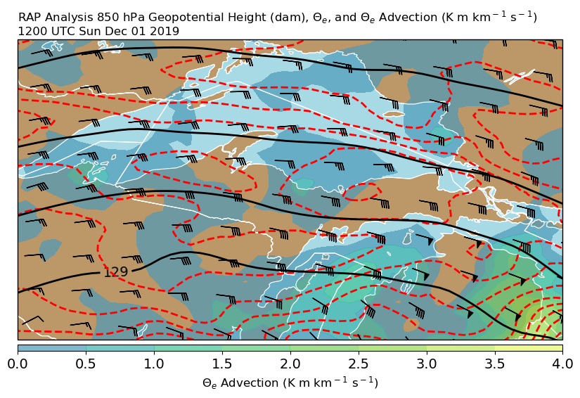
| 850 mb Height and Temperature at 12z (7 am EST) Sunday, December 1 | 850 mb Height, Wind, Theta-e, and Theta-e Advection at 12z (7 am EST) Sunday, December 1 | 925 mb Height and Wind, and 850 mb Temperature, at 12z (7 am EST) Sunday, December 1 |
 |
Media use of NWS Web News Stories is encouraged! Please acknowledge the NWS as the source of any news information accessed from this site. |
|