Overview
|
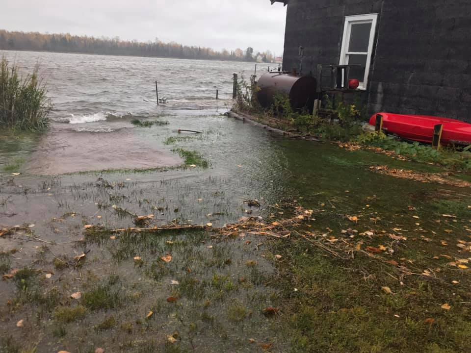
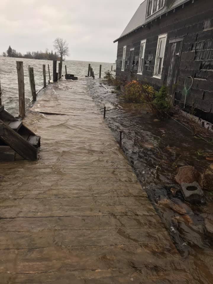
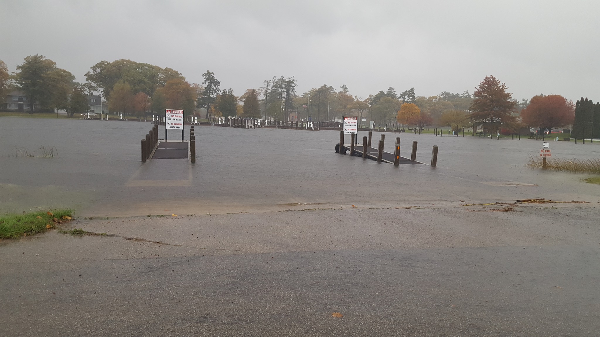
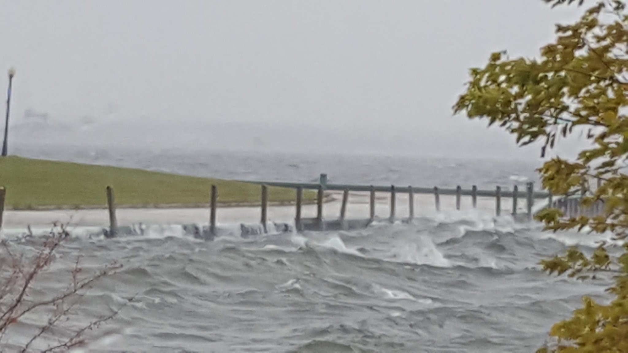
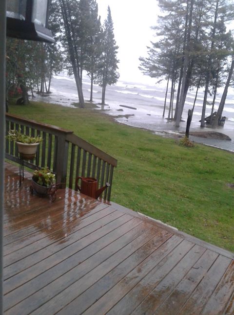
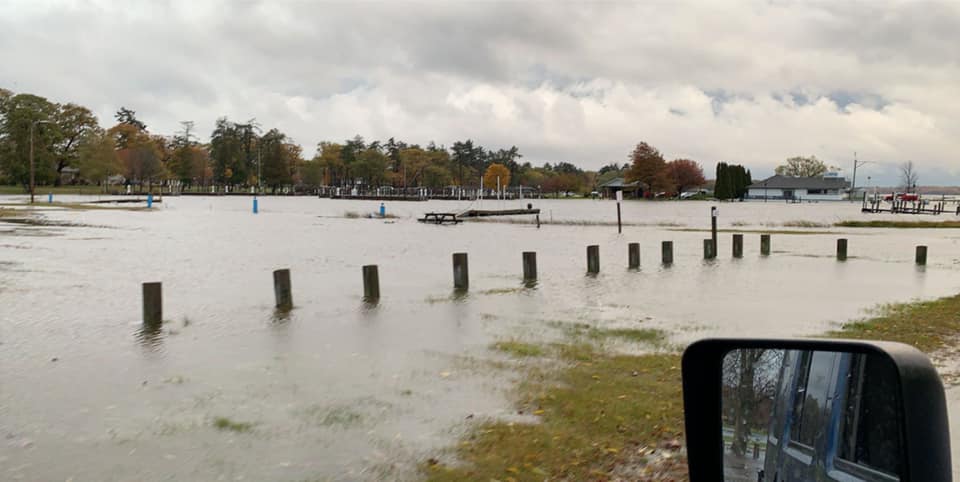
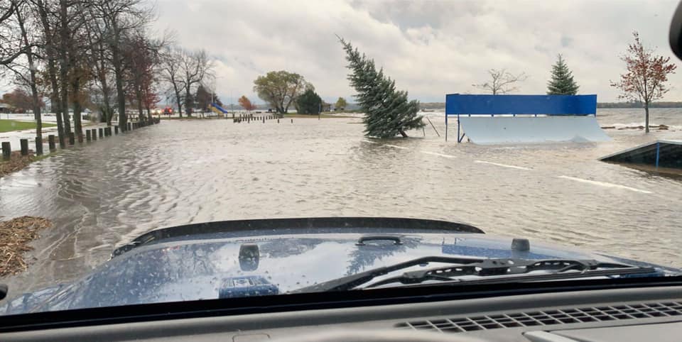
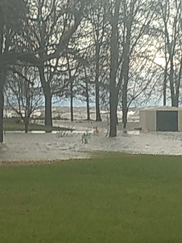
This strong fall storm system produced storm-force gusts (defined as greater than 47 kt, or 54 mph) on Lake Superior as well as lakeshore flooding along the Bay of Green Bay shoreline. The water level on the Lakes Michigan-Huron system was already at nearly a record high from about a year of anomalously high precipitation. Combined with the prolonged east wind with this storm pushing water to the west, lakeshore flooding affected nearly all of the Bay of Green Bay. |
Loop of radar images and Mean Sea Level Pressure analysis for the storm |
Environment
 |
 |
 |
 |
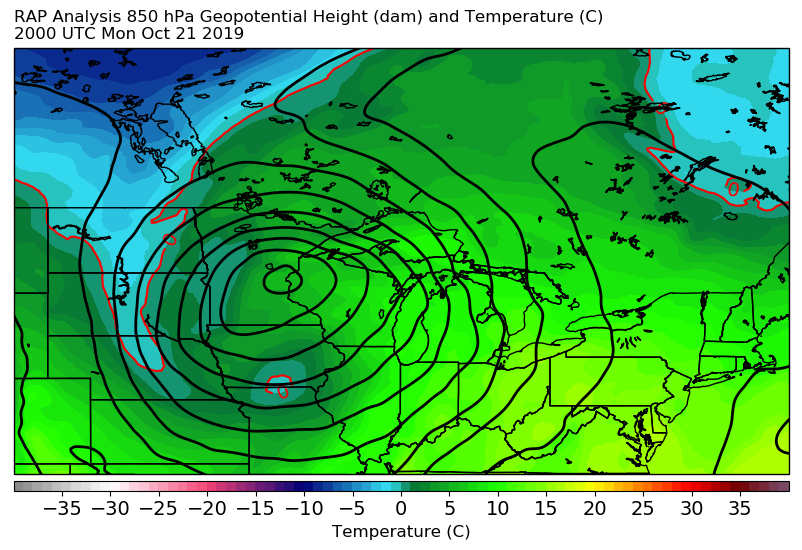
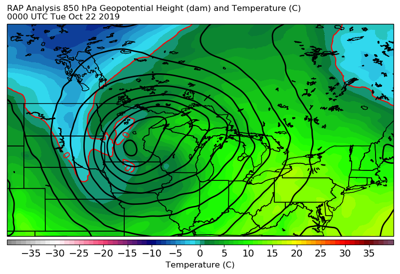
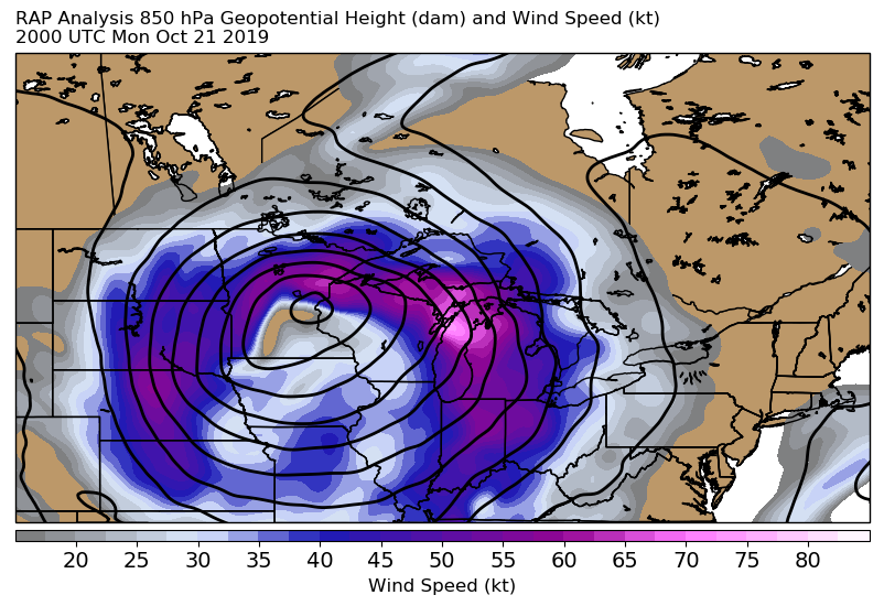
| 850 mb Height and Temperature at 20z (4 pm EDT) October 21 | 850 mb Height and Temperature at 00z (8 pm EDT) October 21 | 850 mb Height and Wind at 20z (4 pm EDT) October 21 | 850 mb Height and Wind at 00z (8 pm EDT) October 21 |
 |
 |
 |
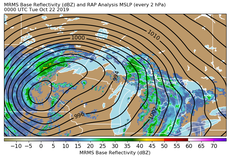 |
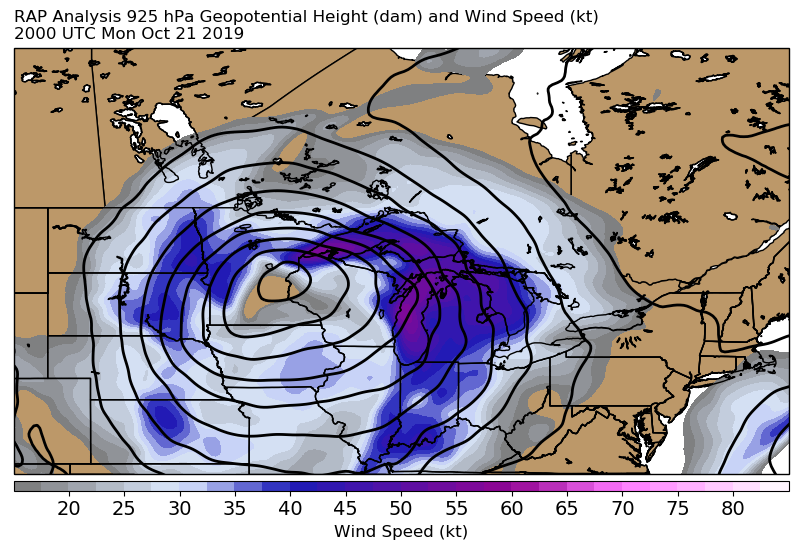
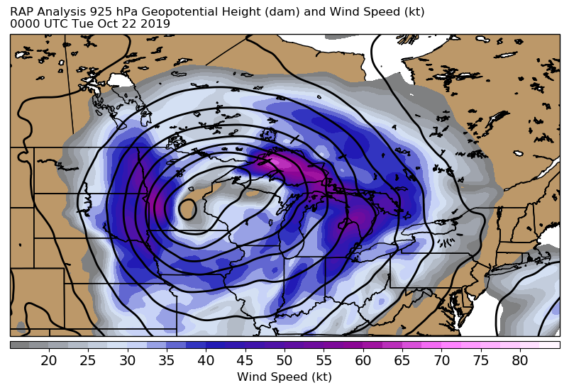
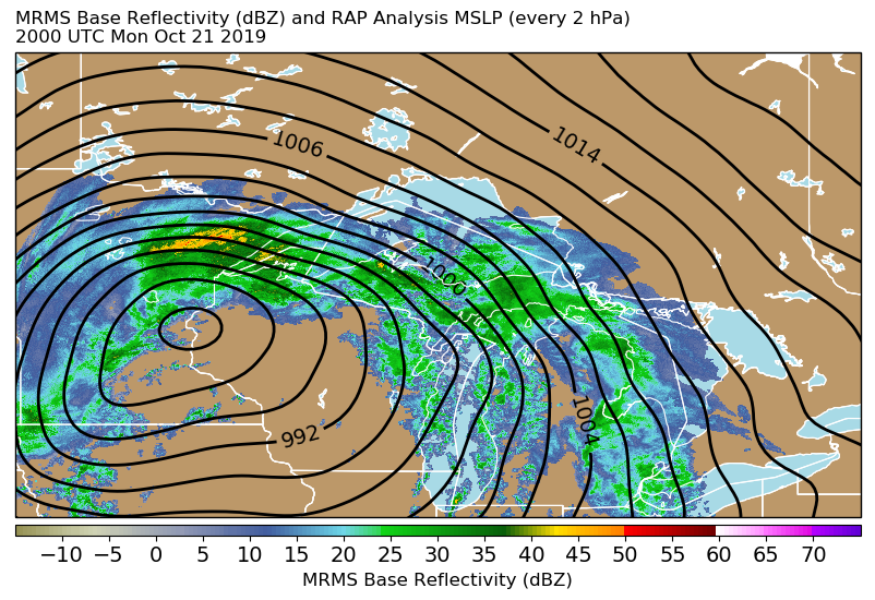
| 925 mb Height and Wind at 20z (4 pm EDT) October 21 | 925 mb Height and Wind at 00z (8 pm EDT) October 21 | MRMS base reflectivity and RAP analysis mean sea level pressure at 20z (4 pm EDT) October 21 showing a 986 mb low near the Twin Cities | MRMS base reflectivity and RAP analysis mean sea level pressure at 00z (8 pm EDT) October 21 showing the low near the Twin Cities weakening slightly to 988 mb |
Lakeshore Flooding Photos
 |
 |
 |
 |
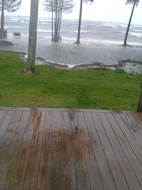
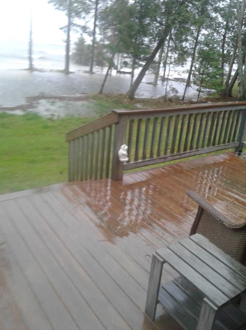
| Courtesy Taana Blom | Courtesy Taana Blom | Escanaba, courtesy Steve Fritz | Escanaba, courtesy Steve Fritz |
 |
 |
 |
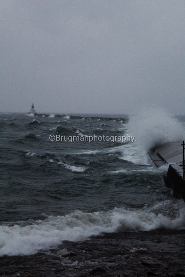 |
| Courtesy Marie Kakuk | Courtesy Marie Kakuk | Courtesy Marie Kakuk | Courtesy Jason Burgman |
 |
 |
 |
 |
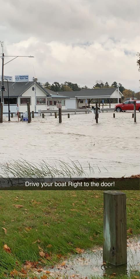
| Gladstone Yacht Club, courtesy Scott Gordon | Gladstone Yacht Club, courtesy Scott Gordon | Gladstone Yacht Club, courtesy Scott Gordon | Courtesy Stephen Neal |
 |
Media use of NWS Web News Stories is encouraged! Please acknowledge the NWS as the source of any news information accessed from this site. |
|


